17th Century Prints
to
903
1,005
49
1,057
Height
to
Width
to
14
1
5,235
9,585
5,493
889
1,194
1,731
1,674
197
79
209
260
250
312
413
692
370
227
1,055
9
5
3
3
131
50
37
16
8
1,057
1,057
1,057
46
18
11
6
5
Period: 17th Century
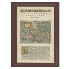
Antique Map of the Moluccas by Porcacchi, 'circa 1620'
Located in Langweer, NL
Antique map titled 'Isole Molucche'. The map depicts the East Indies and Indochina, including modern-day Indonesia and the Philippines. The area covered stretches from the Bay of Bengal...
Category
Antique 17th Century Prints
Materials
Paper
$680 Sale Price
20% Off
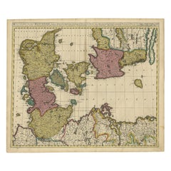
Map of Denmark Divided into Dioceses – G. & L. Valk, ca. 1690
Located in Langweer, NL
Map of Denmark Divided into Dioceses – G. & L. Valk, ca. 1700
Detailed antique map titled "Regnum Daniae, divisum in Dioeceses Arhusiam, Albergum, Viborgum, et Ripam," showing Denma...
Category
Antique 17th Century Prints
Materials
Paper
$519 Sale Price
20% Off
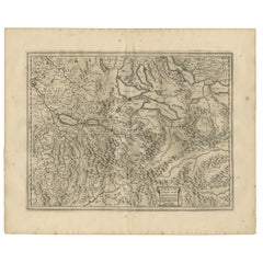
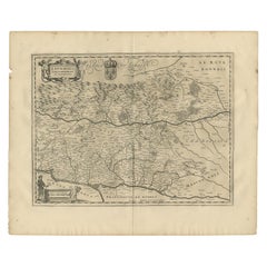
Antique Map of the Region of Aargau by Janssonius, '1657'
Located in Langweer, NL
Antique map 'Argow cum parte merid. Zurichgow'. Detailed map of Switzerland showing Aargau with the southern part of Zürich. This map originates from 'Atlas Novus, Sive Theatrum Orbi...
Category
Antique 17th Century Prints
Materials
Paper
$567 Sale Price
20% Off
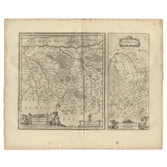
Antique Map of Loudun and Mirebeau by Janssonius '1657'
Located in Langweer, NL
Antique map 'Loudunois Laudunum - Mirebalais'. Decorative map of the region of Loudun and Mirebeau. This map originates from 'Atlas Novus, Sive Theatrum Orbis Orbis Terrarum: In quo ...
Category
Antique 17th Century Prints
Materials
Paper
$519 Sale Price
20% Off
Antique Map of the Region of Lyonnais by Janssonius, '1657'
Located in Langweer, NL
Antique map 'Lionnois, forest, beauviolois et masconnois'. Decorative map of the Lyonnais region, France. The Lyonnais is a historical province of France which owes its name to the c...
Category
Antique 17th Century Prints
Materials
Paper
$472 Sale Price
20% Off
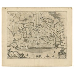
Antique Map of the North-Western Part of France by Janssonius (c.1657)
Located in Langweer, NL
Antique map of France titled 'Le Gouvernement de Calais'. Attractive map of the north-western part of France including the towns of Calais, Gravelines. This map originates from 'Atla...
Category
Antique 17th Century Prints
Materials
Paper
$543 Sale Price
20% Off
Antique Print of the Churches of Ilondi Matual, Ureputti, Catavelli and Paretitu
Located in Langweer, NL
Antique print titled 'Illondi Matual, Ureputti, Catavelli, Paretiture'. Antique print with four views of the churches of Ilondi Matual, Ureputti, Catavelli and Paretiture (Ceylon/Sri...
Category
Dutch Antique 17th Century Prints
Materials
Paper
$141 Sale Price
20% Off
Antique Print of the Churches of Kopay, Poutour, Navacouli and Chavagatzeri
Located in Langweer, NL
Antique print titled 'Kopay, Poutour, Navacouli, Chavagatzeri'. Antique print with four views of the churches of Kopay, Poutour, Navacouli and Chavagatzeri (Ceylon/Sri Lanka). The pl...
Category
Dutch Antique 17th Century Prints
Materials
Paper
$189 Sale Price
20% Off
Antique Print of a Tiger by A. Kircher, circa 1660
Located in Langweer, NL
Antique print titled 'Vera Trigridis forma'. This is an extremely rare print most likely originating from the Dutch edition (by Janssonius van Waesberge) of 'China Monumentis' by A. ...
Category
Antique 17th Century Prints
Materials
Paper
$245 Sale Price
20% Off
Antique Map of Brabant 'The Netherlands' by N. Visscher, circa 1670
Located in Langweer, NL
Detailed map of the southern part of The Netherlands and the northern part of Belgium with Antwerp and Brussels. In the corner top left in Holland with Rotterdam partly on the map. S...
Category
Antique 17th Century Prints
Materials
Paper
$586 Sale Price
20% Off
Antique Map of Brabant 'The Netherlands' by N. Visscher, circa 1690
Located in Langweer, NL
Antique map titled 'Brabantiae Batavae Pars Occidentalis (..)'. Highly detailed map of the region between Bergen Op Zoom, Breda, Hoogstraten and Sandvliet, The Netherlands. Published...
Category
Antique 17th Century Prints
Materials
Paper
$623 Sale Price
20% Off
Antique Print of the City of Hoaigan 'China' by J. Nieuhof, 1666
Located in Langweer, NL
Antique print titled 'Hoaigan'. This plate shows a view on the Chinese city of Hoaigan with its rampartss. Several ships are depicted. Behind the city wall a pagoda and palm trees ca...
Category
Antique 17th Century Prints
Materials
Paper
$274 Sale Price
20% Off
Antique Print of the City of Kiangsi China by J. Nieuhof, 1666
Located in Langweer, NL
Antique print titled 'Kiangsi'. This plate shows a view on the Chinese city of Kiangsi with its ramparts. Behind the city wall a pagoda can be seen. On the foreground several ships a...
Category
Antique 17th Century Prints
Materials
Paper
$293 Sale Price
20% Off
Antique Print of the City of Tonglou 'China' by J. Nieuhof, 1666
Located in Langweer, NL
Antique print titled 'Tonglou'. This plate shows a view on the Chinese city of Tonglou with its ramparts. Also depicted are ships. This print originates from a German edition of : 'G...
Category
Dutch Antique 17th Century Prints
Materials
Paper
$189 Sale Price
23% Off
Antique Print of the Churches of Poelepolay, Mogommate, Tambamme and Mulipatto
Located in Langweer, NL
Antique print titled 'De Kerck Poelepolay / De Kerck Mogommate / De Kerck Tambamme / De Kerck Mulipatto.' Four views of the churches of Poelepolay, Mogommate, Tambamme, Mulipatto (Ce...
Category
Antique 17th Century Prints
Materials
Paper
$245 Sale Price
20% Off
Antique Print of the Churches of Mallagam, Achiavelli, Mayletti and Oudewil
Located in Langweer, NL
Antique print titled 'Mallagam / Achiavelli / Mayletti / Oudewil.' View of the churches of Mallagam, Achiavelli, Mayletti and Oudewil (Ceylon, Sri Lanka). This print originates from ...
Category
Antique 17th Century Prints
Materials
Paper
$245 Sale Price
20% Off
Antique Print of the Ruins of the Roman Fortress Brittenburg, The Netherlands
Located in Langweer, NL
The ruins of the Roman fortress Brittenburg near Katwijk, The Netherlands. Made by 'Ludovico Guicciardini' after an anonymous artist. Lodovico Guicciardini (19 August 1521-22 March 1...
Category
Antique 17th Century Prints
Materials
Paper
$165 Sale Price
22% Off
17th Century Hand Colored Map of the Liege Region in Belgium by Visscher
Located in Alamo, CA
An original 17th century map entitled "Leodiensis Episcopatus in omnes Subjacentes Provincias distincté divisusVisscher, Leodiensis Episcopatus" by Nicolaes Visscher II, published in Amsterdam in 1688. The map is centered on Liege, Belgium, includes the area between Antwerp, Turnhout, Roermond, Cologne, Trier and Dinant.
This attractive map is presented in a cream-colored mat measuring 30" wide x 27.5" high. There is a central fold, as issued. There is minimal spotting in the upper margin and a tiny spot in the right lower margin, which are under the mat. The map is otherwise in excellent condition.
The Visscher family were one of the great cartographic families of the 17th century. Begun by Claes Jansz Visscher...
Category
Dutch Antique 17th Century Prints
Materials
Paper
17th Century Hand-Colored Map of Southeastern England by Mercator and Hondius
Located in Alamo, CA
A 17th century copperplate hand-colored map entitled "The Sixt Table of England" by Gerard Mercator and Jodocus Hondius, published in Amsterdam in 1635 in 'Cosmographicall Descriptio...
Category
Dutch Antique 17th Century Prints
Materials
Paper
17th Century Hand-Colored Map of a Region in West Germany by Janssonius
Located in Alamo, CA
This attractive highly detailed 17th century original hand-colored map is entitled "Archiepiscopatus Maghdeburgensis et Anhaltinus Ducatus cum terris adjacentibus". It was published ...
Category
Dutch Antique 17th Century Prints
Materials
Paper
"Nova Barbariae Descriptio", a 17th Century Hand-Colored Map of North Africa
Located in Alamo, CA
This original attractive 17th century hand-colored map of North Africa entitled "Nova Barbariae Descriptio" by Johannes Janssonius was published in Paris in 1635. It includes the Med...
Category
Dutch Antique 17th Century Prints
Materials
Paper
Africa: A Large 17th Century Hand-Colored Map by Sanson and Jaillot
Located in Alamo, CA
This large original hand-colored copperplate engraved map of Africa entitled "L'Afrique divisee suivant l'estendue de ses principales parties ou sont distingues les uns des autres, L...
Category
French Antique 17th Century Prints
Materials
Paper
Italy, Sicily, Sardinia, Corsica and Dalmatian Coast: A 17th Century Dutch Map
By Theodorus Danckerts
Located in Alamo, CA
This hand colored 17th century Dutch map entitled "Novissima et Accuratissima totius Italiae Corsicae et Sardiniae Descriptio" by Theodore Danckerts depicts the Italian Peninsula in ...
Category
Dutch Antique 17th Century Prints
Materials
Paper
Dutch Map and City Plan of La Roche-sur-Foron, France, 17th Century Hand Colored
Located in Alamo, CA
"Rupes Allobrogum vulgo La Roche" by Dutch engraver Coenraet Decker (1650-1685) is from the atlas Theatrum Statuum Regiae Celestudinis Sabaudiae Ducis, published in 1682. This richly...
Category
Dutch Antique 17th Century Prints
Materials
Paper
After Carracci, Atlantes from the Farnese Palace, 2 Engravings, 17th Century ?
Located in MARSEILLE, FR
This pair of engravings is made in the sanguine style, using red chalk. They represent the preparatory work for the Atlanteans of the Farnese Gallery in Rome, according to Carracci. ...
Category
French Renaissance Antique 17th Century Prints
Materials
Paper
Southeastern Ireland: A 17th Century Hand Colored Map by Mercator and Hondius
Located in Alamo, CA
A 17th century copperplate hand-colored map entitled "The Second Table of Ireland, Udrone" by Gerard Mercator and Jodocus Hondius, published in Amsterdam in 1635 in 'Cosmographicall ...
Category
Dutch Antique 17th Century Prints
Materials
Paper
Hampshire County, Britain/England: A Map from Camden's" Britannia" in 1607
By John Norden
Located in Alamo, CA
An early hand-colored map of Britain's Hampshire county, published in the 1607 edition of William Camden's great historical description of the British Isles, "Britannia". This map was drawn by cartographer John Norden (c. 1547-1625) and engraved by William Hole (active 1607-1624) and William Kip...
Category
English Antique 17th Century Prints
Materials
Paper
Framed Engraving, Nereid Tritons And Sea Horses, 17th/18th Century
Located in MARSEILLE, FR
Engraving entitled "Tritons, Nereids and Sea Horses" represents various characters from Greek mythology, with an illustration of Venus with the shell of the Borghese Palace. This eng...
Category
French Greco Roman Antique 17th Century Prints
Materials
Paper
Antique Map Of Lovanium By Bleau Circa 1640
Located in Brussels, Brussels
map of the brabent of leuven (Belgium) circa 1640 by Bléau. Bléau was well known for antique atlas that he draw during the 17 century
beautiful map, double page folded in the middle,...
Category
French Renaissance Antique 17th Century Prints
Materials
Paper
Louis XIV Framed Photo
Located in Los Angeles, CA
Louis XIV, Roi de France et de Navarre, 1643-1715. Gravure.
Category
French French Provincial Antique 17th Century Prints
Materials
Other
C. 1625 After Antoine de Pluvinel, "Henry IV, Mounted", Hand Colored Engraving
Located in Morristown, NJ
Early 17th century, French hand colored equestrian engraving. After Antoine de Pluvinel (French, 1552-1620), "Henry IV, Mounted", figure 42 from "L'Instruction du Roy en l'Exercice de Monter a Cheval", c. 1625, matted and framed under UF-3 plexiglass (blocks approx. 97% of UV) , gallery label verso. Figures from this publication have sold at Christie's. Those were not hand colored.
A highly detailed engraving with the French King Henry 1V the central figure. Mounted on horseback, Le Roy (the King) is watched by no less than 10 courtiers some of whom are mounted on horseback, all of which are named in the engraving.
Antoine de Pluvinel (1552, Crest, Dauphine - 24 August 1620) was the first of the French riding masters, and has had great influence on modern dressage. He wrote L’Instruction du Roy en L'exercice de Monter à Cheval ("instruction of the King in the art of riding"), was tutor to King Louis XIII, and is credited with the invention of using two pillars, as well as using shoulder-in to increase suppleness.
In 1594, Pluvinel founded the "Academie d'Equitation" near what is now Place des Pyramides. There, the French nobility was trained not only in horsemanship, but also in all the accomplishments (dancing, fashionable dressing, etc.) It can be said that Pluvinel's influence on the aristocracy lasted from the late 16th century to the 17th century. Richelieu, the future Prime Minister of King Louis XIII attended the Academie; so did William, Duke of Cavendish.
Pluvinel's book was published posthumously by the Flemish engraver Crispijn van de Passe II and the royal valet de chambre...
Category
French Baroque Antique 17th Century Prints
Materials
Plexiglass, Boxwood, Paint, Paper
Antique English Engraving on Architecture
Located in Alessandria, Piemonte
Antique English engraving on Architecture: rare and very interesting, especially for an Archituctural Study.
I can frame it upon request.
ref. ST/382.
Category
English Other Antique 17th Century Prints
Materials
Paper
17th Century Map of Denmark by French Cartographer Sanson, Dated 1658
Located in Copenhagen, K
17th century map of Denmark by French cartographer Sanson.
Nicolas Sanson (20 December 1600-7 July 1667) was a French cartographer, termed by some the creator of French geography an...
Category
French Antique 17th Century Prints
Materials
Paper
Copperplate Set 5 Gentlemans Recreation in Two Parts Richard Blome SRoycroft L35
Located in BUNGAY, SUFFOLK
BLOME, Richard (d. 1705).
A set of 5 framed plates from the first part of The gentlemans recreation in two parts : the first being an encyclopedy of the arts and sciences ... the s...
Category
English Baroque Antique 17th Century Prints
Materials
Paper
Hand-Colored Engraving of the Ceiling of the Church of Santa Costanza in Frame
Located in Pembroke, MA
A large, nicely-framed Italian hand-colored engraving in tones of terracotta and black (17th century, with more recent matte and frame) by Pietro Bartoli. The engraving depicts the mosaic ceiling in the church of Santa Costanza outside of Rome, which was studied by the ecclesiatical archaeologist Giovanni Ciampini. The mosaic ceiling no longer exists, but is known through various depictions of the artwork, such as this engraving. The images include Christian imagery including the sacrifice of Cain and Abel and possibly Noah building the ark. The upper row of mosaics is believed to represent scenes from the New Testament, with caryatids dividing the ceiling into twelve segments. The engraving is captioned in Latin: "Opus Musiuum olim in tholo Templi, quod vulgo creditur Bacchi, nunc Sancte Constantie extra Portam Piam cariatides, et Telamones in duodecium dividant Segmenta, ubi plura autumnales ferias, et piscationis Genium demostrant, iuxta interpretionem Ciampini qui mediatatem exhibet Veterum monum." In the 17th century, the church of Santa Costanza was known as the "Temple of Bacchus," and was the site of rowdy Bacchic festivals until Pope Clement XI banned the rites in 1720. Pietro Santo...
Category
Italian Baroque Antique 17th Century Prints
Materials
Paper, Paint, Wood, Ink
17th Century Hand-Colored Engraving of Scenes of Roman Life by Pietro Bartoli
By Pietro Santo Bartoli
Located in Pembroke, MA
A large, nicely-framed Italian hand-colored engraving in tones of terracotta and black. The engraving depicts various figures and scenes from the house of Titus, including angels in chariots bringing love and prosperity, boys playing childhood games, fishing, and other elements of Roman life (17th century, with more recent matte and frame). Engraving is captioned in Latin: "Pictura qua Domus Titi fornices exornabat, plures exhibens Genios in bigis, variosque puerorum ludos, et piscationem, ultra alias principales figuras." "Petrus Sancte Bartoli delin." Pietro Santo...
Category
Italian Baroque Antique 17th Century Prints
Materials
Paper, Paint, Wood
Antique Portrait of Philip of Hohenlohe-Neuenstein by Van Meteren, 1618
Located in Chonburi, TH
This antique portrait engraving of Philip of Hohenlohe-Neuenstein, created by the renowned engraver Emanuel van Meteren in 1618, is a remarkable piece of historical artwork. Van Mete...
Category
Dutch Antique 17th Century Prints
Materials
Paper
Recently Viewed
View AllMore Ways To Browse
Antique Enamel Coffee Pot
Antique Glass Sugar Shakers
Antique Hand Painted Nippon
Antique Hunting Flasks
Antique India Sword
Antique Jacobean Chest
Antique Japanese Satsuma Tea Sets
Antique Japanese Shibayama
Antique Military Saddles
Antique Milk Glass Vase
Antique Nantucket Signs
Antique Oak Card Cabinet
Antique Pegasus
Antique Peugeot
Antique Red Transferware
Antique Salt Dishes
Antique Silver Grape Scissors
Antique Smiths Clocks
