Charleston Maps
to
5,432
240
2
1
1
1
1
2
2
2
2
1
2
1
1
1
2
2
2
Item Ships From: Charleston
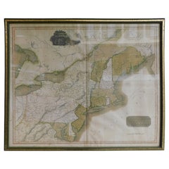
English Engraved Hand Colored Map of the North Eastern United States, circa 1817
Located in Charleston, SC
English copper engraved hand colored map of the North Eastern United States matted under glass in a gilt frame, Early 19th Century. Drawn and Engraved for Thomson's New General Atlas...
Category
1810s English George III Antique Charleston Maps
Materials
Glass, Giltwood, Paint, Paper
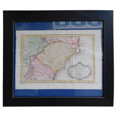
French Framed Copper Engraved Hand Colored Map of Carolina & Georgia, Circa 1757
Located in Charleston, SC
French copper engraved hand colored map of Carolina & Georgia matted under glass with a painted frame, mid-18th century
Category
1750s French Louis XV Antique Charleston Maps
Materials
Glass, Wood, Paint, Paper
Related Items
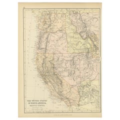
Antique Map of The United States of North America, Pacific States, 1882
Located in Langweer, NL
The map is from the same 1882 Blackie Atlas and focuses on the Pacific States of the United States of America during that period. Here are some details and historical context about t...
Category
1880s Antique Charleston Maps
Materials
Paper
$239 Sale Price
20% Off
H 14.97 in W 11.03 in D 0 in
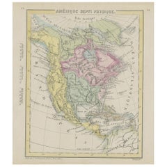
Small Map of the United States
Located in Langweer, NL
Antique map titled 'Amérique septe. Physique'. Small map of the United States. lithographed by C. Callewaert brothers in Brussels circa 1870.
Category
Mid-19th Century Antique Charleston Maps
Materials
Paper
Claude Lalanne, a Rare Gilt-Bronze Dragonfly Frame, France, C. 1985
By Claude Lalanne
Located in Queens, NY
Claude Lalanne (1925-2019) A rare gilt-bronze dragonfly frame, France C. 1985,
Signed on reverse Cl. Lalanne Artcurial 25/450.
Measures: 4" high x 3...
Category
20th Century French Art Nouveau Charleston Maps
Materials
Bronze
Dalila Picture Frame in Corno Italiano and Hand Engraved Gilded Brass, Mod. 4002
By Filippo Dini, Arcahorn Srl.
Located in Recanati, Macerata
Emulating the finest jewelry techniques, the Dalila picture frame stands out for the dazzling beauty of its gems in Corno Italiano. Additional artistic intrigue is given by the 24-ka...
Category
21st Century and Contemporary Italian Charleston Maps
Materials
Brass
$3,597 / item
H 14.18 in W 11.82 in D 0.79 in
Antique Art Nouveau Photo Album or Book with Brass Stand Up Frame
Located in Hamilton, Ontario
This antique standing photo album is unsigned, but presumed to have originated from France and date to approximately 1900 and done in the period Art Nouveau style. The album is compo...
Category
Late 19th Century French Art Nouveau Antique Charleston Maps
Materials
Brass
Hand-Carved Oak Picture Frame from France, Circa 1900
Located in High Point, NC
Circa 1900 hand carved oak picture frame from France. The frame is oval and has hand carved floral and leaf decoration surrounding the central picture place. There is a wood easel ...
Category
Early 1900s French Antique Charleston Maps
Materials
Oak
Antique Map of the United States by Titus '1871'
Located in Langweer, NL
Antique map titled 'The United States of America'. Original antique map of the United States. This map originates from 'Atlas of Prebl...
Category
Late 19th Century Antique Charleston Maps
Materials
Paper
$766 Sale Price
20% Off
H 16.54 in W 26.78 in D 0.02 in
Antique Map of the United States by Balbi '1847'
Located in Langweer, NL
Antique map titled 'Etats-Unis'. Original antique map of the United States. This map originates from 'Abrégé de Géographie (..)' by Ad...
Category
Mid-19th Century Antique Charleston Maps
Materials
Paper
$191 Sale Price
20% Off
H 9.06 in W 11.23 in D 0.02 in
Antique Picture Frame, Photo Frame, France, Circa 1880, 3 x 5 cm
Located in Greven, DE
Exceptional picture frame with beautifully crafted angels on each side, France circa 1880.
Picture size: 3 cm x 5 cm.
In the salons of the wealthy bourgeoisie and aristocracy, such...
Category
Late 19th Century French Antique Charleston Maps
Materials
Brass
French Crucifix Vitrine and Oval Frame, Late 19th Century
Located in Labrit, Landes
Crucifix in its oval vitrine, French, late 19th century
Golden frame
Good condition
For shipping: 9/51/60 cm, 3.3 kg.
Category
Late 19th Century French Napoleon III Antique Charleston Maps
Materials
Glass, Wood
$700 Sale Price
67% Off
H 23.63 in W 20.08 in D 3.55 in
Antique Map of the United States with inset map of the region of Mexico City
Located in Langweer, NL
Antique map titled 'Verein-Staaten von Nord-America, Mexico, Yucatan u.a.'. Very detailed map of the United States of America showing the Caribbean. With an inset map of the surround...
Category
Mid-19th Century Antique Charleston Maps
Materials
Paper
$825 Sale Price
20% Off
H 14.69 in W 17.92 in D 0.02 in
Large Antique English Silver Plated Military Photograph / Picture Frame c.1910
Located in Bath, GB
A large and grand silver plated photograph frame with military / Royal Artillary interest dating to c.1910.
The top of the frame is mounted with a gilded Royal Artillary cap badge...
Category
1950s English Vintage Charleston Maps
Materials
Silver Plate
$1,042 Sale Price
20% Off
H 14 in W 10 in D 1 in
Previously Available Items
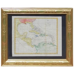
English Map of West Indies with a Gilt Wood Frame Under Glass, Late 19th Cent
Located in Charleston, SC
English hand colored accurate map of the West Indies with a foliage gilt wood and gesso frame under glass, Late 19th century. Long West from London.
Category
Late 19th Century English Victorian Antique Charleston Maps
Materials
Gesso, Glass, Giltwood, Paint, Paper
H 13.75 in W 16.75 in D 0.75 in
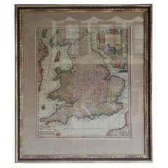
Framed Britannia Map Hand Tinted and Colored, Signed Matthaus Seutter, C. 1725
Located in Charleston, SC
Framed and Matted Britannia Map hand tinted and colored with gilt frame.
Signed Matthaus Seutter, 1725
Seutter was one of the most important and prolific German map publishers of t...
Category
1720s German George II Antique Charleston Maps
Materials
Glass, Giltwood, Paper
H 33 in W 28.75 in D 1.25 in
French European Framed Map Printed on Linen, Signed, Circa 1781
Located in Charleston, SC
French European framed map printed on linen with a colorful outlines and border under glass. Late 18th Century.
Measures: Map dimensions 22" Tall / 3...
Category
1780s French Louis XVI Antique Charleston Maps
Materials
Glass, Linen, Wood
A Rare French Engraved Map of The Southeastern United States. R.Bonne Circa 1780
By Rigobert Bonne
Located in Charleston, SC
A rare framed French engraved map on paper of the southeastern United States including Virginia, North Carolina, South Carolina, and Georgia. Rigobert Bonne, Paris Circa 1780. Plat...
Category
1780s French Louis XVI Antique Charleston Maps
Materials
Paper, Wood
H 16.5 in W 21 in D 1 in
Rare Charleston, South Carolina Engraved Map "Town & Harbor, " Circa 1700
Located in Charleston, SC
French engraved map of Charleston, South Carolina town and harbor depicting the Ashley & Cooper River, Fort Johnson and Port ET Ville in wood frame, ...
Category
Early 1700s French Louis XIV Antique Charleston Maps
Rare Charleston, South Carolina Engraved Map "Town and Harbor, " Circa 1747
By Bowen
Located in Charleston, SC
Charleston, South Carolina engraved map of "The Town and Harbor of Charles town" in wood frame by Bowen, London, Circa 1747. Fourth plan of Charleston. Inside Map dimensions 4.5" T /...
Category
