Continental Europe Maps
to
4,200
5,168
5,520
197
5,167
1
2
2
2
1
2,844
2,005
318
1
179
12
1
68
3
3
3
2
3
1
5,149
17
11
10
8
463
192
89
81
53
5,168
5,168
5,168
104
58
20
14
13
Item Ships From: Continental Europe
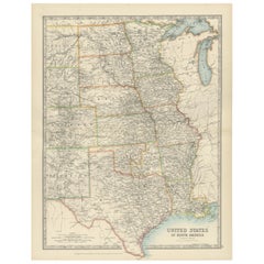
Map of United States Central Sheet 1903 – Railroads, States, and Topography
Located in Langweer, NL
Map of United States Central Sheet 1903 – Railroads, States, and Topography
This is a finely engraved and beautifully colored map titled "United States of North America (Central She...
Category
Early 20th Century Continental Europe Maps
Materials
Paper
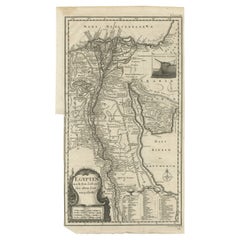
Antique Map of Egypt and the Nile River
Located in Langweer, NL
Antique map titled 'Egypten nach dem Zustand der alten Zeit vorgestellt'. This uncommon and richly detailed map of Egypt features hundreds of place names along the Nile. The Sinai Pe...
Category
Mid-18th Century Antique Continental Europe Maps
Materials
Paper
$324 Sale Price
20% Off
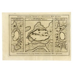
Antique Map of Cities in the Region of Hubei in China, 1758
Located in Langweer, NL
Antique map titled 'Plans de Quelques villes de la province de Hou-Quang.' Three plans of cities in a region named Hou-Quang (currently Hubei). While these maps by Van Schley after B...
Category
18th Century Antique Continental Europe Maps
Materials
Paper
$305 Sale Price
20% Off
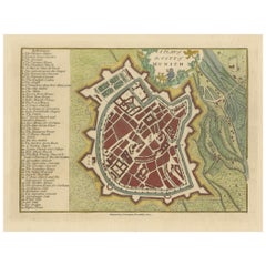
Original Antique Map of Munich, Germany by J. Stockdale, 1800
Located in Langweer, NL
Title: Vintage Map of Munich, Germany by J. Stockdale, 1800
This vintage map, titled "A Plan of the City of Munich," was published by J. Stockdale in Piccadilly, London, in 1800. Th...
Category
Early 1800s Antique Continental Europe Maps
Materials
Paper
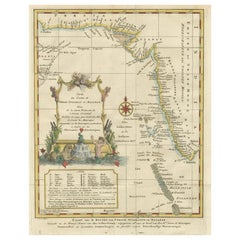
1773 Map of Persia, Gujarat & Malabar Coasts – Arabia to India, Hand-Colored
Located in Langweer, NL
1773 Bellin map of Persia, Gujarat and Malabar coasts with Arabia and Maldives
Description:
This finely engraved and delicately hand-colored 18th-century map titled Kaart van de Kusten van Persië, Guzaratte en Malabar was produced by the eminent French cartographer Jacques-Nicolas Bellin and engraved by Jakob van der Schley. It was published in 1773 in Amsterdam by E. van Harrevelt and D. Changuion, as part of a Dutch edition of Bellin’s maritime atlas focused on the East Indies and the Indian Ocean.
The map presents the coastline bordering the Arabian Sea, extending from the Persian Gulf and parts of the Arabian Peninsula to the shores of Gujarat and the Malabar Coast in southwestern India. It provides a detailed representation of the coastlines of Persia (modern-day Iran), the western coast of India, and a portion of southern Arabia including the Oman Peninsula. Coastal towns, rivers, ports, and geographical landmarks are clearly labeled, including prominent trading centers like Surat, Goa, Calicut, Cochin, and Cape Comorin (now Kanyakumari).
Additionally, the map shows the Laccadive Islands (Laka Dives) and the Maldives (Maldivische Eilanden), with attention to navigational details such as shoals, sandbanks, and anchor points. A large compass rose and clear latitude and longitude markings enhance its utility as a navigational aid.
A highly decorative title cartouche at lower left features maritime iconography such as sea creatures, a fountain, and shells. An inset legend beneath the map provides explanations in Dutch for the symbols used to indicate bays, capes, ports, forts, islands, and towns.
This is a copperplate engraving printed on laid paper with full original hand coloring. It retains its original fold lines as issued. The condition is generally good, with minor age toning and a few light spots in the margins. No repairs or restoration are visible. The paper is strong, and the impression remains crisp and clear.
This historical map is a significant and attractive example of 18th-century European cartography, especially valued for its depiction of maritime trade regions and coastal geography during the age of exploration and colonial expansion.
To frame this 1773 Bellin map attractively and safely:
- Use acid-free matting in a neutral tone like cream or antique white
- Consider double matting with a subtle inner color that complements the map
- Choose a simple wooden frame in walnut, cherry, or aged oak for a classic look
- Use UV-protective glass or acrylic to prevent fading
- For a full display, consider float mounting to show the edges and fold lines
- Allow 2 to 3 inch mat margins to balance the composition and enhance presentation
Keywords:
Bellin map 1773, van der Schley, Persia coast map, Gujarat map, Malabar map...
Category
1780s Antique Continental Europe Maps
Materials
Paper
$324 Sale Price
20% Off
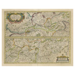
Antique Map of the of the Course of the Albis River 'or Elbe River'
By Johannes Janssonius
Located in Langweer, NL
Antique map titled 'Albis Fluvius Germaniae celebris A Fontiubus Ad Ostia, Cum Fluminibus ab utroque latere in illum fluenibus descriptus'. Detailed map of the course of the Albis Ri...
Category
Mid-17th Century Antique Continental Europe Maps
Materials
Paper
$572 Sale Price
20% Off
Map of Turkish Dominions in Europe, Ottoman Balkan Territories 1813
Located in Langweer, NL
Map of Turkish Dominions in Europe, Ottoman Balkan Territories 1814
This antique map titled "Turkish Dominions in Europe" provides a detailed depiction of the Balkan Peninsula and a...
Category
1810s Antique Continental Europe Maps
Materials
Paper
Very Large Hand-Drawn View of St Iago Cape Verde, by Frederici, 1783
Located in Amsterdam, NL
Johann Christian Friderici [= Frederici] (Heldburg 1766 - Cape Town 1804)
Prospect van het eyland, en de rheede van St. Iago. Geteekend van Johann Christian Friderici / Verbeelding van de inwoonders op St Iago
(View of the island, and the roadstead of St. Iago. Drawn by Johann Christian Friderci / Depiction of the inhabitants on St Iago)
?Porto Praia, Cape Verde...
Category
Late 18th Century Cape Verdean Dutch Colonial Antique Continental Europe Maps
Materials
Paper
Antique Map of Cyprus (Cypern) from Meyer's Lexikon, Leipzig, circa 1890
Located in Langweer, NL
Antique Map of Cyprus (Cypern) from Meyer's Lexikon, Leipzig, circa 1890
This finely detailed antique map titled "Cypern" presents the island of Cyprus as it appeared in the late 19...
Category
1890s Antique Continental Europe Maps
Materials
Paper
1889s Antique Celestial Globe Signed Gussoni e Dotti Milano Papier Maché Sphere
Located in Milan, IT
Celestial globe compiled on the Hesi & Gould catalogs by Eng. Pini and published in 1889 by Gussoni & Dotti Milano piazza del Duomo. Sphere in paper mache covered with paper printed by engraving on copper plate and hand watercolored, base in turned and ebonized wood.
Good condition, conservative restoration at the base. Measures: Height 45 cm, inche 17.8, sphere diameter 22 cm 8.7.
Giovanni Gussoni in 1874 bought the business of Antonio Ronchi typographer in Via Unione 5 in Milan, and then moved in 1883 to the shop of the Southern Porticoes in Piazza Duomo. Giovanni Gussoni was followed by his son Vittorio, who on April 16, 1907 sold the company to a collaborator, Giovanni Serra, who continued the business until November 1914.
Man has always wanted to know the world in which he lives and has used all the means available to measure the space that surrounds him to expand his knowledge more and more. The conditions that allowed man to develop models of the world and space were probably realized only after...
Category
1880s Antique Continental Europe Maps
Materials
Paper
Antique Map of the Location of the Garden of Eden and Travels of the Patriarchs
Located in Langweer, NL
Title: Map of the Location of the Garden of Eden and Travels of the Patriarchs
Cartographer/Publisher:
Pieter Mortier (1661–1711), published by Covens & Mortier (Amsterdam, 1725)...
Category
1720s Antique Continental Europe Maps
Materials
Paper
Australia, New Zealand, and Neighbouring Islands Map 1858
Located in Langweer, NL
Australia and Neighbouring Islands Map 1858
This attractive antique print shows “Festland von Australien und benachbarte Inseln” meaning “Mainland Australia and neighbouring islands...
Category
Mid-19th Century German Antique Continental Europe Maps
Materials
Paper
England and London Government Map with Allegorical Vignettes, ca. 1720
Located in Langweer, NL
England and London Government Map with Allegorical Vignettes, ca. 1720
Description:
This highly decorative and information-rich copperplate engraving, titled "Nouvelle carte du Gouv...
Category
Early 18th Century French Antique Continental Europe Maps
Materials
Paper
Important and Scarce Antique Map of Asia from Jesuit Sources, C.1713
Located in Langweer, NL
Antique map titled 'L'Asie selon les nouvelles observations de Messrs de l'Academie des Sciences etc'. The main focus of this important and scarce map of Asia is the delineation of the northeast part of the continent from Jesuit sources. The northeast coast is severely truncated with the discoveries of Nicolas Witsen shown, and the partial coastlines of Jesso and Compagnies Land are depicted to the north of Japan. Inset in the North Pacific is a map of that same region based on the information from Father Martino Martini. It shows Jesso connected to the mainland with a narrow strait between it and a huge Compagnies Land. An inset below, taken from Father Ferdinand Verbiest, illustrates the road between Peking and Kirin and Nincrita. Father Verbiest's world map of 1674, which he compiled for the Chinese, subsequently led to the Jesuits obtaining a commission to make a comprehensive topographical...
Category
18th Century Antique Continental Europe Maps
Materials
Paper
$3,336 Sale Price
20% Off
Mountain Elevation Profiles – Alps, Pyrenees, Andes & World Heights 1857
Located in Langweer, NL
Mountain Elevation Profiles – Alps, Pyrenees, Andes & World Heights 1857
This intriguing antique print shows comparative elevation profiles titled “Die bekannteren Höhen über der Me...
Category
Mid-19th Century German Antique Continental Europe Maps
Materials
Paper
Antique Map of Greece and the Cyclades, 1903, with Many Details and Inset Maps
Located in Langweer, NL
Title: Antique Map of Greece and the Cyclades, 1903, with Intricate Detail and Inset Maps
Description: This antique map, titled "Greece with Its Islands, Including the Cyclades," wa...
Category
Early 20th Century Continental Europe Maps
Materials
Paper
Planiglob of the Antipodes – Unique Global Projection Map 1857
Located in Langweer, NL
Planiglob of the Antipodes – Unique Global Projection Map 1857
This rare and fascinating antique print shows a “Planiglob der Antipoden” or Planiglob of the Antipodes, depicting the...
Category
Mid-19th Century German Antique Continental Europe Maps
Materials
Paper
Northern Hemisphere Star Map – Constellations & Astronomical Chart, c.1858
Located in Langweer, NL
Northern Hemisphere Star Map – Constellations & Astronomical Chart c.1858
This attractive antique print shows the northern starry sky titled “Der nördliche gestirnte Himmel”, meanin...
Category
Mid-19th Century German Antique Continental Europe Maps
Materials
Paper
Antique Map of Sweden & Norway, 1903, with Intricate Topographical Detail
Located in Langweer, NL
Title: Antique Map of Sweden & Norway, 1903, with Intricate Topographical Detail
Description:
This antique map, titled "Sweden & Norway (Scandinavia)," was engraved and published in...
Category
Early 20th Century Continental Europe Maps
Materials
Paper
Beautiful 17th Century Map of Paris and Isle de France by Templeux, c.1650
Located in Langweer, NL
Map of Isle de France by D. de Templeux, ca. 1650, Hand-Colored and Decorative
This richly detailed antique map titled *Le Gouvernement de L'Isle de France* was engraved by Daniel d...
Category
1650s Antique Continental Europe Maps
Materials
Paper
Hand-Colored Map of Delfland by Hendrik de Leth, 1740 – Delft & The Hague
Located in Langweer, NL
Hand-Colored Map of Delfland by Hendrik de Leth, 1740 – Delft & The Hague
This beautifully preserved antique map titled "Nieuwe Gemeete Kaert van Delfland" was engraved by Hendrik d...
Category
1740s Antique Continental Europe Maps
Materials
Paper
Antique Map of the Djati 'teak wood' Forest Near Rembang, Java by Stemler, 1875
By Stemler
Located in Langweer, NL
Antique map titled 'Overzichtskaart van de Djatibosschen in de Residentie Rembang, Java.' This scarce map shows the Djati (teak) Forest on the indonesian island of Java. Originates f...
Category
19th Century Antique Continental Europe Maps
Materials
Paper
$257 Sale Price
20% Off
Antique Map of China, Taiwan, Korea, Hong-Kong and Japan, 1903
Located in Langweer, NL
Antique Map of China, Taiwan, Korea, Hong-Kong and Japan, 1903
Description: This antique map, titled "India (Southern Sheet) and the South Eastern Provinces," was engraved and publi...
Category
Early 20th Century Continental Europe Maps
Materials
Paper
1794 Map of Jamaica by Bryan Edwards – Parishes, Plantations, Settlements
Located in Langweer, NL
1794 Bryan Edwards Map of Jamaica – Parishes, Plantations, Settlements
This is an important antique map titled “A Map of the Island of Jamaica, Divided into Counties and Parishes,” created by Bryan Edwards in 1794. It was published in the second edition of his influential work *The History of the British West Indies*, which provided detailed insights into the geography, society, and economy of the Caribbean at the height of British colonial influence.
The map meticulously depicts Jamaica divided into its traditional counties and parishes, each shaded to aid visual differentiation. Major settlements are clearly labelled, including Kingston, Montego Bay, Spanish Town, and Falmouth. The island’s intricate network of rivers, mountains, and coastal features are rendered with careful hachure and stipple shading to indicate elevation and terrain. Edwards uses small circular symbols to denote the locations of numerous sugar plantations that formed the backbone of Jamaica’s economy during this period, each plantation representing not only agricultural wealth but also the grim history of enslaved African labour central to the island’s prosperity.
Further notations identify churches, barracks, forts, and ports, demonstrating the comprehensive utility of this map for historical research into colonial infrastructure. The map even marks Bryan...
Category
Late 18th Century English Antique Continental Europe Maps
Materials
Paper
Italia Antiqua Philippo Cluvero – 1603 Hondius Map of Ancient Italy, Handcolored
Located in Langweer, NL
Italia Antiqua Philippo Cluvero – 1603 Hondius Map of Ancient Italy with Hand Color
This stunning early 17th-century map, *Italia Antiqua Philippo Cluvero Borusso Designatore*, wa...
Category
Early 1600s Antique Continental Europe Maps
Materials
Paper
Antique Map of Andalusia Spain – Hand-Coloured Tassin Engraving 1651
Located in Langweer, NL
Antique Map of Andalusia Spain – Hand-Coloured Tassin Engraving 1651
This fine hand-coloured engraved map shows the historic kingdom of Andalusia in southern Spain, created by Nicol...
Category
Mid-17th Century French Antique Continental Europe Maps
Materials
Paper
1616 Petrus Kaerius Map of Southern India and Ceylon – Narsinga et Ceylon
Located in Langweer, NL
Title: 1616 Petrus Kaerius Map of Southern India and Ceylon – Narsinga et Ceylon
This rare early 17th-century copper engraved map titled 'Narsinga et Ceylon' was created by Petrus K...
Category
Early 17th Century German Antique Continental Europe Maps
Materials
Paper
Antique Map of the Region of Touraine in France by Janssonius, 1657
By Johannes Janssonius
Located in Langweer, NL
Antique map titled 'Touraine - Turonensis Ducatus'.
Decorative map of the Touraine region. This map originates from 'Atlas Novus, Sive Theatrum Orbis Orbis Terrarum: In quo Galli...
Category
17th Century Antique Continental Europe Maps
Materials
Paper
1902 Cartographic View of Salamanca: The Golden Province of Spain
Located in Langweer, NL
This map showcases the province of Salamanca in the year 1902. Salamanca is located in the autonomous community of Castile and León in western Spain. It is bordered by the provinces ...
Category
Early 1900s Antique Continental Europe Maps
Materials
Paper
$263 Sale Price
35% Off
Antique Map Plan of Town and Mole of CAP D'agde & Fort De Brescou, France, 1759
Located in Langweer, NL
Antique Plan titled 'Plan of the Town and Mole of Agde with the Fort de Brescou'. Antique town plan of Agde, engraved for the Geographical Dictionary, by Rol...
Category
Mid-18th Century Antique Continental Europe Maps
Materials
Paper
$467 Sale Price
20% Off
Map of Iran, Arabia, Asia Minor & Caucasus by Perthes, 1858
Located in Langweer, NL
Map of Iran, Arabia, Asia Minor & Caucasus by Perthes, 1858
This is a detailed engraved map titled Vorder-Asien oder Iran, Turan, Arabien, Kleinasien und die Kaukasus Länder, publis...
Category
Mid-19th Century German Antique Continental Europe Maps
Materials
Paper
Antique Map of Gelderland with the Veluwe Etc, the Netherlands, 1864
Located in Langweer, NL
Antique map titled 'De Provincie Gelderland'. Map of the province of Gelderland, the Netherlands.
This map originates from 'F. C. Brugsma's Atlas van het Koninkrijk der Nederland...
Category
19th Century Antique Continental Europe Maps
Materials
Paper
Antique Map of the Province of Friesland in The Netherlands, 1718
Located in Langweer, NL
Antique map titled 'Frisiae Dominium vernacule Friesland (..)'.
Original antique map of Friesland, the Netherlands. Originates from 'Uitbeelding van de Heerlijkheid van Friesland...
Category
18th Century Antique Continental Europe Maps
Materials
Paper
$716 Sale Price
20% Off
18th Century Antique Engraving of the Southern Hemisphere by G. de L'Isle
By Guillaume De L'Isle
Located in Langweer, NL
Antique map titled 'Hemisphere Meridional pour voir plus distinctement Les Terres Australes'. Hemispherical map of the southern hemisphere centered on ...
Category
Late 18th Century Antique Continental Europe Maps
Materials
Paper
Arkansas Map by Colton, USA Published c.1864 – Hand-Colored County Map
Located in Langweer, NL
Arkansas Map by Colton, USA Published c.1864 – Hand-Colored County Map
This is a finely engraved and hand-colored map titled Arkansas, published by G.W. & C.B. Colton & Co. in New Y...
Category
Mid-19th Century American Antique Continental Europe Maps
Materials
Paper
Map of Côte-d'Or France with Dijon and Burgundy Wine Region, 19th Century
Located in Langweer, NL
Map of Côte-d'Or France with Dijon and Burgundy Wine Region, 19th Century
Description:
This beautifully engraved 19th-century map of Côte-d'Or, located in the historic region of Bur...
Category
Mid-19th Century French Antique Continental Europe Maps
Materials
Paper
Plan of Cincinnati Map, USA c.1870 – Hand-Colored Street Plan with Wards
Located in Langweer, NL
Plan of Cincinnati Map, USA c.1870 – Hand-Colored Street Plan with Wards
This is a finely engraved and hand-colored street plan titled Plan of Cincinnati and Vicinity, published in ...
Category
Mid-19th Century American Antique Continental Europe Maps
Materials
Paper
Rare 1690 Map of England by Nicolaes Visscher II – Heptarchy Depicted
Located in Langweer, NL
Map of England 1690 by Nicolaes Visscher II – Heptarchy and Counties Shown
Antique 1690 map of England by Nicolaes Visscher II, showing the Anglo-Saxon Heptarchy and detailed county...
Category
Late 17th Century Dutch Antique Continental Europe Maps
Materials
Paper
Pl. 67 Antique Print of Decorative Art in the Renaissance Period by Racinet, 186
Located in Langweer, NL
Old print of decorative art in the Renaissance period. This print originates from 'L'Ornement polychrome'. A beautiful work containing about 2000 patterns of all the styles of Art ol...
Category
19th Century Antique Continental Europe Maps
Materials
Paper
Minnesota and Dakota Map – Johnson, Hand-Colored, USA c.1864
Located in Langweer, NL
Johnson’s Minnesota and Dakota Map, USA c.1864 – Hand-Colored Territorial Map
Description:
This is a finely engraved and hand-colored map titled Johnson’s Minnesota and Dakota, pub...
Category
Mid-19th Century American Antique Continental Europe Maps
Materials
Paper
Attack Plan of Douay Fortress, France, 1710 Siege – Brussels c.1720 Map
Located in Langweer, NL
Attack Plan of Douay Fortress, France, 1710 Siege – Brussels c.1720 Map
This engraved military map shows the detailed plan of attacks on the fortress city of Douay (Douai) in northe...
Category
Early 18th Century French Antique Continental Europe Maps
Materials
Paper
Map of Shropshire, 1844: Telford, Shrewsbury, Oswestry, Bridgnorth & Wellington
Located in Langweer, NL
Old Map of Shropshire by Samuel Lewis, 1844: Telford, Shrewsbury, Oswestry, Bridgnorth, and Wellington
This 1844 map of Shropshire is an antique engraving from Samuel Lewis' Topogr...
Category
1840s Antique Continental Europe Maps
Materials
Paper
$181 Sale Price
20% Off
Old Engraving the City and Harbour of Pathmos, Patmos or Patimo in Greece, 1725
Located in Langweer, NL
Antique print, titled: 'Gezicht van het eiland en de haven van Pathmos (…).'
This plate shows a view of the city and harbour of Pathmos, Patmos or Patimo in Greece. This plate or...
Category
1720s Antique Continental Europe Maps
Materials
Paper
$886 Sale Price
20% Off
Johnson’s Mexico Map with Tehuantepec Inset, USA c.1864 – Hand-Colored
Located in Langweer, NL
Johnson’s Mexico Map with Tehuantepec Inset, USA c.1864 – Hand-Colored
This is a finely engraved and hand-colored map titled Johnson’s Mexico, published by Johnson and Ward in New Y...
Category
Mid-19th Century American Antique Continental Europe Maps
Materials
Paper
1728 Map of Batavia Castle & City, Java – Van der Aa after 1669
Located in Langweer, NL
1728 Map of Batavia Castle & City, Java – Van der Aa after 1669
This is an original antique copperplate engraving titled “Plan de la Ville et du Château de Batavia en l’Isle de Iava...
Category
Early 18th Century Dutch Antique Continental Europe Maps
Materials
Paper
Johnson’s Australia Map, USA Published c.1864 – Decorative Hand-Colored Map
Located in Langweer, NL
Johnson’s Australia Map, USA Published c.1864 – Decorative Hand-Colored Map
This is a finely engraved and hand-colored map titled Johnson’s Australia published by Johnson and Ward i...
Category
Mid-19th Century American Antique Continental Europe Maps
Materials
Paper
Map of Persia, the Caspian & India – Isaak Tirion, c.1730
Located in Langweer, NL
Map of Persia and Surrounding Regions – “Nieuwe Kaart van 't Ryck van Persie” by Isaak Tirion, Amsterdam, c. 1730
This finely detailed copperplate map titled “Nieuwe Kaart van 't Ry...
Category
Mid-18th Century Dutch Antique Continental Europe Maps
Materials
Paper
Antique Map of Romania and Bulgaria Centered on the Danube River
Located in Langweer, NL
Antique map titled 'Vetus descriptio Daciarum nec non Moesiarum'. Impressive map of the area of Romania and Bulgaria centered on the Danube River. The map is based on Ortelius' map o...
Category
Mid-17th Century Antique Continental Europe Maps
Materials
Paper
$658 Sale Price
20% Off
1756 Map of Brazil from Bahia to São Paulo by Bellin – French Colonial Engraving
Located in Langweer, NL
Antique Map of Brazil from Bahia to São Paulo – Bellin for L'Histoire des Voyages
This elegant 18th-century French map titled "Suite du Bresil, Depuis la Baie de Tous les Saints jus...
Category
1750s Antique Continental Europe Maps
Materials
Paper
Old Map of the UK & Ireland, Insets of Orkney, Shetland and Faroe Islands, 1786
Located in Langweer, NL
Title: "Les Isles Britanniques qui contiennent les Royaumes d'Angleterre, Escosse, et Irlande".
Hand-colored engraved map with 2 (large) decorative cartouches, inset map of the Ork...
Category
1780s Antique Continental Europe Maps
Materials
Paper
$1,287 Sale Price
20% Off
Old Eastern Balkans Map, with Dalmatia, Croatia, Slavonia, Bosnia, Serbia, 1633
Located in Langweer, NL
Antique map titled 'Sclavonia, Croatia, Bosnia cum Dalmatiae Parte'. Old map of the Eastern Balkans with the geographical & political divisions of Dalmatia, Croatia, Slavonia, Bosnia, Serbia, etc. The map details the course of the Danube, Sauus, and Drauus Rivers. Originates from the 1633 German edition of the Mercator-Hondius Atlas Major, published by Henricus Hondius and Jan Jansson under the title: 'Atlas: das ist Abbildung der gantzen Welt, mit allen darin begriffenen Laendern und Provintzen: sonderlich von Teutschland, Franckreich, Niderland, Ost und West Indien: mit Beschreibung der selben.'
Artists and Engravers: Gerard Mercator (1512 - 1594) originally a student of philosophy was one of the most renowned cosmographers and geographers of the 16th century, as well as an accomplished scientific instrument maker. He is most famous for introducing Mercators Projection, a system which allowed navigators to plot the same constant compass bearing on a flat map...
Category
1630s Antique Continental Europe Maps
Materials
Paper
$905 Sale Price
20% Off
1726 Map of Bengal by Van der Aa after Valentijn – Dutch East Indies
Located in Langweer, NL
1726 Map of Bengal by Van der Aa after Valentijn – Dutch East Indies
This is an original antique map titled “Nieuwe Kaart van ’t Koninryk van Bengale,” published by Pieter van der Aa in Leiden in 1726. The map depicts the Kingdom of Bengal and surrounding regions, based on earlier work by François Valentijn, a Dutch East India Company (VOC) official and historian whose extensive writings on Asia were among the most important early European sources.
The engraving covers the Bengal region (modern-day Bangladesh and West Bengal, India), showing detailed river systems including the Ganges and its distributaries flowing into the Gulf of Bengal. Major towns, cities, and kingdoms are labelled in Dutch, such as Orixa (Orissa), Arracan, Tipera (Tripura), and Cos Assam (Assam). Mountain ranges are represented pictorially with stylised hachured peaks, while fertile plains are indicated with field patterns, adding visual texture to the map.
In the upper right is an elegant title cartouche with dedication to VOC officials, referencing Mathijs van den Broecke, a director in Bengal, and Johannes Lennep. A compass rose is positioned at the bottom, enhancing its decorative maritime appeal, with north oriented to the right as typical for Dutch maps of Asian regions in this period.
Pieter van der Aa (1659–1733) was a prolific publisher known for compiling maps from earlier explorers and engravers into elegant and collectible volumes. His works remain valued for their historical significance, decorative artistry, and connection to VOC trade networks and colonial history.
Condition:
Good condition. Strong impression with later hand colouring. Light age toning, faint foxing mainly in margins, and some creasing along original fold lines as issued. Fully suitable for framing.
Framing tips:
Frame this map in a slim gilt or dark wood frame to highlight its decorative hand colouring. Use an off-white archival mat to accentuate the engraving and protect the edges. UV-protective glazing is recommended to maintain colour vibrancy and paper integrity.
Keywords block for your listing:
bengal map...
Category
Early 18th Century Dutch Antique Continental Europe Maps
Materials
Paper
Antique Engraved Map of the Friendly Islands or Tonga, ca.1785
Located in Langweer, NL
Antique map titled 'Carte des Isles des Amis'.
Map of the Friendly Islands / Tonga. The Tongan people first encountered Europeans in 1616 when the Dutch vessel Eendracht, captain...
Category
1780s Antique Continental Europe Maps
Materials
Paper
$305 Sale Price
20% Off
Relief Atlas Map of South America by Hachette – Antique French Map c.1883
Located in Langweer, NL
Antique Map of South America – Physical Relief Map by Hachette, c.1883
Description:
This antique map titled “Amérique du Sud” was published circa 1883 by Hachette in Paris as part o...
Category
Late 19th Century French Antique Continental Europe Maps
Materials
Paper
Egypt and Lower Nubia, 1903 - Historical Map Highlighting Nile and Red Sea
Located in Langweer, NL
Egypt and Lower Nubia, 1903 - Historical Map Highlighting Nile and Red Sea
This beautifully detailed map titled "Egypt, Arabia Petraea, and Lower Nubia" was engraved, printed, and p...
Category
Early 20th Century Continental Europe Maps
Materials
Paper
Antique Map of Africa by Bordiga Fratelli 'circa 1818'
Located in Langweer, NL
Antique map titled 'Carta dell Africa'. Large and quite scarce Italian map of Africa, reflecting the then-current knowledge of the continent's geography, with large areas left comple...
Category
Early 19th Century Antique Continental Europe Maps
Materials
Paper
$1,716 Sale Price
20% Off
Map of the Southeastern USA and Atlantic States – Vintage 1903 Geography
Located in Langweer, NL
Map of the Southeastern USA and Atlantic States – Vintage 1903 Geography
This original engraved map, titled “United States of North America (South Eastern Sheet) with the Atlantic S...
Category
Early 20th Century Continental Europe Maps
Materials
Paper
Antique Map of North America – Physical Relief Map by Hachette c.1883
Located in Langweer, NL
Antique Map of North America – Physical Relief Map by Hachette c.1883
Description:
This antique map titled “Amérique du Nord” was published around 1883 by E. Hachette in Paris as pa...
Category
Late 19th Century French Antique Continental Europe Maps
Materials
Paper
Relief Atlas Map of Asia by Hachette – Antique French Map, circa 1883
Located in Langweer, NL
Antique Map of Asia – Relief Atlas Map by Hachette, circa 1883
Description:
This antique map titled “Asie” was published by Hachette in Paris around 1883 and originates from their e...
Category
Late 19th Century French Antique Continental Europe Maps
Materials
Paper
Old Antique Map of the East Indies and Southeast Asia, ca.1644
Located in Langweer, NL
Antique map titled 'India quae Orientalis dicitur, et Insulae adiacentes'.
Old map of the East Indies and Southeast Asia showing the area between India in the West and parts of Japan, the Marianas and New Guinea/Australia in the East. This map is dedicated to D. Christophorus Thisius by Henricus...
Category
1640s Dutch Antique Continental Europe Maps
Materials
Paper
$2,372 Sale Price
25% Off
Recently Viewed
View AllMore Ways To Browse
Vintage Industrial Bins
Vintage Liquor Labels
Vintage Utensil Holders
Vintage Wicker Wine Bottles
Vintage Wrought Iron Fire Screen
Viso Porcelain
Wall Mount Water Fountains
Wedding Cabinets and Armoires
Wedgwood Green Jasperware
Wedgwood Portrait
West German Pot
White Ceramic Garden Stool
White Ironstone China
White Lacquer Bar Cart
Woman With Water Jug
Wooden Chest 1800
Wooden Tea Cart
Worcester Jug
