Continental Europe Maps
to
4,207
5,108
5,461
195
5,107
1
2
2
2
1
2,803
1,986
318
1
179
12
1
68
3
3
3
2
3
1
5,089
17
10
10
7
366
130
79
75
39
5,108
5,108
5,108
104
59
20
14
13
Item Ships From: Continental Europe
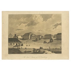
Antique Print of the Bolshoi Theatre in Saint Petersburg, Russia, ca.1810
Located in Langweer, NL
Description: Antique print titled 'The Stone Theatre at St. Petgersbourg'. View ofthe Bolshoi Theatre in Saint Petersburg, Russia. In 1886 the building was declared unsafe and, at th...
Category
1810s Antique Continental Europe Maps
Materials
Paper
$226 Sale Price / item
20% Off
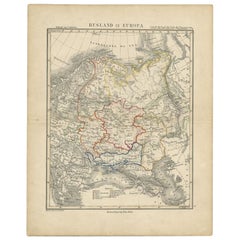
Antique Map of Russia in Europe by Petri, c.1873
Located in Langweer, NL
Antique map titled 'Rusland in Europa'. Old map depicting Russia in Europe. This map originates from 'School-Atlas van alle Deelen der Aarde'. Artists and Engravers: Published by O. ...
Category
19th Century Antique Continental Europe Maps
Materials
Paper
$91 Sale Price
20% Off
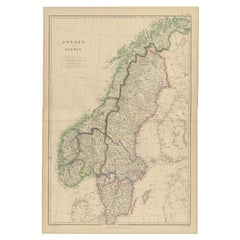
Antique Map of Sweden and Norway by W. G. Blackie, 1859
Located in Langweer, NL
Antique map titled 'Sweden and Norway'. Original antique map of Sweden and Norway. This map originates from ‘The Imperial Atlas of Modern Geography’. Published by W. G. Blackie, 1859.
Category
Mid-19th Century Antique Continental Europe Maps
Materials
Paper
$236 Sale Price
20% Off
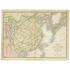
Antique Map of China and Japan by Tardieu, 1821
Located in Langweer, NL
Antique map titled 'Carte de la Chine et du Japon'. Detailed map of China, showing Korea, Japan and Taiwan. This map originates from 'L'histoire général des voyages' by J.F. de la Harpe.
Category
Early 19th Century Antique Continental Europe Maps
Materials
Paper
$685 Sale Price
20% Off
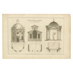
Pl. 8 Antique Print of Various Garden Temples by Le Rouge, c.1785
Located in Langweer, NL
Antique print titled 'Divers petits Temples pour les Jardins Anglais'. Copper engraving showing various temples for English gardens. This print originat...
Category
18th Century Antique Continental Europe Maps
Materials
Paper
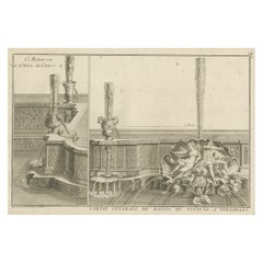
Antique Print of the Neptune Fountain of Versailles, Paris, France, 1776
Located in Langweer, NL
Antique print titled 'Partie Centrale du Bassin de Neptune a Versailles'. Copper engraving showing parts of the Neptune fountain of Versailles, France...
Category
18th Century Antique Continental Europe Maps
Materials
Paper
$321 Sale Price
20% Off
Original Antique Map Showing the Mountain Ranges in Asia and Europe, 1849
Located in Langweer, NL
Antique map titled 'Bergketten in Asien und Eüropa'. Original antique map showing the mountain ranges in Asia and Europe. In outline color with inset maps of Java, Luzon, and Reguain...
Category
1840s Antique Continental Europe Maps
Materials
Paper
$264 Sale Price
20% Off
Antique Map of the North Sea From the English Channel to Norway & Sweden, 1746
Located in Langweer, NL
Antique map titled 'A correct Chart of the German Ocean from the North of Scotland to the Start Point, on the Coast of Great Britain; and from So. Bygden on ye coast of Norway, to C....
Category
1740s Antique Continental Europe Maps
Materials
Paper
$463 Sale Price
20% Off
Old Antique Map of the Banda Islands (Southeast), Indonesia & Northern Australia
By F. Valentijn
Located in Langweer, NL
Original antique map titled 'Kaart van de Zuyd-Ooster Eylanden van Banda'. Important map of the seas and islands surrounding the Banda Islands, Indonesia, extending south to northern Australia, east to Papua New Guinea and north to Ceram. Published 1724-1726 by Joannes van Braam...
Category
Early 18th Century Antique Continental Europe Maps
Materials
Paper
$727 Sale Price
20% Off
Rare Original Miniature Map of Papua New Guinea and the Salomon Islands, 1600
Located in Langweer, NL
Very handsome original old coloured copper engraving of Papua and the Solomon Island. Title of the map 'Descriptio Novae Guneae et Inss. Salom.
On the reverse text in Latin.
Ve...
Category
Early 1600s Antique Continental Europe Maps
Materials
Paper
$510 Sale Price
20% Off
Antique Map of Cities in the Region of Hubei in China, 1758
Located in Langweer, NL
Antique map titled 'Plans de Quelques villes de la province de Hou-Quang.' Three plans of cities in a region named Hou-Quang (currently Hubei). While these maps by Van Schley after B...
Category
18th Century Antique Continental Europe Maps
Materials
Paper
$302 Sale Price
20% Off
Architectural Print of French Villa de la Hutte A Deauville by Chabat, c.1900
Located in Langweer, NL
Antique print titled 'Villa de la Hutte A Deauville, Mr. E. Saintin Architecte'. This print depicts the design of a building in France. Originates from 'La Brique et La Terre Cuite' ...
Category
20th Century Continental Europe Maps
Materials
Paper
La Brique Architectural Print – Parisian Stables on Avenue Raphaël, c.1900
Located in Langweer, NL
La Brique Architectural Print – Parisian Stables on Avenue Raphaël, c.1900
This finely detailed architectural lithograph presents the elegant design of Écuries Avenue Raphaël Paris,...
Category
20th Century French Continental Europe Maps
Materials
Paper
Antique Map of Part of Russia, c.1740
Located in Langweer, NL
Antique map titled 'Ienisensis Provinicia cum adjacentibus Toboliensis & Irkutensis'. Old map of part of Russia including the city of Tobolsk and others. Source unknown, to be determ...
Category
18th Century Antique Continental Europe Maps
Materials
Paper
$129 Sale Price
20% Off
Antique Map of Polynesia with Details of Many Islands, 1840
Located in Langweer, NL
Antique map titled 'Polynesia or Islands in the Pacific Ocean'.
This map depicts various islands including the Lousiade Archipelago, Tahiti, Pitcairn Island, Juan Fernandez, The lo...
Category
19th Century Antique Continental Europe Maps
Materials
Paper
Antique Map of North and South Africa by Johnston, 1882
Located in Langweer, NL
Two antique maps on one sheet titled 'N.W. Africa, Marocco, Algeria & Tunis' and 'Southern Africa, comprising Cape Colony, Natal & c'.
This map originates from 'The Royal Atlas of ...
Category
19th Century Antique Continental Europe Maps
Materials
Paper
Antique Map of the Austrian Empire by W. G. Blackie, 1859
Located in Langweer, NL
Antique map titled 'The Austrian Empire'. Original antique map of the Austrian Empire with inset map of Montenegro. This map originates from ‘The Imperial Atlas of Modern Geography’....
Category
Mid-19th Century Antique Continental Europe Maps
Materials
Paper
$206 Sale Price
30% Off
Antique Map of the Region of Liege by Coronelli, 1690
By Vincenzo Coronelli
Located in Langweer, NL
Antique map titled 'Vescovato di Liege (..)'. Map of the Belgium area centered on Liege and the course of Meuse/Maas River. Also depicts the cities of Maastricht, Namur and Tienen. O...
Category
17th Century Antique Continental Europe Maps
Materials
Paper
$434 Sale Price
20% Off
Heliograph of Tin Mining in Tronoh, Perak and Tambun in Sabah, Malaysia, 1907
Located in Langweer, NL
Three views of the Mining Industry in Malaysia around 1907.
1. Lankshuts at Tronoh, Perak
2. Puddling Machinery, Tambun in Sabah
3. Shaking Machinery at Red Hill
This helio...
Category
Early 1900s Antique Continental Europe Maps
Materials
Paper
$614 Sale Price
20% Off
Antique Print Showing Remnants of Constantine I the Great's Baths, Rome, 1704
Located in Langweer, NL
Antique print, titled: 'De Overblyfzels der Badstoven van Konstantyn den Grooten' - This original old antique print shows the remnants of Constantine I the Great's baths in Rome, Ita...
Category
18th Century Antique Continental Europe Maps
Materials
Paper
Antique Map of South America by Balbi '1847'
Located in Langweer, NL
Antique map titled 'Amérique du sud'. Original antique map of South America. This map originates from 'Abrégé de Géographie (..)' by Adrie...
Category
Mid-19th Century Antique Continental Europe Maps
Materials
Paper
$188 Sale Price
20% Off
Antique Map of West, South, North Australia and Tasmania by W. G. Blackie, 1859
Located in Langweer, NL
Antique map titled 'Western Australia, South Australia, North Australia and Tasmania'. Original antique map of Western Australia, South Australia, North Australia and Tasmania. This ...
Category
Mid-19th Century Antique Continental Europe Maps
Materials
Paper
$236 Sale Price
20% Off
Circus Flaminius (..), Anonymous, 1704
Located in Langweer, NL
Antique print, titled: 'Circus Flaminius (?)' - This original old antique print shows a reconstruction of Circus Flaminius, a large, circular area in ancient Rome, located in the sou...
Category
18th Century Antique Continental Europe Maps
Materials
Paper
Pl. 1 Antique Print of Pavillon La Bouëxière by Le Rouge, c.1785
Located in Langweer, NL
Antique print titled 'Pavillon de Labossiere (..)'. Copper engraving of pavillon La Bouëxière. This print originates from 'Jardins Anglo-Chinois à la Mode' by Georg Louis le Rouge. A...
Category
18th Century Antique Continental Europe Maps
Materials
Paper
Antique Map of the Arabian Desert by Cellarius, 1731
Located in Langweer, NL
Antique map titled 'Arabia Petraea et Deserta.' Arabian desert with present day Israel, Jordania, Iraq. With decorative cartouche showing dromedaries. T...
Category
18th Century Antique Continental Europe Maps
Materials
Paper
$165 Sale Price
20% Off
Antique Print of Warriors from Ombai Island, Alor, Archipel, Indonesia, ca.1845
Located in Langweer, NL
Antique print titled 'Bewohner von Ombai, Habitans de l'isle de Ombai'.
This print depicts natives from Ombai, Indonesia. Originates from 'Naturgeschichte und Abbildungen des Men...
Category
1840s Antique Continental Europe Maps
Materials
Paper
$321 Sale Price
20% Off
Great Antique Bird's-Eye View Plan of Brielle by Blaeu in The Netherlands, 1649
Located in Langweer, NL
Antique print, titled: 'Briela.'
Bird's-eye view plan of Brielle in The Netherlands. With key to locations and coats of arms. Text in Dutch on verso. This plan originates from the famous city Atlas: 'Toneel der Steeden' published by Joan Blaeu...
Category
1640s Antique Continental Europe Maps
Materials
Paper
$1,181 Sale Price
20% Off
Inside View of Magdalen Chapel in the Cowgate in Edinburgh. Scotland, 1790
Located in Langweer, NL
Antique print titled 'Inside View of Magdalen Chapel, near Winchester, from the West'. Inside view of the Magdalen Chapel taken from the Chancel from the West. Artists and Engravers:...
Category
18th Century Antique Continental Europe Maps
Materials
Paper
The Holy Sepulchre '..', Basire, 1795
Located in Langweer, NL
Antique print titled 'The Holy Sepulchre at Northwold in the County of Norfolk'. Antique print depicting the Holy Sepulchre, Northwold. Artists and Engr...
Category
18th Century Antique Continental Europe Maps
Materials
Paper
$141 Sale Price
20% Off
Antique Print of the Stowe House in Stowe, Buckinghamshire, England, c.1785
Located in Langweer, NL
Antique print titled 'Plan actuel du Chateau de Stowe'.
Copper engraving showing a plan and elements of the Stowe House.
Stowe House is a grade I l...
Category
18th Century Antique Continental Europe Maps
Materials
Paper
$538 Sale Price
20% Off
Antique Map of the Black Sea and Surroundings by Sharpe, 1849
Located in Langweer, NL
Antique map titled 'Russia on the Euxine'. Old map of the Black Sea and the surrounding (Russia). This map originates from 'Sharpe's Corresponding Atlas (..)' by J. Sharpe. Artists and Engravers: Published by Chapman and Hall...
Category
19th Century Antique Continental Europe Maps
Materials
Paper
$89 Sale Price
20% Off
Antique Map of the Province of Zeeland by Veelwaard, C.1840
Located in Langweer, NL
Antique map titled 'Kaart van Zeeland (..).' Uncommon map showing the province of Zeeland in the Netherlands. Source unkown, to be determined. Published circa 1840.
Artists and E...
Category
19th Century Antique Continental Europe Maps
Materials
Paper
$118 Sale Price
20% Off
Pavillon Tuilerie – French Architecture Lithograph from La Brique, 1889 Expo
Located in Langweer, NL
Pavillon Tuilerie – French Architectural Lithograph from La Brique, Exposition 1889
This richly detailed architectural lithograph presents the front elevation of the Pavillon de la ...
Category
20th Century French Continental Europe Maps
Materials
Paper
Antique Map of the Region of Bavaria and Austria by Tirion, c.1740
Located in Langweer, NL
Antique map titled 'Carte des environs de Batavia - Kaart van de Buitenstreken van Batavia'. Map of the Batavia area (Jakarta) in Indonesia. With cartouche, scale and compass rose. P...
Category
18th Century Antique Continental Europe Maps
Materials
Paper
$210 Sale Price
20% Off
Antique Map of Gabon, Angola and the Congo Region in Africa c.1680
Located in Langweer, NL
Antique map titled 'Royaume de Congo'.
Map of Gabon, the Congo and Angola from Cape Lopez and Sao Tomé to approximately the border with present-day Namibia. The map is fully engrav...
Category
17th Century Antique Continental Europe Maps
Materials
Paper
Antique Map of the Moluques Islands, Part of Indonesia, circa 1750
Located in Langweer, NL
Map of the Moluques (also known as the Moluccas, Moluccan Islands or simply Maluku). Depicts the islands of Herij, Ternate, Tidor, Pottebackers, Timor, Machian and Bachian.
Category
Mid-18th Century Antique Continental Europe Maps
Materials
Paper
$198 Sale Price
20% Off
Antique Map of Picardy, Aroits and French Flanders by Bonne, c.1780
Located in Langweer, NL
Antique map titled 'Carte des Gouvernements de Flandre Francoise, d'Artois, de Picardie et du Boulenois.' An attractive example of Rigobert Bonne's 1771 decorative map of the French regions of Picardy, Artois, and French Flanders. Covers the region in full from the English Chanel to Normandy. A large decorative title cartouche appears in the upper right. Source unknown, to be determined. Artists and Engravers: Rigobert Bonne (1727-1795 ) was one of the most important cartographers of the late 18th century. In 1773 he succeeded Jacques Bellin as Royal Cartographer to France in the office of the Hydrographer at the Depôt de la Marine. Working in his official capacity Bonne compiled some of the most detailed and accurate maps of the period. Bonne's work represents an important step in the evolution of the cartographic ideology away from the decorative work of the 17th and early 18th century towards a more detail oriented and practical aesthetic. With regard to the rendering of terrain Bonne maps...
Category
18th Century Antique Continental Europe Maps
Materials
Paper
$165 Sale Price
20% Off
Antique Map of the Coast of Africa and the Cape Verde Islands, ca.1680
Located in Langweer, NL
Antique map Africa titled 'Isles du Cap Verd Coste et Pays des Negres'.
Antique map of the coast of Africa and the Cape Verde islands.
Artis...
Category
1680s Antique Continental Europe Maps
Materials
Paper
$330 Sale Price
20% Off
Antique Map of Haute-Garonne ‘France’ by V. Levasseur, 1854
Located in Langweer, NL
Antique map titled 'Dépt. de la Hte. Garonne'. Map of the French department of Haute-Garonne, France. This area of France produces the delicious but lesser known Buzet wines, and ten...
Category
Mid-19th Century Antique Continental Europe Maps
Materials
Paper
$170 Sale Price
20% Off
Old Map of Indian Ocean & Sumatra, Java, Borneo, India, Arabia, Africa, c.1783
Located in Langweer, NL
Antique map titled 'Carte des Declinaisons et Inclinaisons de L'Aiguille Aimantée redigée d'après la table des observations Magnetiques faites par les Voyageurs depuis l'Année 1775'....
Category
1780s Antique Continental Europe Maps
Materials
Paper
$1,322 Sale Price
20% Off
Antique Map of the City of Leeuwarden by Christyn, 1785
Located in Langweer, NL
Antique map titled 'La Ville de Lewarde'. Old map of the city of Leeuwarden, Friesland. Originates from 'Les Délices des Pays-Bas' by J.B. Christyn.
Artists and Engravers: Author:...
Category
18th Century Antique Continental Europe Maps
Materials
Paper
$107 Sale Price
20% Off
Cary’s Map of the Low Countries – Antique 1813 British Map
Located in Langweer, NL
Antique map of the Netherlands titled 'A New Map of the United Provinces comprehending Holland, Zealand, Utrecht, Gelders, Over Yssel, Friesland and Groningen (..)'. Scarce re-editio...
Category
19th Century English Antique Continental Europe Maps
Materials
Paper
Antique Map of the Coast of Northwest Africa by Dien, 1820
Located in Langweer, NL
Antique map Africa titled 'Partie Occidentale de l'Ancien Continent, depuis Lisbonne jusquá la Riviere de Sierra Leona'. Detailed map of Coastal Nor...
Category
19th Century Antique Continental Europe Maps
Materials
Paper
$116 Sale Price
20% Off
Antique Map of the Seven United Provinces of Holland by Seutter, 1727
Located in Langweer, NL
Antique map titled ‘Belgium Foederatum Auctius Et Emendatius‘. Important antique map of the Seven United Provinces of Holland with inset views of the East Indies, the province of Lim...
Category
18th Century Antique Continental Europe Maps
Materials
Paper
$685 Sale Price
20% Off
Antique Map of the Banda Islands in Indonesia by Valentijn, 1726
Located in Langweer, NL
Antique map Indonesia titled 'Kaart der Zuyd-Wester Eylanden van Banda'. Map of the islands in the southwestern part of the Banda Sea including ...
Category
Mid-18th Century Dutch Antique Continental Europe Maps
Materials
Paper
$472 Sale Price
20% Off
Antique Map of the Danube River by Homann, c.1720
By Homann Heirs
Located in Langweer, NL
Antique map titled 'Danubii Fluminis (..)'. Regional map of the Donau river, Shows the Danube river from Belgrade in Serbia, along the border between Roma...
Category
18th Century Antique Continental Europe Maps
Materials
Paper
$874 Sale Price
20% Off
Antique Print of Decorative Art in the Renaissance Period by Racinet, 186
Located in Langweer, NL
Old print of decorative art in the Renaissance period. This print originates from 'L'Ornement polychrome'. A beautiful work containing about 2000 patterns of all the styles of Art ol...
Category
19th Century Antique Continental Europe Maps
Materials
Paper
1889 Decorative Brickwork Patterns – Gallerie des Machines, Chabat c.1900
Located in Langweer, NL
1889 Decorative Brickwork Patterns – Gallerie des Machines, Chabat c.1900
This antique architectural print presents a series of decorative brick and tile floor patterns from the Gal...
Category
20th Century French Continental Europe Maps
Materials
Paper
Antique Map of South America ‘North’ by A.K. Johnston, 1865
Located in Langweer, NL
Antique map titled 'South America, Northern Sheet'. Depicting Guiana, Ecuador, Brazil, Bolivia the Amazones and more. This map originates from the ‘Royal Atlas of Modern Geography’ b...
Category
Mid-19th Century Antique Continental Europe Maps
Materials
Paper
$259 Sale Price
20% Off
Pl. XII Villa a Houlgate, Chabat, c.1900
Located in Langweer, NL
Antique print titled 'Villa a Houlgate Mr. E. Papinot Architecte'. This print depicts the design of a villa in France. Originates from 'La Brique et La Terre Cuite' by P. Chabat. Art...
Category
20th Century Continental Europe Maps
Materials
Paper
$118 Sale Price
20% Off
Antique Map of Germany of German in Roman Times, c.1660
Located in Langweer, NL
Antique map Germany titled 'Germaniae Veteris Typus'. Antique map probably by Blaeu or based on an earlier state by W. Blaeu.
Minor differences shown in the cartouches. Top left ha...
Category
17th Century Antique Continental Europe Maps
Materials
Paper
$803 Sale Price
20% Off
Original Old Map of South East England Incl London, Oxford, Cambridge, Etc, 1633
Located in Langweer, NL
Antique map titled 'Warwicum, Northhamtonia, Huntingdonia, Cantabrigia, Suffolcia, Oxonium, Buckinghamia, Befordia, Harfordia, Essexia, Berceria, Middlesexia, Southhatonia, Surria, Catiu & Southsexia'.
Old map of south east England. Includes London, Salisbury, Oxford, Cambridge, Leicester and Norwich and the Isle of Wight. Originates from the 1633 German edition of the Mercator-Hondius Atlas Major, published by Henricus Hondius and Jan Jansson under the title: 'Atlas: das ist Abbildung der gantzen Welt, mit allen darin begriffenen Laendern und Provintzen: sonderlich von Teutschland, Franckreich, Niderland, Ost und West Indien: mit Beschreibung der selben.'
Artists and engravers: Gerard Mercator (1512 - 1594) originally a student of philosophy was one of the most renowned cosmographers and geographers of the 16th century, as well as an accomplished scientific instrument maker. He is most famous for introducing Mercators Projection, a system which allowed navigators to plot the same constant compass bearing on a flat map.
Category
1630s Antique Continental Europe Maps
Materials
Paper
$1,086 Sale Price / item
20% Off
Encoloured Engraving of Cliff Kaloiero or Caloiero Island, Panaia, Greece, 1688
Located in Langweer, NL
Antique print Greece titled 'De Klip van Kaloiero'. Old print of the Island Kaloiero or Panaia, Greece. This print originates from 'Nauwkeurige Be...
Category
17th Century Antique Continental Europe Maps
Materials
Paper
$274 Sale Price
20% Off
Antique Map of Northwest Europe by Kiepert, c.1870
Located in Langweer, NL
Antique map titled 'Germanisches Nordwest-Europa'. Old map of North-West Europe depicting the United Kingdom, Ireland, the Netherlands, Germany, Scandinavia and surroundings. This ma...
Category
19th Century Antique Continental Europe Maps
Materials
Paper
$127 Sale Price
20% Off
Antique Map of the Netherlands in 1530 by Mees, 1852
Located in Langweer, NL
Antique map titled 'Noord-Nederland in 1530. De laatste tijden der Grafelijke Regering'. Map of the Netherlands in 1530. This map originates from 'Historische Atlas van Noord-Nederla...
Category
19th Century Antique Continental Europe Maps
Materials
Paper
$120 Sale Price
20% Off
Antique Map of the Island Java, Indonesia, c.1650
Located in Langweer, NL
Antique map titled 'Insulae Iavae cum parte insularum Boreno Sumatrae (..)'.
Beautiful map of the island of Java and part of Borneo, Bali, Madura and Sumatra. With decorative carto...
Category
17th Century Antique Continental Europe Maps
Materials
Paper
$3,071 Sale Price
20% Off
Old Print with a View of Saint Petersburg, Russia, 1887
Located in Langweer, NL
Description: Antique print titled 'Birds-Eye View of St. Petersburg'.
Old print with a view of Saint Petersburg, Russia. Originates from 'Voyages and Travels'.
Artists and En...
Category
1880s Antique Continental Europe Maps
Materials
Paper
$245 Sale Price
20% Off
Antique Map of France by Janssonius, c.1650
Located in Langweer, NL
Antique map titled 'Gallia Vetus'. Beautiful map of France based on Caesar's De Bello Gallico. In the columns to the left and right important tribes and people are described.
Art...
Category
17th Century Antique Continental Europe Maps
Materials
Paper
$496 Sale Price
20% Off
Antique Map of the County of Hainaut by Jaillot, 1692
Located in Langweer, NL
Antique map titled 'Le Comté de Haynaut divisé en Chateliensis, Balliages, Prevoste's (..)'. Large map of the county of Hainaut (France) with its most important cities, Mons (Bergen)...
Category
17th Century Antique Continental Europe Maps
Materials
Paper
$210 Sale Price
20% Off
Antique Map of the Region of Lyon by Janssonius, 1657
By Johannes Janssonius
Located in Langweer, NL
Antique map of France titled 'La Principaute de Dombes'. Detailed map of the area above Lyon. This map originates from 'Atlas Novus, Sive Theatrum Orbis Orbis Terrarum: In quo Gallia...
Category
17th Century Antique Continental Europe Maps
Materials
Paper
$390 Sale Price
20% Off
Recently Viewed
View AllMore Ways To Browse
Vintage Industrial Bins
Vintage Liquor Labels
Vintage Utensil Holders
Vintage Wicker Wine Bottles
Vintage Wrought Iron Fire Screen
Viso Porcelain
Wall Mount Water Fountains
Wedding Cabinets and Armoires
Wedgwood Green Jasperware
Wedgwood Portrait
West German Pot
White Ceramic Garden Stool
White Ironstone China
White Lacquer Bar Cart
Woman With Water Jug
Wooden Chest 1800
Wooden Tea Cart
Worcester Jug
