Manhattan Maps
to
1
11
5,436
241
11
1
1
1
6
1
4
1
3
1
1
1
7
3
1
1
1
8
5
2
2
1
11
11
11
1
1
Item Ships From: Manhattan
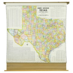
1850-1960 Cram's Superior Latest Federal Census Texas Map
By G. F. Cram Company
Located in New York, NY
The 1850-1960 Cram's Superior Latest Federal Census Texas Map, crafted from pine wood, steel, and canvas, is a valuable historical cartographic piece. Publi...
Category
1910s American Vintage Manhattan Maps
Materials
Canvas
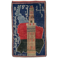
Vintage Afghan Pictorial Map Rug
Located in New York, NY
A vintage Afghan Pictorial map rug from the mid-20th century.
Measures: 3' 0" x 4' 10"
Category
Mid-20th Century Afghan Folk Art Manhattan Maps
Materials
Wool
$660 Sale Price
20% Off
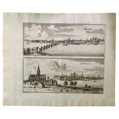
17th Century Topographical Engraving Nantes & St. Malo, France, by Iohan Peeters
Located in New York, NY
The ancient city of Saint Malo in North Western France has long been associated with adventure on the high seas, piracy and exploration. It was the birthplace of several important in...
Category
17th Century Dutch Antique Manhattan Maps
Materials
Paper
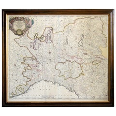
Map of the Republic of Genoa
Located in New York, NY
Framed antique hand-coloured map of the Republic of Genoa including the duchies of Mantua, Modena, and Parma.
Europe, late 18th century.
Dimension: 25...
Category
Late 18th Century European Antique Manhattan Maps
1950's Glass Globe Lamp, Denmark
Located in New York, NY
Danish Glass Globe Lamp, c. 1950's.
Can be lit with inner bulb.
Category
1950s Danish Mid-Century Modern Vintage Manhattan Maps
Materials
Glass, Wood
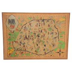
Art Deco Cartoon Style Map of Paris possibly by Arthur Zaindenberg circa 1930's
By Arthur Zaidenberg
Located in New York, NY
Art Deco cartoon style map of Paris possibly by Arthur Zaidenberg. The map depicts witty references to Parisians lifestyle, along with drawings of notable landmarks, circa 1930's. T...
Category
1930s American Art Deco Vintage Manhattan Maps
Materials
Paper
17th Century Topographical Map, French Champagne Region, Epernay, Iohan Peeters
Located in New York, NY
Fine topographical 17th century map by Iohan Peeters of the towns of Epernay and Lametz in the Champagne Region of North Eastern France.
Fabulous period engraving for a Wine Cellar,...
Category
17th Century Dutch Antique Manhattan Maps
Materials
Paper
17th Century Toulouse, Savve, Sommieres Topographical Map by Iohan Peeters
Located in New York, NY
Fine topographical 17th century map of Toulouse, Savve and Sommieres by Iohan Peeters
Beautiful engraving of the capital of France's Occitanie Region, Toulouse, called La Ville Rose- the Pink City, for the terracotta bricks used in its many buildings, giving the city a distinct apricot-rose hue. An important cultural and educational center, the city's residents included Nobel Prize winners and world renown artists- Henri de Toulouse-Lautrec, Henri Martin, Jean-Auguste-Dominique Ingres, Antonin Mercie, Alexandre Falguiere and more recently Cyril Kongo...
Category
17th Century Dutch Antique Manhattan Maps
Materials
Paper
17th Century Topographical Map, Champagne-Ardenne, Marsal, Maubert Iohan Peeters
Located in New York, NY
Fine topographical 17th century map by Iohan Peeters of Marsal and Maubert Fontaine in the Champagne-Ardennes Region of North Eastern France.
Fabulous period engraving for a Wine Ce...
Category
17th Century Dutch Antique Manhattan Maps
Materials
Paper
Antique Map of Italy by Andriveau-Goujon, 1843
By Andriveau-Goujon
Located in New York, NY
Antique Map of Italy by Andriveau-Goujon, 1843. Map of Italy in two parts by Andriveau-Goujon for the Library of Prince Carini at Palazzo Carini i...
Category
1840s French Antique Manhattan Maps
Materials
Linen, Paper
$3,350 / set
17th Century Topographical Map of Cote D'azur, Avignon, Frejus by Iohan Peeters
Located in New York, NY
Fine topographical 17th century map by Iohan Peeters of the towns of Avignon and Frejus in the Cote d'Azur-Provence-Alpes Region of Southeastern France.
Beautifully suited decorativ...
Category
17th Century Dutch Antique Manhattan Maps
Materials
Paper
Related Items
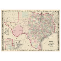
Large Antique Map of the State of Texas, 1861
Located in Langweer, NL
Antique map titled 'Johnson's New Map of the State of Texas' Large map of Texas, shows railroads, wagon roads, the U.S. Mail Route, rivers, ports, ...
Category
Mid-19th Century American Antique Manhattan Maps
Materials
Paper
Colorful Insect Composition in Czech Mouth Blown Glass Globe
Located in Leuven , BE
This lovely colorful composition of five purple wing grasshoppers. Titanacris albipes come from South America and are one of the most beautiful grasshoppers in the world.
Category
21st Century and Contemporary Belgian Manhattan Maps
Materials
Organic Material
Mid-Century World Map Globe Table Light or Lamp
Located in Miami, FL
Good quality world map globe lamp.
If you are looking for stylish and beautiful quality item to upgrade your interior (whether at home or in your office) then this Parisian globe...
Category
Mid-20th Century French Mid-Century Modern Manhattan Maps
Materials
Chrome
Small Map of the United States
Located in Langweer, NL
Antique map titled 'Amérique septe. Physique'. Small map of the United States. lithographed by C. Callewaert brothers in Brussels circa 1870.
Category
Mid-19th Century Antique Manhattan Maps
Materials
Paper
Plan of Paris, France, by A. Vuillemin, Antique Map, 1845
Located in Colorado Springs, CO
This large and detailed plan of Paris was published by Alexandre Vuillemin in 1845. The map conveys a wonderful amount of information and is decorated throughout with pictorial vigne...
Category
1840s American Antique Manhattan Maps
Materials
Paper
Large Art Deco Airplane Model by ART BOIS 1930s
By Anthoine Art Bois
Located in Saint-Amans-des-Cots, FR
Large French Art Deco airplane by Anthoine ART BOIS, France, 1930s. Wood, thuja, metal and marble. Wooden airplane. Thuja ball (earth). Black marble base...
Category
1930s Art Deco Vintage Manhattan Maps
Materials
Marble, Metal
Casket Art Deco from 1930
Located in Kraków, Małopolska
We present casket Art Deco from 1930
Every piece of furniture that leaves our workshop from the beginning to the end is subjected to manual renovation, so as to restore its origin...
Category
1920s Polish Art Deco Vintage Manhattan Maps
Materials
Walnut
Oil Lamp with an Illuminating Globe Shade, circa 1885
Located in London, GB
A rare late 19th century oil lamp with a globe shade and base decorated with a castle set in a rural scene, circa 1885.
Northern Europe...
Category
Late 19th Century European Antique Manhattan Maps
Materials
Glass
Art Deco Smoking Accessory, Black and Chocolate Sundae Bakelite, circa 1930
By Travail Francais
Located in Atlanta, GA
This stunning Art Deco Bakelite smoking ensemble is the perfect piece for collectors. The piece was crafted in France circa 1930. The all-in-one tobacco accessory features a cigarett...
Category
1930s French Art Deco Vintage Manhattan Maps
Materials
Bakelite
$700
H 3.38 in W 9.25 in D 3.94 in
North & South America: A 17th Century Hand-colored Map by Jansson & Goos
By Johannes Janssonius
Located in Alamo, CA
A 17th century hand-colored map of North & South America entitled "Americae Descriptio" by the cartographer Johannes Jansson, published in Jansson's Atlas Minor in Amsterdam in 1628....
Category
1620s Dutch Antique Manhattan Maps
Materials
Paper
$1,275
H 7 in W 8.63 in D 0.07 in
Large 17th Century Hand Colored Map of England and the British Isles by de Wit
By Frederick de Wit
Located in Alamo, CA
A large hand colored 17th century map of England and the British Isles by Frederick de Wit entitled "Accuratissima Angliæ Regni et Walliæ Principatus", published in Amsterdam in 1680. It is a highly detailed map of England, Scotland, the Scottish Isles...
Category
Late 17th Century Dutch Antique Manhattan Maps
Materials
Paper
$1,175
H 35 in W 30.5 in D 2 in
Texas California Mexico Map – Antique Tallis Map with Gold Region, c.1850
Located in Langweer, NL
Texas California Mexico Map – Antique Tallis Map with Gold Region, c.1850
This highly decorative and historically rich map titled 'Mexico, California and Texas' was published around...
Category
Mid-19th Century Antique Manhattan Maps
Materials
Paper
$780
H 10.44 in W 13.78 in D 0.02 in
Previously Available Items
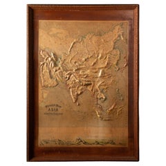
Early 20th C. Relief Maps: Asia Wood and Leather Frames
Located in New York, NY
This early 20th-century set of three relief maps offers a captivating glimpse into the geographical features of Asia. The maps, meticulously crafted, are elevated by their presentat...
Category
Early 20th Century American Victorian Manhattan Maps
Materials
Leather, Wood, Paper
Pan American Airways 1952 World Route Map
By Pan American Airways
Located in New York, NY
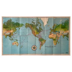
World Route Map published in 1952 by Pan American World Airways and printed by Jeppesen and Company, showing the worldwide destinations on six continents ser...
Category
1950s American Mid-Century Modern Vintage Manhattan Maps
Materials
Paper
Early 20th C. Relief Maps: Asia Wood and Leather Frames
Located in New York, NY
This early 20th-century set of three relief maps offers a captivating glimpse into the geographical features of South America, Asia, and Africa. The maps, meticulously crafted, are e...
Category
Early 20th Century American Victorian Manhattan Maps
Materials
Leather, Wood, Paper
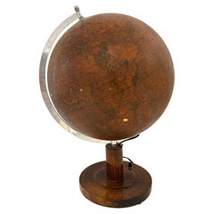
Mid Century Terrestrial Globe on Wooden Stand
Located in New York, NY
Mid Century Terrestrial Globe on Wooden Stand:
Measures: 23" x 23" x 33" H
Category
Mid-20th Century Manhattan Maps
Materials
Wood
17th Century French Champagne Region, Mouzon & St. Menehould Map, Iohan Peeters
Located in New York, NY
Fine 17th Century engraved views of the towns of Mouzon and Sainte-Menehould in the Champagne Region of Northern France. Notably, Dom Perignon, the Benedictine monk associated with the discovery of Champagne, was born in Sainte-Menehould in 1638.
The double map showing finely detailed views of the towns including the grand Gothic Cathedral of Mouzon, fortified walls along the river, the famed so-called Castle Mound of Sainte Menehould with the striking historic town hall and bucolic pasture by the river with prancing horses and grazing cows.
Signed lower right Ioh. Peeters
Size: 15.38 inches by 12.38 inches
Condition: Excellent commensurate with age
European travel and culinary/libation interest.
Other maps of the French region of the same size and by the same engraver are available.
Excellent for Wine Cellar...
Category
17th Century Dutch Antique Manhattan Maps
Materials
Paper
H 12.38 in W 15.38 in D 0 in
Antique Wood Block Map Puzzle
By George Philip & Son
Located in New York, NY
Antique wood block map puzzle. Unusual English six sided block puzzle consisting of 42 wood cubes with each side making up one of six puzzles compri...
Category
Late 19th Century English Antique Manhattan Maps
Materials
Wood
Framed Nautical Chart of Provincetown Harbor, 1935
Located in New York, NY
This nautical chart of Provincetown Harbor was created circa 1935 and depicts the coasts of Cape Cod and surrounding bodies of water The chart has been...
Category
1930s American Vintage Manhattan Maps
Materials
Paper
Vintage Brass and Mirror Compact Case or Box with Map of France
Located in New York, NY
A vintage brass makeup mirror compact case with map of France embossed on front. Case measures: 2 3/8" square x 5/16" height.
Category
Mid-20th Century French Manhattan Maps
Materials
Brass
Repoussé Map from JFK Airline Terminal by Patricio Caces, 1972
By Patricio Caces
Located in New York, NY
This is an extraordinary and unique map of the world salvaged from the Sabena airlines terminal check in counter at JFK airport. It was created by Chilean artist Patricio Caces in 1972.
Category
1970s American Vintage Manhattan Maps
Materials
Copper
Assembled Pair of Terrestrial and Celestial Globes by Delamarche and Fortin
By Charles Francois Delamarche
Located in New York, NY
Assembled pair of globes.
Terrestrial globe, Charles-Francois Delamarche, 1821
Celestial globe, Augustin Fortin, 1780.
Category
18th Century and Earlier French Antique Manhattan Maps
Materials
Wood, Paper
Vintage Roll Up Map by Denoyer Geppart
By Denoyer-Geppert
Located in New York, NY
Vintage canvas roll up map by Denoyer Geppart. USA, circa 1950. Two-sided, with the world map on one side, and the U.S.A on the second side. Includes origina...
Category
1950s American Mid-Century Modern Vintage Manhattan Maps
Materials
Wood
20 Drawer Tiger Oak Map Cabinet or Flat File with Original Brass Hardware
Located in New York, NY
Modular design. Smooth sliding. This can be seen at our 149 Madison Ave store in Manhattan.
Category
1930s American Vintage Manhattan Maps
H 67.5 in W 30 in D 41.25 in
Recently Viewed
View AllMore Ways To Browse
Crescent China
Crock Vase
Crystal Dresser Set
Crystal Glass Luster Antique
Czech Malachite Glass
Daum France Limited Edition
David Palombo Menorahs
Dino Martens On Sale
Dior Dice
Dip Pen
Dip Pens
Dorothy Draper Espana Chest
Dorothy Draper Heritage
Drexel Danish Modern
Drexel Heritage French
Dried Gourd
Dry Bar With Stools 3
Dutch Clog
