Milan Maps
to
17
5,466
195
17
2
1
1
16
1
1
1
16
10
5
3
1
16
12
2
2
1
17
17
17
4
1
1
1
1
Item Ships From: Milan
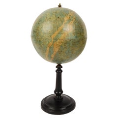
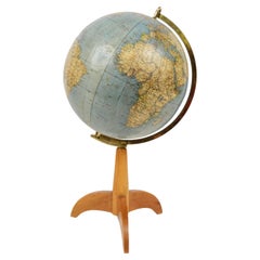
1889s Antique Celestial Globe Signed Gussoni e Dotti Milano Papier Maché Sphere
Located in Milan, IT
Celestial globe compiled on the Hesi & Gould catalogs by Eng. Pini and published in 1889 by Gussoni & Dotti Milano piazza del Duomo. Sphere in paper mache covered with paper printed by engraving on copper plate and hand watercolored, base in turned and ebonized wood.
Good condition, conservative restoration at the base. Measures: Height 45 cm, inche 17.8, sphere diameter 22 cm 8.7.
Giovanni Gussoni in 1874 bought the business of Antonio Ronchi typographer in Via Unione 5 in Milan, and then moved in 1883 to the shop of the Southern Porticoes in Piazza Duomo. Giovanni Gussoni was followed by his son Vittorio, who on April 16, 1907 sold the company to a collaborator, Giovanni Serra, who continued the business until November 1914.
Man has always wanted to know the world in which he lives and has used all the means available to measure the space that surrounds him to expand his knowledge more and more. The conditions that allowed man to develop models of the world and space were probably realized only after...
Category
1880s Antique Milan Maps
Materials
Paper
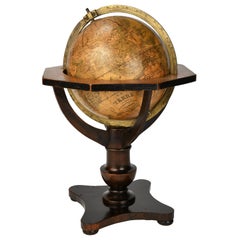
Ptolemaic Armillary Sphere Charles-François Delamarche Paris, 1805-1810 Circa
By Charles Francois Delamarche
Located in Milano, IT
Charles-François Delamarche
Ptolemaic armillary sphere
Paris, circa 1805-1810
Wood and papier-mâché
covered with printed and partly hand-coloured paper
It measures 15.74” in height, ...
Category
Early 1800s French Empire Antique Milan Maps
Materials
Paper, Wood
German Globe by C. Abel-Klinger, Nuremberg, circa 1860
By C. Abel-Klinger
Located in Milano, IT
Terrestrial globe
Artistic company C. Abel - Klinger
Nuremberg, circa 1860
H cm 31 x 22 cm (12.20 x 8.66 in); sphere 14 cm (5.51 in) in diameter
lb 2.30 (kg 1.04)
State of conservation: good. On the sphere there are slight visible signs of accidental bumping at the poles, as well as on New Guinea and England (vertical and more visible); some ink stains, especially at the South Pole and on the meridian that crosses North America.
The globe is composed of twelve whole gores of printed paper, juxtaposed and glued on a sphere made with a chalky base mixture.
The circle of the meridian, made of brass...
Category
1860s German Other Antique Milan Maps
Materials
Wood, Paper
Miniature Terrestrial Globe Newton & Son London, Post 1833, Ante 1858
By Newton and Son
Located in Milano, IT
Miniature Terrestrial Globe
Newton & Son
London, post 1833, ante 1858
Paper, papier-mâché, bronze and wood
It measures: sphere diameter 2.95 in (7.6 cm); diameter of the wooden base 6.02 in (15.3 cm); height 8.36 in (21.24 cm).
Weight: 2,067 lb.
State of conservation: the globe still bears its original paint, but has various small gaps, abrasions and stains on the surface.
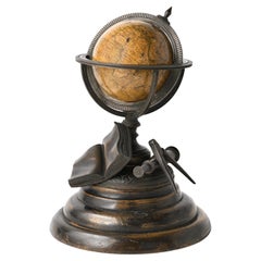
The globe is hinged with two pins at the meridian circle, which is in turn inserted perpendicular to the horizon circle; this is supported by four semi-arches connected at the bottom by a small goblet-shaped foot, resting on a wooden bell-shaped base.
Apart from the wooden base, the entire support structure is made of bronze; on the foot there are the scale reproductions of a compass, a telescope and an open book.
The sphere is made of papier-mâché and is covered with twelve printed paper gores.
In the North Pacific Ocean the globe bears a cartouche with the inscription (about 30% of the writing is illegible, but the missing parts can be easily integrated based on the rest):
NEWTON’S
New & Improved
TERRESTRIAL
Globe
Published by Newton & Son
66 Chancery Lane
LONDON
On the globe, much of central Africa is empty and the great lakes Tanganyika and Victoria are not marked (Europeans would begin to explore the area after 1858). Canada is called "British Territory" and Alaska "Russian Territory" (it would become part of the United States in 1867). Australia already bears its modern name (until 1829 it had been called New Holland) and its coasts are completely designed; Tasmania is listed as an island (Matthew Flinders circumnavigated it in 1798). The routes of Cook's various voyages are plotted; both the route followed by Biscoe in 1831 and the "Land of Enderby" which he discovered on the coast of Antarctica, south of Africa, are marked.
Bibliography
P. Van der Krogt, Old Globes...
Category
1840s English Early Victorian Antique Milan Maps
Materials
Bronze
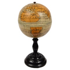
End XIX century Small Terrestrial Globe Signed C.M.C Paris Papier Maché Sphere
Located in Milan, IT
Small terrestrial globe signed C.M.C. Paris, end of XIX century. Papier maché sphere and turned and ebonized wooden base. Height cm 13 - inches 5.1, diameter of sphere cm 6,5 - inche...
Category
1890s French Antique Milan Maps
Materials
Paper
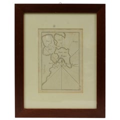
Antique Nautical Portolano of Isle De Poro by Antoine Roux, France, 1844
By Antoine Roux
Located in Milan, IT
Antique portolano, nautical map of Isle De Poro engraved on a copper plate by Antoine Roux, Marseille France 1844, from his work Recueil des principaux plans des ports et de Rades de...
Category
1840s French Antique Milan Maps
Materials
Paper
Terrestrial Table Globe by Félix Delamarche, Paris, 1821
By Félix Delamarche
Located in Milano, IT
Terrestrial table globe
Félix Delamarche
Paris, 1821
It measures 20.47 in height, Ø max 14.17 in; the sphere Ø 9.44 in (h 52 cm x Ø max 36.5 cm; the sphere Ø 24 cm)
Wood, printed...
Category
1820s French Restauration Antique Milan Maps
Materials
Metal
Pair of Miniature Globes Lane’s on Tripod Bases, London post 1833, ante 1858
By Lane's
Located in Milano, IT
Pair of miniature globes
Lane’s, London, post 1833, ante 1858
Papier-mâché, wood and paper
They measure:
Height 9.44 in (24 cm);
Sphere diameter 2.75 in (7 cm);
Diameter of t...
Category
1840s English Early Victorian Antique Milan Maps
Materials
Paper, Wood
Italian modern Table globe map of the world in metal, 1960s
Located in MIlano, IT
Italian modern Table globe map of the world in metal, 1960s
Table map of the world with metal structure. The globe rotates thanks to the pins of the curved metal structure. The base ...
Category
1960s Italian Modern Vintage Milan Maps
Materials
Metal
1844 French Nautical Portolano of Port De Chichimé Natolie by Antoine Roux
By Antoine Roux
Located in Milan, IT
Antique portolano, nautical map of Port De Chichimé Natolie engraved on a copper plate by Antoine Roux, Marseille France 1844, from his work Recueil des principaux plans des ports et...
Category
1840s French Antique Milan Maps
Materials
Paper
1850 Old French Map Depicting the Entire Earth's Surface Divided into Two Parts
Located in Milan, IT
Geographical map depicting the entire earth's surface divided into two parts that correspond to the two hemispheres or globes, the map deals with the earth in general. Detailed expla...
Category
Mid-19th Century French Antique Milan Maps
Materials
Glass, Wood, Paper
1844 French Antique Nautical Portolan of Plan du Port de Cherfe by Antoine Roux
By Antoine Roux
Located in Milan, IT
Antique portolano, nautical map of Plan du Port de Cherfe engraved on a copper plate by Antoine Roux, Marseille France 1844, from his work Recueil des principaux plans des ports et d...
Category
1840s French Antique Milan Maps
Materials
Paper
Old Map Depicting the Entire Earth's Surface Divided into Six Parts France 1850
Located in Milan, IT
Map depicting the entire earth's surface divided into six parts which depicts the position of peoples on Earth based on the assumption that it is impossible for each people to have t...
Category
Mid-19th Century French Antique Milan Maps
Materials
Glass, Wood, Paper
1850 Old French Map Depicting the Entire Earth's Surface Divided into Two Parts
Located in Milan, IT
Geographical map depicting the entire earth's surface divided into two parts that correspond to the two hemispheres where the emerged lands are depicted which have been classified wi...
Category
Mid-19th Century French Antique Milan Maps
Materials
Glass, Wood, Paper
Antique Nautical Portolano of Port St. Antoine by Antoine Roux, France, 1844
By Antoine Roux
Located in Milan, IT
Antique portolano, nautical map of Port St. Antoine engraved on a copper plate by Antoine Roux, Marseille, France, 1844, from his work Recueil des principaux plans des ports et de Ra...
Category
1840s French Antique Milan Maps
Materials
Paper
1850 Old French Map Depicting the Entire Earth's Surface Divided into Two Parts
Located in Milan, IT
Geographical map depicting the entire earth’s surface divided into two parts that correspond to the two hemispheres or globes, the map deals with the latitudes and longitudes, the me...
Category
Mid-19th Century French Antique Milan Maps
Materials
Glass, Wood, Paper
1850 Old French Map Depicting the Entire Earth's Surface Divided into Two Parts
Located in Milan, IT
Map depicting the entire earth's surface divided into two parts corresponding to the two hemispheres and showing the Arctic to Antarctic polar circle, the tropics of Cancer and Capri...
Category
Mid-19th Century French Antique Milan Maps
Materials
Glass, Wood, Paper
Related Items
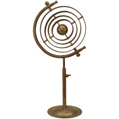
Italian Renaissance Chrome Armillary
Located in Queens, NY
Italian Renaissance-style (20th Century) chrome armillary globe with a rust patina.
Category
20th Century American Renaissance Revival Milan Maps
Materials
Chrome
Late 19th Century Small Size Globe Edited by Philips Terrestrial London
Located in Casteren, Noord-Brabant
A lovely small size antique French globe. With a wooden base, the globe itself is made of carton with paper. The map is published by Philips Terre...
Category
1890s French Belle Époque Antique Milan Maps
Materials
Brass
Antique Map of Africa by Delamarche, 1806
Located in Langweer, NL
Antique map titled 'L'Afrique'.
Decorative map of Africa by Robert de Vaugondy, revised and published by Delamarche. Source unknown, to be determined.
Artists and Engravers: Charl...
Category
19th Century Antique Milan Maps
Materials
Paper
Replogle Terrestrial Floor Globe
By Replogle Globes
Located in Asbury Park, NJ
This floor globe by Replogle floats within a ring of walnut, supported by four 'turned' chrome stiles, which connect to a base of walnut. The ...
Category
1960s American Mid-Century Modern Vintage Milan Maps
19th Century Terrestrial Globe by G. Thomas, Editeur & Globe Maker, Paris, 1890s
By G. Thomas, Éditeur
Located in San Francisco, CA
Rare 19th century terrestrial globe by G. Thomas, Editeur & Globe Maker, Paris, circa 1890s
The globe sits atop a wooden stand and measures 4" diameter x 6.5" high.
The globe i...
Category
Late 19th Century French Antique Milan Maps
Materials
Paper
$750
H 6.5 in W 4 in D 4 in
Miniature Iron Maiden of Nuremberg
Located in Hanover, MA
Miniature "Iron Maiden" in blackened cast metal attached to its original round wood base. The front doors are pin-hinged and open to reveal pointed spikes. At base of doors is printe...
Category
1890s German Gothic Antique Milan Maps
Materials
Iron
Antique World Globe From Fleet Street London 1923 on Wooden Stand
Located in Reading, Berkshire
Antique Terrestrial Geographia of Fleet Street London 12"inch World Globe on handcrafted Wooden Three Legged Base 1923
Made 55 Fleet Street, London
Beautiful desktop globe, showcas...
Category
1920s British Art Deco Vintage Milan Maps
Materials
Wood, Paper
$1,318 Sale Price
25% Off
H 18.51 in Dm 11.82 in
Celestial Table Globe by Harris and Son
Located in Lymington, Hampshire
A 12 inch celestial table globe by Harris and Son, the horizon ring, with the original papers, set on four turned mahogany legs, the label statin...
Category
1810s English Antique Milan Maps
Materials
Mahogany
Large and Extremely Rare Terrestrial Globe by Newton
By Newton Globes - Planer & Newton
Located in Lymington, Hampshire
A large and extremely rare 24-inch terrestrial globe by Newton
Our most magnificent and rare globes were a pair of 24-inch Newton globes.
These too were updated in 1852 (terre...
Category
Mid-19th Century English Antique Milan Maps
Materials
Mahogany
19th Century German Miniature Pocket Terrestrial Globe
By C. Abel-Klinger
Located in Essex, MA
A miniature 19th century 3.5 inch diameter pocket terrestrial globe by C. Abel-Klinger, Nuremberg, Germany, in English for the English speaking markets. Signed with cartouche reading...
Category
1880s German Antique Milan Maps
Materials
Brass
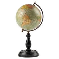
Antique Hammond's 6-Inch Terrestrial Globe on Stand
By C.S. Hammond & Co.
Located in Philadelphia, PA
Offered here for your consideration is, A fine antique 6-inch terrestrial globe.
Additional Details:
By C.S. Hammond & Co.
The globe likely dates from 1927 to 1930 due to the ...
Category
20th Century Unknown Art Deco Milan Maps
Materials
Wood, Paper
French Late 19th Century Bronze Armillary Sphere Depicting the Titan Atlas
Located in Atlanta, GA
A French bronze armillary sphere depicting Atlas carrying the world from the late 19th century with verdigris patina. Created in France during the last quarter of the 19th century, t...
Category
Late 19th Century French Antique Milan Maps
Materials
Bronze
$1,950
H 33.7 in Dm 15.7 in
Previously Available Items
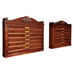
Pair of Containers for Geographical Atlas Henry Thomas Peters (1792-1852) att
By Henry Thomas Peters
Located in Milano, IT
Pair of poplar wall cabinets veneered in mahogany, each with six pull-out drawers with maps signed "J. Andriveau-Goujon, Paris, 1837." On the front of each of the pulls is an inlaid ...
Category
1840s Italian Restauration Antique Milan Maps
Materials
Poplar
H 22.84 in W 27.37 in D 4.73 in
1930s Antique Terrestrial Globe Edited By Vallardi Editore in Milan
Located in Milan, IT
Terrestrial globe published in the 1930s by Vallardi Editore, papier-mâché sphere covered with engraving paper on a copper plate and watercolored, turned wooden base complete with engraved brass meridian circle.
Very good condition, height 57 cm, inches 22.5 - sphere diameter 27 cm, inches 10.6.
Shipping is insured by Lloyd's London; it is available our free gift box (look at the last picture).
The origins of the publisher Vallardi date back to 1750 when founder Francesco Cesare (1736-1799) acquired a small craft in the heart of old Milan. In the early nineteenth century, the publishing house was noted for the production of works of art, geography and science, including a "Tour of Italy" which took twenty-two printings between 1819 and 1835. The complete works of various maps and directions for travel, including timetables and fares for transportation of the time, can be considered the first modern tourist guide. The firm "Vallardi" was born in 1843 and the company became industrial, with the opening of branches on national scale.
Category
1930s Vintage Milan Maps
Materials
Paper
1930s Antique Italian Terrestrial Globe Signed Vallardi Editore Milano
Located in Milan, IT
Terrestrial globe edited by Vallardi Editore Milano in 1930s, engraved by A. Minelli, diameter of sphere cm 18 – inches 7, height cm 38 – inches 15.
Wooden base and cardboard sphere covered by paper printed by engraving on a copper plate and watercoloured. Good condition.
Shipping is insured by Lloyd's London; our gift box is free, see last picture.
The origins of the publisher Vallardi date back to 1750 when founder Francesco Cesare (1736-1799) acquired a small craft in the heart of old Milan. In the early nineteenth century, the publishing house was noted for the production of works of art, geography and science, including a "Tour of Italy" which took twenty-two printings between 1819 and 1835. The complete works of various maps and directions for travel, including timetables and fares for transportation of the time, can be considered the first modern tourist guide. The firm "Vallardi" was born in 1843 and the company became industrial, with the opening of branches on national scale...
Category
1930s Vintage Milan Maps
Materials
Paper
1864s Paravia Milano Antique Rare Physical and Political Terrestrial Globe
Located in Milan, IT
Extremely rare physical and political Terrestrial globe according to the most recent discoveries published by G.B. Paravia and Comp. Rome - Turin - Milan - Florence in 1864. This glo...
Category
1860s Antique Milan Maps
Materials
Paper
19th Century Small Terrestrial Globe Edited in Germany by Prof. Arthur Krause
Located in Milan, IT
Terrestrial globe edited by Prof. Arthur Krause the German geographer, end of the XIX century. There are territorial map and commercial routes.
Turned w...
Category
1890s Antique Milan Maps
Materials
Paper
19th Century Small French Antique Terrestrial Globe Editet by J. Forest a Paris
Located in Milan, IT
Small terrestrial published in the early 1870s by the French geographer J. Forest; there are territorial maps, ocean currents and the major trade routes of that period.
Papier maché and plaster sphere covered by paper printed by an engraved copper plate and watercoloured,turned and ebonized wooden base.
Measures: Height 23 cm- inches 9, diameter of sphere cm 10 – inches 3.95.
Good condition, signs of use
Our gift box is free.
J. Forest made several globes in the late 19th and early 20th centuries, largely for didactic use. These products included table globes, as globes with ebonized turned stands; library globes; and some new and particular globes, like terrestrial globes on geared turntable stands...
Category
Late 19th Century Antique Milan Maps
Materials
Paper
Celestial Pocket Globe by Newton London, 1860 Circa
By Newton and Son
Located in Milano, IT
Pocket Globe
Newton
London, 1860 circa
The globe is contained in a cylindrical box of turned and stained wood.
It measures: the globe 3 in (7,6 cm) in diameter; the box 3.54 in...
Category
1850s English Victorian Antique Milan Maps
Materials
Wood, Paper
Grand Panorama of London, the City Seen from the Thames, Evans & Whitelaw, 1849
Located in Milan, IT
Grand Panorama of London, a very special map of London seen from the Thames, published by Charles Evans and I. Whitelaw in 1849, realized on a long ...
Category
1840s British Antique Milan Maps
Materials
Paper
H 6.03 in W 7.09 in D 0.28 in
Pocket Globe John and William Cary, London 1791
By Cary’s
Located in Milano, IT
John and William Cary
Pocket globe
London, 1791
The pocket globe is contained in its original case, which itself is covered in shark skin.
Few and slight gaps in the original p...
Category
1790s English George III Antique Milan Maps
Materials
Shagreen, Paper
English Pocket Globe by Lane, London, between 1817 and 1833
By Lane's
Located in Milano, IT
Pocket Globe
Lane, London, between 1817 and 1833
The globe is contained in its original case covered with black leather.
Diameter: globe 2.75 in (7 cm); case 3.26 in (8.3 cm).
Weight: 0.28 lb (128 g)
State of conservation: almost excellent. It has some slight abrasions and some signs of use.
The globe is made up of twelve printed paper gores aligned and glued to the sphere. Two pins are inserted on the poles.
In the North Pacific Ocean, above the Tropic of Cancer, the globe bears a cartouche with the inscription:
LANE’S
Improved
GLOBE
LONDON
and, under cartouche
J. Mynde Sc[ulpsit]
On the globe, much of central Africa is empty and the great lakes Tanganyika and Victoria are not marked (Europeans would begin to explore the area after 1858). Australia is still called New Holland (the new name would be introduced in 1829); Tasmania is listed as an island (Matthew Flinders circumnavigates it in 1798). The routes of Cook's and Anson's various voyages are plotted; on the island of Sandwich, between Guinea and Mexico, in the middle of the Pacific Ocean, the place and date of Cook's killing are reported.
The antipode of London is marked in the south of New Zealand.
The pocket globe was made between 1817 and 1833.
The reconstruction of the history of this dating is due to Elly Dekker (E., Dekker, Globes at Greenwich, Oxford 1999, pp. 128-129).
Around 1757 James Ferguson...
Category
1820s English George IV Antique Milan Maps
Materials
Shagreen, Paper
Pocket Globe John and William Cary, London, 1791
By Cary’s
Located in Milano, IT
John and William Cary
Pocket globe
London, 1791
The pocket globe is contained in its original case, which itself is covered in shark skin.
Few and slight gaps in the original p...
Category
1790s English George III Antique Milan Maps
Materials
Shagreen, Paper
Antique World Map Published in Vienna 1786 by Franz Anton Schraembl
Located in Milan, IT
Large world map by cartographer Jean Baptist D'Anvile revised and republished in Vienna in 1786 by Franz Anton Schraembl. It is a geographical map prin...
Category
1780s Austrian Antique Milan Maps
Materials
Glass, Wood, Paper
Recently Viewed
View AllMore Ways To Browse
Egyptian Granite
Enamel Peacock Feather
English Chinoiserie Chest
English Oak Gateleg Table
Etienne Henry
Fantastic Planet
Faux Tortoise Tray
Flamingo Animal Sculptures
Flemish Cabinets 17th Century
Fox Figurine
Fox Hunt Plate
French Art Deco Rosewood Buffet
French Bulldog Gold
French Calendar Clock
French Louis Xvi Enfilade
French Provincial Antique Dresser
French Provincial Furniture Antique Dresser
French Zinc Bar
