Tri-State Area Maps
to
1
16
5,433
239
16
3
1
1
7
3
6
1
3
1
1
1
10
4
4
2
1
12
5
3
3
2
16
16
16
1
1
Item Ships From: Tri-State Area
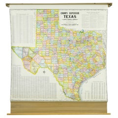
1850-1960 Cram's Superior Latest Federal Census Texas Map
By G. F. Cram Company
Located in New York, NY
The 1850-1960 Cram's Superior Latest Federal Census Texas Map, crafted from pine wood, steel, and canvas, is a valuable historical cartographic piece. Publi...
Category
1910s American Vintage Tri-State Area Maps
Materials
Canvas
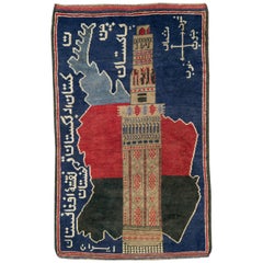
Vintage Afghan Pictorial Map Rug
Located in New York, NY
A vintage Afghan Pictorial map rug from the mid-20th century.
Measures: 3' 0" x 4' 10"
Category
Mid-20th Century Afghan Folk Art Tri-State Area Maps
Materials
Wool
$660 Sale Price
20% Off
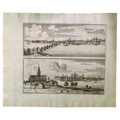
17th Century Topographical Engraving Nantes & St. Malo, France, by Iohan Peeters
Located in New York, NY
The ancient city of Saint Malo in North Western France has long been associated with adventure on the high seas, piracy and exploration. It was the birthplace of several important in...
Category
17th Century Dutch Antique Tri-State Area Maps
Materials
Paper
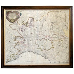
Map of the Republic of Genoa
Located in New York, NY
Framed antique hand-coloured map of the Republic of Genoa including the duchies of Mantua, Modena, and Parma.
Europe, late 18th century.
Dimension: 25...
Category
Late 18th Century European Antique Tri-State Area Maps
1950's Glass Globe Lamp, Denmark
Located in New York, NY
Danish Glass Globe Lamp, c. 1950's.
Can be lit with inner bulb.
Category
1950s Danish Mid-Century Modern Vintage Tri-State Area Maps
Materials
Glass, Wood
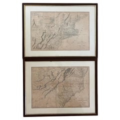
Pair Antique Italian Maps of the North American Eastern Seaboard
Located in New York, NY
Pair antique Italian maps of the North American Eastern Seaboard. Late 18th early 19th century original Italian documentation of the East Coast of the United States from Passamaquadd...
Category
Late 18th Century Italian Antique Tri-State Area Maps
Materials
Wood, Paper
Art Deco Cartoon Style Map of Paris possibly by Arthur Zaindenberg circa 1930's
By Arthur Zaidenberg
Located in New York, NY
Art Deco cartoon style map of Paris possibly by Arthur Zaidenberg. The map depicts witty references to Parisians lifestyle, along with drawings of notable landmarks, circa 1930's. T...
Category
1930s American Art Deco Vintage Tri-State Area Maps
Materials
Paper
17th Century Topographical Map, French Champagne Region, Epernay, Iohan Peeters
Located in New York, NY
Fine topographical 17th century map by Iohan Peeters of the towns of Epernay and Lametz in the Champagne Region of North Eastern France.
Fabulous period engraving for a Wine Cellar,...
Category
17th Century Dutch Antique Tri-State Area Maps
Materials
Paper
17th Century Toulouse, Savve, Sommieres Topographical Map by Iohan Peeters
Located in New York, NY
Fine topographical 17th century map of Toulouse, Savve and Sommieres by Iohan Peeters
Beautiful engraving of the capital of France's Occitanie Region, Toulouse, called La Ville Rose- the Pink City, for the terracotta bricks used in its many buildings, giving the city a distinct apricot-rose hue. An important cultural and educational center, the city's residents included Nobel Prize winners and world renown artists- Henri de Toulouse-Lautrec, Henri Martin, Jean-Auguste-Dominique Ingres, Antonin Mercie, Alexandre Falguiere and more recently Cyril Kongo...
Category
17th Century Dutch Antique Tri-State Area Maps
Materials
Paper
17th Century Topographical Map, Champagne-Ardenne, Marsal, Maubert Iohan Peeters
Located in New York, NY
Fine topographical 17th century map by Iohan Peeters of Marsal and Maubert Fontaine in the Champagne-Ardennes Region of North Eastern France.
Fabulous period engraving for a Wine Ce...
Category
17th Century Dutch Antique Tri-State Area Maps
Materials
Paper
17th Century Topographical Map of Cote D'azur, Avignon, Frejus by Iohan Peeters
Located in New York, NY
Fine topographical 17th century map by Iohan Peeters of the towns of Avignon and Frejus in the Cote d'Azur-Provence-Alpes Region of Southeastern France.
Beautifully suited decorativ...
Category
17th Century Dutch Antique Tri-State Area Maps
Materials
Paper
Framed Map of China
Located in Greenwich, CT
Map of China, 19th century. European print map of China
Conservation frame with walnut frame
Overall dimension : 28 1/2" wide 31" high 2" depth with fra...
Category
19th Century European Qing Antique Tri-State Area Maps
Materials
Paper
$3,800
Vintage Framed United States Map
Located in Queens, NY
Vintage aged paper map of the United States mounted on particle board and framed in a simple wooden frame.
Category
20th Century American Mid-Century Modern Tri-State Area Maps
Materials
Wood, Paper
Antique Map of Italy by Andriveau-Goujon, 1843
By Andriveau-Goujon
Located in New York, NY
Antique Map of Italy by Andriveau-Goujon, 1843. Map of Italy in two parts by Andriveau-Goujon for the Library of Prince Carini at Palazzo Carini i...
Category
1840s French Antique Tri-State Area Maps
Materials
Linen, Paper
$3,350 / set
Antique Map of Eastern Hemisphere from the collection of Thierry Despont
Located in New York, NY
Designed by Enrico Bonetti (E. Bonatti) and published by Francesco Vallardi Editore. Based on an earlier map by Evangelista Azzi (Ev. Azzi). Labeled as such at bottom edge of map.
T...
Category
Late 19th Century Italian Antique Tri-State Area Maps
Materials
Canvas, Wood
Large Framed Map of the Mediterranean
Located in Queens, NY
Large map/chart chart of The Mediterranean and the Grecian Archipelago showing Italy, Sardinia, Corsica, part of France, etc. in a black frame.
Category
20th Century French Mid-Century Modern Tri-State Area Maps
Related Items
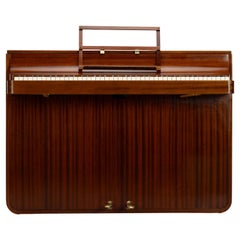
Danish Design Midcentury Pianette by Louis Zwicki in Mahogany, 1950s
Located in Breda, Netherlands
Danish design
A rare Danish midcentury pianette made of mahogany. It is called pianette due to the 82 keys rather than the standard 88 of a full size piano. This pianette is made by ...
Category
1950s Danish Mid-Century Modern Vintage Tri-State Area Maps
Materials
Mahogany
$10,514
H 35.83 in W 49.22 in D 22.05 in
Danish Louis Zwicki Rosewood Upright Pianette, Circa 1950's
Located in Norwalk, CT
Step back in time with this masterfully-crafted Danish Mid-Century Rosewood Pianette by the renowned Louis Zwicki. From the heart of the 1960's, a period when design and craftsmanshi...
Category
1950s Danish Mid-Century Modern Vintage Tri-State Area Maps
Materials
Wood
Antique Map of North America by Lapie '1842'
Located in Langweer, NL
Antique map titled 'Carte de l'Amérique septentrionale'. Map of North America, with an inset map of the Aleutian Islands. This map originates from 'Atlas universel de géographie anci...
Category
Mid-19th Century Antique Tri-State Area Maps
Materials
Paper
Southwestern U.S. Immigration Map for Texas, Arkansas, and Louisiana, 1881
Located in Langweer, NL
Southwestern U.S. Immigration Map - Published by The Southwestern Immigration Company, Austin, Texas. Detailed Railroad Routes and Regional Statistics for Texas, Arkansas, and Louisi...
Category
1880s Antique Tri-State Area Maps
Materials
Paper
$974 Sale Price
25% Off
H 26.97 in W 25.2 in D 0.01 in
Antique Map of North America by Dufour 'circa 1834'
Located in Langweer, NL
Antique map titled 'Amérique Septentrionale'. Uncommon map of North America. Published by or after A.H. Dufour, circa 1834. Source unknown, to be determined.
Category
Mid-19th Century Antique Tri-State Area Maps
Materials
Paper
$189 Sale Price
20% Off
H 8.08 in W 10.44 in D 0.02 in
Antique Map of North America by Johnson, '1872'
Located in Langweer, NL
Antique map titled 'Johnson's North America'. Original map of North America, with an inset map of the Hawaiian group or Sandwich Islands. This map originates from 'Johnson's New Illu...
Category
Late 19th Century Antique Tri-State Area Maps
Materials
Paper
$378 Sale Price
20% Off
H 26.58 in W 18.12 in D 0.02 in
Antique Map of the United States with inset map of the region of Mexico City
Located in Langweer, NL
Antique map titled 'Verein-Staaten von Nord-America, Mexico, Yucatan u.a.'. Very detailed map of the United States of America showing the Caribbean. With an inset map of the surround...
Category
Mid-19th Century Antique Tri-State Area Maps
Materials
Paper
$812 Sale Price
20% Off
H 14.69 in W 17.92 in D 0.02 in
Mid-Century World Map Globe Table Light or Lamp
Located in Miami, FL
Good quality world map globe lamp.
If you are looking for stylish and beautiful quality item to upgrade your interior (whether at home or in your office) then this Parisian globe...
Category
Mid-20th Century French Mid-Century Modern Tri-State Area Maps
Materials
Chrome
Large Antique Map of the State of Texas, 1861
Located in Langweer, NL
Antique map titled 'Johnson's New Map of the State of Texas' Large map of Texas, shows railroads, wagon roads, the U.S. Mail Route, rivers, ports, ...
Category
Mid-19th Century American Antique Tri-State Area Maps
Materials
Paper
Small Map of the United States
Located in Langweer, NL
Antique map titled 'Amérique septe. Physique'. Small map of the United States. lithographed by C. Callewaert brothers in Brussels circa 1870.
Category
Mid-19th Century Antique Tri-State Area Maps
Materials
Paper
Antique Map of The United States of North America, Pacific States, 1882
Located in Langweer, NL
The map is from the same 1882 Blackie Atlas and focuses on the Pacific States of the United States of America during that period. Here are some details and historical context about t...
Category
1880s Antique Tri-State Area Maps
Materials
Paper
$236 Sale Price
20% Off
H 14.97 in W 11.03 in D 0 in
Antique Map of North America by Johnston, 1882
By Alexander Keith Johnston
Located in Langweer, NL
Antique map titled 'North America'.
Old map of North America. This map originates from 'The Royal Atlas of Modern Geography, Exhibiting, in a Series of Entirely Original and Authen...
Category
19th Century Antique Tri-State Area Maps
Materials
Paper
Previously Available Items
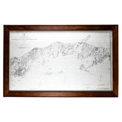
Framed Long Island Sound Map C. 1899
Located in Locust Valley, NY
Map of Long Island Sound with a rustic wood frame and nautical details for Connecticut and Long Island.
Category
Late 19th Century Antique Tri-State Area Maps
Materials
Paper
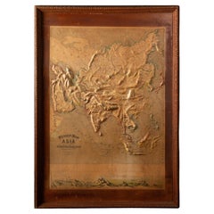
Early 20th C. Relief Maps: Asia Wood and Leather Frames
Located in New York, NY
This early 20th-century set of three relief maps offers a captivating glimpse into the geographical features of Asia. The maps, meticulously crafted, are elevated by their presentat...
Category
Early 20th Century American Victorian Tri-State Area Maps
Materials
Leather, Wood, Paper
Pan American Airways 1952 World Route Map
By Pan American Airways
Located in New York, NY
World Route Map published in 1952 by Pan American World Airways and printed by Jeppesen and Company, showing the worldwide destinations on six continents ser...
Category
1950s American Mid-Century Modern Vintage Tri-State Area Maps
Materials
Paper
Early 20th C. Relief Maps: Asia Wood and Leather Frames
Located in New York, NY
This early 20th-century set of three relief maps offers a captivating glimpse into the geographical features of South America, Asia, and Africa. The maps, meticulously crafted, are e...
Category
Early 20th Century American Victorian Tri-State Area Maps
Materials
Leather, Wood, Paper
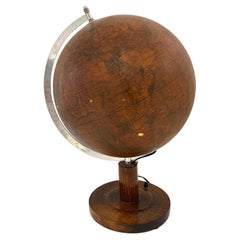
Mid Century Terrestrial Globe on Wooden Stand
Located in New York, NY
Mid Century Terrestrial Globe on Wooden Stand:
Measures: 23" x 23" x 33" H
Category
Mid-20th Century Tri-State Area Maps
Materials
Wood
La Galleria Delle Carte Geografiche in Vaticano, Maps in the Vatican, 3 Vols
By Fra Egnazio Danti
Located in Morristown, NJ
La Galleria delle Carte geografiche in Vaticano / The Gallery of Maps in the Vatican, Mirabilia Italiae / Franco Cosimo Panini, (3) vols. in black silk cloth, slipcase with golden ti...
Category
1990s Italian Renaissance Tri-State Area Maps
Materials
Linen, Paper
H 13 in W 5.5 in D 10 in
Antique Framed Hand Colored Map of the Americas by Frederick De Wit, circa 1675
By Frederick de Wit
Located in Morristown, NJ
Frederick De Wit (Dutch, 1629-1706), "Novissima et Accuratissima totius Americae Descriptio", hand-colored map engraving of North and South America with California depicted as an island, decorated with images of Native Americans and indigenous flora and fauna, framed under glass, 19.5"h x 23"l (sheet), 22.5"h x 1.75"d x 26"w (frame), From the collection of an NY corporation.
A fine example of De Wit’s map of the Americas, first published ca. 1675. This map is fascinating. It was the first Dutch map to include all five Great Lakes; Lac Superieur (Lake Superior), Lac des Puans (Lake Michigan), Mare Dulce (Lake Huron...
Category
1670s Dutch Baroque Antique Tri-State Area Maps
Materials
Glass, Wood, Giltwood, Paint, Paper
H 22.5 in W 26 in D 1.75 in
17th Century French Champagne Region, Mouzon & St. Menehould Map, Iohan Peeters
Located in New York, NY
Fine 17th Century engraved views of the towns of Mouzon and Sainte-Menehould in the Champagne Region of Northern France. Notably, Dom Perignon, the Benedictine monk associated with the discovery of Champagne, was born in Sainte-Menehould in 1638.
The double map showing finely detailed views of the towns including the grand Gothic Cathedral of Mouzon, fortified walls along the river, the famed so-called Castle Mound of Sainte Menehould with the striking historic town hall and bucolic pasture by the river with prancing horses and grazing cows.
Signed lower right Ioh. Peeters
Size: 15.38 inches by 12.38 inches
Condition: Excellent commensurate with age
European travel and culinary/libation interest.
Other maps of the French region of the same size and by the same engraver are available.
Excellent for Wine Cellar...
Category
17th Century Dutch Antique Tri-State Area Maps
Materials
Paper
H 12.38 in W 15.38 in D 0 in
Vintage Map of Paris after the Original Turgot Plan of 1739
Located in Stamford, CT
Vintage map of Paris after the original Turgot Plan of 1739 in white frame.
Category
1950s Vintage Tri-State Area Maps
Materials
Paper
Rare Chart of the Caribbean Islands Published by James Imray & Son, London, 1866
Located in Stamford, CT
Rare chart of the Caribbean Islands published by James Imray & Son, London, 1866.
FW 1370.
Category
Mid-19th Century English Folk Art Antique Tri-State Area Maps
Materials
Paper
H 44 in W 30 in D 1.5 in
Massive 1930s Oak Artist's Flat File
Located in Garnerville, NY
Solid oak construction with 10 flat drawers. The piece is comprised of two 5 drawer units that stack onto a sturdy footed base and a "drop in" top. Ten slim line drawers that have Ma...
Category
Mid-20th Century American Schoolhouse Tri-State Area Maps
Materials
Oak
1950s Economic European Pull Down School Map
Located in Tarrytown, NY
1950s economic European pull down school map.
Category
1950s Vintage Tri-State Area Maps
Materials
Paper
Recently Viewed
View AllMore Ways To Browse
De Schrijver Olivier
Deck Cannon
Derby Silver Co
Dieulefit Pottery
Dillingham Walnut Furniture
Dillingham Walnut
Distressed Armoires
Dresser With Mirror English
Drink Caddy
Duck Statue
Dutch Marquetry Commode
Dynasty Ancestor Portraits
E Picault Bronze
E Serafini
Edouard Sandoz Porcelain
Edwardian Mahogany Clocks
Elephant Clock Bronze
Enamel Foo Dogs
