Items Similar to Map of Puy De Dome - Original Etching - 19th Century
Want more images or videos?
Request additional images or videos from the seller
1 of 2
UnknownMap of Puy De Dome - Original Etching - 19th Century19th century
19th century
$295.09
£224.74
€250
CA$413.65
A$452.54
CHF 236.35
MX$5,407.97
NOK 2,969.45
SEK 2,794.73
DKK 1,904.30
About the Item
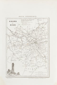
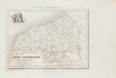
Map of Puy De Dome is an original etching realized by an anonymous engraver of the XIX century.
Printed in series of "France Pittoresque" at the top center.
The state of preservation of the artwork is good except for diffused foxing.
A fascinating piece of history and a beautiful piece of art represented in this geographical map, with precise borders and names of places.
- Creation Year:19th century
- Dimensions:Height: 6.7 in (17 cm)Width: 9.85 in (25 cm)Depth: 0.04 in (1 mm)
- Medium:
- Period:
- Framing:Framing Options Available
- Condition:Insurance may be requested by customers as additional service, contact us for more information.
- Gallery Location:Roma, IT
- Reference Number:Seller: M-1157471stDibs: LU65037644182
About the Seller
4.9
Platinum Seller
Premium sellers with a 4.7+ rating and 24-hour response times
1stDibs seller since 2017
7,797 sales on 1stDibs
Typical response time: 1 hour
- ShippingRetrieving quote...Shipping from: Grasse, France
- Return Policy
More From This Seller
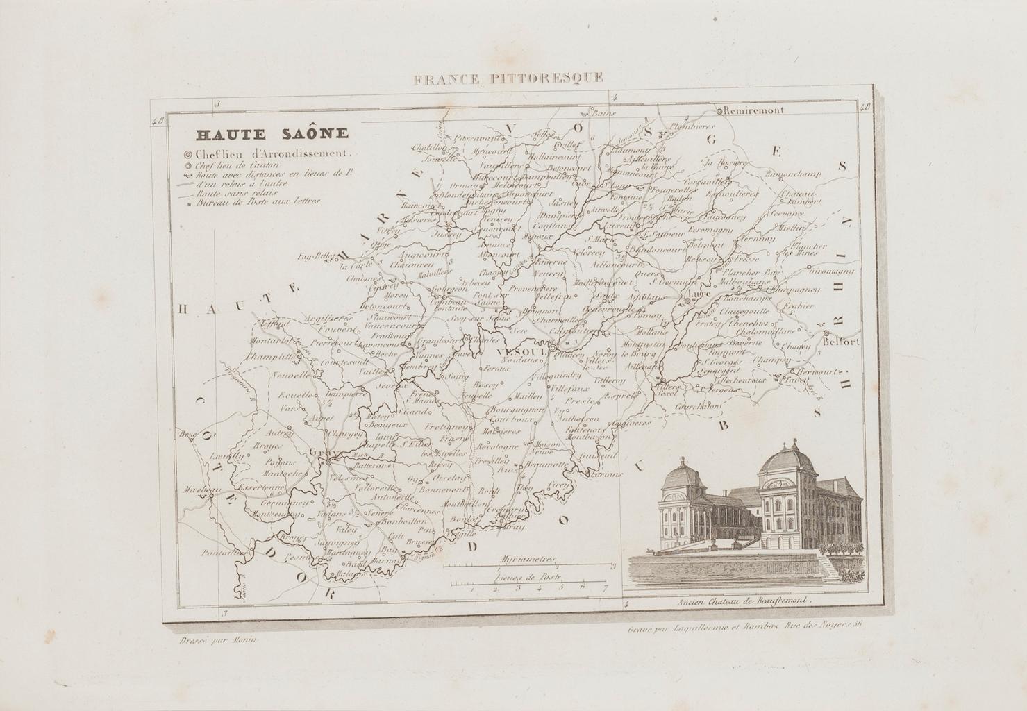
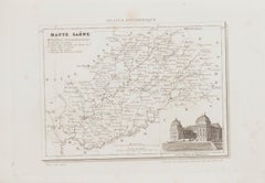
View AllMap of Haute-Saône - Original Etching - 19th Century
Located in Roma, IT
Map of Haute-Saône is an original antique etching realized by an anonymous engraver of the 19th Century.
Printed in series of "France Pittoresque" at the top center.
The state of p...
Category
19th Century Modern Figurative Prints
Materials
Etching
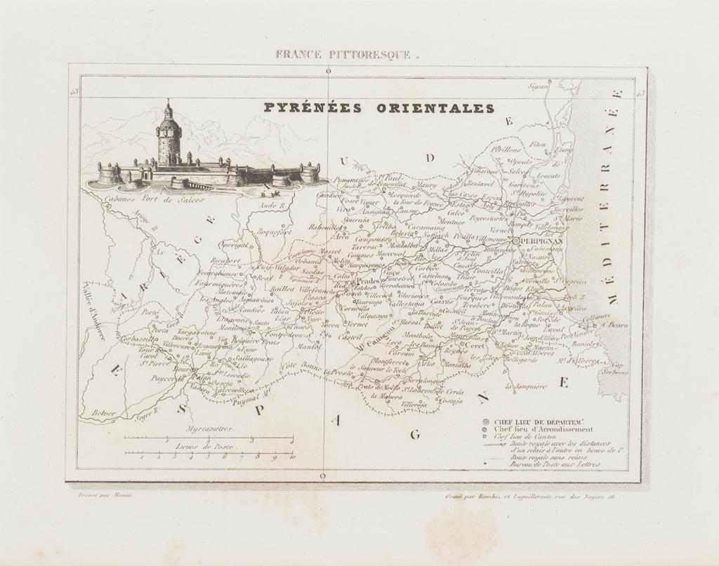
Map of Pyrénées - Original Etching - 19th Century
Located in Roma, IT
Map of Pyrénées is an original antique etching realized by an anonymous engraver of the XIX century.
Printed in series of "France Pittoresque" at the top center.
The state of prese...
Category
19th Century Modern Figurative Prints
Materials
Etching

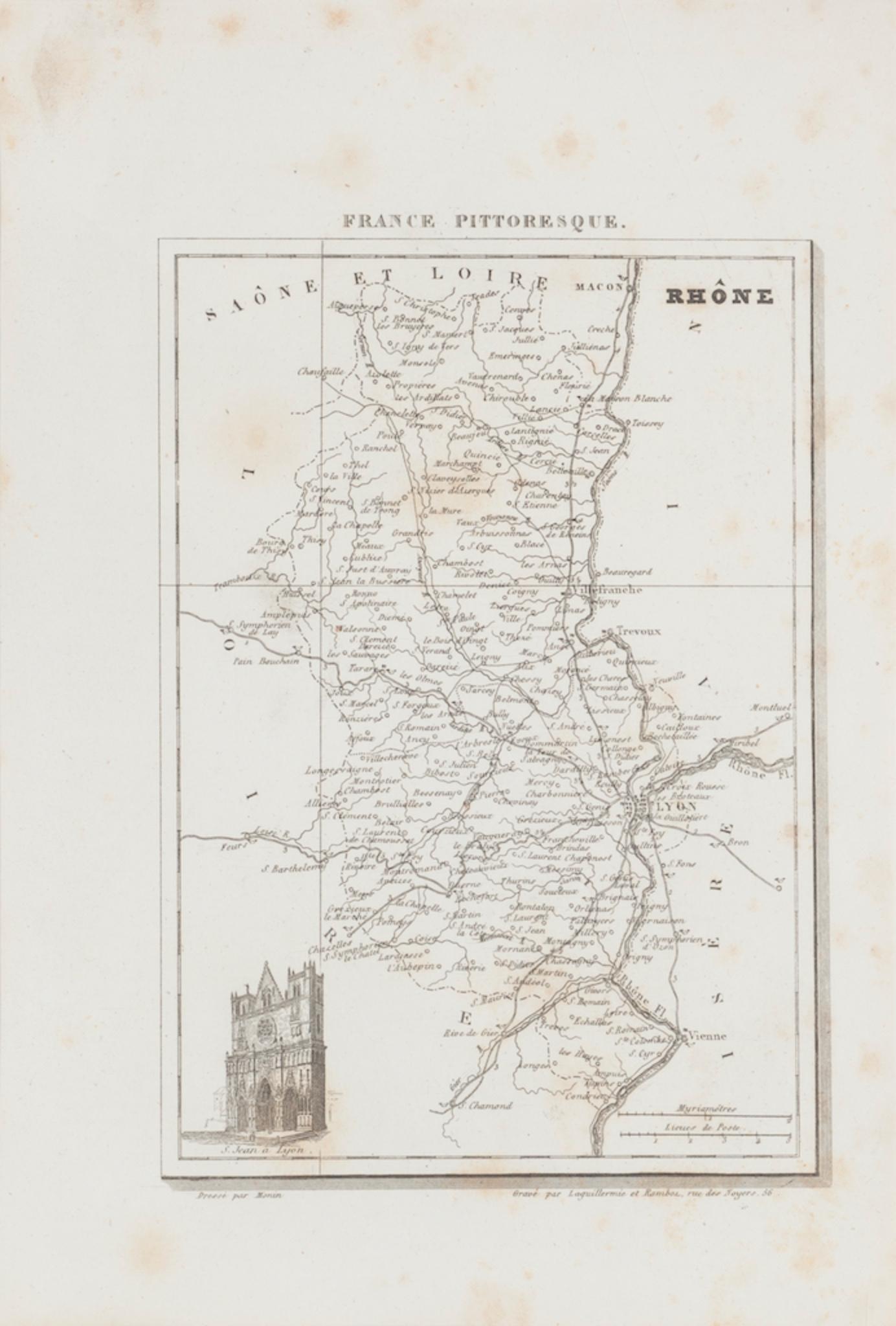
Map of Rhône - Original Etching - 19th Century
Located in Roma, IT
Map of Rhône is an original antique etching realized by an anonymous engraver of the 19th Century.
Printed in series of "France Pittoresque" at the top center.
The state of preserv...
Category
19th Century Modern Figurative Prints
Materials
Etching

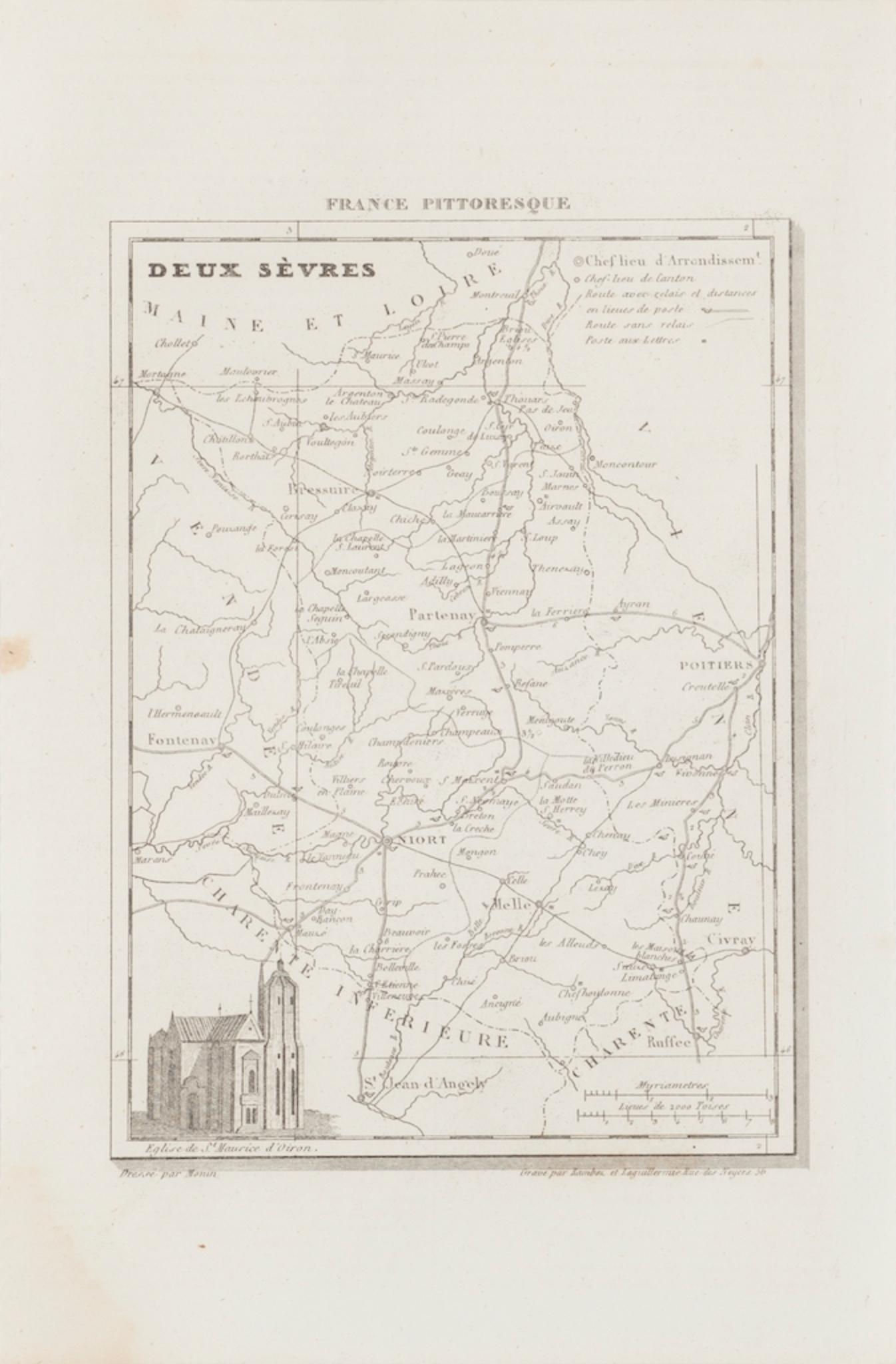
Map of Deux Sèvres - Original Etching - 19th Century
Located in Roma, IT
Map of Deux Sèvres is an original antique etching realized by an anonymous engraver of the 19th Century.
Printed in series of "France Pittoresque" at the top center.
The state of p...
Category
19th Century Modern Figurative Prints
Materials
Etching

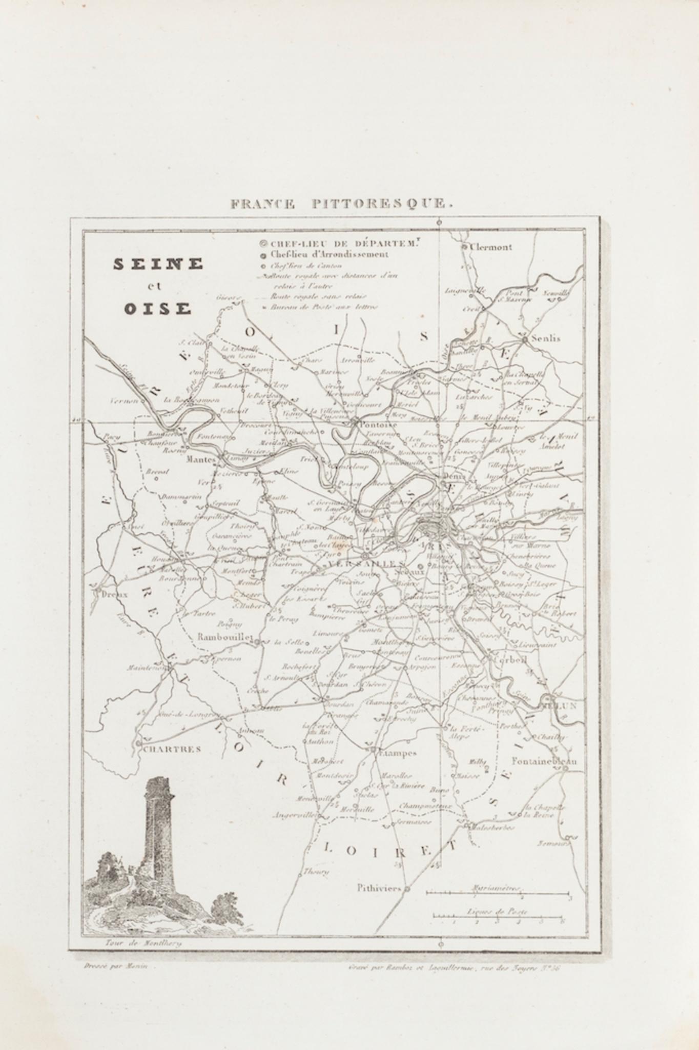
Map of Seine - Original Etching - 19th Century
Located in Roma, IT
Map of Seine is an original etching realized by an anonymous engraver of the 19th Century.
Printed in series of "France Pittoresque" at the top center.
The state of preservation of...
Category
19th Century Figurative Prints
Materials
Etching
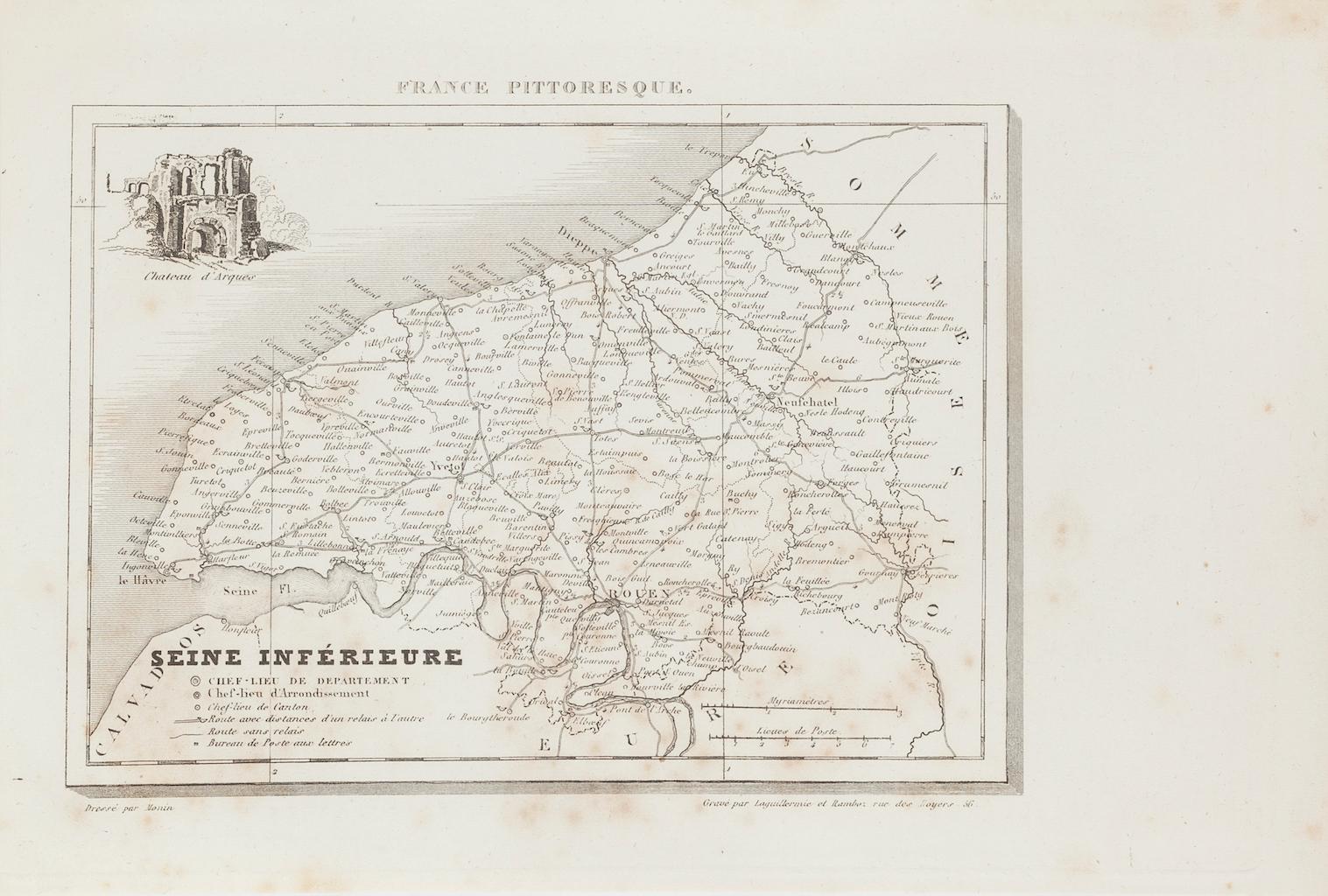
Map of Seine - Original Etching - 19th Century
Located in Roma, IT
Map of Seine is an original etching realized by an anonymous engraver of the XIX century.
Printed in series of "France Pittoresque" at the top center.
The state of preservation of ...
Category
19th Century Figurative Prints
Materials
Etching
You May Also Like
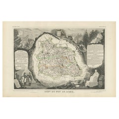
Antique Map of Puy de Dôme ‘France’ by V. Levasseur, 1854
By Victor Levasseur
Located in Langweer, NL
Antique map titled 'Dépt. du Puy de Dôme'. Map of the French department of Puy De Dome, France. This mountainous department includes Auvergne, one of the l...
Category
Antique Mid-19th Century Maps
Materials
Paper
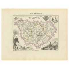
Map of Haute-Loire France with Le Puy-en-Velay by Vuillemin, 19th c
Located in Langweer, NL
Map of Haute-Loire France with Le Puy-en-Velay by Vuillemin, 19th c
This 19th-century hand-colored map of the Haute-Loire department in south-central France is from Alexandre Vuille...
Category
Antique Mid-19th Century French Maps
Materials
Paper
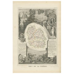
Lozere, France. Antique map of a French department, 1856
By Victor Levasseur
Located in Melbourne, Victoria
'Dept. de La Lozere', steel engraving with original outline hand-colouring., 1856, from Levasseur's 'Atlas National Illustre'.
This remote mountainous part of Languedoc is rural, s...
Category
19th Century Naturalistic Landscape Prints
Materials
Engraving

Aube, France. Antique map of a French department, 1856
By Victor Levasseur
Located in Melbourne, Victoria
'Dept. de L'Aube', steel engraving with original outline hand-colouring., 1856, from Levasseur's 'Atlas National Illustre'.
This area of France is known for its production of Chaou...
Category
19th Century Naturalistic Landscape Prints
Materials
Engraving

Antique Map of Lozère ‘France’ by V. Levasseur, 1854
Located in Langweer, NL
Antique map titled 'Dépt. de la Lozère'. Map of the French department of Lozere, France. This remote mountainous part of Languedoc is rural, sparcely populated, and extremely beautif...
Category
Antique Mid-19th Century Maps
Materials
Paper
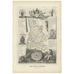
Antique Map of Drôme ‘France’ by V. Levasseur, 1854
Located in Langweer, NL
Antique map titled 'Dépt. de la Drôme'. Map of the French department of Drome, France. This area is known for its production of Picodon, a spicy goats-milk ch...
Category
Antique Mid-19th Century Maps
Materials
Paper
More Ways To Browse
Joze Ciuha
Julian Opie Paper Heads
Kalman Kubinyi
Karl Gerich
Karl Neumann
Katarina Vavrova
Keith Haring Untitled D
Large Erte
Large Signed Picasso Prints
Le Blanc Seing
Leger Hand Signed Lithograph
Leonard H Mersky
Leroy Neiman Americas Cup
Leroy Neiman Silkscreens
Leroy Neiman Skier
Leroy Neiman Stud Poker
Leroy Neiman Vegas
Lichtenstein Crak