Items Similar to Map of Vaucluse - Etching - 19th Century
Want more images or videos?
Request additional images or videos from the seller
1 of 2
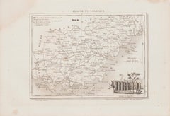
UnknownMap of Vaucluse - Etching - 19th Century19th Century
19th Century
$451.53
£335.66
€380
CA$621.11
A$692.01
CHF 364.97
MX$8,389.47
NOK 4,642.90
SEK 4,325.16
DKK 2,895.01
About the Item
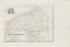
Map of Vaucluse is an original antique etching realized by an anonymous engraver of the XIX century.
Printed in series of "France Pittoresque" at the top center.
The state of preservation of the artwork is good except for diffused foxing due to timing.
A fascinating piece of history and a beautiful piece of art represented in this geographical map, with precise borders and names of places.
- Creation Year:19th Century
- Dimensions:Height: 6.7 in (17 cm)Width: 8.67 in (22 cm)Depth: 0.04 in (1 mm)
- Medium:
- Movement & Style:
- Period:
- Framing:Framing Options Available
- Condition:Insurance may be requested by customers as additional service, contact us for more information.
- Gallery Location:Roma, IT
- Reference Number:Seller: M-1155381stDibs: LU65037607062
About the Seller
4.9
Platinum Seller
Premium sellers with a 4.7+ rating and 24-hour response times
1stDibs seller since 2017
7,646 sales on 1stDibs
Typical response time: 2 hours
- ShippingRetrieving quote...Shipping from: Grasse, France
- Return Policy
Authenticity Guarantee
In the unlikely event there’s an issue with an item’s authenticity, contact us within 1 year for a full refund. DetailsMoney-Back Guarantee
If your item is not as described, is damaged in transit, or does not arrive, contact us within 7 days for a full refund. Details24-Hour Cancellation
You have a 24-hour grace period in which to reconsider your purchase, with no questions asked.Vetted Professional Sellers
Our world-class sellers must adhere to strict standards for service and quality, maintaining the integrity of our listings.Price-Match Guarantee
If you find that a seller listed the same item for a lower price elsewhere, we’ll match it.Trusted Global Delivery
Our best-in-class carrier network provides specialized shipping options worldwide, including custom delivery.More From This Seller
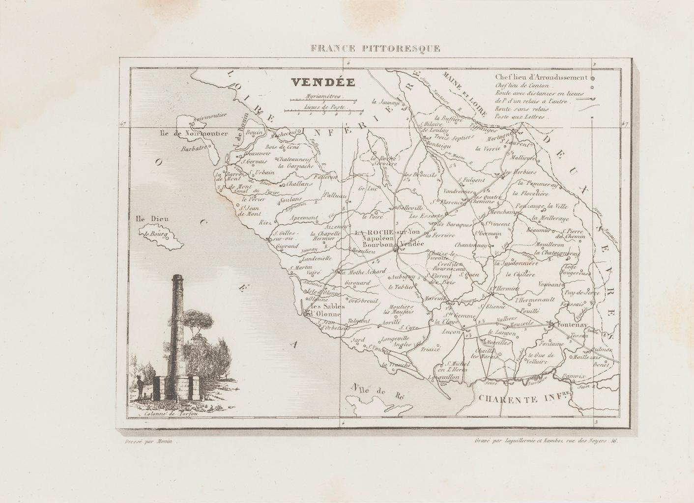
View AllMap of Vendée - Etching - 19th Century
Located in Roma, IT
Map of Vendée is an etching realized by an anonymous engraver of the 19t century.
Printed in series of "France Pittoresque" at the top center.
The state of preservation of the artw...
Category
19th Century Modern Figurative Prints
Materials
Etching

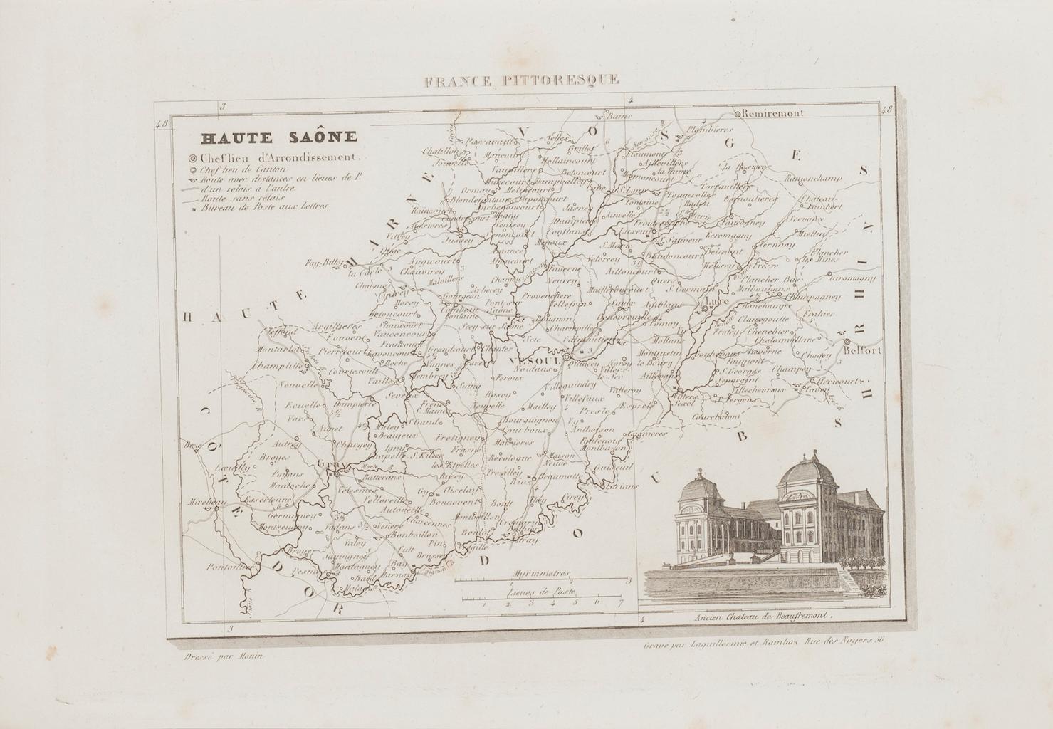
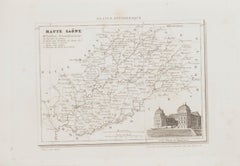
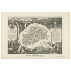
Map of Haute-Saône - Original Etching - 19th Century
Located in Roma, IT
Map of Haute-Saône is an original antique etching realized by an anonymous engraver of the 19th Century.
Printed in series of "France Pittoresque" at the top center.
The state of p...
Category
19th Century Modern Figurative Prints
Materials
Etching
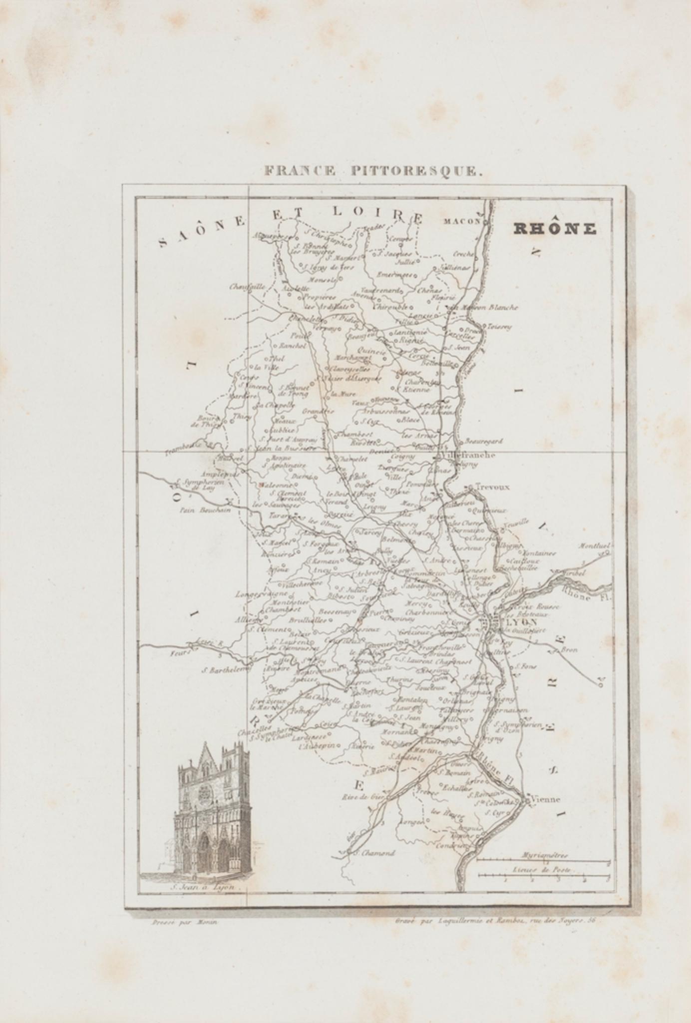
Map of Rhône - Original Etching - 19th Century
Located in Roma, IT
Map of Rhône is an original antique etching realized by an anonymous engraver of the 19th Century.
Printed in series of "France Pittoresque" at the top center.
The state of preserv...
Category
19th Century Modern Figurative Prints
Materials
Etching

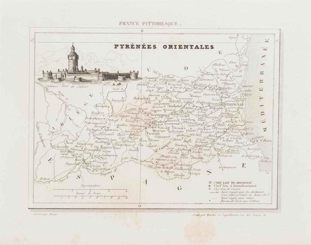
Map of Pyrénées - Original Etching - 19th Century
Located in Roma, IT
Map of Pyrénées is an original antique etching realized by an anonymous engraver of the XIX century.
Printed in series of "France Pittoresque" at the top center.
The state of prese...
Category
19th Century Modern Figurative Prints
Materials
Etching

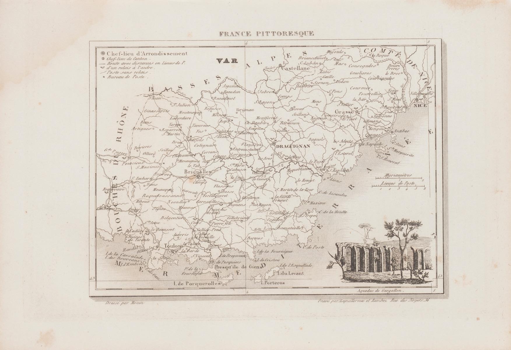
Map of Var - Original Lithograph- 19th Century
Located in Roma, IT
Map of Var is an original lithograph realized by an Anonymous artist of the 19th century.
Printed in series of "France Pittoresque", as indicated on the top center.
The state of pr...
Category
19th Century Modern Figurative Prints
Materials
Paper, Lithograph
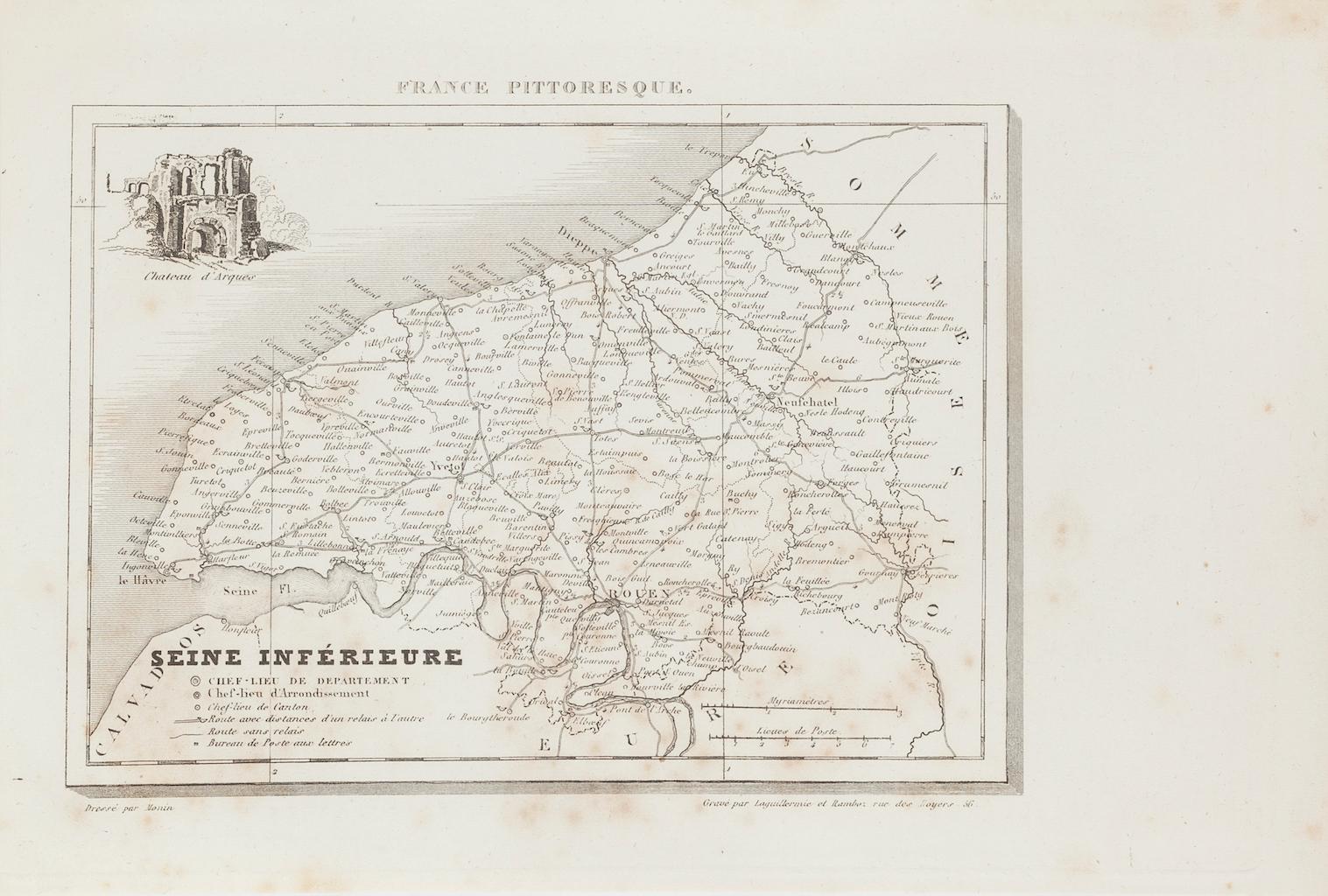
Map of Seine - Original Etching - 19th Century
Located in Roma, IT
Map of Seine is an original etching realized by an anonymous engraver of the XIX century.
Printed in series of "France Pittoresque" at the top center.
The state of preservation of ...
Category
19th Century Figurative Prints
Materials
Etching
You May Also Like
Var, France. Antique map of a French department, 1856
By Victor Levasseur
Located in Melbourne, Victoria
'Dept. du Var', steel engraving with original outline hand-colouring., 1856, from Levasseur's Atlas National Illustre.
Var covers the heart of the French Riviera or Cote d'Azur., and includes the resort cities of Cannes, Nice and San Tropez...
Category
19th Century Naturalistic Landscape Prints
Materials
Engraving

Aude, France. Antique map of a French department, 1856
By Victor Levasseur
Located in Melbourne, Victoria
'Dept. de L' Aude', steel engraving with original outline hand-colouring., 1856, from Levasseur's 'Atlas National Illustre'.
This area of France is famous for its wide variety of v...
Category
19th Century Naturalistic Landscape Prints
Materials
Engraving

Antique Map of France by Balbi '1847'
Located in Langweer, NL
Antique map titled 'France'. Original antique map of France. This map originates from 'Abrégé de Géographie (..)' by Adrien Balbi. Published 1847.
Category
Antique Mid-19th Century Maps
Materials
Paper

$118 Sale Price
20% Off
Antique Map of Haute-Saone, France by V. Levasseur, 1854
By Victor Levasseur
Located in Langweer, NL
Antique map titled 'Dépt. de la Hte. Saône'. Map of the French department of Haute-Saone, France. Part of France's important Burgundy or Bourgogne Wine Region. This area is home to t...
Category
Antique Mid-19th Century Maps
Materials
Paper
$171 Sale Price
20% Off
Antique Map of France in Ancient Roman Times by d'Anville, c.1795
Located in Langweer, NL
Antique map titled 'Gallia Antiqua ex Aevi Romani Monumentis (..)'. Original, large, map of France in ancient Roman times. Bottom left, a large inset shows Gallia's southern most Rom...
Category
Antique Late 18th Century French Maps
Materials
Paper

$665 Sale Price
30% Off
L'Isere, France. Antique map of French department, 1856
By Victor Levasseur
Located in Melbourne, Victoria
'Dept. de L'Isere', Steel engraving with original outline hand-colouring., 1856, from Levasseur's 'Atlas National Illustre'.
This area is known for its production of Bleu du Vercor...
Category
19th Century Naturalistic Landscape Prints
Materials
Engraving

More Ways To Browse
Salvador Dali Lettre
Salvador Dali Lobster
Salvador Dali Paradise 6
Salvador Dali Signed Prints Bullfight
Samuel Carter
Sinatra Neiman
Stanley Ellis
Stephen Wilkes
Tadanori Yokoo
Utagawa Yoshiiku
Utagawa Yoshitora
Velvet Elvis Painting
Vincent Gallo
Vintage Erotism
Vivian Springford
William Anderson Sherwood
Wolfgang Hutter
Wynn Chamberlain