1690s Prints and Multiples

to
2
7
4
12
Overall Width
to
Overall Height
to
13
9
2
1
4,662
9,968
56,676
26,636
717
1,051
2,138
2,271
2,493
5,007
8,180
13,119
7,341
3,884
3,890
20
5
8
8
7
4
1
1
1
1
1
1
1
1
1
1
25
1
1
6
16
9
Period: 1690s
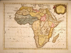
"Africa Vetus": A 17th Century Hand-colored Map By Sanson
Located in Alamo, CA
This original hand-colored copperplate engraved map of Africa entitled "Africa Vetus, Nicolai Sanson Christianiss Galliar Regis Geographi" was originally created by Nicholas Sanson d...
Category

1690s Prints and Multiples

Materials

Engraving

Carte Particuliere Des Coste De Bretagne qui Comprend Morlaix
Located in Paonia, CO
Carte Particuliere Des Costes De Bretagne qui Comprend Morlaix, Saint Paul de Leon, les Sept Isles, et L’Isle. Faite par ordre Exprez Du Roy de France is from the collection of ch...
Category

1690s Prints and Multiples

Materials

Engraving

The Normandy Region of France: A 17th C. Hand-colored Map by Sanson and Jaillot
Located in Alamo, CA
This large hand-colored map entitled "Le Duché et Gouvernement de Normandie divisée en Haute et Basse Normandie en divers Pays; et par evêchez, avec le Gouvernement General du Havre ...
Category

1690s Prints and Multiples

Materials

Engraving

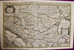
Hungary & Eastern Europe: A Large 17th C. Hand-colored Map by Sanson & Jaillot
Located in Alamo, CA
This large hand-colored map entitled "Le Royaume De Hongrie et les Estats qui en ont este sujets et qui font presentement La Partie Septentrionale de la Turquie en Europe" was origin...
Category

1690s Prints and Multiples

Materials

Engraving

The Loire Valley of France: A 17th C. Hand-colored Map by Sanson and Jaillot
Located in Alamo, CA
This large 17th century copper plate hand-colored engraved map entitled "Gouvernement D'Orleans et la Generalite divisee en ses Elections Par...
Category

1690s Prints and Multiples

Materials

Engraving

Portugal: A Large 17th Century Hand-colored Map by Sanson and Jaillot
Located in Alamo, CA
This large hand-colored map entitled "Le Royaume de Portugal et des Algarves Divisee en see Archeveches, Eveches et Territoires Par le Sr Sanson" was originally created by Nicholas S...
Category

1690s Prints and Multiples

Materials

Engraving

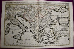
Southern & Eastern Europe: A Large 17th C. Hand-colored Map by Sanson & Jaillot
Located in Alamo, CA
This large hand-colored map entitled "Estats de L'Empire des Turqs en Europe, ou sont les Beglerbeglicz our Gouvernements" was originally created by Nicholas Sanson d'Abbeville and this version was published by Hubert Jaillot in "Atlas Nouveau" in Paris in 1692. It depicts the territories of the Ottoman Empire in Europe, predominantly Eastern Europe. Highlights include, the Mediterranean Sea, the Adriatic Sea, the Black Sea, the Dalmation Coast including present day Croatia, Bosnia and Herzegovina, Montenegro, Serbia, Slovenia, Italy, Greece, North Macedonia, Turkey, Romania, Hungary, Albania, Kosovo, Bulgaria, Transylvania, Moldova and southern portions of France, Switzerland, Germany, and Poland.. The map consists of two sheets joined as one along a vertical joint. The map has original hand-coloring. It is printed on antique hand-made laid, chain-linked paper with wide margins. The sheet measures 24.88" high and 38" wide. There is a central vertical joint, as issued. The map is in very good condition. Nicholas Sanson d'Abbeville (1600-1667) was one of the greatest French cartographather of French cartography. Sanson opened his first printing business in Paris in 1638. The king recognized his skill and knowledge and made him the official geographer to the court. He eventually served two kings in this capacity. Sanson was succeeded by his sons and son...
Category

1690s Prints and Multiples

Materials

Engraving

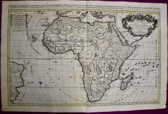
Africa: A Large 17th Century Hand-colored Map By Sanson and Jaillot
Located in Alamo, CA
This large original hand-colored copperplate engraved map of Africa entitled "L'Afrique divisee suivant l'estendue de ses principales parties ou sont distingues les uns des autres, L...
Category

1690s Prints and Multiples

Materials

Engraving

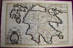
Southern Greece: A Large 17th Century Hand-colored Map By Sanson and Jaillot
Located in Alamo, CA
This large original hand-colored copperplate engraved map of southern Greece and the Pelopponese Peninsula entitled "La Moree Et Les Isles De Zante, Cefalonie, Ste. Marie, Cerigo & C...
Category

1690s Prints and Multiples

Materials

Engraving

Great Britain, N. France: A Large 17th C. Hand-colored Map by Sanson and Jaillot
Located in Alamo, CA
This large hand-colored 17th century copperplate engraved map entitled "Le Royaume D Angleterre, distingué en ses Provinces. Par le Sr. Sanson. Geographe du Roy. Presenté A Monseigne...
Category

1690s Prints and Multiples

Materials

Engraving

Jesus College, Cambridge engraving by David Loggan
Located in London, GB
To see our other views of Oxford and Cambridge, scroll down to "More from this Seller" and below it click on "See all from this seller" - or send us a message if you cannot find the ...
Category

Realist 1690s Prints and Multiples

Materials

Engraving

17th Century Dutch Map of Italy, Sicily, Sardinia, Corsica and Dalmatian Coast
By Theodorus Danckerts
Located in Alamo, CA
This hand colored 17th century Dutch map entitled "Novissima et Accuratissima totius Italiae Corsicae et Sardiniae Descriptio" by Theodore Danckerts depicts the Italian Peninsula in ...
Category

1690s Prints and Multiples

Materials

Engraving

North Holland, Netherlands: A Large 17th C. Hand-colored Map by Sanson & Jaillot
Located in Alamo, CA
This large hand-colored map entitled "Le Comte De Hollande Dressee sur les Memoires les plus Nouveaux" was originally created by Nicholas Sanson d'Abbeville. This version was publish...
Category

1690s Prints and Multiples

Materials

Engraving

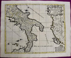
Naples and S. Italy: A Large 17th C. Hand-colored Map by Sanson and Jaillot
Located in Alamo, CA
This large hand-colored map entitled "Le Royaume de Naples Divisé en Douze Provinces. sur les Memoires les plus Nouveaux. Par le Sr. Sanson Presenté" was originally created by Nicholas Sanson d'Abbeville and published by Hubert Jaillot in "Atlas Nouveau" in Paris in 1692. It depicts central and southern Italy, as well as Corfu, Albania, Mediterranean Sea and the Adriatic Sea. Naples, Sorrento, the Isle of Capri, Rome in the upper left corner of the map, as well as many other landmarks. This striking original hand-colored map of Italy is printed on antique hand-made laid, chain-linked paper with wide margins. The sheet measures 20" high and 24.88" wide. There is one spot on the left, it is otherwise in very good to excellent condition. Nicholas Sanson d'Abbeville (1600-1667) was one of the greatest French cartographather of French cartography. Sanson opened his first printing business in Paris in 1638. The king recognized his skill and knowledge and made him the official geographer to the court. He eventually served two kings in this capacity. Sanson was succeeded by his sons and son...
Category

1690s Prints and Multiples

Materials

Engraving

Utrecht, Netherlands: A Large 17th Century Hand-colored Map by Sanson & Jaillot
Located in Alamo, CA
This large hand-colored map entitled "La Seigneurie d'Utrecht. Dressé sur les memoires les plus nouveaux par le Sr. Sanson" was originally created by Nicholas Sanson d'Abbeville. Thi...
Category

1690s Prints and Multiples

Materials

Engraving

Vienna, Austria: A Large 17th Century Hand-colored Map by Sanson and Jaillot
Located in Alamo, CA
This large 17th century hand-colored map of Vienna, Austria and the surrounding countryside and villages entitled "Plan de la Ville de Vienne en Austrich...
Category

1690s Prints and Multiples

Materials

Engraving

David Loggan King's College Cambridge engraving 1690
Located in London, GB
To see our other views of Oxford and Cambridge, scroll down to "More from this Seller" and below it click on "See all from this Seller" - or send us a message if you cannot find the view you want. David Loggan (1634-1692) King's College Cambridge Engraving 1690 40x51cm Baptised in Danzig in 1634 Loggan's parents were English and Scottish. Studying engraving in Danzig with Willem Hondius (1598-1652 or 1658) he moved to London in the late 1650s producing the engraved title-page for the folio 1662 Book of Common Prayer. Marrying in 1663 he moved to Nuffield, Oxfordshire in 1665 to avoid the Plague and was in 1668/9 appointed Public Sculptor to the nearby University of Oxford having been commissioned to produce bird’s-eye views of all the Oxford Colleges. He lived in Holywell Street as he did this. Oxonia illustrata was published in 1675, with the help of Robert White (1645-1704). Following its completion he commenced work on his equivalent work for Cambridge, Cantabrigia Illustrata which was finally published in 1690 when he was made engraver to Cambridge University. Oxonia illustrata also includes an engraving of Winchester College (sharing its founder – William of Wykeham – with New College) whilst Cantabrigia illustrata includes one of Eton College (which shares its founder – Henry VIII – with King’s College). Bird’s-eye views required a particular talent as an architectural perspectivist of that era as it was not until 1783 that the first living thing (a sheep, named Montauciel ‘climb to the sky’) was sent aloft by the Mongolfier brothers in a balloon. Loggan thus had to rely on his imagination in conceiving the views. Loggan’s views constitute the first accurate depictions of the two Universities, in many ways unchanged today. Whilst the Oxford engravings were produced in reasonable numbers and ran to a second edition by Henry Overton (on thicker paper and with a plate number in the bottom right-hand corner), those of Cambridge were printed in smaller numbers and it is thought largely no second edition was produced. The Dutchman Pieter van der Aa published some miniature versions of the engravings for James Beverell’s guidebook to the UK Les Delices de la Grande Bretagne c. 1708. Edmund Hort New (1871-1931) produced a series of pen-and-ink drawings of views of Oxford that paid homage to Loggan showing the development of the city in the following two hundred years. They were turned into photoengravings by Emery Walker...
Category

Realist 1690s Prints and Multiples

Materials

Engraving

Clare College, Cambridge 1690 aerial view engraving by David Loggan
Located in London, GB
To see our other views of Oxford and Cambridge, scroll down to "More from this Seller" and below it click on "See all from this Seller" - or send us a message if you cannot find the ...
Category

Realist 1690s Prints and Multiples

Materials

Engraving

Trinity College, Cambridge engraving by David Loggan
Located in London, GB
To see our other views of Oxford and Cambridge, scroll down to "More from this Seller" and below it click on "See all from this seller" - or send us a message if you cannot find the view you want. David Loggan (1634 - 1692) Trinity College, Cambridge (1690) Engraving 80 x 50 cm Loggan's marvellous and large view of Trinity from the 'Cantabrigia Illustrata'. Loggan was born to English and Scottish parents, and was baptised in Danzig in 1634. After studying engraving in Danzig with Willem Hondius (1598-1652 or 1658), he moved to London in the late 1650s, going on to produce the engraved title-page for the folio 1662 Book of Common Prayer. He married in 1663 and moved to Nuffield in Oxfordshire in 1665. Loggan was appointed Public Sculptor to the nearby University of Oxford in the late 1660s, having been commissioned to produce bird’s-eye views of all the Oxford colleges. He lived in Holywell Street as he did this. The 'Oxonia Illustrata' was published in 1675, with the help of Robert White (1645-1704). Following its completion, Loggan began work on his equivalent work for Cambridge; the 'Cantabrigia Illustrata' was finally published in 1690, when he was made engraver to Cambridge University. The 'Oxonia Illustrata' also includes an engraving of Winchester College (Winchester and New College share William of Wykeham as their founder) whilst the 'Cantabrigia Illustrata' includes one of Eton College (which shares its founder, Henry VIII, with King’s College). Bird’s-eye views from this era required a particular talent as an architectural perspectivist; it was not until 1783 that it became possible for artists to ascend via hot air balloons and view the scenes they were depicting from above. Loggan thus had to rely on his imagination in conceiving the views. Loggan’s views constitute the first accurate depictions of the two Universities, in many ways unchanged today. Whilst the Oxford engravings were produced in reasonable numbers and ran to a second edition by Henry Overton (on thicker paper and with a plate number in Roman numerals in the bottom right-hand corner), those of Cambridge were printed in much smaller numbers. The Dutchman Pieter van der Aa published some miniature versions of the engravings for James Beverell’s guidebook to the UK, 'Les Delices de la Grande Bretagne' (circa 1708). The contemporary artist Andrew Ingamells...
Category

Realist 1690s Prints and Multiples

Materials

Engraving

David Loggan: New College, Oxford 1690 engraving
Located in London, GB
To see our other views of Oxford and Cambridge, scroll down to "More from this Seller" and below it click on "See all from this seller" - or send us a message if you cannot find the view you want. David Loggan (1634-1692) New College...
Category

Realist 1690s Prints and Multiples

Materials

Engraving

David Loggan: Great St Mary's Church Cambridge University engraving 1690
Located in London, GB
To see our other views of Oxford and Cambridge, scroll down to "More from this Seller" and below it click on "See all from this Seller" - or send us a message if you cannot find the ...
Category

Realist 1690s Prints and Multiples

Materials

Engraving

David Loggan Cambridge portrait Charles Duke of Somerset 1690
Located in London, GB
To see our other views of Oxford and Cambridge, scroll down to "More from this Seller" and below it click on "See all from this Seller" - or send us a message if you cannot find the view you want. David Loggan (1634-1692) Charles Duke of Somerset...
Category

Realist 1690s Prints and Multiples

Materials

Mezzotint

New College, Oxford, engraving, 1690 David Loggan
Located in London, GB
To see our other views of Oxford and Cambridge, scroll down to "More from this Seller" and below it click on "See all from this seller" - or send us a message if you cannot find the view you want. David Loggan (1634-1692) New College...
Category

Realist 1690s Prints and Multiples

Materials

Engraving

Carte Particular Des Costes De Bretagne Depuis le Cap de Frehel, Jusques a Perros
Located in Paonia, CO
Carte Particulaire Des Costes De Bretagne Depuis Le Cap de Frehel, Jusques a Perros, & L’Isle Tome. This large sea scale chart shows part of the northwestern co...
Category

1690s Prints and Multiples

Materials

Engraving

David Loggan Trinity College Cambridge Bishop's Hostel engraving 1690
Located in London, GB
To see our other views of Oxford and Cambridge, scroll down to "More from this Seller" and below it click on "See all from this Seller" - or send us a message if you cannot find the view you want. David Loggan (1634-1692) The Bishop's Hostal, Trinity College Cambridge...
Category

Realist 1690s Prints and Multiples

Materials

Engraving

Related Items
West Africa: A 17th Century Hand-Colored Map by Mercator/Hondius
Located in Alamo, CA
A 17th century hand-colored map entitled "Guineae Nova Descriptio" by Gerard Mercator and Jodocus Hondius, published in their 'Atlas Minor' in Amsterdam in 1635. It is focused on the...
Category

1690s Prints and Multiples

Materials

Engraving

Crossings
Located in New York, NY
CROSSINGS Contemporary artist Frederick Mershimer created the mezzotint engraving entitled "Crossings" in 1998. This impression is signed, titled, and dated in pencil. The printed ...
Category

American Realist 1690s Prints and Multiples

Materials

Mezzotint

Crossings
Crossings
H 30 in W 41 in D 0.94 in
Frankfort, Germany: A 16th Century Hand-colored Map by Braun & Hogenberg
Located in Alamo, CA
This is a 16th century original hand-colored copperplate engraved map of Frankfort, Germany entitled "Francenbergum, vel ut alij Francoburgum Hassiae Opp" by Georg Braun & Franz Hogenberg, from their famous city atlas "Civitates Orbis Terrarum", published in Cologne, Germany in 1595. This is an English translation of an excerpt from the original text in the atlas: "Frankenberg or, according to others, Francoburgum, a town in Hesse. Charlemagne vested the town of Frankenberg with many freedoms and privileges, which it still enjoys to this day, and on account of its valiant and victorious soldiers awarded a signet, upon which there formerly appeared a golden castle with a tower, together with the letter F and a golden crown. Frankenberg, seen here from the northeast, lies on a hill above the River Eder. The hillside is covered with fields neatly separated by bushes and fences. Soaring above the town is the massive Liebfrauenkirche, which was modelled on St Elizabeth's church in Marburg. The New Town was founded in 1335 at the foot of the hill (right) and merged with the Old Town as late as 1556. Frankenberg was founded by Conrad of Thuringia in 1233/34 to prevent the archbishops of Mainz from expanding their sphere of influence...
Category

Old Masters 1690s Prints and Multiples

Materials

Engraving

Niagara
Located in New York, NY
NIAGARA Contemporary artist Frederick Mershimer created the mezzotint engraving entitled “Niagara” in 2021. This impression is signed, titled, dated, and inscribed “5/45”- the 5th ...
Category

American Realist 1690s Prints and Multiples

Materials

Mezzotint

Niagara
Niagara
H 43 in W 31.75 in D 0.94 in
Branches Blue, Limited edition print, Landscape, Tree, Nature art
Located in Deddington, GB
This print is part of a small series of works to investigate the use of layering, colour blends and texture in screen print to elicit an ethereal, eerie and potentially dizzying sens...
Category

Contemporary 1690s Prints and Multiples

Materials

Drypoint, Etching

Branches Gold, Limited edition print, Landscape, Tree, Nature art
Located in Deddington, GB
Scots Pine drypoint etching printed onto Japanese gampi tissue and backed onto German Hahnemule printmaking paper. This print depicts a mature pine tree, standing proud from the rest...
Category

Contemporary 1690s Prints and Multiples

Materials

Drypoint, Etching

Slope w.five trees
Located in New York, NY
“Slope w/five trees” is a drypoint engraving created by Robert Kipniss in 2020. The paper size is 12.50 x 10.50 inches and the printed image size is 6.75 x ...
Category

Modern 1690s Prints and Multiples

Materials

Engraving, Drypoint

Slope w.five trees
Slope w.five trees
H 12.5 in W 10.5 in D 0.96 in
Hidden Cities I / second state
Located in New York, NY
“Hidden Cities I : The Ministry. Second State.” Contemporary artist Peter Milton created this etching and engraving in 2006. The printed image size is Image size 23.50 x 36.88 inches and the paper size is 31 x 42 inches. This impression is signed, dated, and titled in pencil and inscribed “11/75” – the 11th impression from the total printing of 75. “I do love to draw. I feel that I am being granted membership in the Brotherhood of Merlin, conjuring forth some apparition. As a drawing develops, I sense a vague presence coming more and more into focus, something in a white fog emerging and becoming increasingly palpable.” – P. Milton, “The primacy of touch. The Drawings of Peter Milton” “Working in layers, Milton begins with drawings based on people and places, with nods to Western art history and culture. He is a master of the appropriated image, a term that may conjure Andy Warhol and his Pop Art comrades. But Milton steps further back in history, avoiding the Pop sense of cool advertising and popular culture references. Instead, a broader cultural past is tapped through historical photographs of key players, architecture, and locales, which he reinvents by hand. He adds content drawn from his life as an avid reader – always with multiple possible interpretations – thus incorporating deeper meaning in his cinematic worlds. Elements of Greek mythology, classical music, art history, and history coalesce in his images, which embrace the messiness, sorrow, and elation that is life. One is hard-pressed to imagine a more erudite, skilled, passionate, and cheeky soul. In addition to a storied career in printmaking, since 2007 Milton has fearlessly produced artwork digitally. He now creates images using Adobe Photoshop in files consisting of more than two thousand layers, which are printed both as digital prints on paper and, for display on Led light boxes...
Category

American Realist 1690s Prints and Multiples

Materials

Engraving, Etching

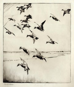
Here They Come !
Located in New York, NY
This impression of "Here They Come !" is from the fourth state of eight. There are six known impressions of the fourth state. Edition 150 (final state). It is signed in pencil in the lower left and inscribed "D-1". The image size 13 7/8 x 11 3/4" (34.6 x 28.8 cm) and sheet size 16 3/4 x 14 5/8" (42.8 x 37.1 cm). FRANK W. BENSON (1862-1951) Frank Weston Benson, well known for his American impressionist paintings, also produced an incredible body of prints - etchings, drypoints, and a few lithographs. Born and raised on the North Shore of Massachusetts, Benson, a natural outdoorsman, grew up sailing, fishing, and hunting. From a young age, he was fascinated with drawing and birding – this keen interest continued throughout his life. His first art instruction was with Otto Grundman at the Museum of Fine Arts in Boston, and then in 1883 in Paris at the Academie Julian where he studied the rigorous ‘ecole des beaux arts’ approach to drawing and painting for two years. During the early 1880’s Seymour Haden visited Boston giving a series of lectures on etching. This introduction to the European etching...
Category

American Impressionist 1690s Prints and Multiples

Materials

Drypoint

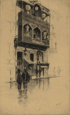
Restaurant in Mott Street
Located in New Orleans, LA
The image depicts a restaurant on New York's Mott Street with ornamental iron work on the balconies. There are six figures in the scene in various stages of contrast. Mott Street is considered the unofficial Main Street of New York's Chinatown. Ella Fitzgerald sang it best: “And tell me what street compares with Mott Street in July? Sweet pushcarts gently gliding by.” CFW Mielatz was an early influence on the drypoints and etchings of Martin Lewis. This piece was created in 1906 and it is signed in pencil. It is part of the collection of New York's Metropolitan Museum of Art C.F.W. Mielatz American, 1860-1919 Born in Bredding, Germany in 1864, Mielatz emigrated to the United States as a young boy and studied at the Chicago School of Design. Mostly self-taught, his first prints were large New England landscapes reminiscent of the painter-etcher school of American Art. Around 1890 he started to produce prints of New York City and by the time of his death, the number totaled over ninety images. He was a master technician in the field of etching, reworking many of his plates to get the exact feeling he was seeking. Mielatz was a member of the New York Etching...
Category

American Modern 1690s Prints and Multiples

Materials

Drypoint, Etching

Canterbury: An Original 16th C. Framed Hand-colored Map by Braun & Hogenberg
Located in Alamo, CA
This is a framed 16th century map and city view of Canterbury, England entitled "Cantuarbury" by Braun & Hogenburg, from their famous landmark atlas of city views 'Civitates Orbis Terrarum' (Atlas of the Cities of the World), which was first published in Cologne, Germany in 1572. The map of Canterbury was first published in 1588. It depicts a detailed birdseye view of the completely walled and fortified city of Canterbury, with its cathedral the most prominent feature. The coat of arms of England, Canterbury, and the Archbishop of Canterbury are included. This beautifully hand-colored map is presented in a gold-colored wood frame with a beaded inner trim and a paprika-colored mat that highlights details in the map. The frame measures 18.75" high by 22.25" wide by 0.875" deep. There is a central vertical fold, as issued. The map is in excellent condition. Braun and Hogenberg's 'The Civitates Orbis Terrarum' was the second atlas of maps ever published and the first atlas of cities and towns of the world. It is one of the most important books published in the 16th century. Most of the maps in the atlas were engraved by Franz Hogenberg and the text, with its descriptions of the history and additional factual information of the cities, was written by a team of writers and edited by Georg Braun. The work contained 546 bird-eye views and map views of cities and towns from all over the world. It gave graphic representation of the main features of the illustrated cities and towns, including the buildings and streets. Although the ordinary buildings are stylized, the principal buildings are reproduced from actual drawings created on location. The principal landmarks and streets can still be recognized today. In addition, the maps often include the heraldic arms of the city, the nature of the surrounding countryside, the important rivers, streams and harbors, even depicting stone bridges, wooden pontoons, flat-bottomed ferries, ships and working boats, wharves and jetties, as well as land-based activities, including horsemen, pedestrians, wagons, coaches, and palanquins. Small vignettes are often included which illustrate the trade, occupations and habits of the local inhabitants, such as agriculture, paper-making and textiles, as well as local forms of punishment, such as gibbets, wheels, floggings etc. Large figures dressed in their local costume are often presented out of proportion in the foreground. The aim of the authors was to give as much information as possible in a pleasing visual form. They succeeded in creating maps that were both informative and decorative works of art. The atlas is a wonderful glimpse of life in medieval Europe. Georg Braun (1541-1622) was German Catholic...
Category

Old Masters 1690s Prints and Multiples

Materials

Engraving

Mont et Mervale (Mountains and Wonder)
Located in New Orleans, LA
Born in Charleroi, Belgium, Christine Ravaux is an artist who mirrors her surroundings in the mezzotints she creates. She has portrayed the black hills that dot the landscape of the ...
Category

Contemporary 1690s Prints and Multiples

Materials

Mezzotint, Aquatint

Previously Available Items
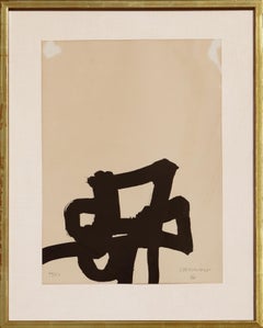
“Dentro y Fuera” Black and White Abstract Modern Lithograph
Located in Houston, TX
Minimalist abstract lithograph by Spanish artist Eduardo Chilida. The piece features Chilida's signature geometric loops rendered at the middle bottom of the paper. Edition 40/150. S...
Category

Abstract 1690s Prints and Multiples

Materials

Lithograph

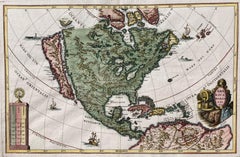
AMERICA BOREALIS (California As An Island)
Located in Santa Monica, CA
HEINRICH SCHERER (1628 - 1704) AMERICA BOREALIS, 1699 (MCLaughlin 128, Tooley 85, Burden 756) Engraving, with full color and showing California as an Island...
Category

Old Masters 1690s Prints and Multiples

Materials

Engraving

David Loggan St John's College, Cambridge engraving 1690
Located in London, GB
To see our other views of Oxford and Cambridge, scroll down to "More from this Seller" and below it click on "See all from this Seller" - or send us a message if you cannot find the ...
Category

Realist 1690s Prints and Multiples

Materials

Engraving

New College, Oxford, engraving aerial view, 1690 David Loggan
Located in London, GB
To see our other views of Oxford and Cambridge, scroll down to "More from this Seller" and below it click on "See all from this seller" - or send us a message if you cannot find the ...
Category

Realist 1690s Prints and Multiples

Materials

Engraving

AMERICA BOREALIS (California As An Island)
Located in Santa Monica, CA
HEINRICH SCHERER (1628 - 1704) AMERICA BOREALIS, 1699 (MCLaughlin 128, Tooley 85, Burden 756) Engraving, with outline color and showing California as an Island...
Category

Old Masters 1690s Prints and Multiples

Materials

Engraving

Recently Viewed

View All