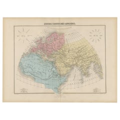
Antique World Maps
to
209
411
110
255
219
138
102
92
52
52
45
37
31
23
22
22
22
19
19
16
15
12
9
9
8
8
8
8
7
7
7
6
6
6
5
5
5
5
5
4
3
3
3
2
2
2
1
1
1
1
1
1
1
23
5
4
4
3
Sort By
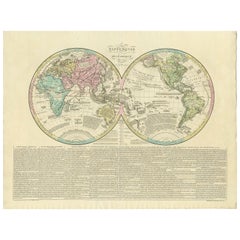
Antique World Map by Lesage, 1823
Located in Langweer, NL
Antique world map titled 'Mappe Monde Historique'. The map depicts both the Eastern and Western
Category
Early 19th Century Antique World Maps
Materials
Paper
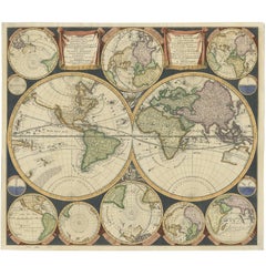
Antique World Map by P. Schenk '1706'
By Peter Schenk
Located in Langweer, NL
Aert-klooten (..)'. One of the earliest Dutch World Maps to focus on a more modern cartographic style
Category
Early 18th Century Antique World Maps
Materials
Paper
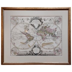
Original Antique Hand-colored World Map with or without Frame, '1696'
Located in Langweer, NL
Antique world map titled 'Mappe-Monde dressee sur les Observations de Mrs. de l'Academie Royale des
Category
Late 17th Century French Antique World Maps
Materials
Paper
$5,333
H 28.75 in W 33.67 in D 1.58 in
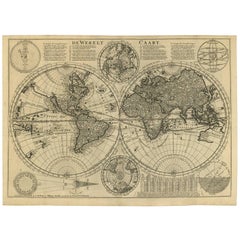
Antique Bible World Map by R. & J. Wetstein, 1743
Located in Langweer, NL
Antique world map titled 'De Werelt Caart'.
A scarce and richly detailed double hemisphere world
Category
Mid-18th Century Antique World Maps
Materials
Paper
$2,370 Sale Price
20% Off
H 15.52 in W 21.26 in D 0.02 in
Gorgeous Antique World Map by the Dutch Mapmaker Visscher, published circa 1679
Located in Langweer, NL
example of Nicholas Visscher's World map, which appeared in his Atlas Minor after 1679.
The map is
Category
Late 17th Century Dutch Antique World Maps
Materials
Paper
$7,822
H 20.79 in W 25.2 in D 0.02 in
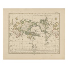
World Map – Mercator Projection with Global Sea Routes, Published in 1857
Located in Langweer, NL
World Map – Mercator Projection with Global Sea Routes 1857
This attractive antique print shows a
Category
Mid-19th Century German Antique World Maps
Materials
Paper
$450
H 14.77 in W 17.88 in D 0.01 in
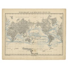
Antique Mercator Projection World Map by Petri, c.1873
Located in Langweer, NL
Antique world map titled 'Wereldkaart naar Mercator's Projectie'. Old map of the world. This map
Category
19th Century Antique World Maps
Materials
Paper
$119 Sale Price
20% Off
H 10.32 in W 12.84 in D 0 in
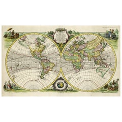
Rare Original Double Hemisphere World Map with Allegorical Figures, 1785
Located in Langweer, NL
hemisphere world map. Four allegorical figures in the corners represent Europe, Asia, Africa and America
Category
1780s Antique World Maps
Materials
Paper
$2,812 Sale Price
20% Off
H 17.05 in W 23.23 in D 0 in
Antique World Map before the Voyages of Christopher Columbus, 1880
Located in Langweer, NL
Antique world map titled 'Monde Connu des Anciens'. Antique map of the World and continents before
Category
19th Century Antique World Maps
Materials
Paper
$228 Sale Price
20% Off
H 13.59 in W 18.71 in D 0 in
Small Antique World Map in Decorative Old Hand-Colouring, circa 1840
Located in Langweer, NL
Antique map titled 'Wereld Kaart'. Small and very decorative double hemisphere world map. Source
Category
19th Century Antique World Maps
Materials
Paper
$209 Sale Price
20% Off
H 6.19 in W 7.41 in D 0 in
World Map in Two Hemispheres: Eastern & Western - 1802 Tardieu Atlas
Located in Langweer, NL
Revolutionary Calendar)
**Geographical Scope:**
This antique map illustrates a double-hemisphere world map
Category
Early 1800s Antique World Maps
Materials
Paper
$438 Sale Price
20% Off
H 16.34 in W 22.13 in D 0.01 in
Antique World Map in Hemispheres with Delicate Pastel Coloring, 1903
Located in Langweer, NL
Title: Antique World Map in Hemispheres with Delicate Pastel Coloring, 1903
Description:
This
Category
Early 20th Century Antique World Maps
Materials
Paper
$284
H 14.49 in W 18.9 in D 0.01 in
Antique World Map with Astronomical Spheres by Pierre Mortier, Amsterdam, c.1700
Located in Langweer, NL
Antique World Map with Astronomical Spheres by Pierre Mortier, Amsterdam, circa 1700
This
Category
17th Century French Antique World Maps
Materials
Paper
$871 Sale Price
25% Off
H 16.93 in W 20.08 in D 0 in
Ancient World Map
Located in Houston, TX
Over 150 year old engraved map of the world as it was known during the antiquities by cartographer
Category
1830s Antique World Maps
Materials
Ink, Watercolor, Handmade Paper
Veteris Orbis Climata – Ancient World Map after Strabo by Cellarius, 1731
Located in Langweer, NL
Veteris Orbis Climata – Ancient World Map after Strabo by Cellarius, 1731
This fascinating hand
Category
1730s Antique World Maps
Materials
Paper
$429 Sale Price
20% Off
H 9.45 in W 14.57 in D 0 in
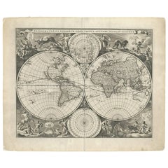
WORLD MAP - Planisphaerium Terrestre Sive Terrarum Orbis... 1696
By Carel Allard
Located in Santa Monica, CA
)
Engraving, 20 ½ x 23 ½”, sheet 21 x 24 1/8". A stunning double hemisphere World Map with sphere projections
Category
17th Century Old Masters Antique World Maps
Materials
Engraving
$4,750
H 20.5 in W 23.5 in
Antique World Map on Mercator's Projection, Ocean Currents and Trade Routes 1903
Located in Langweer, NL
Title: Antique World Map on Mercator's Projection, 1903, Showing Ocean Currents and Trade Routes
Category
Early 20th Century Antique World Maps
Materials
Paper
$331
H 14.49 in W 18.9 in D 0.01 in
Ancient World Map: Europe, Africa & Asia - 1802 Tardieu Atlas
Located in Langweer, NL
Revolutionary Calendar)
Geographical Scope:
This antique map illustrates the "known world" of the ancients
Category
Early 1800s Antique World Maps
Materials
Paper
$419 Sale Price
20% Off
H 16.3 in W 22.33 in D 0.01 in
Old World Map Featuring Captain Cook's Exploration Routes and Polar Views, 1787
Located in Langweer, NL
1786 World Map with Polar Projections - "Globo Terrestre" by Giovanni Maria Cassini
This 1786
Category
1860s Antique World Maps
Materials
Paper
$1,801 Sale Price
20% Off
H 17.13 in W 20.08 in D 0.01 in
Ancient World Map of Europe, Asia & Northern Africa with Ancient Names, 1725
Located in Langweer, NL
ancient world depicting Europe, Asia, and northern Africa with ancient place names. This map originates
Category
1720s Antique World Maps
Materials
Paper
$1,111 Sale Price
24% Off
H 15.75 in W 18.51 in D 0 in
1864 Original illustrated planisphere - World Map - Geography
Located in PARIS, FR
relive the great discoveries that shaped our world. A true collector's item, this cartographic
Category
1860s Antique World Maps
Materials
Linen, Lithograph, Paper
$4,148
H 32.29 in W 44.49 in
Monumental Design with World Map Pillar – Engraving after Volckamer, c.1780
Located in Langweer, NL
Monumental Design with World Map Pillar – Engraving after Volckamer, c.1780
This antique engraving
Category
18th Century Antique World Maps
Materials
Paper
$440
H 19.3 in W 13.39 in D 0 in
World Map of Ocean Currents by A.K. Johnston, Educational Print 1852
Located in Langweer, NL
World Map of Ocean Currents by A.K. Johnston, Educational Print 1852
This detailed and
Category
Mid-19th Century Scottish Antique World Maps
Materials
Paper
$286 / item
H 10.79 in W 13.59 in D 0.01 in
Antique Map of the World by Johnson, '1872'
Located in Langweer, NL
Antique map titled 'Johnson's World. Original world map. This map originates from 'Johnson's New
Category
Late 19th Century Antique World Maps
Materials
Paper
New Map of the Terraqueous Globe - WORLD MAP - CALIFORNIA AS AN ISLAND
By Edward Wells
Located in Santa Monica, CA
EDWARD WELLS (British 1667- 1727)
A NEW MAP of the TERRAQUEOUS GLOBE - according to the latest
Category
Early 1700s Old Masters Antique World Maps
Materials
Engraving
$1,750
H 14.25 in W 20.125 in
Antique Map of the World in Hemispheres by Johnson, '1872'
Located in Langweer, NL
Antique map titled 'Johnson's Globular World. Original world map depicting the Eastern Hemisphere
Category
Late 19th Century Antique World Maps
Materials
Paper
Antique Map of the World, Mercator Projection, by Wyld, '1845'
Located in Langweer, NL
Antique map titled 'The World'. Original antique world map, on Mercator's projection. This map
Category
Mid-19th Century Antique World Maps
Materials
Paper
$331 Sale Price
20% Off
H 10.24 in W 14.18 in D 0.02 in
Antique Map of the World on Mercator's Projection, 1788
Located in Langweer, NL
Antique map titled 'Kaart van de Geheele Wereld (..)'. Uncommon small world map on Mercator's
Category
Late 18th Century Antique World Maps
Materials
Paper
$715 Sale Price
20% Off
H 8.08 in W 12.8 in D 0.02 in
Antique 10K Rose Gold & Porcelain Globe / World Map Spinner Charm or Pendant
Located in Philadelphia, PA
porcelain bead decorated with a polychrome, simplified map of the world.
Set with a 10 karat rose gold yoke
Category
Early 20th Century Unknown Antique World Maps
Materials
Rose Gold
$695
H 1.12 in W 0.8 in D 0.72 in
Antique Map of the World Showing the Distribution of Plants and Minerals, 1872
Located in Langweer, NL
Antique map titled 'Johnson's World showing the distribution of the Characteristic Forest Trees
Category
Late 19th Century Antique World Maps
Materials
Paper
$190 Sale Price
20% Off
H 13.39 in W 16.93 in D 0.02 in
Antique Hemisphere Map of the World 'Two on One Sheet' by Levasseur, '1875'
Located in Langweer, NL
la projection polaire'. Large map with two hemisphere world maps on one sheet. This map originates
Category
Late 19th Century Antique World Maps
Materials
Paper
$325 Sale Price
44% Off
H 24.02 in W 18.71 in D 0.02 in
Antique Map of the World in two Hemispheres by Keizer & de Lat, 1788
Located in Langweer, NL
Antique map titled 'Kaart van de Twee platte Warelds Bollen (..)'. Interesting world map in two
Category
Late 18th Century Antique World Maps
Materials
Paper
$625 Sale Price
30% Off
H 8.08 in W 13 in D 0.02 in
Antique Map of the World in Hemispheres by Keizer & de Lat, 1788
Located in Langweer, NL
double hemisphere world map on polar projections. In North America, there is a large Island of California
Category
Late 18th Century Antique World Maps
Materials
Paper
$474 Sale Price
20% Off
H 8.08 in W 11.03 in D 0.02 in
Antique Map of the World with Polar Projections by Keizer & de Lat, 1788
Located in Langweer, NL
Antique map titled 'Schuine Ronde Aard-Klooten (..)'. Interesting double hemisphere world map with
Category
Late 18th Century Antique World Maps
Materials
Paper
$446 Sale Price
25% Off
H 8.08 in W 11.03 in D 0.02 in
Very Attractive Antique Map of the World as Planisphere, Shows Cook's Voyages
Located in Langweer, NL
Antique map titled 'Chart of the World, according to Mercators Projection'. This world map shows
Category
Late 18th Century Antique World Maps
Materials
Paper
$1,333 Sale Price
25% Off
H 16.15 in W 20.08 in D 0.02 in
Antique Map Showing the Ocean Currents and Temperature of Air, '1872'
Located in Langweer, NL
Two maps on one sheet titled 'Johnson's Oceans Currents (..)' and 'Johnson's World showing the
Category
Late 19th Century Antique World Maps
Materials
Paper
$333 Sale Price
20% Off
H 26.78 in W 18.12 in D 0.02 in
Antique Map of the World with California as an Island, 1788
Located in Langweer, NL
Wareld verbeeld in de gedaante van een hard'. This interesting composition contains three world maps on
Category
1780s Antique World Maps
Materials
Paper
$616 Sale Price
20% Off
H 8.86 in W 12.8 in D 0 in
Antique Map of the Night Skies of the Northern and Southern Hemispheres, 1880
Located in Langweer, NL
Antique world map titled 'Planisphère en Céleste'.
This map depicts the night skies of both the
Category
1880s Antique World Maps
Materials
Paper
$276 Sale Price
20% Off
H 13.59 in W 18.71 in D 0 in
Original Decorative Antique Map of Prussia, 1628
Located in Langweer, NL
cartographer from the County of Flanders. He is most renowned for creating the 1569 world map based on a new
Category
1620s Antique World Maps
Materials
Paper
Interesting Original Antique Hemisphere Map Showing the Latest Discoveries
Located in Langweer, NL
Antique world map titled 'A Map of the World from the best Authorities'. Detailed map of the World
Category
Late 18th Century Antique World Maps
Materials
Paper
$1,043 Sale Price
20% Off
H 13.39 in W 22.05 in D 0.02 in
Map Silk Embroidered Western Eastern Hemisphere New Old World Asia America Afri
Located in BUNGAY, SUFFOLK
A rare, late-18th century, silk, embroidered, double hemisphere, world map, blackwork, sampler
Category
18th Century British Georgian Antique World Maps
Materials
Silk
$8,220
H 0.4 in W 0.4 in D 0.4 in
Antique Zoological Map, 1843
Located in Langweer, NL
Two antique world maps on one sheet. The upper map shows the distribution of animals over the world
Category
19th Century Antique World Maps
Materials
Paper
Antique Map of Macedonia by the Famous Mapmaker Blaeu, c.1650
Located in Langweer, NL
started producing map and sea charts, including his first world map in 1605. His most famous work was the
Category
17th Century Antique World Maps
Materials
Paper
$1,096 Sale Price
20% Off
H 22.72 in W 18.39 in D 0 in
Scarce Antique Map of the Middle East, Surrounded by Latin Text, 1624
Located in Langweer, NL
, surrounded by Latin text. The two insets show Israel and an oval world map. This map (from the last edition
Category
1620s Antique World Maps
Materials
Paper
$905 Sale Price
20% Off
H 16.54 in W 20.28 in D 0 in
1633 Map Entitled "Beauvaisis Comitatus Belova Cium, Ric.0002
Located in Norton, MA
/Ashley) * 1590 World Map in two hemispheres illustrating Drake\\\\\\\\\\\\\\\'s circumnavigation * c
Category
17th Century Dutch Antique World Maps
Materials
Paper
$875 / set
H 18.9 in W 22.45 in D 0.4 in
Antique Tidal Chart and Botanical Map, 1843
Located in Langweer, NL
Two antique world maps on one sheet. The upper map is a tidal chart of the world and shows the
Category
19th Century Antique World Maps
Materials
Paper
Antique Map of Friesland Also Know as the Peacock Map, C.1580
Located in Langweer, NL
established a business in dealing with books and drawing maps. His first remarkable map was a 8 sheet world
Category
18th Century Antique World Maps
Materials
Paper
$1,564 Sale Price
20% Off
H 17.64 in W 22.13 in D 0 in
Antique Map of Russia in Asia by Tallis, c.1851
Located in Langweer, NL
of the last series of decorative world maps ever produced. The maps were engraved by John Rapkin, a
Category
19th Century Antique World Maps
Materials
Paper
Antique Map of Guinea in West Africa by Blaeu, c.1638
Located in Langweer, NL
world map in 1605. His most famous work was the "Atlas Novus" or "Theatrum Orbis Terrarum sive Atlas
Category
17th Century Antique World Maps
Materials
Paper
$524 Sale Price
20% Off
H 18.59 in W 23.04 in D 0 in
Antique Map of South Australia by Tallis, 1851
By Thomas Kitchin
Located in Langweer, NL
published the Illustrated World Atlas, one of the last series of decorative world maps ever produced. The
Category
19th Century Antique World Maps
Materials
Paper
Antique Map of Delfland and Schieland by Hondius, c.1630
Located in Langweer, NL
. Henricus obtained the original plates of the Mercator 1569 world map, and published a 1606 version of it
Category
17th Century Antique World Maps
Materials
Paper
$786 Sale Price
20% Off
H 18.51 in W 22.64 in D 0 in
Monumental Framed Medieval Facsimile Map Of The World Fra Mauro Wood Wall Panel
Located in Forney, TX
A remarkable palatial nearly 7.5ft x 7.5ft facsimile of the important Map of the World (circa 1450
Category
Early 20th Century Medieval Antique World Maps
Materials
Linen, Wood, Paper
$2,950
H 88.25 in W 90.25 in D 2 in
Original Antique Map of the Channel Islands, Incl. Decorative Vignettes, 1851
Located in Langweer, NL
Illustrated World Atlas, one of the last series of decorative world maps ever produced. The maps were engraved
Category
1850s Antique World Maps
Materials
Paper
$426 Sale Price
20% Off
H 14.57 in W 10.24 in D 0 in
Antique Map of the Distribution of Air and Rain by Reynolds, 1843
Located in Langweer, NL
Two antique world maps on one sheet. The upper map shows the distribution of the currents of air
Category
19th Century Antique World Maps
Materials
Paper
$170 Sale Price
20% Off
H 11.23 in W 8.94 in D 0 in
Beautiful Decorative Hand-Colored Antique Map of West Canada, 1851
Located in Langweer, NL
decorative world maps ever produced. The maps were engraved by John Rapkin, a skilled artisan. The maps were
Category
1850s Antique World Maps
Materials
Paper
$905 Sale Price
20% Off
H 10.63 in W 14.38 in D 0 in
Map of the Duchy Clivia & Ravestein, Brabant in The Netherlands & Germany, 1635
Located in Langweer, NL
world map in 1605. His most famous work was the "Atlas Novus" or "Theatrum Orbis Terrarum sive Atlas
Category
1630s Antique World Maps
Materials
Paper
$715 Sale Price
20% Off
H 16.86 in W 22.05 in D 0 in
Terrestrial Globe in Lithographed Paper and Cast Iron, J.Lebègue & Cie – Late 19
By J. Lebegue & Cie
Located in HÉRIC, FR
showing a detailed world map with 'International Railways', 'Telegraph Lines', 'Steam Navigation Lines
Category
19th Century French Antique World Maps
Materials
Iron
$1,936
H 23.63 in Dm 13 in
Old Engraved Map of Hungary with Decorative Vignettes, 1851
Located in Langweer, NL
the last series of decorative world maps ever produced. The maps were engraved by John Rapkin, a
Category
19th Century Antique World Maps
Materials
Paper
$305 Sale Price
20% Off
H 10.63 in W 10.44 in D 0 in
- 1
Get Updated with New Arrivals
Save "Antique World Maps", and we’ll notify you when there are new listings in this category.
Antique World Maps For Sale on 1stDibs
At 1stDibs, there are several options of antique world maps available for sale. Each of these unique antique world maps was constructed with extraordinary care, often using paper, wood and metal. Antique world maps have long been popular, with older editions for sale from the 18th Century and newer versions made as recently as the 20th Century. Antique world maps made by Victorian designers — as well as those associated with Baroque — are very popular at 1stDibs. Many antique world maps are appealing in their simplicity, but George F. Cram, Herman Moll and Victor Levasseur produced popular antique world maps that are worth a look.
How Much are Antique World Maps?
Antique world maps can differ in price owing to various characteristics — the average selling price at 1stDibs is $750, while the lowest priced sells for $76 and the highest can go for as much as $85,000.
More Ways To Browse
Antique Water Wagon
18th Century Sampler
Bactrian Camel
Antique Sheep Shearer
Celtic Antiques
Atlas Holding Globe
Martin Brothers Bird
John Leone
Gold Grenade
Vasco Da Gama
Ascension Of Christ
Austrian Cold Painted Birds
Austrian Painted Chest
Baby Giraffe
Baccarat Crystal Ice Bucket
Baccarat Ice Bucket
Baccarat Swans
Baccarat Tree
