Heinrich Kiepert Wall Decorations
to
5
6
6
Height
to
Width
to
6
6
1
1
6
6
6
5
436
301
286
282
Creator: Heinrich Kiepert
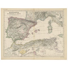
Antique Map of Spain, Mauritia and Africa by H. Kiepert, circa 1870
By Heinrich Kiepert
Located in Langweer, NL
Antique map titled 'Hispania, Mauretania et Africa'. This map originates from 'Atlas Antiquus. Zwölf Karten zur Alten Geschichte' by H. Kiepert. Published in Berlin, circa 1870.
Category
Late 19th Century Antique Heinrich Kiepert Wall Decorations
Materials
Paper
$141 Sale Price
20% Off
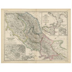
Antique Map of Italy and Greece by H. Kiepert, circa 1870
By Heinrich Kiepert
Located in Langweer, NL
Antique map titled 'Italiae pars media'. This map originates from 'Atlas Antiquus. Zwölf Karten zur Alten Geschichte' by H. Kiepert. Published in Berlin, circa 187.
Category
Late 19th Century Antique Heinrich Kiepert Wall Decorations
Materials
Paper
$141 Sale Price
20% Off
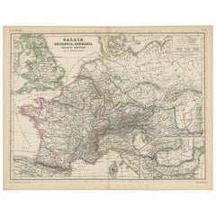
Antique Map of Western Europe by H. Kiepert, circa 1870
By Heinrich Kiepert
Located in Langweer, NL
Antique map titled 'Gallia, Britannia, Germania'. This map depicts a large part of Western Europe including countries like Germany, France, Great Britain, The Netherlands and more. T...
Category
Late 19th Century German Antique Heinrich Kiepert Wall Decorations
Materials
Paper
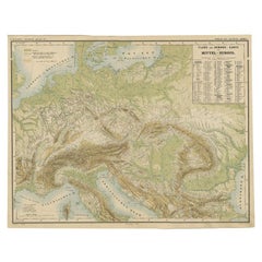
Nice Colourful Antique Map of the Rivers and Mountains of Europe c.1870
By Heinrich Kiepert
Located in Langweer, NL
Antique map titled 'Fluss und Gebirgs Karte von Mittel-Europa'. Old map of the European continent depicting the European mountains and rivers. This map originates from 'H. Kiepert's ...
Category
19th Century Antique Heinrich Kiepert Wall Decorations
Materials
Paper
$226 Sale Price
20% Off
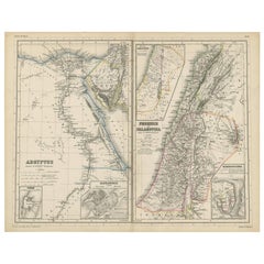
Antique Map of Egypt and Palestina by H. Kiepert 'circa 1870'
By Heinrich Kiepert
Located in Langweer, NL
Antique map titled 'Aegyptus, Phoenice et Palestina'. With inset maps of Tyrus, Alexandria and Hierosolyma. This map originates from 'Atlas Antiquus. Zwölf Karten zur Alten Geschicht...
Category
Late 19th Century Antique Heinrich Kiepert Wall Decorations
Materials
Paper
$151 Sale Price
20% Off
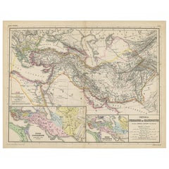
Antique Map of Part of the Roman Empire by H. Kiepert, circa 1870
By Heinrich Kiepert
Located in Langweer, NL
Antique map titled 'Imperia Persarum et Macedonum'. Depicts part of the Roman Empire, from Greece to Eastern India. This map originates from 'Atlas Antiqus. Zwölf Karten zur Alten Ge...
Category
Late 19th Century Antique Heinrich Kiepert Wall Decorations
Materials
Paper
$141 Sale Price
20% Off
Related Items
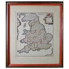
Large 17th Century Hand Colored Map of England and the British Isles by de Wit
By Frederick de Wit
Located in Alamo, CA
A large hand colored 17th century map of England and the British Isles by Frederick de Wit entitled "Accuratissima Angliæ Regni et Walliæ Principatus", published in Amsterdam in 1680. It is a highly detailed map of England, Scotland, the Scottish Isles...
Category
Late 17th Century Dutch Antique Heinrich Kiepert Wall Decorations
Materials
Paper
$1,175
H 35 in W 30.5 in D 2 in
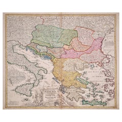
Hand-Colored 18th Century Homann Map of the Danube, Italy, Greece, Croatia
By Johann Baptist Homann
Located in Alamo, CA
"Fluviorum in Europa principis Danubii" is a hand colored map of the region about the Danube river created by Johann Baptist Homann (1663-1724) in his 'Atlas Novus Terrarum', publish...
Category
Early 18th Century German Antique Heinrich Kiepert Wall Decorations
Materials
Paper
$875
H 20 in W 23.88 in D 0.07 in
New Map of North America from the Latest Discoveries, 1763
Located in Philadelphia, PA
A fine antique 18th century map of the North American seaboard.
Entitled "A New Map of North America from the Latest Discoveries 1763".
By the Cartographer/Engraver - John Spil...
Category
Mid-18th Century English Georgian Antique Heinrich Kiepert Wall Decorations
Materials
Paper
Original Antique Map of Ancient Greece, Achaia, Corinth, 1786
Located in St Annes, Lancashire
Great map of Ancient Greece. Showing the region of Thessaly, including Mount Olympus
Drawn by J.D. Barbie Du Bocage
Copper plate engraving by P.F Tardieu
Original hand color...
Category
1780s French Other Antique Heinrich Kiepert Wall Decorations
Materials
Paper
Map of the Republic of Genoa
Located in New York, NY
Framed antique hand-coloured map of the Republic of Genoa including the duchies of Mantua, Modena, and Parma.
Europe, late 18th century.
Dimension: 25...
Category
Late 18th Century European Antique Heinrich Kiepert Wall Decorations
Original Antique Map of Spain and Portugal, circa 1790
Located in St Annes, Lancashire
Super map of Spain and Portugal
Copper plate engraving by A. Bell
Published, circa 1790.
Unframed.
Category
1790s English Other Antique Heinrich Kiepert Wall Decorations
Materials
Paper
Original Antique Map of South East Asia by Thomas Clerk, 1817
Located in St Annes, Lancashire
Great map of South East Asia
Copper-plate engraving
Drawn and engraved by Thomas Clerk, Edinburgh.
Published by Mackenzie And Dent, 1817
Unframed.
Category
1810s English Antique Heinrich Kiepert Wall Decorations
Materials
Paper
Vintage "View of the Center of Paris Taken from the Air" Lithograph Map
Located in San Diego, CA
A very stylish "View of the Center of Paris Taken from the Air" lithograph map published by the Paris Ministry of Tourism, circa early 1950s. The piece measures 27" x 43" and shows...
Category
20th Century French Mid-Century Modern Heinrich Kiepert Wall Decorations
Materials
Paper
$680 Sale Price
20% Off
H 43 in W 27 in D 0.25 in
Original Antique Map of Africa by Dower, circa 1835
Located in St Annes, Lancashire
Nice map of Africa
Drawn and engraved by J.Dower
Published by Orr & Smith. C.1835
Unframed.
Free shipping
Category
1830s English Antique Heinrich Kiepert Wall Decorations
Materials
Paper
Original Antique Map of South America. C.1780
Located in St Annes, Lancashire
Great map of South America
Copper-plate engraving
Published C.1780
Two small worm holes to left side of map
Unframed.
Category
Early 1800s English Georgian Antique Heinrich Kiepert Wall Decorations
Materials
Paper
Large Original Antique Map of the World, Fullarton, circa 1870
Located in St Annes, Lancashire
Great map of the World.
From the celebrated Royal Illustrated Atlas
Lithograph. Original color.
Published by Fullarton, Edinburgh, circa 1870.
Unframed.
Category
1870s Scottish Antique Heinrich Kiepert Wall Decorations
Materials
Paper
Antique Map of Principality of Monaco
By Antonio Vallardi Editore
Located in Alessandria, Piemonte
ST/619 - "Old Geographical Atlas of Italy - Topographic map of ex-Principality of Monaco" -
ediz Vallardi - Milano -
A somewhat special edition ---
Category
Late 19th Century Italian Other Antique Heinrich Kiepert Wall Decorations
Materials
Paper
Previously Available Items
Antique Map of the World by H. Kiepert, circa 1870
By Heinrich Kiepert
Located in Langweer, NL
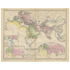
Antique map titled 'Orbis Terrarum'. This map originates from 'Atlas Antiquus. Zwölf Karten zur Alten Geschichte' by H. Kiepert. Published in Berlin, circa 1870.
Category
Late 19th Century Antique Heinrich Kiepert Wall Decorations
Materials
Paper
Antique Map of Rome 'Italy' by H. Kiepert, circa 1870
By Heinrich Kiepert
Located in Langweer, NL
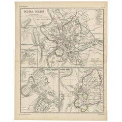
Antique map titled 'Roma Urbs'. This map originates from 'Atlas Antiquus. Zwölf Karten zur Alten Geschichte' by H. Kiepert. Published in Berlin, circa 187.
Category
Late 19th Century Antique Heinrich Kiepert Wall Decorations
Materials
Paper
Antique Map of Italy by H. Kiepert, circa 1870
By Heinrich Kiepert
Located in Langweer, NL
Antique map titled 'Italia'. This map originates from 'Atlas Antiquus. Zwölf Karten zur Alten Geschichte' by H. Kiepert. Published in Berlin, circa 1870.
Category
Late 19th Century Antique Heinrich Kiepert Wall Decorations
Materials
Paper
Antique Map of Greece by H. Kiepert, circa 1870
By Heinrich Kiepert
Located in Langweer, NL
Antique map titled 'Graecia'. With an inset map of Athens and the surroundings of Athens. This map originates from 'Atlas Antiquus. Zwölf Karten zur Alten Geschichte' by H. Kiepert. ...
Category
Late 19th Century Antique Heinrich Kiepert Wall Decorations
Materials
Paper
Antique Map of the Roman Empire by H. Kiepert, circa 1870
By Heinrich Kiepert
Located in Langweer, NL
Antique map titled 'Imperium Romanium'. This map depicts a large part of Europe including countries like Germany, France, Spain, Italy, Great Britain, The Netherlands and more. This ...
Category
Late 19th Century Antique Heinrich Kiepert Wall Decorations
Materials
Paper
Heinrich Kiepert wall decorations for sale on 1stDibs.
Heinrich Kiepert wall decorations are available for sale on 1stDibs. These distinctive items are frequently made of paper and are designed with extraordinary care. There are many options to choose from in our collection of Heinrich Kiepert wall decorations, although beige editions of this piece are particularly popular. If you’re looking for additional options, many customers also consider wall decorations by Georg Balthasar Probst, Homann Heirs, and Johann Wilhelm Weinmann. Prices for Heinrich Kiepert wall decorations can differ depending upon size, time period and other attributes — on 1stDibs, these items begin at $99 and can go as high as $259, while a piece like these, on average, fetch $99.
Creators Similar to Heinrich Kiepert
WMF Württembergische Metallwarenfabrik
