J. Migeon Maps
to
6
6
6
6
6
2
2
6
6
6
9
104
63
28
24
Creator: J. Migeon
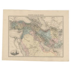
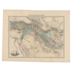
Antique Map of the Turkish Empire and Persia, circa 1890
By J. Migeon
Located in Langweer, NL
Antique map Turkish Emprie titled 'Turquie d'Asie et Perse'. Beautiful map depicting the Turkish Empire and Persia. With vignette depicting Damascus. This map originates from 'Nouvel...
Category
19th Century Antique J. Migeon Maps
Materials
Paper
$364 Sale Price
20% Off
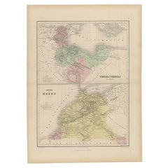
Antique Map of Tunis and Tripoli in Northern Africa, circa 1880
By J. Migeon
Located in Langweer, NL
Antique map titled 'Tunis et Tripoli & Empire de Maroc'. Old map of Tunis and Tripoli and the Empire of Morocco. This map originates from 'Géographie Universelle Atlas-Migeon' by J. ...
Category
19th Century Antique J. Migeon Maps
Materials
Paper
$153 Sale Price
20% Off
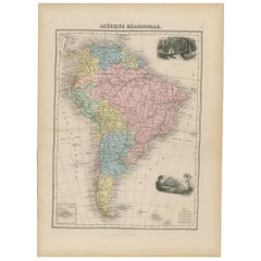
Antique Map of South America by Migeon '1880'
By J. Migeon
Located in Langweer, NL
Antique map titled 'Amérique Méridionale'. Old map of South America. With an inset map of the Galapagos Islands and decorative vignettes. This map...
Category
Late 19th Century French Antique J. Migeon Maps
Materials
Paper
$143 Sale Price
20% Off
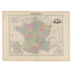
Antique Political Map of France, 1880
By J. Migeon
Located in Langweer, NL
Antique map titled 'France Féodale'. Old map of France with a decorative vignette of Castle de Pierrefonds. This map originates from 'Géographie Universelle Atlas-Migeon' by J. Migeo...
Category
19th Century Antique J. Migeon Maps
Materials
Paper
$115 Sale Price
20% Off
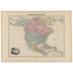
Antique Map of North and Central America by Migeon '1880'
By J. Migeon
Located in Langweer, NL
Antique map titled 'Amérique Septentrionale'. Old map of North and Central America. With a decorative vignette of the Niagara Falls. This map originates from 'Géographie Universelle ...
Category
Late 19th Century French Antique J. Migeon Maps
Materials
Paper
$143 Sale Price
20% Off
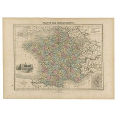
Antique Map of the Departments of France by Migeon, 1880
By J. Migeon
Located in Langweer, NL
Antique map titled 'France par Départements'. Old map of France with a decorative vignette of Strasbourg and an inset map of Corsica. This map originate...
Category
19th Century Antique J. Migeon Maps
Materials
Paper
$115 Sale Price
20% Off
Related Items
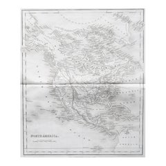
Original Antique Map of North America by Dower, circa 1835
Located in St Annes, Lancashire
Nice map of North America
Drawn and engraved by J.Dower
Published by Orr & Smith. C.1835
Unframed.
Free shipping
Category
1830s English Antique J. Migeon Maps
Materials
Paper
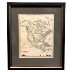
1846 "North America" Map, Engraved by I. Dower
Located in Colorado Springs, CO
Presented is an original 1846 map of “North America.” The map was drawn and engraved by I. Dower and published in London by Orr & Company. The map depicts North America, to include G...
Category
1840s English Victorian Antique J. Migeon Maps
Materials
Paper
Plan of Paris, France, by A. Vuillemin, Antique Map, 1845
Located in Colorado Springs, CO
This large and detailed plan of Paris was published by Alexandre Vuillemin in 1845. The map conveys a wonderful amount of information and is decorated throughout with pictorial vigne...
Category
1840s American Antique J. Migeon Maps
Materials
Paper
North & South America: A 17th Century Hand-colored Map by Jansson & Goos
By Johannes Janssonius
Located in Alamo, CA
A 17th century hand-colored map of North & South America entitled "Americae Descriptio" by the cartographer Johannes Jansson, published in Jansson's Atlas Minor in Amsterdam in 1628....
Category
1620s Dutch Antique J. Migeon Maps
Materials
Paper
$1,275
H 7 in W 8.63 in D 0.07 in
Antique North America Map, USA, Canada, Mexico, Cartography, Colton, Victorian
Located in Hele, Devon, GB
This is an antique North America map. A USA, framed lithography atlas engraving of the continent by JH Colton, dating to the Victorian period and later, circa 1860.
Fascinating, large framed map...
Category
Mid-19th Century American Victorian Antique J. Migeon Maps
Materials
Paper
$1,173
H 22.45 in W 18.71 in D 0.99 in
Large Original Antique Map of the World, Fullarton, circa 1870
Located in St Annes, Lancashire
Great map of the World.
From the celebrated Royal Illustrated Atlas
Lithograph. Original color.
Published by Fullarton, Edinburgh, circa 1870.
Unframed.
Category
1870s Scottish Antique J. Migeon Maps
Materials
Paper
New Map of North America from the Latest Discoveries, 1763
Located in Philadelphia, PA
A fine antique 18th century map of the North American seaboard.
Entitled "A New Map of North America from the Latest Discoveries 1763".
By the Cartographer/Engraver - John Spil...
Category
Mid-18th Century English Georgian Antique J. Migeon Maps
Materials
Paper
Large Original Antique Map of Ireland. C.1900
Located in St Annes, Lancashire
Fabulous map of Ireland
Original color.
Engraved and printed by the George F. Cram Company, Indianapolis.
Published, C.1900.
Unframed.
Free shipping.
Category
1890s American Antique J. Migeon Maps
Materials
Paper
The Peoples of North America, the Japanese Americans
Located in North Hollywood, CA
The peoples of North America, the Japanese Americans.
Discusses the history, culture, and religion of the Japanese, factors encouraging their emigra...
Category
20th Century American Japonisme J. Migeon Maps
Materials
Paper
Large Original Vintage Map of The World, circa 1920
Located in St Annes, Lancashire
Great map of The World
Original color.
Good condition / minor foxing
Published by Alexander Gross
Unframed.
Category
1920s English Vintage J. Migeon Maps
Materials
Paper
Large Original Antique Map of North Carolina, USA, 1894
By Rand McNally & Co.
Located in St Annes, Lancashire
Fabulous map of North Carolina
Original color
By Rand, McNally & Co.
Published, 1894
Unframed
Free shipping.
Category
1890s American Antique J. Migeon Maps
Materials
Paper
Large Original Vintage Map of Persia / Iran, circa 1920
Located in St Annes, Lancashire
Great maps of Persia.
Unframed.
Original color.
By John Bartholomew and Co. Edinburgh Geographical Institute.
Published, circa 1920.
Free shipping.
Category
1920s British Vintage J. Migeon Maps
Materials
Paper
Previously Available Items
Antique Map of the Turkish Empire and Persia, c.1890
By J. Migeon
Located in Langweer, NL
Antique map Turkish Emprie titled 'Turquie d'Asie et Perse'. Beautiful map depicting the Turkish Empire and Persia. With vignette depicting Damascus. This map originates from 'Nouvel...
Category
19th Century Antique J. Migeon Maps
Materials
Paper
Antique Map of North America by Migeon '1880'
By J. Migeon
Located in Langweer, NL
Antique map titled 'États-Unis'. Old map of the United States. With a decorative vignette of Washington. This map originates from 'Géographie Universelle Atlas-Migeon' by J. Migeon.
Category
Late 19th Century French Antique J. Migeon Maps
J. Migeon maps for sale on 1stDibs.
J. Migeon maps are available for sale on 1stDibs. These distinctive items are frequently made of paper and are designed with extraordinary care. There are many options to choose from in our collection of J. Migeon maps, although beige editions of this piece are particularly popular. If you’re looking for additional options, many customers also consider maps by and Nicolas Sanson. Prices for J. Migeon maps can differ depending upon size, time period and other attributes — on 1stDibs, these items begin at $121 and can go as high as $337, while a piece like these, on average, fetch $133.
