Bartele Gallery More Furniture and Collectibles
to
4,717
5,701
5,700
1
3,077
2,265
358
1
208
10
73
4
3
3
2
5,692
9
7
2
2
483
193
103
80
61
5,701
5,701
5,701
104
58
20
14
14
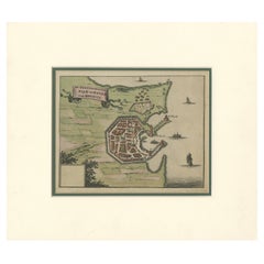
City and Harbour of Rhodes – Olfert Dapper, 1688 Hand-Coloured Engraving
Located in Langweer, NL
City and Harbour of Rhodes – Olfert Dapper, 1688 Hand-Coloured Engraving
Description:
This historical hand-coloured copperplate engraving, titled “De hedendaegsche Stad en Haven van...
Category
Antique Late 17th Century Dutch Maps
Materials
Paper
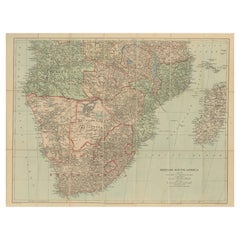
Antique Map of British South Africa – Colonial Territories & Railways, c.1920s
Located in Langweer, NL
Antique Map of British South Africa – Colonial Territories & Railways, c.1920s
This large and detailed folding map depicts British South Africa during the early 20th century, showin...
Category
Early 20th Century English Maps
Materials
Paper
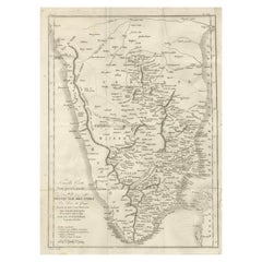
Antique Map of Southern India – French Engraving by D’Anville, 18th Century
Located in Langweer, NL
This finely detailed antique map presents the southern portion of India, engraved in the 18th century by the renowned French cartographer Jean-Baptiste Bourguignon d’Anville.
It de...
Category
Antique Late 18th Century French Maps
Materials
Paper
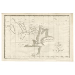
Antique Map of Tonkin and Hainan Island – 18th Century French Engraving
Located in Langweer, NL
Antique Map of Tonkin and Hainan Island – 18th Century French Engraving
This is the “5me Carte du Tunquin,” an antique engraved map depicting the northern coastal region of modern-d...
Category
Antique Late 18th Century French Maps
Materials
Paper
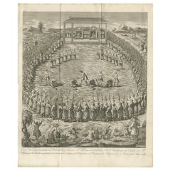
Public Execution Scene in Tonkin (Northern Vietnam) – Antique Engraving, 1787
Located in Langweer, NL
Public Execution Scene in Tonkin – Antique Engraving, 1787
Striking 18th-century copperplate engraving depicting a large-scale public execution in the Kingdom of Tonkin (present-day...
Category
Antique Late 18th Century French Maps
Materials
Paper
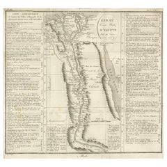
Antique Map of Egypt and the Nile Valley with City Index, 1715
Located in Langweer, NL
Antique map of Egypt, titled "Essay d'une Carte d'Égypte Fait au Caire en 1715".
This finely engraved map presents a detailed depiction of Egypt along the Nile River from the Medit...
Category
Antique Early 18th Century French Maps
Materials
Paper
Antique Map of the Red Sea & Basse Thebaide with Monastery Plans, Egypt, 1777
Located in Langweer, NL
Antique Map of the Red Sea & Basse Thebaide with Monastery Plans, Egypt, 1777
This finely detailed 18th-century engraving depicts the coastal and inland geography of the Red Sea reg...
Category
Antique Late 18th Century French Maps
Materials
Paper
Antique Map of Tonkin, Northern Vietnam – Red River Delta, Engraved circa 1780
Located in Langweer, NL
Map of Tonkin. This early engraved map shows the historical region of Tonkin in northern Vietnam, centered on the Red River Delta and the capital, present-day Hanoi (here marked as T...
Category
Antique Late 18th Century French Maps
Materials
Paper
Antique Map of Paraguay and Jesuit Missions by D’Anville, 1733
Located in Langweer, NL
Antique Map of Paraguay and Jesuit Missions by D’Anville, 1733
Antique map titled Le Paraguay. This finely detailed copperplate engraving depicts the region of Paraguay along with ...
Category
Antique Mid-18th Century French Maps
Materials
Paper
Antique Engraving – Layout of the King of Persia’s Field Camp, 18th Century
Located in Langweer, NL
Antique Engraving – Layout of the King of Persia’s Field Camp, 18th Century
Fascinating 18th-century engraved plan depicting the arrangement of the royal encampment of the King of P...
Category
Antique Mid-18th Century French Maps
Materials
Paper
Antique Map of the Amazon River – Maragnon or River of the Amazons, c.1760
Located in Langweer, NL
Map of the Amazon River – “Cours du Fleuve Maragnon autrement dit des Amazones”, c.1760
This 18th-century copperplate map, titled Cours du Fleuve Maragnon autrement dit des Amazones...
Category
Antique Mid-18th Century French Maps
Materials
Paper
Map of Tierra del Fuego and the Straits of Magellan and Le Maire, c.1760
Located in Langweer, NL
Map of Tierra del Fuego and the Straits of Magellan and Le Maire, c.1760
This 18th-century copperplate map, titled Carte de la Terre de Feu et des Détroits de Magellan et de le Mair...
Category
Antique Mid-18th Century French Maps
Materials
Paper
Antique Map of Syria, Mount Lebanon and Palestine – circa 1760
Located in Langweer, NL
Map of Syria and Mount Lebanon – “Carte de la Syrie”, c.1760
This finely engraved 18th-century map, titled Carte de la Syrie nouvellement corrigée, presents the region of Syria and ...
Category
Antique Mid-18th Century French Maps
Materials
Paper
Antique Map of the Caroline Islands – Early Exploration of the Pacific, c.1760
Located in Langweer, NL
Map of the Caroline Islands – “Nouvelle Description des Isles Carolines”, c.1760
This 18th-century copperplate map, titled Nouvelle Description des Isles Carolines, charts the Carol...
Category
Antique Mid-18th Century French Maps
Materials
Paper
Old Map of the Overland Route to California – Early Exploration Pathways, 1701
Located in Langweer, NL
Map of the Overland Route to California – 18th Century
This 18th-century copperplate map, titled Passage par terre à la Californie, illustrates the overland route to California as r...
Category
Antique Early 18th Century French Maps
Materials
Paper
Old Map of the New Philippines – Early 18th Century Spanish East Indies, 1706
Located in Langweer, NL
Map of the New Philippines – “Carte des Nouvelles Philippines”, 1706
This 18th-century copperplate map, titled Carte des Nouvelles Philippines, depicts the island chain referred to ...
Category
Antique Early 18th Century French Maps
Materials
Paper
Antique Map of the Environs of Cap-Français, Saint-Domingue, c.1760
Located in Langweer, NL
Antique Map of the Environs of Cap-Français, Saint-Domingue, c.1760
This detailed 18th-century copperplate engraving, titled Carte des Environs du Cap Français et des Paroisses qui ...
Category
Antique Early 18th Century French Maps
Materials
Paper
Antique Map of the Jesuit Missions in Madurai and Surrounding Kingdoms, c.1760
Located in Langweer, NL
Antique Map of the Jesuit Missions in Madurai and Surrounding Kingdoms, c.1760
This 18th-century copperplate map, titled Carte des Missions du P.P. de la Compagnie de Jésus dans le ...
Category
Antique Early 18th Century French Maps
Materials
Paper
Antique Map of the Route of the Hebrews – Egypt to the Red Sea, 1720
Located in Langweer, NL
Map of the Route of the Hebrews – Egypt to the Red Sea, 1720
This finely engraved 18th-century map, titled Route des Hébreux pour passer la Mer Rouge, conforme à l’Écriture, traces ...
Category
Antique Early 18th Century French Maps
Materials
Paper
Antique Map of the Coast of Peru and Chile – Detailing Ports & Coastlines, c1760
Located in Langweer, NL
Map of the Coast of Peru and Chile – “Côte du Pérou et Côte du Chili”, c.1760
This 18th-century copperplate engraving presents a detailed chart of the Pacific coastline from norther...
Category
Antique Late 18th Century French Maps
Materials
Paper
Antique Map of the Ryukyu Islands – Map of the Islands of Lieou-Kieou, c.1760
Located in Langweer, NL
Map of the Ryukyu Islands – “Carte des Isles de Lieou-Kieou”, c.1760
This rare 18th-century copperplate map, titled Carte des Isles de Lieou-Kieou, presents the Ryukyu Islands (toda...
Category
Antique Late 18th Century French Maps
Materials
Paper
Original Antique Map of the Route of M. Zurabek – Caspian Sea to Isfahan, 1722
Located in Langweer, NL
Original Antique Map of the Route of M. Zurabek – Caspian Sea to Isfahan, 1722
This 18th-century copperplate map, titled Carte de la Route de M. Zurabek, Ambassadeur du Roi de Polog...
Category
Antique Early 18th Century French Maps
Materials
Paper
Antique Map of Nagasaki – Nangasacki Called Tchangki by the Chinese, circa 1790
Located in Langweer, NL
Map of Nagasaki – “Nangasacki appellé par les Chinois Tchangki”, c.1760
This finely engraved 18th-century map depicts the Japanese port city of Nagasaki (Nangasacki), here noted as ...
Category
Antique Late 18th Century French Maps
Materials
Paper
Sacrifice Offered to the Sun – Antique Engraving, Upper Egypt, c.1790
Located in Langweer, NL
Sacrifice Offered to the Sun – Antique Engraving, Upper Egypt, c.1790
This 18th-century copperplate engraving, titled *Sacrifice Offert au Soleil*, presents a striking scene carved ...
Category
Antique Late 18th Century French Maps
Materials
Paper
South Gate of Antinoë – Architectural Engraving, Upper Egypt, c.1790
Located in Langweer, NL
South Gate of Antinoë – Architectural Engraving, Upper Egypt, c.1790
This finely detailed 18th-century copperplate engraving depicts the *Porte du Midi de la Ville d’Antinoë* (South...
Category
Antique Late 18th Century French Maps
Materials
Paper
Chinese Calligraphy Inscription – Antique Engraving with Kangxi-era Text, c.1770
Located in Langweer, NL
Chinese Calligraphy Inscription – Antique Engraving with Kangxi-era Text, c.1770
This elegant 18th-century copperplate engraving reproduces a Chinese inscription, framed within thre...
Category
Antique Late 18th Century French Maps
Materials
Paper
Flying Lizard and Flying Squirrel – Antique Engraving, Poulo Condore, c.1770
Located in Langweer, NL
Flying Lizard and Flying Squirrel – Antique Engraving, Poulo Condore, c.1770
This fine 18th-century engraving presents two remarkable animals observed on the Con Dao Islands (histor...
Category
Antique Late 18th Century French Maps
Materials
Paper
Plan of Poulo Condore (Côn Sơn Island) – Antique French Engraving, ca.1790
Located in Langweer, NL
Plan of Poulo Condore (Côn Sơn Island) – Antique French Engraving by Portier, c.1790
This antique French engraving, created by Portier around 1790, presents a detailed plan of Poulo...
Category
Antique Late 18th Century French Maps
Materials
Paper
Views of St. Denis and St. Paul, Île de Bourbon – Antique French Engraving, 1790
Located in Langweer, NL
Views of St. Denis and St. Paul, Île de Bourbon – Antique French Engraving by Portier, c.1790
This antique French engraving by Portier, produced around 1790, presents two coastal vi...
Category
Antique Late 18th Century French Maps
Materials
Paper
Plan of the Dutch Fort in Formosa – Antique French Jesuit Engraving, ca.1790
Located in Langweer, NL
Plan of the Dutch Fort in Formosa – Antique French Jesuit Engraving by Portier, c.1790
This antique French engraving by Portier, produced around 1790, shows a detailed plan of the D...
Category
Antique Late 18th Century French Maps
Materials
Paper
Map of Formosa and Pescadores – French Jesuit Engraving by Portier, c.1790
Located in Langweer, NL
Map of Formosa and Pescadores – French Jesuit Engraving by Portier, c.1790
This antique French map, engraved by Portier around 1790, depicts the island of Formosa (modern Taiwan), t...
Category
Antique Late 18th Century French Maps
Materials
Paper
Map of Pescadores Islands (Pong-Hou) & Formosa – French Jesuit Engraving, 1790
Located in Langweer, NL
Map of the Pescadores Islands (Pong-Hou) and Formosa – French Jesuit Engraving by Portier, c.1790
This finely engraved French map, produced by Portier around 1790, depicts the Pesca...
Category
Antique Late 18th Century French Maps
Materials
Paper
Map of the Philippines and Palau Islands – Antique French Engraving, c.1790
Located in Langweer, NL
Map of the Philippines and Palau Islands – Antique French Engraving, c.1790
This antique French maritime chart depicts the western Pacific region between the Philippines and the Pal...
Category
Antique Late 18th Century French Maps
Materials
Paper
Mission of the Moxos, Peru – Antique French Jesuit Map by Portier, c.1790
Located in Langweer, NL
Mission of the Moxos, Peru – Antique French Jesuit Map by Portier, c.1790
This antique French map, engraved by Portier around 1790, depicts the “Mission des Moxes” in the Viceroyalt...
Category
Antique Late 18th Century French Maps
Materials
Paper
Western Gate of Antinoë, Egypt – Antique French Architectural Engraving, c.1790
Located in Langweer, NL
Western Gate of Antinoë, Egypt – Antique French Architectural Engraving, c.1790
This antique French engraving depicts the “Porte du Couchant” (Western Gate) of the ancient city of A...
Category
Antique Late 18th Century French Maps
Materials
Paper
Map of the Volcano Islands of Santorini – Antique Engraving by Portier, ca.1790
Located in Langweer, NL
Map of the Volcano Islands of Santorini – Antique French Engraving by Portier, c.1790
This antique French engraving presents a detailed view of the volcanic islands at the center of...
Category
Antique Late 18th Century French Maps
Materials
Paper
Poisson Cornu dit “Le Diable” – Antique French Engraving of a Horned Fish, 1790
Located in Langweer, NL
Poisson Cornu dit “Le Diable” – Antique French Engraving of a Horned Fish, c.1790
This striking antique engraving depicts a horned fish, identified in the French caption as “Poisson...
Category
Antique Late 18th Century French Maps
Materials
Paper
Plan of the Town and River of Ganjam, India – Antique French Map by Portier 1790
Located in Langweer, NL
Plan of the Town and River of Ganjam, India – Antique French Map by Portier, c.1790
This antique French engraving shows a detailed plan of the town and river of Ganjam, located on t...
Category
Antique Late 18th Century French Maps
Materials
Paper
Large Decorative Colonial-Era Map of South India – Peninsula of India, 1800
Located in Langweer, NL
Antique Map of South India – “A Map of the Peninsula of India,” London 1800
This large and detailed antique map titled *A Map of the Peninsula of India* was published in London in 1...
Category
Antique Early 19th Century English Maps
Materials
Linen, Paper
Antique Map of Algeria, Tunisia & Tripolitania – Andriveau-Goujon, Paris 1865
Located in Langweer, NL
Antique Map of Algeria, Tunisia & Tripolitania – Andriveau-Goujon, Paris 1865
This finely detailed and beautifully colored map was engraved and published in Paris in 1865 by the ren...
Category
Antique Mid-19th Century French Maps
Materials
Paper
Egypt & Red Sea Antique Map – Detailed 1865 Chart of Nubia and Nile Regions
Located in Langweer, NL
Antique Map of Egypt, Nubia & Red Sea Coast – Andriveau-Goujon, Paris 1865
This delicately colored antique map, titled *Partie du Cours du Nil comprenant l'Égypte, la Nubie, l'Abyss...
Category
Antique Mid-19th Century French Maps
Materials
Paper
Antique Map of China, Japan & Korea – Eastern Asia by Andriveau-Goujon, 1860
Located in Langweer, NL
Antique Map of China, Japan & Korea – Eastern Asia by Andriveau-Goujon, 1860
This beautifully hand-colored antique map, titled “Carte de la Chine, de la Corée et du Japon,” was publ...
Category
Antique Mid-19th Century French Maps
Materials
Paper
Antique Map of India, Persia & Afghanistan – Detailed Continental Engraving 1864
Located in Langweer, NL
Antique Map of India, Persia & Afghanistan – Andriveau-Goujon, Paris 1864
This detailed 19th-century map titled “Asie Méridionale comprenant la Presqu'île de l'Inde, la Perse, l'Afg...
Category
Antique Mid-19th Century French Maps
Materials
Paper
Antique Asia Map – Large 19th-Century Engraving with Political Boundaries, 1865
Located in Langweer, NL
Antique Map of Asia – Andriveau-Goujon, Paris 1865
This large and finely engraved antique map titled “Asie” was published in Paris in 1865 by the prominent French cartographer E. An...
Category
Antique Mid-19th Century French Maps
Materials
Paper
Large Antique Set Ottoman Empire Maps – Europe & Asia in Striking Detail, 1868
Located in Langweer, NL
Antique Maps of the Ottoman Empire – Europe and Asia by Andriveau-Goujon, circa 1865
This finely engraved and hand-colored two-sheet map of the Ottoman Empire was published in Paris...
Category
Antique Mid-19th Century French Maps
Materials
Paper
Antique Map of Eastern Europe – Russia, Ottoman Empire & Greece, 1868
Located in Langweer, NL
Antique Map of Eastern Europe – Russia, Ottoman Empire and Greece by Andriveau-Goujon, 1868
This detailed antique map titled “Carte de l’Europe Orientale, la Russie d’Europe, l’Empi...
Category
Antique Mid-19th Century French Maps
Materials
Paper
Antique Map of Scandinavia and the Baltic – Andriveau-Goujon, circa 1860s
Located in Langweer, NL
Antique Map of Scandinavia and the Baltic – Andriveau-Goujon, circa 1860s
This impressive antique map presents Northern Europe, focusing on the Scandinavian Peninsula, the Baltic re...
Category
Antique Mid-19th Century French Maps
Materials
Paper
Germany & Central Europe – Antique 1865 Map by Andriveau-Goujon, Paris
Located in Langweer, NL
Antique Map of Germany and Central Europe – “Allemagne et Europe Centrale” by Andriveau-Goujon, 1865
This large, finely engraved map titled “Allemagne et Europe Centrale” was publis...
Category
Antique Mid-19th Century French Maps
Materials
Paper
Spain & Portugal Map – Antique 1867 Engraving by Andriveau-Goujon, Paris
Located in Langweer, NL
Antique Map of Spain and Portugal – “Espagne et Portugal” by Andriveau-Goujon, 1867
This finely detailed antique map titled “Espagne et Portugal” was published in Paris in 1867 by t...
Category
Antique Mid-19th Century French Maps
Materials
Paper
Antique Map of Italy – Pre-Unification Italy by Andriveau-Goujon, Paris 1861
Located in Langweer, NL
Antique Map of Italy – Pre-Unification Italy by Andriveau-Goujon, Paris 1861
This antique map of Italy, titled simply “Italie,” was published in Paris in 1861 by E. Andriveau-Goujon...
Category
Antique Mid-19th Century French Maps
Materials
Paper
Antique Map of France – Divided into 89 Departments by Andriveau-Goujon, 1861
Located in Langweer, NL
Antique Map of France – Divided into 89 Departments by Andriveau-Goujon, 1861
This finely engraved and beautifully hand-colored map titled “France divisée en 89 Départements” was pu...
Category
Antique Mid-19th Century French Maps
Materials
Paper
Antique Map of Europe – Political Divisions by Andriveau-Goujon, Paris 1861
Located in Langweer, NL
Antique Map of Europe – Political Divisions by Andriveau-Goujon, Paris 1861
This beautifully engraved and hand-colored antique map of Europe was published in 1861 by the Parisian ca...
Category
Antique Mid-19th Century French Maps
Materials
Paper
World Wind Currents Map – “Courants de l’Atmosphère” by Andriveau-Goujon, 1861
Located in Langweer, NL
World Wind Currents Map – “Courants de l’Atmosphère” by Andriveau-Goujon, 1861
This striking and educational antique chart titled “Courants de l’Atmosphère d’après le Lt. F. Maury” ...
Category
Antique Mid-19th Century French Maps
Materials
Paper
Roman Gaul & Northern Italy – Antique Map of La Gaule by Andriveau-Goujon, 1861
Located in Langweer, NL
Roman Gaul & Northern Italy – Antique Map of La Gaule by Andriveau-Goujon, 1861
This antique map titled "Carte Comparée de La Gaule" was published in Paris in 1861 by J. Andriveau-G...
Category
Antique Mid-19th Century French Maps
Materials
Paper
Antique Celestial Star Map – Northern & Southern Hemispheres, 1860
Located in Langweer, NL
Antique Celestial Star Map – Northern & Southern Hemispheres, Andriveau-Goujon 1860
This elegant antique celestial chart, published in Paris in 1860 by the noted French cartographer...
Category
Antique Mid-19th Century French Maps
Materials
Paper
Konstantinopel – Panoramic View of Istanbul by François Halma, 1705
Located in Langweer, NL
Konstantinopel – Panoramic View of Istanbul by François Halma, 1705
This engaging hand-colored engraving of “Konstantinopel” offers a sweeping panoramic view of 18th-century Istanbu...
Category
Antique Early 18th Century Dutch Maps
Materials
Paper
Byzantium Nunc Constantinopolis – Braun & Hogenberg View of Istanbul, 1572
Located in Langweer, NL
Byzantium Nunc Constantinopolis – Braun & Hogenberg View of Istanbul, Cologne, 1572
This iconic 16th-century bird’s-eye view titled “Byzantium Nunc Constantinopolis” presents the ci...
Category
Antique 16th Century German Maps
Materials
Paper
Constantinople – Panoramic Engraving by Matthäus Merian the Elder, 1635
Located in Langweer, NL
Constantinople – Panoramic Engraving by Matthäus Merian the Elder, Frankfurt, 1635
This finely detailed copperplate engraving presents a sweeping bird’s-eye view of Constantinople (...
Category
Antique Early 17th Century German Maps
Materials
Paper
Constantinople – Panoramic Hand-Colored Engraving, Augsburg, circa 1720
Located in Langweer, NL
Constantinople – Panoramic Hand-Colored Engraving, Augsburg, circa 1720
This panoramic hand-colored engraving presents a sweeping bird’s-eye view of Constantinople (modern-day Istan...
Category
Antique Early 18th Century German Maps
Materials
Paper
Constantinople (Istanbul) – City View by Werner and Gläser, Augsburg ca.1730
Located in Langweer, NL
Constantinople (Istanbul) – Panoramic City View by Werner and Gläser, Augsburg c.1730
This striking hand-colored copper engraving offers a grand panoramic view of Constantinople (mo...
Category
Antique Early 18th Century German Maps
Materials
Paper
