Bartele Gallery More Furniture and Collectibles
to
4,717
5,701
5,700
1
3,077
2,265
358
1
208
10
73
4
3
3
2
5,692
9
7
2
2
483
193
103
80
61
5,701
5,701
5,701
104
58
20
14
14
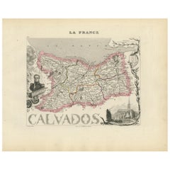
Map of Calvados France with Caen and Cider-Brandy Region, 19th Century
Located in Langweer, NL
Map of Calvados France with Caen and Cider-Brandy Region, 19th Century
Description:
This finely engraved 19th-century map of the Calvados department in Normandy, northwestern France...
Category
Antique Mid-19th Century French Maps
Materials
Paper
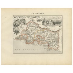
Map of Bouches-du-Rhône France with Marseille and Rhône Delta, 19th Century
Located in Langweer, NL
Map of Bouches-du-Rhône France with Marseille and Rhône Delta, 19th Century
Description:
This finely engraved 19th-century map of the Bouches-du-Rhône department in southeastern Fra...
Category
Antique Mid-19th Century French Maps
Materials
Paper
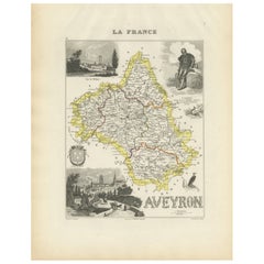
Map of Aveyron France with Rodez, Millau and Wine Routes, 19th Century
Located in Langweer, NL
Map of Aveyron France with Rodez, Millau and Wine Routes, 19th Century
Description:
This detailed and decorative 19th-century map of Aveyron, a department in southern France, was dr...
Category
Antique Mid-19th Century French Maps
Materials
Paper
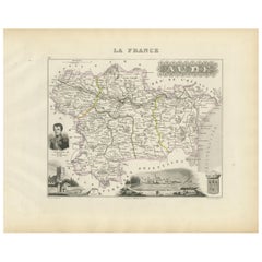
Map of Aude France with Carcassonne and Languedoc Vineyards, 19th Century
Located in Langweer, NL
Map of Aude France with Carcassonne and Languedoc Vineyards, 19th Century
Description:
This elegant 19th-century map of Aude, a department in southern France along the Mediterranean...
Category
Antique Mid-19th Century French Maps
Materials
Paper
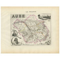
Map of Aube France with Troyes and Champagne Wine Region, 19th Century
Located in Langweer, NL
Map of Aube France with Troyes and Champagne Vineyards by Vuillemin, 19th c
Description:
This 19th-century map of the Aube department in the Grand Est region of northeastern France ...
Category
Antique Mid-19th Century French Maps
Materials
Paper
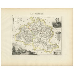
Map of Ariège France with Foix and Pyrenees Landscape by Vuillemin, 19th c
Located in Langweer, NL
Map of Ariège France with Foix and Pyrenees Landscape by Vuillemin, 19th c
Description:
This beautifully detailed 19th-century map of the Ariège department in southwestern France wa...
Category
Antique Mid-19th Century French Maps
Materials
Paper
Map of Ardennes France with Sedan and Military History by Vuillemin, c.1850
Located in Langweer, NL
Map of Ardennes France with Sedan and Military History by Vuillemin, 19th c
Description:
This detailed and decorative 19th-century map of the Ardennes department in northeastern Fra...
Category
Antique Mid-19th Century French Maps
Materials
Paper
Map of Ardèche France with Annonay and Vineyards by Vuillemin, 19th c
Located in Langweer, NL
Map of Ardèche France with Annonay and Vineyards by Vuillemin, 19th c
This beautifully engraved 19th-century map of Ardèche, a department in southeastern France, comes from Alexandr...
Category
Antique Mid-19th Century French Maps
Materials
Paper
Map of Hautes-Alpes France with Gap and Alpine Scenery by Vuillemin, c.1850
Located in Langweer, NL
Map of Hautes-Alpes France with Gap and Alpine Scenery by Vuillemin
Description:
This elegant 19th-century map of the Hautes-Alpes department in southeastern France was created by A...
Category
Antique Mid-19th Century French Maps
Materials
Paper
Map of Basses-Alpes France with Digne and Lavender Region by Vuillemin, c.1850
Located in Langweer, NL
Map of Basses-Alpes France with Digne and Lavender Region by Vuillemin, 19th c
This finely engraved 19th-century map of the Basses-Alpes department of France (known today as Alpes-d...
Category
Antique Mid-19th Century French Maps
Materials
Paper
Map of Allier France with Saint-Pourçain Wine Region by Vuillemin, 19th c
Located in Langweer, NL
Map of Allier France with Saint-Pourçain Wine Region by Vuillemin, 19th c
This decorative 19th-century map of Allier, a central department of France, comes from the celebrated Nouve...
Category
Antique Mid-19th Century French Maps
Materials
Paper
Map of Aisne France with Soissons and Champagne Vineyards by Vuillemin, 19th c
Located in Langweer, NL
Map of Aisne France with Soissons and Champagne Vineyards by Vuillemin, 19th c
Description:
This richly detailed 19th-century engraved and hand-colored map of the department of Aisn...
Category
Antique Mid-19th Century French Maps
Materials
Paper
Map of Ain France with Vineyards of Bugey and Notable Portraits, c.1850
Located in Langweer, NL
Map of Ain France with Portraits of Bichat and Joubert by Vuillemin, 19th c
This highly decorative 19th-century map of the French department of Ain is taken from the celebrated Nouv...
Category
Antique Mid-19th Century French Maps
Materials
Paper
Map of Saintonge and Aunis with Cognac and Rochefort, France - 1665 Original
Located in Langweer, NL
Map of Saintonge and Aunis, with Charente Coast and Cognac, 1665
This beautifully hand-colored antique map, titled *Xaintonge, avec Le Pays D’Avlnis* (Saintonge, with the Country of...
Category
Antique 1660s Maps
Materials
Paper
Map of Avenches Region Switzerland by Mercator, Original 1585 Engraving
Located in Langweer, NL
Map of Wiflispurgergov by Gerardus Mercator, Avenches Region, 1585
This rare and finely engraved map, titled *Das Wiflispurgergov*, was produced by Gerardus Mercator and published i...
Category
Antique 16th Century Dutch Maps
Materials
Paper
Map of Lake Geneva and Surroundings by Hondius, Geneva Region, circa 1612
Located in Langweer, NL
Map of Lake Geneva and Surroundings by Hondius, Geneva Region, 1606
This rare and intricately engraved map, titled *Chorographica Tabula Lacus Lemanni Locorumque Circumiacentium*, w...
Category
Antique Early 17th Century Dutch Maps
Materials
Paper
Map of Zurich and Basel Region by Mercator, Uncolored Engraving c.1600
Located in Langweer, NL
Map of Zurich and Basel Region by Mercator, Uncolored Engraving c.1600
This original uncolored copperplate engraving, titled *Zurichgow et Basiliensis Provincia*, was created by the...
Category
Antique Early 17th Century Maps
Materials
Paper
Nautical Chart of Cape Verde Islands by J.W. Norie, 1824 Coastal Map
Located in Langweer, NL
Nautical Chart of Cape Verde Islands by J.W. Norie, 1824 Coastal Map
This beautifully engraved nautical chart, titled “A New Chart of the Cape Verde Islands,” was drawn by J.W. Nori...
Category
Antique Early 19th Century English Maps
Materials
Paper
Map of Turkish Dominions in Europe, Ottoman Balkan Territories 1813
Located in Langweer, NL
Map of Turkish Dominions in Europe, Ottoman Balkan Territories 1814
This antique map titled "Turkish Dominions in Europe" provides a detailed depiction of the Balkan Peninsula and a...
Category
Antique 1810s Maps
Materials
Paper
Map of Southern South America – Richly Detailed Engraving by K.Johnston, 1903
Located in Langweer, NL
Title (80 characters, keyword-first):
Map of Southern South America – Richly Detailed Engraving by Keith Johnston, 1903
Description:
This elegant map titled "South America: Southern...
Category
Early 20th Century Maps
Materials
Paper
Map of Northern South America – Vibrant Engraving by Keith Johnston, 1903
Located in Langweer, NL
Map of Northern South America – Vibrant Engraving by Keith Johnston, 1903
This beautifully engraved map titled "South America: Northern Sheet" was created by Keith Johnston, F.R.G.S...
Category
Early 20th Century Maps
Materials
Paper
Map of the West India Islands and Central America – Colorful 1903 Engraving
Located in Langweer, NL
Map of the West India Islands and Central America – Colorful 1903 Engraving
This vibrant engraved map, titled "West India Islands and Central America," was created by Keith Johnston...
Category
Early 20th Century Maps
Materials
Paper
Map of Western United States 1903 – Railroads, State Borders, and Terrain
Located in Langweer, NL
Map of Western United States 1903 – Railroads, State Borders, and Terrain
This beautifully engraved map titled "United States of North America (Western Sheet)" was created by Keith ...
Category
Early 20th Century Maps
Materials
Paper
Map of United States Central Sheet 1903 – Railroads, States, and Topography
Located in Langweer, NL
Map of United States Central Sheet 1903 – Railroads, States, and Topography
This is a finely engraved and beautifully colored map titled "United States of North America (Central She...
Category
Early 20th Century Maps
Materials
Paper
Map of the Southeastern USA and Atlantic States – Vintage 1903 Geography
Located in Langweer, NL
Map of the Southeastern USA and Atlantic States – Vintage 1903 Geography
This original engraved map, titled “United States of North America (South Eastern Sheet) with the Atlantic S...
Category
Early 20th Century Maps
Materials
Paper
Antique Map of the Northeast USA - Vibrant 1903 Cartographic Detail
Located in Langweer, NL
Map of the Northeastern United States of North America, 1903
This striking antique map titled “United States of North America (North Eastern Sheet)” was created by the renowned Scot...
Category
Early 20th Century Maps
Materials
Paper
Canada’s West – 1903 Engraved Map by Johnston – Unique and Historic
Located in Langweer, NL
This beautiful and detailed map, titled "Dominion of Canada (Western Sheet)," was created by Keith Johnston and published in 1903.
It presents a fascinating depiction of Canada's w...
Category
Early 20th Century Maps
Materials
Paper
Canada Map 1903 - Dominion of Canada, West Central Sheet
Located in Langweer, NL
Title: Canada Map 1903 - Dominion of Canada, West Central Sheet
Description:
This fascinating 1903 map of the Dominion of Canada’s West Central regions by T.R. Johnston offers a viv...
Category
Early 20th Century Maps
Materials
Paper
Canada Map 1903 - East Central Dominion - Ontario, Quebec & More
Located in Langweer, NL
Canada Map 1903 - East Central Dominion - Ontario, Quebec & More
This captivating antique map, titled "Dominion of Canada (East Central Sheet)" and published in 1903 by Keith Johnst...
Category
Early 20th Century Maps
Materials
Paper
Canada Dominion Map 1903 - A Detailed View of Eastern Canada and Newfoundland
Located in Langweer, NL
North America, 1903 - A Colorful Historical Map with Detailed Borders
This attractive map of North America was engraved, printed, and published by W. & A.K. Johnston in 1903. A wond...
Category
Early 20th Century Maps
Materials
Paper
Explore North America in 1903 - Intricately Detailed Antique Map
Located in Langweer, NL
North America, 1903 - A Colorful Historical Map with Detailed Borders
This attractive map of North America was engraved, printed, and published by W. & A.K. Johnston in 1903. A wond...
Category
Early 20th Century Maps
Materials
Paper
Abyssinia and Upper Nubia, 1903 - Detailed Map of the Horn of Africa Region
Located in Langweer, NL
Title: Abyssinia and Upper Nubia, 1903 - Detailed Map of the Horn of Africa Region
This fascinating map titled "Abyssinia and Upper Nubia" was engraved, printed, and published by W....
Category
Early 20th Century Maps
Materials
Paper
Egypt and Lower Nubia, 1903 - Historical Map Highlighting Nile and Red Sea
Located in Langweer, NL
Egypt and Lower Nubia, 1903 - Historical Map Highlighting Nile and Red Sea
This beautifully detailed map titled "Egypt, Arabia Petraea, and Lower Nubia" was engraved, printed, and p...
Category
Early 20th Century Maps
Materials
Paper
Antique Map of Central Africa, 1903, With Colonial Territories Explorers Routes
Located in Langweer, NL
Antique Map of Central Africa, 1903, Featuring Colonial Territories and Explorers’ Routes
This antique map, titled "Central Africa," was engraved and published in 1903 by W. & A.K. ...
Category
Early 20th Century Maps
Materials
Paper
Antique Map of Africa, Highlighting Colonial Divisions, Geographic Features 1903
Located in Langweer, NL
Title: Antique Map of Africa, 1903, Highlighting Colonial Divisions and Geographic Features
Description: This antique map, titled "Africa," was engraved and published in 1903 by W. ...
Category
Early 20th Century Maps
Materials
Paper
Antique Map of New Zealand, 1903, Featuring the North and South Islands and Alps
Located in Langweer, NL
Title: Antique Map of New Zealand, 1903, Featuring the North and South Islands and the Southern Alps
Description:
This antique map, titled "New Zealand," was engraved and published ...
Category
Early 20th Century Maps
Materials
Paper
Antique Map of South Australia, New South Wales, Victoria and Queensland, 1903
Located in Langweer, NL
Title: Antique Map of South Australia, New South Wales, Victoria, and Queensland, 1903
Description:
This antique map, titled "South Australia, New South Wales, Victoria, and Queensl...
Category
Early 20th Century Maps
Materials
Paper
Antique Map of Australia, 1903, with Colonial Divisions and Detailed Topography
Located in Langweer, NL
Title: Antique Map of Australia, 1903, with Colonial Divisions and Detailed Topography
Description: This antique map, titled "Australia," was engraved and published in 1903 by W. & ...
Category
Early 20th Century Maps
Materials
Paper
Antique Map of Oceania, 1903, Featuring the Pacific Islands and Australasia
Located in Langweer, NL
Title: Antique Map of Oceania, 1903, Featuring the Pacific Islands and Australasian Region
Description:
This antique map, titled "Oceania," was engraved and published in 1903 by W. ...
Category
Early 20th Century Maps
Materials
Paper
Antique Map of China, Taiwan, Korea, Hong-Kong and Japan, 1903
Located in Langweer, NL
Antique Map of China, Taiwan, Korea, Hong-Kong and Japan, 1903
Description: This antique map, titled "India (Southern Sheet) and the South Eastern Provinces," was engraved and publi...
Category
Early 20th Century Maps
Materials
Paper
Antique Map of Southern India and South Eastern Provinces, 1903
Located in Langweer, NL
Title: Antique Map of Southern India and South Eastern Provinces, 1903, with Intricate Detail
Description:
This antique map, titled "India (Southern Sheet) and the South Eastern Pro...
Category
Early 20th Century Maps
Materials
Paper
Antique Map of Northern India, Featuring Boundaries & Himalayan Detail, 1903
Located in Langweer, NL
Antique Map of Northern India, 1903, Featuring Provincial Boundaries and Himalayan Detail
This antique map, titled "India (Northern Sheet)," was engraved and published in 1903 by W....
Category
Early 20th Century Maps
Materials
Paper
Antique Map of Central Asia - Featuring the Caspian Sea and Silk Road Regions
Located in Langweer, NL
Antique Map of Central Asia, 1903, Featuring the Caspian Sea and Silk Road Regions
This antique map, titled "Central Asia," was engraved and published in 1903 by W. & A.K. Johnston ...
Category
Early 20th Century Maps
Materials
Paper
Antique Map of Persia and Afghanistan, 1903, with Delicate Pastel Borders
Located in Langweer, NL
Title: Antique Map of Persia and Afghanistan, 1903, with Delicate Pastel Borders and Detailed Topography
Description:
This antique map, titled "Persia and Afghanistan," was engraved...
Category
Early 20th Century Maps
Materials
Paper
Antique Map of Turkey in Asia (Asia Minor and Transcaucasia), 1903
Located in Langweer, NL
Antique Map of Turkey in Asia (Asia Minor and Transcaucasia), 1903, with Intricate Provincial Borders
This antique map, titled "Turkey in Asia (Asia Minor) and Transcaucasia," was e...
Category
Early 20th Century Maps
Materials
Paper
Antique Map of Asia with Intricate Provincial Boundaries, Published in 1903
Located in Langweer, NL
Title: Antique Map of Asia, 1903, with Intricate Provincial Boundaries and Coastal Features
Description:
This antique map, titled "Asia," was engraved and published in 1903 by the r...
Category
Early 20th Century English Maps
Materials
Paper
Antique Map of European Russia, 1903, with Colorful Provincial Boundaries
Located in Langweer, NL
Title: Antique Map of European Russia, 1903, with Colorful Provincial Boundaries
Description:
This antique map, titled "European Russia," was engraved and published in 1903 by W. & ...
Category
Early 20th Century Maps
Materials
Paper
Antique Map of Sweden & Norway, 1903, with Intricate Topographical Detail
Located in Langweer, NL
Title: Antique Map of Sweden & Norway, 1903, with Intricate Topographical Detail
Description:
This antique map, titled "Sweden & Norway (Scandinavia)," was engraved and published in...
Category
Early 20th Century Maps
Materials
Paper
Antique Map of Greece and the Cyclades, 1903, with Many Details and Inset Maps
Located in Langweer, NL
Title: Antique Map of Greece and the Cyclades, 1903, with Intricate Detail and Inset Maps
Description: This antique map, titled "Greece with Its Islands, Including the Cyclades," wa...
Category
Early 20th Century Maps
Materials
Paper
Antique Map of Turkey in Europe, 1903, with Delicate Pastel Coloration
Located in Langweer, NL
Title: Antique Map of Turkey in Europe, 1903, with Delicate Pastel Coloration
Description:
This antique map, titled "Turkey in Europe," was engraved and published in 1903 by the dis...
Category
Early 20th Century Maps
Materials
Paper
Antique Map of the Austro-Hungarian Monarchy, 1903, with Colorful Borderlines
Located in Langweer, NL
Title: Antique Map of the Austro-Hungarian Monarchy, 1903, with Colorful Provincial Borders
Description:
This antique map, titled "Austro-Hungarian Monarchy," was engraved and publi...
Category
Early 20th Century Maps
Materials
Paper
Antique Map of the German Empire, 1903, Northern Portion with Coastal and Inland
Located in Langweer, NL
Title: Antique Map of the German Empire, 1903, Northern Portion with Coastal and Inland Detail
Description:
This antique map, titled "Empire of Germany (Northern Portion)," was engr...
Category
Early 20th Century Maps
Materials
Paper
Antique Map of the German Empire, 1903, with Intricate Provincial Boundaries
Located in Langweer, NL
Title: Antique Map of the German Empire, 1903, with Intricate Provincial Boundaries
Description:
This antique map, titled "Empire of Germany (Southern Portion)," was engraved and pu...
Category
Early 20th Century Maps
Materials
Paper
Antique Map of Denmark and German Empire Regions, 1903, Intricate and Colorful
Located in Langweer, NL
Title: Antique Map of Denmark and German Empire Regions, 1903, Intricate and Colorful
Description:
This antique map, titled "Denmark with North West Portions of the German Empire," ...
Category
Early 20th Century Maps
Materials
Paper
Antique Map of Belgium and The Netherlands with Delicate Pastel Coloration, 1903
Located in Langweer, NL
Antique Map of Belgium and The Netherlands, 1903, with Delicate Pastel Coloration
This antique map, titled "Belgium and The Netherlands," was engraved and published in 1903 by the d...
Category
Early 20th Century Maps
Materials
Paper
Antique Map of Switzerland and the Alps of Savoy & Piedmont, 1903 Edition
Located in Langweer, NL
Title: Antique Map of Switzerland and the Alps of Savoy & Piedmont, 1903, with Intricate Topographical Detail
Description:
This beautifully engraved antique map, titled "Switzerland...
Category
Early 20th Century Maps
Materials
Paper
Antique Map of the Mediterranean Basin, 1903, with Detailed Coastal and Inland
Located in Langweer, NL
Title: Antique Map of the Mediterranean Basin, 1903, with Detailed Coastal and Inland Geography
Description: This antique map, titled "Basin of the Mediterranean," was engraved and ...
Category
Early 20th Century Maps
Materials
Paper
Antique Map of Spain and Portugal, 1903, Regional Boundaries and Coastal Detail
Located in Langweer, NL
Antique Map of Spain and Portugal, 1903, Featuring Regional Boundaries and Coastal Detail
Description: This antique map, titled "Spain & Portugal," was engraved and published in 190...
Category
Early 20th Century Maps
Materials
Paper
Antique Map of France, 1903, with Inset of Paris and Corsica
Located in Langweer, NL
Title: Antique Map of France, 1903, with Inset of Paris and Corsica
Description:
This antique map, titled "France," was engraved and published in 1903 by the renowned W. & A.K. John...
Category
Early 20th Century Maps
Materials
Paper
Antique Map of Ireland, 1903, with Intricate County Boundaries & Coastal Details
Located in Langweer, NL
Title: Antique Map of Ireland, 1903, with Intricate County Boundaries and Coastal Detail
Description:
This antique map of Ireland, engraved and published in 1903 by the esteemed W. ...
Category
Early 20th Century Maps
Materials
Paper
