Bartele Gallery More Furniture and Collectibles
to
4,717
5,701
5,700
1
3,077
2,265
358
1
208
10
73
4
3
3
2
5,692
9
7
2
2
483
193
103
80
61
5,701
5,701
5,701
104
58
20
14
14
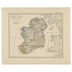
Ireland Map – Provincial and County Divisions 1851
Located in Langweer, NL
Ireland Map – Provincial and County Divisions 1851
This fine antique print shows Ireland titled simply “Ireland,” published in 1851 by Justus Perthes in Gotha as part of Adolf Stiel...
Category
Antique Mid-19th Century German Maps
Materials
Paper
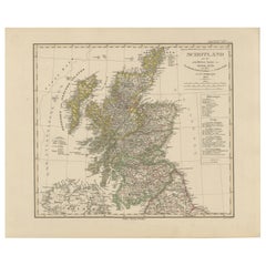
Scotland Map – Highlands, Islands, and Northern England 1858
Located in Langweer, NL
Scotland Map – Highlands, Islands, and Northern England 1858
This attractive antique print shows Scotland and its surroundings titled “Schotland mit der ...
Category
Antique Mid-19th Century German Maps
Materials
Paper
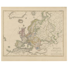
Europe Map – Political Divisions and Borders, Published in 1858
Located in Langweer, NL
Europe Map – Political Divisions and Borders 1858
This fine antique print shows Europe with its political divisions titled “Europa zur Übersicht der politischen Verhältnisse” meanin...
Category
Antique Mid-19th Century German Maps
Materials
Paper
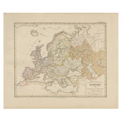
Europe Map – Rivers, Watersheds and Elevation, Published in 1857
Located in Langweer, NL
Europe Map – Rivers, Watersheds and Elevation 1857
This beautiful antique print shows Europe with its river systems and watershed regions, titled “Europa zur Übersicht der Flussgebi...
Category
Antique Mid-19th Century German Maps
Materials
Paper
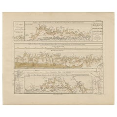
Mountain Elevation Profiles – Alps, Pyrenees, Andes & World Heights 1857
Located in Langweer, NL
Mountain Elevation Profiles – Alps, Pyrenees, Andes & World Heights 1857
This intriguing antique print shows comparative elevation profiles titled “Die bekannteren Höhen über der Me...
Category
Antique Mid-19th Century German Maps
Materials
Paper
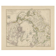
Arctic Polar Map – North Pole and Russian Empire Regions 1857
Located in Langweer, NL
Arctic Polar Map – North Pole and Russian Empire Regions 1857
This remarkable antique print shows the Arctic titled “Polar-Karte enthaltend die Länder und Meere am Nord-Pol” meaning...
Category
Antique Mid-19th Century German Maps
Materials
Paper
World Map – Mercator Projection with Global Sea Routes, Published in 1857
Located in Langweer, NL
World Map – Mercator Projection with Global Sea Routes 1857
This attractive antique print shows a world map titled “Planiglob in Mercators Projection zur Übersicht der Erdfläche und...
Category
Antique Mid-19th Century German Maps
Materials
Paper
Planiglob of the Antipodes – Unique Global Projection Map 1857
Located in Langweer, NL
Planiglob of the Antipodes – Unique Global Projection Map 1857
This rare and fascinating antique print shows a “Planiglob der Antipoden” or Planiglob of the Antipodes, depicting the...
Category
Antique Mid-19th Century German Maps
Materials
Paper
Western & Eastern Hemisphere Maps – World Double Hemisphere Engravings 1857
Located in Langweer, NL
Western & Eastern Hemisphere Maps – World Double Hemisphere Engravings 1857
These beautiful antique prints show two complementary hemispheric maps titled “Westliche Halbkugel” (West...
Category
Antique Mid-19th Century German Maps
Materials
Paper
Northern Hemisphere Star Map – Constellations & Astronomical Chart, c.1858
Located in Langweer, NL
Northern Hemisphere Star Map – Constellations & Astronomical Chart c.1858
This attractive antique print shows the northern starry sky titled “Der nördliche gestirnte Himmel”, meanin...
Category
Antique Mid-19th Century German Maps
Materials
Paper
Solar System Map – Planetary Orbits and Data Chart, Published in 1857
Located in Langweer, NL
Solar System Map – Planetary Orbits and Data Chart 1857
This antique print shows a detailed diagram of the solar system titled “Planeten-System der Sonne” meaning “Planetary System ...
Category
Antique Mid-19th Century German Maps
Materials
Paper
Visible Side of the Moon Map – Detailed Lunar Crater Chart, Published in 1858
Located in Langweer, NL
Visible Side of the Moon Map – Detailed Lunar Crater Chart 1858
This fascinating antique print shows the visible side of the moon with incredible precision and detail. It depicts th...
Category
Antique Mid-19th Century German Maps
Materials
Paper
Antique Map of Granada Spain – Hand-Coloured Tassin Engraving 1651
Located in Langweer, NL
Antique Map of Granada Spain – Hand-Coloured Tassin Engraving 1651
This beautiful hand-coloured engraved map depicts the historic Kingdom of Granada in southern Spain, created by th...
Category
Antique Mid-17th Century French Maps
Materials
Paper
Antique Map of Andalusia Spain – Hand-Coloured Tassin Engraving 1651
Located in Langweer, NL
Antique Map of Andalusia Spain – Hand-Coloured Tassin Engraving 1651
This fine hand-coloured engraved map shows the historic kingdom of Andalusia in southern Spain, created by Nicol...
Category
Antique Mid-17th Century French Maps
Materials
Paper
Map of Virgin Islands and Lesser Antilles by Rigobert Bonne, c. 1780
Located in Langweer, NL
Map of Virgin Islands and Lesser Antilles by Rigobert Bonne, c. 1780
This fine antique map is titled 'Supplément pour les Isles Antilles, extrait des cartes angloises' and was engraved by Rigobert Bonne, Ingénieur-Hydrographe de la Marine, around 1780. It depicts:
Upper half:
* The Virgin Islands (*Les Isles Vierges*), including:
* St. Thomas
* St. John
* Tortola
* Virgin Gorda
* Jost Van Dyke
* Surrounding smaller islands and passages.
* Parts of Puerto Rico visible left.
Lower half:
Nine inset maps of individual Caribbean islands with coastal details:
1. I. de la Barboude (Barbuda)
2. I. St. Christophe (St. Kitts)
3. I. Antigoa (Antigua)
4. I. de la Dominique (Dominica)
5. I. de Sainte Lucie (St. Lucia)
6. I. de la Barbade (Barbados)
7. I. de St. Vincent
8. I. de la Grenade (Grenada)
9. I. de Tabago (Tobago)
Features:
* Coastal names, bays, capes, and harbours noted.
* Fine clear engraving typical of Bonne’s atlases for maritime use.
* Scale bar with French lieues marines.
Engraver: Rigobert Bonne
Date: circa 1780
Published in: Atlas Encyclopédique
Condition:
Good dark impression on laid paper with wide margins. Some slight toning along centre fold and faint edge wear consistent with age. Original platemark visible.
Framing suggestions:
Display with other Bonne Caribbean or West Indies maps in a travel, history, or colonial themed wall. Ideal floated in a black or walnut wood frame with archival matting to preserve the crisp engraving.
Keywords:
Rigobert Bonne Caribbean maps...
Category
Antique 1780s French Maps
Materials
Paper
1758 Map of Saint Kitts – St. Christophe, Antique French Engraving
Located in Langweer, NL
Map of Saint Kitts (St. Christophe), circa 1758
This is an antique French map titled *Carte de l'Isle St. Christophe*, engraved by Jacques-Nicolas Bellin and published around 1758 f...
Category
Antique Mid-18th Century French Maps
Materials
Paper
Map of Guyane (French Guiana) with Cayenne, circa 1826
Located in Langweer, NL
Map of Guyane (French Guiana) with Cayenne, circa 1826
This is an antique French map titled “Guyane” from *Petit Atlas National (Colonies françaises)* published by Blaisot around 18...
Category
Antique Early 19th Century French Maps
Materials
Paper
Martinique Map by Rigobert Bonne – French Antique Map, c.1768
Located in Langweer, NL
Map of Martinique by Rigobert Bonne, circa 1768
This is a detailed antique map of Martinique titled “Isle de la Martinique,” engraved by Rigobert Bonne around 1768 for the Atlas Encyclopédique. Bonne, a renowned French hydrographer and successor to Bellin, is celebrated for his scientifically precise and elegantly engraved maps.
The map shows Martinique with its mountainous interior, rivers, and settlements labelled, including Fort Royal, Fort St. Pierre, Le Marin, and Le Prêcheur. Coastal features, bays, and capes are marked, along with anchorages important for maritime navigation in the 18th century. The depiction includes relief shown pictorially, characteristic of Bonne’s cartographic style, enhancing both geographic understanding and aesthetic appeal.
This copperplate engraving retains original hand colouring outlining the coastlines in delicate blue and brown tones, typical for the period. It served as a key reference for scholars, navigators, and colonial administrators during France’s colonial presence in the Caribbean.
Condition:
Good condition overall. A strong impression with bright, original hand-colour outlines. General age toning, faint offsetting, and a vertical fold as issued in the atlas. Margins ample all around for framing.
Framing suggestions:
This historic Caribbean map...
Category
Antique 1760s French Maps
Materials
Paper
Map of Martinique, Guadeloupe, Marie-Galante, Désirade & Saintes by Bonne, 1788
Located in Langweer, NL
Map of Martinique, Guadeloupe, Marie-Galante, Désirade & Saintes by Bonne, 1788
This fine antique map, titled *Isle de la Martinique, Isles de la Guadeloupe, de Marie Galante, de la...
Category
Antique Late 18th Century French Maps
Materials
Paper
1758 Bellin Map of Guadeloupe and Marie-Galante – Caribbean Islands
Located in Langweer, NL
Thank you for noting the correct date on the map. Here is your **updated plain text catalog listing**:
---
**Title (under 80 characters):**
1758 Bellin Map of Guadeloupe and Marie-Galante – Caribbean Islands
**Description:**
Original antique map titled *Carte de l’Isle de la Guadeloupe* by Jacques Nicolas Bellin, engraved for the *Histoire Générale des Voyages*, published in Paris in 1758.
This finely engraved copperplate map depicts the French Caribbean island of Guadeloupe, showing its distinctive butterfly-shaped division into Basse-Terre and Grande-Terre. The surrounding smaller islands include Marie-Galante (bottom right) and Les Saintes. The map details numerous place names, parishes, rivers, bays, mountains, and anchorages. A decorative rococo title cartouche graces the upper right corner, complemented by a scale bar cartouche in the upper left.
Jacques Nicolas Bellin (1703-1772) served as Hydrographer to the King and was one of the most prominent French cartographers of the 18th century, producing maps noted for their accuracy, elegance, and clarity. This map was created for the influential *Histoire Générale des Voyages* by Abbé Prévost.
Condition report:
Excellent condition. Strong and clean impression on fine laid paper with wide margins. Original hand coloring in outline and wash, highlighting coastlines and cartouches. Minor age toning at edges; verso blank.
Framing suggestion:
Frame with a classic gold or dark wood moulding and a neutral cream archival mat to emphasize the fine engraving and delicate color washes. Museum glass is recommended to preserve this 18th-century Caribbean map...
Category
Antique Mid-18th Century French Maps
Materials
Paper
Map of Iran, Arabia, Asia Minor & Caucasus by Perthes, 1858
Located in Langweer, NL
Map of Iran, Arabia, Asia Minor & Caucasus by Perthes, 1858
This is a detailed engraved map titled Vorder-Asien oder Iran, Turan, Arabien, Kleinasien und die Kaukasus Länder, publis...
Category
Antique Mid-19th Century German Maps
Materials
Paper
Plan of Cincinnati Map, USA c.1870 – Hand-Colored Street Plan with Wards
Located in Langweer, NL
Plan of Cincinnati Map, USA c.1870 – Hand-Colored Street Plan with Wards
This is a finely engraved and hand-colored street plan titled Plan of Cincinnati and Vicinity, published in ...
Category
Antique Mid-19th Century American Maps
Materials
Paper
Brazil Coastline Map – Broenner Carte du Bresil, 1772 Captaincies
Located in Langweer, NL
Carte du Bresil Map, Broenner Krefeld 1772 – Brazil Coastline Captaincies
This is an engraved map titled Carte du Bresil Prem. Partie, published in Krefeld (Germany) by J.J. Broenne...
Category
Antique Late 18th Century French Maps
Materials
Paper
Johnson’s Illinois Map, USA c.1864 – Hand-Colored with Chicago Courthouse View
Located in Langweer, NL
Johnson’s Illinois Map, USA c.1864 – Hand-Colored with Chicago Courthouse View
This is a finely engraved and hand-colored map titled Johnson’s Illinois, published by Johnson and War...
Category
Antique Mid-19th Century American Maps
Materials
Paper
Johnson’s New Brunswick Nova Scotia Newfoundland Map, USA c.1864
Located in Langweer, NL
Johnson’s New Brunswick Nova Scotia Newfoundland Map, USA c.1864
This is a finely engraved and hand-colored map titled Johnson’s New Brunswick, Nova Scotia, Newfoundland, and Prince...
Category
Antique Mid-19th Century American Maps
Materials
Paper
Plan of Baltimore City Map, USA c.1870 – Hand-Colored Street Plan
Located in Langweer, NL
Plan of Baltimore City Map, USA c.1870 – Hand-Colored Street Plan
This is a finely engraved and hand-colored street plan titled Plan of Baltimore, published in the United States cir...
Category
Antique Mid-19th Century American Maps
Materials
Paper
Central America Map – Johnson, Hand-Colored with Insets, c.1864
Located in Langweer, NL
Johnson’s Central America Map, USA c.1864 – Hand-Colored with Insets
This is a finely engraved and hand-colored map titled Johnson’s Central America, published by Johnson and Ward i...
Category
Antique Mid-19th Century American Maps
Materials
Paper
Washington Oregon Idaho Map – Johnson, Hand-Colored, c.1864
Located in Langweer, NL
Johnson’s Washington Oregon Idaho Map, USA c.1864 – Hand-Colored
This is a finely engraved and hand-colored map titled Johnson’s Washington, Oregon, and Idaho, published by Johnson ...
Category
Antique Mid-19th Century American Maps
Materials
Paper
Minnesota and Dakota Map – Johnson, Hand-Colored, USA c.1864
Located in Langweer, NL
Johnson’s Minnesota and Dakota Map, USA c.1864 – Hand-Colored Territorial Map
Description:
This is a finely engraved and hand-colored map titled Johnson’s Minnesota and Dakota, pub...
Category
Antique Mid-19th Century American Maps
Materials
Paper
Maine County Map – Johnson, Hand-Colored, USA c.1864
Located in Langweer, NL
Johnson’s Maine Map, USA Published c.1864 – Hand-Colored County Map
This is a finely engraved and hand-colored map titled Johnson’s Maine, published by Johnson and Ward in New York ...
Category
Antique Mid-19th Century American Maps
Materials
Paper
Delaware and Maryland Map – Johnson, Hand-Colored with Insets, 1864
Located in Langweer, NL
Johnson’s Delaware and Maryland Map, USA c.1864 – Hand-Colored with Insets
This is a finely engraved and hand-colored map titled Johnson’s Delaware and Maryland, published by Johnso...
Category
Antique Mid-19th Century American Maps
Materials
Paper
Arkansas Map by Colton, USA Published c.1864 – Hand-Colored County Map
Located in Langweer, NL
Arkansas Map by Colton, USA Published c.1864 – Hand-Colored County Map
This is a finely engraved and hand-colored map titled Arkansas, published by G.W. & C.B. Colton & Co. in New Y...
Category
Antique Mid-19th Century American Maps
Materials
Paper
Hindostan or British India Map – Johnson, Hand-Colored USA c.1864
Located in Langweer, NL
Johnson’s Hindostan or British India Map, USA c.1864 – Hand-Colored
This is a finely engraved and hand-colored map titled Johnson’s Hindostan or British India, published by Johnson ...
Category
Antique Mid-19th Century American Maps
Materials
Paper
Johnson’s Mexico Map with Tehuantepec Inset, USA c.1864 – Hand-Colored
Located in Langweer, NL
Johnson’s Mexico Map with Tehuantepec Inset, USA c.1864 – Hand-Colored
This is a finely engraved and hand-colored map titled Johnson’s Mexico, published by Johnson and Ward in New Y...
Category
Antique Mid-19th Century American Maps
Materials
Paper
Johnson’s China Map with Canton Inset, USA Published c.1864 – Hand-Colored
Located in Langweer, NL
Johnson’s China Map with Canton Inset, USA Published c.1864 – Hand-Colored
This is a finely engraved and hand-colored map titled Johnson’s China, publis...
Category
Antique Mid-19th Century American Maps
Materials
Paper
Johnson’s Australia Map, USA Published c.1864 – Decorative Hand-Colored Map
Located in Langweer, NL
Johnson’s Australia Map, USA Published c.1864 – Decorative Hand-Colored Map
This is a finely engraved and hand-colored map titled Johnson’s Australia published by Johnson and Ward i...
Category
Antique Mid-19th Century American Maps
Materials
Paper
Attack Plan of Douay Fortress, France, 1710 Siege – Brussels c.1720 Map
Located in Langweer, NL
Attack Plan of Douay Fortress, France, 1710 Siege – Brussels c.1720 Map
This engraved military map shows the detailed plan of attacks on the fortress city of Douay (Douai) in northe...
Category
Antique Early 18th Century French Maps
Materials
Paper
Detailed 1720s Map – Siege of Douay and Lines of Circumvallation, France
Located in Langweer, NL
Detailed 1720s Map – Siege of Douay and Lines of Circumvallation, France
This engraved map shows the detailed fortifications and surrounding region of Douay (Douai) in northern Fran...
Category
Antique Early 18th Century French Maps
Materials
Paper
Detailed 1729 Battle Map – Allied Army Camp at Denain France, 1712 Siege
Located in Langweer, NL
Map of Allied Camp at Denain, France, 1712 Attack – Published 1729
This engraved map depicts the army camp of the Allied forces at Denain, attacked by the French on July 24, 1712 du...
Category
Antique Early 18th Century Dutch Maps
Materials
Paper
Plan of Pondicherry Fortifications and Attacks, France, c.1750
Located in Langweer, NL
Plan of Pondicherry Fortifications and Attacks, France, c.1750
This finely engraved map depicts the fortified city of Pondicherry, titled "Plan de Pondichéry et de ses attaques." It...
Category
Antique Mid-18th Century French Maps
Materials
Paper
1874 Map of Western United States – Detailed Atlas by Keith Johnston
Located in Langweer, NL
1874 Map of Western United States by Keith Johnston – Detailed Atlas
This is an original antique map titled “United States of North America (Western States)” by Alexander Keith John...
Category
Antique 1870s Scottish Maps
Materials
Paper
Batavia Market Scenes & Government House – Antique Prints VOC Period, c.1780
Located in Langweer, NL
Batavia Views – Government House and Market Scenes, circa 1780
This is an original late 18th-century engraving featuring two detailed views of Batavia (now Jakarta, Indonesia) under...
Category
Antique Late 18th Century Dutch Maps
Materials
Paper
1728 Map of Batavia Castle & City, Java – Van der Aa after 1669
Located in Langweer, NL
1728 Map of Batavia Castle & City, Java – Van der Aa after 1669
This is an original antique copperplate engraving titled “Plan de la Ville et du Château de Batavia en l’Isle de Iava...
Category
Antique Early 18th Century Dutch Maps
Materials
Paper
1726 Map of Bengal by Van der Aa after Valentijn – Dutch East Indies
Located in Langweer, NL
1726 Map of Bengal by Van der Aa after Valentijn – Dutch East Indies
This is an original antique map titled “Nieuwe Kaart van ’t Koninryk van Bengale,” published by Pieter van der Aa in Leiden in 1726. The map depicts the Kingdom of Bengal and surrounding regions, based on earlier work by François Valentijn, a Dutch East India Company (VOC) official and historian whose extensive writings on Asia were among the most important early European sources.
The engraving covers the Bengal region (modern-day Bangladesh and West Bengal, India), showing detailed river systems including the Ganges and its distributaries flowing into the Gulf of Bengal. Major towns, cities, and kingdoms are labelled in Dutch, such as Orixa (Orissa), Arracan, Tipera (Tripura), and Cos Assam (Assam). Mountain ranges are represented pictorially with stylised hachured peaks, while fertile plains are indicated with field patterns, adding visual texture to the map.
In the upper right is an elegant title cartouche with dedication to VOC officials, referencing Mathijs van den Broecke, a director in Bengal, and Johannes Lennep. A compass rose is positioned at the bottom, enhancing its decorative maritime appeal, with north oriented to the right as typical for Dutch maps of Asian regions in this period.
Pieter van der Aa (1659–1733) was a prolific publisher known for compiling maps from earlier explorers and engravers into elegant and collectible volumes. His works remain valued for their historical significance, decorative artistry, and connection to VOC trade networks and colonial history.
Condition:
Good condition. Strong impression with later hand colouring. Light age toning, faint foxing mainly in margins, and some creasing along original fold lines as issued. Fully suitable for framing.
Framing tips:
Frame this map in a slim gilt or dark wood frame to highlight its decorative hand colouring. Use an off-white archival mat to accentuate the engraving and protect the edges. UV-protective glazing is recommended to maintain colour vibrancy and paper integrity.
Keywords block for your listing:
bengal map...
Category
Antique Early 18th Century Dutch Maps
Materials
Paper
Original Antique Blaeu Map of Karst, Carniola, Istria, and Trieste, circa 1640
Located in Langweer, NL
Blaeu Map of Karst, Carniola, Istria, and Trieste, circa 1640
This is an original antique map titled “Karstia, Carniola, Histria et Windorum Marchia,” published by Willem Blaeu in Amsterdam circa 1640. The map depicts the historical regions of Karst (Karstia), Carniola (modern-day Slovenia), Istria (the peninsula shared by Croatia, Slovenia, and Italy), and the Windic March, a medieval border territory.
The engraving shows detailed place names, rivers, mountains, and settlements across present-day Slovenia, northeastern Italy, and northwestern Croatia. The Gulf of Trieste is prominently illustrated at the lower left, with Trieste labelled and coastal settlements clearly indicated. The Adriatic Sea is elegantly engraved with stippled waters, a compass rose, rhumb lines, and a sailing ship, enhancing its decorative maritime appeal.
In the upper left corner is a beautifully designed cartouche bearing the title within a scrollwork frame with foliage and drapery motifs. The lower left includes a mileage scale in Italian miles and a dedication to Guiljelmus Blaeu excudit, confirming its publication from the Blaeu workshop.
Willem Janszoon Blaeu (1571–1638) was one of the leading Dutch cartographers of the early 17th century, succeeded by his son Joan Blaeu. Their maps were known for their precision, aesthetic engraving, and clarity, making the Blaeu atlases the most prestigious publications of the Dutch Golden Age.
Condition:
Good condition. Strong, clean impression on laid paper with wide margins. Light age toning and faint foxing in blank margins, minor creasing along the original centre fold as issued. No tears or repairs noted. Fully suitable for framing.
Framing tips:
Frame this map in a thin black, walnut, or gilt frame to enhance its historic character. Use an off-white or cream archival mat to highlight the detailed engraving and preserve the sheet edges. UV-protective glazing is recommended to protect the paper and ensure its clarity and integrity over time.
Keywords: Here are short keyword blocks formatted for direct copy-pasting into your website SEO or 1stdibs tags:
karst map, carniola map, istria map, trieste map, blaeu map, willem blaeu,
17th century map, dutch cartography, antique balkan map, slovenia antique map,
croatia antique...
Category
Antique 17th Century Dutch Maps
Materials
Paper
Antique Map of Slavonia, Croatia, Bosnia and Dalmatia by Janssonius, circa 1640
Located in Langweer, NL
Antique Map of Slavonia, Croatia, Bosnia and Dalmatia by Janssonius, circa 1640
This elegant and detailed map titled Sclavonia, Croatia, Bosnia cum Dalmatiae Parte was published by ...
Category
Antique 17th Century Dutch Maps
Materials
Paper
Blaeu Map of Ottoman Balkans – Walachia Bulgaria Romania, circa 1665
Located in Langweer, NL
Blaeu Map of Ottoman Balkans – Walachia Bulgaria Romania, circa 1665
This is an original hand-coloured antique map titled “Walachia, Servia, Bulgaria, Romania,” published by Joan Bl...
Category
Antique 17th Century Dutch Maps
Materials
Paper
17th Century Blaeu Map – Ottoman Balkans: Walachia, Bulgaria, Romania, ca. 1650
Located in Langweer, NL
Blaeu Map of Walachia, Servia, Bulgaria, Romania, circa 1640
This is an original antique map titled “Walachia, Servia, Bulgaria, Romania,” published by Joan Blaeu in Amsterdam betwe...
Category
Antique 17th Century Dutch Maps
Materials
Paper
Antique 1743 Map – Travels of Jesus Christ & Apostles by Seutter
Located in Langweer, NL
Antique 1743 Map – Travels of Jesus Christ & Apostles by Seutter
This is an original antique map titled “Carte des Voyages de Notre Seigneur Jesus-Christ et des Actes des Apotres St...
Category
Antique Mid-18th Century German Maps
Materials
Paper
$1,614 Sale Price
20% Off
Japanese Isles Map by Mallet, 1683 – Decorative Miniature Map
Located in Langweer, NL
1683 Map of Japan Isles by Mallet – Decorative Miniature Map
This is an original antique map titled “Isles du Japon,” created by Alain Manesson Mallet and published in Paris in 1683...
Category
Antique 1680s French Maps
Materials
Paper
Saint Domingue Map 1793 – Colonial Haiti and Dominican Republic Plan
Located in Langweer, NL
1793 Map of Saint Domingue (Haiti and DR) – Colonial Island Plan
This antique map is titled “A Map of the Island of St. Domingo” and dates from circa 1793. It depicts the entire isl...
Category
Antique Late 18th Century English Maps
Materials
Paper
1794 Map of Jamaica by Bryan Edwards – Parishes, Plantations, Settlements
Located in Langweer, NL
1794 Bryan Edwards Map of Jamaica – Parishes, Plantations, Settlements
This is an important antique map titled “A Map of the Island of Jamaica, Divided into Counties and Parishes,” created by Bryan Edwards in 1794. It was published in the second edition of his influential work *The History of the British West Indies*, which provided detailed insights into the geography, society, and economy of the Caribbean at the height of British colonial influence.
The map meticulously depicts Jamaica divided into its traditional counties and parishes, each shaded to aid visual differentiation. Major settlements are clearly labelled, including Kingston, Montego Bay, Spanish Town, and Falmouth. The island’s intricate network of rivers, mountains, and coastal features are rendered with careful hachure and stipple shading to indicate elevation and terrain. Edwards uses small circular symbols to denote the locations of numerous sugar plantations that formed the backbone of Jamaica’s economy during this period, each plantation representing not only agricultural wealth but also the grim history of enslaved African labour central to the island’s prosperity.
Further notations identify churches, barracks, forts, and ports, demonstrating the comprehensive utility of this map for historical research into colonial infrastructure. The map even marks Bryan...
Category
Antique Late 18th Century English Maps
Materials
Paper
Jerusalem and Temple Imaginary Map by Blome, Published London 1689
Located in Langweer, NL
Imaginary Plan of Jerusalem by Blome after Villalpando, 1689
This impressive antique engraving presents an imaginary plan of Jerusalem by Richard Blome, published in 1689. The engra...
Category
Antique Late 17th Century English Maps
Materials
Paper
Ottoman Empire in Europe – Antique Map by Reilly, Vienna, 1796
Located in Langweer, NL
Map of the Ottoman Empire in Europe – Reilly, Vienna circa 1794-1796
This large original antique map, titled “Karte von dem Oschmanischen Reiche in Europa,” was published between 17...
Category
Antique Late 18th Century Austrian Maps
Materials
Paper
Antique Map of North America – Physical Relief Map by Hachette c.1883
Located in Langweer, NL
Antique Map of North America – Physical Relief Map by Hachette c.1883
Description:
This antique map titled “Amérique du Nord” was published around 1883 by E. Hachette in Paris as pa...
Category
Antique Late 19th Century French Maps
Materials
Paper
Antique Map of Australia and Oceania – Physical Relief Map by Hachette, c.1883
Located in Langweer, NL
Antique Map of Australia and Oceania – Physical Relief Map by Hachette, c.1883
Description:
This antique map titled “Australie” was published circa 1883 by Hachette in Paris as part...
Category
Antique Late 19th Century French Maps
Materials
Paper
Relief Atlas Map of South America by Hachette – Antique French Map c.1883
Located in Langweer, NL
Antique Map of South America – Physical Relief Map by Hachette, c.1883
Description:
This antique map titled “Amérique du Sud” was published circa 1883 by Hachette in Paris as part o...
Category
Antique Late 19th Century French Maps
Materials
Paper
Relief Atlas Map of Europe by Hachette – Antique French Map c.1883
Located in Langweer, NL
Antique Map of Europe – Physical Relief Map by Hachette, circa 1883
Description:
This antique map titled “Europe Physique” was published by Hachette in Paris around 1883 and origina...
Category
Antique Late 19th Century French Maps
Materials
Paper
Relief Atlas Map of Asia by Hachette – Antique French Map, circa 1883
Located in Langweer, NL
Antique Map of Asia – Relief Atlas Map by Hachette, circa 1883
Description:
This antique map titled “Asie” was published by Hachette in Paris around 1883 and originates from their e...
Category
Antique Late 19th Century French Maps
Materials
Paper
Relief Atlas Map of Africa by Hachette – Antique c.1883 French Map
Located in Langweer, NL
Antique Map of Africa – Relief Atlas Map by Hachette, circa 1880
Description:
This is an attractive antique map titled “Afrique,” published by Hachette...
Category
Antique Late 19th Century Maps
Materials
Paper
