Bartele Gallery More Furniture and Collectibles
to
4,717
5,701
5,700
1
3,077
2,265
358
1
208
10
73
4
3
3
2
5,692
9
7
2
2
483
193
103
80
61
5,701
5,701
5,701
104
58
20
14
14
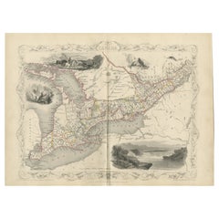
A 19th-Century Map of West Canada with Niagara Falls and Indigenous Scenes
Located in Langweer, NL
Decorative 19th-Century Map of West Canada with Niagara Falls and Indigenous Scenes
This detailed 19th-century map of West Canada, drawn and engraved by J. Rapkin and published by...
Category
Antique 1850s Maps
Materials
Paper
Ornate 1850s Map of the United States: Featuring Iconic Landmarks and Portrets
Located in Langweer, NL
Ornate 1850s Map of the United States: Featuring Iconic Landmarks and Historical Portraits
This decorative 19th-century map of the United States, created by J. Rapkin and publishe...
Category
Antique 1850s Maps
Materials
Paper
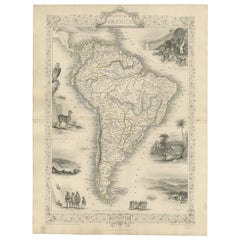
Ornate 1850s Map of South America: A Masterpiece of Exploration & Art by Rapkin
Located in Langweer, NL
Decorative 19th-Century Map of South America by J. Rapkin, Published by J & F Tallis
Description: This beautifully detailed map of South America, drawn and engraved by J. Rapkin a...
Category
Antique 1850s Maps
Materials
Paper
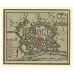
Detailed Plan of the City of Zutphen, The Netherlands – Hendrik de Leth, c.1740
Located in Langweer, NL
Title: Detailed Plan of the City of Zutphen – Hendrik de Leth, ca. 1740
This hand-colored engraving, created by Hendrik de Leth and published around 1740, presents a detailed and ...
Category
Antique 1740s Maps
Materials
Paper
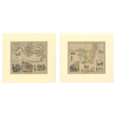
Biblical Journeys: Apostle Paul's Voyages and the Israelites' Exodus, 1856
Located in Langweer, NL
Two maps in matting board. From the Pictorial Bible Atlas, published in 1856.
Title for Map 1: Voyages and Travels of Apostle Paul – Illustrated Antique...
Category
Antique 1850s Maps
Materials
Paper
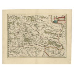
Map of Styria by William Blaeu, 1645: A Masterpiece of 17th-Century Cartography
Located in Langweer, NL
This 1645 map, created by Willem Janszoon Blaeu, represents Styria (Steyrmark), a historical region in present-day Austria, located in the Alpine regions. Blaeu, one of the most sign...
Category
Antique 1640s Maps
Materials
Paper
An Original Antique Mid-17th Century Blaeu Map of Styria in Southeastern Austria
Located in Langweer, NL
This is an antique map of Styria (referred to as “Stiria” or “Steyrmarck”), published by the renowned Dutch cartographer Willem Janszoon Blaeu (often simply “Blaeu”). The first editi...
Category
Antique 1640s Maps
Materials
Paper
Detailed 18th-Century Map of Paris and Its Surrounding Regions by Johann Homann
Located in Langweer, NL
This map, titled “Agri Parisiensis Tabula particularis,” was created and published by the German cartographer Johann Baptist Homann (1664–1724), or his workshop, in Nuremberg. Homann...
Category
Antique 1720s Maps
Materials
Paper
A Detailed Mid-18th Century German Map of North-Central Europe
Located in Langweer, NL
This is an antique, hand-colored engraved map of north-central Europe (centered on the region of Brandenburg, Pomerania, and portions of what is now northern Poland) that was produce...
Category
Antique 1730s Maps
Materials
Paper
Decorative Map of the Royal Württemberg District of Welzheim, Germany, ca.1880
Located in Langweer, NL
The Royal Württemberg District of Welzheim is located in Germany. Welzheim is a town in the state of Baden-Württemberg, which was historically part of the Kingdom of Württemberg. The...
Category
Antique 1880s Maps
Materials
Paper
Orignal Hand-Colored Antique Map of Chili by W. Blaeu, 1658
By Willem Blaeu
Located in Langweer, NL
Very decorative antique map of Chili published by W. Blaeu, 1658. This map depicts Chile from Copiapo southward to the island of Chiloé with ships and sea monsters adorning the sea. ...
Category
Antique Mid-17th Century Maps
Materials
Paper
$893 Sale Price
20% Off
1606 Hand-Colored Woodcut Map of Sumatra from Ramusio’s Delle Navigationi
Located in Langweer, NL
This is a fascinating woodcut map titled Taprobana, depicting the island of Sumatra, hand-colored, and published in Venice in 1606. The map originates from Giovanni Battista Ramusio’...
Category
Antique Early 1600s Italian Maps
Materials
Paper
1601 Miniature Map of Southeast Asia & Nova Guinea by Ortelius, Vrients Edition
Located in Langweer, NL
This miniature map of the East Indies and Nova Guinea was created by Abraham Ortelius and published in 1601 as part of the "Epitome" by Giovanni Battista Vrients. It is a finely hand...
Category
Antique Early 1600s Maps
Materials
Paper
17th-Century Map of Sri Lanka (Ceylon) by Mercator & van den Keere, 1630
Located in Langweer, NL
This captivating 17th-century map titled "Zeilan ou Ceilon Isle" (Ceylon/Sri Lanka) was engraved by Petrus Kaerius (van den Keere) and published in Mercator's "Atlas Minor," edited b...
Category
Antique 1630s Maps
Materials
Paper
Antique Bird's-Eye View of Hangzhou (China) by Matthäus Merian, 1638
Located in Langweer, NL
This is an exquisite antique bird's-eye view map of Hangzhou, historically referred to as "Xuntien or Quinzay," from the first edition of Matthäus Merian's publication in 1638. This ...
Category
Antique 1630s Maps
Materials
Paper
Territorium Norimbergense - Antique Map of Nürnberg by Janssonius (1645-58)
Located in Langweer, NL
This is an antique map of Nürnberg, titled "Territorium Norimbergense," created by Johannes Janssonius and published between 1645 and 1658. It is a copperplate engraving printed on p...
Category
Antique 1650s Maps
Materials
Paper
Old Map of the Lower Bishopric of Münster (1726-1750) by Sanson & Ottens, c.1750
Located in Langweer, NL
Historical Map of the Lower Bishopric of Münster (1726-1750) by Sanson & Ottens – Hand-Colored Copperplate Engraving
The map titled "BASSE PARTIE DE L'EVESCHE DE MUNSTER" is a detai...
Category
Antique 1750s Maps
Materials
Paper
Moullart-Sanson Map of the Holy Land and Sacred Geography of the Old Testament
Located in Langweer, NL
"1716 Moullart-Sanson Map of the Holy Land and Sacred Geography of the Old Testament"
This engraved map, created by Pierre Moullart-Sanson and reissued by Robert de Vaugondy in 1740...
Category
Antique 1710s Maps
Materials
Paper
1767 D’Anville Map of the Holy Land: Ancient Divisions and Biblical Geography
Located in Langweer, NL
Ancient Map of Palestine or the Holy Land by D'Anville (1767)
This detailed map, created by the renowned French cartographer Jean Baptiste Bourguignon d'Anville in 1767, depicts the...
Category
Antique 1670s Maps
Materials
Paper
Map of Europe Highlighting Ancient and Modern Geographical Divisions (1794)
Located in Langweer, NL
Map of Europe Highlighting Ancient and Modern Geographical Divisions (1794). Germany, France, Italy, Spain, and the British Isles – Map by D’Anville (1794).
This detailed 18th-cent...
Category
Antique 1790s Maps
Materials
Paper
$1,614 Sale Price
20% Off
Mythical Atlantis Restored - A 1694 Map of the Americas and Ancient Geography
Located in Langweer, NL
This rare and fascinating map, titled "Atlantis Insula a Nicolao Sanson Antiquitati Restituta" by Guillaume Sanson, presents an unusual interpretation of the Western Hemisphere, comb...
Category
Antique 1690s Maps
Materials
Paper
Rare North Atlantic and Caribbean Sea Chart: Newfoundland to Venezuela, 1745
Located in Langweer, NL
This impressive map titled "Terra Neuf, en de Custen van Nieu Vranckryck, Nieuw Engeland... Venezuela," published by Louis Renard in 1745, captures the North Atlantic coastline, enco...
Category
Antique 1740s Maps
Materials
Paper
Detailed 1795 Map of the Americas with Exploration Tracks and Nice Cartouche
Located in Langweer, NL
This is a very handsome and rare 1795 map of the Americas titled "Amerique ou Nouveau Continent Dressee sur les Nouvelles Relations Decouvertes et Observations" by Jean Baptiste Noli...
Category
Antique 1790s Maps
Materials
Paper
$2,234 Sale Price
20% Off
Old World Map Featuring Captain Cook's Exploration Routes and Polar Views, 1787
Located in Langweer, NL
1786 World Map with Polar Projections - "Globo Terrestre" by Giovanni Maria Cassini
This 1786 map titled "Globo Terrestre" by Giovanni Maria Cassini offers a fascinating and detai...
Category
Antique 1860s Maps
Materials
Paper
$1,814 Sale Price
20% Off
1877 Satirical Map of the Eastern War: Europe's Powers as Caricatured Characters
Located in Langweer, NL
Title: 1877 Caricature Map of the Eastern War - "Carte de la Guerre en Orient" by H. Demare
Description: This 1877 satirical map, titled "Carte de la Guerre en Orient," was publis...
Category
Antique 1870s French Maps
Materials
Paper
$1,766 Sale Price
20% Off
1711 Star Chart of Southern Sky with Mythical Constellations and Exotic Animals
Located in Langweer, NL
1711 Star Chart of the Southern Sky - "Mappa Stellarum Australium quae in Altitudine Poli Borei Graduum"
This beautiful star chart, engraved by Arnold van Westerhout in 1711, shows ...
Category
Antique 1710s Maps
Materials
Paper
$1,614 Sale Price
20% Off
1654 Nicolas Sanson Map of Southern India and Southeast Asia
Located in Langweer, NL
1654 Nicolas Sanson Map of Southern India and Southeast Asia - Partie Meridionale de L'Inde
This 1654 map by Nicolas Sanson, titled "Partie Meridionale de L'Inde en deux Presqu'Is...
Category
Antique 1650s Maps
Materials
Paper
1717 Johannes Van Keulen Sea Chart of the Eastern Atlantic - Amsterdam to Gambia
Located in Langweer, NL
1717 Johannes Van Keulen Sea Chart of the Eastern Atlantic - Amsterdam to Gambia
This 1717 sea chart by Johannes Van Keulen, titled "Nieuwe Paskaert vande ...
Category
Antique 1710s Maps
Materials
Paper
1690 Frederick de Wit Sea Chart of Hudson Bay, Baffin Bay and Greenland
Located in Langweer, NL
Title: c. 1690 Frederick de Wit Sea Chart of Hudson Bay, Baffin Bay, and Greenland - Engraved by Romeyn de Hooghe
This striking sea chart by Frederick de Wit, titled "Septemtrionali...
Category
Antique 1690s Maps
Materials
Paper
1802 Map of Australasia and the South Pacific - European Exploration Routes
Located in Langweer, NL
1802 Johann Walch Map of Australasia and the South Pacific - European Exploration Routes
This 1802 map by Johann Walch provides a highly detailed view of Australasia and the South P...
Category
Antique Early 1800s Maps
Materials
Paper
$1,719 Sale Price
20% Off
Large Map of Russian Discoveries in Siberia, Alaska & the Bering Strait, 1784
Located in Langweer, NL
1784 Russian Discoveries in Siberia, Alaska & the Bering Strait - Gerhard Friedrich Muller
"Nouvelle Carte des Decouvertes Faites par des Vaisseaux Russiens Aux Cotes Inconnues de L'Amerique Septentrionale avec Les Pais Adiacents" is a seminal map by Gerhard Friedrich Muller, showcasing Russian discoveries in Siberia, Alaska, and the Bering Strait region. Originally published in 1754, this map served as a direct counter to Guillaume de L'Isle's speculative "fantasy" map of the same area, which prominently featured the fictitious Mer de l'Ouest (Sea of the West).
This edition, published in 1784 by the Imperial Academy of Sciences in St. Petersburg, reflects the substantial geographic knowledge gained through Russian explorations, particularly the voyages of Vitus Bering. It accurately depicts the northern Pacific coasts, focusing on Siberia, the Aleutian Islands, and the Alaskan coast. The hand-coloring remains vibrant, emphasizing key geographic details, and a richly decorated rococo cartouche adorns the upper right, indicating the map's origins.
This map is a significant artifact, illustrating the progression of cartographic accuracy and the influence of Russian expeditions in shaping the early knowledge of the North Pacific and Arctic regions.
The 1784 edition of Gerhard Friedrich Muller's map features the routes of key Russian voyages that explored the North Pacific, specifically those related to the exploration of Siberia, Alaska, and the Bering Strait. These include:
1. Vitus Bering's Voyages (1728 and 1741) - The map shows routes of Vitus Bering, a Danish explorer in the Russian Navy, who led two important expeditions:
- During his first Kamchatka Expedition (1728), Bering navigated through what is now known as the Bering Strait, proving that Siberia and Alaska were separated by a sea.
- His second Kamchatka Expedition (1741) extended further eastward to Alaska. This journey greatly expanded European knowledge of the northern Pacific and confirmed Alaska as part of the North American continent.
2. Aleksei Chirikov's Route (1741) - As part of the second Kamchatka Expedition, Aleksei Chirikov, who was Bering's second-in-command, led a separate ship and reached the Alaskan coast, discovering the southeastern parts of Alaska and providing further detailed knowledge of the area.
3. Russian Navigators in the Aleutian Islands - The map also shows the exploration routes in and around the Aleutian Islands, which were instrumental for Russian fur...
Category
Antique 1780s Maps
Materials
Paper
1625 Petrus Plancius / Cloppenburg Map of the Holy Land with Biblical Vignettes
Located in Langweer, NL
1625 Petrus Plancius / Johannes Cloppenburg Map of the Holy Land with Biblical Vignettes
This exquisite 1625 map by Petrus Plancius and Johannes Cloppenburg represents the Holy Lan...
Category
Antique 1620s Maps
Materials
Paper
Scarce Latin Edition of Guillaume Delisle's 1700 Map of North America
Located in Langweer, NL
Scarce German Edition of Guillaume Delisle's 1700 Map of North America
This beautifully colored and highly detailed map is a rare Latin edition of Guillaume Delisle's influential 17...
Category
Antique Early 1700s Maps
Materials
Paper
$1,862 Sale Price
20% Off
WWI Satirical Cartoon Map: 'Kill That Eagle' by J.H. Amschewitz, 1914
Located in Langweer, NL
This fascinating serio-comic map was created by John Henry Amschewitz and published in December 1914, at the beginning of WWI.
Amschewitz was a British born artist who was unable to enlist for war service due to an injury he sustained while working on a mural project in Liverpool. Instead Amschewitz focused on his interests in art and theater, themes which are apparent in this map and even the title itself: European Revue.
The eagle refers of course to Germany, which has its claw on Marianne's bayonet, while its other claw is being pulled by the Russian bear...
Category
Vintage 1910s Maps
Materials
Paper
Antique Map of the Electorate of Brandenburg by Georges-Louis Le Rouge, 1768
Located in Langweer, NL
Antique Map of the Electorate of Brandenburg by Georges-Louis Le Rouge, 1748
This 1748 map by Georges-Louis Le Rouge, titled "Le Marquisat et Electorat de Brandenbourg," depicts the...
Category
Antique 1760s Maps
Materials
Paper
1788 Map of Europe - France, Italy, Spain, Germany, Great Britain & Ireland
Located in Langweer, NL
Title: "1788 Map of Europe - France, Italy, Spain, Germany, Great Britain & Ireland by D'Anville"
Description:
This detailed map of Europe, titled "First Part of the Map of Europe...
Category
Antique 1780s Maps
Materials
Paper
$1,069 Sale Price
20% Off
Map of the Dutchy of Holstein and the Territories of Hamburg & Lübek, 1875
Located in Langweer, NL
Title: Map of the Dutchy of Holstein and the Territories of Hamburg & Lübek by James Wyld, ca. 1875
Description: This is an antique map titled "A Map of the Dutchy of Holstein, with...
Category
Antique 1870s Maps
Materials
Paper
$897 Sale Price
20% Off
1811 John Cary Map of Lower Saxony - Featuring Bremen, Holstein, and More
Located in Langweer, NL
Title: "1811 John Cary Map of Lower Saxony - Featuring Bremen, Holstein, and More"
Description: This is an exquisite map of the Lower Saxony region, created by the renowned cartogra...
Category
Antique 1810s Maps
Materials
Paper
Prussian Dominions Map by John Pinkerton, 1818 - Detailed Copperplate Engraving
Located in Langweer, NL
Prussian Dominions Map by John Pinkerton, 1818 - Detailed Copperplate Engraving
Description: This detailed map by John Pinkerton depicts the Prussian Dominions as of 1818, including...
Category
Antique 1810s Maps
Materials
Paper
Europe Divided into Principal States by Jean Denis Janvier, Paris, 1782
Located in Langweer, NL
This is a historical map of Europe titled "L'Europe divisee en ses Principaux Etats," created by Jean Denis Janvier in 1782.
This beautiful map depicts the political boundaries and...
Category
Antique 1780s Maps
Materials
Paper
Antique Map of Europe in the 12th Century - Malte-Brun & Sarrazin, 1880
Located in Langweer, NL
Title: Antique Map of Europe in the 12th Century - Malte-Brun & Sarrazin, 1880
Description: This is an antique map titled "Europe en 1100," depicting Europe as it was around the 12...
Category
Antique 1880s Maps
Materials
Paper
Early Woodcut Bird's Eye View of Rouffach, France, by Sebastian Münster, 1554
Located in Langweer, NL
Early Woodcut Bird's Eye View of Rouffach, France, by Sebastian Münster, 1554
Description: This rare 1554 woodcut is a bird's eye view of Rouffach, a town in the Haut-Rhin departmen...
Category
Antique 16th Century Maps
Materials
Paper
Vibrant 1782 Map of Northern Upper Saxony and Baltic Coast by Antonio Zatta
Located in Langweer, NL
This map is titled "Parte Settentrionale del Circolo dell'Alta Sassonia" and was created by Pietro Antonio Zatta in 1782. It is a beautifully colored copperplate engraving, depicting...
Category
Antique 1780s Maps
Materials
Paper
A Stunning 1744 Bowen Map: South East Germany & Queen of Hungary’s Dominions
Located in Langweer, NL
Title: A New and Correct Map of the South East part of Germany, 1744
This map by Emanuel Bowen, dating to around 1744, beautifully captures the southeastern part of Germany. The det...
Category
Antique 1740s Maps
Materials
Paper
Dresden Germany, Old Town Plan by Baldwin & Cradock 1833
Located in Langweer, NL
Dresden, depicted in this antique map by Baldwin & Cradock from 1833, was a historically significant city in Saxony, Germany. This map, published under the supervision of the Society...
Category
Antique 1830s Maps
Materials
Paper
Early Woodcut Map of Franconia and Surrounding Regions, 1628
Located in Langweer, NL
Title: Early Woodcut Map of Franconia and Surrounding Regions, 1628
Franconia (Franckenlande) is a region in Germany. Historically, Franconia was a significant part of the Holy Roma...
Category
Antique 1620s Maps
Materials
Paper
Rare Engraved City Plan of Nuremberg, Bavaria by Christoph Weigel, 1718
Located in Langweer, NL
Title: Rare Engraved City Plan of Nuremberg, Bavaria by Christoph Weigel, 1718
Description:
This detailed city plan of Nuremberg, Bavaria was crafted by Christoph Weigel in 1718 an...
Category
Antique 1710s Maps
Materials
Paper
Woodcut Map of the Rhine River Region Covering the Palatinate, Austria and Elsa
Located in Langweer, NL
Early Woodcut Map of the Rhine River Region Covering the Palatinate, Austria, and Elsass, ca. 1628
This early woodcut map, titled "Die ander Tafel des Rheinstromes/begriffen die Pfa...
Category
Antique 1620s Maps
Materials
Paper
Early Woodcut Map of Swabia and Bavaria in Germany, 1628
Located in Langweer, NL
Title: Early Woodcut Map of Swabia and Bavaria, 16th Century
This early woodcut map titled "Schwaben und Bayernlande / Darbey auch begreiffen der Oenwaldt / Nordgaw / etc." provides...
Category
Antique 1620s Maps
Materials
Paper
Ornate Hand-Colored Map of Germany by John Tallis with Vignettes, ca. 1850
Located in Langweer, NL
Title: Hand-Colored Map of Germany by J. Tallis, ca. 1850
This beautifully hand-colored map of Germany, published by John Tallis & Co. around 1850, provides a comprehensive depictio...
Category
Antique 1850s Maps
Materials
Paper
Early Woodcut Map of the Rhine River Region in Germany and Holland, circa 1628
Located in Langweer, NL
Early Woodcut Map of the Rhine River Region, "Die Dritte Tafel des Rheinstroms," ca. 16th Century
This early woodcut map, titled "Die Dritte Tafel des Rheinstroms Innhaltend das Nid...
Category
Antique 1620s Maps
Materials
Paper
Decorative Hand-Colored Map of Germany by Nicolas Sanson, 1648
Located in Langweer, NL
Title: Hand-Colored Map of Germany by Nicolas Sanson, 1648
This hand-colored map, titled "Allemagne," was created by Nicolas Sanson, a prominent 17th-century French cartographer and...
Category
Antique 1640s Maps
Materials
Paper
Hand-Colored City Plan of Cologne by Nicolas de Fer, 1705
Located in Langweer, NL
Title: Hand-Colored City Plan of Cologne by Nicolas de Fer, 1705
This hand-colored map, titled "Cologne Ville Considerable Situee sur le Bord Occidentale du Rhein Capit. de l'Electo...
Category
Antique Early 1700s Maps
Materials
Paper
Original Antique Map of Munich, Germany by J. Stockdale, 1800
Located in Langweer, NL
Title: Vintage Map of Munich, Germany by J. Stockdale, 1800
This vintage map, titled "A Plan of the City of Munich," was published by J. Stockdale in Piccadilly, London, in 1800. Th...
Category
Antique Early 1800s Maps
Materials
Paper
Decorative Map of Hanover, Lower Saxony by Lodge, ca. 1785
Located in Langweer, NL
Title: Decorative Map of Hanover, Lower Saxony by Lodge, ca. 1785
This decorative map, titled "A New & Correct Plan of Hanover, a City in the circle of Lower Saxony," was engraved b...
Category
Antique 1780s Maps
Materials
Paper
Original Antique Map of Dresden, Germany by J. Stockdale, 1800
Located in Langweer, NL
Vintage Map of Dresden, Germany by J. Stockdale, 1800
This vintage map titled "A Plan of the City of Dresden" was published by J. Stockdale in Piccadilly, London, in 1800. It provid...
Category
Antique Early 1800s Maps
Materials
Paper
Antique Map of Mecklenburg-Vorpommern in Germany by J.B. Homann, c.1720
Located in Langweer, NL
Antique Map of Mecklenburg-Vorpommern by J.B. Homann, c.1720
Old colored antique map of Mecklenburg-Vorpommern by Johann Baptist Homann. This stunning map, titled "Ducatus Meklenbur...
Category
Antique 1720s Maps
Materials
Paper
$515 Sale Price
20% Off
Bishopric of Hildesheim Map in Northern Germany by Willem & Joan Blaeu, 1645
Located in Langweer, NL
This beautifully hand-colored map, titled "Episcopatus Hildesiensis Descriptio Novissima," depicts the Bishopric of Hildesheim, a historical ecclesiastical territory in present-day L...
Category
Antique 1640s Maps
Materials
Paper
$496 Sale Price
20% Off
Historic Map of the Bishopric of Paderborn by Blaeu, a Masterpiece of 1645
Located in Langweer, NL
This hand-colored map, titled "Paderbornensis Episcopatus Descriptio Nova," depicts the Bishopric of Paderborn, a historical ecclesiastical territory within the Holy Roman Empire, lo...
Category
Antique 1640s Maps
Materials
Paper
$496 Sale Price
20% Off
Bird's-Eye View of Blâmont in Lorraine by Braun and Hogenberg, 1597
Located in Langweer, NL
Title: Bird's-Eye View of Blâmont in Lorraine by Braun and Hogenberg, 1597
This copperplate engraving, published in 1597 by Braun and Hogenberg, depicts a bird's-eye view of the t...
Category
Antique 16th Century Maps
Materials
Paper
$401 Sale Price
30% Off
