Bartele Gallery More Furniture and Collectibles
to
4,717
5,701
5,700
1
3,077
2,265
358
1
208
10
73
4
3
3
2
5,692
9
7
2
2
483
193
103
80
61
5,701
5,701
5,701
104
58
20
14
14
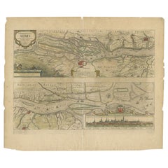
Antique Map of the Course of the Elbe River by Janssonius, c.1650
By Johannes Janssonius
Located in Langweer, NL
Antique map titled 'Nobilis Flubius Albis (..)'. Old map of the course of the Elbe river, large inset view of the city of Hamburg. Source unknown, to be determined.
Artists and En...
Category
Antique 17th Century Maps
Materials
Paper
$425 Sale Price
20% Off
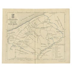
Antique Map of the Ferwerderadeel Township by Behrns, 1861
Located in Langweer, NL
Antique map titled 'Ferwerderadeel'. Old map depicting the Ferwerderadeel township including cities and villages like Ferwerd, Marrum, Hallum, Wanswerd and Hijum. This map orginates ...
Category
Antique 19th Century Maps
Materials
Paper
$85 Sale Price
20% Off
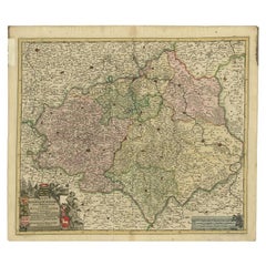
Antique Map of the Duchy of Saxony by De Wit, c.1680
Located in Langweer, NL
Antique map titled 'Circuli Saxoniae Superior Pars Meridionalis in qua sunt Ducatus Saxoniae, Comitatus Mansfeldiae, et Voitlandiae, Landgraviat Thuringiae, Marchionatus Misniae Prin...
Category
Antique 17th Century Maps
Materials
Paper
$687 Sale Price
20% Off
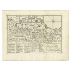
Antique Map of the Expedition of Govert Knol by Van Schley, 1765
By Jakob van der Schley
Located in Langweer, NL
Antique map titled 'Plan de l' expédition de Mr. le Commiss. re Govert Knol, forti de Soerabaja, pour aller recévoir Pangerang Depati Anom. / Aftékening der Expeditie van de H. r Commiss. is Govert Knol , uyt Soerabaya , tot afhaalinge van Pangerang Depati Anom'. Map showing the expedition...
Category
Antique 18th Century Maps
Materials
Paper
$114 Sale Price
20% Off
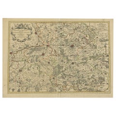
Antique Map of the County of Hainaut by Jaillot, 1692
Located in Langweer, NL
Antique map titled 'Le Comté de Haynaut divisé en Chateliensis, Balliages, Prevoste's (..)'. Large map of the county of Hainaut (France) with its most important cities, Mons (Bergen)...
Category
Antique 17th Century Maps
Materials
Paper
$212 Sale Price
20% Off
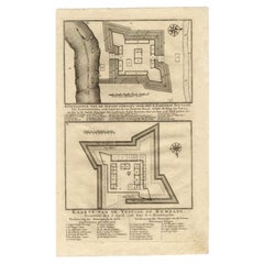
Antique Map of the Fortress of Captain E. Bintang by Valentijn, 1726
Located in Langweer, NL
Antique print titled 'Kaarte van de Schans gemaakt door den E. Capitein Bintang. Kaarte van de Vesting op Rembang.' A plan of the fort constructed by the Captain E. Bintang, in the B...
Category
Antique 18th Century Maps
Materials
Paper
$88 Sale Price
20% Off
Antique Map of the East Indies by Walker, c.1840
Located in Langweer, NL
Original antique map of the East Indies including Borneo, Celebes, Java, Sumatra and surrounding islands. Published circa 1840.
Artists and Engravers: Engraved by J. & C. Walker
...
Category
Antique 19th Century Maps
Materials
Paper
$229 Sale Price
20% Off
The Cape Verde Islands Coast Antique Engraving by Van Schley, 1747
Located in Langweer, NL
Antique map titled ‘Carte Exacte de la cote du Cap Verd (..) - Naauwkeurige Kaart van de Kust van Kabo Verde (..)'. Original antique map of the coast of the Cape Verde Islands. This ...
Category
Antique 18th Century Maps
Materials
Paper
$100 Sale Price
20% Off
Antique Map of the Coast of North and East Asia by Diderot, 1751
By Denis Diderot
Located in Langweer, NL
Map 3: 'Nouvelle Representation des Cotes Nord et Est de L'Asie'. (New map of the coast of North and East Asia.) Three maps on one sheet. Depicting three maps centered on mainland Ch...
Category
Antique 18th Century Maps
Materials
Paper
$210 Sale Price
20% Off
Antique Map of the City of Sint-Maartensdijk by Smallegange, c.1696
Located in Langweer, NL
Antique map titled 'St. Maertensdyk'. Original antique map of the city of Sint-Maartensdijk, the Netherlands. Source unknown, to be determined.
Artists and Engravers: Published b...
Category
Antique 17th Century Maps
Materials
Paper
$157 Sale Price
20% Off
Antique Map of the City of Leeuwarden by Harrewijn, 1743
Located in Langweer, NL
Antique map titled 'La Ville de Lewarde'. Old map of the city of Leeuwarden, Friesland. Originates from 'Les Délices des Pays-Bas' by Widow Foppens.
Artists and Engravers: Engrav...
Category
Antique 18th Century Maps
Materials
Paper
$117 Sale Price
20% Off
Antique Map of the City of Zwolle by Guicciardini, 1613
Located in Langweer, NL
Antique map titled 'Swolla'. Map of the city of Zwolle, the Netherlands. This map originates from the 1613 edition of 'Discrittione di tutti i Paesi Bassi', by L. Guicciardini, publi...
Category
Antique 17th Century Maps
Materials
Paper
$205 Sale Price
20% Off
Antique Map of the City of Woerden by Tirion, c.1750
Located in Langweer, NL
Antique map titled 'Nieuwe Grondtekening van de Stad Woerden'. Plan of the city of Woerden, the Netherlands. Published circa 1750.
Artists and Engravers: Published by I. Tirion. ...
Category
Antique 18th Century Maps
Materials
Paper
$119 Sale Price
20% Off
Antique Map of the City of Zutphen, c.1650
Located in Langweer, NL
Antique map titled 'Zutphen'. Uncommon original antique map of the city of Zutphen, the Netherlands. Source unknown, to be determined.
Artists and Engravers: Anonymous.
Conditi...
Category
Antique 17th Century Maps
Materials
Paper
$223 Sale Price
20% Off
Antique Map of the Coast of Artois by Janssonius, 1657
By Johannes Janssonius
Located in Langweer, NL
Antique map of France titled 'Descriptio Boloniae, Pontieu'. Detailed map of the coast of Artois featuring the fortified cities of St. Valery-sur-Somme, Le Crotoy, Rue, Estaples, and...
Category
Antique 17th Century Maps
Materials
Paper
$305 Sale Price
20% Off
Antique Map of the City of Ypres by Beaulieu, 1729
Located in Langweer, NL
Antique map titled 'Plan de la Ville d'Ipren/Plan der Stadt Ipren'. Map of the city of Ieper/Ypres in Belgium. This map originates from 'Histoire Militaire du Prince Eugene de Savoye...
Category
Antique 18th Century Maps
Materials
Paper
$212 Sale Price
20% Off
Antique Map of the City of Leeuwarden and Franeker by Braun & Hogenberg, 1580
Located in Langweer, NL
Antique map titled 'Lewardum Occidentlis Frisiae Opp: 1580, Franicher Nobiliu hominum, in Frisia Occidentali, ut plurimum saedes'. This sheet contains two very detailed bird’s-eye pl...
Category
Antique 16th Century Maps
Materials
Paper
$310 Sale Price
20% Off
Antique Map of the City of Muiden by Merian, 1659
Located in Langweer, NL
Antique map titled 'Muyden'. Original antique map of the city of Muiden, the Netherlands. This map originates from 'Topographia Germania Inferioris' by C. Merian. Published 1659.
...
Category
Antique 17th Century Maps
Materials
Paper
$148 Sale Price
20% Off
Antique Map of the City of Leeuwarden by Merian, 1659
Located in Langweer, NL
Antique map titled 'Leurwaerden'. This print depicts the city of Leeuwarden (Friesland, The Netherlands). This print originates from 'Topographia Germaniae Inferioris (..)' by C. Mer...
Category
Antique 17th Century Maps
Materials
Paper
$76 Sale Price
20% Off
Antique Map of the City of Zutphen by Guicciardini, 1612
Located in Langweer, NL
Antique map Zutphen titled 'Zutphen'. This map depicts the city of Zutphen, Gelderland, The Netherlands. Originates from 'Beschryvinghe van alle de Neder-landen anderssins ghenoemt N...
Category
Antique 17th Century Maps
Materials
Paper
$179 Sale Price
20% Off
Antique Map of the City of Stavoren by Merian, 1659
Located in Langweer, NL
Antique map titled 'Staveren'. Original antique map of the city of Stavoren, Friesland, the Netherlands. This map originates from 'Topographia Germania Inferioris' by C. Merian. Publ...
Category
Antique 17th Century Maps
Materials
Paper
$148 Sale Price
20% Off
Antique Map of the City of Sneek by Blaeu, 1649
Located in Langweer, NL
Antique map Friesland titled 'Sneeck'. Bird's-eye view plan of Sneek, the Netherlands. This map originates from 'Toneel der Steeden' published by Joan Blaeu, 1649.
Artists and Eng...
Category
Antique 17th Century Maps
Materials
Paper
$417 Sale Price
20% Off
Antique Map of the City of Leeuwarden by Merian, 1659
Located in Langweer, NL
Antique map titled 'Leurwaerden'. This print depicts the city of Leeuwarden (Friesland, The Netherlands). This print originates from 'Topographia Germaniae Inferioris (..)' by C. Mer...
Category
Antique 17th Century Maps
Materials
Paper
$141 Sale Price
20% Off
Antique Map of the Coast of Juan Fernandez by Van Schley, 1757
Located in Langweer, NL
Antique map titled 'Cote du Nord Est de l'Isle de Juan Fernandez (..).' Map of the Chilean South Pacific archipelago of the Juan Fernandez Islands. This island was made famous by Dan...
Category
Antique 18th Century Maps
Materials
Paper
$136 Sale Price
20% Off
Antique Map of the City of Roermond by Guicciardini, 1613
Located in Langweer, NL
Antique map titled ‚Ruremunda Gelriae Opp‘. Plan of Roermond in the province of Limburg, The Netherlands, Holland. This map originates from the 1613 edition of 'Discrittione di tutti...
Category
Antique 17th Century Maps
Materials
Paper
$212 Sale Price
20% Off
Antique Map of the City of Zutphen by Guicciardini, 1613
Located in Langweer, NL
Antique map Zutphen titled 'Zutphen'. This map depicts the city of Zutphen, Gelderland, The Netherlands. Originates from 'Discrittione di tutti i Paesi Bassi'.
Artists and Engrav...
Category
Antique 17th Century Maps
Materials
Paper
$160 Sale Price
20% Off
Antique Map of the Coast of Southwest Asia by Kitchin, c.1770
By Thomas Kitchin
Located in Langweer, NL
Antique map titled 'Chart of the Coast of Persia, Malabar & c'. Antique map of the coast of Southwest Asia. It shows the Maldives and part of Persia and India. Published for the 'Lon...
Category
Antique 18th Century Maps
Materials
Paper
$107 Sale Price
20% Off
Antique Map of the Coast of China by Bellin, 1752
By Jacques-Nicolas Bellin
Located in Langweer, NL
Antique map titled 'Carte des Costes de Cochinchine, Tunquin et Partie de celles de Chine'. Detailed map of the region from the Cambodia River to Macao, along the coast of China.
...
Category
Antique 18th Century Maps
Materials
Paper
$105 Sale Price
20% Off
Antique Map of the City of Leeuwarden by Bast, 1603
Located in Langweer, NL
Antique map titled 'Leeuwerden de hooft stadt van Frislant. Leoverdia Metropolis Frisiae (…) 1603.' Very rare plan of Leeuwarden, Friesland, The Netherlands. With several carouches a...
Category
Antique 17th Century Maps
Materials
Paper
$2,602 Sale Price
20% Off
Antique Map of the City of Leeuwarden by Priorato, 1673
Located in Langweer, NL
Antique map titled 'Leverden'. This map depicts the city of Leeuwarden (Friesland, The Netherlands). This original antique print originates from 'Teatro del Belgio (…)', published in...
Category
Antique 17th Century Maps
Materials
Paper
$114 Sale Price
20% Off
Antique Map of the City of Oudewater by Merian, 1659
Located in Langweer, NL
Antique map titled 'Oudewater'. Plan of the city of Oudewater, the Netherlands. This map originates from 'Topographia Germania Inferioris' by C. Merian, 1659.
Artists and Engraver...
Category
Antique 17th Century Maps
Materials
Paper
$90 Sale Price
20% Off
Antique Map of the City of Leeuwarden by Christyn, 1785
Located in Langweer, NL
Antique map titled 'La Ville de Lewarde'. Old map of the city of Leeuwarden, Friesland. Originates from 'Les Délices des Pays-Bas' by J.B. Christyn.
Artists and Engravers: Author:...
Category
Antique 18th Century Maps
Materials
Paper
$108 Sale Price
20% Off
Antique Map of the City of Verdun by Merian, c.1650
Located in Langweer, NL
Antique map titled 'Verdun'. Orginal antique map of Verdun, a small city in the Meuse department in Grand Est in northeastern France. This map originates from 'Topographia Germaniae'...
Category
Antique 17th Century Maps
Materials
Paper
$56 Sale Price
20% Off
Antique Map of the City of Leeuwarden, The Netherlands, by Guicciardini, 1612
Located in Langweer, NL
Antique map titled 'Lewardum Occidentalis Frisia Opp'. Plan of the city of Leeuwarden, in the province of Friesland, the Netherlands. This map originates from 'Beschryvinghe van alle...
Category
Antique 17th Century Maps
Materials
Paper
Antique Map of the City of Sneek by Blaeu, 1652
Located in Langweer, NL
Antique map titled: 'Sneeck.' Bird's-eye view plan of Sneek, Friesland, The Netherlands. From a Latin edition of the town atlas 'Toneel der Steden', published by Joan Blaeu, Amsterda...
Category
Antique 17th Century Maps
Materials
Paper
$332 Sale Price
20% Off
Handcolored Rare Map of Leeuwarden, Capital of Friesland, The Netherlands, 1622
Located in Langweer, NL
Antique map titled 'Leeuwerden de Hooftstadt van Vrieslandt'. Rare and old map of the city of Leeuwarden, Friesland.
Artists and Engravers: Published by Pieter Feddes van Harlingen...
Category
Antique 17th Century Maps
Materials
Paper
Antique Map of the Coast of Southern Brazil by Bellin, c.1755
By Jacques-Nicolas Bellin
Located in Langweer, NL
Antique map titled ‘Suite de Bresil’. Map of the coast of southern Brazil, with Lagoa Mirim, and Uruguay (here named as Paraguay). This print originates from 'Histoire générale des V...
Category
Antique 18th Century Maps
Materials
Paper
$93 Sale Price
20% Off
Antique Map of the City of Tiel by Blaeu, 1649
Located in Langweer, NL
Antique map titled 'Tyel'. Beautiful map of the city of Tiel, The Netherlands. With a coat of arms and key of various locations. Originates from 'Toneel der Steeden' published by Joa...
Category
Antique 17th Century Maps
Materials
Paper
$571 Sale Price
20% Off
Antique Map of the City of Leeuwarden by Guicciardini, 1613
Located in Langweer, NL
Antique map tited 'Lewardum'. Plan of the city of Leeuwarden, Friesland, the Netherlands. This map originates from the 1613 edition of 'Discrittione di tutti i Paesi Bassi', by L. Gu...
Category
Antique 17th Century Maps
Materials
Paper
$136 Sale Price
20% Off
Antique Map of the City of Workum by Merian, 1654
Located in Langweer, NL
Antique map titled 'Worcum'. Old map of the city of Workum, Friesland. Originates from 'Topographia Germaniæ Inferioris' by C. Merian.
Artists and Engravers: Caspar Merian (1627-1...
Category
Antique 17th Century Maps
Materials
Paper
$69 Sale Price
20% Off
Antique Map of the City of Oldenzaal by Orlers, 1615
Located in Langweer, NL
Antique map depicting the Siege of Oldenzaal, the Netherlands. The Siege of Oldenzaal was a short siege that took place during the Eighty Years' War and the Anglo–Spanish War by a Du...
Category
Antique 17th Century Maps
Materials
Paper
$175 Sale Price
20% Off
Antique Map of the Coast of Northwest Africa by Dien, 1820
Located in Langweer, NL
Antique map Africa titled 'Partie Occidentale de l'Ancien Continent, depuis Lisbonne jusquá la Riviere de Sierra Leona'. Detailed map of Coastal Nor...
Category
Antique 19th Century Maps
Materials
Paper
$117 Sale Price
20% Off
Antique Map of the City of Leeuwarden by Leti, 1690
Located in Langweer, NL
Antique map titled 'Leovardia.' A plan of Leeuwarden in Friesland, the Netherlands. With two coats of arms, the title in a scroll and an index of 30 buildings in the lower right. Fro...
Category
Antique 17th Century Maps
Materials
Paper
$638 Sale Price
20% Off
Antique Map of the Coast of Kerguelens Island by Cook, 1803
Located in Langweer, NL
Antique map Desolation Islands titled 'Van Kerguelens Land door Cook genaamd (..)'. Antique map of Kerguelens island coast, known today as the Desolation islands. Originates from 'Re...
Category
Antique 19th Century Maps
Materials
Paper
$293 Sale Price
20% Off
Antique Map of the City of Muiden by Merian, 1659
Located in Langweer, NL
Antique map titled 'Muyden'. Original antique map of the city of Muiden, the Netherlands. This map originates from 'Topographia Germania Inferioris' by C. Merian. Published 1659.
...
Category
Antique 17th Century Maps
Materials
Paper
$107 Sale Price
20% Off
Antique Map of the City of Rotterdam by Guicciardini, C.1600
Located in Langweer, NL
Antique map titled 'Rotterdam'. Bird's eye view plan of Rotterdam in the province of Zuid-Holland, The Netherlands, Holland. This map originates from one of the editions of 'Discritt...
Category
Antique 17th Century Maps
Materials
Paper
$377 Sale Price
20% Off
Antique Map of the City of Workum by Blaeu, 1649
Located in Langweer, NL
Antique map titled 'Worckum'. Old map of the city of Workum, Friesland. Originates from J. Blaeu's 'Town Book'.
Artists and Engravers: Joan Blaeu (23 September 1596 - 28 May 1673...
Category
Antique 17th Century Maps
Materials
Paper
$124 Sale Price
20% Off
Antique Map of the Coast of Guinea, Africa, c.1780
Located in Langweer, NL
Antique map Africa titled 'Carte de la Haute et de la Basse Guinée'. Map of the Coast of Guinea, Africa. Represents modern day Liberia, Ivory Coast, Ghana, Nigeria, Cameroon, Gabon, Congo, and Equatorial Guinea...
Category
Antique 18th Century Maps
Materials
Paper
$151 Sale Price
20% Off
Antique Map of the City of Gorinchem by Merian, 1659
Located in Langweer, NL
Antique map titled 'Gorckum'. This print depicts the city of Gorinchem (or Gorcum/Gorkum, The Netherlands). This print originates from 'Topographia Germaniae Inferioris (..)' by C. M...
Category
Antique 17th Century Maps
Materials
Paper
$94 Sale Price
20% Off
Antique Map of the City of Dokkum by Blaeu, c.1650
Located in Langweer, NL
Antique map titled 'Dockum'. Large map of the city of Dokkum, Friesland, The Netherlands. Originates from 'Toneel der Steden', published by Joan Blaeu, Amsterdam. Artists and Engrave...
Category
Antique 17th Century Maps
Materials
Paper
Antique Map of the City of Groningen by Merian, 1659
Located in Langweer, NL
Antique map titled 'Gröningen'. This print depicts the city of Groningen, the Netherlands. This print originates from 'Topographia Germaniae Inferioris (..)' by C. Merian.
Artist...
Category
Antique 17th Century Maps
Materials
Paper
$87 Sale Price
20% Off
Antique Map of the City of Franeker by Blaeu, 1652
Located in Langweer, NL
Antique map titled 'Franekera'. Old map of the city of Franeker, Friesland. Also shows two cartouches, coats of arms and legend. This map originates from a Latin edition of the town ...
Category
Antique 17th Century Maps
Materials
Paper
$308 Sale Price
20% Off
Antique Map of the City of Hindeloopen by Braun & Hogenberg, c.1598
Located in Langweer, NL
Antique map titled 'Hindelopia'. Original antique map of the city of Hindeloopen, Friesland, the Netherlands. Originally published on one sheet together with other Frisian cities, trimmed. This print originates from the town atlas by Braun and Hogenberg...
Category
Antique 16th Century Maps
Materials
Paper
Antique Map of the City of Arnhem by Guicciardini, 1613
Located in Langweer, NL
Antique map titled ?Arnhemium Gelriae in Ripa Rheni Opp?. Plan of Arnhem in the province of Gelderland, The Netherlands, Holland. This map originates from the 1613 edition of 'Discri...
Category
Antique 17th Century Maps
Materials
Paper
$181 Sale Price
20% Off
Antique Map of the City of Goch by Blaeu, 1649
Located in Langweer, NL
Antique map titled 'Gochum vernacule Goch'. Old map of the city of Goch, Germany. This map originates from 'Novum Ac Magnum Theatrum Urbium Belgicæ Liberæ ac Foederatæ' by J. Blaeu. ...
Category
Antique 17th Century Maps
Materials
Paper
$404 Sale Price
20% Off
Antique Map of the Cities of the Province of Quey-Chew by Basire, 1738
Located in Langweer, NL
Antique print titled 'Cities of the Province of Quey-Chew'. Old map depicting four walled cities of the Chinese Qing dynasty province of Quey-Chew (modern day Guizhou) in S.W. China:...
Category
Antique 18th Century Maps
Materials
Paper
$194 Sale Price
20% Off
Antique Map of the Cities of the Province of Shen-Si by Basire, 1738
Located in Langweer, NL
Antique print titled 'Cities of the Province of Shen-Si'. Old map depicting four walled cities of the Chinese Qing dynasty province of Shen-si (modern day SHAANXI): Si-ngan-fu, Chwan...
Category
Antique 18th Century Maps
Materials
Paper
$194 Sale Price
20% Off
Antique Map of the Circle of Franconia by Homann, c.1703
Located in Langweer, NL
Antique map titled 'Circuli Franconiae pars Occidentalis, exhibes simul integrum fere Electoratum Moguntinum (..)'. Antique map centered on Nuremberg and Bamberg. Extends from the Do...
Category
Antique 18th Century Maps
Materials
Paper
$420 Sale Price
20% Off
Antique Map of the City of Enkhuizen by Merian, 1659
Located in Langweer, NL
Antique map titled 'Enckhuysen'. This print depicts the city of Enkhuizen, the Netherlands. This print originates from 'Topographia Germaniae Inferioris (..)' by C. Merian. Artists a...
Category
Antique 17th Century Maps
Materials
Paper
$117 Sale Price
20% Off
Antique Map of the City of Franeker by Janssonius, 1657
By Johannes Janssonius
Located in Langweer, NL
Antique map titled ‘Franekera‘. This map depicts the city of Franeker (Friesland, The Netherlands). Published by J. Janssonius, Amsterdam, 1657.
Artists and Engravers: Johannes Jans...
Category
Antique 17th Century Maps
Materials
Paper
