Items Similar to Antique Map of the City of Oldenzaal by Orlers, 1615

Want more images or videos?
Request additional images or videos from the seller
1 of 5
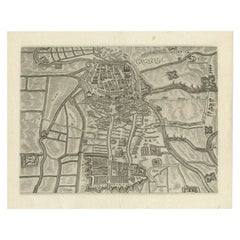
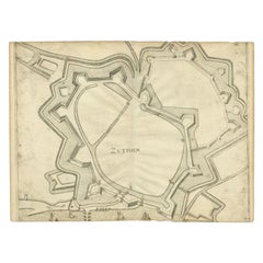
Antique Map of the City of Oldenzaal by Orlers, 1615
About the Item
Antique map depicting the Siege of Oldenzaal, the Netherlands. The Siege of Oldenzaal was a short siege that took place during the Eighty Years' War and the Anglo–Spanish War by a Dutch and English army led by Maurice of Orange of the city of Oldenzaal from 20 to 23 October 1597. The city surrendered to the overwhelming Dutch and English force. The siege was part of Maurice's Campaign of 1597 known as the Ten Glory Years, his highly successful offensive against the Spaniards. This map originates from 'La genealogie des illustres Comtes de Nassau' by Jan Jansz. Orlers.
Artists and Engravers: Jan Janszoon Orlers (1570 - 1646), Dutch historian.
Condition: Good, age-related toning. Please study image carefully.
Date: 1615
Overall size: 37 x 31 cm.
Image size: 31 x 22 cm.
We sell original antique maps to collectors, historians, educators and interior decorators all over the world. Our collection includes a wide range of authentic antique maps from the 16th to the 20th centuries. Buying and collecting antique maps is a tradition that goes back hundreds of years. Antique maps have proved a richly rewarding investment over the past decade, thanks to a growing appreciation of their unique historical appeal. Today the decorative qualities of antique maps are widely recognized by interior designers who appreciate their beauty and design flexibility. Depending on the individual map, presentation, and context, a rare or antique map can be modern, traditional, abstract, figurative, serious or whimsical. We offer a wide range of authentic antique maps for any budget.
- Dimensions:Height: 12.21 in (31 cm)Width: 14.57 in (37 cm)Depth: 0 in (0.01 mm)
- Materials and Techniques:
- Period:
- Date of Manufacture:1615
- Condition:
- Seller Location:Langweer, NL
- Reference Number:
About the Seller
5.0
Platinum Seller
These expertly vetted sellers are 1stDibs' most experienced sellers and are rated highest by our customers.
Established in 2009
1stDibs seller since 2017
1,933 sales on 1stDibs
Typical response time: <1 hour
- ShippingRetrieving quote...Ships From: Langweer, Netherlands
- Return PolicyA return for this item may be initiated within 14 days of delivery.
More From This SellerView All
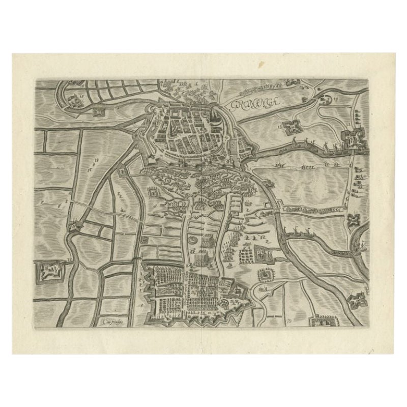
- Antique Map of the City of Groningen by Orlers, 1615Located in Langweer, NLAntique map titled 'Gronenga'. Map of the city of Groningen, the Netherlands. This map originates from 'La genealogie des illustres Comtes de Nassau' by Jan Jansz. Orlers. Artists...Category
Antique 17th Century Maps
MaterialsPaper
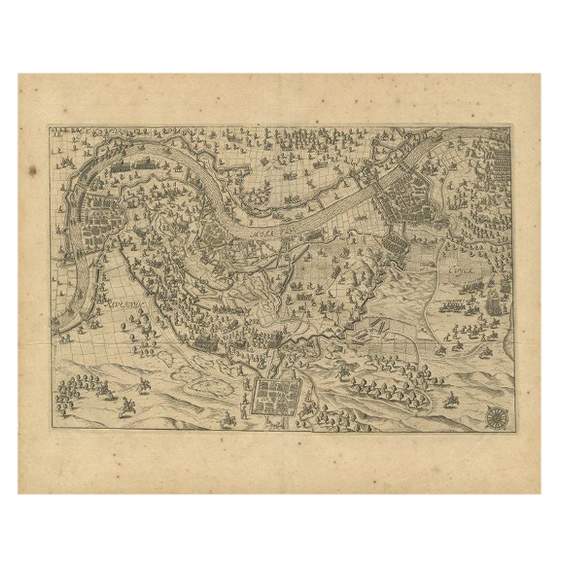
- Antique Map of the Region of Grave by Orlers, 1615Located in Langweer, NLAntique map of the region of Grave, also including Cuijk and Ravestein. This map originates from 'La genealogie des illustres Comtes de Nassau' by Jan Jansz. Orlers. Artists and E...Category
Antique 17th Century Maps
MaterialsPaper
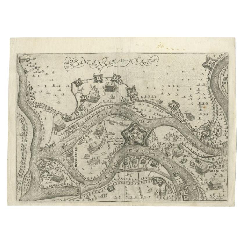
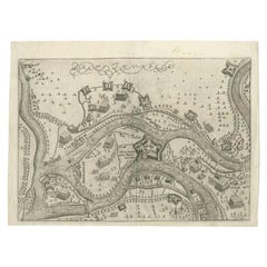
- Antique Map of St. Andries 'Heerewaarden' by Orlers, 1615Located in Langweer, NLAntique map titled 'Prata Inundata'. This map depicts the area between the Maas and Waal river (The Netherlands) during the siege of St. Andries and Voorne under command of prince Ma...Category
Antique 17th Century Maps
MaterialsPaper
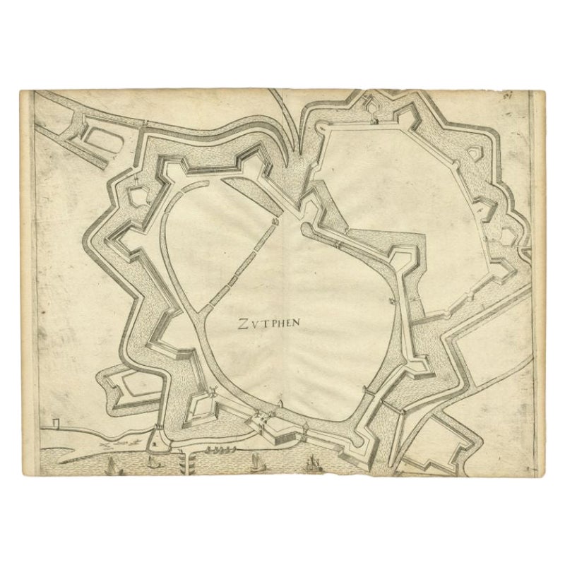
- Antique Map of the City of Zutphen, c.1650Located in Langweer, NLAntique map titled 'Zutphen'. Uncommon original antique map of the city of Zutphen, the Netherlands. Source unknown, to be determined. Artists and Engravers: Anonymous. Conditi...Category
Antique 17th Century Maps
MaterialsPaper
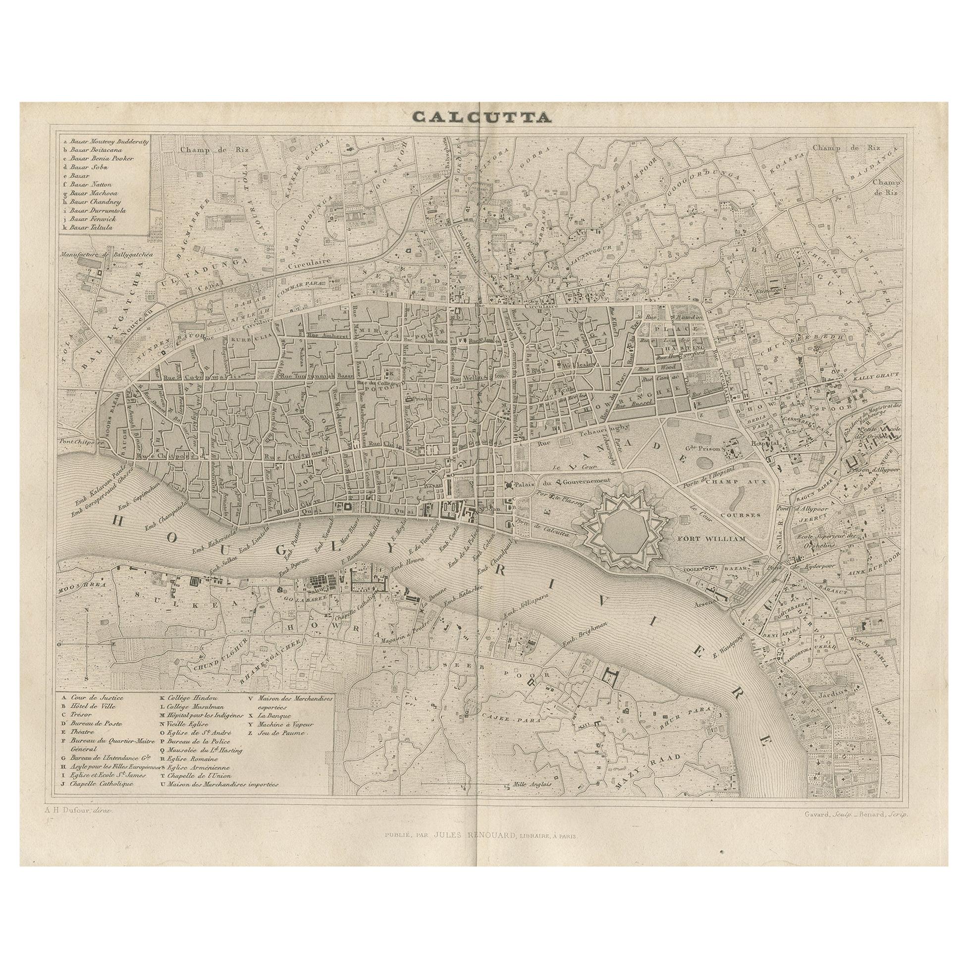
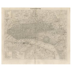
- Antique Map of the City of Kolkata by Balbi '1847'Located in Langweer, NLAntique map titled 'Calcutta'. Original antique map of the city of Kolkata, India. This map originates from 'Abrégé de Géographie (..)' by Adrien Balbi. Published 1847.Category
Antique Mid-19th Century Maps
MaterialsPaper
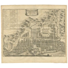
- Antique Map of the City of Ambon by Valentijn, 1726By F. ValentijnLocated in Langweer, NLAntique map titled 'De Platte Grond van Amboina zoo als het was in den Jaare, 1718'. Antique map depicting the City of Ambon, Indonesia. This print originates from 'Oud en Nieuw Oost...Category
Antique Early 18th Century Dutch Maps
MaterialsPaper
You May Also Like
- 1840 Map of the City of Washington Published by William M. MorrisonLocated in Colorado Springs, COThis map, printed in 1840, is a detailed representation of Washington, D.C. in the mid-19th century. The map shows block numbers, wards, and government buildings as well as details o...Category
Antique 1840s American Federal Maps
MaterialsPaper
- Antique Map of American Cities, Vignette of New York City, circa 1920Located in St Annes, LancashireGreat maps of American Cities Unframed Original color By John Bartholomew and Co. Edinburgh Geographical Institute Published, circa 1920Category
Vintage 1920s British Maps
MaterialsPaper
- 1861 Topographical Map of the District of Columbia, by Boschke, Antique MapLocated in Colorado Springs, COPresented is an original map of Albert Boschke's extremely sought-after "Topographical Map of the District of Columbia Surveyed in the Years 1856 ...Category
Antique 1860s American Historical Memorabilia
MaterialsPaper
- Original Antique Map / City Plan of Brussels by Tallis, circa 1850Located in St Annes, LancashireGreat map of Brussels. Steel engraving. Published by London Printing & Publishing Co. (Formerly Tallis), C.1850 Free shipping.Category
Antique 1850s English Maps
MaterialsPaper
- Italian Parchment Map of the City of Lucca Dated 1640By Matthäus Merian the ElderLocated in Roma, ITAn antique map of the Tuscan city of Lucca engraved for The 'Itinerarium Italiæ Nov-antiquæ' by Matthäus Merian the Elder and printed in 1640...Category
Antique 1640s Italian Maps
MaterialsParchment Paper, Paper
- Italian Parchment Map of the City of Pisa Dated, 1640By Matthäus Merian the ElderLocated in Roma, ITAn antique map of the Tuscan city of Pisa engraved for The 'Itinerarium Italiæ Nov-antiquæ' by Matthäus Merian the Elder and printed in 1640....Category
Antique 1640s Italian Maps
MaterialsPaper


Recently Viewed
View AllMore Ways To Browse
City Used Office Furniture
La Place Antiques
Jans Antiques
Antique English 17th Century
16th Century English Antique
Siege Of
Spanish Antiques 17th Century
Maurice Antiques
Siege Antique
Spanish Netherlands
Anglo Dutch Furniture
Anglo Dutch
Antique Maps Spain
Antique Spain Map
Antique Map Spain
Spain Antique Map
Antique Maps Of Spain
Antique Map Of Spain