Items Similar to 1579 Ornate Map of Burgundy County by Ferdinand de Lannoy


Want more images or videos?
Request additional images or videos from the seller
1 of 7
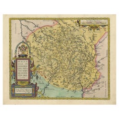
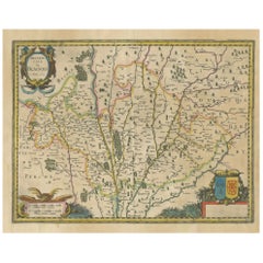
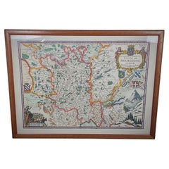
1579 Ornate Map of Burgundy County by Ferdinand de Lannoy
$948.61
$1,185.7620% Off
£702.97
£878.7220% Off
€792
€99020% Off
CA$1,295.03
CA$1,618.7920% Off
A$1,440.67
A$1,800.8420% Off
CHF 755.22
CHF 944.0220% Off
MX$17,604.65
MX$22,005.8120% Off
NOK 9,616.76
NOK 12,020.9420% Off
SEK 9,052.85
SEK 11,316.0620% Off
DKK 6,030.22
DKK 7,537.7720% Off
Shipping
Retrieving quote...The 1stDibs Promise:
Authenticity Guarantee,
Money-Back Guarantee,
24-Hour Cancellation
About the Item
1579 Ornate Map of Burgundy County by Ferdinand de Lannoy
Description of the Map:
This is a beautifully detailed map of the Burgundy region, titled "Bvrgvndiae Comitatus Recentiss. Descriptio," created by Ferdinand de Lannoy and published in 1579. The map is an original and a fine example of Renaissance cartography, with its rich, hand-colored details showing cities, rivers, and topographical features. It includes parts of neighboring regions such as Lotharingiae (Lorraine) and parts of Helvetia (Switzerland), indicating its extensive coverage. The map is adorned with a decorative title cartouche and a striking coat of arms, enhancing its visual appeal.
Maker:
Ferdinand de Lannoy, though not as widely known as Ortelius, contributed significantly to the cartographic representations of European regions during the Renaissance. His maps are valued for their artistic merit and accuracy.
Year of Publication: 1579.
Collectors might be particularly interested in the depiction of Burgundy due to its historical importance and the aesthetic qualities of the map. The inclusion of parts of Lorraine and Switzerland might also appeal to those interested in these areas.
Condition of the Map:
The map appears to be in very good condition, considering its age. The colors are vibrant, suggesting careful preservation, and there are no visible major tears or water damage. The paper shows typical signs of aging like slight yellowing, which adds to the authenticity and charm of this antique piece.
This map would appeal to collectors who are interested in the historical and geographical aspects of Burgundy, as well as the artistic and cartographic style of the late 16th century.
- Dimensions:Height: 17.13 in (43.5 cm)Width: 21.66 in (55 cm)Depth: 0 in (0.02 mm)
- Materials and Techniques:Paper,Engraved
- Period:
- Date of Manufacture:1579
- Condition:Condition: Good, given age. General age-related toning and minor defects from handling, mainly around the borders. One old repair with tape on the bottom but outside the plate-mark. Please study scans carefully.
- Seller Location:Langweer, NL
- Reference Number:Seller: BG-13644-31stDibs: LU3054341305172
About the Seller
5.0
Recognized Seller
These prestigious sellers are industry leaders and represent the highest echelon for item quality and design.
Platinum Seller
Premium sellers with a 4.7+ rating and 24-hour response times
Established in 2009
1stDibs seller since 2017
2,502 sales on 1stDibs
Typical response time: <1 hour
- ShippingRetrieving quote...Shipping from: Langweer, Netherlands
- Return Policy
Authenticity Guarantee
In the unlikely event there’s an issue with an item’s authenticity, contact us within 1 year for a full refund. DetailsMoney-Back Guarantee
If your item is not as described, is damaged in transit, or does not arrive, contact us within 7 days for a full refund. Details24-Hour Cancellation
You have a 24-hour grace period in which to reconsider your purchase, with no questions asked.Vetted Professional Sellers
Our world-class sellers must adhere to strict standards for service and quality, maintaining the integrity of our listings.Price-Match Guarantee
If you find that a seller listed the same item for a lower price elsewhere, we’ll match it.Trusted Global Delivery
Our best-in-class carrier network provides specialized shipping options worldwide, including custom delivery.More From This Seller
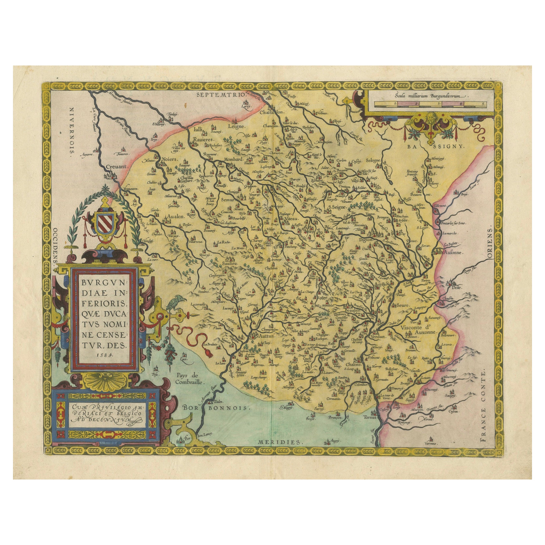
View All1584 Abraham Ortelius Map of Lower Burgundy, France
Located in Langweer, NL
1584 Abraham Ortelius Map of Lower Burgundy, France
Description of the Map:
This antique map by Abraham Ortelius, titled "Bvrgvndiae Inferioris Qvae Dvcatvs Nomine Censetur Des," w...
Category
Antique 16th Century Maps
Materials
Paper
$1,216 Sale Price
20% Off
Antique Map of the Picardy Region of France by Ortelius, 'circa 1590'
Located in Langweer, NL
Antique map titled 'Picardiae Belgicae regionis descriptio'. Original antique map of the Picardy region, France. Published by A. Ortelius, circa 1590.
Category
Antique 16th Century Maps
Materials
Paper

$574 Sale Price
20% Off
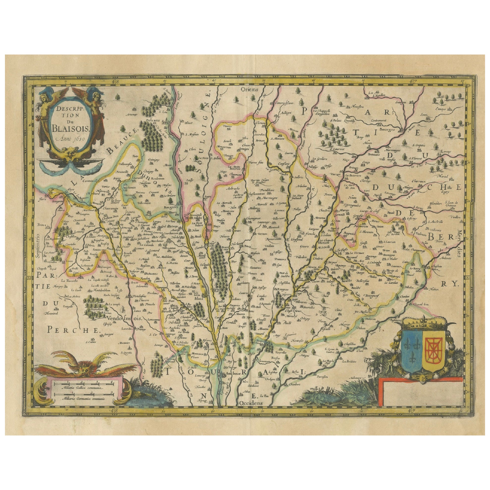
Antique Map of the Region of Blois by Janssonius, 'circa 1640'
By Johannes Janssonius
Located in Langweer, NL
Antique map titled 'Description du Blaisois'. Old map of the region of Blois, France. It shows the city of Blois, Amboise, the Loire River and more. Published by J. Janssonius, circa...
Category
Antique Mid-17th Century Maps
Materials
Paper

$389 Sale Price
35% Off
Map of Blaisois by Janssonius, 1633, Decorative Antique Map of Loire Valley
Located in Langweer, NL
Map of Blaisois by Janssonius, 1633, Decorative Antique Map of Loire Valley
This finely detailed and colorfully embellished map titled 'Description du Blaisois' was published in 163...
Category
Antique 1630s Maps
Materials
Paper
Antique Map of the Hainaut and Namur Region by Janssonius, 'circa 1640'
By Johannes Janssonius
Located in Langweer, NL
Antique map titled 'Comitatuum Hannoniae et Namurci Descriptio'. Old map of the region of Hainaut and Namur, France. Published by J. Janssonius, circa 1640.
Category
Antique Mid-17th Century Maps
Materials
Paper

$479 Sale Price
20% Off
Antique Map of the Region of Île-de-France by Hondius, circa 1630
Located in Langweer, NL
Antique map titled Gouvernement de l'Isle de France'. Old map of the region of Île-de-France, France. It is located in the north-central part of the country and often called the régi...
Category
Antique Mid-17th Century Maps
Materials
Paper

$527 Sale Price
20% Off
You May Also Like
1625 Mercator Map of the Provenience of Quercy, "Quercy Cadvrcivm Ric.0013
Located in Norton, MA
1625 Mercator map of the provenience of Quercy, entitled
"Quercy Cadvrcivm,"
Ric.0013
" Authentic" - Map of the provenience of Quercy Cadvrcivm
D...
Category
Antique 17th Century French Maps
Materials
Paper

Vintage 20th Century Engraving of a Map of Duchy of Burgundy and County - 2Y442
Located in Bordeaux, FR
This vintage 20th-century engraving features a detailed map of the Duchy of Burgundy and the County of Bresse, making it an elegant and historical addition to any collection. Measuri...
Category
20th Century Antiquities
Materials
Wood, Paper
1594 Maurice Bouguereau Map of the Region Limoges, France, Ric0015
Located in Norton, MA
1594 Maurice Bouguereau map of the region Limoges, France, entitled
"Totivs Lemovici et Confinium Pro Uinciarum Quantum ad Dioecefin Lemo Uicenfen Fpectant,"
Hand Colored
Ric0015
Jean IV Le Clerc...
Category
Antique 16th Century Dutch Maps
Materials
Paper

1640 Joan Bleau Map Entitled"Diocecese de rheims et le pais de rethel, " Eic.a011
Located in Norton, MA
1640 Joan Bleau map entitled
"Diocecese de rheims et le pais de rethel,"
Ric.a011
OAN BLAEU
Diocecese de Rheims, et le pais de Rethel.
Handcolored engraving, c.1640.
...
Category
Antique 17th Century Dutch Maps
Materials
Paper

1656 Jansson Map Metz Region of France Entitled "Territorium Metense" Ric0014
Located in Norton, MA
1656 Jansson map Metz Region of France entitled "Territorium Metense."
Ric0014
" Authentic" - Map of the historical region surrounding Metz, in Lorraine, France.
Oriented with ...
Category
Antique 17th Century Dutch Maps
Materials
Paper

17th Century Hand-Colored Map of a Region in West Germany by Janssonius
By Johannes Janssonius
Located in Alamo, CA
This attractive highly detailed 17th century original hand-colored map is entitled "Archiepiscopatus Maghdeburgensis et Anhaltinus Ducatus cum terris adjacentibus". It was published ...
Category
Antique Mid-17th Century Dutch Maps
Materials
Paper

More Ways To Browse
Coffee Table Black Italian Modern
Christofle America
Iranian Silk Rug Carpet
Poul Moller
Tables With Inlaid Wood
World War Table
Antonio Jacobsen
Ariston Chairs
Coffee Tables Europe
Marble Top Dining Tables
Nordiska Argentina
Pink And Black Rug
Black Wooden Chair
Orrefors Embassy
Black Ebonized
Elios Chair
Panache Designs
Plata Lappas