Items Similar to 1882 Map of France Highlighting Political Boundaries, Cities, Insets of Corsica


Want more images or videos?
Request additional images or videos from the seller
1 of 8
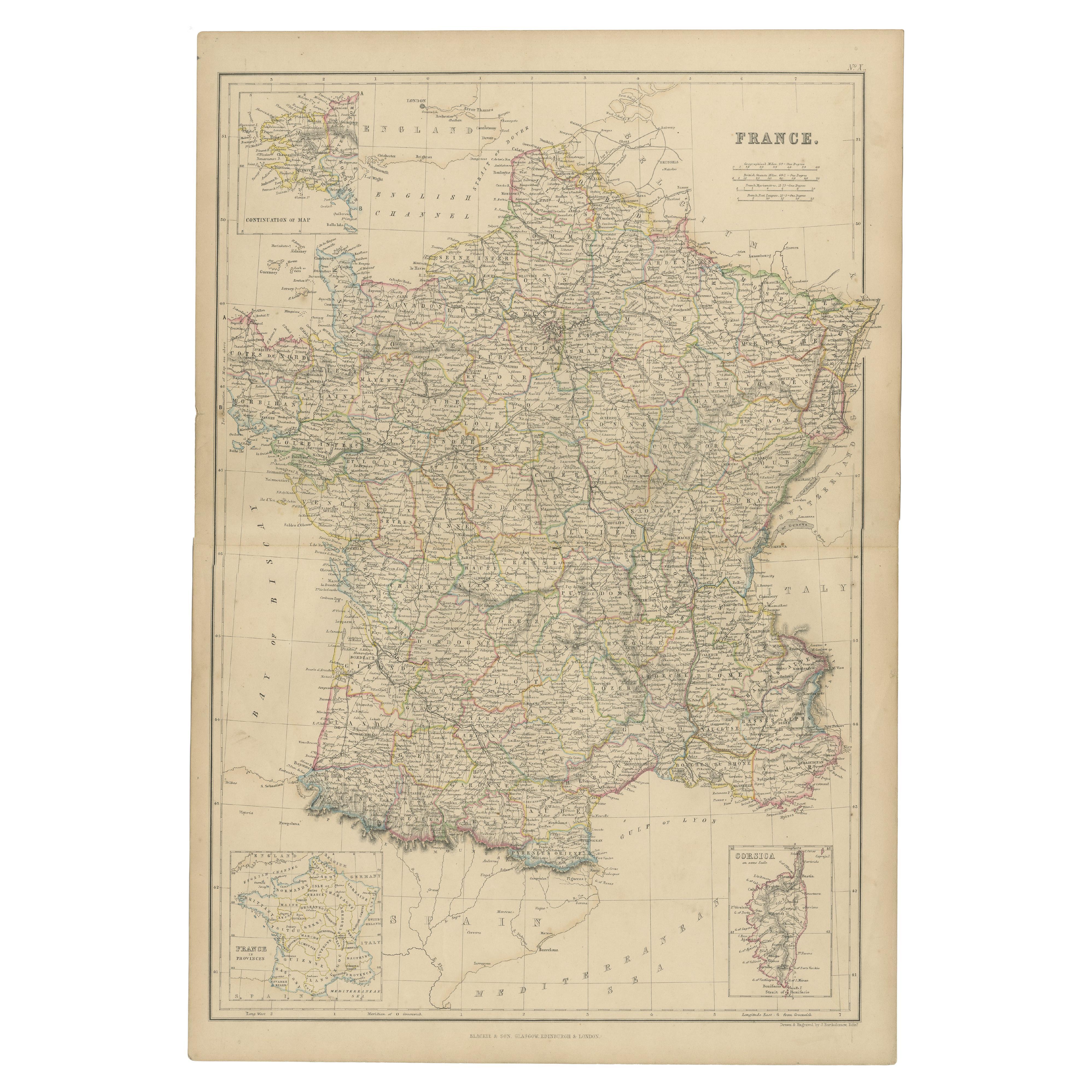
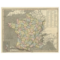
1882 Map of France Highlighting Political Boundaries, Cities, Insets of Corsica
$299.43
£221.90
€250
CA$408.79
A$454.76
CHF 238.39
MX$5,557.02
NOK 3,035.59
SEK 2,857.59
DKK 1,903.48
Shipping
Retrieving quote...The 1stDibs Promise:
Authenticity Guarantee,
Money-Back Guarantee,
24-Hour Cancellation
About the Item
This 1882 map of France, published by Blackie and Son as part of the 'Comprehensive Atlas and Geography of the World,' offers a detailed depiction of the country during the late 19th century. It includes the administrative divisions of France, showing departments and key cities such as Paris, Lyon, Marseille, and Bordeaux. The map also highlights significant transportation routes, including railways and major roads, reflecting the infrastructure development of the time.
Topographical details are meticulously illustrated, with the Pyrenees and Alps mountain ranges clearly marked, as well as river systems like the Seine, Loire, and Rhône. Coastal details along the English Channel, the Atlantic Ocean, and the Mediterranean Sea are carefully drawn, showcasing France’s maritime boundaries. Insets of Corsica and southwestern France provide additional detail, emphasizing the geographic diversity of the country.
Condition report: The map is in good condition, with slight toning and minor spotting typical of its age. The engraving remains crisp, and the pastel coloring used to differentiate departments is vibrant. There are no visible tears or repairs.
Framing tips: Opt for a classic wooden frame with a walnut or dark oak finish to complement the map’s vintage character. Use a double mat with an inner cream or off-white layer to match the paper tone and an outer mat in soft green or beige to enhance the map’s delicate colors. To preserve the map, use UV-protective, anti-reflective glass, ensuring both protection and optimal display for this historical piece.
- Dimensions:Height: 22.45 in (57 cm)Width: 15.36 in (39 cm)Depth: 0 in (0.02 mm)
- Materials and Techniques:
- Period:
- Date of Manufacture:1882
- Condition:Condition report: The map is in good condition with minimal edge wear. Slight toning and occasional spotting are present, consistent with its age. The engraving remains sharp, and the colors are well-preserved. Fold line in middle, as issued.
- Seller Location:Langweer, NL
- Reference Number:Seller: BG-13601-2-211stDibs: LU3054343556492
About the Seller
5.0
Recognized Seller
These prestigious sellers are industry leaders and represent the highest echelon for item quality and design.
Platinum Seller
Premium sellers with a 4.7+ rating and 24-hour response times
Established in 2009
1stDibs seller since 2017
2,494 sales on 1stDibs
Typical response time: 1 hour
- ShippingRetrieving quote...Shipping from: Langweer, Netherlands
- Return Policy
Authenticity Guarantee
In the unlikely event there’s an issue with an item’s authenticity, contact us within 1 year for a full refund. DetailsMoney-Back Guarantee
If your item is not as described, is damaged in transit, or does not arrive, contact us within 7 days for a full refund. Details24-Hour Cancellation
You have a 24-hour grace period in which to reconsider your purchase, with no questions asked.Vetted Professional Sellers
Our world-class sellers must adhere to strict standards for service and quality, maintaining the integrity of our listings.Price-Match Guarantee
If you find that a seller listed the same item for a lower price elsewhere, we’ll match it.Trusted Global Delivery
Our best-in-class carrier network provides specialized shipping options worldwide, including custom delivery.More From This Seller
View AllAntique Map of France, 1903, with Inset of Paris and Corsica
Located in Langweer, NL
Title: Antique Map of France, 1903, with Inset of Paris and Corsica
Description:
This antique map, titled "France," was engraved and published in 1903 by the renowned W. & A.K. John...
Category
Early 20th Century Maps
Materials
Paper

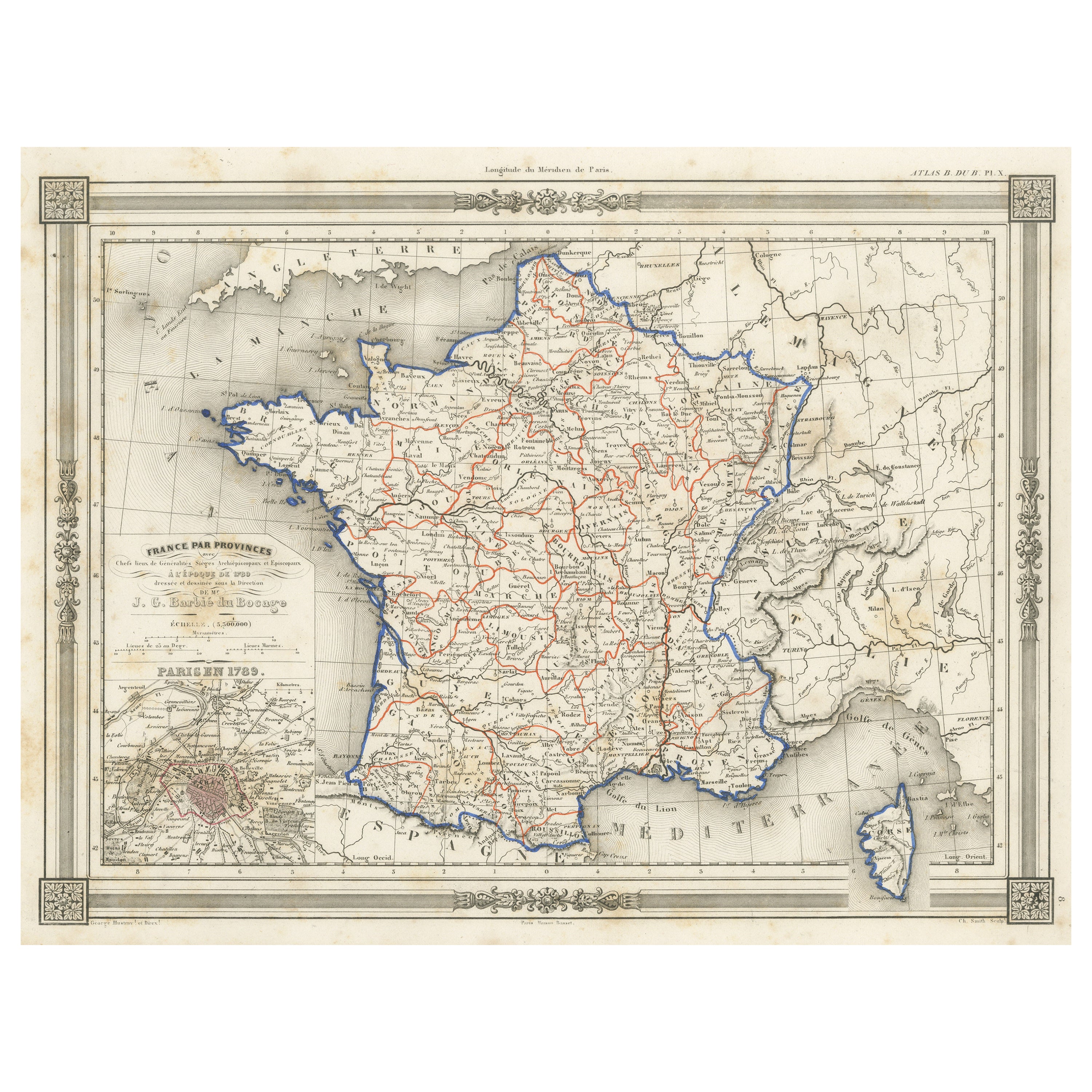
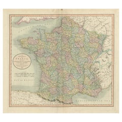
Antique Map of France by A & C. Black, 1870
Located in Langweer, NL
Antique map titled 'France'. Original antique map of France with inset map of France as divided into provinces, before the revolution of 1789 and map of Corsica...
Category
Antique Late 19th Century Maps
Materials
Paper

$263 Sale Price
20% Off
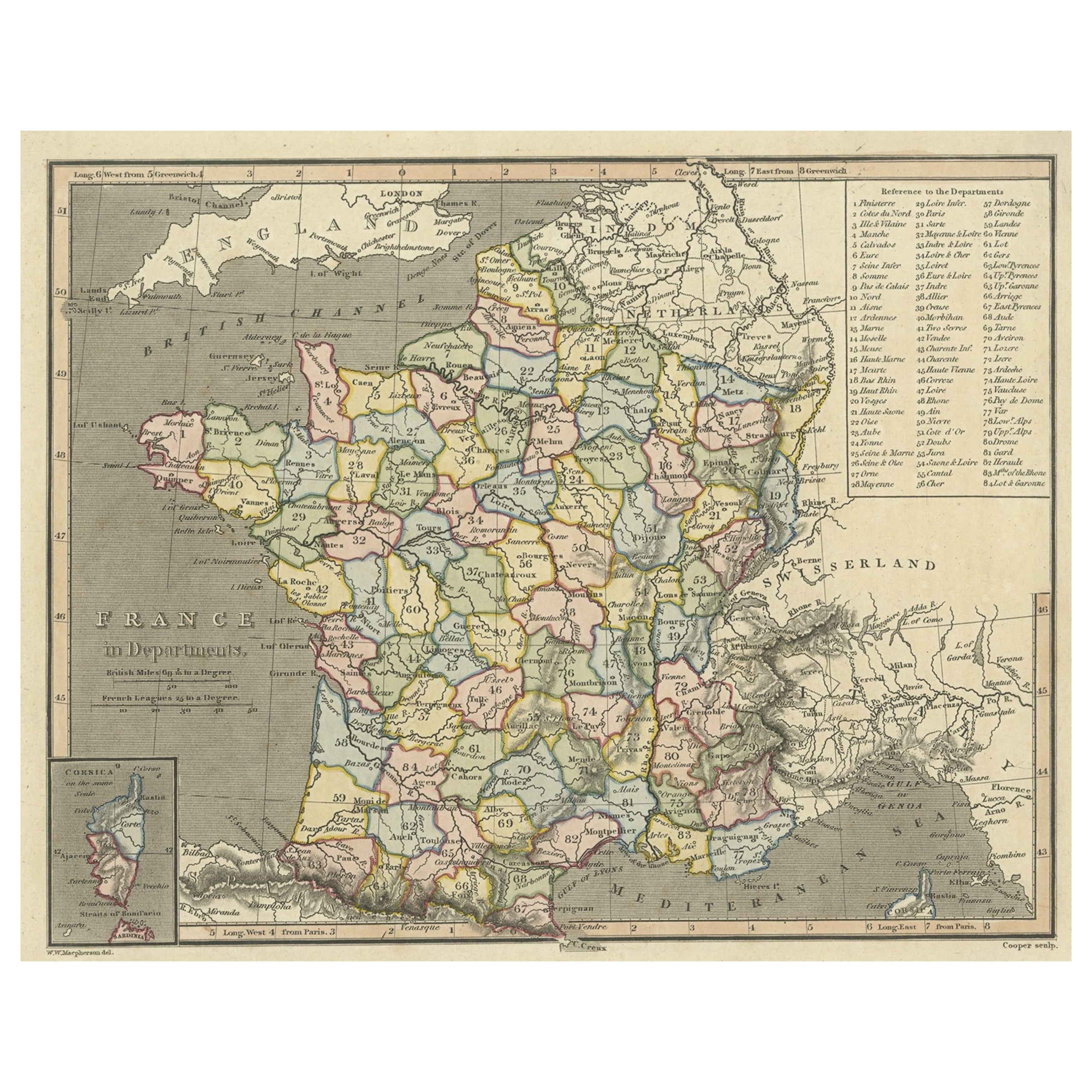
Antique Map of France with Inset Map of the Island of Corsica, 1820
Located in Langweer, NL
Antique map titled 'France in Departments'. Old map of France, with small inset map of the island of Corsica. Includes a table with reference to the departments.
Artists and Engr...
Category
Antique 19th Century Maps
Materials
Paper
$249 Sale Price
20% Off
1859 Classic Map of France: Blackie's Imperial Geographic Masterpiece
Located in Langweer, NL
The "Antique Map of France" from 'The Imperial Atlas of Modern Geography', published in 1859 by W. G. Blackie, is a historically valuable cartographic work that offers a comprehensiv...
Category
Antique Mid-19th Century Maps
Materials
Paper

$224 Sale Price
25% Off
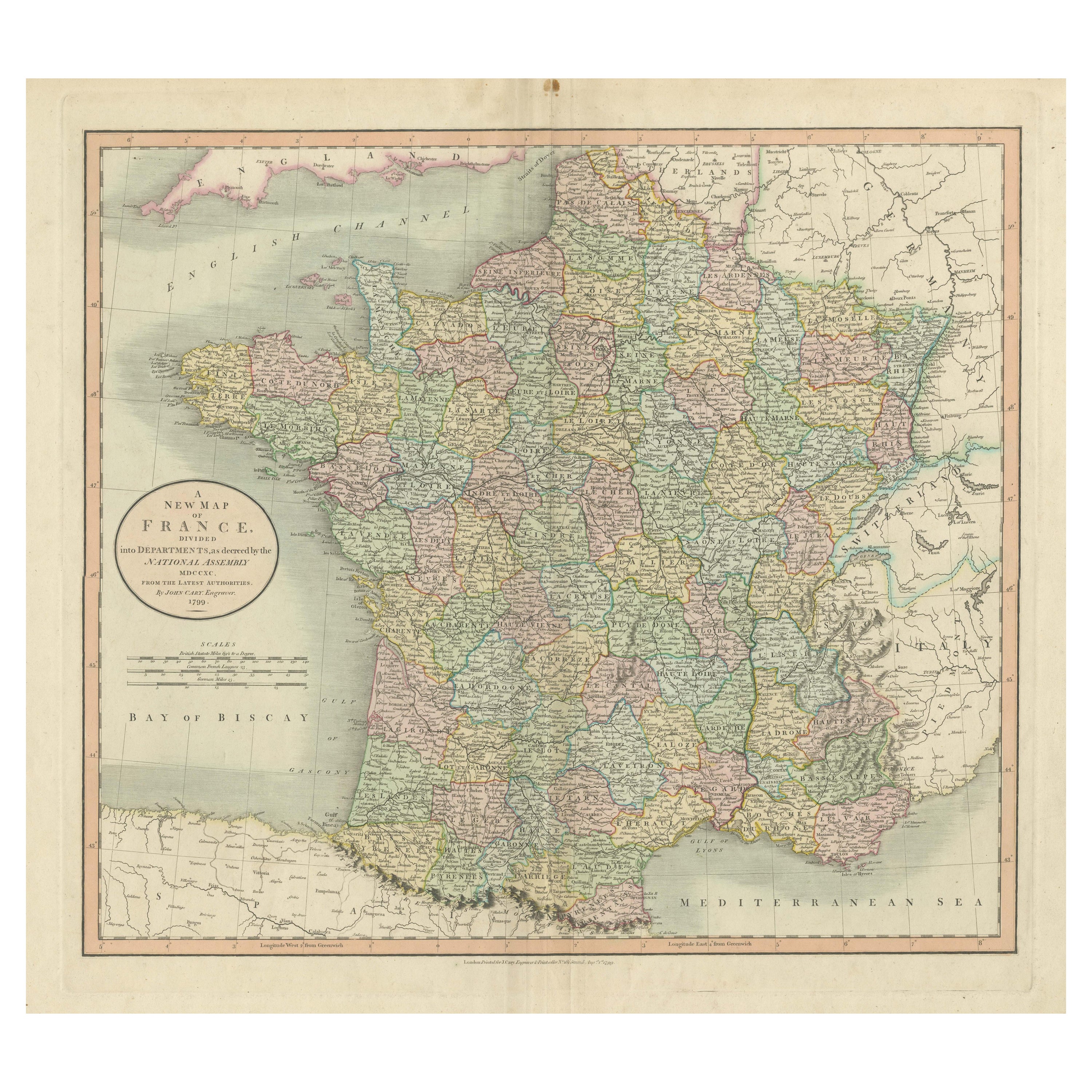
Antique Map of France in Provinces, with Inset of Paris
Located in Langweer, NL
Antique map titled 'France par Provinces'. Original antique map of France in Provinces. It covers from the Flanders in the north to Roussillon in the south and from Brittany in the w...
Category
Antique Mid-19th Century Maps
Materials
Paper

$105 Sale Price
20% Off
Antique Map of France Divided into Departments, with Original Hand Coloring
Located in Langweer, NL
Antique map titled 'A New Map of France (..)'. Original old map of France, divided into departments. With original/contemporary hand coloring. Published by John Cary, 1799. John Cary was an important and prolific London map seller...
Category
Antique Late 18th Century Maps
Materials
Paper
$421 Sale Price
20% Off
You May Also Like
Large 19th Century Map of France
Located in Pease pottage, West Sussex
Large 19th Century Map of France.
Remarkable condition, with a pleasing age worn patina.
Recently framed.
France Circa 1874.
Category
Antique Late 19th Century French Maps
Materials
Linen, Paper

France, Northern Part. Century Atlas antique map
Located in Melbourne, Victoria
'The Century Atlas. France, Northern Part.'
Original antique map, 1903.
Inset maps of 'France in Provinces' and 'Paris and Vicinity'.
Central fold as issued. Map name and number pr...
Category
Early 20th Century Victorian More Prints
Materials
Lithograph

Antique Map of France
Located in Dallas, TX
Nice antique map of France in wood frame. This would make a great gift for a collector. A wonderful accessory!
Category
Early 20th Century Decorative Art
Materials
Glass, Wood, Paper

$1,760
Large Vintage France Map, Continental, Historical Cartography, Late 20th Century
Located in Hele, Devon, GB
This is a large vintage map of France. A Continental, framed example of historical cartography, dating to the late 20th century, circa 1970.
Fas...
Category
Late 20th Century European Mid-Century Modern Prints
Materials
Glass, Wood, Paper

Map of France - Etching - 1820
Located in Roma, IT
Map of France is an Original Etching realized by an unknown artist of 19th century in 1820.
Very good condition on two sheets of white paper joined at t...
Category
1820s Modern Figurative Prints
Materials
Etching

The Normandy Region of France: A 17th C. Hand-colored Map by Sanson and Jaillot
By Nicolas Sanson
Located in Alamo, CA
This large hand-colored map entitled "Le Duché et Gouvernement de Normandie divisée en Haute et Basse Normandie en divers Pays; et par evêchez, avec le Gouvernement General du Havre ...
Category
Antique 1690s French Maps
Materials
Paper

More Ways To Browse
Railway Map
Post Modern High Chairs
Vintage Vine Rug
Silver Metal Chair
Swedish Kilim
Vintage Scandanavian Chairs
Vintage Tropical Furniture
19th Century Red Glass
Antique French Console Table Tables
French 50s
Rusted Metal Art
Silver Bowl Large
Antique French Silk
Down Couch
Cobalt Blue Glass
Used Lighter Art
Blue Edge Glass
Mahogany 1950s Furniture