Items Similar to 1948 "A Hysterical Map of Yellowstone National Park" by Jolly Lindgren, 2nd Ed.

Want more images or videos?
Request additional images or videos from the seller
1 of 11
1948 "A Hysterical Map of Yellowstone National Park" by Jolly Lindgren, 2nd Ed.
$3,600
£2,764.45
€3,171.26
CA$5,058.42
A$5,665.11
CHF 2,955.96
MX$69,196.93
NOK 37,608.46
SEK 35,450.48
DKK 23,666.76
About the Item
Presented is a second edition printing of Jolly Lindgren’s “Hysterical Map of Yellowstone National Park.” This comical pictorial map highlights the famous Yellowstone National Park. The map is labeled with geysers, mountains, lakes, and roads, but also filled with cartoonish figures, jokes, and puns. An inset chart at bottom left indicates mile distances from one popular mountain or junction to the next. First published in 1936, this second edition of the map was published by the Lingren Brothers in Spokane, WA, in 1948.
Lindgren maps have become well-known among collectors of 20th-century maps for their distinctive style-- a yellow background, a blue border, and plenty of visual gags. Lingren maps blend historical facts and geographical data with tongue-in-cheek wordplay and cartoons. Labels like “Hot Springs- Mustn't Touch,” “Gibbon Falls- 80 Ft.- Are Ya Hurt?,” and “Grand Canyon- Don’t Think It Ain't!” offer playful commentary alongside real elevation data and helpful information for visitors like labels for ranger stations, distances between mountain ranges, and more.
Born Hjalmer and Oscar Lindgren to Swedish parents in Wisconsin in the 1890s, the brothers adopted the nicknames Jolly and Ott when they joined the Army during World War I. After returning from military service, Jolly Lindgren opened a commercial art studio in Spokane, Washington, where he made signs for local theaters. His older brother Ott joined him to help manage the business and Ted Turner, Jr. was brought on board to complete the business trio.
The Lindgren-Turner Company was founded in 1928. When the Great Depression hit, the company tried to stay afloat by making calendars, featuring a pictorial map of Spokane. “When it became clear that the map had more appeal than the calendar itself, the company shifted to mapmaking, taking advantage of the tourism industry and creating maps of national parks. Turner was the one who proposed using the word “hysterical” in the title, over “historical,” as historical maps were also common souvenirs” (J. Stoner, Library of Congress, 2020).
Condition:
Expert repairs to corners; touched-up at folds; light spotting in margin. Linen backed. B+/B. Map measures 16 x 16”. Map has been expertly framed, to the highest archival standards in a custom-built wooden frame with acid-free mats and spacers. Framed Dimensions: 20”H x 20”W x 3/4”D.
- Dimensions:Height: 20 in (50.8 cm)Width: 20 in (50.8 cm)Depth: 0.75 in (1.91 cm)
- Materials and Techniques:
- Place of Origin:
- Period:
- Date of Manufacture:1948
- Condition:Additions or alterations made to the original: Map has been archivally framed by Rio Grande Custom Framing in Colorado Springs, Colorado, in October of 2021. Wear consistent with age and use.
- Seller Location:Colorado Springs, CO
- Reference Number:Seller: M3131stDibs: LU909725919232
About the Seller
4.9
Platinum Seller
Premium sellers with a 4.7+ rating and 24-hour response times
Established in 2010
1stDibs seller since 2011
462 sales on 1stDibs
- ShippingRetrieving quote...Shipping from: Colorado Springs, CO
- Return Policy
Authenticity Guarantee
In the unlikely event there’s an issue with an item’s authenticity, contact us within 1 year for a full refund. DetailsMoney-Back Guarantee
If your item is not as described, is damaged in transit, or does not arrive, contact us within 7 days for a full refund. Details24-Hour Cancellation
You have a 24-hour grace period in which to reconsider your purchase, with no questions asked.Vetted Professional Sellers
Our world-class sellers must adhere to strict standards for service and quality, maintaining the integrity of our listings.Price-Match Guarantee
If you find that a seller listed the same item for a lower price elsewhere, we’ll match it.Trusted Global Delivery
Our best-in-class carrier network provides specialized shipping options worldwide, including custom delivery.More From This Seller
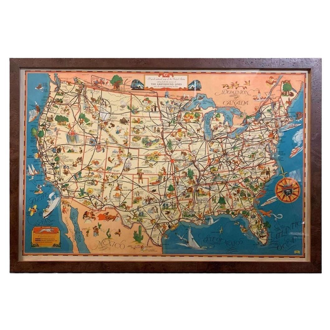
View All1939 "A Good-Natured Map of the United States" by Greyhound
Located in Colorado Springs, CO
Presented is an original 1939 map, titled “A Good-Natured Map of the United States Setting Forth the Services of the Greyhound Lines and a Few Principal Connecting Bus Lines.” This brightly colored pictographic map was one of several similar United States maps...
Category
Vintage 1930s American Art Deco Maps
Materials
Paper

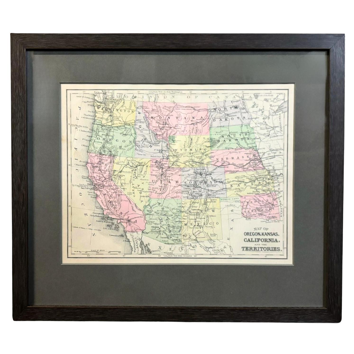
1890 "Map of Oregon, Kansas, California, and the Territories" by S. A. Mitchell
By Samuel Augustus Mitchell 1
Located in Colorado Springs, CO
Presented is an 1890 map "Map of Oregon, Kansas, California, and the Territories" by S. A. Mitchell Jr. The map was issued in the atlas “Mitchell's New Intermediate Geography” publis...
Category
Antique 1890s American Victorian Maps
Materials
Paper

1904 "Nell's Topographical Map of the State of Colorado"
Located in Colorado Springs, CO
This highly detailed pocket map is a topographical map of the state of Colorado by Louis Nell from 1904. The map "has been compiled from all available...
Category
Antique Early 1900s American Maps
Materials
Leather, Paper

"Atlas to Accompany Monograph XXXII on the Geology of Yellowstone National Park"
By United States Geological Survey
Located in Colorado Springs, CO
This is an original 1904 "Atlas to Accompany Monograph XXXII on the Geology of the Yellowstone National Park" by Arnold Hague. Published by the Department of the Interior, the Atlas ...
Category
Antique Early 1900s American Maps
Materials
Leather, Fabric, Paper
1960 "The 50 United States of America" Pictorial Map by Lorin Thompson
Located in Colorado Springs, CO
This colorful map of the United States was drawn by Lorin Thompson and published by the General Foods Corporation in 1960. The map was issued as a promotional pamphlet in advance of the 1960 presidential election. The cover title for the pamphlet reads: "Election Map and 1960 Presidential Fact Sheet...Yours Free with Any Purchase of Gravy Train."
The map has a unique pictorial style with bright colors and dynamic illustrations celebrating key moments of American history. The map is illustrated with past presidents, Native Americans, depictions of the "Golden Spike...
Category
Vintage 1960s Mid-Century Modern Prints
Materials
Paper
$1,750 Sale Price
22% Off
1943 "USO Map Guide to Washington"
Located in Colorado Springs, CO
This is a WWII map of Washington, DC, issued as a guide for service men and women visiting or working in the city during the war. The map was created by Allen F. Free and published a...
Category
Vintage 1940s American Mid-Century Modern Maps
Materials
Paper
You May Also Like
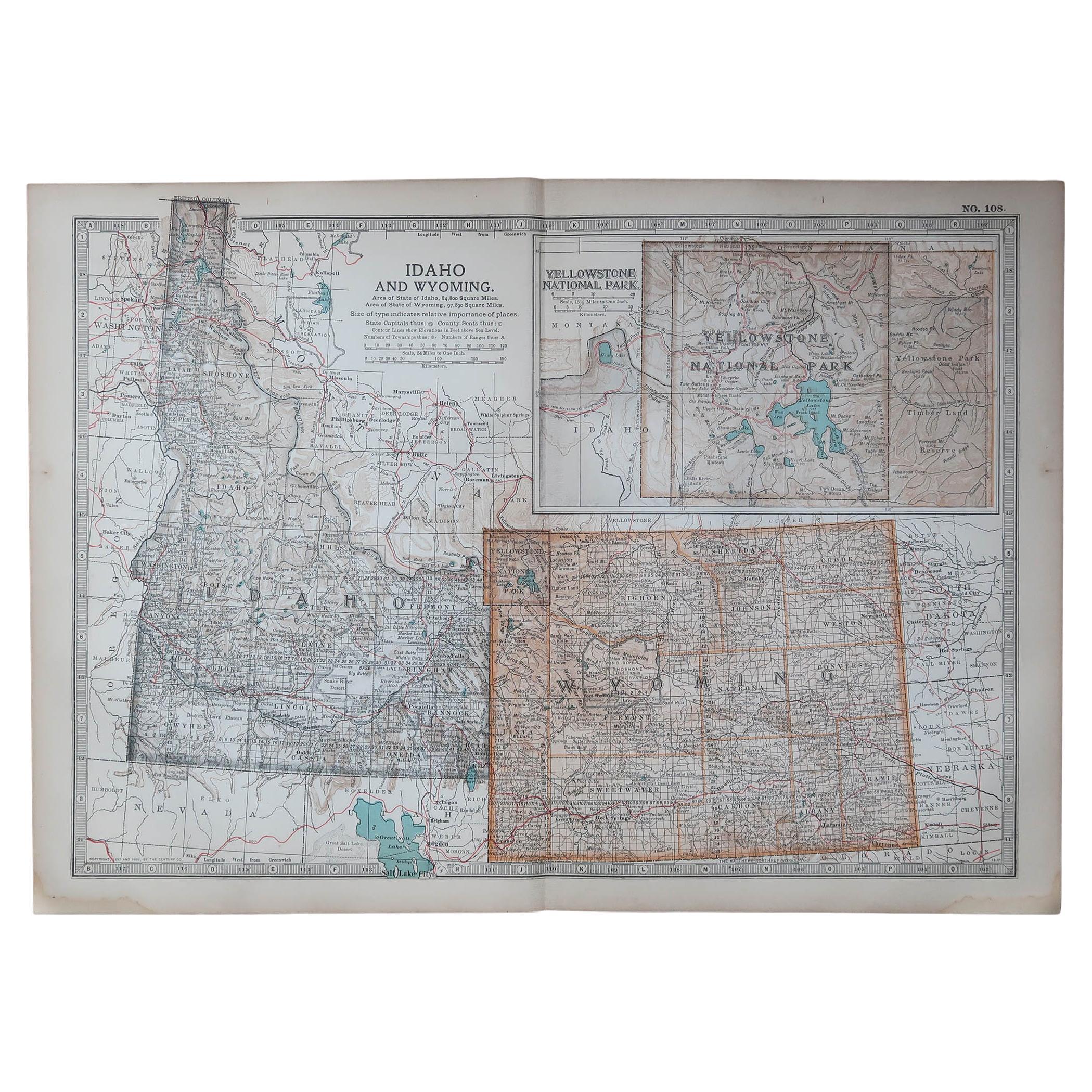
Original Antique Map of the American State of Idaho & Wyoming, 1903
Located in St Annes, Lancashire
Antique map of Idaho and Wyoming
Published By A & C Black. 1903
Original colour
Good condition
Unframed.
Free shipping
Category
Antique Early 1900s English Maps
Materials
Paper

Old Decorative Pictorial Map of the United States, circa 1953
Located in Langweer, NL
Antique map titled 'A Pictorial Map of the United States of America Showing Principal Regional Resources, Products, and Natural Features'.
This information-packed map was create by the General Drafting Company for the New Jersey Bell Telephone Company. The main map features over 700 drawings in full color including points of interest, natural resources, and agricultural products. At bottom are inset maps showing railroad lines, air routes, telephone lines, as well as a pictorial map of New Jersey...
Category
20th Century Maps
Materials
Paper

$708 Sale Price
20% Off
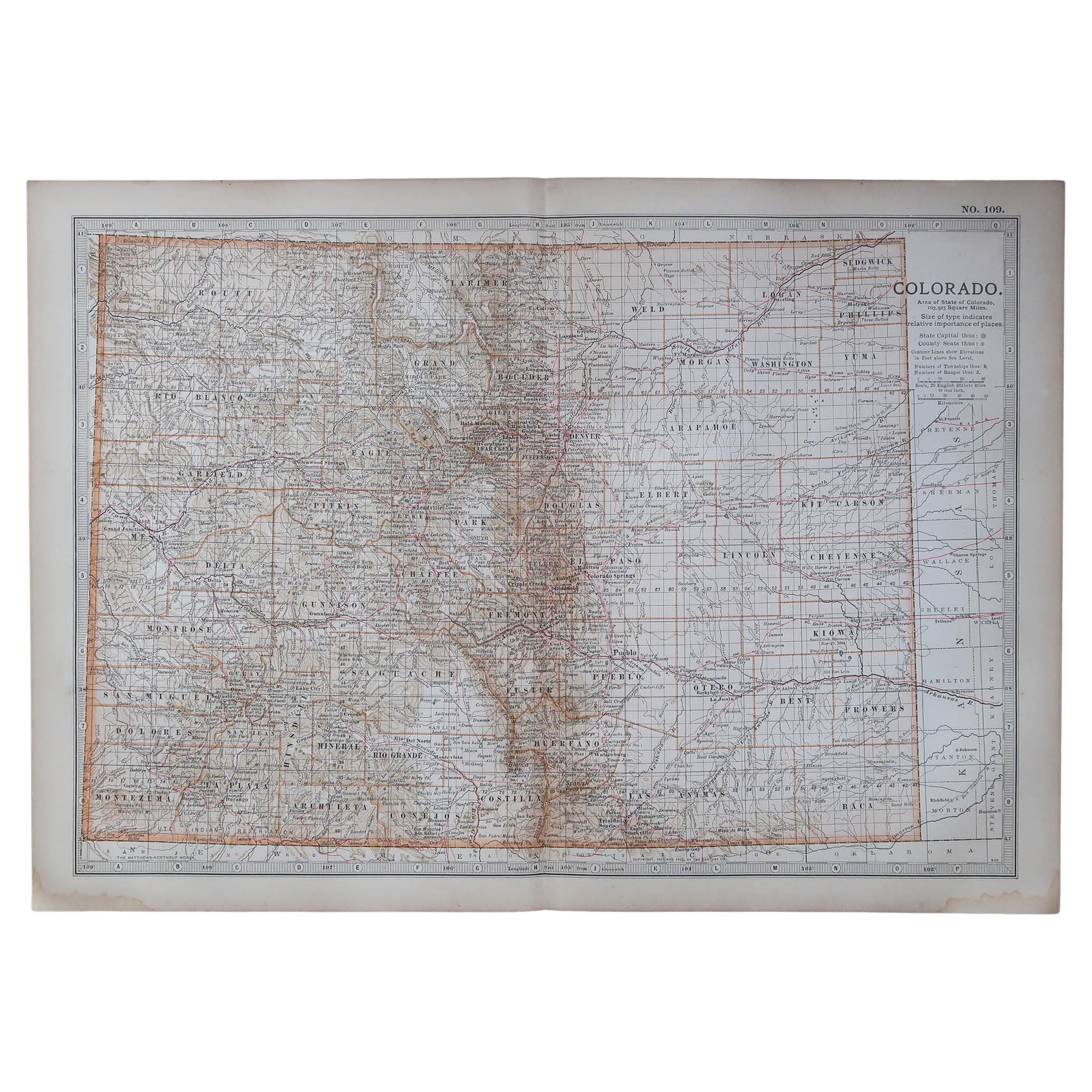
Original Antique Map of the American State of Colorado, 1903
Located in St Annes, Lancashire
Antique map of Colorado
Published By A & C Black. 1903
Original colour
Good condition
Unframed.
Free shipping
Category
Antique Early 1900s English Maps
Materials
Paper

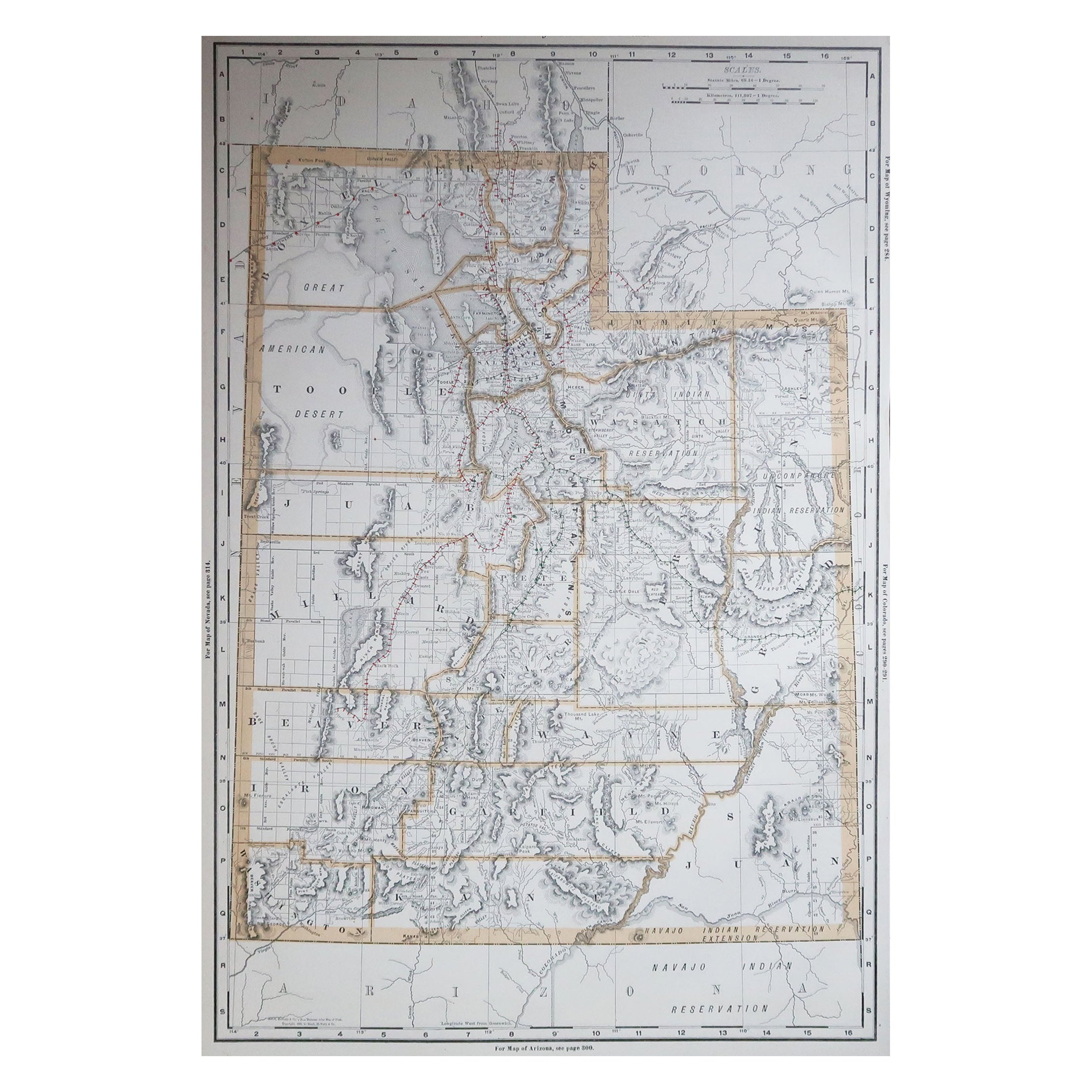
Large Original Antique Map of Utah, USA, 1894
By Rand McNally & Co.
Located in St Annes, Lancashire
Fabulous map of Utah
Original color
By Rand, McNally & Co.
Published, 1894
Unframed
Free shipping.
Category
Antique 1890s American Maps
Materials
Paper

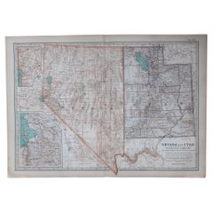
Original Antique Map of the American State of Nevada & Utah, 1903
Located in St Annes, Lancashire
Antique map of Nevada and Utah
Published By A & C Black. 1903
Original colour
Good condition
Unframed.
Free shipping
Category
Antique Early 1900s English Maps
Materials
Paper
Map of Western United States 1903 – Railroads, State Borders, and Terrain
Located in Langweer, NL
Map of Western United States 1903 – Railroads, State Borders, and Terrain
This beautifully engraved map titled "United States of North America (Western Sheet)" was created by Keith ...
Category
Early 20th Century Maps
Materials
Paper

More Ways To Browse
National Furniture Company
The Vintage Map
Used Furniture Wa
Vintage Folded Map
Ted Turner
Used Furniture Spokane
Spokane Vintage Furniture
Framed Map Of Paris
Used Nautical Charts
Antique Navigator
Map Of Middle East
Antique Map Of Switzerland
World Map Copper
British Empire Map
Malaysian Antique Furniture
Birds Eye View Map
Map Of Arabia
Map Of Vienna