Items Similar to 19th Century Illustrated Map of Ceylon (Sri Lanka) with Notable Landmarks

Want more images or videos?
Request additional images or videos from the seller
1 of 6
19th Century Illustrated Map of Ceylon (Sri Lanka) with Notable Landmarks
$277.97
$347.4620% Off
£206.89
£258.6120% Off
€232
€29020% Off
CA$380.75
CA$475.9420% Off
A$423.48
A$529.3420% Off
CHF 221.13
CHF 276.4120% Off
MX$5,153.25
MX$6,441.5620% Off
NOK 2,824.11
NOK 3,530.1420% Off
SEK 2,648.52
SEK 3,310.6520% Off
DKK 1,766.14
DKK 2,207.6720% Off
Shipping
Retrieving quote...The 1stDibs Promise:
Authenticity Guarantee,
Money-Back Guarantee,
24-Hour Cancellation
About the Item
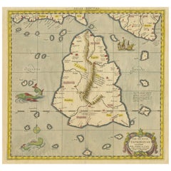
John Tallis & Company is known for producing maps and atlases that were highly regarded for their accurate cartographic detail and their distinctive style. They often included ornate borders and decorative vignettes depicting culturally and historically relevant scenes of the areas they represent. These vignettes served as illustrations of local scenes, people, and historical events, providing a visual context for the places on the map.
The map of Ceylon, now known as Sri Lanka, from Tallis's series would be a fine example of their work. Ceylon was an important British colony at the time, and maps like these would have been used both for administrative purposes and for educating the British public about their empire.
Robert Montgomery Martin, often credited with the text accompanying these maps, was a civil servant, a colonial administrator, and an author with a deep interest in the British Empire and its colonies. He was involved in various aspects of colonial administration and trade, and his works reflected his interests in economics, history, and geography.
Tallis maps are appreciated not just as navigational tools but also as works of art and historical documents. They represent a time when the British Empire was at its height, and they reflect the Victorian interest in exploration, commerce, and the wider world. Collectors and historians value them for their beauty and the insight they provide into 19th-century colonial attitudes and knowledge.
Regarding the countries depicted, many of the regions shown in the Tallis series have undergone significant changes since the time of publication. Borders have shifted, countries have gained independence, and names have changed. The maps offer a snapshot of the world as it was understood in the Victorian era.
The Tallis series itself was among the last decorative map series produced as the industrial age was turning toward more utilitarian and less artistic representations. As such, they represent the end of an era in map-making.
More details of the map and its insets:
The insets on the map of Ceylon (Sri Lanka) are small, detailed illustrations that embellish the cartographic information with cultural, historical, and geographical context. They are typical of the style of Tallis maps, which combined practical cartography with decorative artistry.
1. **Temple of Buddha, KALANY**: This inset appears to depict a grand Buddhist temple, indicative of the country's deep-rooted Buddhist traditions. The presence of a stupa-like structure suggests the temple is significant for Buddhist worship and may be a site of pilgrimage. The lush vegetation and architectural style reflect the tropical climate and cultural heritage of the region.
2. **COLOMBO**: The port city of Colombo is shown from a coastal perspective, highlighting its importance as a maritime hub. The image shows several ships in the harbor, pointing to the active trade and colonial influence of the time. Notably, the colonial architecture, such as the clock tower, reveals the European impact on the city's development.
3. **LAKE OF KANDY**: This illustration presents a serene view of the Lake of Kandy, surrounded by the hill country. Kandy was the last capital of the ancient kings' era of Sri Lanka and is known for its scenic beauty and historical significance. The calm water, the gentle hills in the background, and the classical pavilion style buildings suggest a place of both beauty and cultural importance.
4. **RUINS OF A DAGORA, TOOFARAMAYA**: This vignette captures the ruins of a dagoba (stupa), which is a typical structure in Buddhist temple complexes. The depiction of ruins indicates the long history of the island and the presence of ancient civilizations. The tropical flora indicates the natural environment in which these historical sites are found.
These vignettes serve not only as decorations but also as a window into the life, history, and environment of Ceylon during the time of the British colonial period. They provide a visual narrative that complements the map's geographical information, offering a snapshot of the land, its monuments, and its colonial urban centers.
- Dimensions:Height: 14.26 in (36.2 cm)Width: 10.71 in (27.2 cm)Depth: 0 in (0.02 mm)
- Materials and Techniques:
- Period:
- Date of Manufacture:1851
- Condition:Good given age. Original fold in middle as published. General age-related toning, please study scan carefully.
- Seller Location:Langweer, NL
- Reference Number:Seller: BG-13736-71stDibs: LU3054339291982
About the Seller
5.0
Recognized Seller
These prestigious sellers are industry leaders and represent the highest echelon for item quality and design.
Platinum Seller
Premium sellers with a 4.7+ rating and 24-hour response times
Established in 2009
1stDibs seller since 2017
2,508 sales on 1stDibs
Typical response time: <1 hour
- ShippingRetrieving quote...Shipping from: Langweer, Netherlands
- Return Policy
Authenticity Guarantee
In the unlikely event there’s an issue with an item’s authenticity, contact us within 1 year for a full refund. DetailsMoney-Back Guarantee
If your item is not as described, is damaged in transit, or does not arrive, contact us within 7 days for a full refund. Details24-Hour Cancellation
You have a 24-hour grace period in which to reconsider your purchase, with no questions asked.Vetted Professional Sellers
Our world-class sellers must adhere to strict standards for service and quality, maintaining the integrity of our listings.Price-Match Guarantee
If you find that a seller listed the same item for a lower price elsewhere, we’ll match it.Trusted Global Delivery
Our best-in-class carrier network provides specialized shipping options worldwide, including custom delivery.More From This Seller
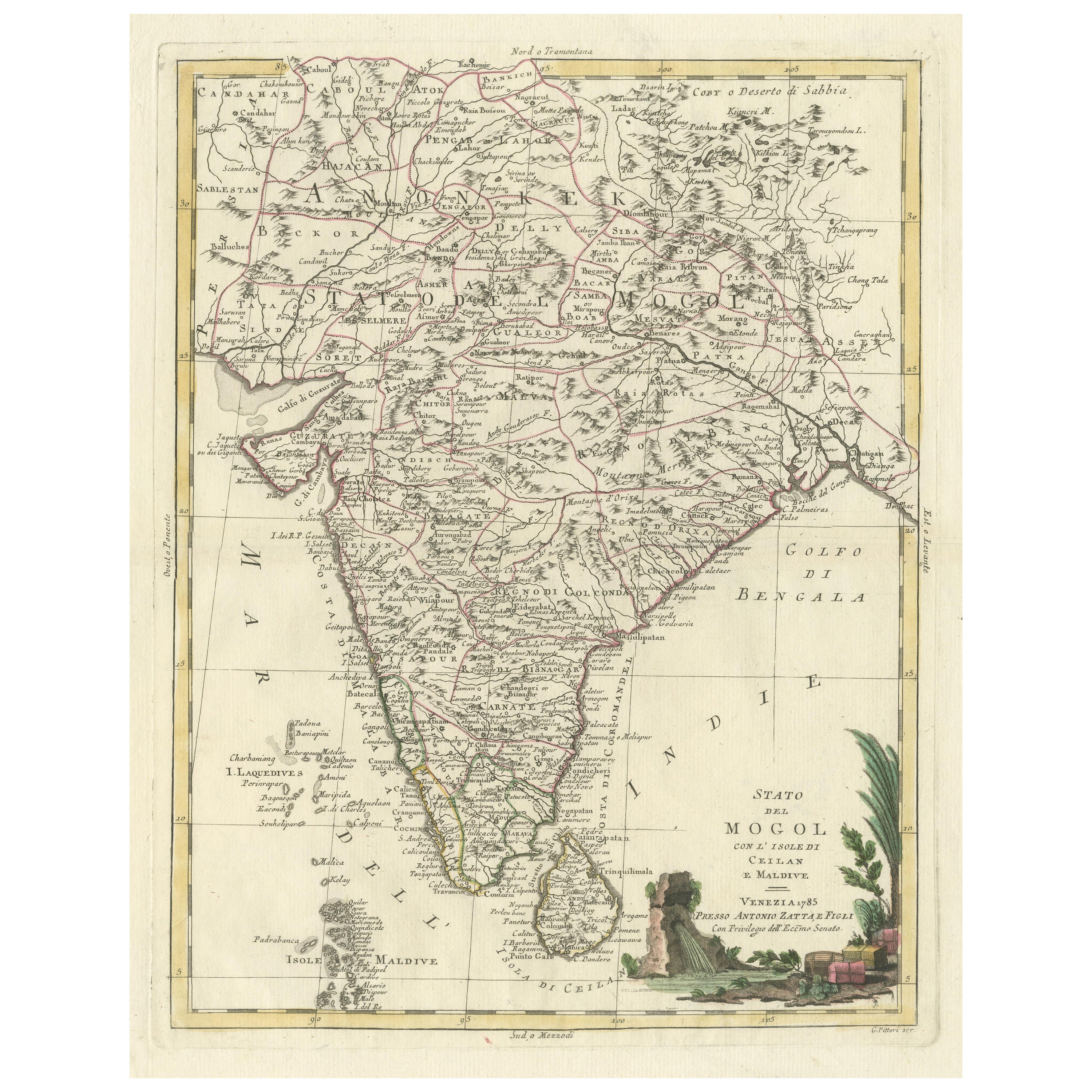
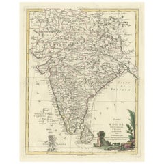
View AllAntique Map of India and Ceylon, along with the Maldives
Located in Langweer, NL
Antique map titled 'Stato del Mogol con l'Isole di Ceilan e Maldive'. Beautiful map of India and Ceylon, along with the Maldives. Includes a large decorative title cartouche. The map...
Category
Antique Late 18th Century Maps
Materials
Paper
$517 Sale Price
20% Off
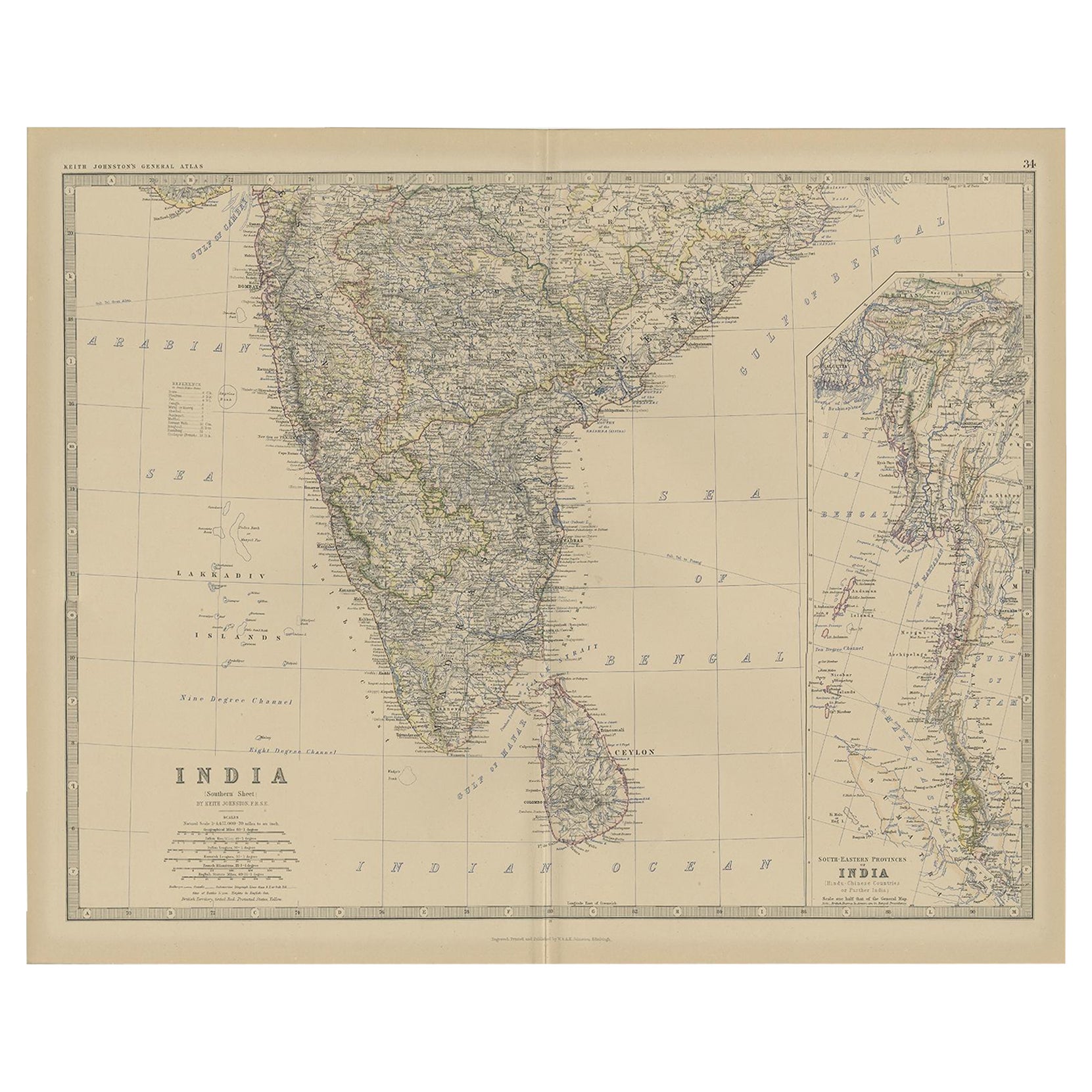
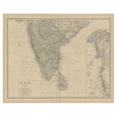
Old Map of Southern India and Ceylon 'Sri Lanka', 1882
Located in Langweer, NL
Antique map titled 'India (Southern Sheet)'.
Old map of Southern India and Ceylon (Sri Lanka). With an inset map of the South-Eastern Provinces of India. This map originates from...
Category
Antique 1880s Maps
Materials
Paper
$277 Sale Price
20% Off
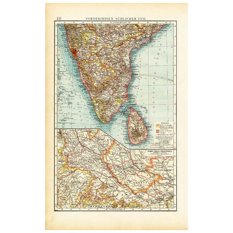
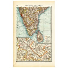
Antique Map of Southern India by Andree, 1904
Located in Langweer, NL
"Antique map titled 'Vorderindien, sudlicher Teil'. Map of India, southern part. This map originates from 'Andrees Allgemeiner Handatlas in 126 Haupt-Und 139 Nebenkarten', Bielefeld;...
Category
20th Century Maps
Materials
Paper
$69 Sale Price
20% Off
Antique Map of India and Ceylon by Lapie, 1842
Located in Langweer, NL
Antique map titled 'Carte de l'Inde en deca et au dela du Gange'. Map of India and Ceylon (Sri Lanka). This map originates from 'Atlas universel de géographie ancienne et moderne (.....
Category
Antique Mid-19th Century Maps
Materials
Paper

$527 Sale Price
20% Off
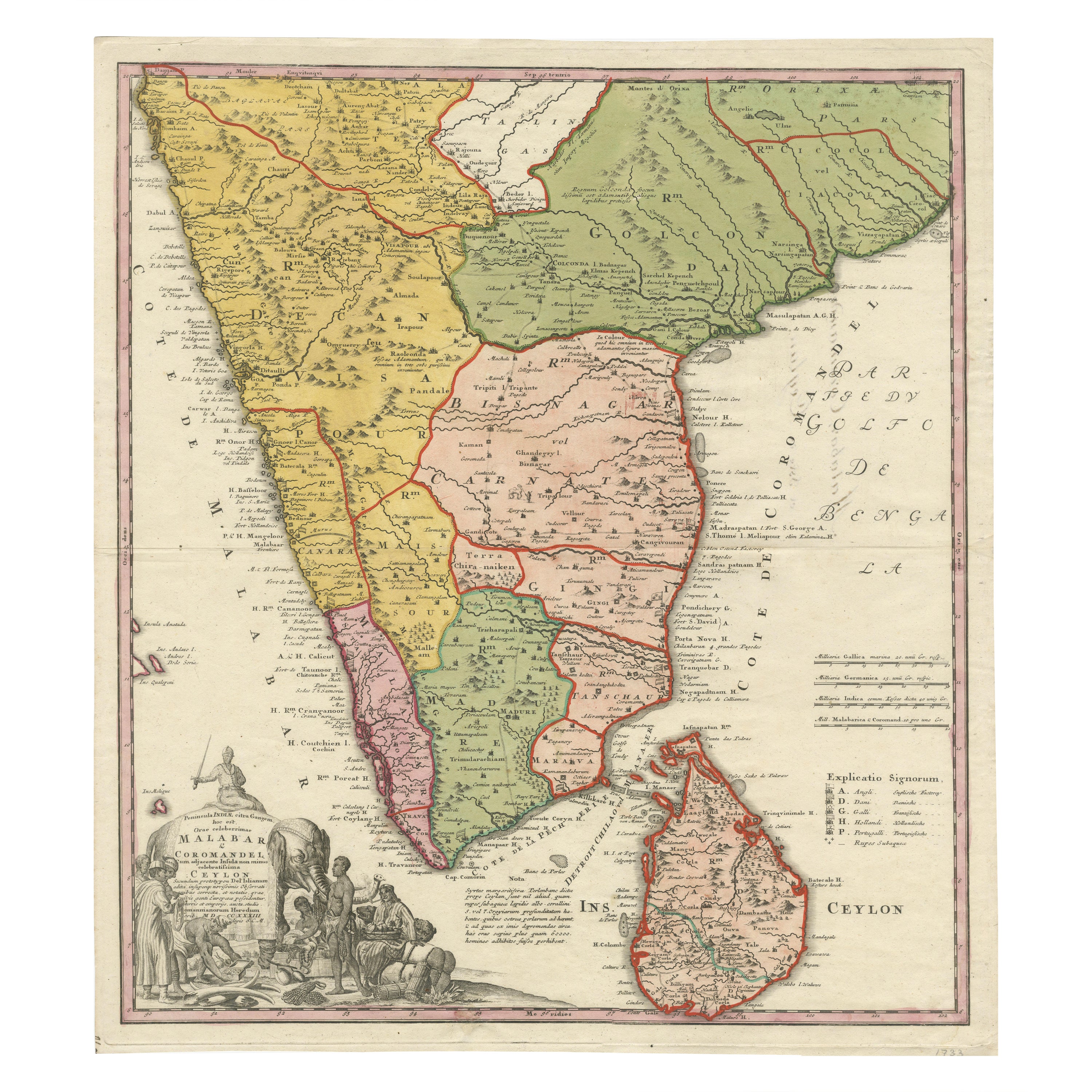
Original Antique Map of Malabar, Coromandel 'India' and Ceylon
Located in Langweer, NL
Antique map titled 'Peninsula Indiae citra Gangem, hoc est Orae celeberrimae Malabar & Coromandel (..)'. Large and attractive original hand colored map of Sri Lanka and the Southern ...
Category
Antique Mid-18th Century Maps
Materials
Paper

$1,341 Sale Price
20% Off
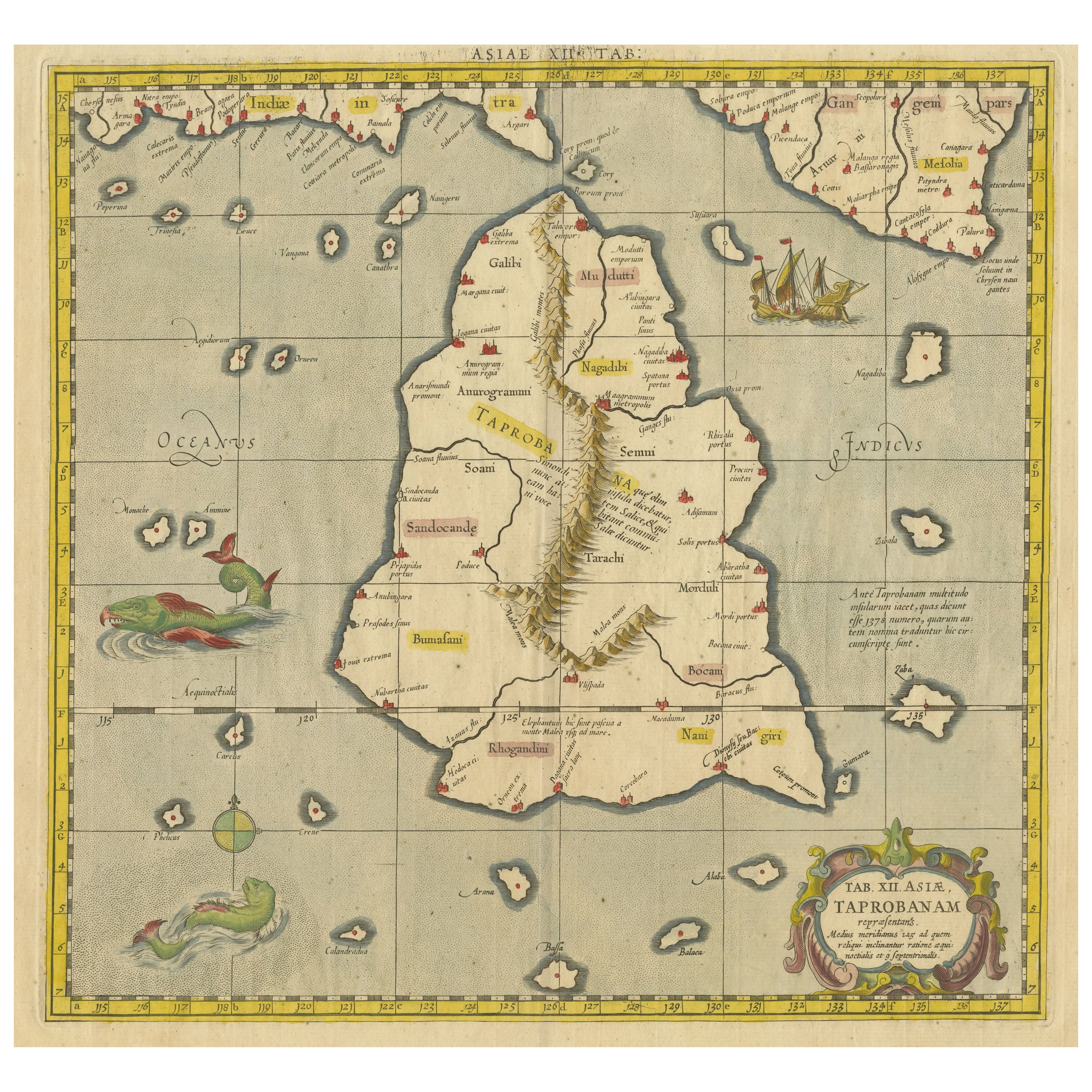
Antique Ptolemaic Map of Ceylon or nowadays Sri Lanka
Located in Langweer, NL
Antique map titled 'Tab XII. Asiae Taprobanam'. Ptolemaic map of Sri Lanka. Ptolemy drew on the accounts of travelers and sailors and though the information was secondhand and often ...
Category
Antique Mid-18th Century Maps
Materials
Paper
$661 Sale Price
20% Off
You May Also Like
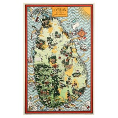
Original Vintage Pictorial Map Poster Ceylon Tea And Other Industries Sri Lanka
By "Leslie MacDonald ""Max"" Gill"
Located in London, GB
Original vintage pictorial map poster for Ceylon Her Tea & Other Industries featuring artwork by the notable British cartographer, graphic design...
Category
Vintage 1940s British Posters
Materials
Paper
India (Southern Sheet), English antique map by Alexander Keith Johnston, 1901
Located in Melbourne, Victoria
'India (Southern Sheet)', antique lithographic map by Keith Johnston.
Inset maps of 'Bombay Island & Town', 'Madras & Environs', and 'South-Eastern Provinces of India'.
Central vertical fold as issued.
495mm by 625mm (sheet)
Alexander Keith...
Category
Early 20th Century Victorian More Prints
Materials
Lithograph

Original Antique Map of India by Dower, circa 1835
Located in St Annes, Lancashire
Nice map of India
Drawn and engraved by J.Dower
Published by Orr & Smith. C.1835
Unframed.
Free shipping
Category
Antique 1830s English Maps
Materials
Paper

Original Antique Map of South East Asia by Thomas Clerk, 1817
Located in St Annes, Lancashire
Great map of South East Asia
Copper-plate engraving
Drawn and engraved by Thomas Clerk, Edinburgh.
Published by Mackenzie And Dent, 1817
Unframed.
Category
Antique 1810s English Maps
Materials
Paper

Large Original Vintage Map of S.E Asia, with a Vignette of Singapore
Located in St Annes, Lancashire
Great map of South East Asia
Original color. Good condition
Published by Alexander Gross
Unframed.
Category
Vintage 1920s English Maps
Materials
Paper

Antique 1803 Italian Map of Asia Including China Indoneseia India
Located in Amsterdam, Noord Holland
Antique 1803 Italian Map of Asia Including China Indoneseia India
Very nice map of Asia. 1803.
Additional information:
Type: Map
Country of Manufacturing: Europe
Period: 19th centu...
Category
Antique 19th Century European Maps
Materials
Paper

$584 Sale Price
20% Off
More Ways To Browse
Sri Lanka Art
Ceylon Furniture
Colonial Tropical
Ancient Clocks
British Antique Clocks
Antique Ships Clock
Used Clock Tools
Water Clock
Colonial Sri Lankan
Temple Window
Antique Water Clock Antique Clocks
Antique Water Clock
Antique Industrial Windows
Colonial Clock
World Map Clock
Sri Lanka Buddha
Atlas Clock
Antique Oushak Carpets