Items Similar to 8 Foot Framed World Map by Philips
Want more images or videos?
Request additional images or videos from the seller
1 of 13
8 Foot Framed World Map by Philips
$1,695
£1,287.05
€1,471.84
CA$2,368.16
A$2,633.91
CHF 1,375.35
MX$32,051.90
NOK 17,565.28
SEK 16,473.13
DKK 10,984.92
Shipping
Retrieving quote...The 1stDibs Promise:
Authenticity Guarantee,
Money-Back Guarantee,
24-Hour Cancellation
About the Item
1951 map of the world by George Philip and Son. Large beautiful map as it was in 1951. Nice patina mounted to a sturdy wood frame. Overall good condition. Very large in size. 90" W x 51" T.
- Dimensions:Height: 51 in (129.54 cm)Width: 90 in (228.6 cm)Depth: 1 in (2.54 cm)
- Materials and Techniques:
- Place of Origin:
- Period:
- Date of Manufacture:1951
- Condition:
- Seller Location:Norwell, MA
- Reference Number:Seller: 24NV0671stDibs: LU1741242770452
About the Seller
5.0
Vetted Professional Seller
Every seller passes strict standards for authenticity and reliability
Established in 1967
1stDibs seller since 2015
407 sales on 1stDibs
Typical response time: 3 hours
- ShippingRetrieving quote...Shipping from: Norwell, MA
- Return Policy
Authenticity Guarantee
In the unlikely event there’s an issue with an item’s authenticity, contact us within 1 year for a full refund. DetailsMoney-Back Guarantee
If your item is not as described, is damaged in transit, or does not arrive, contact us within 7 days for a full refund. Details24-Hour Cancellation
You have a 24-hour grace period in which to reconsider your purchase, with no questions asked.Vetted Professional Sellers
Our world-class sellers must adhere to strict standards for service and quality, maintaining the integrity of our listings.Price-Match Guarantee
If you find that a seller listed the same item for a lower price elsewhere, we’ll match it.Trusted Global Delivery
Our best-in-class carrier network provides specialized shipping options worldwide, including custom delivery.More From This Seller
View AllOriginal 1891 Walker Map
Located in Norwell, MA
Original 1891 map of Massachusetts by Walker. Towns include Cambridge, Boston, Dedham, Ashland, Brookline, Newton etc... burl wood frame. Measures...
Category
Antique 19th Century Maps

Original 1910 George Eldridge Chart
Located in Norwell, MA
Original framed 1910 George Eldridge chart "E" showing Gloucester to the Kennebec river. Showing the coast of Maine in great detail. Towns includ...
Category
20th Century Unknown Maps
Original Imray & Son Chart of North Atlantic, 1876
Located in Norwell, MA
Nautical chart of the North Atlantic showing the Eastern United States coast, Caribbean Islands, South America (Venezuela and ), British Possessions (Canada - Gulf of Lawrence, Newfo...
Category
Antique 1870s Nautical Objects
Materials
Paper

Antique Maritime Chart of East Coast Virginia to Nova Scotia
Located in Norwell, MA
1920 nautical chart of the East Coast of the United States from Virginia to Maine, New Brunswick, and Nova Scotia. The chart shows Cape Cod, Long Island, the Connecticut coast, Jersey Shore, Maine, New Hampshire, etc. Very detailed, showing ports, lighthouses, shoals, depths, etc. The chart is by famous cartographer George W. Eldridge, compiled from surveys of the United States government, British Admiralty, George Eldridge, and others. First authorized by George Eldridge, published in 1916 by Wilfred O. White with a merchant's stamp of Charles Hutchinson...
Category
Vintage 1920s North American Maps
Materials
Paper

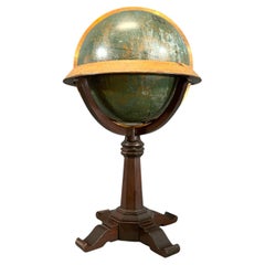
Maitland Smith Globe on Stand
Located in Norwell, MA
World globe with brass horizon band. Intricately carved pedestal base with ball and claw feet. Quite detailed. By the famous Maitland Smith, globe itself is from Replogle. 62" H x 26...
Category
Vintage 1970s North American Maps
Materials
Wood
Early 20th Century American Library Globe
Located in Norwell, MA
Fine library globe with makers logo from Atlas School Supply Co., Chicago. Hardwood base with rich finish and nice detail. Celestial globe with equ...
Category
Vintage 1920s North American Maps
Materials
Wood
You May Also Like
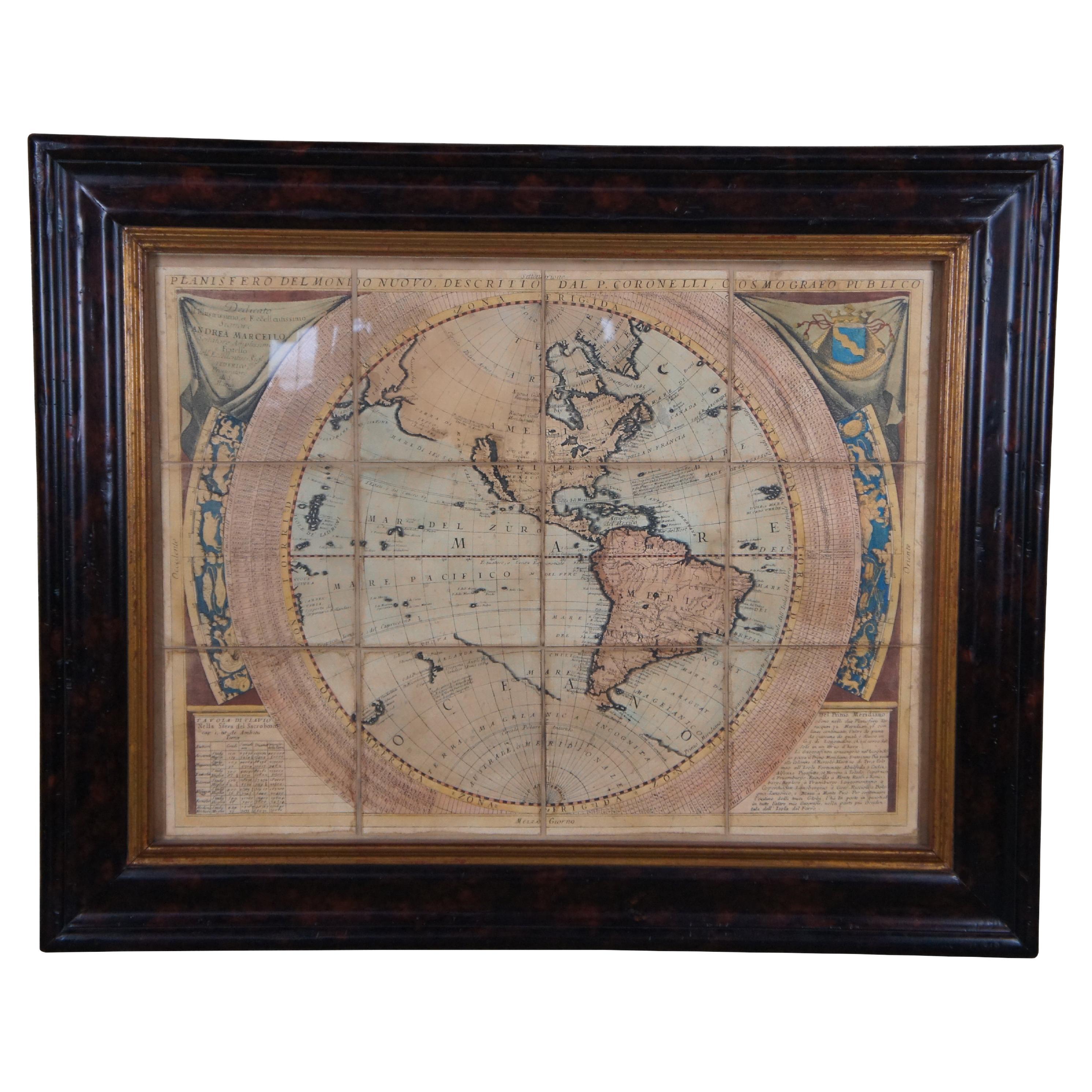
Vincenzo Coronelli's Colored Map of the New World Western Hemisphere Framed 47"
By Vincenzo Coronelli
Located in Dayton, OH
A Framed Reproduction of Coronelli's Map of the New World, Attributed to Trevor James Company. The map shows the Western Hemisphere including the discoveries made by Abel Tasman in A...
Category
20th Century Maps
Materials
Paper

$1,080 Sale Price
20% Off
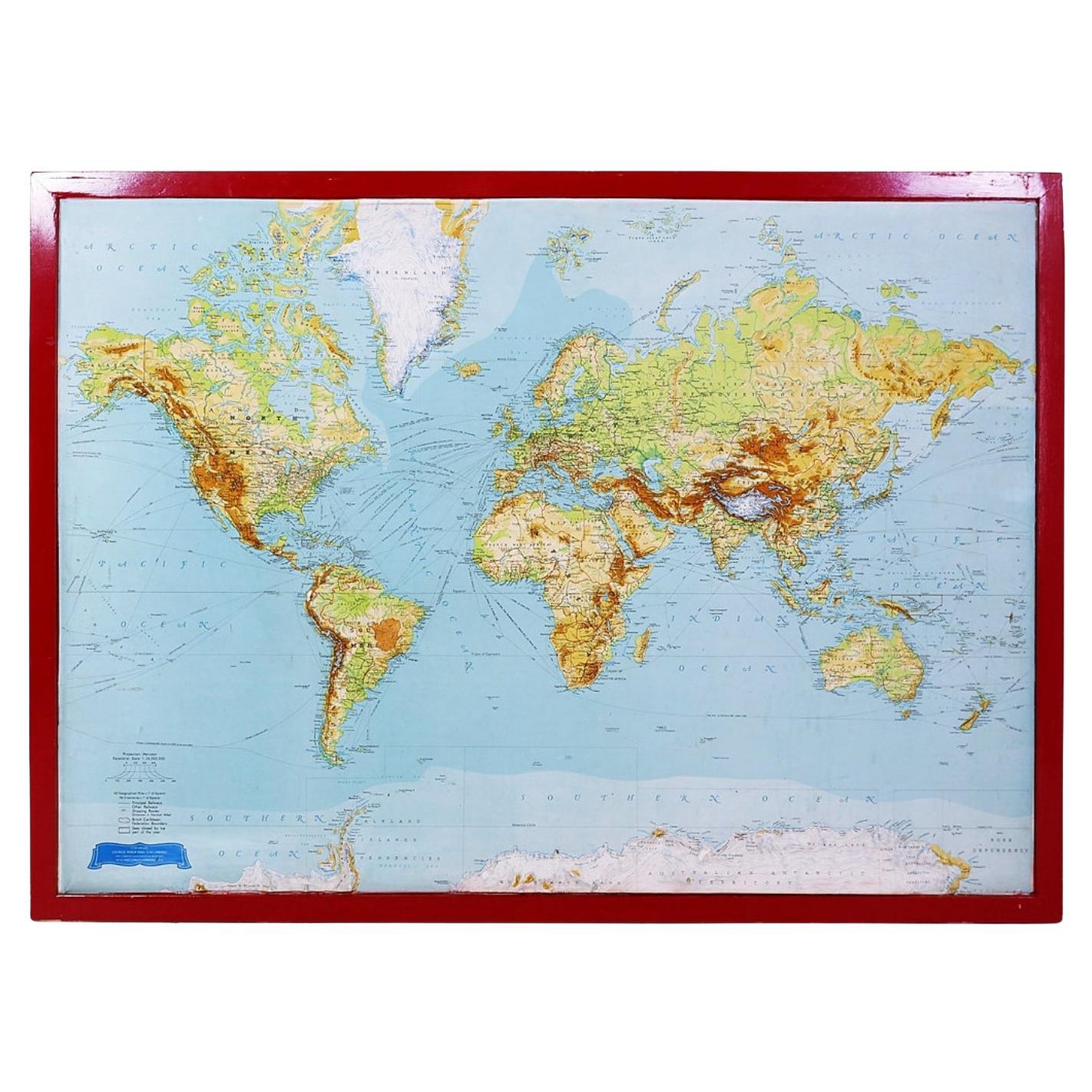
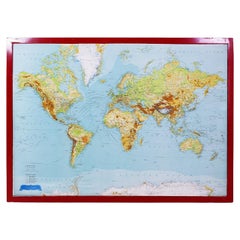
George Philip's Large Relief Map of the World 150x110cm
By George Philip & Son
Located in Linkebeek, BE
George Philip's Large Relief Map of the World 150x110cm
PHILIP, George Relief Map of the World. George Philip and Son Limited, c. 1950. Large 3D relief map of the world. Shaded relie...
Category
20th Century British Maps
Materials
Plastic, Wood
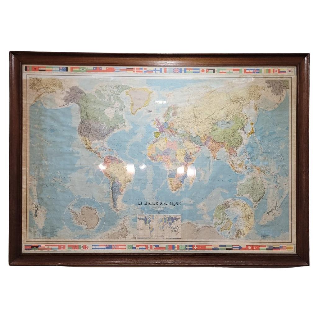
Map of France, globe / Planisphere “Le Monde Politique”, National Geographic Ins
By French House & Garden
Located in Valladolid, ES
Outstanding 19th-century French map designed and published by the French National Geographic Institute following the Aïtoff Wagner cartographic projection, a type of projection used...
Category
Vintage 1960s French Mid-Century Modern Prints
Materials
Crystal
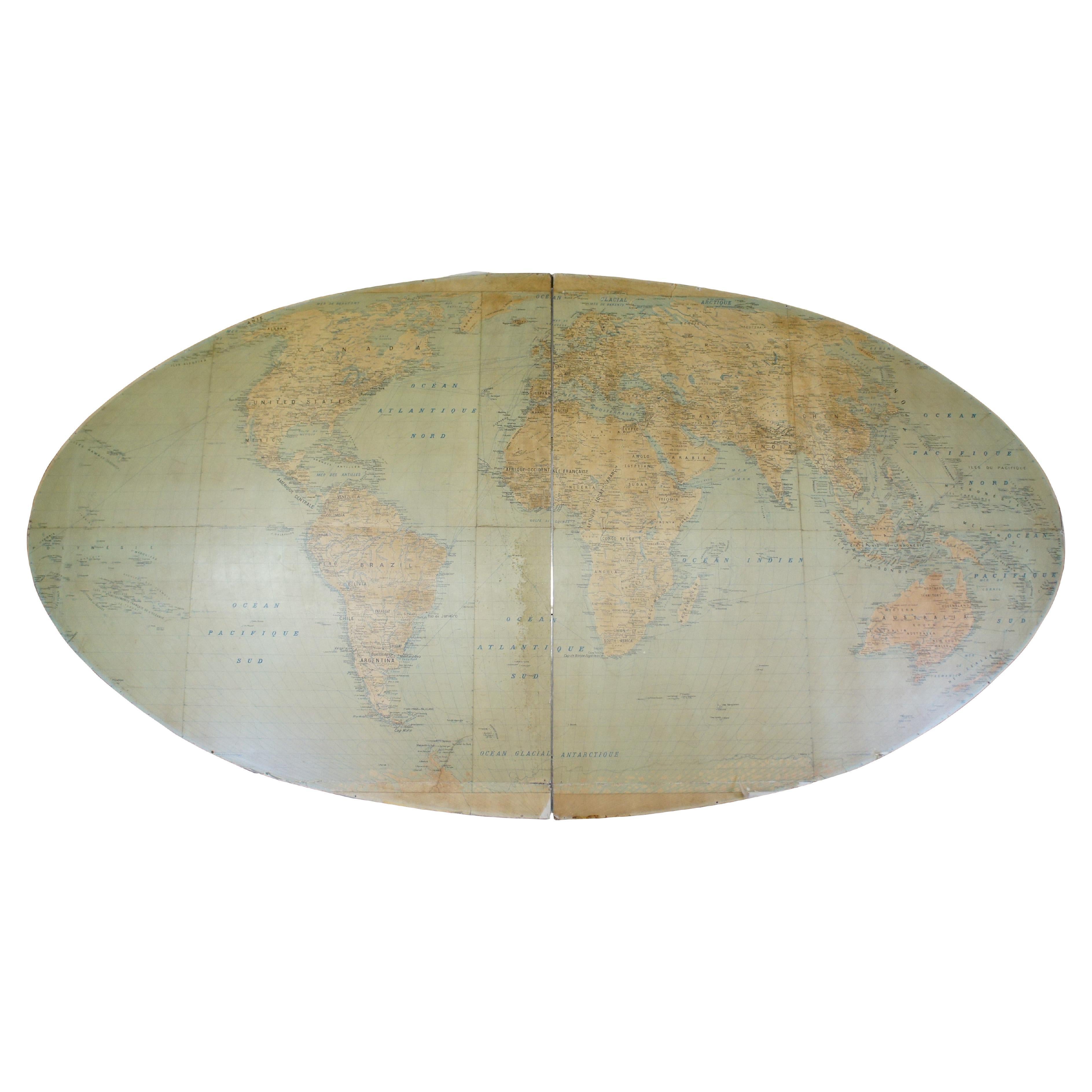
20th Century Large Vintage Oval Wall Map of the World Globe Conference Table 13'
Located in Dayton, OH
Monumental oval classroom map of the world / wall globe from the second half of the 20th century. A two piece sculpture design made with heavy wood and metal trim paneling. Can be ...
Category
20th Century Maps
Materials
Metal

$2,400 Sale Price
20% Off
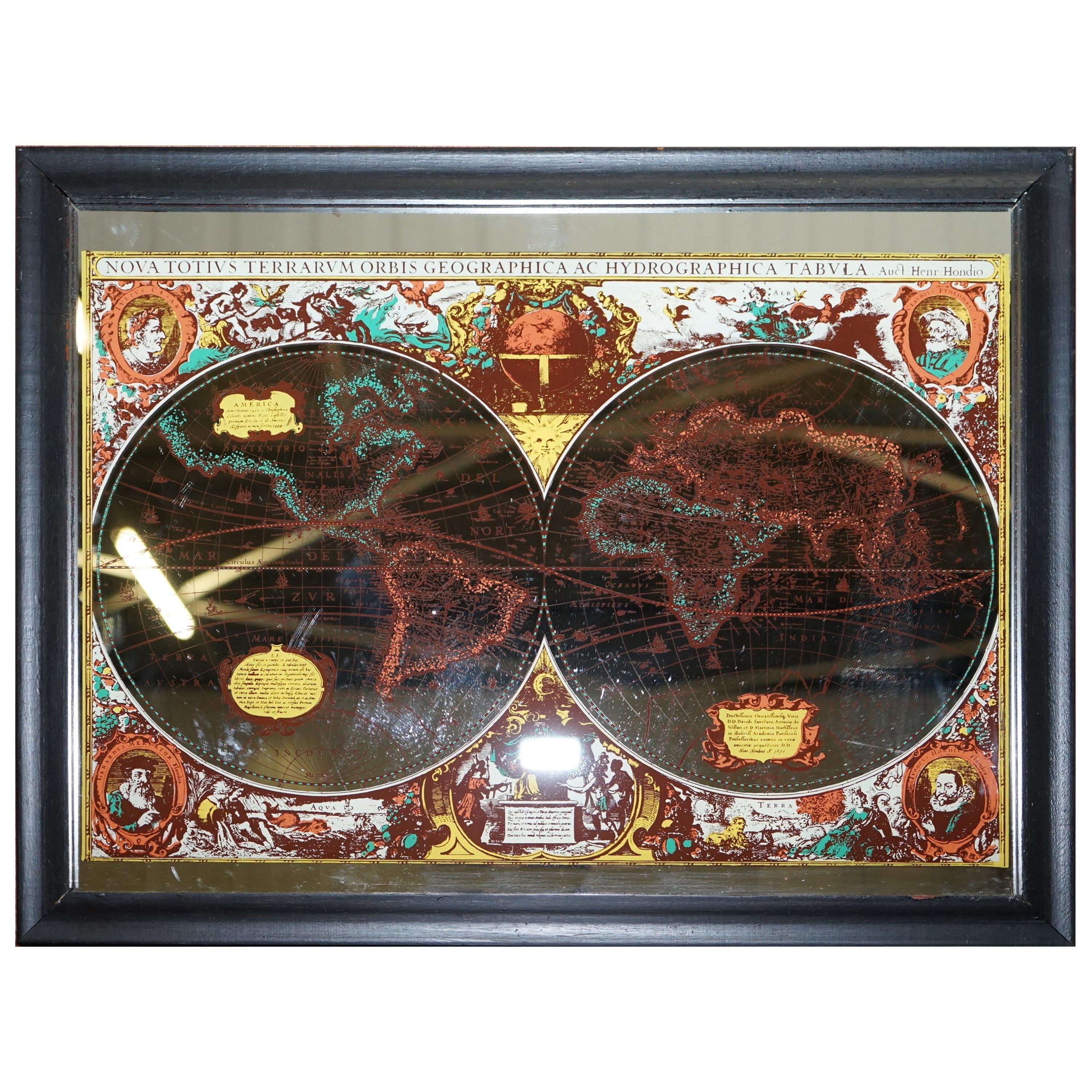
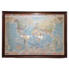
Vintage World Map Mirror Based on the Original by Johnson 1882 Military Campaign
Located in West Sussex, Pulborough
We are delighted to offer for sale this lovely Antique style pictorial plan map of the globe based on the original by Johnson in 1882
This is a very interesting and decorative pie...
Category
20th Century English Campaign Maps
Materials
Mirror

$287 Sale Price
30% Off
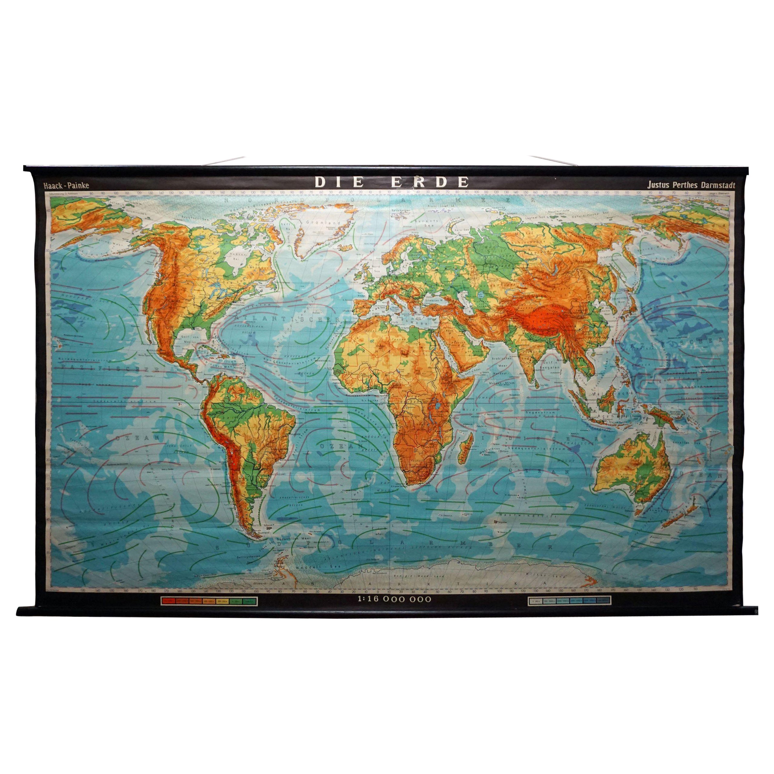
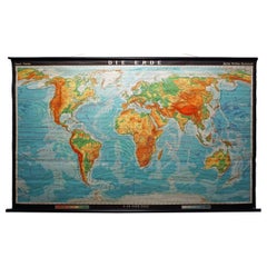
Vintage Mural World Map Earth Poster Pull-Down Wall Chart Poster Print
Located in Berghuelen, DE
A large decorative world map – named our earth, impressive wall chart decoration, published by Justus Perthes. Colorful print on paper reinforced with canvas.
Measurements:
Width 210 cm (82.68 inch)
Height 126,50cm (49.80 inch)
The measurements shown refer just to the canvas and do not include the poles.
Background information on the history of school wall charts:
The idea to upgrade every day school life by using pictures was supported in the late 18th century by Johann Bernhard Basedow. In 1774 he published a four-volume book "Elementarwerk" which combined pictures, text and information with merely hundred copperplates. Modern printing methods enabled the spread from rich private schools to rural grade schools. From 1820-1836 the oldest mentioned series of wall charts were published with the range of six booklets including 63 large sized charts...
Category
Vintage 1970s German Country Prints
Materials
Canvas, Wood, Paper
More Ways To Browse
The Vintage Map
Large Vintage Map
Philip North
Red Retro Dining Set
Antique Silver Glasses Case
Carlo Scarpa 1934 Chairs
Christofle Marly
1900 Antique Chairs
Glass Table Italian Round
Mid Century Colonial
Alvar Aalto Poster
Geometric Metal Table
Post Modern High Chairs
United Nations
Vintage Vine Rug
Cancel An Order
Antique Framing Square
Silver Metal Chair