Items Similar to America Septentrionalis by Carroli Allard (1648-1709) Copper Plate Engraving


Want more images or videos?
Request additional images or videos from the seller
1 of 12
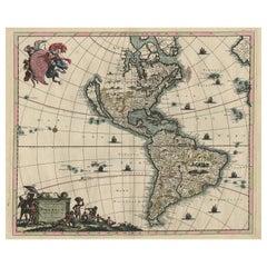
America Septentrionalis by Carroli Allard (1648-1709) Copper Plate Engraving
$975
£745.44
€858.60
CA$1,366.27
A$1,525.32
CHF 799.24
MX$18,671.37
NOK 10,150.39
SEK 9,570.53
DKK 6,407.79
Shipping
Retrieving quote...The 1stDibs Promise:
Authenticity Guarantee,
Money-Back Guarantee,
24-Hour Cancellation
About the Item
"Recentissuma Novi Orbis Sive Americae Septentrionale et Meriodionalis"
A hand-colored copper plate engraving of North and South America by Carel Allard depicting recent discoveries in North and South America, circa 1700. A lovely hand colored map depicting California as an island as well as an inset of New Zealand and a land bridge connection the northwest coast of America with Japan. Carel Allard was an engraver and publisher based in Amsterdam from a famous family of Dutch publishers and mapmakers. First published in 1696, this map dates from the early to mid 18th century. This is the fifth state with the great lakes being named. The Allard family started mapmaking under the guidance of its patriarch Hugo Allard. Later coloring.
Framed dimensions H. 22" W. 26".
- Dimensions:Height: 22 in (55.88 cm)Width: 26 in (66.04 cm)Depth: 1 in (2.54 cm)
- Materials and Techniques:
- Place of Origin:
- Period:Late 17th Century
- Date of Manufacture:Circa 1700
- Condition:Wear consistent with age and use. Minor structural damages. Toned. Old small repairs on verso; later color. some rippling to sheet. Deacidified.
- Seller Location:San Francisco, CA
- Reference Number:Seller: C424-26C1stDibs: LU855239702402
About the Seller
5.0
Recognized Seller
These prestigious sellers are industry leaders and represent the highest echelon for item quality and design.
Platinum Seller
Premium sellers with a 4.7+ rating and 24-hour response times
Established in 1982
1stDibs seller since 2008
358 sales on 1stDibs
Typical response time: 1 hour
Associations
The Art and Antique Dealers League of AmericaAntiques Associations Members
- ShippingRetrieving quote...Shipping from: San Francisco, CA
- Return Policy
Authenticity Guarantee
In the unlikely event there’s an issue with an item’s authenticity, contact us within 1 year for a full refund. DetailsMoney-Back Guarantee
If your item is not as described, is damaged in transit, or does not arrive, contact us within 7 days for a full refund. Details24-Hour Cancellation
You have a 24-hour grace period in which to reconsider your purchase, with no questions asked.Vetted Professional Sellers
Our world-class sellers must adhere to strict standards for service and quality, maintaining the integrity of our listings.Price-Match Guarantee
If you find that a seller listed the same item for a lower price elsewhere, we’ll match it.Trusted Global Delivery
Our best-in-class carrier network provides specialized shipping options worldwide, including custom delivery.More From This Seller
View AllScarce U.S. Coast Survey Map Depicting Entrance to San Francisco Bay Dated 1856
Located in San Francisco, CA
A fine example of the 1856 U.S. Coast lithographic survey nautical chart of the entrance to San Francisco bay and the city. Published in 1856 by the Office of the Coast Survey the of...
Category
Antique Mid-19th Century American Maps
Materials
Paper

Early San Francisco View by Henry Firks Printed by W.H. Jones in 1849
Located in San Francisco, CA
A tinted lithographic view of San Francisco, made during the gold rush, showing a panoramic view of the bay's waterfront from the south along Montgomery Street to Telegraph Hill. The...
Category
Antique Mid-19th Century American Victorian Maps
Materials
Paper
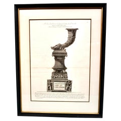
Original Piranesi Framed Engraving of a Monument in the Form of a Cornucopia
By Giovanni Battista Piranesi
Located in San Francisco, CA
Giovanni Battista Piranesi, Italian 1720-1778) Engraving on wove paper depicting an ancient Roman funeral monument in the form of a cornucopia from the Via...
Category
Antique Early 19th Century French Neoclassical Prints
Materials
Paper
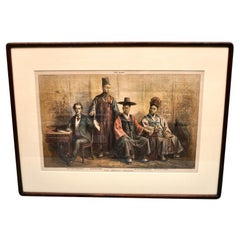
The Korean Embassy Wood Engraving from The Wasp
Located in San Francisco, CA
An interesting depiction of the Korean Embassy as published in The Wasp, a weekly San Francisco newspaper started in 1876 by Francis Korbel. The Wasp had a very political and anti-im...
Category
Antique Late 19th Century American Victorian Prints
Materials
Paper
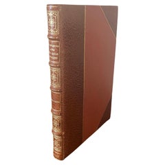
California and Its Gold Regions by Fayette Robinson
Located in San Francisco, CA
California and Its Gold Regions
by Fayette Robinson
137 pages, small octavo
Published New York: Stringer & Townsend 222 Broadway. 1849. First Edition
Beautifully rebound in gilt-tool...
Category
Antique Mid-19th Century American Books
Materials
Leather, Paper
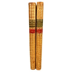
Histoire De Russie Published 1797 with 36 Engraved Plates by E.A. David
Located in San Francisco, CA
The History of Russia in 2 volumes published 1797, in French.
A lovely 2 volume first edition titled "Histoire de Russie" by Blin de Sainmore, French poet, playwright and historian (...
Category
Antique Late 18th Century French Books
Materials
Leather, Paper
You May Also Like
Rare Antique Map of the Americas with Island California by Danckerts, c.1680
Located in Langweer, NL
Rare Antique Map of the Americas with Island California by Justus Danckerts, ca. 1696
This exceptional antique map titled Novissima et Accuratissima Totius Americae Descriptio per I...
Category
Antique Late 17th Century Dutch Maps
Materials
Paper
Antique Map of America with California as an Island by Homann '1710'
Located in Langweer, NL
This antique map, titled "Totius Americae Septentrionalis et Meridionalis," represents a significant cartographic piece from 1710 by Johann Baptist Homann. Here's a description of this remarkable map:
- Title: Totius Americae Septentrionalis et Meridionalis (...)
- Date: Published in 1710 by Johann Baptist Homann.
Description:
This map is a first edition of Johann Baptiste Homann's map of America, and it is notable for several cartographic features and historical representations:
1. California as an Island...
Category
Antique Early 18th Century Maps
Materials
Paper

$2,248 Sale Price
25% Off
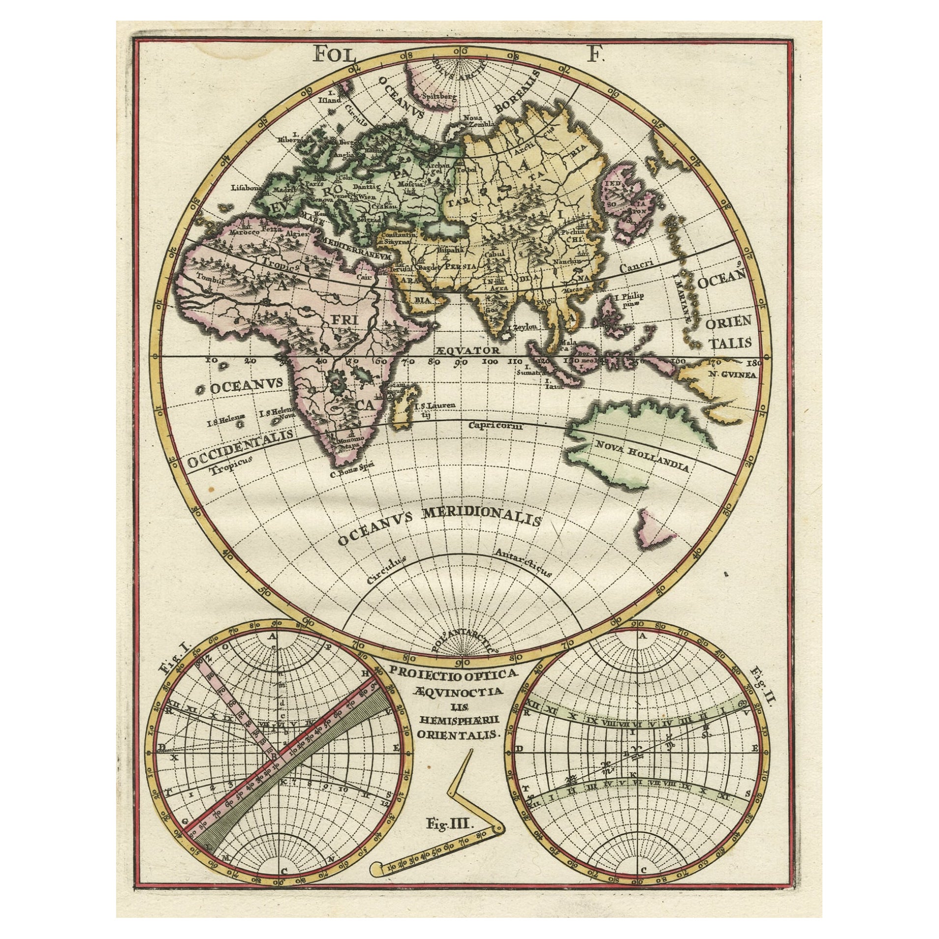
Original Antique Engraving of the Eastern Hemisphere, c.1700
Located in Langweer, NL
Antique map titled 'Proiectio Optica Aequinoctia lis Hemishaerii Orientalis' - Map of the Eastern Hemisphere with Africa, Europe, Asia and Nova Hollandia...
Category
Antique 17th Century Maps
Materials
Paper
$869 Sale Price
20% Off
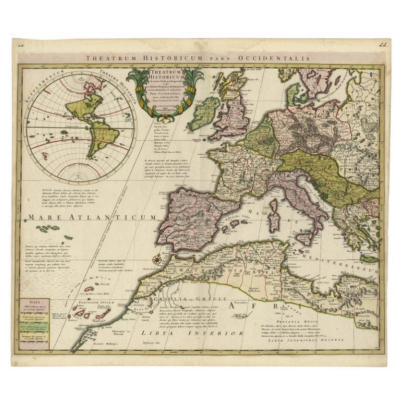
Finely Engraved Antique Map of Europe with inset of America, c.1745
By Guillaume De L'Isle
Located in Langweer, NL
Antique map titled 'Theatrum Historicum pars Occidentalis.' Finely engraved historical map with a profusion of details. It shows western Europe and the northern Mediterranean basin a...
Category
Antique 18th Century Maps
Materials
Paper
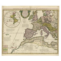
$1,391 Sale Price
20% Off
Antique Map of South American, The West Indies & Most of Africa, Ca.1775
Located in Langweer, NL
Antique map titled 'Carte pour Servir a l' Histoire Philosophique et Politique des Etablissemens et du Commerce des Europeens dans les deux Indes'.
This map is roughly centered o...
Category
Antique 1770s Maps
Materials
Paper

$718 Sale Price
20% Off
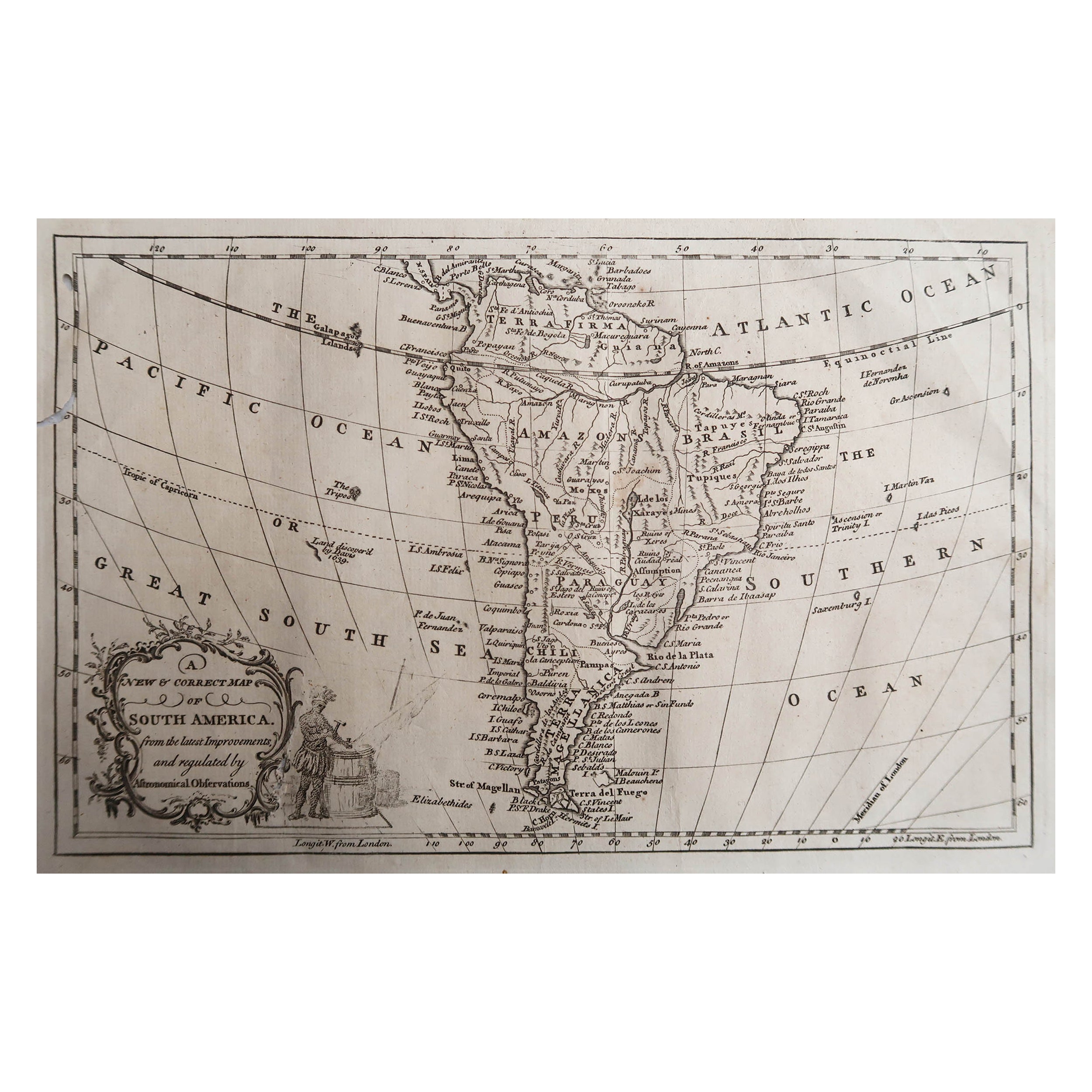
Original Antique Map of South America. C.1780
Located in St Annes, Lancashire
Great map of South America
Copper-plate engraving
Published C.1780
Two small worm holes to left side of map
Unframed.
Category
Antique Early 1800s English Georgian Maps
Materials
Paper

More Ways To Browse
Antique Copper Plates
17th Century American Furniture
Hand Colored Copper Engraving
Engravings 1700
Antique Oushak Carpets
Blue Coffee Tables
1945 Chair Juhl
Antique Three Leg Table
Folke Arstrom
Silver Over Copper
Vintage Barware Glasses
Antique Etched Glass
Antique French Shell
Coffee Table Black Italian Modern
Christofle America
Iranian Silk Rug Carpet
Poul Moller
Tables With Inlaid Wood