Items Similar to Ancient Realms of Northeast Africa: Arabia, Ethiopia, and Egypt, Published 1880
Want more images or videos?
Request additional images or videos from the seller
1 of 7
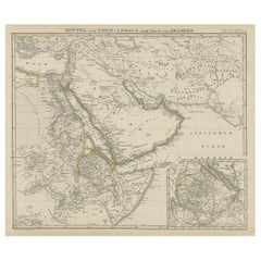
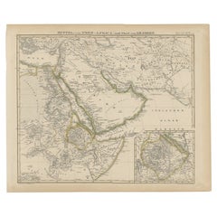
Ancient Realms of Northeast Africa: Arabia, Ethiopia, and Egypt, Published 1880
$444.23
$555.2820% Off
£332.98
£416.2220% Off
€376
€47020% Off
CA$610.29
CA$762.8620% Off
A$681.33
A$851.6720% Off
CHF 357.01
CHF 446.2620% Off
MX$8,340.18
MX$10,425.2320% Off
NOK 4,534.01
NOK 5,667.5120% Off
SEK 4,274.99
SEK 5,343.7420% Off
DKK 2,862.25
DKK 3,577.8120% Off
Shipping
Retrieving quote...The 1stDibs Promise:
Authenticity Guarantee,
Money-Back Guarantee,
24-Hour Cancellation
About the Item
This map, titled "ARABIA, AETHIOPIA, AEGYPTUS," illustrates the regions of ancient Arabia, Ethiopia, and Egypt.
Features that make this map interesting include:
1. **Geographical Span**: It covers a significant portion of the northeast African continent and parts of the Arabian Peninsula, areas rich in history and culture.
2. **Historical Detail**: The map displays detailed information from the ancient world, including the Nile River, the Red Sea, and possibly caravan routes across the desert.
3. **Inset Maps**: The inclusion of inset maps provides detailed views of particular areas, such as "AEGYPTUS INFERIOR" and "HEPTANOMIS, THEBAIS," which show lower Egypt and the Theban region respectively, offering more granular detail about these historically significant locations.
4. **Ancient Cities and Sites**: Locations of ancient cities, temples, and trade centers are likely marked, revealing the advanced civilizations that thrived in these regions.
5. **Topographical Features**: The map shows the varied landscapes, from the mountain ranges in Arabia and Ethiopia to the vast deserts and the fertile Nile valley in Egypt.
6. **Latin Labels**: The use of Latin for place names and descriptions enhances the map's historical authenticity.
7. **Cultural and Political Boundaries**: The boundaries of the regions reflect the political and cultural divisions of the time, providing insight into the ancient kingdoms and empires of Northeast Africa and the Near East.
The period represented by the map is likely during the classical antiquity, specifically during the times when these regions were well-known to the Roman Empire. For Egypt, this would be the period following its conquest by Alexander the Great, its subsequent rule by the Ptolemaic dynasty, and ultimately as a province of Rome after 30 BC. For Arabia and Ethiopia, the period could be reflective of their interactions with the Roman and Hellenistic worlds, which were especially pronounced from the first centuries BC to AD. This map would be particularly interesting to those studying the ancient civilizations of the Nile Valley, the Red Sea trade, and the interactions between Rome and the kingdoms of the Near East and Northeast Africa.
The map is from the "Spruner-Menke Atlas Antiquus," which is a historical atlas created by Karl Spruner von Merz, and later edited by Theodorus Menke. The atlas is known for its detailed maps of historical geographic regions, rendered with great precision and accompanied by scholarly research. These maps were particularly designed for educational use, providing a visual aid for the study of historical and ancient geography. The "Spruner-Menke Atlas Antiquus" is considered a significant work in the field of historical cartography and was published in the late 19th century.
- Dimensions:Height: 15.56 in (39.5 cm)Width: 18.51 in (47 cm)Depth: 0 in (0.02 mm)
- Materials and Techniques:
- Period:
- Date of Manufacture:1880
- Condition:Good, given age. General age-related toning, especially around the edges. Vertical folding line as issued. Please study scan carefully.
- Seller Location:Langweer, NL
- Reference Number:Seller: BG-13686-2-171stDibs: LU3054338541432
About the Seller
5.0
Recognized Seller
These prestigious sellers are industry leaders and represent the highest echelon for item quality and design.
Platinum Seller
Premium sellers with a 4.7+ rating and 24-hour response times
Established in 2009
1stDibs seller since 2017
2,511 sales on 1stDibs
Typical response time: <1 hour
- ShippingRetrieving quote...Shipping from: Langweer, Netherlands
- Return Policy
Authenticity Guarantee
In the unlikely event there’s an issue with an item’s authenticity, contact us within 1 year for a full refund. DetailsMoney-Back Guarantee
If your item is not as described, is damaged in transit, or does not arrive, contact us within 7 days for a full refund. Details24-Hour Cancellation
You have a 24-hour grace period in which to reconsider your purchase, with no questions asked.Vetted Professional Sellers
Our world-class sellers must adhere to strict standards for service and quality, maintaining the integrity of our listings.Price-Match Guarantee
If you find that a seller listed the same item for a lower price elsewhere, we’ll match it.Trusted Global Delivery
Our best-in-class carrier network provides specialized shipping options worldwide, including custom delivery.More From This Seller
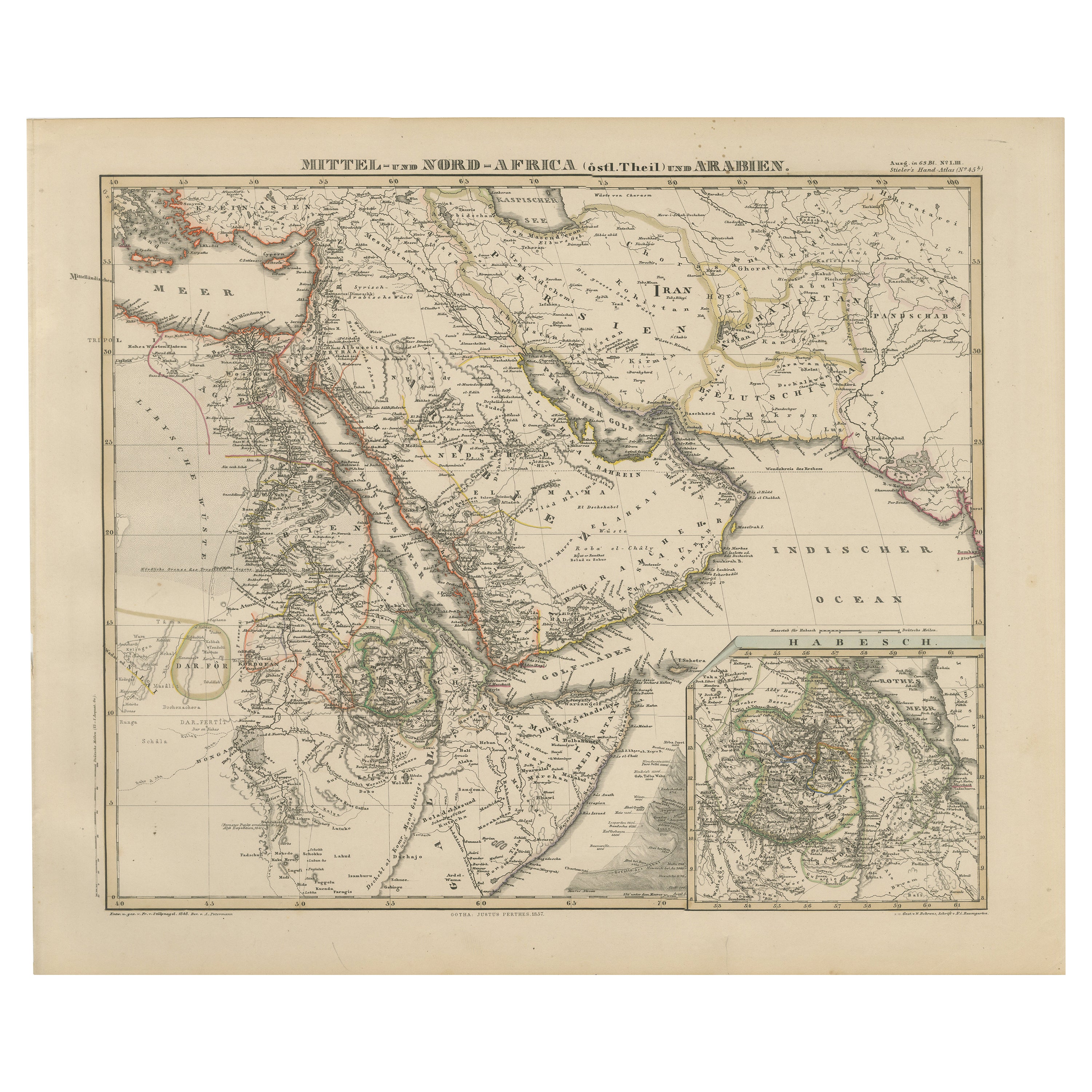
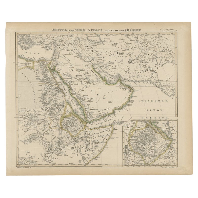
View AllHistoric 1857 Map of North-East Africa & Arabia – Fine Engraving
Located in Langweer, NL
North-East Africa and Arabia Map 1857
This detailed antique print shows “Mittel- und Nord-Afrika (östl. Theil) und Arabien” meaning “Central and North Africa (eastern part) and Arab...
Category
Antique Mid-19th Century German Maps
Materials
Paper
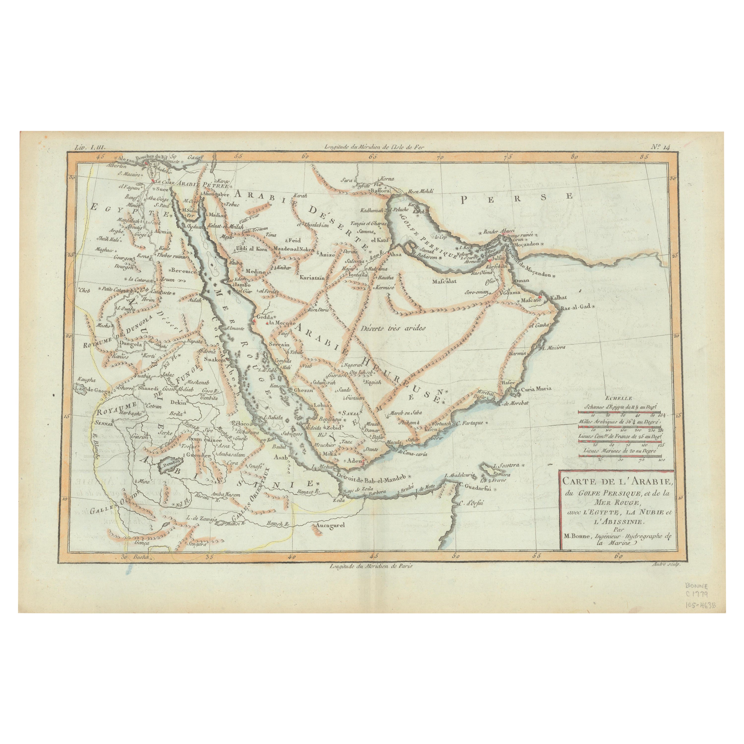
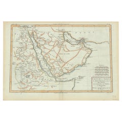
Old Map of the Arabian Peninsula with Parts of Egypt, Sudan, Eritrea & Ethiopia
Located in Langweer, NL
"Carte de l'Arabie, du Golfe Persique, et de la Mer Rouge, avec l'Egypte, la Nubie et l'Abissinie", Bonne, Rigobert
Subject: Arabia
Period: 1780 (circa)
Publication: Atlas de Toutes...
Category
Antique 1780s Maps
Materials
Paper
$359 Sale Price
20% Off
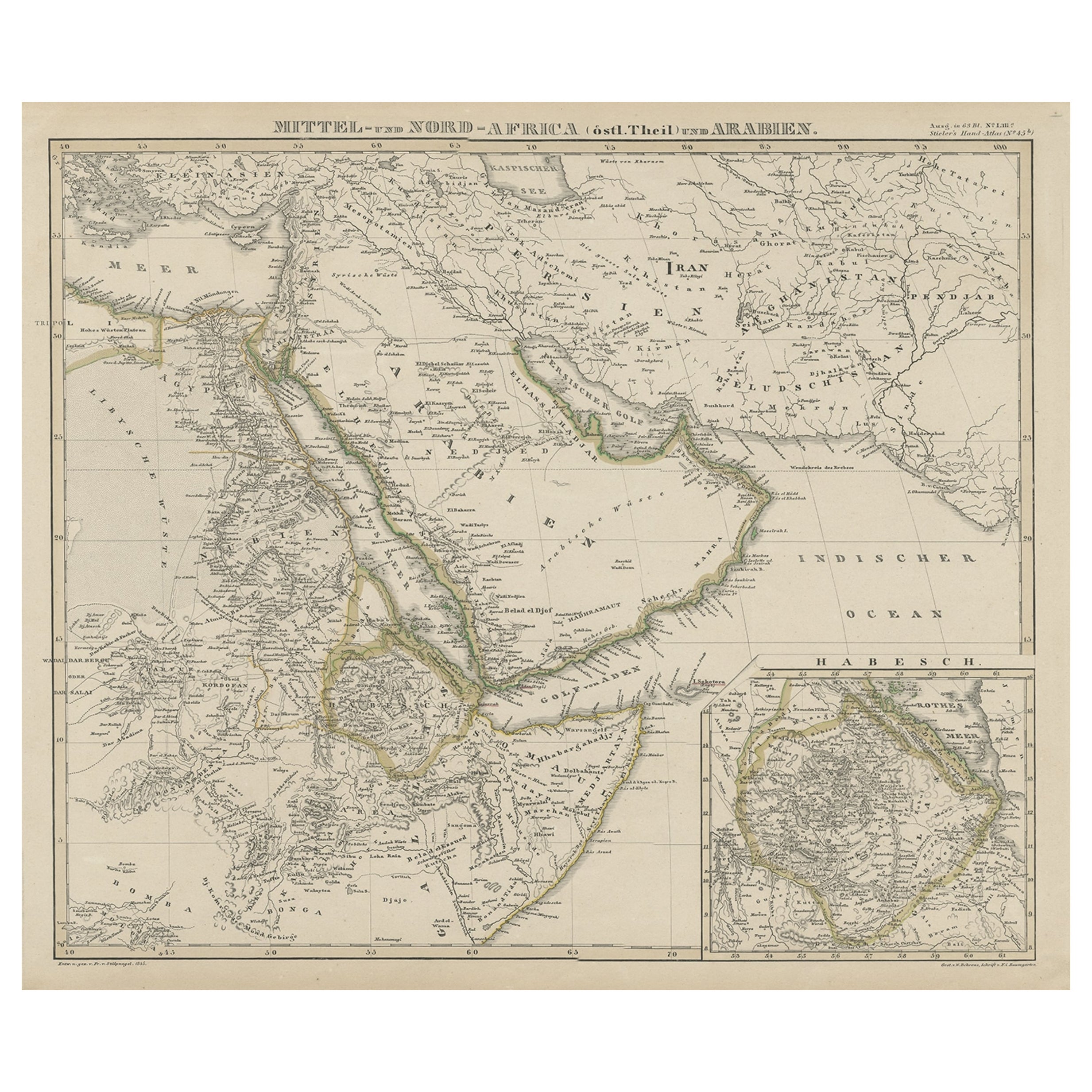
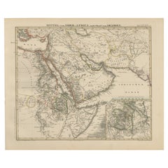
North & Central Africa & Arabia, Inset Map of Habesch 'Ethiopia & Eritrea', 1845
Located in Langweer, NL
Antique map titled 'Mittel- und Nord-Africa (östl. Theil) und Arabien'.
This map depicts North and Central Africa and Arabia with an inset map of Habesch (Ethiopia and Eritrea).
...
Category
Antique 1840s Maps
Materials
Paper
$226 Sale Price
20% Off
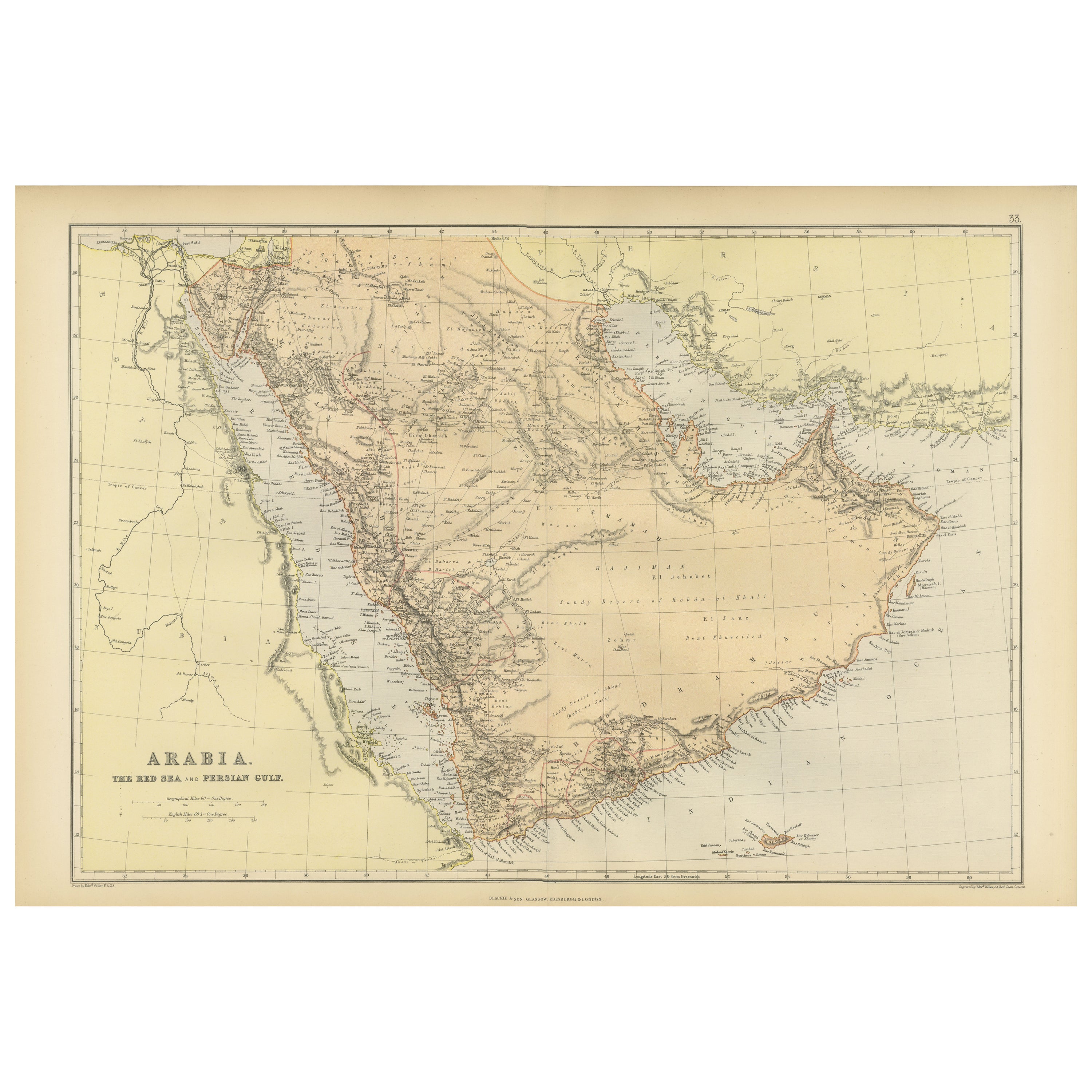
Original 1882 Map of Arabia, Red Sea & Persian Gulf
Located in Langweer, NL
This print is a historically significant map titled "Arabia, the Red Sea, and the Persian Gulf," originally published in 1882 as part of the 'Comprehensive Atlas and Geography of the...
Category
Antique 1880s Maps
Materials
Paper
$330 Sale Price
20% Off
Antique Map of Africa and Arabia with Inset Map of Ethiopia and Eritrea, 1845
Located in Langweer, NL
Antique map titled 'Mittel- und Nord-Africa (östl. Theil) und Arabien'. This map depicts North and Central Africa and Arabia with an inset map of Habesch (Ethiopia and Eritrea).
Ar...
Category
Antique 19th Century Maps
Materials
Paper
$207 Sale Price
20% Off
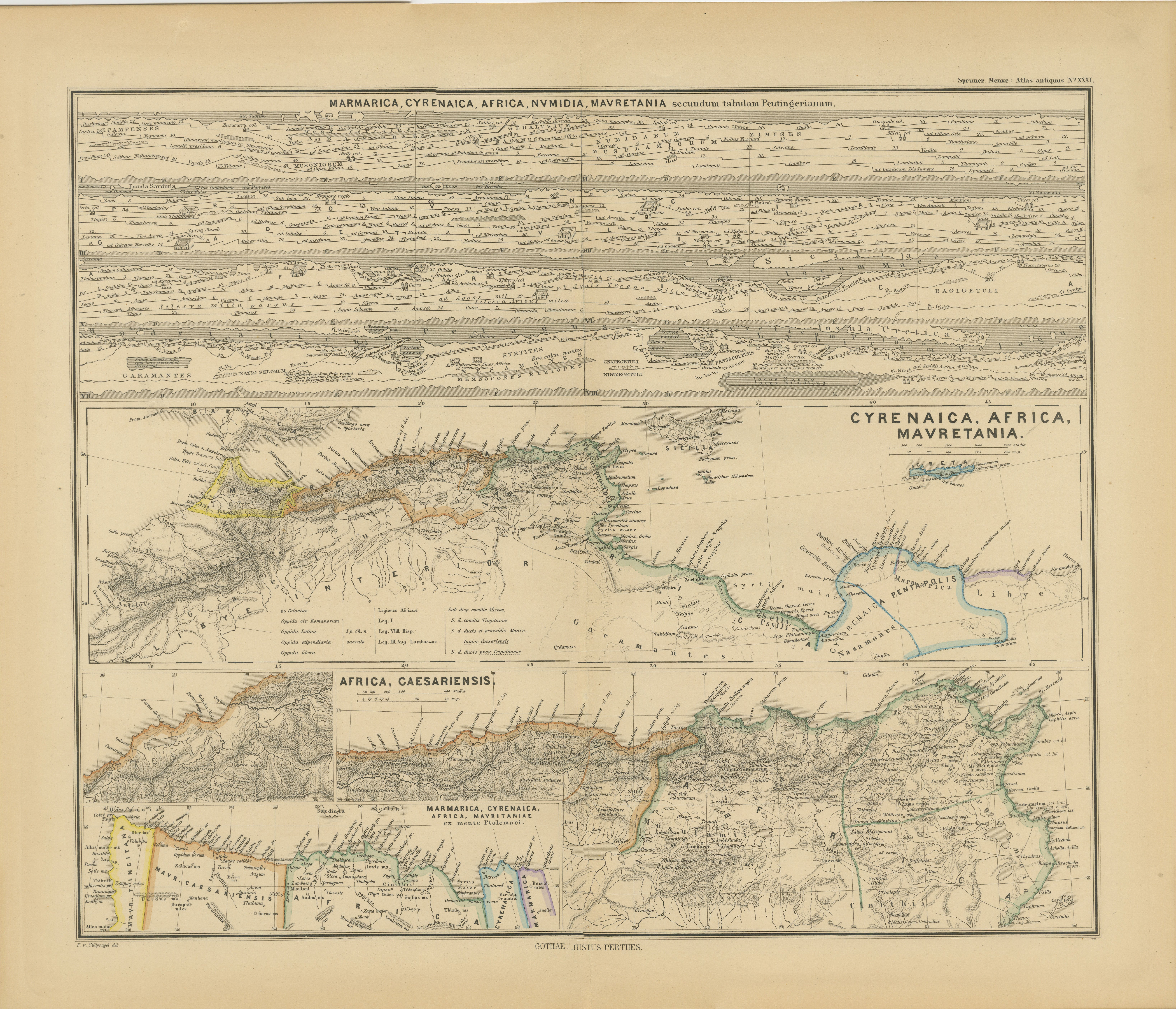
North African Coasts: Marmarica to Mauretania in Roman Times, Published in 1880
Located in Langweer, NL
The map with the title "MARMARICA, CYRENAICA, AFRICA, NUMIDIA, MAURETANIA secundum Italiam Poetarum" presents a historical geographical view of the northern coast of Africa, detailin...
Category
Antique 1880s Maps
Materials
Paper
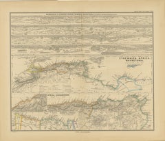
$349 Sale Price
20% Off
Free Shipping
You May Also Like
Africa. North-East Part. Century Atlas antique vintage map
Located in Melbourne, Victoria
'The Century Atlas. Africa. North-East Part'
Original antique map, 1903.
Inset map of 'Nile Delta and Suez Canal'.
Central fold as issued. Map name and nu...
Category
Early 20th Century Victorian More Prints
Materials
Lithograph

Africa. North-West Part. Century Atlas antique vintage map
Located in Melbourne, Victoria
'The Century Atlas. Africa. Southern Part'
Original antique map, 1903.
Central fold as issued. Map name and number printed on the reverse corners.
Sheet 40cm by 29.5cm.
Category
Early 20th Century Victorian More Prints
Materials
Lithograph

Map of the Holy Land "Carte de la Syrie et de l'Egypte" by Pierre M. Lapie
By Pierre M. Lapie
Located in Alamo, CA
An early 19th century map of ancient Syria and Egypt entitled "Carte de la Syrie et de l'Egypte anciennes/dressée par M. Lapie, Colonel d'Etat Major, et...
Category
Antique Early 19th Century French Maps
Materials
Paper

Map of the Holy Land "Carte de la Syrie et de l'Egypte" by Pierre Lapie
By Pierre M. Lapie
Located in Alamo, CA
This is an early 19th century map of ancient Syria and Egypt entitled "Carte de la Syrie et de l'Egypte anciennes/dressée par M. Lapie, Colonel d'Etat M...
Category
1830s Landscape Prints
Materials
Engraving

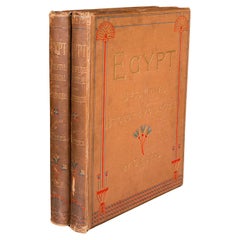
2 Large Vols Antique Reference Book, Egypt - Historical and Picturesque, English
Located in Hele, Devon, GB
This is 2 large volumes of the antique reference book 'Egypt - Descriptive, Historical and Picturesque by G. Ebers. An English translation by Clara Bell, wi...
Category
Antique Late 19th Century British Victorian Books
Materials
Textile, Paper
Large Original Antique Map of Afghanistan. Edward Weller, 1861
Located in St Annes, Lancashire
Great map of Afghanistan
Lithograph engraving by Edward Weller
Original colour
Published, 1861
Unframed
Good condition
Category
Antique 1860s English Victorian Maps
Materials
Paper

More Ways To Browse
Arabian Antique
Vintage Wood Table With Glass Top
19th Century Square Table
Galle Chairs
Large Chinese Rug
1940s Vintage French Art Deco
20th Century Spanish Table
Antonio Bellini
Retro Fiberglass Furniture
Shipping Crate
Antique Oushak Carpets
Blue Coffee Tables
German Bauhaus Posters
1945 Chair Juhl
Antique Three Leg Table
Folke Arstrom
Silver Over Copper
Vintage Barware Glasses