Items Similar to Antique 1882 Antique Map of Peru and Bolivia: Andes Mountains and Amazon Rivers


Want more images or videos?
Request additional images or videos from the seller
1 of 7
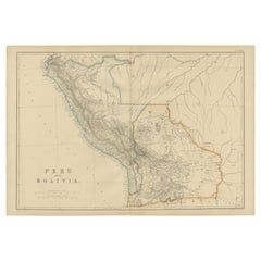
Antique 1882 Antique Map of Peru and Bolivia: Andes Mountains and Amazon Rivers
$299.79
£223.02
€250
CA$410.52
A$456.44
CHF 238.33
MX$5,556.04
NOK 3,040.99
SEK 2,849.26
DKK 1,903.11
Shipping
Retrieving quote...The 1stDibs Promise:
Authenticity Guarantee,
Money-Back Guarantee,
24-Hour Cancellation
About the Item
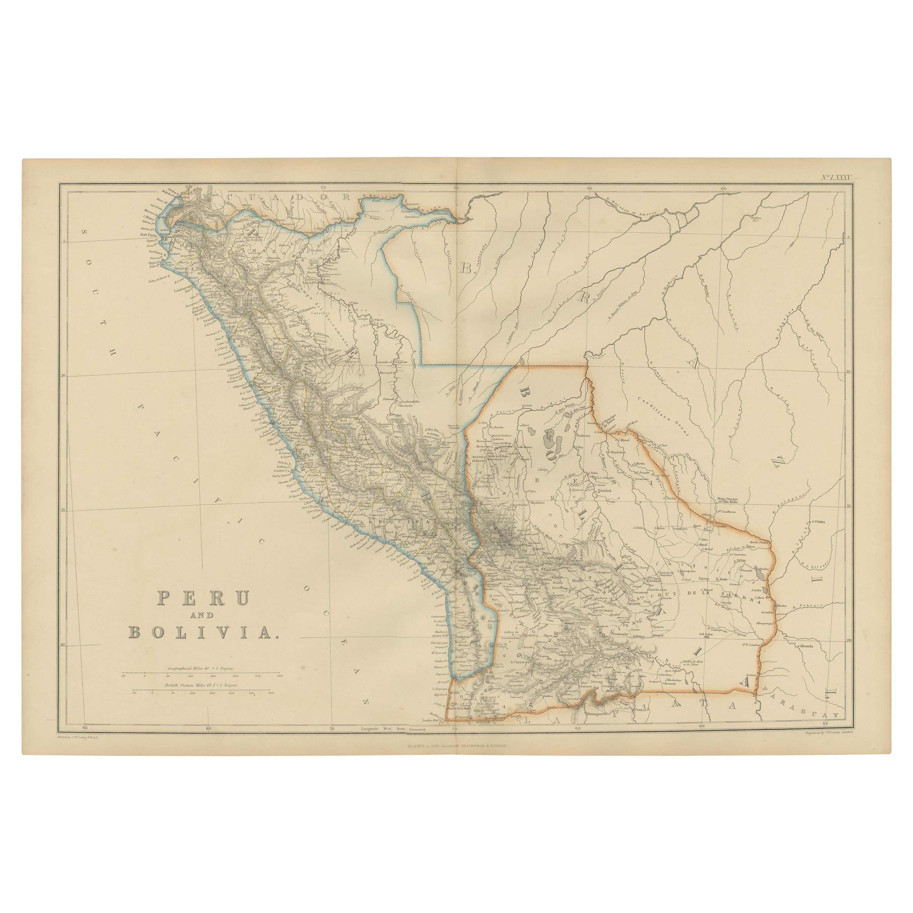
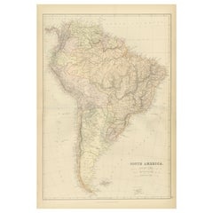
Antique 1882 Map of Peru and Bolivia: Andes Mountains, Amazon Rivers, Historic Borders
This map from 1882 provides a detailed representation of the countries of Peru and Bolivia in South America. It captures the geographical and political features of the region during the late 19th century.
The map highlights the Andes mountain range as a dominant feature, running through both countries. Peru’s western coastline along the Pacific Ocean is depicted with intricate detail, showcasing major cities such as Lima and Arequipa, as well as key rivers like the Amazon's headwaters. Bolivia's highlands and its access to the Andes are prominently displayed, reflecting the country’s diverse terrain. The map also includes significant political boundaries of the time, differentiating regions with color outlines.
Rivers, mountain ranges, towns, and other natural and man-made features are labeled clearly, offering a comprehensive view of the two nations. This map serves as a historical snapshot of the area before major territorial changes and infrastructure developments occurred in later years.
Condition Report: The map is in good condition, with a slight yellowing of the paper that is typical of its age. The edges have minimal wear, and there are faint fold marks from its original inclusion in an atlas. The printed details remain sharp and legible, and the coloring used to denote political boundaries and regions is vibrant and well-preserved.
Tips on How to Frame This Map:
1. Choose a wooden frame with a natural or dark finish, such as walnut or mahogany, to complement the historical aesthetic of the map.
2. Use acid-free matting and backing to protect the map from further aging or discoloration.
3. Consider using UV-protective glass to prevent fading from light exposure.
4. Float-mounting can showcase the map's edges, while a wide mat border offers a clean and professional presentation.
5. Position the map in a location with soft, indirect lighting to avoid glare and preserve its condition.
Recommended Matting Color:
Neutral tones like cream, light beige, or soft gray work well to enhance the map's natural aged tones. A subtle light green mat can evoke the Andean highlands and add a touch of regional context. Avoid bright or bold colors that might distract from the historical charm of the map.
- Dimensions:Height: 14.97 in (38 cm)Width: 22.45 in (57 cm)Depth: 0 in (0.02 mm)
- Materials and Techniques:
- Period:
- Date of Manufacture:1882
- Condition:Good condition, folding line in the middle. The outer borders are slightly discolored due to age, but not the image. This map is ideal for framing. Study the image carefully.
- Seller Location:Langweer, NL
- Reference Number:Seller: BG-13601-2-711stDibs: LU3054343552172
About the Seller
5.0
Recognized Seller
These prestigious sellers are industry leaders and represent the highest echelon for item quality and design.
Platinum Seller
Premium sellers with a 4.7+ rating and 24-hour response times
Established in 2009
1stDibs seller since 2017
2,510 sales on 1stDibs
Typical response time: <1 hour
- ShippingRetrieving quote...Shipping from: Langweer, Netherlands
- Return Policy
Authenticity Guarantee
In the unlikely event there’s an issue with an item’s authenticity, contact us within 1 year for a full refund. DetailsMoney-Back Guarantee
If your item is not as described, is damaged in transit, or does not arrive, contact us within 7 days for a full refund. Details24-Hour Cancellation
You have a 24-hour grace period in which to reconsider your purchase, with no questions asked.Vetted Professional Sellers
Our world-class sellers must adhere to strict standards for service and quality, maintaining the integrity of our listings.Price-Match Guarantee
If you find that a seller listed the same item for a lower price elsewhere, we’ll match it.Trusted Global Delivery
Our best-in-class carrier network provides specialized shipping options worldwide, including custom delivery.More From This Seller
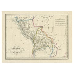
View AllAntique Map of Peru and Bolivia by W. G. Blackie, 1859
Located in Langweer, NL
Antique map titled 'Peru and Bolivia'. Original antique map of Peru and Bolivia. This map originates from ‘The Imperial Atlas of Modern Geography’. Publish...
Category
Antique Mid-19th Century Maps
Materials
Paper
$239 Sale Price
20% Off
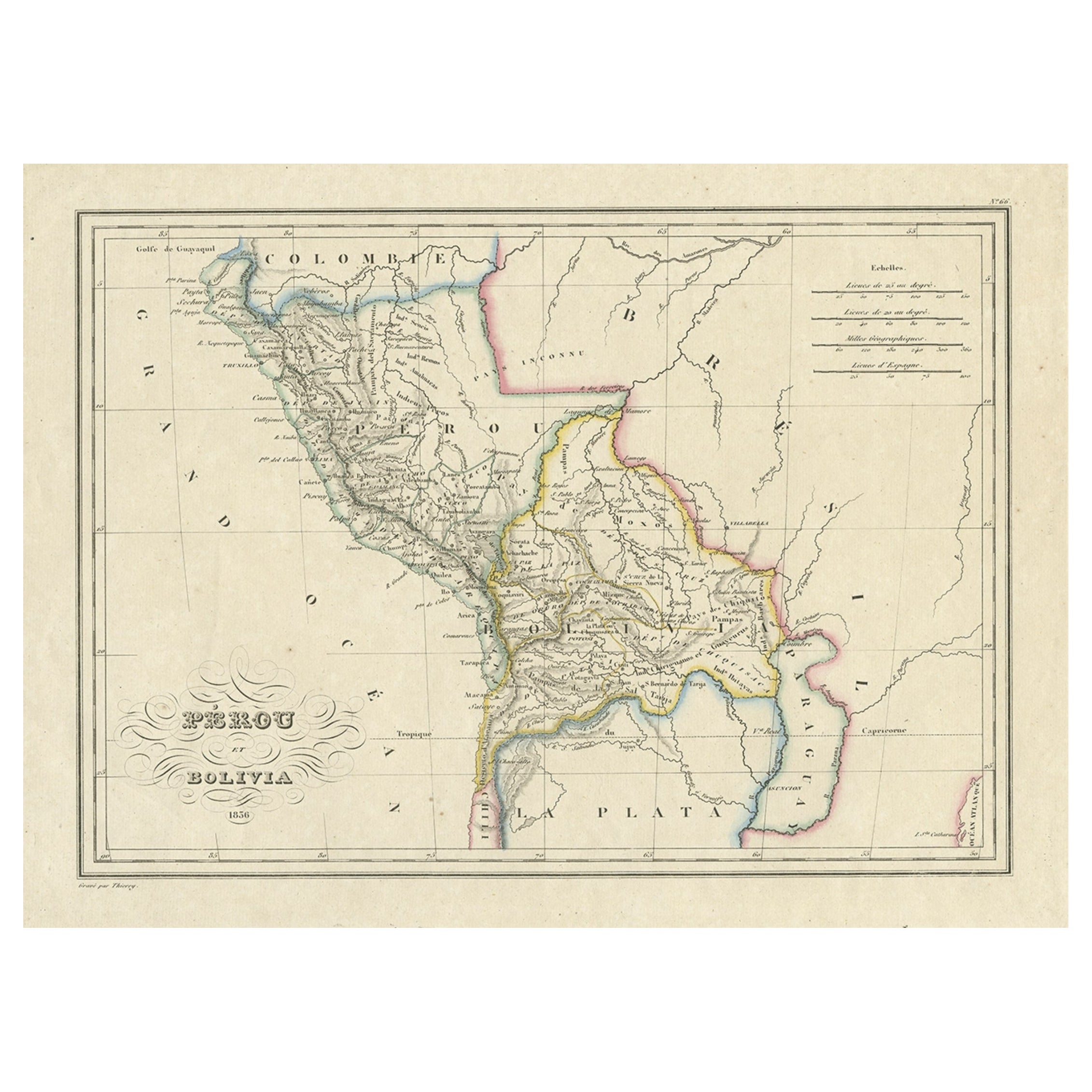
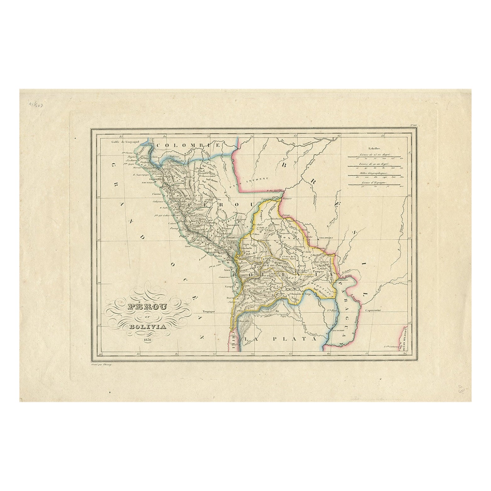
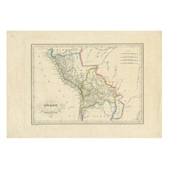
Antique Map of Peru and Bolivia, 1836
Located in Langweer, NL
Antique map titled 'Pérou et Bolivia'.
Decorative map of Peru and Bolivia with outline coloring. Originates from 'Atlas Complet Du Precis De La Geograp...
Category
Antique 1830s Maps
Materials
Paper
$326 Sale Price
20% Off
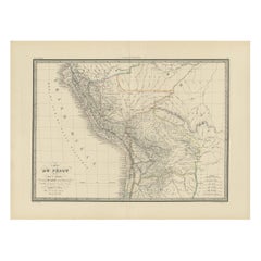
Original Antique Map of Peru in South America, 1875
Located in Langweer, NL
Antique map titled 'Carte générale du Pérou'. Large map of Peru. This map originates from 'Atlas de Géographie Moderne Physique et Politique' by A. Levasse...
Category
Antique Late 19th Century Maps
Materials
Paper

$335 Sale Price
20% Off
Antique Map of Peru and Bolivia by Thierry, 1836
Located in Langweer, NL
Antique map titled 'Pérou et Bolivia'. Decorative map of Peru and Bolivia with outline coloring. Originates from 'Atlas Complet Du Precis De La Geographie ...
Category
Antique 19th Century Maps
Materials
Paper
$124 Sale Price
20% Off
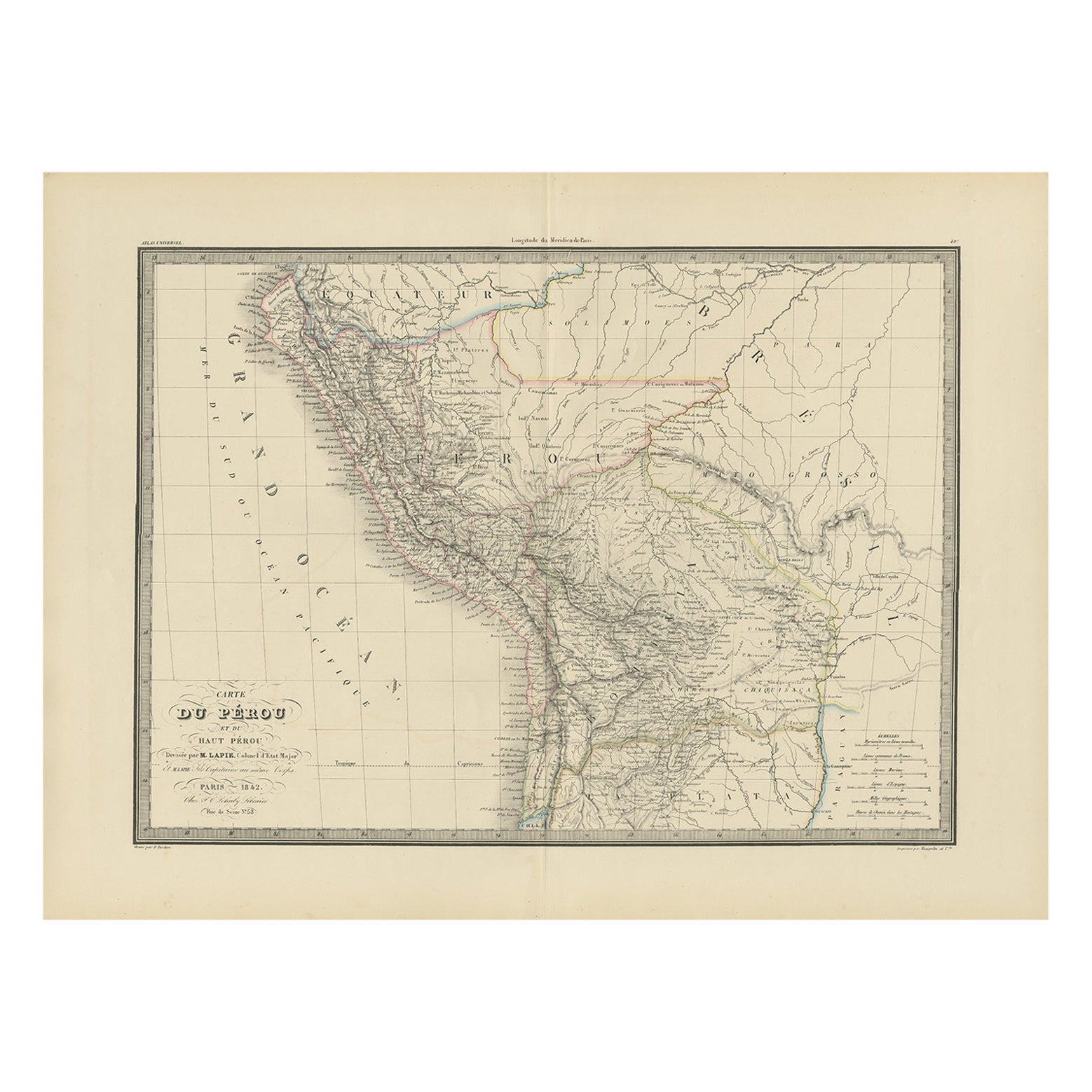
Antique Map of Peru, Ecuador and Bolivia by Lapie, 1842
Located in Langweer, NL
Antique map titled 'Carte du Perou et du Haut Perou'. Map of Peru, Ecuador and Bolivia. This map originates from 'Atlas universel de géographie ancienne et...
Category
Antique 19th Century Maps
Materials
Paper
$229 Sale Price
20% Off
1882 Detailed Map of South America showing Political and Geographical Features
Located in Langweer, NL
This 1882 map of South America, published by Blackie and Son as part of the 'Comprehensive Atlas and Geography of the World,' showcases the continent in remarkable detail. It provide...
Category
Antique 1880s Maps
Materials
Paper
You May Also Like
South America, North-West Part. Century Atlas antique vintage map
Located in Melbourne, Victoria
'The Century Atlas. South America, North-West Part'
Original antique map, 1903.
Central fold as issued. Map name and number printed on the reverse corners.
Sheet 40cm by 29.5cm.
Category
Early 20th Century Victorian More Prints
Materials
Lithograph

Original Antique Decorative Map of South America-West Coast, Fullarton, C.1870
Located in St Annes, Lancashire
Great map of Chili, Peru and part of Bolivia
Wonderful figural border
From the celebrated Royal Illustrated Atlas
Lithograph. Original color.
Published by Fullarton, Edi...
Category
Antique 1870s Scottish Maps
Materials
Paper

South America, Eastern Part. Century Atlas antique vintage map
Located in Melbourne, Victoria
'The Century Atlas. South America. Eastern Part'
Original antique map, 1903.
Inset map 'Rio de Janeiro and Vicinity'.
Central fold as issued. Map name and number printed on the rev...
Category
Early 20th Century Victorian More Prints
Materials
Lithograph

Central America. Century Atlas antique vintage map
Located in Melbourne, Victoria
'The Century Atlas. Central America.'
Original antique map, 1903.
Inset maps of 'The Country around Lake Nicaragua'.
Central fold as issued. Map name and number printed on the reve...
Category
Early 20th Century Victorian More Prints
Materials
Lithograph

Antique Lithography Map, South America, English, Framed, Cartography, Victorian
Located in Hele, Devon, GB
This is an antique lithography map of South America. An English, framed atlas engraving of cartographic interest by John Rapkin , dating to the early Victorian period and later, circ...
Category
Antique Mid-19th Century British Early Victorian Maps
Materials
Wood

Antique Map of South America in Roma Frame
Located in Malibu, CA
Antique map of South America. Displayed in a new Roma frame with museum quality matting. Custom frame in platinum. No print date, but cert...
Category
Antique Late 19th Century Victorian Prints
Materials
Hardwood, Paper

$262 Sale Price
30% Off
More Ways To Browse
Green River Furniture
Antique Peru
Antique Peruvian Furniture
Peruvian Antiques
Post Modern High Chairs
Vintage Vine Rug
Silver Metal Chair
Swedish Kilim
Vintage Scandanavian Chairs
Vintage Tropical Furniture
19th Century Red Glass
Antique French Console Table Tables
French 50s
Rusted Metal Art
Silver Bowl Large
Antique French Silk
Down Couch
Cobalt Blue Glass