Items Similar to Antique Map of Peru and Bolivia by Thierry, 1836
Want more images or videos?
Request additional images or videos from the seller
1 of 5
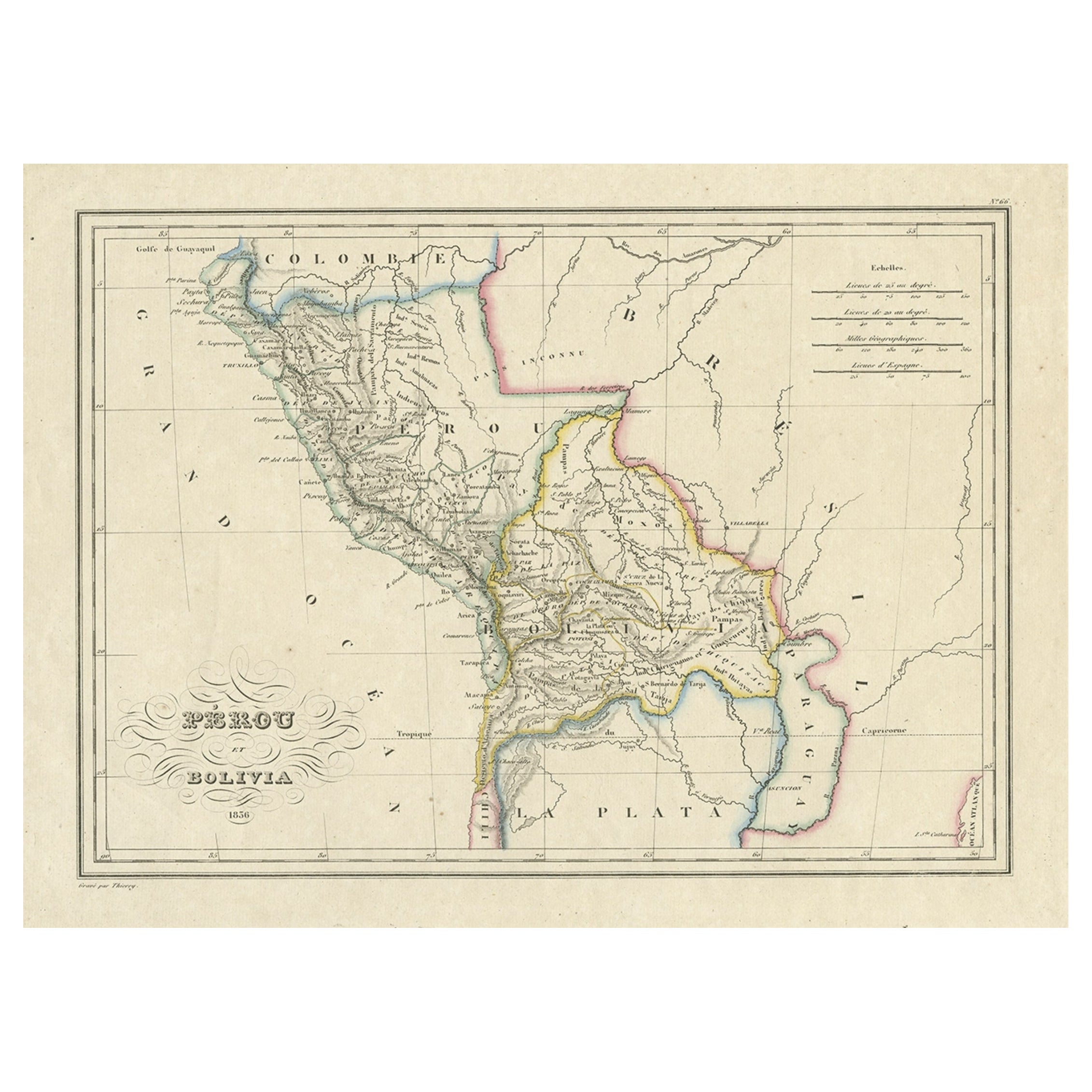
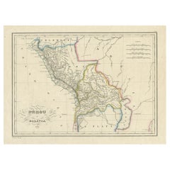
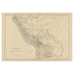
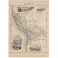
Antique Map of Peru and Bolivia by Thierry, 1836
About the Item
Antique map titled 'Pérou et Bolivia'. Decorative map of Peru and Bolivia with outline coloring. Originates from 'Atlas Complet Du Precis De La Geographie Universelle de M. Malte-Brun'. Artists and Engravers: Engraved by Thierry.
Artist: Engraved by Thierry.
Condition: Very good, general age-related toning. Please study image carefully.
Date: 1836
Overall size: 42.5 x 29.5 cm.
Image size: 0.001 x 30 x 21.5 cm.
Antique prints have long been appreciated for both their aesthetic and investment value. They were the product of engraved, etched or lithographed plates. These plates were handmade out of wood or metal, which required an incredible level of skill, patience and craftsmanship. Whether you have a house with Victorian furniture or more contemporary decor an old engraving can enhance your living space.
- Dimensions:Height: 11.62 in (29.5 cm)Width: 16.74 in (42.5 cm)Depth: 0 in (0.01 mm)
- Materials and Techniques:
- Period:
- Date of Manufacture:1836
- Condition:
- Seller Location:Langweer, NL
- Reference Number:
About the Seller
5.0
Platinum Seller
These expertly vetted sellers are 1stDibs' most experienced sellers and are rated highest by our customers.
Established in 2009
1stDibs seller since 2017
1,929 sales on 1stDibs
Typical response time: <1 hour
- ShippingRetrieving quote...Ships From: Langweer, Netherlands
- Return PolicyA return for this item may be initiated within 14 days of delivery.
More From This SellerView All
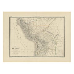
- Antique Map of Peru and Bolivia, 1836Located in Langweer, NLAntique map titled 'Pérou et Bolivia'. Decorative map of Peru and Bolivia with outline coloring. Originates from 'Atlas Complet Du Precis De La Geograp...Category
Antique 1830s Maps
MaterialsPaper
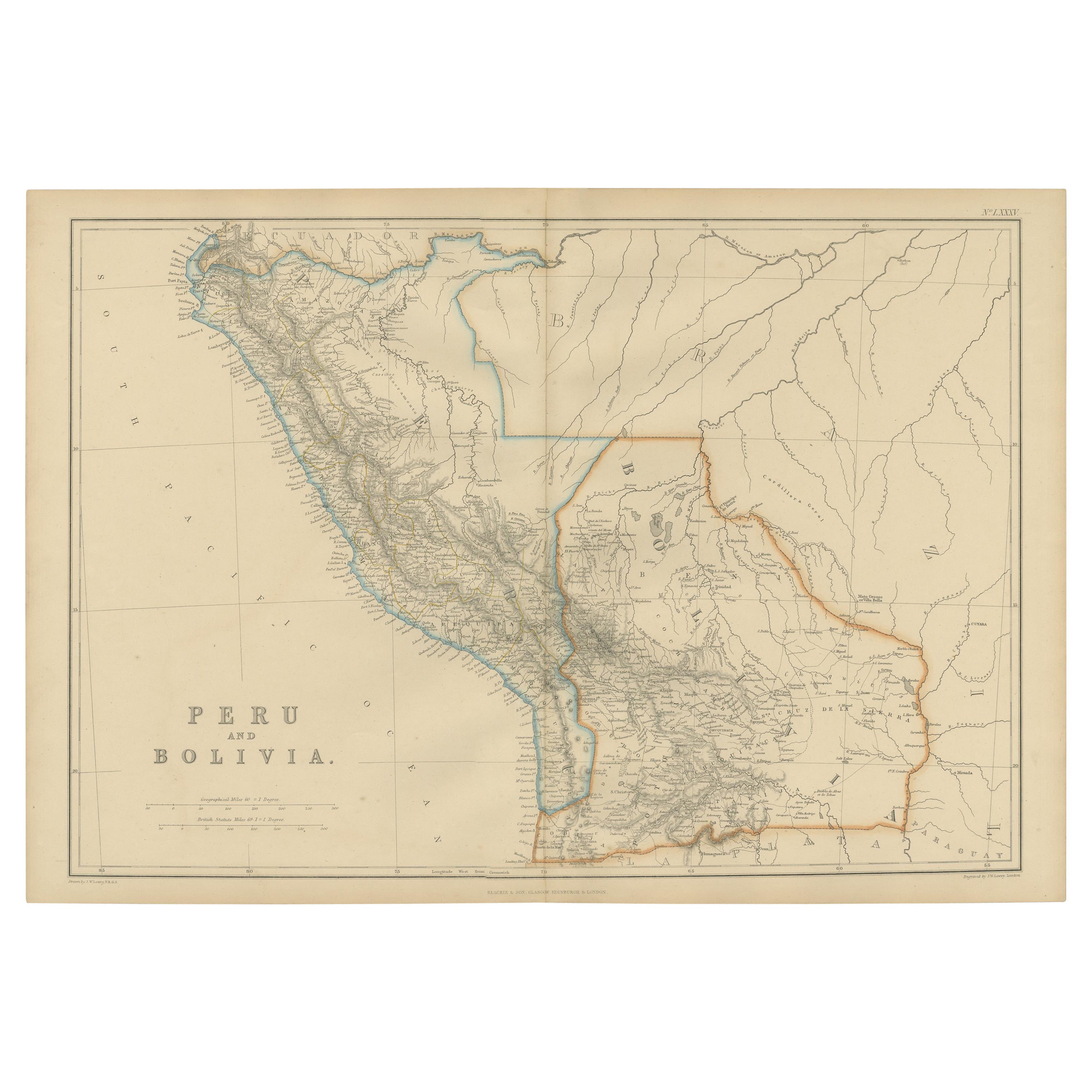
- Antique Map of Peru and Bolivia by W. G. Blackie, 1859Located in Langweer, NLAntique map titled 'Peru and Bolivia'. Original antique map of Peru and Bolivia. This map originates from ‘The Imperial Atlas of Modern Geography’. Publish...Category
Antique Mid-19th Century Maps
MaterialsPaper
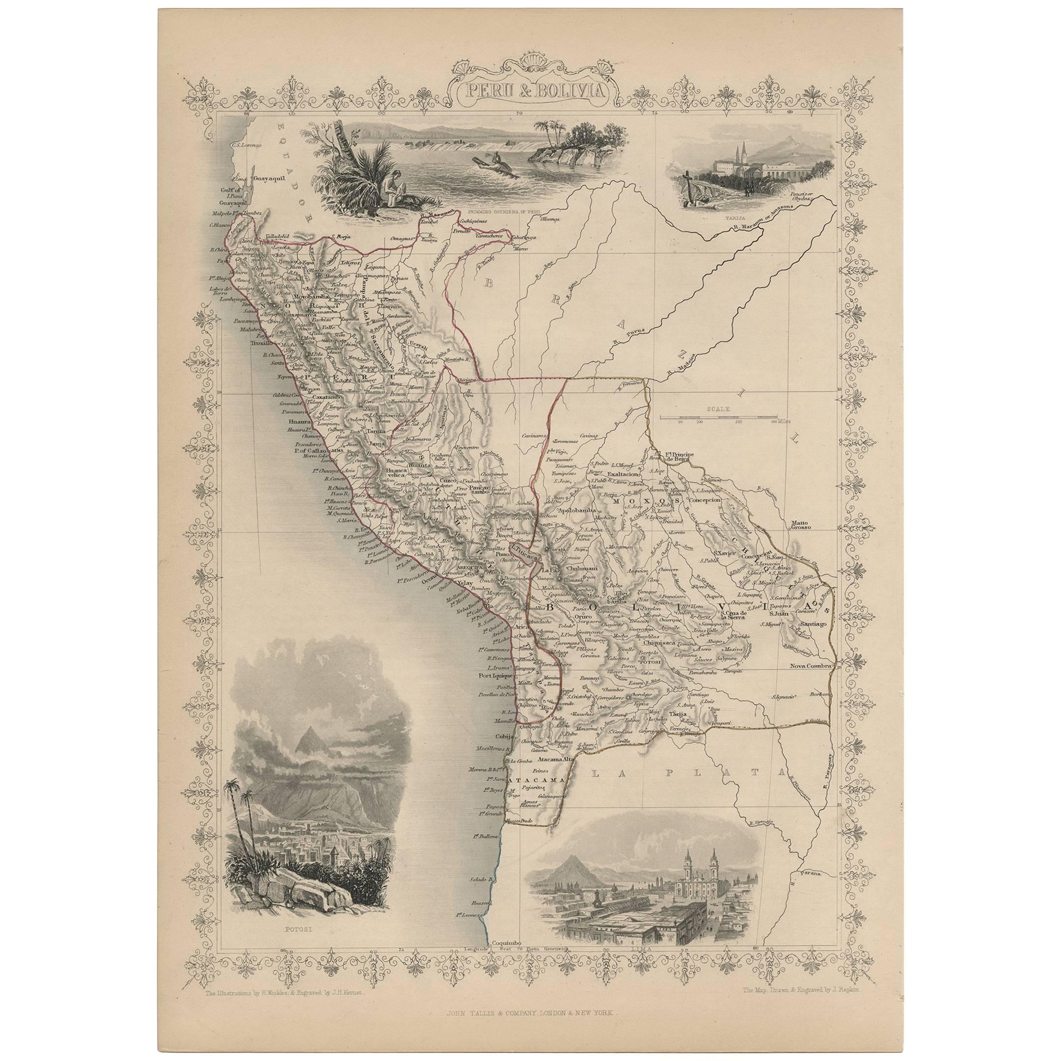
- Antique Map of Peru and Bolivia by J. Tallis, circa 1851Located in Langweer, NLA decorative and detailed mid-19th century map of Peru and Bolivia, South America which was drawn and engraved by J. Rapkin (vignettes by H. Winkles &J. H. Kernot) and published in J...Category
Antique Mid-19th Century Maps
MaterialsPaper
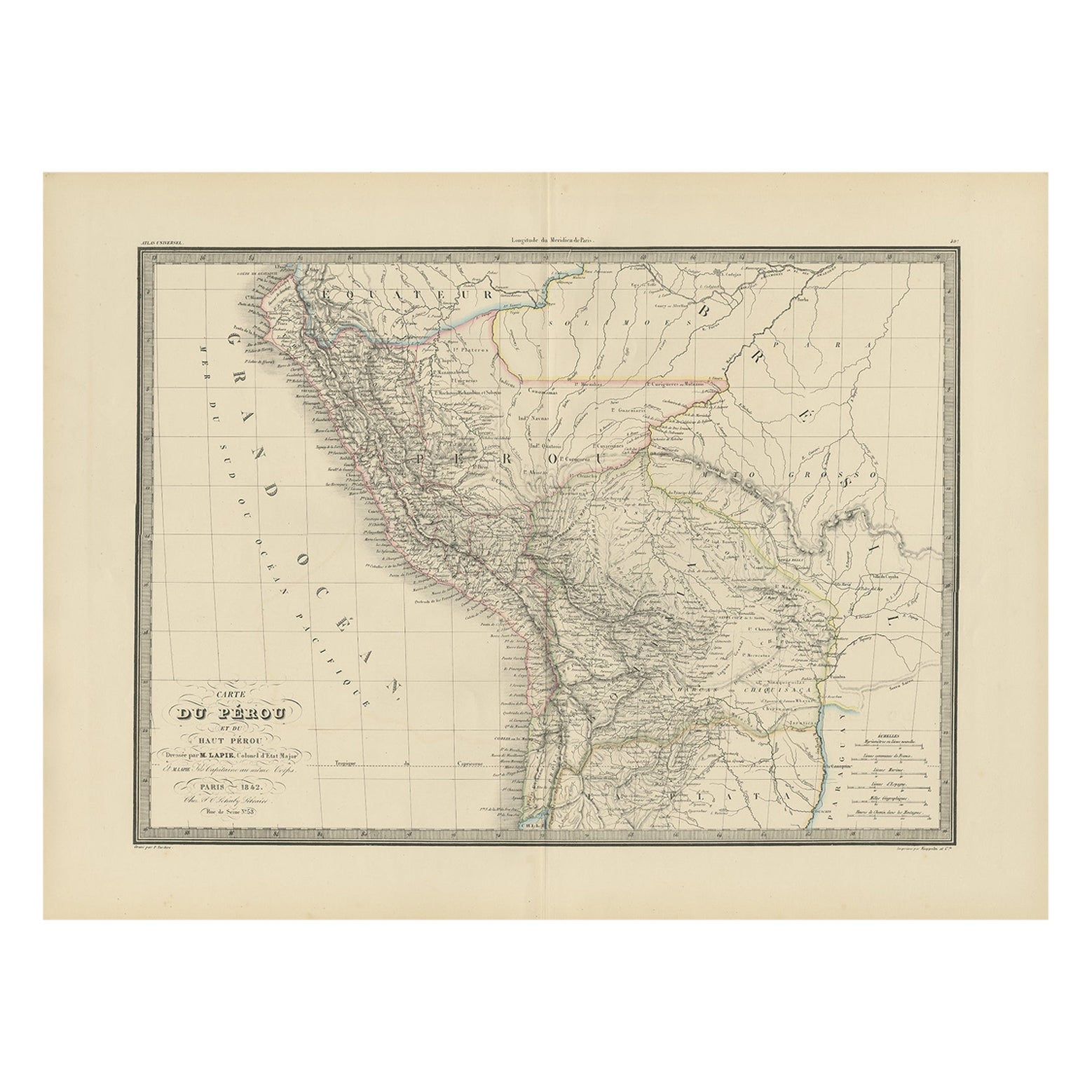
- Antique Map of Peru, Ecuador and Bolivia by Lapie, 1842Located in Langweer, NLAntique map titled 'Carte du Perou et du Haut Perou'. Map of Peru, Ecuador and Bolivia. This map originates from 'Atlas universel de géographie ancienne et...Category
Antique 19th Century Maps
MaterialsPaper
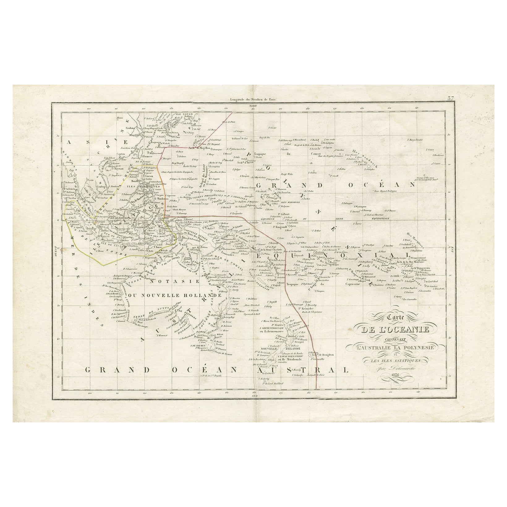
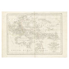
- Antique Map of Oceania by Delamarche, 1836Located in Langweer, NLAntique map titled 'Carte de l'Oceanie contenant l'Australie la Poynesie et les iles Asiatiques.' Antique map of Oceania comprising Australia and Polynesia, New Zealand and Indonesia...Category
Antique 19th Century Maps
MaterialsPaper
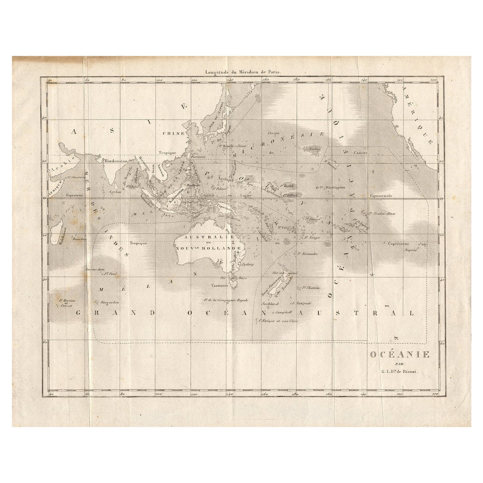
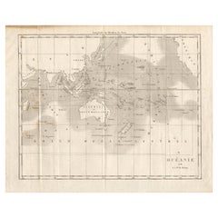
- Antique Map of Oceania by Didot, 1836Located in Langweer, NLAntique map titled 'Oceanie par G.L.Dy. De Rienzi'. Map of the Oceania region, around Australia. This print originates from M.G.L. Domeny de Rienzi's 'Oceanie, ou Cinquieme Partie du...Category
Antique 19th Century Maps
MaterialsPaper
You May Also Like
- 1861 Topographical Map of the District of Columbia, by Boschke, Antique MapLocated in Colorado Springs, COPresented is an original map of Albert Boschke's extremely sought-after "Topographical Map of the District of Columbia Surveyed in the Years 1856 ...Category
Antique 1860s American Historical Memorabilia
MaterialsPaper
- 1907 Map of Colorado, Antique Topographical Map, by Louis NellLocated in Colorado Springs, COThis highly detailed pocket map is a topographical map of the state of Colorado by Louis Nell from 1907. The map "has been complied from all availabl...Category
Antique Early 1900s American Maps
MaterialsPaper
- 1854 Map of Massachusetts, Connecticut and Rhode Island, Antique Wall MapLocated in Colorado Springs, COThis striking wall map was published in 1854 by Ensign, Bridgman & Fanning and has both full original hand-coloring and original hardware. This impression is both informative and highly decorative. The states are divided into counties, outlined in red, green, and black, and subdivided into towns. Roads, canals, and railroad lines are prominently depicted, although they are not all labeled. The mapmakers also marked lighthouses, banks, churches, and prominent buildings, with a key at right. The map is an informative and comprehensive overview of the infrastructural development of New England prior to the Civil War. Physical geographies depicted include elevation, conveyed with hachure marks, rivers and lakes. The impression features an inset map of Boston...Category
Antique 19th Century American Maps
MaterialsPaper
- Antique Map of Italy by Andriveau-Goujon, 1843By Andriveau-GoujonLocated in New York, NYAntique Map of Italy by Andriveau-Goujon, 1843. Map of Italy in two parts by Andriveau-Goujon for the Library of Prince Carini at Palazzo Carini i...Category
Antique 1840s French Maps
MaterialsLinen, Paper
- Antique Map of Principality of MonacoBy Antonio Vallardi EditoreLocated in Alessandria, PiemonteST/619 - "Old Geographical Atlas of Italy - Topographic map of ex-Principality of Monaco" - ediz Vallardi - Milano - A somewhat special edition ---Category
Antique Late 19th Century Italian Other Prints
MaterialsPaper
- Original Antique Map of Russia By Arrowsmith. 1820Located in St Annes, LancashireGreat map of Russia Drawn under the direction of Arrowsmith Copper-plate engraving Published by Longman, Hurst, Rees, Orme and Brown, 1820 Unframed.Category
Antique 1820s English Maps
MaterialsPaper


