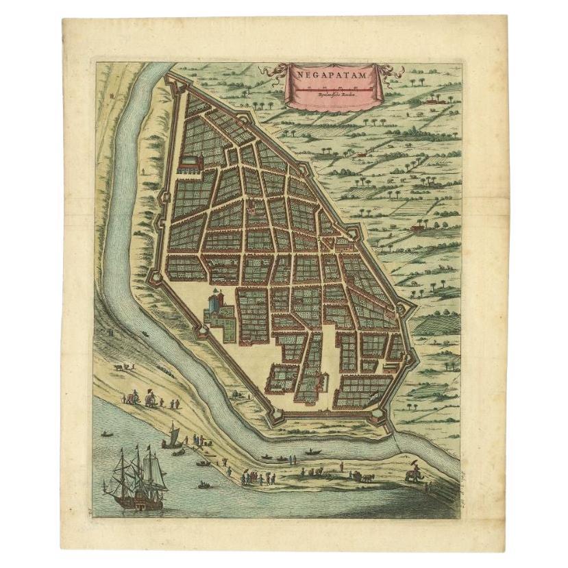
Items Similar to Antique Engraving of a Bird's-Eye Plan of Nagapattinam or Negapatam, India, 1672

Want more images or videos?
Request additional images or videos from the seller
1 of 5
Antique Engraving of a Bird's-Eye Plan of Nagapattinam or Negapatam, India, 1672
$326.18
$407.7220% Off
£242.64
£303.3020% Off
€272
€34020% Off
CA$446.65
CA$558.3120% Off
A$496.61
A$620.7620% Off
CHF 259.30
CHF 324.1320% Off
MX$6,044.97
MX$7,556.2120% Off
NOK 3,308.59
NOK 4,135.7420% Off
SEK 3,099.99
SEK 3,874.9920% Off
DKK 2,070.59
DKK 2,588.2320% Off
Shipping
Retrieving quote...The 1stDibs Promise:
Authenticity Guarantee,
Money-Back Guarantee,
24-Hour Cancellation
About the Item
Antique map titled 'Negapatam.'
Bird's-eye plan of Nagapattinam or Negapatam, India. This map originates from 'Naauwkeurige Beschryvinge van Malabar en Choromandel…en het machtige Eyland Ceyoln (..)' by Philippus Baldaeus.
Artists and Engravers: Made by 'Philip Baldaeus' after an anonymous artist. Philip Baldaeus (1632-1672). Father Philippus Baldaeus, Baelde or Philip Balde (October 1632, Delft - 1672, Geervliet) was a Dutch minister. He went to Jaffna, Ceylon with an invading Dutch force during 17th Century. As the first European he documented the life, language and culture of Tamil people, living in the north of the island. It is a great historical record, similar to Mahawamsa, and it was immediately published in Dutch and German (with many beautiful plates).
Condition: Good, given age. Edges browned and an occasional tiny tear. Small crease top right corner. Two tiny worm holes. Original middle fold as issued. General age-related toning and/or occasional minor defects from handling. Please study image carefully.
- Dimensions:Height: 14.69 in (37.3 cm)Width: 12.01 in (30.5 cm)Depth: 0 in (0.02 mm)
- Materials and Techniques:
- Period:1670-1679
- Date of Manufacture:1672
- Condition:Wear consistent with age and use. Condition: Good, given age. Edges browned and an occasional tiny tear. Small crease top right corner. Two tiny worm holes. Original middle fold as issued. General age-related toning and/or occasional minor defects from handling. Study image carefully.
- Seller Location:Langweer, NL
- Reference Number:Seller: PCT-61415 1stDibs: LU3054326686532
About the Seller
5.0
Recognized Seller
These prestigious sellers are industry leaders and represent the highest echelon for item quality and design.
Platinum Seller
Premium sellers with a 4.7+ rating and 24-hour response times
Established in 2009
1stDibs seller since 2017
2,510 sales on 1stDibs
Typical response time: <1 hour
- ShippingRetrieving quote...Shipping from: Langweer, Netherlands
- Return Policy
Authenticity Guarantee
In the unlikely event there’s an issue with an item’s authenticity, contact us within 1 year for a full refund. DetailsMoney-Back Guarantee
If your item is not as described, is damaged in transit, or does not arrive, contact us within 7 days for a full refund. Details24-Hour Cancellation
You have a 24-hour grace period in which to reconsider your purchase, with no questions asked.Vetted Professional Sellers
Our world-class sellers must adhere to strict standards for service and quality, maintaining the integrity of our listings.Price-Match Guarantee
If you find that a seller listed the same item for a lower price elsewhere, we’ll match it.Trusted Global Delivery
Our best-in-class carrier network provides specialized shipping options worldwide, including custom delivery.More From This Seller
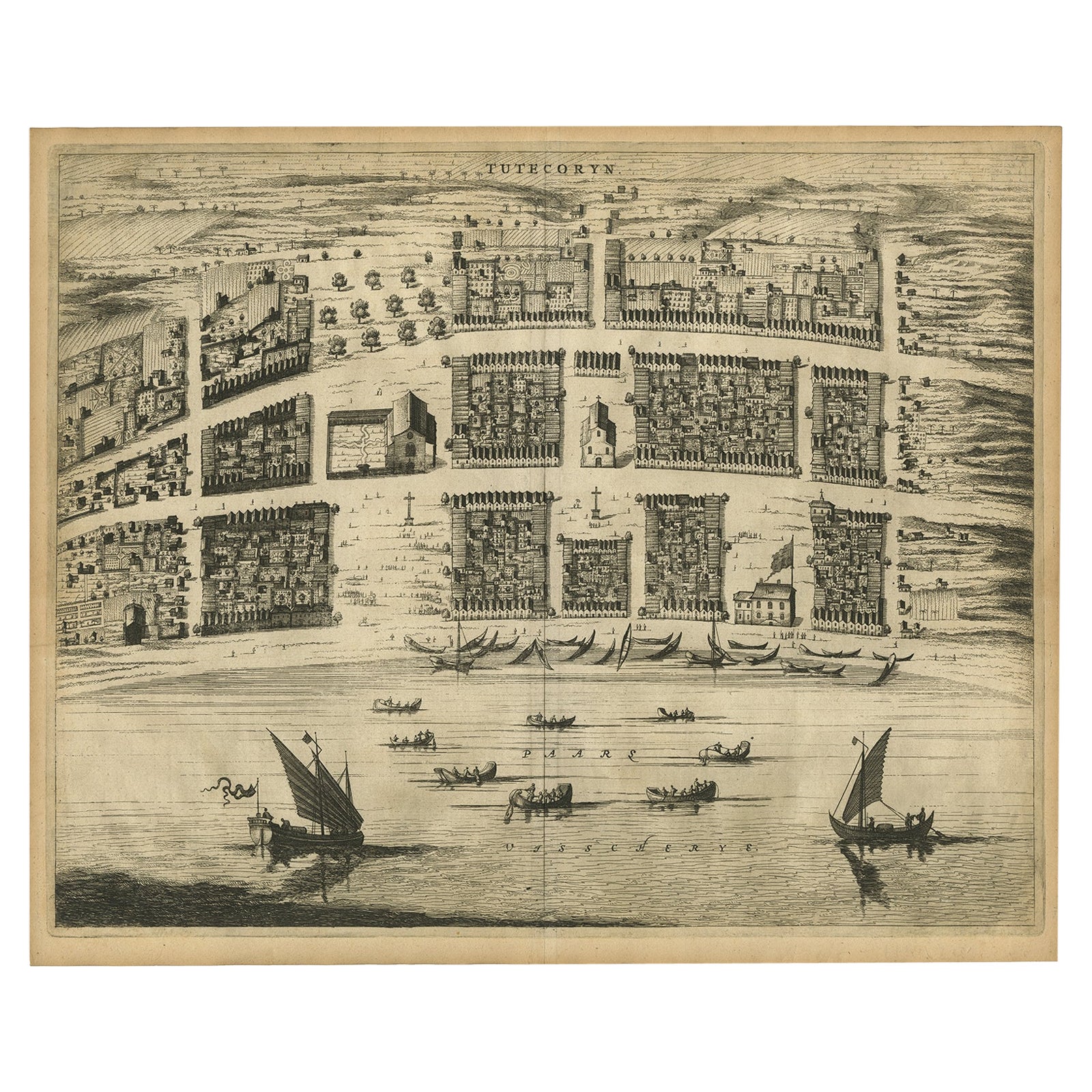
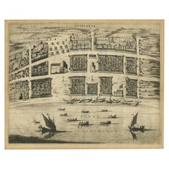
View AllAntique Bird's-Eye Plan of Tutecoryn (Tuticorin or Thoothukudi), India, 1672
Located in Langweer, NL
Antique map, titled: 'Tutecoryn.'
Bird's-eye plan of map of Tutecoryn (Tuticorin or Thoothukudi), India. This map originates from 'Naauwkeurige Beschryvinge van Malabar en Choroman...
Category
Antique 1670s Maps
Materials
Paper
$345 Sale Price
20% Off
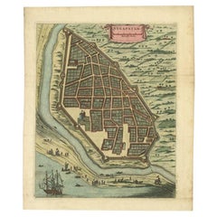
Attractive Hand-Colored Antique Plan of Nagapattinam in India, 1744
Located in Langweer, NL
Antique map titled 'Negapatam.' Attractive bird's-eye view of Nagapattinam, India from Churchill's 'A Collection of Voyages and Travels, some now first printed from original manuscri...
Category
Antique 18th Century Maps
Materials
Paper
$530 Sale Price
25% Off
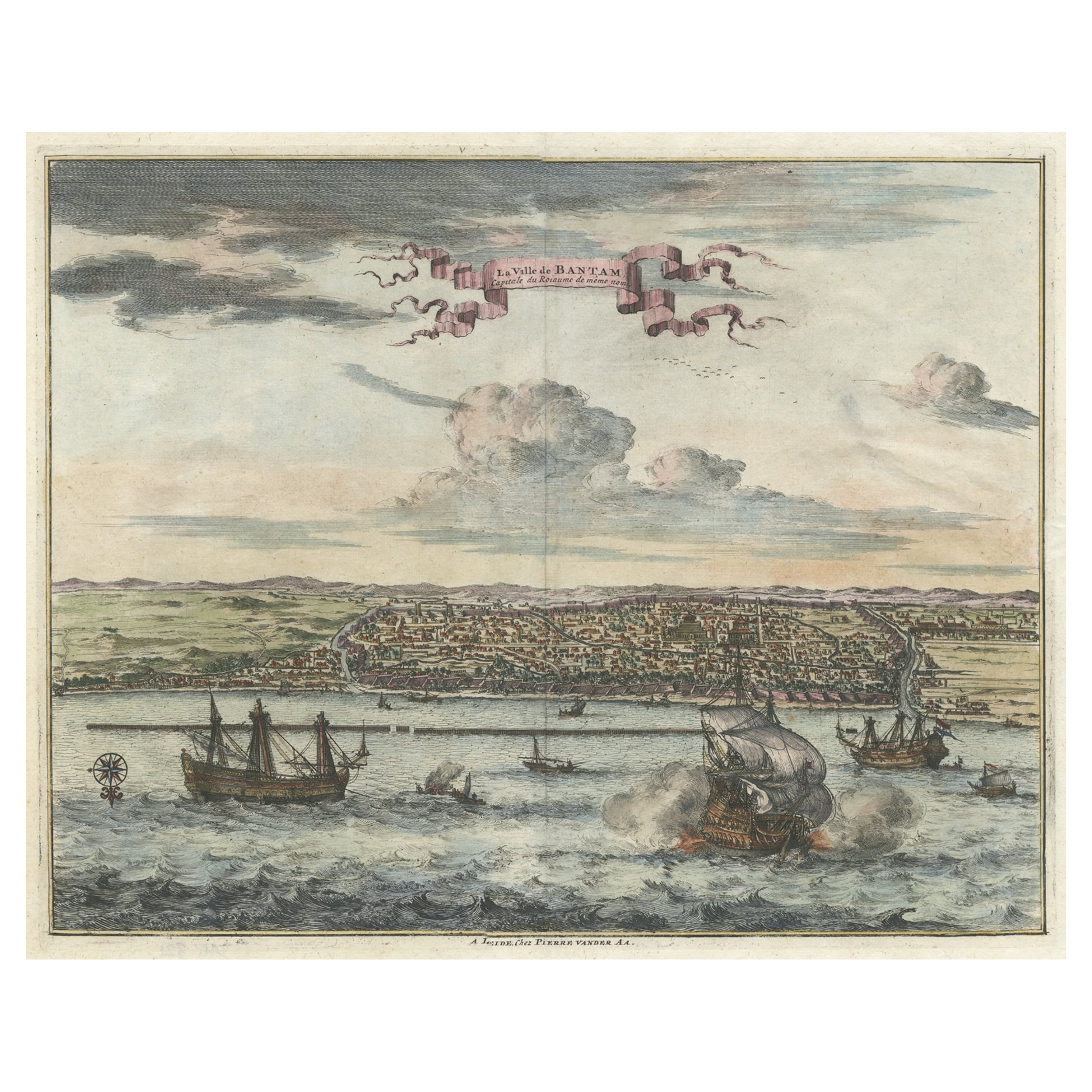
Original Antique Bird's Eye View of Banten or Bantam in Java, Indonesia, 1725
Located in Langweer, NL
Antique print titled 'La Ville de Bantam capitale du Roiaume de meme nom'.
A bird's eye view of the city Banten or Bantam near the western end of Java in Indonesia. Several tall ...
Category
Antique 1720s Prints
Materials
Paper

$690 Sale Price
20% Off
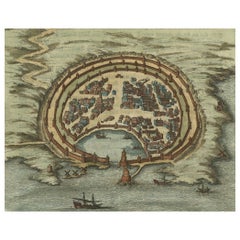
Antique Engraving with a Plan of Rhodes, Greece, 1688
Located in Langweer, NL
Description: Antique map, titled: 'Rhodos.' - Plan of Rhodes, Greece. This map originates from 'Nauwkeurige Beschrijving der eilanden in de in de Archipel der Middellantsche Zee', by...
Category
Antique 1680s Maps
Materials
Paper
$431 Sale Price
20% Off
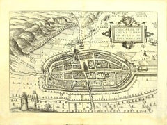
Antique Map of the City of Batavia by Van der Aa 'c.1730'
Located in Langweer, NL
Antique map titled 'Plan de la Ville et du Chateau de Batavia en l'Isle de Iava - Ware affbeeldinge wegens het Casteel ende Stadt Batavia gelegen op groot Eylant Java'. Detailed plan...
Category
Antique Mid-18th Century Maps
Materials
Paper

$1,151 Sale Price
20% Off
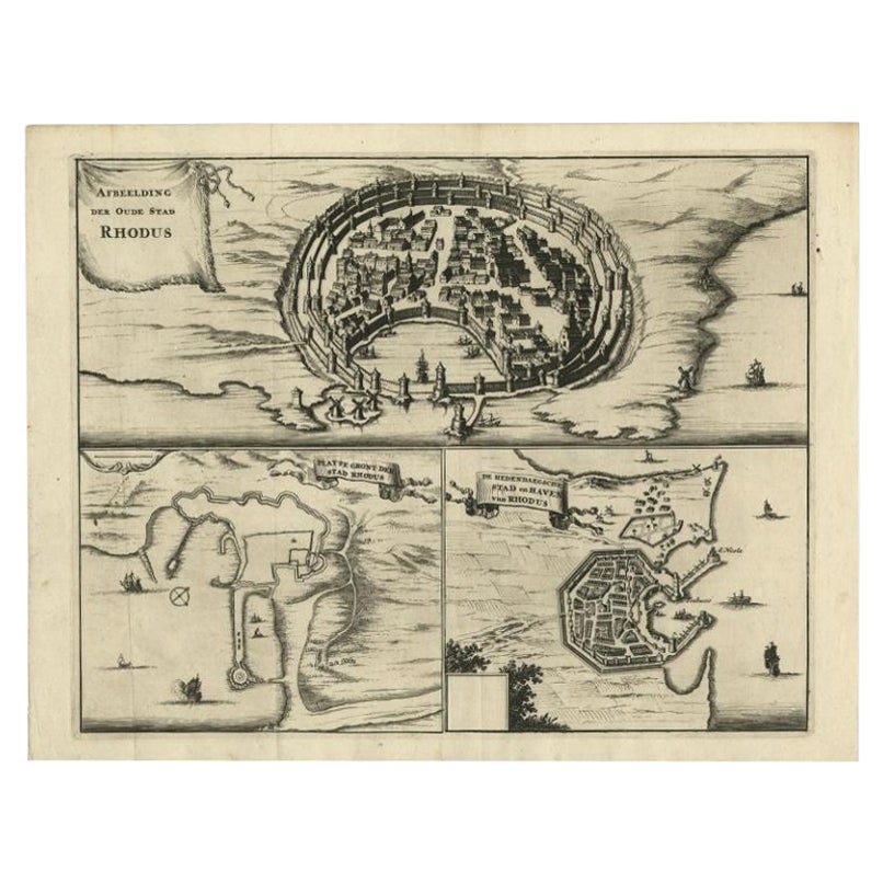
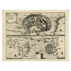
Antique Engravings, One Sheet with 3 Bird's Eye Plans of Rhodes, Greece, 1677
Located in Langweer, NL
Antique map, titled: 'Afbeelding der Oude Stad Rhodus (…).' - Sheet with 3 bird's eye plans of Rhodes, Greece.
Source unknown, to be determined.
Artists and Engravers: Made by ...
Category
Antique 17th Century Prints
Materials
Paper
$407 Sale Price
20% Off
You May Also Like
Map of Embden - Original Etching by G. Braun e F. Hogenberg - Late 16th Century
By Franz Hogenberg
Located in Roma, IT
This map of Embdena is an original etching realized by George Braun and Franz Hogenberg in the Late 16th Century, as part of the famous Series "Civitates Orbis Terrarum" (Atlas of t...
Category
16th Century Figurative Prints
Materials
Etching

18th Century Map Engraving - Newport, a Strong Sea-Port Town in Flanders
Located in Corsham, GB
A map of Nieuwpoort, anglicised to 'Newport', in northern Belgium. There is a panorama in the upper quarter depicting major landmarks. Below is a plan of the town, including its strong defences and ships at the port in the lower register. Inscribed with the title in plate to the lower edge, 'Newport a Strong Sea-Port Town...
Category
18th Century More Prints
Materials
Engraving

$269 Sale Price
20% Off
17th Century Topographical Engraving Nantes & St. Malo, France, by Iohan Peeters
Located in New York, NY
The ancient city of Saint Malo in North Western France has long been associated with adventure on the high seas, piracy and exploration. It was the birthplace of several important in...
Category
Antique 17th Century Dutch Maps
Materials
Paper

Map of Kalkar - Etching by G. Braun and F. Hogenberg - Late 16th Century
By Franz Hogenberg
Located in Roma, IT
This map of Calcaria is an original etching realized by George Braun and Franz Hogenberg, as part of the famous Series "Civitates Orbis Terrarum" (Atlas of the Cities of the World)....
Category
16th Century Figurative Prints
Materials
Etching
Antique Voc Print Holland Malaysia Old Map Melaka History, 1663
Located in Amsterdam, Noord Holland
From my own collection I offer this impressive Antique print of the city of Malakka
A very interesting piece for collectors . It is an museum piece from the Dutch Institute of Orien...
Category
Antique 17th Century European Paintings
Materials
Paper

$293 Sale Price
20% Off
17th Century Toulouse, Savve, Sommieres Topographical Map by Iohan Peeters
Located in New York, NY
Fine topographical 17th century map of Toulouse, Savve and Sommieres by Iohan Peeters
Beautiful engraving of the capital of France's Occitanie Region, Toulouse, called La Ville Rose- the Pink City, for the terracotta bricks used in its many buildings, giving the city a distinct apricot-rose hue. An important cultural and educational center, the city's residents included Nobel Prize winners and world renown artists- Henri de Toulouse-Lautrec, Henri Martin, Jean-Auguste-Dominique Ingres, Antonin Mercie, Alexandre Falguiere and more recently Cyril Kongo...
Category
Antique 17th Century Dutch Maps
Materials
Paper

More Ways To Browse
India Engraving
17th Century German Engravings
Worm Holes
Delft Handles
Philip North
Malabar Map
Persian Maps
Antique Map Of The Philippines
Large Map Of Italy
Used Marine Compass
West Indies Colonial
Antique Pamphlets
Sicily Map
Thailand Map
Antique Maps Of Russian Empire
Antique Navigational Tools
Australian Colonial
Antique German Compass