Items Similar to Original Antique Bird's Eye View of Banten or Bantam in Java, Indonesia, 1725

Want more images or videos?
Request additional images or videos from the seller
1 of 5
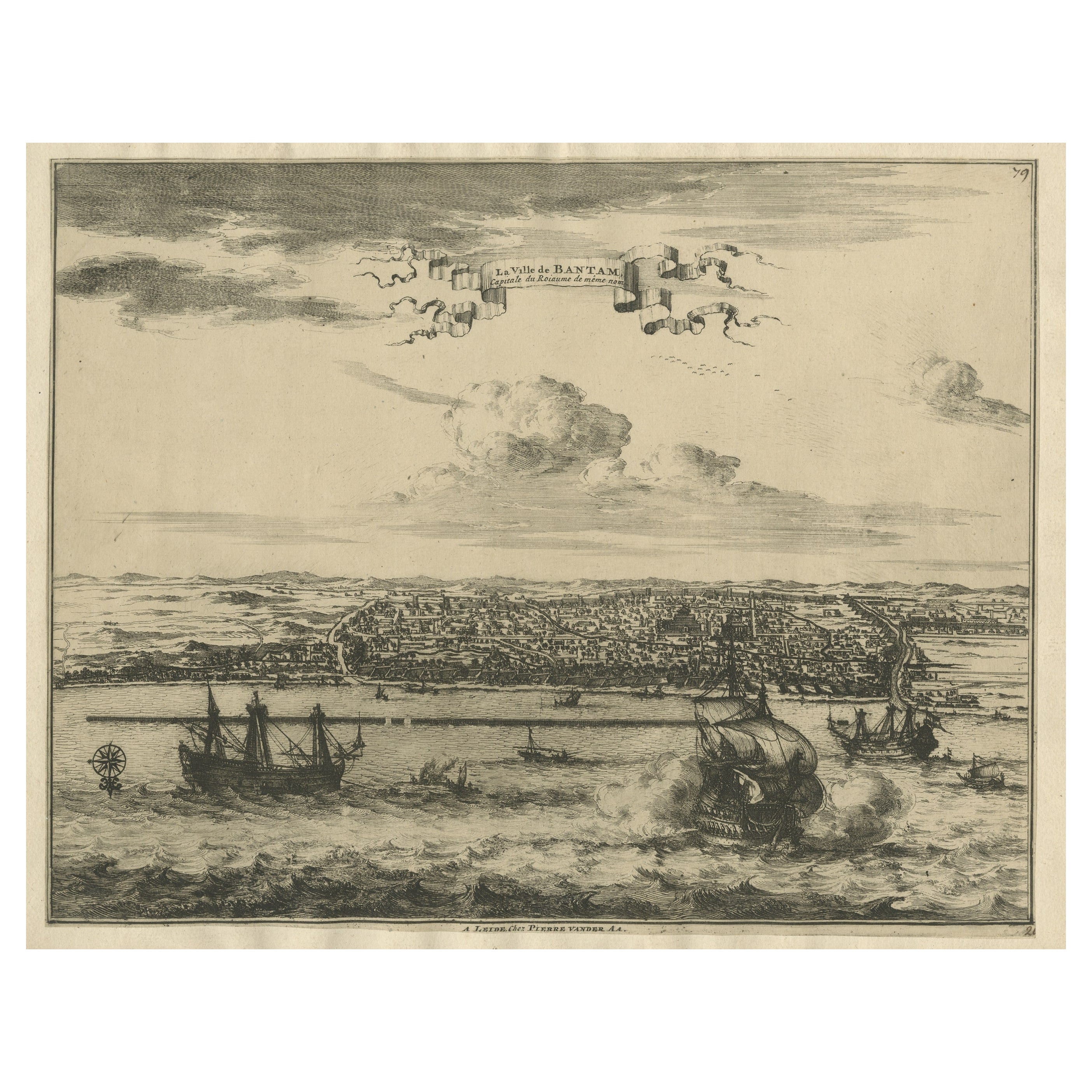
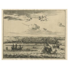
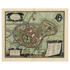
Original Antique Bird's Eye View of Banten or Bantam in Java, Indonesia, 1725
About the Item
Antique print titled 'La Ville de Bantam capitale du Roiaume de meme nom'.
A bird's eye view of the city Banten or Bantam near the western end of Java in Indonesia. Several tall ships and smaller nautical vessels in the harbour. This print originates from the very scarse: La Galerie Agréable du Monde ( ). , published by P. van der Aa, in Leiden, c. 1725.
Artists and Engravers: Pieter van der Aa Pieter van der Aa (Leiden 1659-1733) was a Dutch publisher best known for preparing maps and atlases. The Galerie Agreable contains plates and maps by the best Dutch engravers: Luiken, Goeree, Mulder, Stoopendaal, Aldert Meijer, Romeyn de Hooghe, ao.
- Dimensions:Height: 12.6 in (32 cm)Width: 14.77 in (37.5 cm)Depth: 0 in (0.02 mm)
- Materials and Techniques:
- Period:1720-1729
- Date of Manufacture:circa 1725
- Condition:Repaired: Small repair on the right part of the image. Please study image carefully. Condition: Good, general age-related toning. Later hand coloring. Small repair on the right part of the image. Please study image carefully.
- Seller Location:Langweer, NL
- Reference Number:
About the Seller
5.0
Platinum Seller
These expertly vetted sellers are 1stDibs' most experienced sellers and are rated highest by our customers.
Established in 2009
1stDibs seller since 2017
1,933 sales on 1stDibs
Typical response time: <1 hour
- ShippingRetrieving quote...Ships From: Langweer, Netherlands
- Return PolicyA return for this item may be initiated within 14 days of delivery.
More From This SellerView All
- View of the City Banten or Bantam Near the Western End of Java, Indonesia, c1725Located in Langweer, NLAntique print titled 'La Ville de Bantam capitale du Roiaume de meme nom'. A bird's eye view of the city Banten or Bantam near the western end of Java in Indonesia. Several tall ...Category
Antique 1720s Maps
MaterialsPaper
- Antique Map of Banten Bay, Java, Indonesia, c.1725Located in Langweer, NLA small early 18th century map of Banten Bay showing the islands of Pulo Dua and Pulo Batto together with soundings within the Bay and profiles of hills on the islands published by C...Category
Antique 18th Century Maps
MaterialsPaper
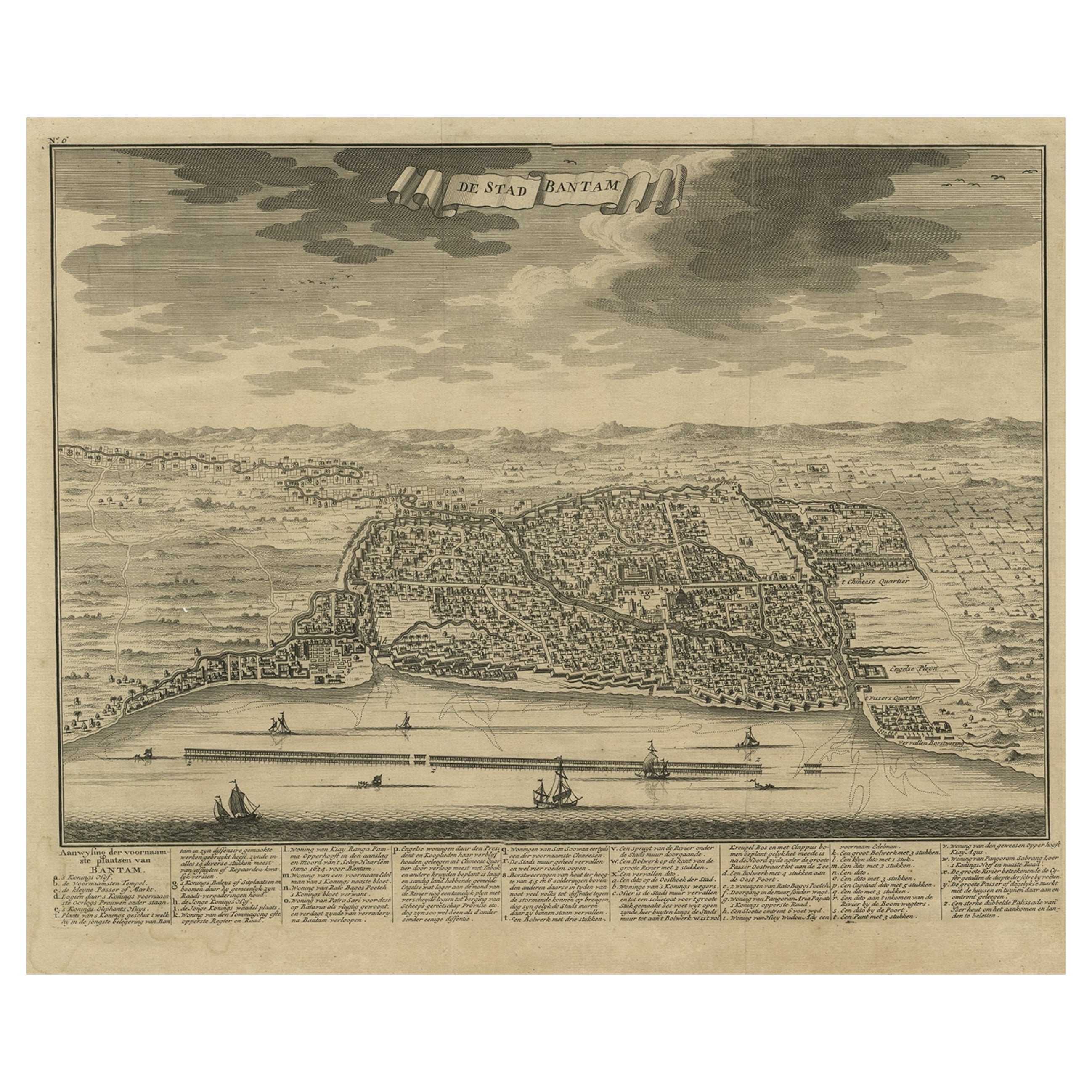
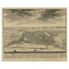
- Decorative View of the Indonesian Town of Bantam 'Banten', Java, 1726Located in Langweer, NLDecorative town-view of the town of Bantam (Banten). In lower margin key a-z to the principal places in town. The Banten Sultanate was founded in the 16th century and centred in ...Category
Antique 1720s Maps
MaterialsPaper
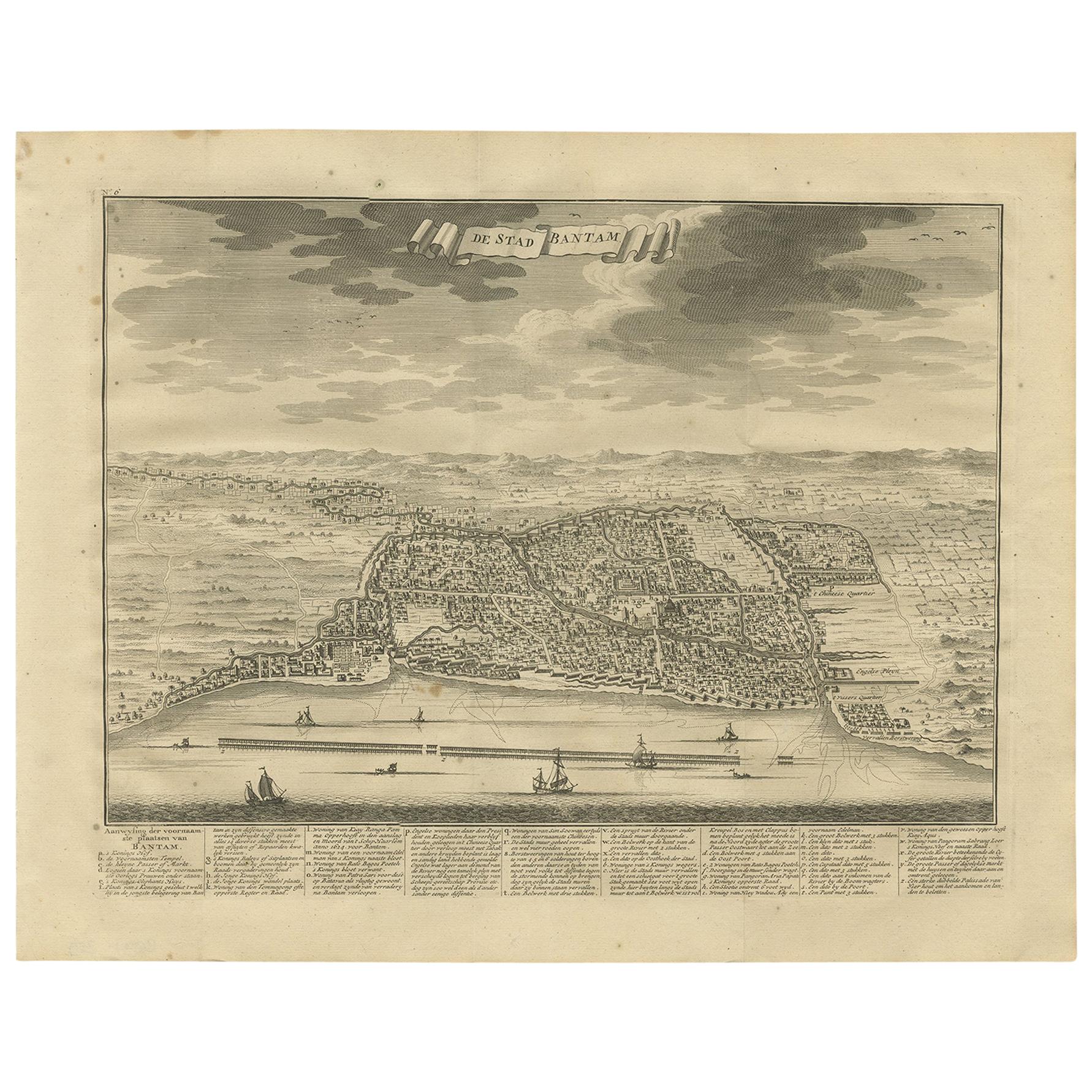
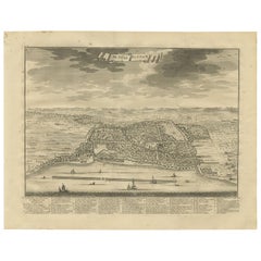
- Antique Print of Bantam or Banten, Java, Indonesia, '1726'Located in Langweer, NLAntique print titled 'De Stad Bantam'. Decorative town-view of the town of Bantam (Banten). In lower margin key a-z to the principal places in town. The Banten Sultanate was founded ...Category
Antique Mid-18th Century Prints
MaterialsPaper
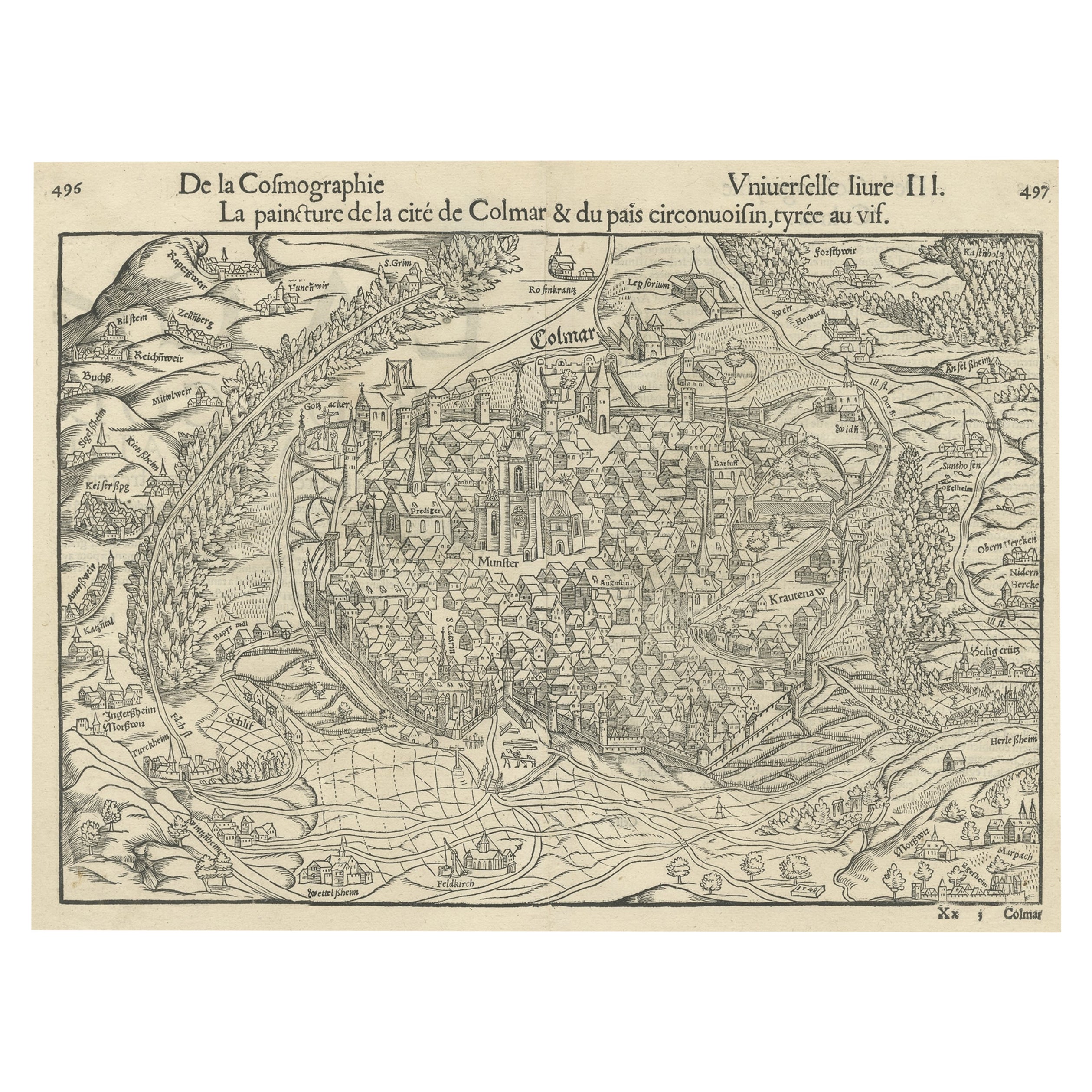
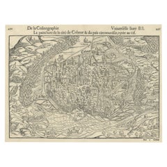
- Original Antique Bird's-Eye View of Colmar, Alsace, France, 1552Located in Langweer, NLAntique map titled 'La Paincture de la cité de Colmar & du pais circonuoisin'. Original antique bird's-eye view of Colmar, Alsace, France. This map originates from 'La Cosmograph...Category
Antique 16th Century Maps
MaterialsPaper
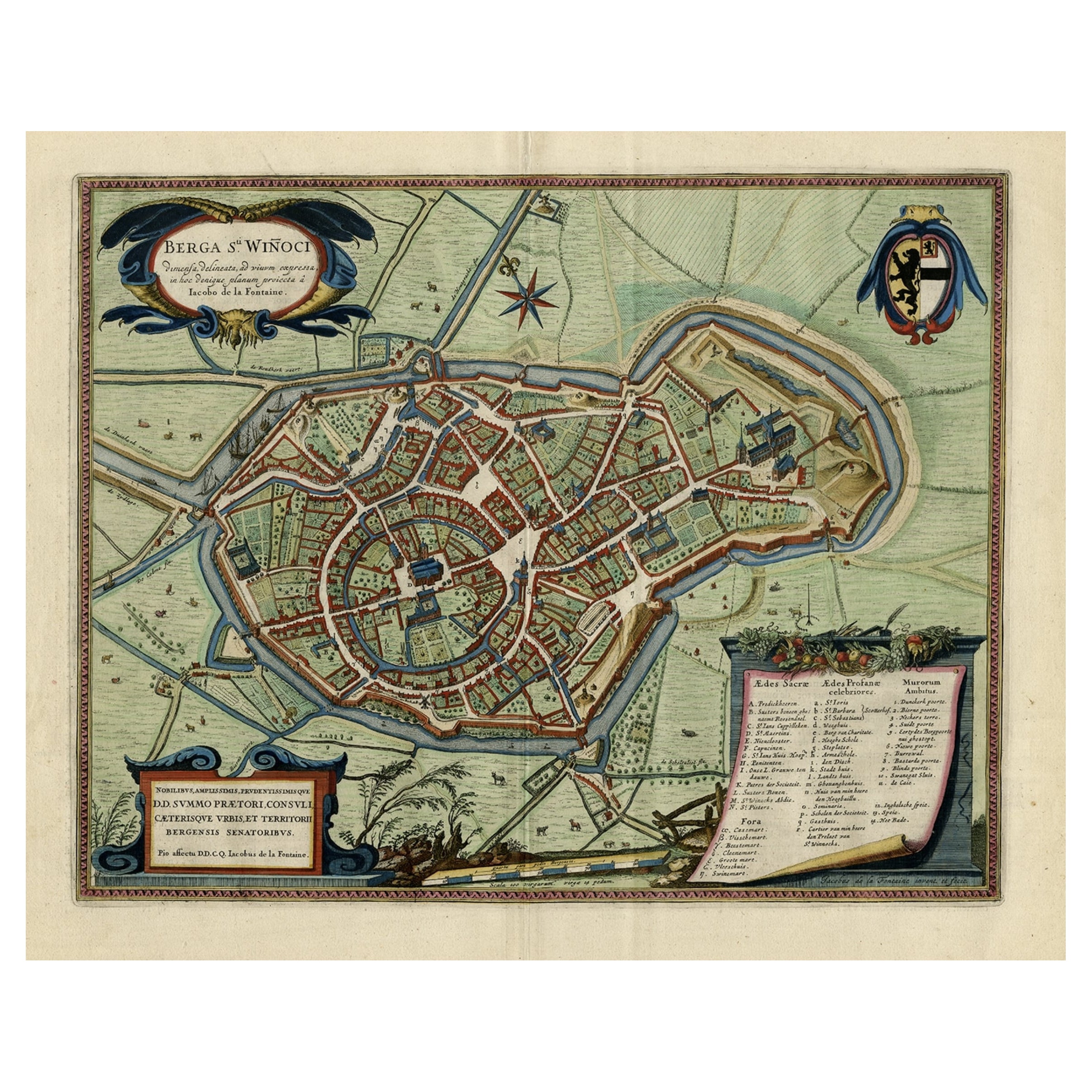
- Original Old Bird's-Eye View Plan of Sint-Winoksbergen or Bergen in France, 1649Located in Langweer, NLAntique map titled 'Berga Sti Winoci.' - Bird's-eye view plan of Sint-Winoksbergen in France, with key to locations and coats of arms. Text in Dutch on verso. This plan originates from the famous city Atlas: 'Toneel der Steeden' published by Joan Blaeu...Category
Antique 1640s Maps
MaterialsPaper

You May Also Like
- Original Antique Map of Italy. C.1780Located in St Annes, LancashireGreat map of Italy Copper-plate engraving Published C.1780 Unframed.Category
Antique Early 1800s English Georgian Maps
MaterialsPaper

- Original Antique Map of Asia. C.1780Located in St Annes, LancashireGreat map of Asia Copper-plate engraving Published C.1780 Two small worm holes to right side of map Unframed.Category
Antique Early 1800s English Georgian Maps
MaterialsPaper

- Original Antique Map of India. C.1780Located in St Annes, LancashireGreat map of India Copper-plate engraving Published C.1780 Three small worm holes to right side of map and one bottom left corner Unframed.Category
Antique Early 1800s English Georgian Maps
MaterialsPaper

- Original Antique Map of China, Arrowsmith, 1820Located in St Annes, LancashireGreat map of China Drawn under the direction of Arrowsmith Copper-plate engraving Published by Longman, Hurst, Rees, Orme and Brown, 1820 Unfr...Category
Antique 1820s English Maps
MaterialsPaper
- Original Antique Map of Canada, Arrowsmith, 1820Located in St Annes, LancashireGreat map of Canada. Drawn under the direction of Arrowsmith. Copper-plate engraving. Published by Longman, Hurst, Rees, Orme and Brown, 1820 ...Category
Antique 1820s English Maps
MaterialsPaper
- Original Antique Map of Europe, Arrowsmith, 1820Located in St Annes, LancashireGreat map of Europe Drawn under the direction of Arrowsmith. Copper-plate engraving. Published by Longman, Hurst, Rees, Orme and Brown, 1820 ...Category
Antique 1820s English Maps
MaterialsPaper


Recently Viewed
View AllMore Ways To Browse
Tall Ship Prints
Dutch Harbour
Antique Nautical Maps
Antique Nautical Map
Birds Eye View Map
Map Monde
Antique Memes
Atlas Du Monde Antique
Sculptures Wall Display
Tapestry Wall Hanging Used
Large Midcentury Wall Sculpture
Tapestry French 20th
Pair Kitchen Shelves
Antique English Display Cabinet
Coral 19th Century
Pink Shell
70s Floral
70s Floral