Items Similar to Antique Engraving of a Map or Plan of Jerusalem and Surrounding Mountains, 1773


Want more images or videos?
Request additional images or videos from the seller
1 of 6
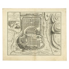
Antique Engraving of a Map or Plan of Jerusalem and Surrounding Mountains, 1773
$257.49
$321.8620% Off
£191.03
£238.7920% Off
€216
€27020% Off
CA$352.52
CA$440.6420% Off
A$394.93
A$493.6620% Off
CHF 205.56
CHF 256.9520% Off
MX$4,809.50
MX$6,011.8820% Off
NOK 2,618.58
NOK 3,273.2220% Off
SEK 2,465.96
SEK 3,082.4520% Off
DKK 1,644.66
DKK 2,055.8320% Off
Shipping
Retrieving quote...The 1stDibs Promise:
Authenticity Guarantee,
Money-Back Guarantee,
24-Hour Cancellation
About the Item
Antique map titled 'Platte grond van Jerusalem, en de omliggende Bergen'. Plan of the city of Jerusalem, with surrounding mountains. Originates from the first Dutch editon of an interesting travel account of Northern Africa titled 'Reizen en Aanmerkingen door en over Barbaryen en het Ooste'. Artists and Engravers: Author: T. Shaw. Translated by P. Boddaert and published by J. van Schoonhoven.
Artist: Author: T. Shaw. Translated by P. Boddaert and published by J. van Schoonhoven.
Condition: Very good, general age-related toning. Blank verso, please study image carefully.
Date: 1773
Overall size: 36 x 26 cm.
Image size: 20 x 23 cm.
- Dimensions:Height: 14.18 in (36 cm)Width: 10.24 in (26 cm)Depth: 0 in (0.01 mm)
- Materials and Techniques:
- Period:
- Date of Manufacture:1773
- Condition:
- Seller Location:Langweer, NL
- Reference Number:Seller: BG-11797b1stDibs: LU3054326397542
About the Seller
5.0
Recognized Seller
These prestigious sellers are industry leaders and represent the highest echelon for item quality and design.
Platinum Seller
Premium sellers with a 4.7+ rating and 24-hour response times
Established in 2009
1stDibs seller since 2017
2,493 sales on 1stDibs
Typical response time: <1 hour
- ShippingRetrieving quote...Shipping from: Langweer, Netherlands
- Return Policy
Authenticity Guarantee
In the unlikely event there’s an issue with an item’s authenticity, contact us within 1 year for a full refund. DetailsMoney-Back Guarantee
If your item is not as described, is damaged in transit, or does not arrive, contact us within 7 days for a full refund. Details24-Hour Cancellation
You have a 24-hour grace period in which to reconsider your purchase, with no questions asked.Vetted Professional Sellers
Our world-class sellers must adhere to strict standards for service and quality, maintaining the integrity of our listings.Price-Match Guarantee
If you find that a seller listed the same item for a lower price elsewhere, we’ll match it.Trusted Global Delivery
Our best-in-class carrier network provides specialized shipping options worldwide, including custom delivery.More From This Seller
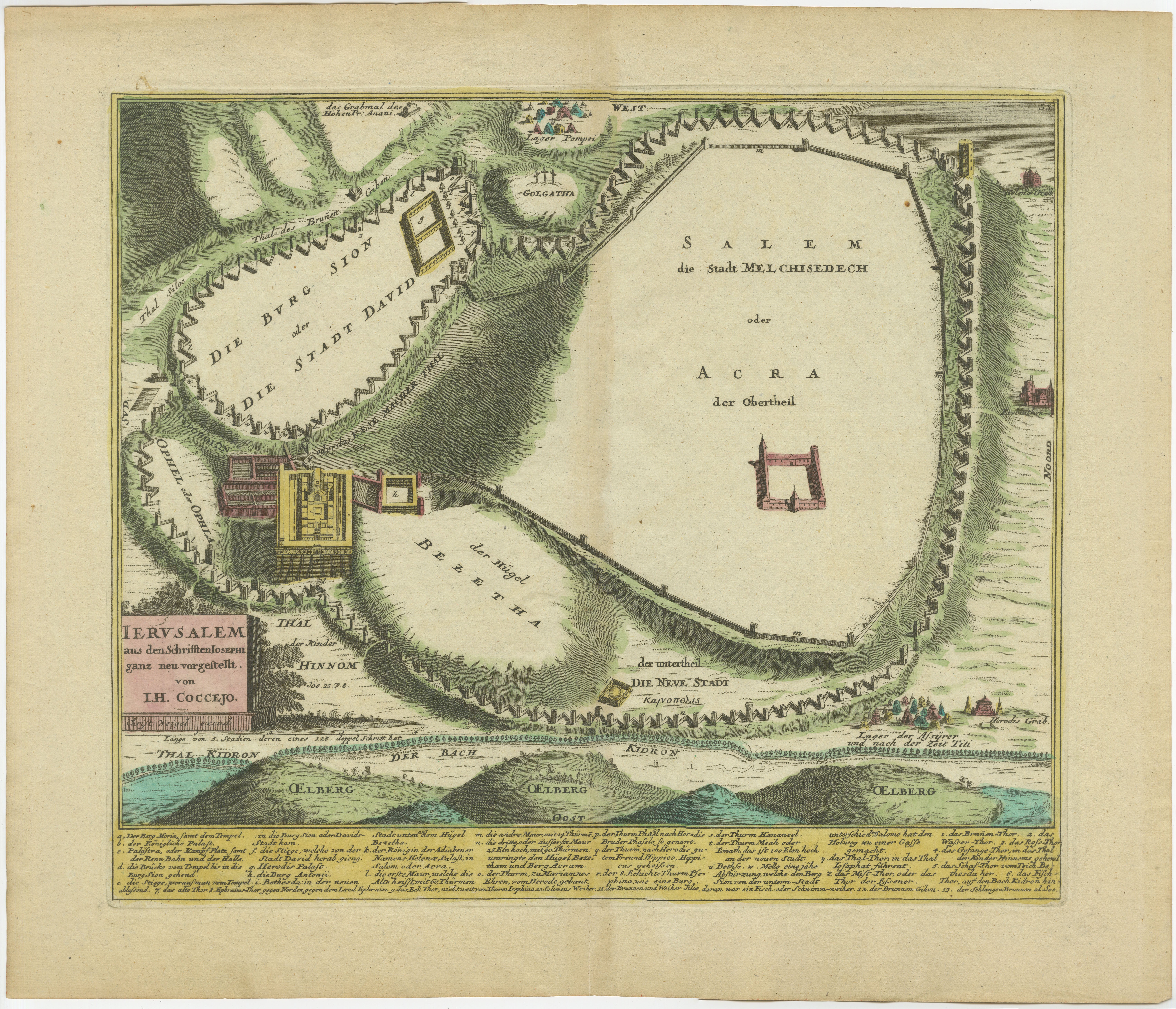
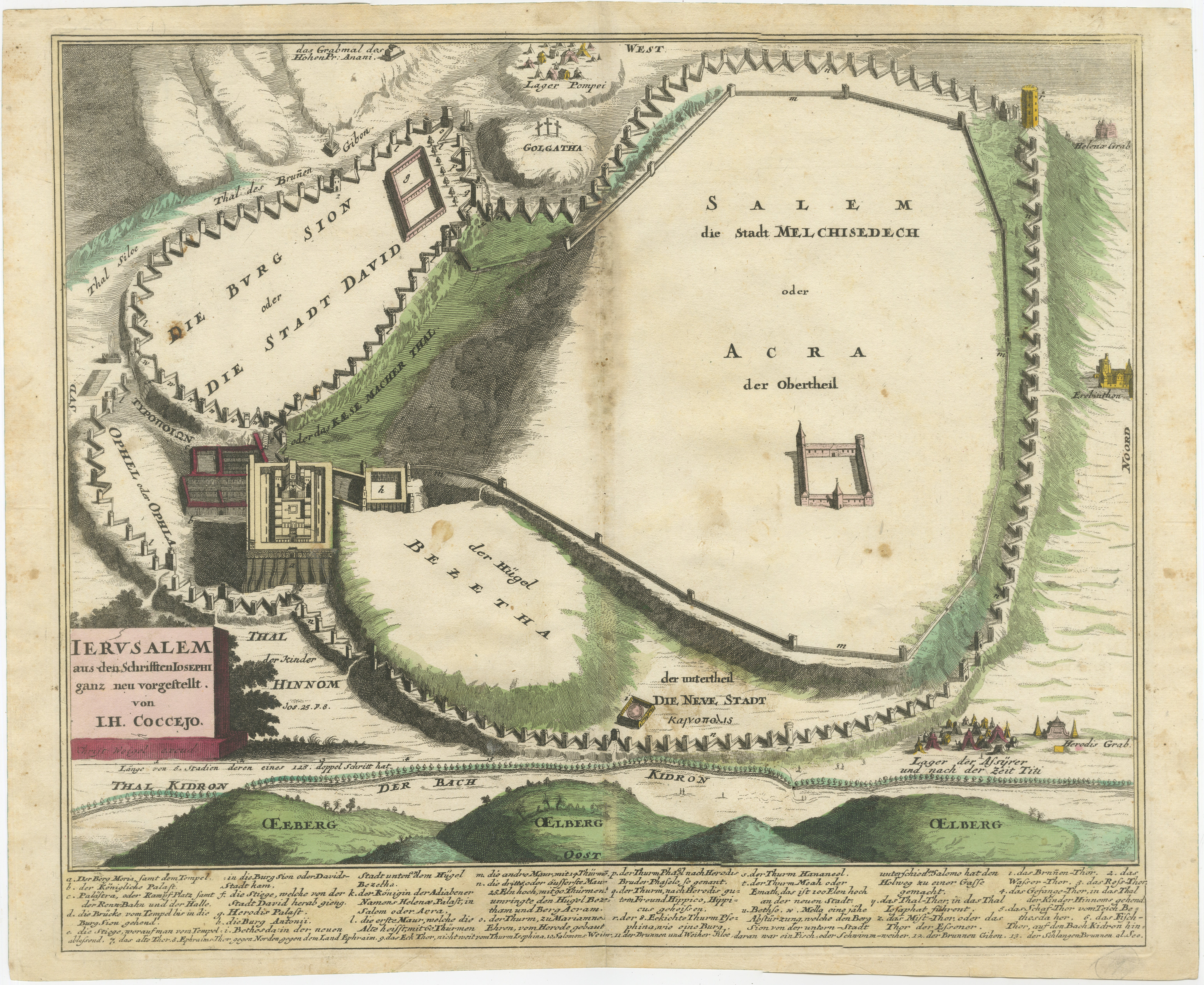
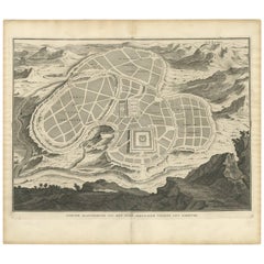
View All1720 Weigel Engraving of Jerusalem: A Biblical View from Josephus' Perspective
Located in Langweer, NL
1720 Weigel Map of Jerusalem Based on Josephus' Writings
This intricate 1720 bird's-eye view map of ancient Jerusalem by I.H. Coccejo, engraved by Christoph Weigel, offers a fasc...
Category
Antique 1720s Maps
Materials
Paper

Spectacular Antique Original Engraving of a Town Plan of Jerusalem, 1708
Located in Langweer, NL
Description: Antique map titled 'Erster Abriss der Stadt Jerusalem wie sie Furnemblich zur Zeit des Hernn Christi beschaffen (..).'
Spectacular town plan...
Category
Antique Early 1700s Maps
Materials
Paper

$1,287 Sale Price
20% Off
Original Antique Map of Jerusalem Based on Josephus' Writings by Weigel, ca.1720
Located in Langweer, NL
1720 Weigel Map of Jerusalem Based on Josephus' Writings
This intricate 1720 bird's-eye view map of ancient Jerusalem by I.H. Coccejo, engraved by Christoph Weigel, offers a fasc...
Category
Antique 1720s Maps
Materials
Paper

Antique Bible Plan of Jerusalem by Covens & Mortier, 1743
Located in Langweer, NL
This plan originates from ‘Biblia Sacra, dat is, de H. Schriftuer van het Oude, en het Nieuwe Testament, naer de laetste Roomsche keure der gemeine Latijnsche overzettinge, in nederd...
Category
Antique Mid-18th Century Maps
Materials
Paper

$524 Sale Price
20% Off
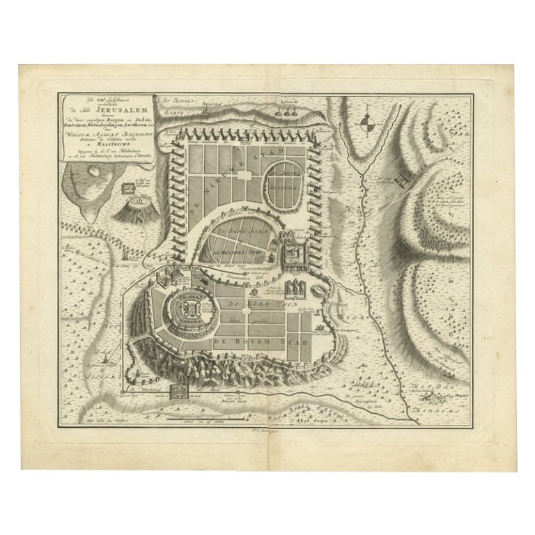
Bird's-Eye Plan of Jerusalem in Israël, a Rare Original Engraving, 1750
Located in Langweer, NL
Antique map titled 'De VIIde Landkaart Verbeeldende de Stad Jerusalem Beneven de daar Omgelegen Bergen en Dalen (..).'
Bird's-eye plan of Jerusalem in Israel. This map shows the mo...
Category
Antique 18th Century Maps
Materials
Paper
$715 Sale Price
20% Off
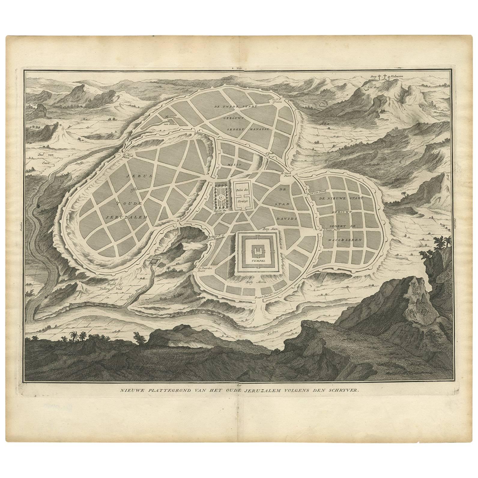
Antique Map of the Ancient City of Jerusalem by A. Calmet, 1725
Located in Langweer, NL
Antique map, titled: 'Nieuwe Plattegrond van het Oude Jeruzalem Volgens den Schryver.' - Bird's-eye view of the ancient city of Jerusalem shows its divisions with prominent depiction...
Category
Antique Early 18th Century Prints
Materials
Paper
$247 Sale Price
20% Off
You May Also Like
17th Century Topographical Map of Cote D'azur, Avignon, Frejus by Iohan Peeters
Located in New York, NY
Fine topographical 17th century map by Iohan Peeters of the towns of Avignon and Frejus in the Cote d'Azur-Provence-Alpes Region of Southeastern France.
Beautifully suited decorativ...
Category
Antique 17th Century Dutch Maps
Materials
Paper

17th Century Topographical Map, Champagne-Ardenne, Marsal, Maubert Iohan Peeters
Located in New York, NY
Fine topographical 17th century map by Iohan Peeters of Marsal and Maubert Fontaine in the Champagne-Ardennes Region of North Eastern France.
Fabulous period engraving for a Wine Ce...
Category
Antique 17th Century Dutch Maps
Materials
Paper

17th-18th Century Siege of Graves Mapping Engraving By Willian III
Located in Kingston, NY
RARE French 17th-18th Century Enhanced Siege of Graves Mapping Engraving BY William III, also widely known as William of Orange,
The Siege of Grave in Dutch Brabant started by Monsie...
Category
Antique 17th Century French Prints
Materials
Paper

1657 Janssonius Map of Vermandois and Cappelle, Ric. A-004
Located in Norton, MA
1657 Janssonius map of
Vermandois and Cappelle
Ric.a004
Description: Antique map of France titled 'Descriptio Veromanduorum - Gouvernement de la Cappelle'. Two detailed maps o...
Category
Antique 17th Century Unknown Maps
Materials
Paper

Li Governi di Borgogna - Ancient Map - 1777
Located in Roma, IT
Li Governi di Borgogna is an original black and white etching on paper, printed by Antonio Zatta in Venice, 1777.
Original Title: Li Governi di Borgogna della Franca Contea e del Ly...
Category
1770s Modern Landscape Prints
Materials
Etching

Original Antique Map of Switzerland, Engraved By Barlow, Dated 1807
Located in St Annes, Lancashire
Great map of Switzerland
Copper-plate engraving by Barlow
Published by Brightly & Kinnersly, Bungay, Suffolk.
Dated 1807
Unframed.
Category
Antique Early 1800s English Maps
Materials
Paper

More Ways To Browse
Antique Map Of Jerusalem
Map Of Jerusalem
Map Of Holy Land
Antique Macedonia
Antique Maps Of New York City
Victorian Compass
Antique Maps Caribbean Islands
Hungary Map
Cartographer Tool
Goa Furniture
George Fleet
Sri Lanka Map
Philippines Map
Antique Map Ceylon
Antique Sri Lanka Map
Persian Maps
Antique Civil War Maps
Antique Map Of The Philippines