Items Similar to Antique Lithography Map, Western Russia, English, Framed, Cartography, Victorian


Want more images or videos?
Request additional images or videos from the seller
1 of 13
Antique Lithography Map, Western Russia, English, Framed, Cartography, Victorian
$858.34
£626
€730.09
CA$1,175.36
A$1,306.85
CHF 682.36
MX$15,907.49
NOK 8,706.65
SEK 8,157.71
DKK 5,448.80
Shipping
Retrieving quote...The 1stDibs Promise:
Authenticity Guarantee,
Money-Back Guarantee,
24-Hour Cancellation
About the Item
This is an antique lithography map of Western Russia. An English, framed atlas engraving of cartographic interest by John Rapkin, dating to the early Victorian period and later, circa 1850.
John Rapkin was considered as one of the best map makers of the mid 19th century, working in conjunction with John Tallis to engrave maps for the Illustrated Atlas and Modern History of the World (1845-51).
Quality lithography of European Russia and its regions - ideal for display
Displaying a desirable aged patina and in very good order
Fascinating cartography, presented tastefully within quality, later frames
Major locations, inland seas and associated regions annotate the map
Superb illustrations showcase local customs, places of interest and wildlife
Dressed to the rear with hanging cord for ease of mounting
This is a quality antique lithography map of Western Russia, with fine cartographic interest. Delivered ready to display.
Dimensions:
Max Width: 44cm (17.25'')
Max Depth: 1.5cm (.5'')
Max Height: 54.5cm (21.5'')
Map Width: 25cm (9.75'')
Map Height: 35cm (13.75'')
- Dimensions:Height: 21.46 in (54.5 cm)Width: 17.33 in (44 cm)Depth: 0.6 in (1.5 cm)
- Style:Early Victorian (Of the Period)
- Materials and Techniques:
- Place of Origin:
- Period:
- Date of Manufacture:circa 1850
- Condition:Wear consistent with age and use. Presented in very good antique condition.
- Seller Location:Hele, Devon, GB
- Reference Number:Seller: 18.99951stDibs: LU2645338395572
About the Seller
5.0
Platinum Seller
Premium sellers with a 4.7+ rating and 24-hour response times
Established in 2005
1stDibs seller since 2017
1,031 sales on 1stDibs
Typical response time: 1 hour
- ShippingRetrieving quote...Shipping from: Hele, Devon, United Kingdom
- Return Policy
Authenticity Guarantee
In the unlikely event there’s an issue with an item’s authenticity, contact us within 1 year for a full refund. DetailsMoney-Back Guarantee
If your item is not as described, is damaged in transit, or does not arrive, contact us within 7 days for a full refund. Details24-Hour Cancellation
You have a 24-hour grace period in which to reconsider your purchase, with no questions asked.Vetted Professional Sellers
Our world-class sellers must adhere to strict standards for service and quality, maintaining the integrity of our listings.Price-Match Guarantee
If you find that a seller listed the same item for a lower price elsewhere, we’ll match it.Trusted Global Delivery
Our best-in-class carrier network provides specialized shipping options worldwide, including custom delivery.More From This Seller
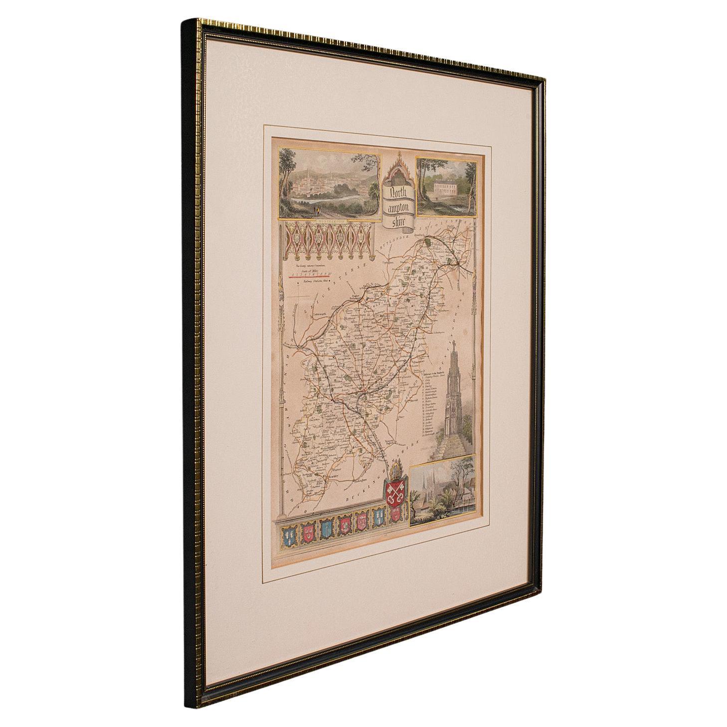
View AllAntique Lithography Map, Cumberland, English, Framed, Cartography, Victorian
Located in Hele, Devon, GB
This is an antique lithography map of Cumberland. An English, framed atlas engraving of cartographic interest, dating to the mid 19th century and la...
Category
Antique Mid-19th Century British Victorian Maps
Materials
Wood

Antique Lithography Map, Northumberland, English, Framed, Engraving, Cartography
Located in Hele, Devon, GB
This is an antique lithography map of Northumberland. An English, framed atlas engraving of cartographic interest, dating to the mid 19th century a...
Category
Antique Mid-19th Century British Victorian Maps
Materials
Wood

Antique Lithography Map, Gloucestershire, English, Framed Engraving, Cartography
Located in Hele, Devon, GB
This is an antique lithography map of Gloucestershire. An English, framed atlas engraving of cartographic interest, dating to the mid 19th century ...
Category
Antique Mid-19th Century British Victorian Maps
Materials
Wood

Antique Lithography Map, Bedfordshire, English, Framed Engraving, Cartography
Located in Hele, Devon, GB
This is an antique lithography map of Bedfordshire. An English, framed atlas engraving of cartographic interest, dating to the mid 19th century and...
Category
Antique Mid-19th Century British Victorian Maps
Materials
Wood

Antique Lithography Map, Hertfordshire, English, Framed Engraving, Cartography
Located in Hele, Devon, GB
This is an antique lithography map of Hertfordshire. An English, framed atlas engraving of cartographic interest, dating to the mid 19th century an...
Category
Antique Mid-19th Century British Victorian Maps
Materials
Wood

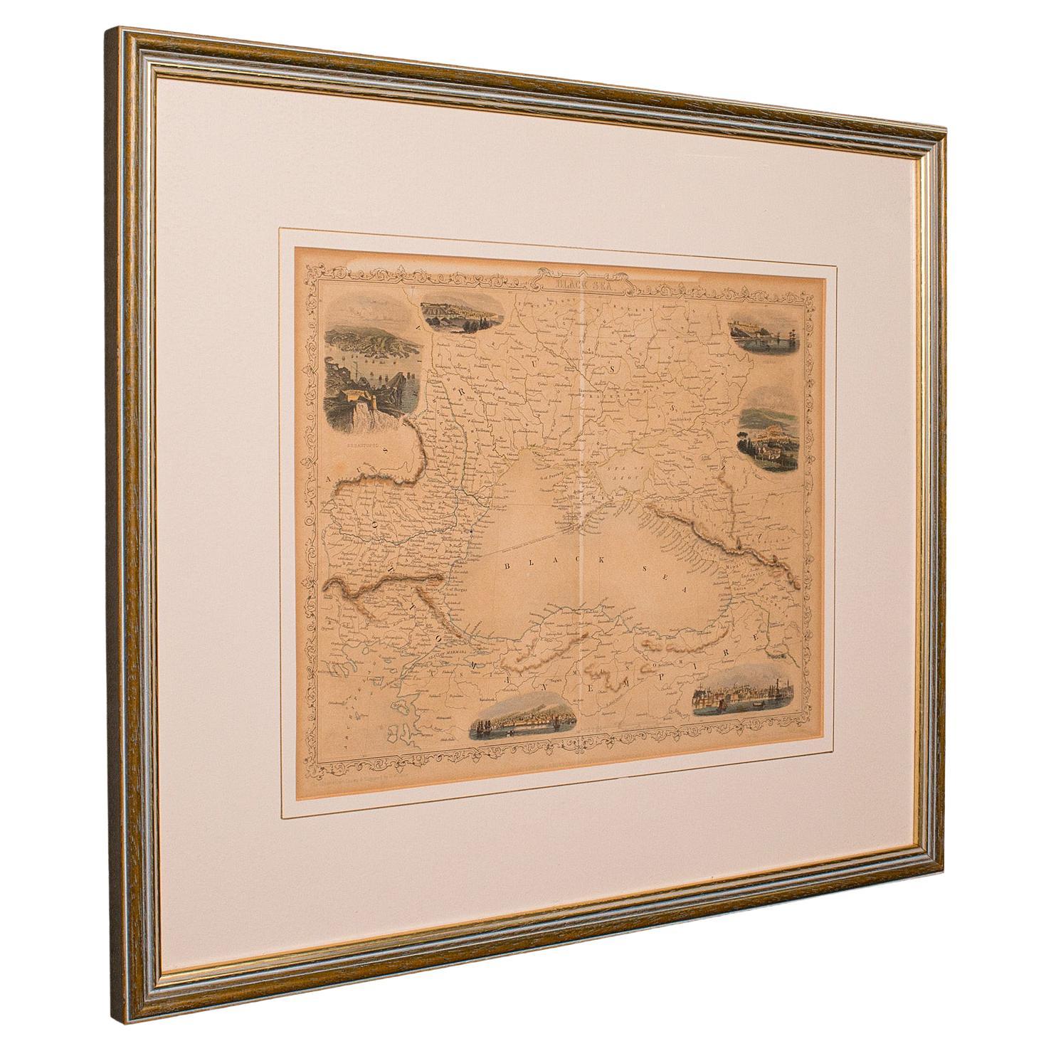
Antique Lithography Map, Black Sea, English, Framed, Cartography, Victorian
Located in Hele, Devon, GB
This is an antique lithography map of the Black Sea region. An English, framed atlas engraving of cartographic interest by John Rapkin, dating to the early Victorian period and later...
Category
Antique Mid-19th Century British Early Victorian Maps
Materials
Wood

You May Also Like
Antique Map of European Russia with Picture Frame Border
Located in Langweer, NL
Antique map titled 'La Moscovie Septentrionale (..)'. Decorative example of van der Aa's map of the northern part of European Russia. With the picture frame border, which appeared in...
Category
Antique Early 18th Century Maps
Materials
Paper
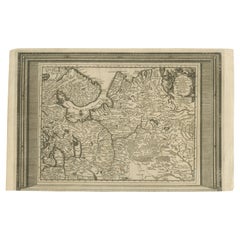
$364 Sale Price
20% Off
Antique Map Of Brabantia Ducantus By Bleau Circa 1640
Located in Brussels, Brussels
map of theBrabantia Ducantus (Belgium) circa 1640 by Bléau. Bléau was well known for antique atlas that he draw during the 17 century
beautiful map, double page folded in the middle,...
Category
Antique 17th Century French Renaissance Maps
Materials
Paper

Map Lancashire 1793 John Cary engraver 37cm 14 1/2" high
Located in BUNGAY, SUFFOLK
Map of Lancashire by John Cary engraver
published 1st Jan 1793 by J Cary Engraver & Mapseller Strand
in original black and gold classic map frame
Category
Antique 18th Century English Georgian Maps
Materials
Paper

Antique Map of Europe by Lapie, '1809'
Located in Langweer, NL
Antique map titled 'Europe'. Original antique map of Europe by P. Lapie, published 1809. Frame included.
Category
Antique Early 19th Century Maps
Materials
Paper
$287 Sale Price
20% Off
Framed 17th Century Map of Cumberland, England by John Speed, 1610
By John Speed
Located in Middleburg, VA
A fascinating and richly detailed antique map of Cumberland County in northwest England, drawn and published by the celebrated English cartographer John Spe...
Category
Antique Early 17th Century English British Colonial Maps
Materials
Copper, Gold Leaf

Antique Map of Overijssel by Visscher, c.1660
Located in Langweer, NL
Antique map titled 'Transisalania provincia vulgo Over-yssel'. Original antique map of the province of Overijssel, the Netherlands. Published by N. Visscher after N. ten Have, circa ...
Category
Antique 17th Century Maps
Materials
Paper

$708 Sale Price
20% Off
More Ways To Browse
Russian Frame Antique
Victorian Antique Illustrations
Vintage Wood Table With Glass Top
19th Century Square Table
Galle Chairs
Large Chinese Rug
1940s Vintage French Art Deco
20th Century Spanish Table
Antonio Bellini
Retro Fiberglass Furniture
Shipping Crate
Antique Oushak Carpets
Blue Coffee Tables
German Bauhaus Posters
1945 Chair Juhl
Antique Three Leg Table
Folke Arstrom
Silver Over Copper