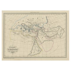
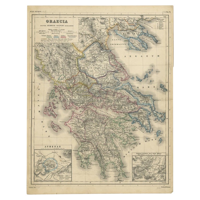
Antique Map of Ancient Greece according to Herodotus, a Greek Historian, 1837
View Similar Items


Want more images or videos?
Request additional images or videos from the seller
1 of 5
Antique Map of Ancient Greece according to Herodotus, a Greek Historian, 1837
$249.18List Price
About the Item
About the Seller
5.0
Recognized Seller
These prestigious sellers are industry leaders and represent the highest echelon for item quality and design.
Platinum Seller
Premium sellers with a 4.7+ rating and 24-hour response times
Established in 2009
1stDibs seller since 2017
2,586 sales on 1stDibs
Authenticity Guarantee
In the unlikely event there’s an issue with an item’s authenticity, contact us within 1 year for a full refund. DetailsMoney-Back Guarantee
If your item is not as described, is damaged in transit, or does not arrive, contact us within 7 days for a full refund. Details24-Hour Cancellation
You have a 24-hour grace period in which to reconsider your purchase, with no questions asked.Vetted Professional Sellers
Our world-class sellers must adhere to strict standards for service and quality, maintaining the integrity of our listings.Price-Match Guarantee
If you find that a seller listed the same item for a lower price elsewhere, we’ll match it.Trusted Global Delivery
Our best-in-class carrier network provides specialized shipping options worldwide, including custom delivery.More From This Seller
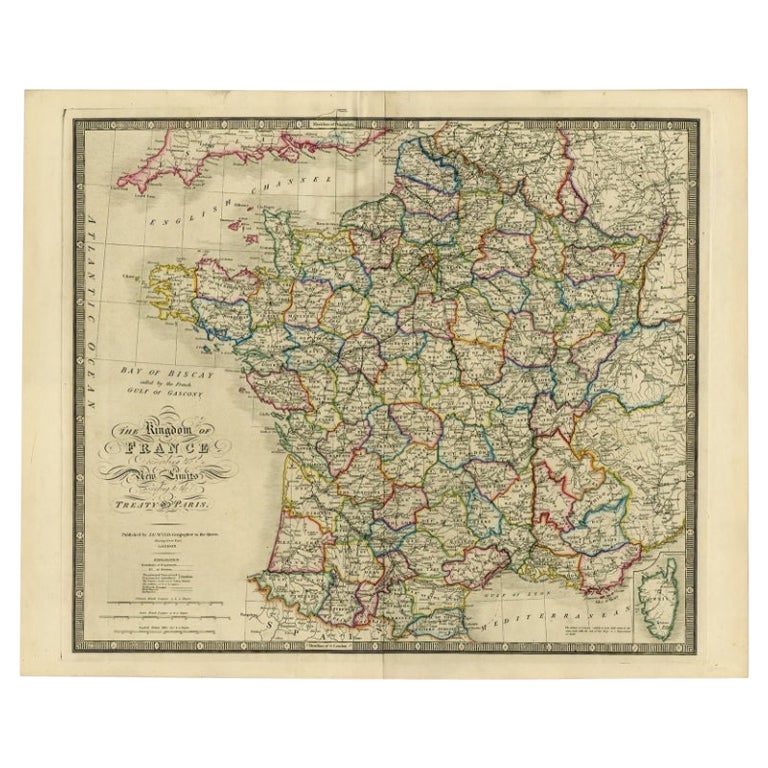
View AllAntique Map of France according to the Treaty of Paris '1815', Published in 1854
Located in Langweer, NL
Antique map titled 'The Kingdom of France, describing the new limits according to the treaty of Paris. (1815)'. Large map of France. From James Wyld's 'A New General Atlas of Modern ...
Category
Antique 19th Century Maps
Materials
Paper
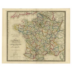
$639 Sale Price
30% Off
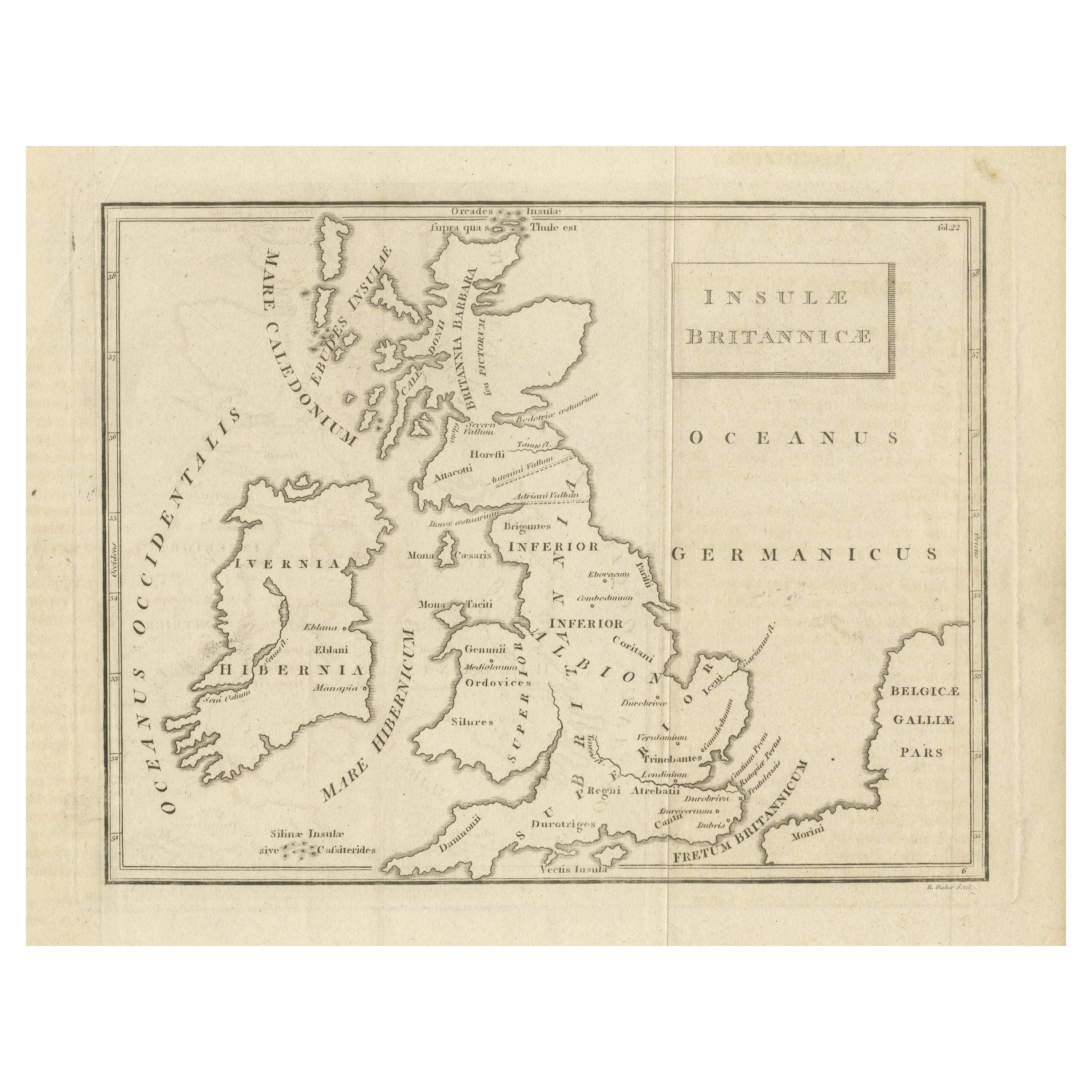
Antique Map of the British Isles According to the Geography of the Roman Empire
Located in Langweer, NL
Antique map titled 'Insulae Britannicae'. Interesting map of Britain, Scotland, and Ireland. It shows a rudimentary outline of the islands according to the geography of the Roman Emp...
Category
Antique Late 18th Century Maps
Materials
Paper
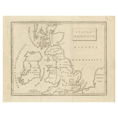
$170 Sale Price
20% Off
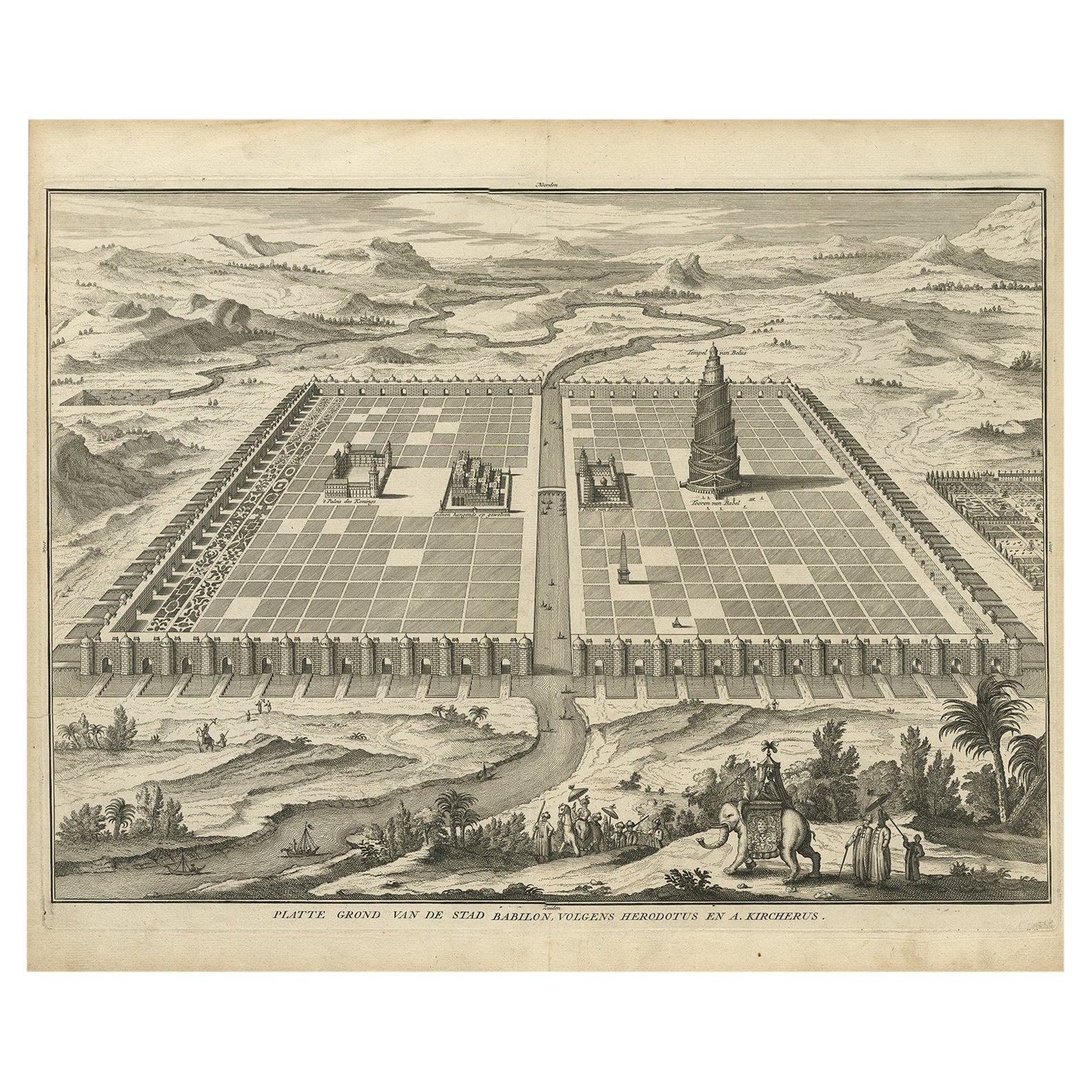
Ancient Babylon with The Tower of Babel According to Herodotus & Kircherus, 1730
Located in Langweer, NL
Antique print titled 'Platte Grond van de Stad Babilon, volgens Herodotus en A. Kircherus'.
This original antique print shows a view of ancient Babylon with the tower of Babel...
Category
Antique 1730s Maps
Materials
Paper
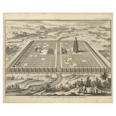
$455 Sale Price
20% Off
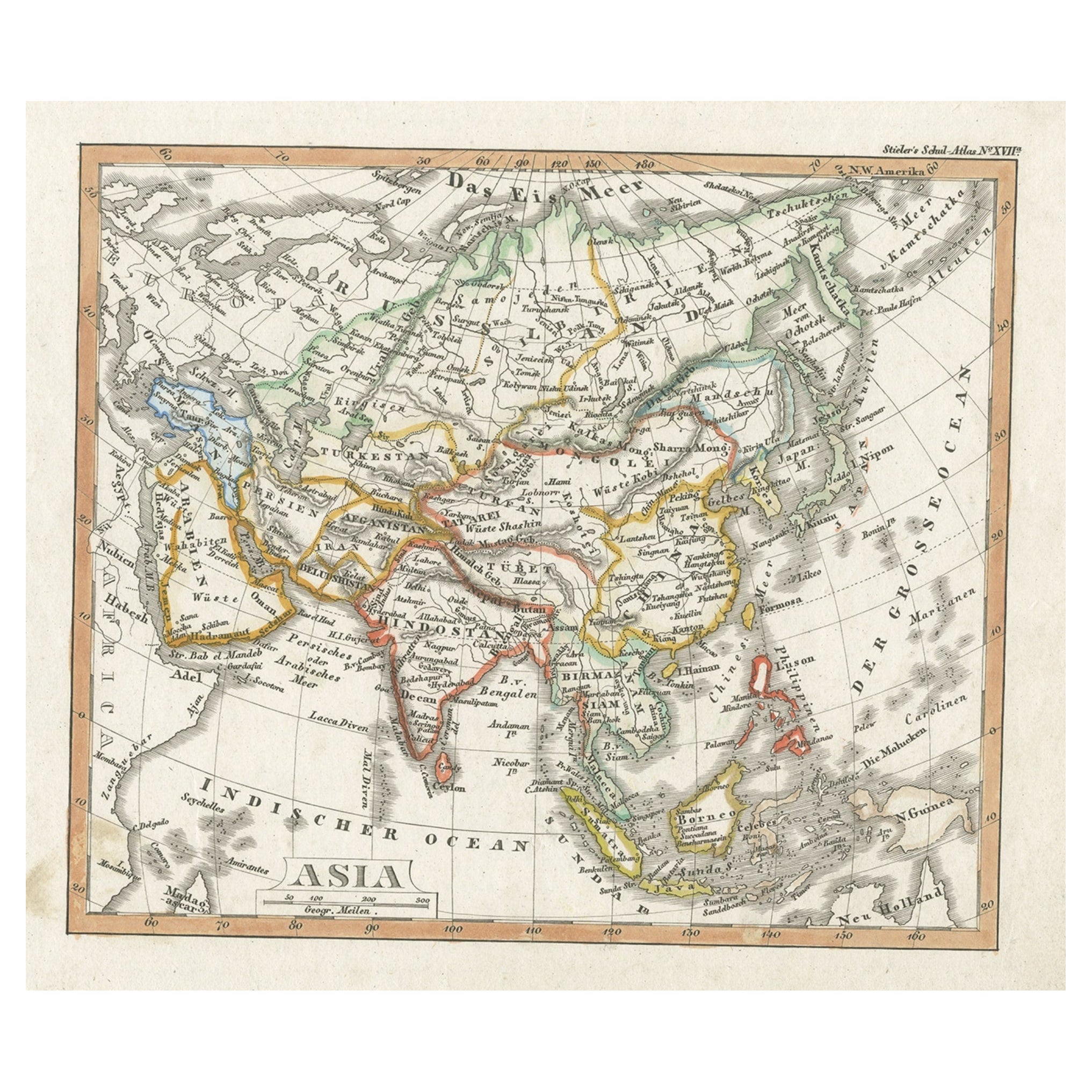
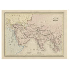
Charming Scarce Small Antique Map of Asia, 1837
Located in Langweer, NL
Antique map titled ‘Asia‘. Scarce and charming little mid-19th century antique map of Asia. Noteworthy for the early date and scarcity factor, from a small pocket sized school atlas ...
Category
Antique 19th Century Maps
Materials
Paper
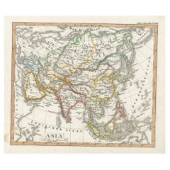
$227 Sale Price
20% Off
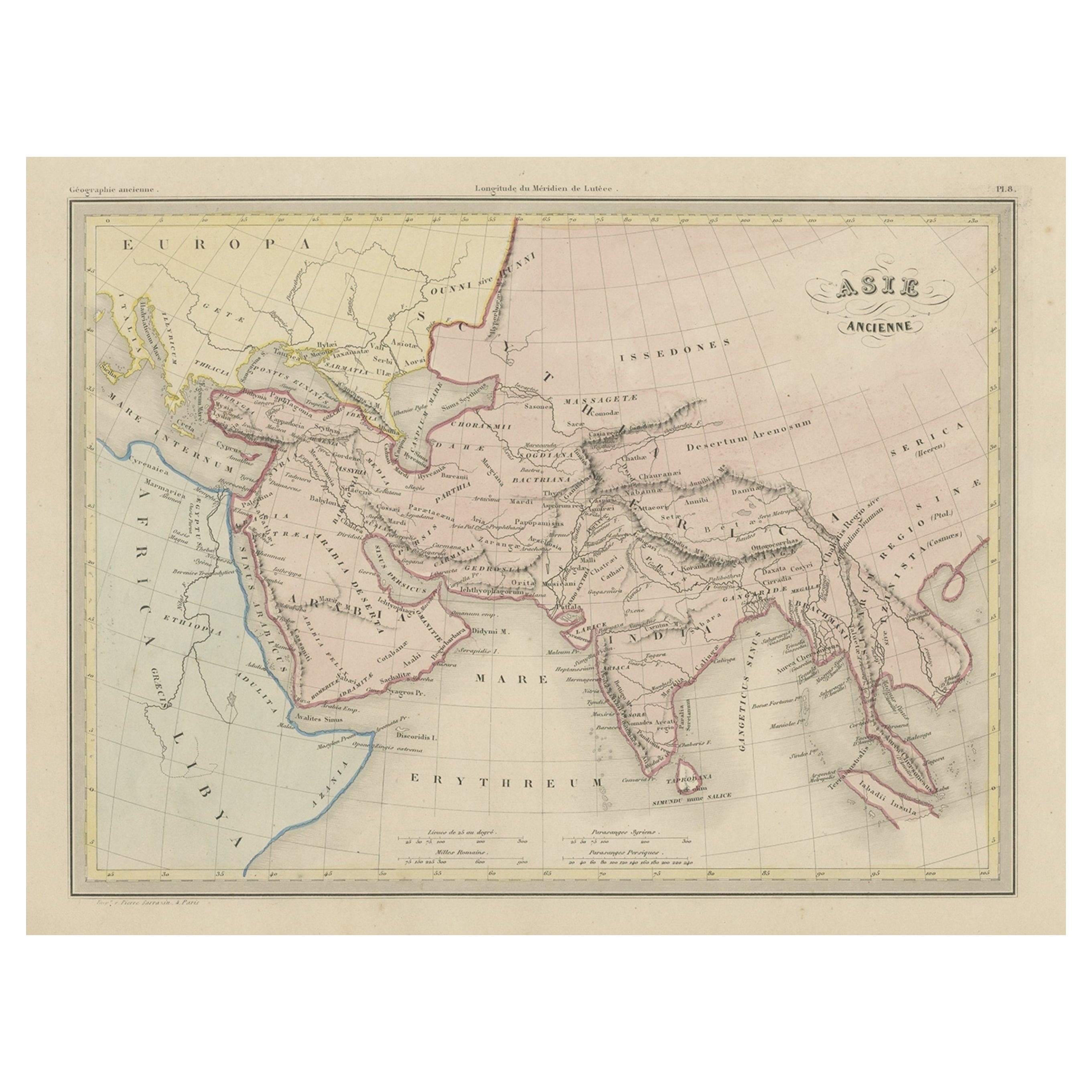
Original Antique Map of Ancient Asia, 1847
Located in Langweer, NL
Description: Antique map Asia titled 'Asie Ancienne'.
This is an original antique map of Ancient Asia and originates from 'Atlas de la Geographie ...
Category
Antique 1840s Maps
Materials
Paper
$170 Sale Price
20% Off
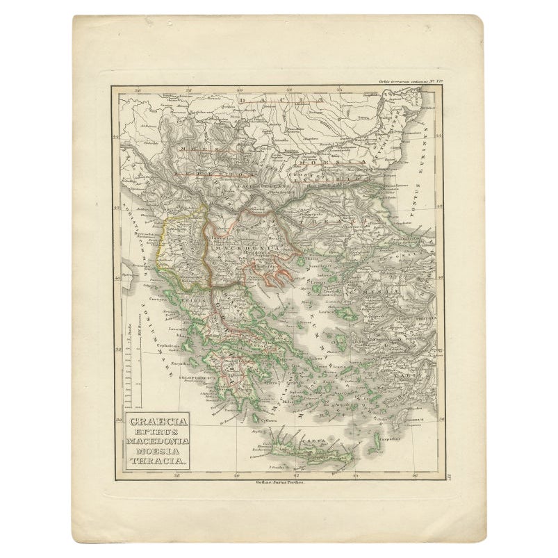
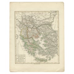
Antique Map of Greece and Macedonia, 1848
Located in Langweer, NL
Antique map titled 'Graecia Epirus Macedonia Moesia Thracia'. Old map of Greece originating from 'Orbis Terrarum Antiquus in usum Scholarum'. Artists and Engravers: Published by Just...
Category
Antique 19th Century Maps
Materials
Paper
$237 Sale Price
20% Off
You May Also Like
Original Antique Map of Ancient Greece- Boeotia, Thebes, 1787
Located in St Annes, Lancashire
Great map of Ancient Greece. Showing the region of Boeotia, including Thebes
Drawn by J.D. Barbie Du Bocage
Copper plate engraving by P.F T...
Category
Antique 1780s French Other Maps
Materials
Paper

Original Antique Map of Ancient Greece, Achaia, Corinth, 1786
Located in St Annes, Lancashire
Great map of Ancient Greece. Showing the region of Thessaly, including Mount Olympus
Drawn by J.D. Barbie Du Bocage
Copper plate engraving by P.F Tardieu
Original hand color...
Category
Antique 1780s French Other Maps
Materials
Paper

Antique Map of Principality of Monaco
By Antonio Vallardi Editore
Located in Alessandria, Piemonte
ST/619 - "Old Geographical Atlas of Italy - Topographic map of ex-Principality of Monaco" -
ediz Vallardi - Milano -
A somewhat special edition ---
Category
Antique Late 19th Century Italian Other Prints
Materials
Paper

Original Antique Map of China, Arrowsmith, 1820
Located in St Annes, Lancashire
Great map of China
Drawn under the direction of Arrowsmith
Copper-plate engraving
Published by Longman, Hurst, Rees, Orme and Brown, 1820
Unfr...
Category
Antique 1820s English Maps
Materials
Paper

Original Antique Map of Ireland- Kerry. C.1840
Located in St Annes, Lancashire
Great map of Kerry
Steel engraving
Drawn under the direction of A.Adlard
Published by How and Parsons, C.1840
Unframed.
Category
Antique 1840s English Maps
Materials
Paper

Original Antique Map of Hungary, Arrowsmith, 1820
Located in St Annes, Lancashire
Great map of Hungary
Drawn under the direction of Arrowsmith.
Copper-plate engraving.
Published by Longman, Hurst, Rees, Orme and Brown, 1820
Unframed.
Category
Antique 1820s English Maps
Materials
Paper

Recently Viewed
View AllMore Ways To Browse
Map Of Ancient Greece
Antique Navigational Tools
Antique German Compass
Key Trade Sign
Spanish Galleon
World Map Of Trade Routes
Antique Puerto Rico
Albanian Antique
Antique Furniture Wiltshire
Antique Maps Of Israel
Framed Africa Maps
Antique Furniture Goa
Croatian Antiques
Map Of Israel
Teak Sphere
18th Century Scottish Collectibles
Map Of Mexican California
Ottoman Map