Items Similar to Antique Map of California, Utah, Nevada, Colorado, New Mexico & Arizona '1872'
Want more images or videos?
Request additional images or videos from the seller
1 of 10
Antique Map of California, Utah, Nevada, Colorado, New Mexico & Arizona '1872'
$239.84
$299.7920% Off
£178.41
£223.0220% Off
€200
€25020% Off
CA$328.42
CA$410.5220% Off
A$365.16
A$456.4420% Off
CHF 190.66
CHF 238.3320% Off
MX$4,444.83
MX$5,556.0420% Off
NOK 2,432.79
NOK 3,040.9920% Off
SEK 2,279.41
SEK 2,849.2620% Off
DKK 1,522.49
DKK 1,903.1120% Off
Shipping
Retrieving quote...The 1stDibs Promise:
Authenticity Guarantee,
Money-Back Guarantee,
24-Hour Cancellation
About the Item
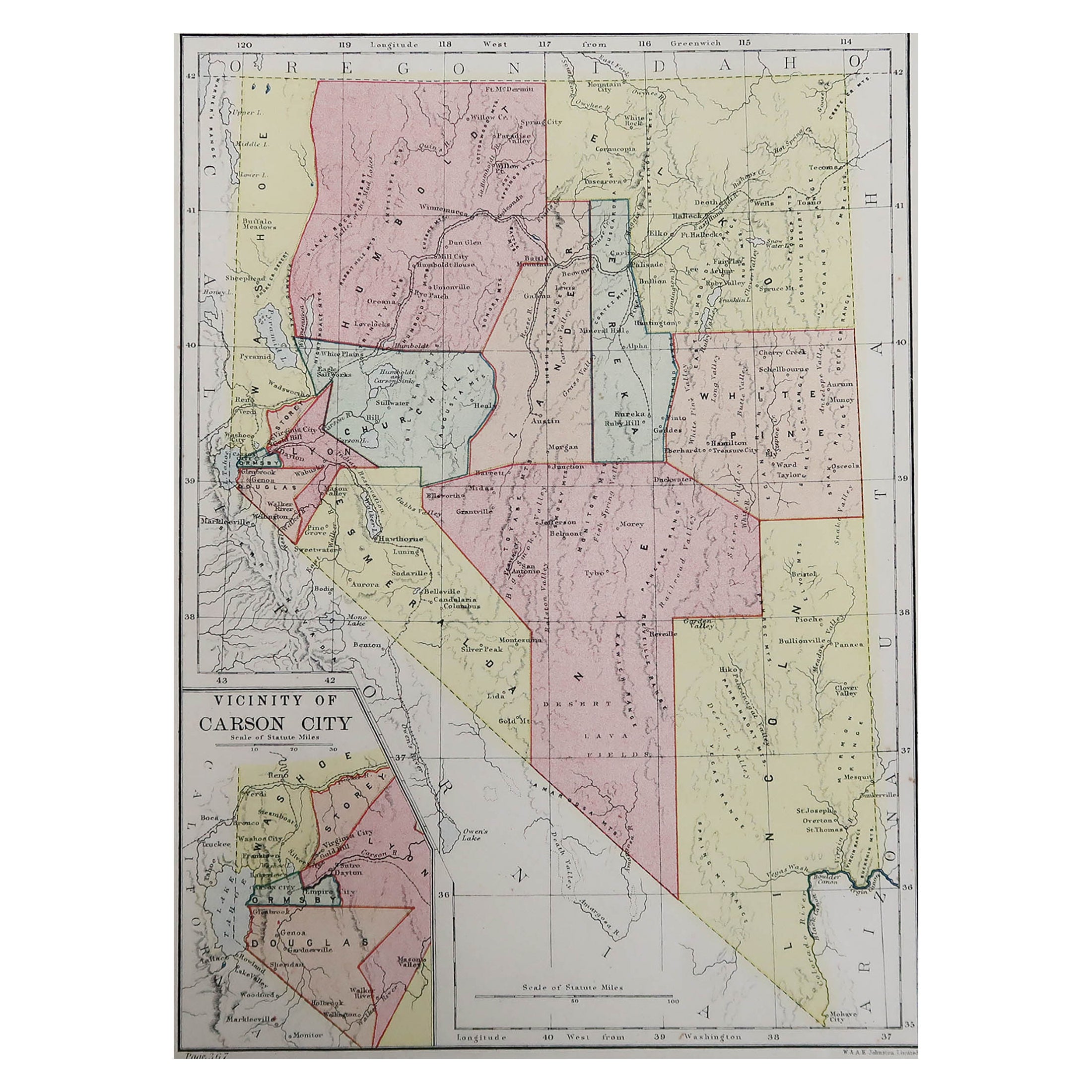
Antique map titled 'Johnson's California (..)'. Original map of California, Utah, Nevada, Colorado, New Mexico and Arizona. This map originates from 'Johnson's New Illustrated Family Atlas of the World' by A.J. Johnson. Published 1872.
- Dimensions:Height: 18.12 in (46 cm)Width: 26.38 in (67 cm)Depth: 0.02 in (0.5 mm)
- Materials and Techniques:
- Period:
- Date of Manufacture:1872
- Condition:Large split on folding line. General age-related toning, shows minor wear and creasing. Some soiling. Original folding line. English text on verso. Please study images carefully.
- Seller Location:Langweer, NL
- Reference Number:Seller: BG-12592-561stDibs: LU3054321468582
About the Seller
5.0
Recognized Seller
These prestigious sellers are industry leaders and represent the highest echelon for item quality and design.
Platinum Seller
Premium sellers with a 4.7+ rating and 24-hour response times
Established in 2009
1stDibs seller since 2017
2,511 sales on 1stDibs
Typical response time: <1 hour
- ShippingRetrieving quote...Shipping from: Langweer, Netherlands
- Return Policy
Authenticity Guarantee
In the unlikely event there’s an issue with an item’s authenticity, contact us within 1 year for a full refund. DetailsMoney-Back Guarantee
If your item is not as described, is damaged in transit, or does not arrive, contact us within 7 days for a full refund. Details24-Hour Cancellation
You have a 24-hour grace period in which to reconsider your purchase, with no questions asked.Vetted Professional Sellers
Our world-class sellers must adhere to strict standards for service and quality, maintaining the integrity of our listings.Price-Match Guarantee
If you find that a seller listed the same item for a lower price elsewhere, we’ll match it.Trusted Global Delivery
Our best-in-class carrier network provides specialized shipping options worldwide, including custom delivery.More From This Seller
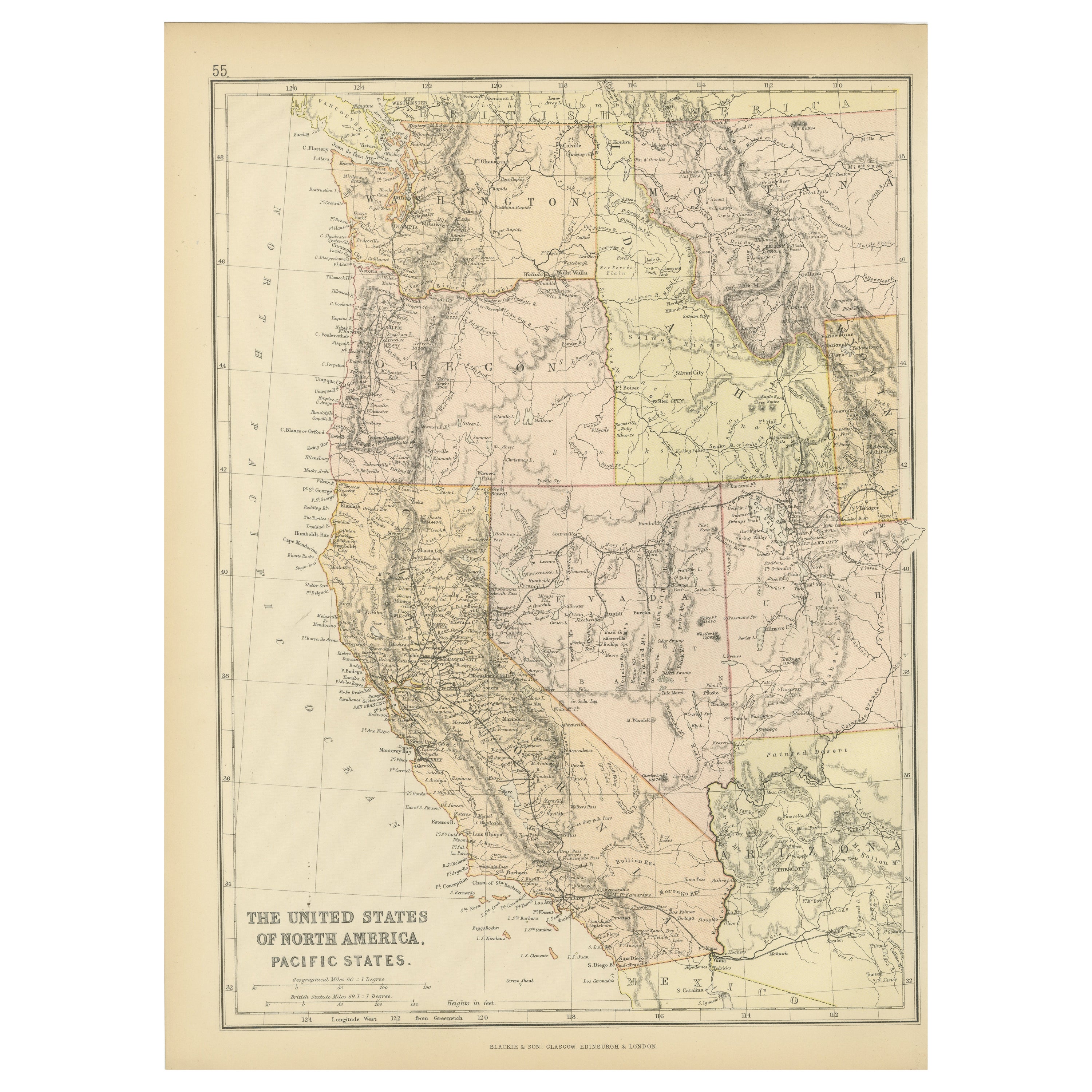
View AllAntique Map of The United States of North America, Pacific States, 1882
Located in Langweer, NL
The map is from the same 1882 Blackie Atlas and focuses on the Pacific States of the United States of America during that period. Here are some details and historical context about t...
Category
Antique 1880s Maps
Materials
Paper

$236 Sale Price
20% Off
Free Shipping
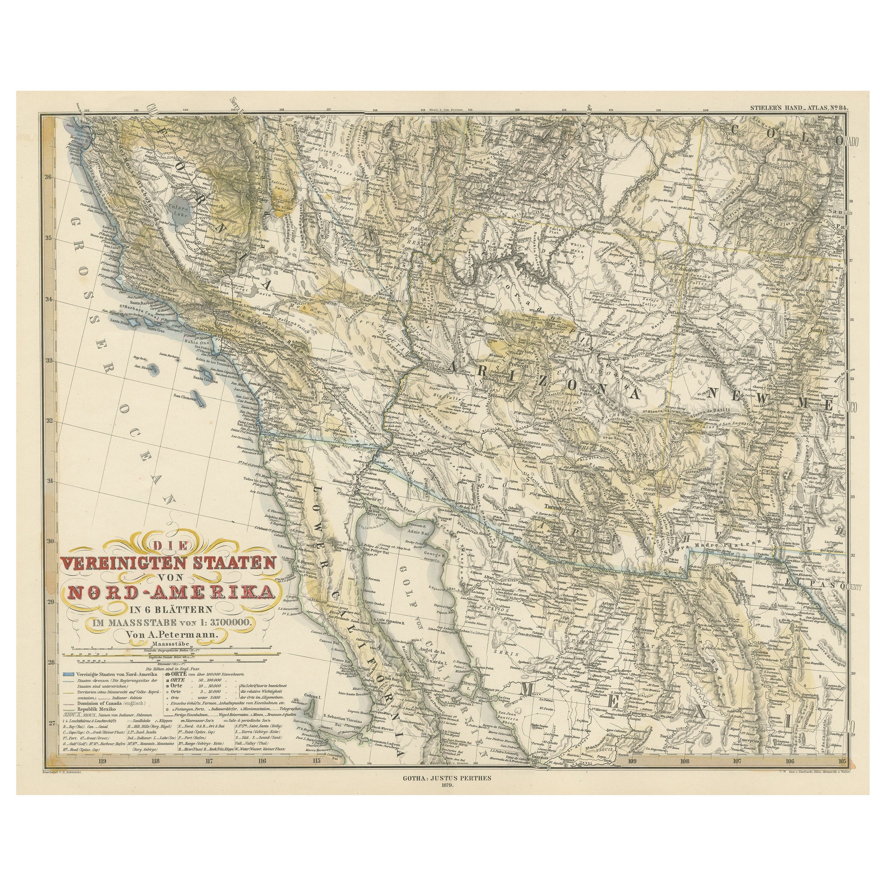
Antique Map of Part of the United States Including Lower California & Arizona
Located in Langweer, NL
Antique map of part of the United States of America including Lower California, Arizona and part of Mexico. This map was part of a set of six individual sheets with maps of the Unite...
Category
Antique Late 19th Century Maps
Materials
Paper

$415 Sale Price
20% Off
Antique Map of the United States 'North West' by Johnston, '1909'
Located in Langweer, NL
Antique map titled 'United States of North America'. Original antique map of the United States of North America ( North West ). This map originates from the ‘Royal Atlas of Modern Ge...
Category
Early 20th Century Maps
Materials
Paper

$236 Sale Price
20% Off
Antique Map of the United States by Titus '1871'
Located in Langweer, NL
Antique map titled 'The United States of America'. Original antique map of the United States. This map originates from 'Atlas of Prebl...
Category
Antique Late 19th Century Maps
Materials
Paper

$767 Sale Price
20% Off
Antique Map of the United States of North America by Johnston '1909'
Located in Langweer, NL
Antique map titled 'United States of North America'. Original antique map of United States of North America ( South West Sheet ). With inset maps of Chicago...
Category
Early 20th Century Maps
Materials
Paper
$330 Sale Price
20% Off
Map of Western United States 1903 – Railroads, State Borders, and Terrain
Located in Langweer, NL
Map of Western United States 1903 – Railroads, State Borders, and Terrain
This beautifully engraved map titled "United States of North America (Western Sheet)" was created by Keith ...
Category
Early 20th Century Maps
Materials
Paper

You May Also Like
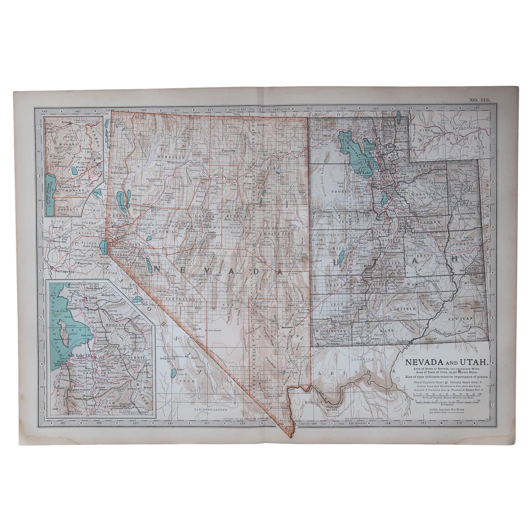
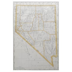
Original Antique Map of the American State of Nevada, 1889
Located in St Annes, Lancashire
Great map of Nevada
Drawn and Engraved by W. & A.K. Johnston
Published By A & C Black, Edinburgh.
Original colour
Unframed.
Category
Antique 1880s Scottish Victorian Maps
Materials
Paper

Original Antique Map of the American State of Nevada & Utah, 1903
Located in St Annes, Lancashire
Antique map of Nevada and Utah
Published By A & C Black. 1903
Original colour
Good condition
Unframed.
Free shipping
Category
Antique Early 1900s English Maps
Materials
Paper
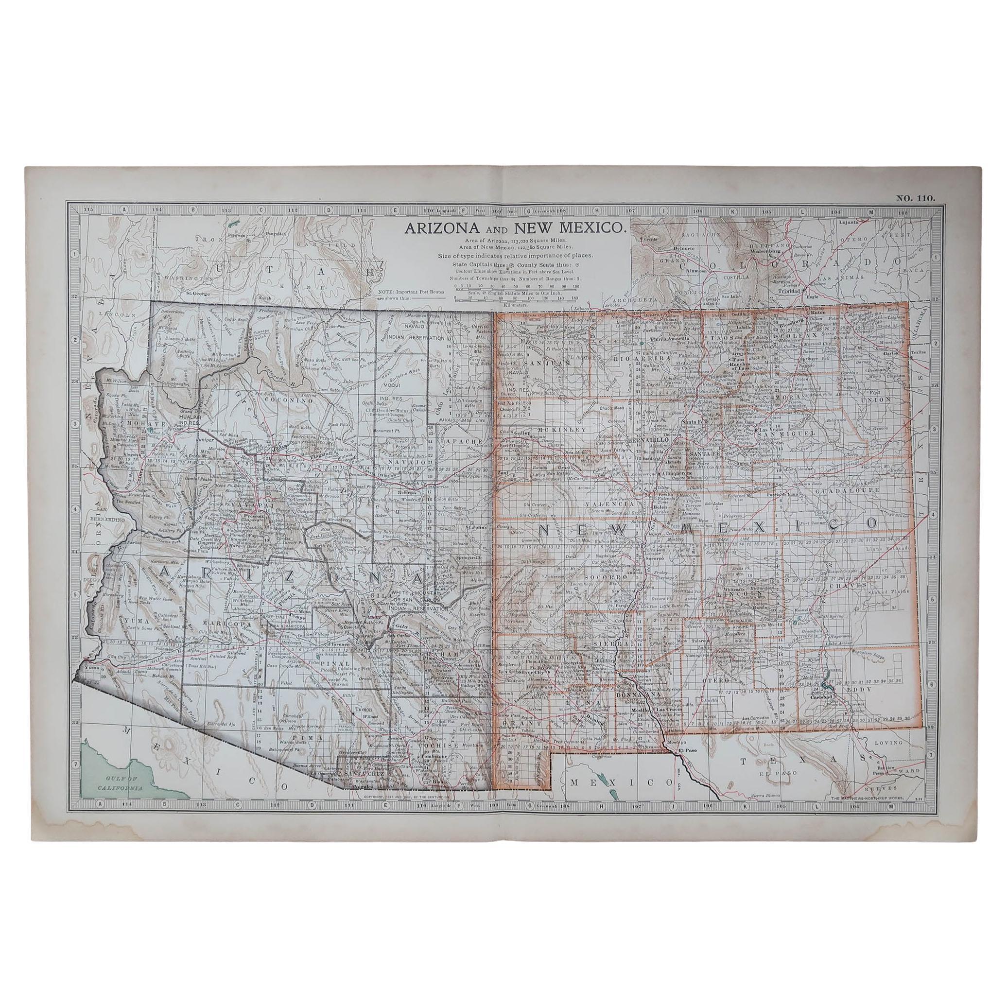
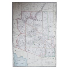
Original Antique Map of the American State of Arizona & New Mexico, 1903
Located in St Annes, Lancashire
Antique map of Arizona and New Mexico
Published By A & C Black. 1903
Original colour
Good condition
Unframed.
Free shipping
Category
Antique Early 1900s English Maps
Materials
Paper

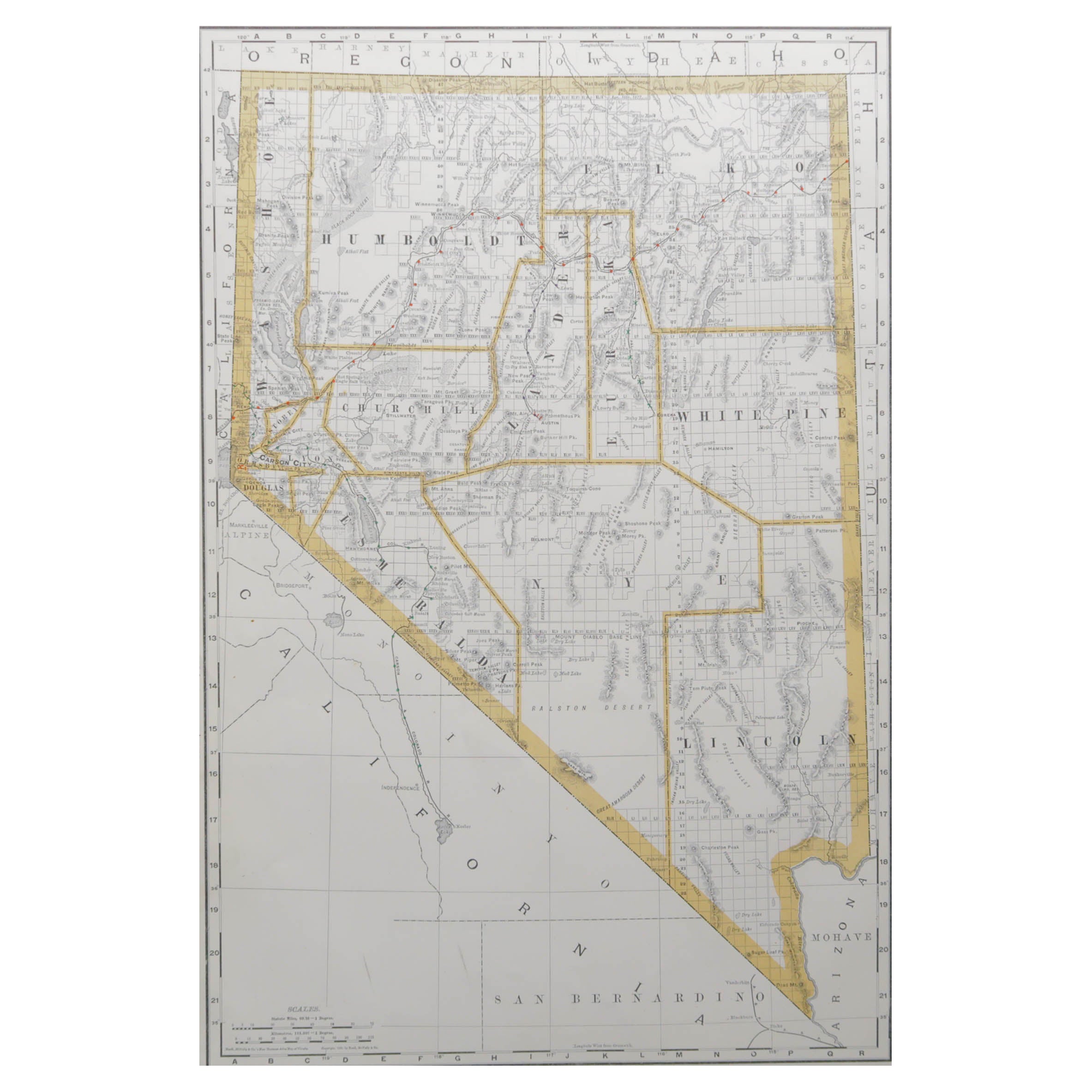
Large Original Antique Map of Nevada, USA, 1894
By Rand McNally & Co.
Located in St Annes, Lancashire
Fabulous map of Nevada
Original color
By Rand, McNally & Co.
Published, 1894
Unframed
Free shipping.
Category
Antique 1890s American Maps
Materials
Paper
Large Original Antique Map of Arizona, Usa, C.1900
Located in St Annes, Lancashire
Fabulous map of Arizona
Original color.
Engraved and printed by the George F. Cram Company, Indianapolis.
Published, C.1900.
Unframed.
Free shipping.
Category
Antique 1890s American Maps
Materials
Paper
Large Original Antique Map of California, USA, circa 1900
Located in St Annes, Lancashire
Fabulous map of California
Original color
Engraved and printed by the George F. Cram Company, Indianapolis.
Published, circa 1900
Unframed
Free shipping.
Category
Antique 1890s American Maps
Materials
Paper

More Ways To Browse
Mexican Antiques
Colorado Used Furniture
Antique Furniture California
19th Century Mexican Furniture
Antique Map Mexico
Antique Maps California
Map Of Mexican California
Antique Maps Colorado
Nevada Antique Map
Map Greece
Roman Map
Antique Maps Of Russia
Antique Roman Map
Maps Of Mediterranean
Mercator Map
Antique Railroad Furniture
Atlas Globe
Antique Mississippi Furniture