Items Similar to Antique Map of East Flanders, Belgium, c.1840

Want more images or videos?
Request additional images or videos from the seller
1 of 5
Antique Map of East Flanders, Belgium, c.1840
$119.81
$149.7720% Off
£89.19
£111.4920% Off
€100
€12520% Off
CA$164.12
CA$205.1420% Off
A$182.53
A$228.1720% Off
CHF 95.31
CHF 119.1420% Off
MX$2,221.23
MX$2,776.5320% Off
NOK 1,217.29
NOK 1,521.6120% Off
SEK 1,141.60
SEK 1,42720% Off
DKK 761.27
DKK 951.5820% Off
Shipping
Retrieving quote...The 1stDibs Promise:
Authenticity Guarantee,
Money-Back Guarantee,
24-Hour Cancellation
About the Item
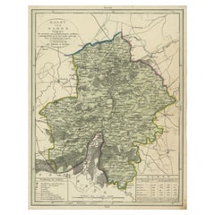
Antique map titled 'Kaart van Oost Vlaanderen'. Original antique map of East Flanders, Belgium. Source unkown, to be determined. Published circa 1840.
Artists and Engravers: Engraved by D. Veelwaard. Published by Erven F. Bohn.
Condition: Good, general age-related toning. Minor wear, blank verso. Please study image carefully.
Date: c.1840
Overall size: 21.5 x 27 cm.
Image size: 20.5 x 25.5 cm.
- Dimensions:Height: 10.63 in (27 cm)Width: 8.47 in (21.5 cm)Depth: 0 in (0.01 mm)
- Materials and Techniques:
- Period:
- Date of Manufacture:circa 1840
- Condition:
- Seller Location:Langweer, NL
- Reference Number:Seller: BV-00701stDibs: LU3054326172082
About the Seller
5.0
Recognized Seller
These prestigious sellers are industry leaders and represent the highest echelon for item quality and design.
Platinum Seller
Premium sellers with a 4.7+ rating and 24-hour response times
Established in 2009
1stDibs seller since 2017
2,508 sales on 1stDibs
Typical response time: <1 hour
- ShippingRetrieving quote...Shipping from: Langweer, Netherlands
- Return Policy
Authenticity Guarantee
In the unlikely event there’s an issue with an item’s authenticity, contact us within 1 year for a full refund. DetailsMoney-Back Guarantee
If your item is not as described, is damaged in transit, or does not arrive, contact us within 7 days for a full refund. Details24-Hour Cancellation
You have a 24-hour grace period in which to reconsider your purchase, with no questions asked.Vetted Professional Sellers
Our world-class sellers must adhere to strict standards for service and quality, maintaining the integrity of our listings.Price-Match Guarantee
If you find that a seller listed the same item for a lower price elsewhere, we’ll match it.Trusted Global Delivery
Our best-in-class carrier network provides specialized shipping options worldwide, including custom delivery.More From This Seller
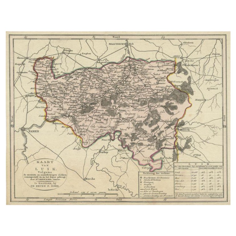
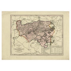
View AllAntique Map of the Region of Luik by Veelwaard, C.1840
Located in Langweer, NL
Antique map titled 'Kaart van Luik'. Original antique map of the region of Luik (Liege), Belgium. Source unkown, to be determined. Published circa 1840.
Artists and Engravers: E...
Category
Antique 19th Century Maps
Materials
Paper

$119 Sale Price
20% Off
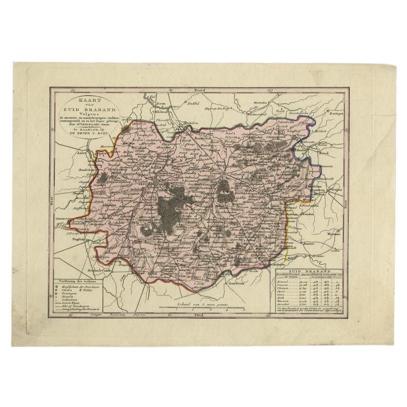
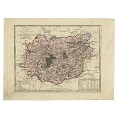
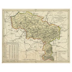
Antique Map of the Province of Brabant in Belgium by Veelwaard, C.1840
Located in Langweer, NL
Antique map titled 'Kaart van Zuid Braband (..).' Uncommon map showing the province of Zuid-Brabant in Belgium. Source unknown, to be determined.
Artists and Engravers: Daniel Vee...
Category
Antique 19th Century Maps
Materials
Paper
$115 Sale Price
20% Off
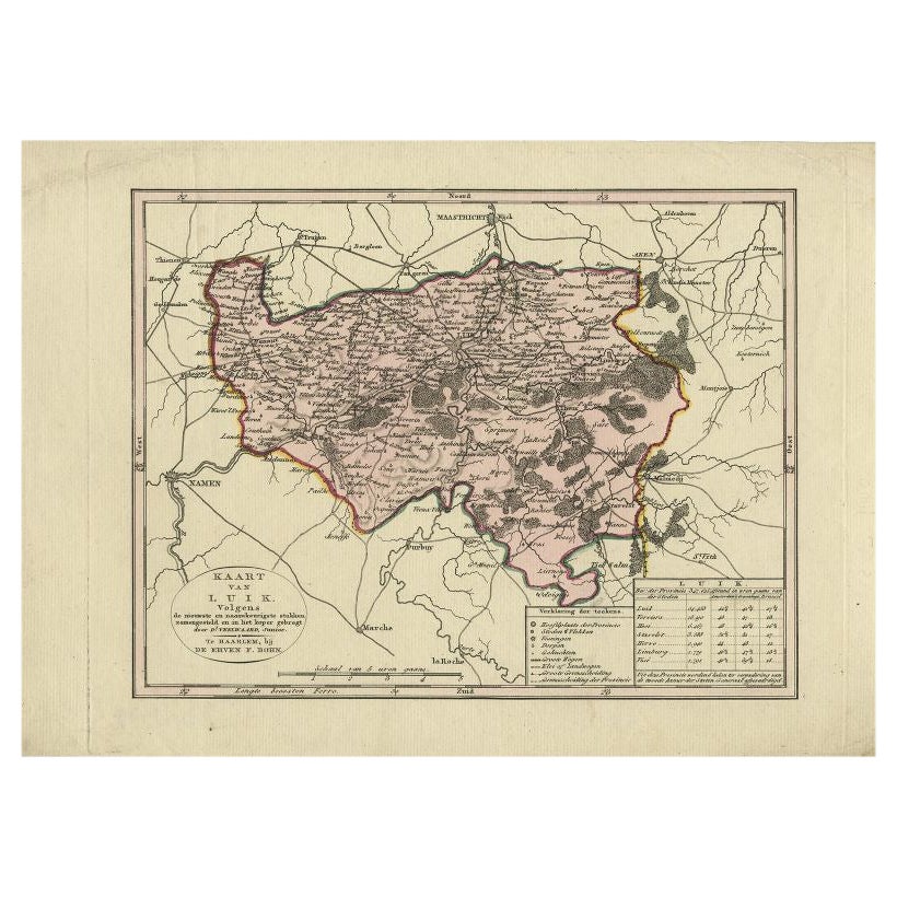
Antique Map of the Region of Luik by Veelwaard, c.1840
Located in Langweer, NL
Antique map titled 'Kaart van Luik'. Original antique map of the region of Luik (Liege), Belgium. Source unkown, to be determined. Published circa 1840.
Artists and Engravers: E...
Category
Antique 19th Century Maps
Materials
Paper
$119 Sale Price
20% Off
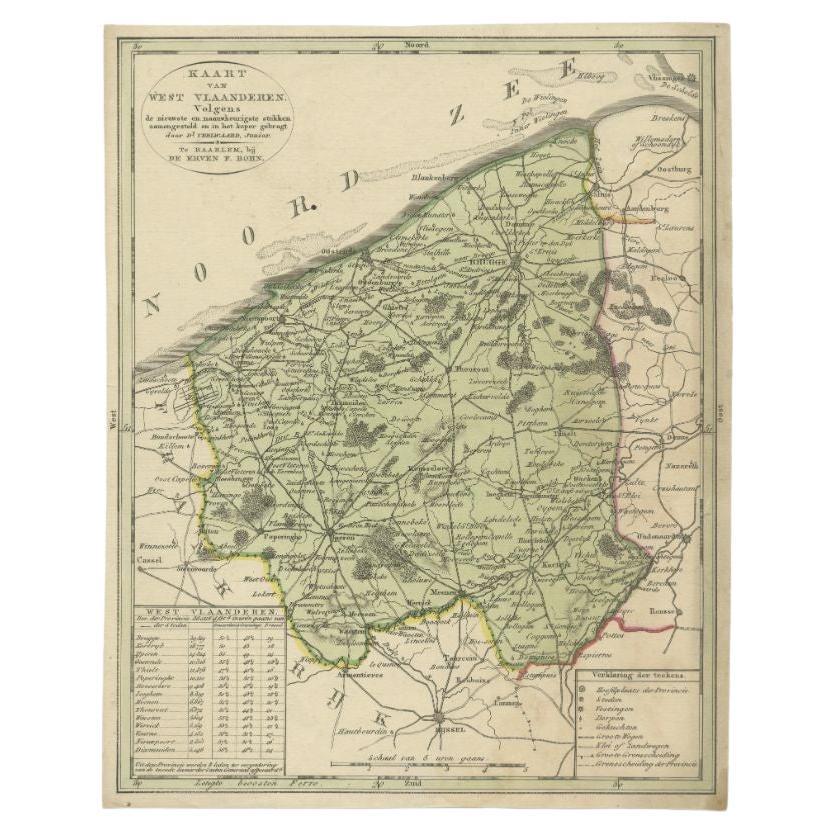
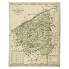
Antique Map of West Flanders in Belgium, c.1840
Located in Langweer, NL
Antique map titled 'Kaart van West Vlaanderen'. Original antique map of West Flanders, Belgium. Source unkown, to be determined. Published circa 1840.
Artis...
Category
Antique 19th Century Maps
Materials
Paper
$277 Sale Price
20% Off
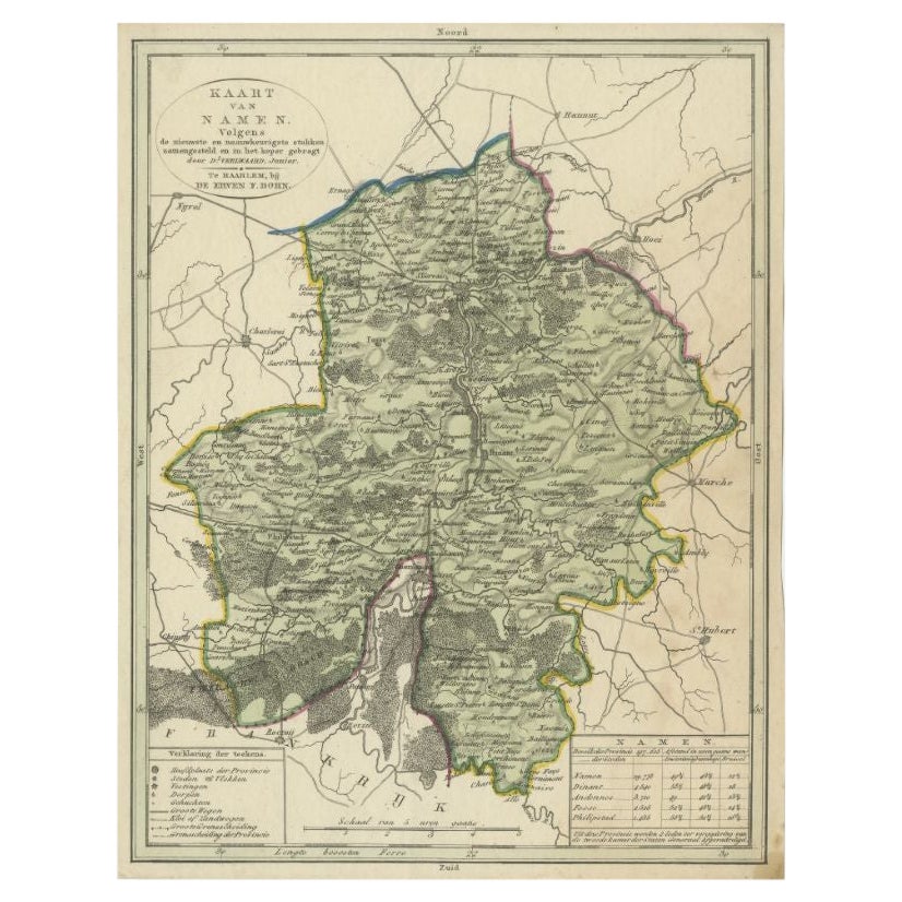
Antique Map of the Region of Namen by Veelwaard, c.1840
Located in Langweer, NL
Antique map titled 'Kaart van Namen'. Original antique map of the region of Namen (Namur), Belgium. Source unkown, to be determined. Published circa 1840.
Artists and Engravers:...
Category
Antique 19th Century Maps
Materials
Paper
$119 Sale Price
20% Off
Antique Map of the Region of Henegouwen by Veelwaard, C.1840
Located in Langweer, NL
Antique map titled 'Kaart van Henegouwen'. Original antique map of the region of Henegouwen (Hainaut), Belgium. Source unkown, to be determined. Published circa 1840.
Artists and...
Category
Antique 19th Century Maps
Materials
Paper
$119 Sale Price
20% Off
You May Also Like
Original Antique English County Map, Cambridgeshire, J & C Walker, 1851
Located in St Annes, Lancashire
Great map of Cambridgeshire
Original colour
By J & C Walker
Published by Longman, Rees, Orme, Brown & Co. 1851
Unframed.
Category
Antique 1850s English Other Maps
Materials
Paper

Original Antique English County Map, Nottinghamshire, J & C Walker, 1851
Located in St Annes, Lancashire
Great map of Nottinghamshire
Original colour
By J & C Walker
Published by Longman, Rees, Orme, Brown & Co. 1851
Unframed.
Category
Antique 1850s English Other Maps
Materials
Paper

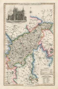
Northamptonshire, English County Antique map, 1847
By Isaac Slater
Located in Melbourne, Victoria
Steel-engraved map with original outline colouring by Isaac Slater. A detailed engraved map of the English county with title, scale, and key. Decorated with an uncoloured engraved view of 'Peterborough...
Category
19th Century Naturalistic Landscape Prints
Materials
Engraving
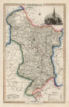
Derbyshire, English County Antique map, 1847
By Isaac Slater
Located in Melbourne, Victoria
Steel-engraved map with original outline colouring by Isaac Slater. A detailed engraved map of the English county with title, scale, and key. Decorated with an uncoloured engraved vi...
Category
19th Century Naturalistic Landscape Prints
Materials
Engraving
Original Antique English County Map, Leicestershire, J & C Walker, 1851
Located in St Annes, Lancashire
Great map of Leicestershire
Original colour
By J & C Walker
Published by Longman, Rees, Orme, Brown & Co. 1851
Unframed.
Category
Antique 1850s English Other Maps
Materials
Paper

1752 Vaugoundy Map of Flanders : Belgium, France, and the Netherlands, Ric.a002
Located in Norton, MA
Large Vaugoundy Map of Flanders:
Belgium, France, and the Netherlands
Colored -1752
Ric.a002
Description: This is a 1752 Didier Robert de Vaugondy map of Flanders. The map de...
Category
Antique 17th Century Unknown Maps
Materials
Paper

More Ways To Browse
Joan Blaeu
Antique Nautical Maps
Antique Portuguese Plates
New Zealand Map
Antique Railroad Collectibles
Blaeu World Map
Roman Empire Map
Antique Map Of Middle East
Caribbean Map
Antique Map Of Egypt
Antique Map Ortelius
Antique Farm Antiques Collectibles
Antique Galleon
Biblical Maps
Medieval Capital
Civil War Map
Map Of Singapore
Migeon Migeon