Items Similar to Antique Map of Fort Mozambique and Mozambique Bay in Africa, c.1759
Want more images or videos?
Request additional images or videos from the seller
1 of 5
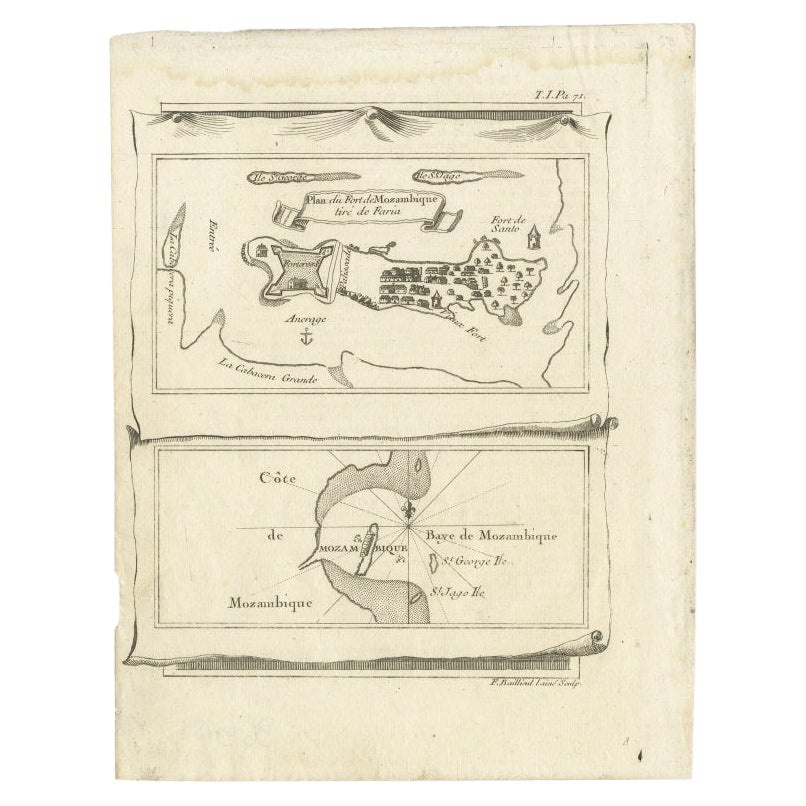
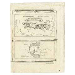
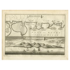
Antique Map of Fort Mozambique and Mozambique Bay in Africa, c.1759
On Hold
$153.31
On Hold
£114.76
On Hold
€130
On Hold
CA$211
On Hold
A$235.18
On Hold
CHF 123.39
On Hold
MX$2,871.93
On Hold
NOK 1,562.39
On Hold
SEK 1,476.70
On Hold
DKK 989.65
About the Item
Two antique maps on one sheet. The upper antique map is titled 'Plan du Fort de Mozambique tiré de Faria' and depicts the island of Mozambique with its fort, settlement, harbor and immediate surroundings. The lower map depicts Mozambique Bay.
Artists and Engravers: Engraved by F. Baillieul.
Artist: Engraved by F. Baillieul.
Condition: Good, original folding lines. General age-related toning, blank verso. Please study image carefully.
Date: c.1759
Overall size: 19.4 x 21.8 cm.
Image size:16 x 19.3 cm.
- Dimensions:Height: 7.64 in (19.4 cm)Width: 8.59 in (21.8 cm)Depth: 0 in (0.01 mm)
- Materials and Techniques:
- Period:
- Date of Manufacture:circa 1759
- Condition:
- Seller Location:Langweer, NL
- Reference Number:Seller: BG-125531stDibs: LU3054326426382
About the Seller
5.0
Recognized Seller
These prestigious sellers are industry leaders and represent the highest echelon for item quality and design.
Platinum Seller
Premium sellers with a 4.7+ rating and 24-hour response times
Established in 2009
1stDibs seller since 2017
2,517 sales on 1stDibs
Typical response time: <1 hour
- ShippingRetrieving quote...Shipping from: Langweer, Netherlands
- Return Policy
Authenticity Guarantee
In the unlikely event there’s an issue with an item’s authenticity, contact us within 1 year for a full refund. DetailsMoney-Back Guarantee
If your item is not as described, is damaged in transit, or does not arrive, contact us within 7 days for a full refund. Details24-Hour Cancellation
You have a 24-hour grace period in which to reconsider your purchase, with no questions asked.Vetted Professional Sellers
Our world-class sellers must adhere to strict standards for service and quality, maintaining the integrity of our listings.Price-Match Guarantee
If you find that a seller listed the same item for a lower price elsewhere, we’ll match it.Trusted Global Delivery
Our best-in-class carrier network provides specialized shipping options worldwide, including custom delivery.More From This Seller
View AllAntique Map of Mozambique Bay and a Map Fort de Mozambique, c.1759
Located in Langweer, NL
Two antique maps on one sheet. The upper antique map is titled 'Plan du Fort de Mozambique tiré de Faria' and depicts the island of Mozambique with its fort, settlement, harbor and i...
Category
Antique 18th Century Maps
Materials
Paper
$103 Sale Price
20% Off
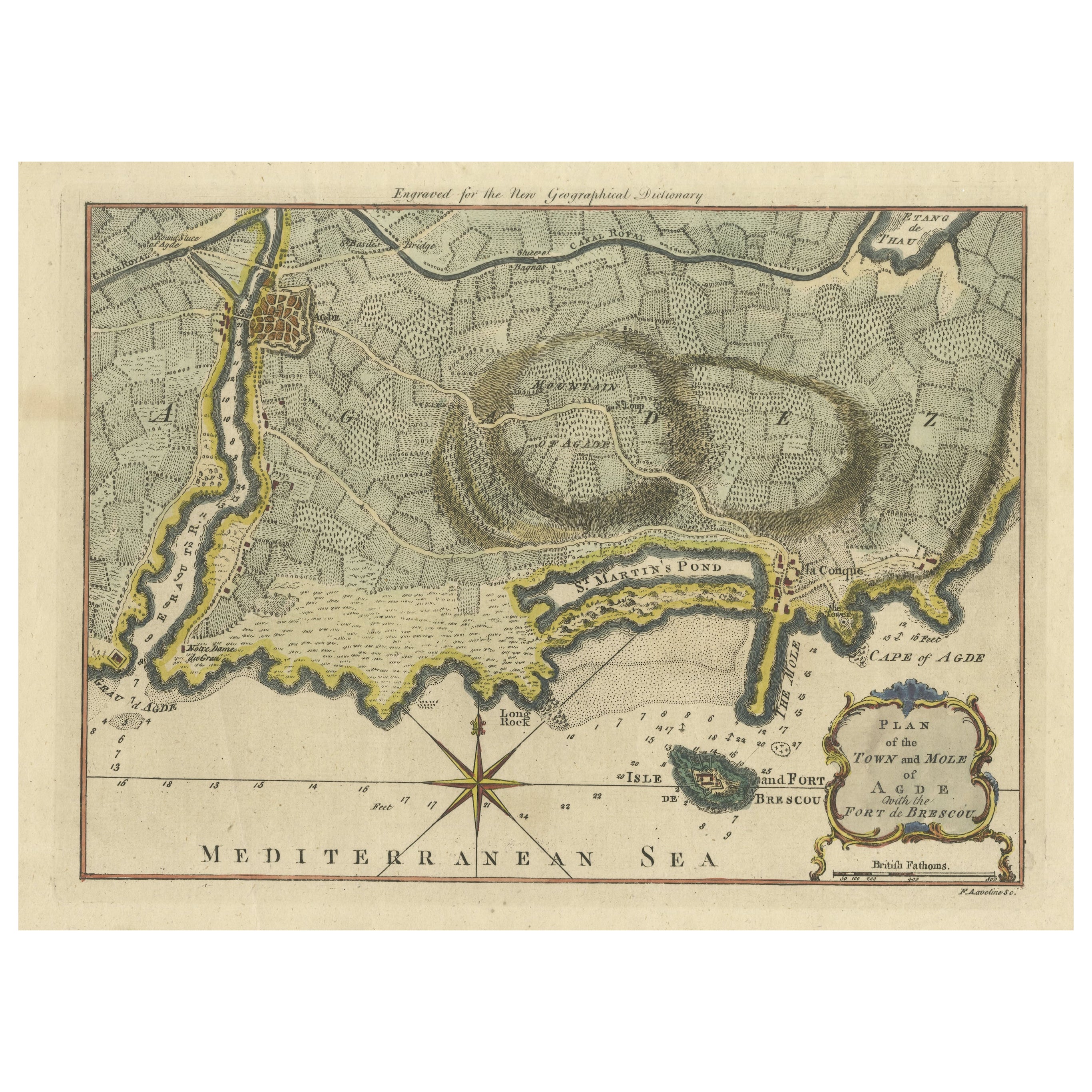
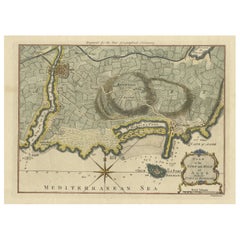
Antique Map Plan of Town and Mole of CAP D'agde & Fort De Brescou, France, 1759
Located in Langweer, NL
Antique Plan titled 'Plan of the Town and Mole of Agde with the Fort de Brescou'. Antique town plan of Agde, engraved for the Geographical Dictionary, by Rol...
Category
Antique Mid-18th Century Maps
Materials
Paper
$462 Sale Price
20% Off
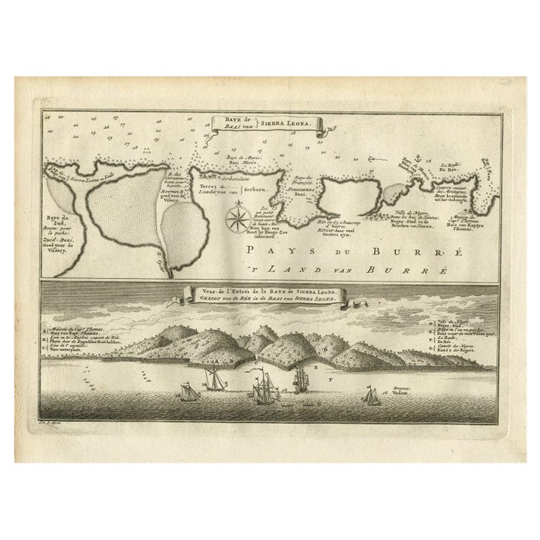
Antique Map and View of the Bay of Sierra Leone in Africa, C.1750
Located in Langweer, NL
Antique print titled 'Baye de Sierra Leona (..) - Baai van Sierra Leona (..)'. Map and view of the bay of Sierra Leone. This print originates from 'Historische beschryving der Reizen...
Category
Antique 18th Century Prints
Materials
Paper
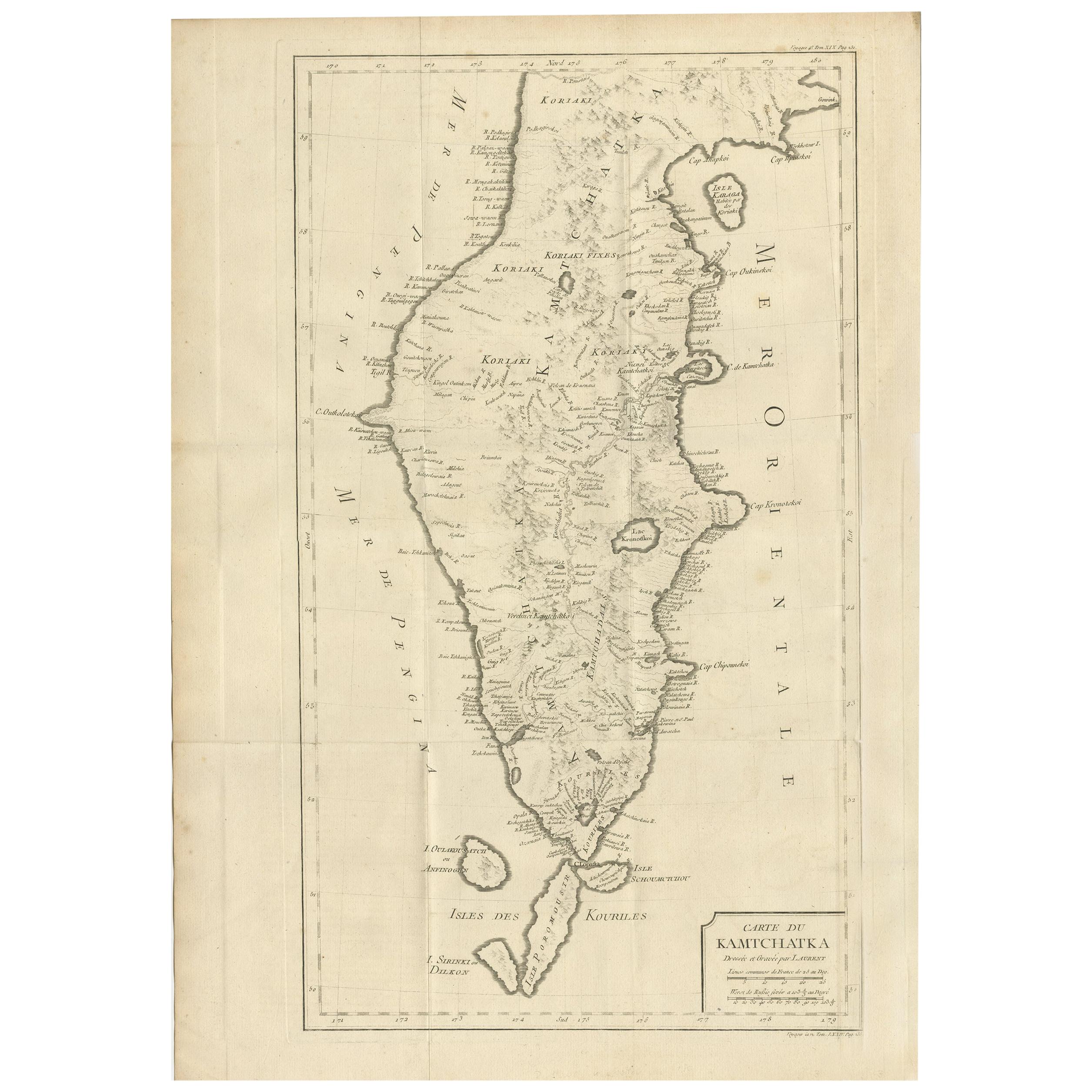
Antique Map of Kamtchatka by Didot, '1759'
Located in Langweer, NL
Antique map titled 'Carte du Kamtchatka'. Antique map of the Kamchatka Peninsula. The map includes the island of Ouiakous Atch ou Anfinogen, Schoumctchou, and Sirinki ou Dilkon. Orig...
Category
Antique Mid-18th Century Maps
Materials
Paper
$283 Sale Price
20% Off
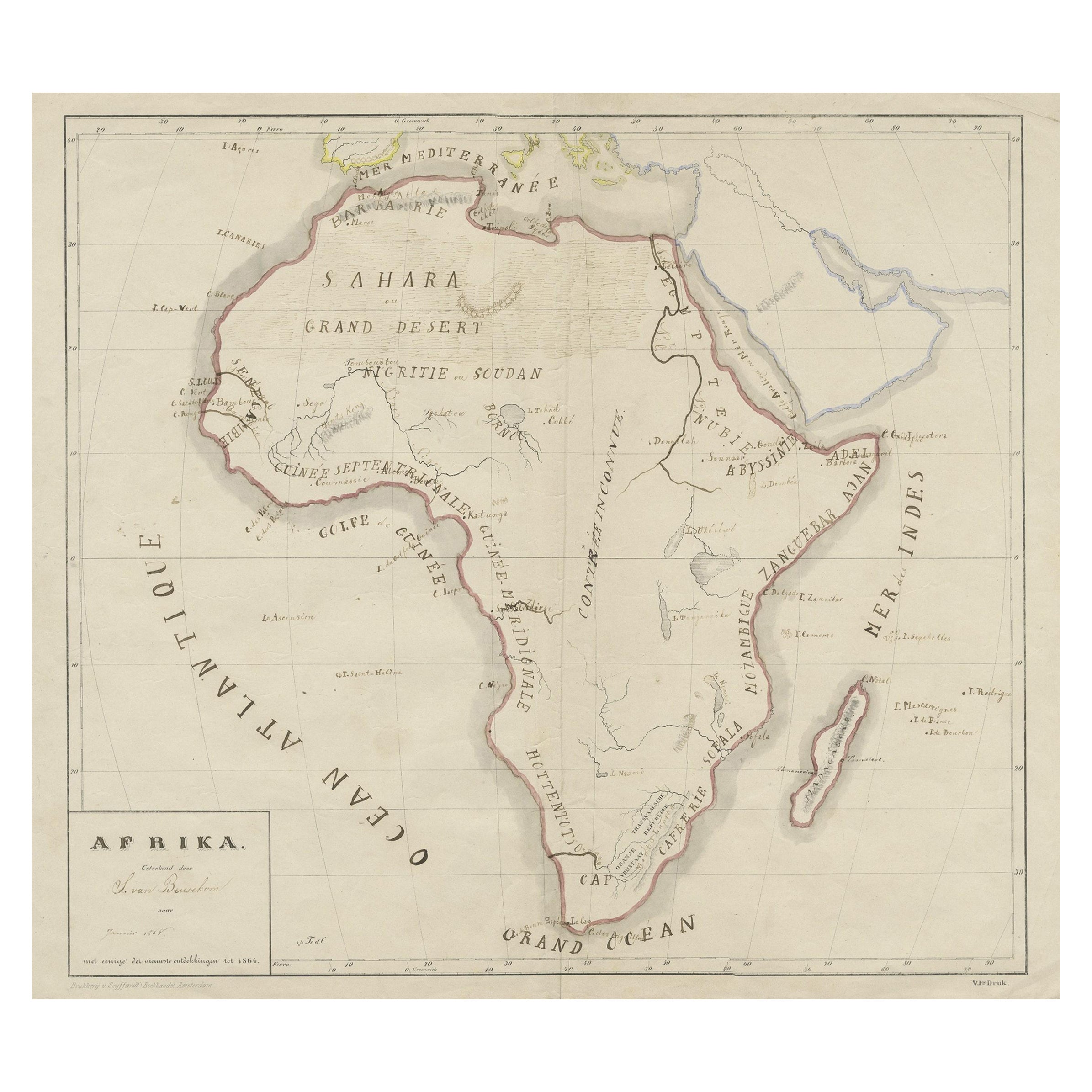
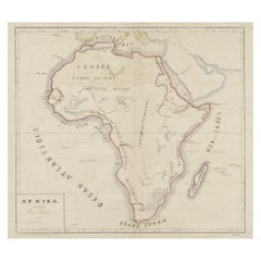
Original Antique Map of Africa
Located in Langweer, NL
Antique map titled 'Afrika'. Original antique map of Africa, drawn by Van Beusekom. Published by 'Seyffardt's Boekhandel' in Amsterdam, circa 1870.
Category
Antique Late 19th Century Maps
Materials
Paper
$320 Sale Price
20% Off
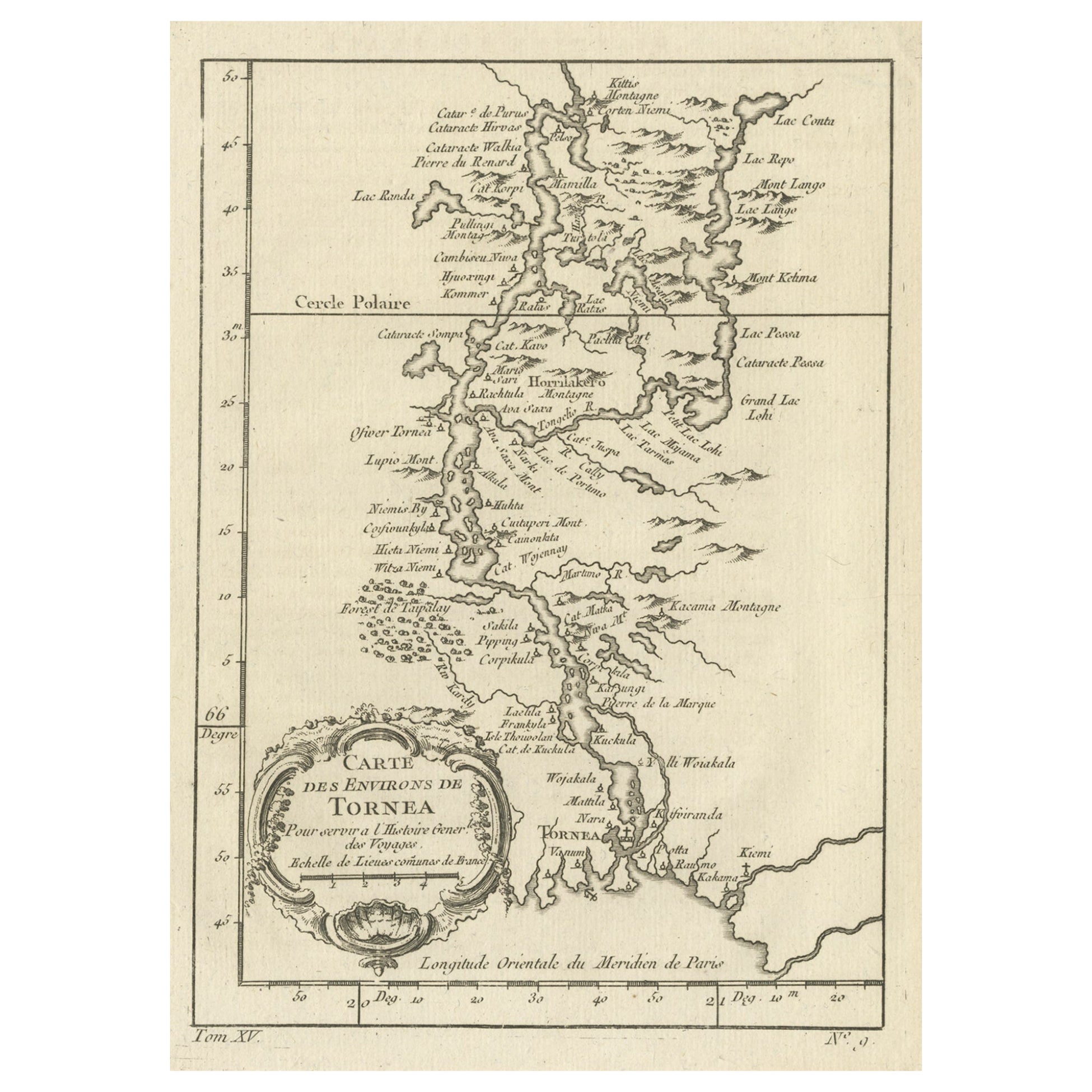
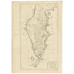
Original Antique Map of the Region of Torneå 'Tornio' in Northern Finland, 1759
Located in Langweer, NL
Antique map titled 'Carte des Environs de Tornea'.
Original antique map of the region of Torneå (or Tornio), in northern Finland. This print originates from volume 19 of 'Histoir...
Category
Antique 1750s Maps
Materials
Paper
$301 Sale Price
20% Off
You May Also Like
Original Antique Map of South Africa, Arrowsmith, 1820
Located in St Annes, Lancashire
Great map of South Africa.
Drawn under the direction of Arrowsmith.
Copper-plate engraving.
Published by Longman, Hurst, Rees, Orme and Br...
Category
Antique 1820s English Maps
Materials
Paper

Antique Map of Principality of Monaco
By Antonio Vallardi Editore
Located in Alessandria, Piemonte
ST/619 - "Old Geographical Atlas of Italy - Topographic map of ex-Principality of Monaco" -
ediz Vallardi - Milano -
A somewhat special edition ---
Category
Antique Late 19th Century Italian Other Prints
Materials
Paper

Original Antique Map of Spain and Portugal, circa 1790
Located in St Annes, Lancashire
Super map of Spain and Portugal
Copper plate engraving by A. Bell
Published, circa 1790.
Unframed.
Category
Antique 1790s English Other Maps
Materials
Paper

Original Antique Map of Ireland- Tipperary and Waterford. C.1840
Located in St Annes, Lancashire
Great map of Tipperary and Waterford
Steel engraving
Drawn under the direction of A.Adlard
Published by How and Parsons, C.1840
Unframed.
Category
Antique 1840s English Maps
Materials
Paper

Original Antique Map of United States, Grattan and Gilbert, 1843
Located in St Annes, Lancashire
Great map of United States
Drawn and engraved by Archer
Published by Grattan and Gilbert. 1843
Original colour
Unframed.
Category
Antique 1840s English Maps
Materials
Paper

Original Antique Map of South America. C.1780
Located in St Annes, Lancashire
Great map of South America
Copper-plate engraving
Published C.1780
Two small worm holes to left side of map
Unframed.
Category
Antique Early 1800s English Georgian Maps
Materials
Paper

More Ways To Browse
Map Of Holy Land
Antique Macedonia
Antique Maps Of New York City
Victorian Compass
Antique Maps Caribbean Islands
Hungary Map
Cartographer Tool
Goa Furniture
George Fleet
Sri Lanka Map
Philippines Map
Antique Map Ceylon
Antique Sri Lanka Map
Persian Maps
Antique Civil War Maps
Antique Map Of The Philippines
Large Map Of Italy
Used Marine Compass