Items Similar to Antique Map of the Netherlands by Zannoni, 1765

Want more images or videos?
Request additional images or videos from the seller
1 of 5
Antique Map of the Netherlands by Zannoni, 1765
$211.37
$264.2220% Off
£155.68
£194.6020% Off
€176
€22020% Off
CA$287.56
CA$359.4520% Off
A$319.54
A$399.4220% Off
CHF 167.44
CHF 209.3020% Off
MX$3,918.58
MX$4,898.2320% Off
NOK 2,135.63
NOK 2,669.5320% Off
SEK 2,009.12
SEK 2,511.4020% Off
DKK 1,339.86
DKK 1,674.8320% Off
Shipping
Retrieving quote...The 1stDibs Promise:
Authenticity Guarantee,
Money-Back Guarantee,
24-Hour Cancellation
About the Item
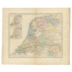
Antique map titled 'Carte Historique, Geographique et Militaire des Campagnes de Louis XIV dans les Pays Bas (..)'. Beautiful old map of the Netherlands. This map originates from 'Atlas Historique de la France Ancienne et Moderne' by M. Rizzi Zannoni.
Artists and Engravers: Published by S. Desons, Paris. Giovanni Rizzi Zannoni (1736-1814 ) was an Italian cartographer and geographer.
Condition: Very good, please study image carefully.
Date: 1765
Overall size: 40 x 28 cm.
Image size: 30 x 24 cm.
We sell original antique maps to collectors, historians, educators and interior decorators all over the world. Our collection includes a wide range of authentic antique maps from the 16th to the 20th centuries. Buying and collecting antique maps is a tradition that goes back hundreds of years. Antique maps have proved a richly rewarding investment over the past decade, thanks to a growing appreciation of their unique historical appeal. Today the decorative qualities of antique maps are widely recognized by interior designers who appreciate their beauty and design flexibility. Depending on the individual map, presentation, and context, a rare or antique map can be modern, traditional, abstract, figurative, serious or whimsical. We offer a wide range of authentic antique maps for any budget.
- Dimensions:Height: 11.03 in (28 cm)Width: 15.75 in (40 cm)Depth: 0 in (0.01 mm)
- Materials and Techniques:
- Period:
- Date of Manufacture:1765
- Condition:
- Seller Location:Langweer, NL
- Reference Number:Seller: BG-11796-571stDibs: LU3054327828732
About the Seller
5.0
Recognized Seller
These prestigious sellers are industry leaders and represent the highest echelon for item quality and design.
Platinum Seller
Premium sellers with a 4.7+ rating and 24-hour response times
Established in 2009
1stDibs seller since 2017
2,494 sales on 1stDibs
Typical response time: 1 hour
- ShippingRetrieving quote...Shipping from: Langweer, Netherlands
- Return Policy
Authenticity Guarantee
In the unlikely event there’s an issue with an item’s authenticity, contact us within 1 year for a full refund. DetailsMoney-Back Guarantee
If your item is not as described, is damaged in transit, or does not arrive, contact us within 7 days for a full refund. Details24-Hour Cancellation
You have a 24-hour grace period in which to reconsider your purchase, with no questions asked.Vetted Professional Sellers
Our world-class sellers must adhere to strict standards for service and quality, maintaining the integrity of our listings.Price-Match Guarantee
If you find that a seller listed the same item for a lower price elsewhere, we’ll match it.Trusted Global Delivery
Our best-in-class carrier network provides specialized shipping options worldwide, including custom delivery.More From This Seller
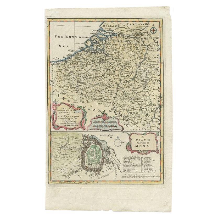
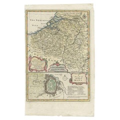
View AllAntique Map of the Netherlands and Belgium by Bowen, 1747
By Emanuel Bowen
Located in Langweer, NL
Antique map Belgium titled 'A New and Accurate Map of the Netherlands or Low Countries'. Detailed map of South of the Netherlands and Belgium. With large inset of the city of Mons, B...
Category
Antique 18th Century Maps
Materials
Paper
$208 Sale Price
20% Off
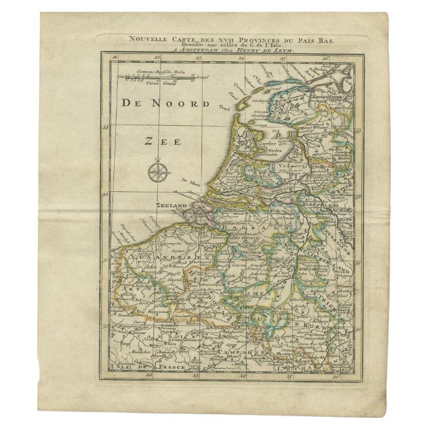
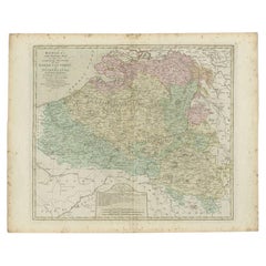
Antique Map of the Netherlands and Belgium by Keizer & De Lat, 1788
Located in Langweer, NL
Antique map titled 'Nouvelle Carte des XVII Provinces du Païs Bas (..)'. Uncommon antique map of Holland and Belgium. This map originates from ...
Category
Antique 18th Century Maps
Materials
Paper

$314 Sale Price
20% Off
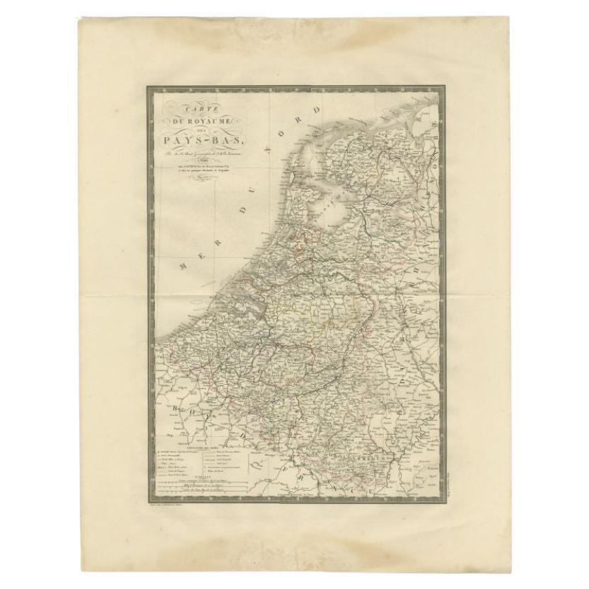
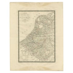
Antique Map of the Low Countries by Brué, 1822
Located in Langweer, NL
Antique map titled 'Carte du Royaume des Pays-Bas'. Large format map of the Low Countries. This map originates from 'Atlas Universel', published 1822...
Category
Antique 19th Century Maps
Materials
Paper
$166 Sale Price
20% Off
Antique Map of the Low Countries by Seutter, c.1745
Located in Langweer, NL
Antique map titled ‘XVII Provinciae Belgii sive Germaniae Inferioris (..)’. Detailed hand colored map of the Low Countries. Includes colored decorative cartouche, compass rose and co...
Category
Antique 18th Century Maps
Materials
Paper

$478 Sale Price
20% Off
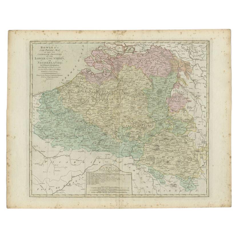
Antique Map of the Southern Netherlands by Bowles, c.1780
Located in Langweer, NL
Antique map titled ‘Bowles's New Pocket Map of the ten Catholick Provinces of the Lower Countries, or Netherlands’. Original antique map of the Southern Netherlands. The Southern Netherlands, also called the Catholic Netherlands, was the part of the Low Countries largely controlled by Spain (1556–1714), later Austria (1714–1794), and occupied then annexed by France (1794–1815). With English legend explaining the ten provinces.
Artists and Engravers: Thomas Bowles, born around 1712, was map publisher and seller in London...
Category
Antique 18th Century Maps
Materials
Paper
$283 Sale Price
20% Off
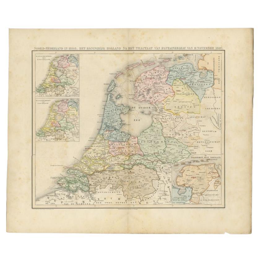
Antique Map of the Netherlands in 1808 by Mees, 1857
Located in Langweer, NL
Antique map titled 'Noord-Nederland in 1808. Het Koningrijk Holland na het tractaat van Fontainebleau van 11 november 1807'. Map of the Netherlands in 1808. This map originates from ...
Category
Antique 19th Century Maps
Materials
Paper
$122 Sale Price
20% Off
You May Also Like
1752 Vaugoundy Map of Flanders : Belgium, France, and the Netherlands, Ric.a002
Located in Norton, MA
Large Vaugoundy Map of Flanders:
Belgium, France, and the Netherlands
Colored -1752
Ric.a002
Description: This is a 1752 Didier Robert de Vaugondy map of Flanders. The map de...
Category
Antique 17th Century Unknown Maps
Materials
Paper

Belgium and the Netherlands: A Hand-colored 17th Century Map by Visscher
By Nicolaus Visscher
Located in Alamo, CA
This is an original hand-colored 17th century map of Belgium by Nicolaus (Nicolas) Visscher II entitled "Belgium Foederatum emendate auctum et novissime editum", published in Amsterdam in 1678. The map shows the seven provinces comprising the Belgium federation or the Republic of the Seven United Netherlands or the Dutch Republic as it was also known. The republic was formed when an alliance of seven Dutch provinces in the Spanish Netherlands revolted against rule by Spain in 1579 (the Union of Utrecht) and declared their independence in 1581 (the Act of Abjuration). The seven provinces were Groningen, Frisia, Overijssel, Guelders, Utrecht, Holland and Zeeland. This was a predecessor state to the Netherlands and the first fully independent Dutch nation state. Amsterdam, Delft, Rouen, Utrecht, Brugge, Ghent, and Antwerp are all included on the map. A small inset map in the lower right depicts the course of the Maas River from Maastricht to Wessem. There is a decorative cartouche in the upper left corner and a distance scale cartouche in the lower right corner.
The map is presented in an attractive antiqued medium brown-colored wood frame with gold-colored inner and outer trim and a light tan-colored fabric mat. The frame measures 26.63" high by 30" wide by 0.75" deep. There is some darkening of the red areas in the map, presumably related to oxidation of the original iron containing pigment over time. There are also a few scattered spots. The map is otherwise in very good condition.
The Visscher family were one of the great cartographic families of the 17th century. Begun by Claes Jansz Visscher...
Category
Late 17th Century Other Art Style Landscape Prints
Materials
Engraving

1643 Willem&Joan Blaeu Map NW Flanders "Flandriae Teutonicae Pars Prientalior
Located in Norton, MA
1643 Willem and Joan Blaeu map of northwest Flanders, entitled
"Flandriae Teutonicae Pars Prientalior,"
Ric0012
" Authentic" - Map of the northwest Fl...
Category
Antique 17th Century Dutch Maps
Materials
Paper

1635 Willem Blaeu Map of Northern France"Comitatvs Bellovacvm" Ric.a08
Located in Norton, MA
1635 Willem Blaeu map of northern France, entitled.
"Comitatvs Bellovacvm Vernacule Beavvais,"
Colored
Ric.a008
“COMITATVS BELLOVACVM…” Amsterdam: W...
Category
Antique 17th Century Unknown Maps
Materials
Paper

North Holland, Netherlands: A Large 17th C. Hand-colored Map by Sanson & Jaillot
By Nicholas Sanson d'Abbeville
Located in Alamo, CA
This large hand-colored map entitled "Le Comte De Hollande Dressee sur les Memoires les plus Nouveaux" was originally created by Nicholas Sanson d'Abbeville. This version was publish...
Category
1690s Landscape Prints
Materials
Engraving

17th Century Hand Colored Map of the Liege Region in Belgium by Visscher
By Nicolaes Visscher II
Located in Alamo, CA
An original 17th century map entitled "Leodiensis Episcopatus in omnes Subjacentes Provincias distincté divisusVisscher, Leodiensis Episcopatus" by Nicolaes Visscher II, published in Amsterdam in 1688. The map is centered on Liege, Belgium, includes the area between Antwerp, Turnhout, Roermond, Cologne, Trier and Dinant.
This attractive map is presented in a cream-colored mat measuring 30" wide x 27.5" high. There is a central fold, as issued. There is minimal spotting in the upper margin and a tiny spot in the right lower margin, which are under the mat. The map is otherwise in excellent condition.
The Visscher family were one of the great cartographic families of the 17th century. Begun by Claes Jansz Visscher...
Category
Antique Late 17th Century Dutch Maps
Materials
Paper

More Ways To Browse
Antique Map Burgundy
Antique Map By Coronelli
Antique Maps Singapore
Constantinople Map
Iraq Map
Mughal Map
Map Of Palestine
Victorian Portico
Antique Furniture Dundee
Antique Map Iceland
Antique Maps Of Malta
Antique Saudi Arabia
Otto Petri
Serbia Antique Map
Taiwan Map
Antique Maps Colorado
Antique Wooden Roller
Hemisphere Antiques