Items Similar to Antique Map of the Province of Constantine, Algeria by Migeon, 1880


Want more images or videos?
Request additional images or videos from the seller
1 of 5
Antique Map of the Province of Constantine, Algeria by Migeon, 1880
$99.21
$124.0120% Off
£74.69
£93.3620% Off
€84
€10520% Off
CA$136.67
CA$170.8320% Off
A$153.06
A$191.3220% Off
CHF 79.86
CHF 99.8320% Off
MX$1,869.54
MX$2,336.9220% Off
NOK 1,016.09
NOK 1,270.1120% Off
SEK 957.79
SEK 1,197.2320% Off
DKK 639.42
DKK 799.2720% Off
About the Item
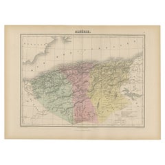
Antique map titled 'Province de Constantine'. Old map of the province of Constantine, Algeria. The Department of Constantine existed from 1848 to 1962 and was one of the three administrative districts of French Algeria. The lower left quadrant contains a legend while the top and bottom of the map includes decorative engravings illustrating the Algerian landscape, the town of Oran, and the activities of the locals. This map originates from 'Géographie Universelle Atlas-Migeon' by J. Migeon.
Artists and Engravers: Published by J. Migeon. Reviewed by A. Vuillemin. Alexandre Vuillemin (1812-1880) was a cartographer and an book editor based in Paris, France.
Condition: Good, age-related toning. Please study image carefully.
Date: 1880
Overall size: 34.5 x 47.5 cm.
Image size: 29 x 43 cm.
We sell original antique maps to collectors, historians, educators and interior decorators all over the world. Our collection includes a wide range of authentic antique maps from the 16th to the 20th centuries. Buying and collecting antique maps is a tradition that goes back hundreds of years. Antique maps have proved a richly rewarding investment over the past decade, thanks to a growing appreciation of their unique historical appeal. Today the decorative qualities of antique maps are widely recognized by interior designers who appreciate their beauty and design flexibility. Depending on the individual map, presentation, and context, a rare or antique map can be modern, traditional, abstract, figurative, serious or whimsical. We offer a wide range of authentic antique maps for any budget.
- Dimensions:Height: 18.71 in (47.5 cm)Width: 13.59 in (34.5 cm)Depth: 0 in (0.01 mm)
- Materials and Techniques:
- Period:
- Date of Manufacture:1880
- Condition:
- Seller Location:Langweer, NL
- Reference Number:Seller: BG-11793-361stDibs: LU3054327872682
About the Seller
5.0
Recognized Seller
These prestigious sellers are industry leaders and represent the highest echelon for item quality and design.
Platinum Seller
Premium sellers with a 4.7+ rating and 24-hour response times
Established in 2009
1stDibs seller since 2017
2,533 sales on 1stDibs
Typical response time: <1 hour
- ShippingRetrieving quote...Shipping from: Langweer, Netherlands
- Return Policy
Authenticity Guarantee
In the unlikely event there’s an issue with an item’s authenticity, contact us within 1 year for a full refund. DetailsMoney-Back Guarantee
If your item is not as described, is damaged in transit, or does not arrive, contact us within 7 days for a full refund. Details24-Hour Cancellation
You have a 24-hour grace period in which to reconsider your purchase, with no questions asked.Vetted Professional Sellers
Our world-class sellers must adhere to strict standards for service and quality, maintaining the integrity of our listings.Price-Match Guarantee
If you find that a seller listed the same item for a lower price elsewhere, we’ll match it.Trusted Global Delivery
Our best-in-class carrier network provides specialized shipping options worldwide, including custom delivery.More From This Seller
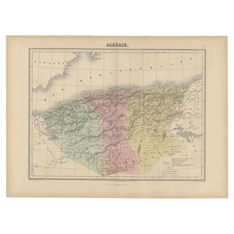
View AllAntique Map of Algeria, 1880
Located in Langweer, NL
Antique map titled 'Algérie. Old map of Algeria. This map originates from 'Géographie Universelle Atlas-Migeon' by J. Migeon.
Artists and Engravers: Published by J. Migeon. Review...
Category
Antique 19th Century Maps
Materials
Paper
$207 Sale Price
20% Off
Antique Map of Algeria and the French Colonies, 1875
Located in Langweer, NL
Antique map titled 'Algérie et Colonies Francaises'. Large map of Algeria and the French Colonies. This map originates from 'Atlas de Géographie Moderne Physique et Politique' by A. ...
Category
Antique Late 19th Century French Maps
Materials
Paper

$307 Sale Price
35% Off
Antique Map of the French Colony of Algeria by V. Levasseur, 1854
By Victor Levasseur
Located in Langweer, NL
Antique map titled 'Algérie, Colonie Francaise'. Shows the region divided into the administrative provinces of Oban, Alger, and Constantine. The map proper is surrounded by elaborate...
Category
Antique Mid-19th Century Maps
Materials
Paper

$188 Sale Price
20% Off
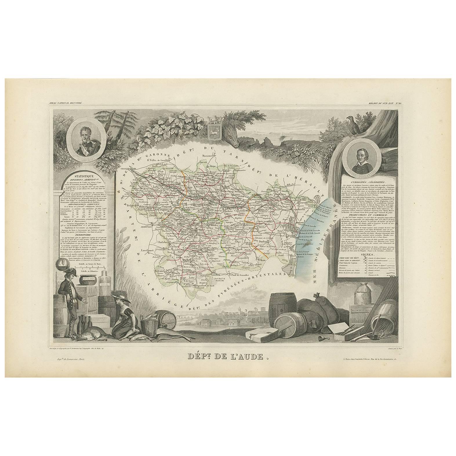
Antique Map of Aude ‘France’ by V. Levasseur, 1854
By Victor Levasseur
Located in Langweer, NL
Antique map titled 'Dépt. de 'l'Aude'. Map of the French department of Aude, France. This area of France is famous for its wide variety of vineyards and wine production. In the east ...
Category
Antique Mid-19th Century Maps
Materials
Paper
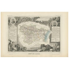
$170 Sale Price
20% Off
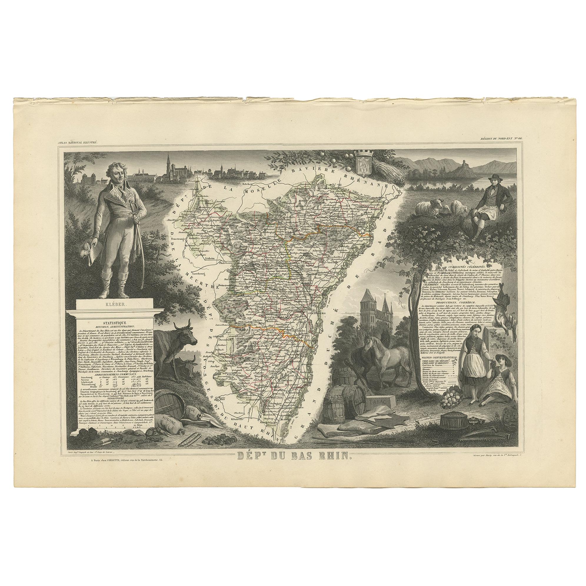
Antique Map of Bas-Rhin ‘France’ by V. Levasseur, 1854
By Victor Levasseur
Located in Langweer, NL
Antique map titled 'Dépt. du Bas Rhin'. Map of the French department of Bas-Rhin, France. Part of the Alsace wine region surrounding Strasbourg. This mountainous area on the west ban...
Category
Antique Mid-19th Century Maps
Materials
Paper
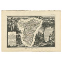
$165 Sale Price
20% Off
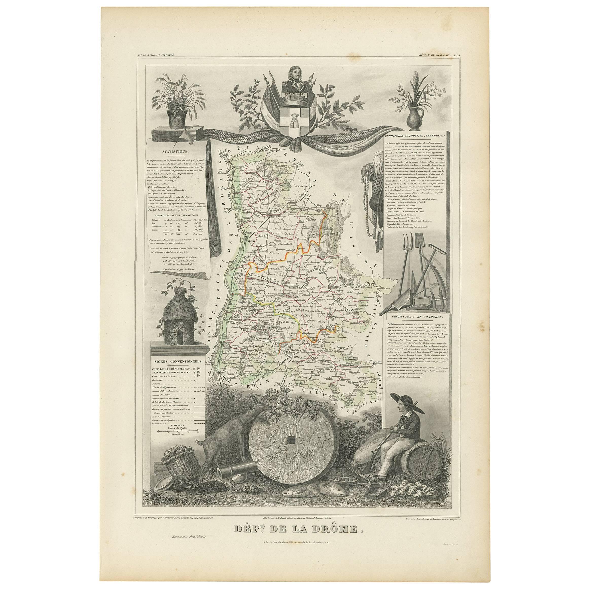
Antique Map of Drôme ‘France’ by V. Levasseur, 1854
Located in Langweer, NL
Antique map titled 'Dépt. de la Drôme'. Map of the French department of Drome, France. This area is known for its production of Picodon, a spicy goats-milk ch...
Category
Antique Mid-19th Century Maps
Materials
Paper
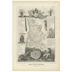
$170 Sale Price
20% Off
You May Also Like
Pyrenees Orientales, France. Antique map of a French department, 1856
By Victor Levasseur
Located in Melbourne, Victoria
'Dept. des Pyrenees Orientales', steel engraving with original outline hand-colouring., 1856, from Levasseur's 'Atlas National Illustre'.
This area is well-known wine producing reg...
Category
19th Century Naturalistic Landscape Prints
Materials
Engraving

Ancient National Atlas of France with Marengo
Located in Alessandria, Piemonte
Ancient National Atlas of France with the department of Marengo: a rare French etching dated 1806.
ST/178.
Category
Antique Early 19th Century French Other Prints
Materials
Paper

Beautiful Colour French Antique 1856 Hand Watercolour Map of Dept Des La Corse
Located in West Sussex, Pulborough
We are delighted to offer for sale this stunning 1856 hand watercolour map of the Austrian Alps titled Dept Des La Course taken from the Atlas National ...
Category
Antique 1850s French Early Victorian Maps
Materials
Paper

Large Original Antique Map of Morocco. Edward Weller, 1861
Located in St Annes, Lancashire
Great map of Morocco
Lithograph engraving by Edward Weller
Original colour
Published, 1861
Unframed
Good condition.
Category
Antique 1860s English Victorian Maps
Materials
Paper

Large Original Antique Map of Cyprus. 1894
Located in St Annes, Lancashire
Superb Antique map of Cyprus
Published Edward Stanford, Charing Cross, London 1894
Original colour
Good condition
Unframed.
Free shipping
Category
Antique 1890s English Maps
Materials
Paper

Map of Eastern Roman Empire -Vintage Offset Print - Early 20th Century
Located in Roma, IT
This map of Eastern Roman Empire is a vintage offset print realized in the early 20th Century.
The state of preservation of the artwork is aged with dif...
Category
Early 20th Century Figurative Prints
Materials
Offset

More Ways To Browse
Map Of Jamaica
Raleigh Antique Furniture
Antique Map Of Colombia
Antique Map Palestine
Vintage Wooden Roller
Antique Constellation Map
Antique Maps Of Cape Of Good Hope
Caucasus Map
Map Of Puerto Rico
Nevada Antique Map
Shetland Map
Antique Chicago Maps
Kolkata Antique Furniture
Antique Bermuda Furniture
Antique Dairy Collectibles
Antique Map Of Cuba
Antique Map Of Yorkshire
Antique Map Vietnam