Items Similar to Antique Map of the Region of Mühlberg by Schreiber, 1749

Want more images or videos?
Request additional images or videos from the seller
1 of 5
Antique Map of the Region of Mühlberg by Schreiber, 1749
$89.14
$111.4320% Off
£66.36
£82.9520% Off
€74.40
€9320% Off
CA$122.10
CA$152.6320% Off
A$135.80
A$169.7620% Off
CHF 70.91
CHF 88.6420% Off
MX$1,652.59
MX$2,065.7420% Off
NOK 905.66
NOK 1,132.0820% Off
SEK 849.35
SEK 1,061.6920% Off
DKK 566.38
DKK 707.9820% Off
Shipping
Retrieving quote...The 1stDibs Promise:
Authenticity Guarantee,
Money-Back Guarantee,
24-Hour Cancellation
About the Item
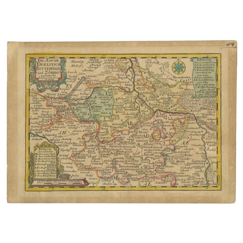
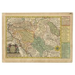
Antique map titled 'Das Amt Muhlberg'. Map of the region of Mühlberg, Germany. This map originates from 'Atlas Selectus von allen Konigreichen und Landern der Welt' by Johann Georg Schreiber.
Artists and Engravers: Johann Georg Schreiber, a German cartographer and geographer, was born 1676 and lived in Leipzig. His only work was the Atlas Selectus published first 1740 and reissued 1749. He died in 1745.
Condition: Fair, original/contemporary hand coloring. Strong toning, minor wear. Blank verso, please study image carefully.
Date: 1749
Overall size: 27 x 19 cm.
Image size: 22 x 16 cm.
We sell original antique maps to collectors, historians, educators and interior decorators all over the world. Our collection includes a wide range of authentic antique maps from the 16th to the 20th centuries. Buying and collecting antique maps is a tradition that goes back hundreds of years. Antique maps have proved a richly rewarding investment over the past decade, thanks to a growing appreciation of their unique historical appeal. Today the decorative qualities of antique maps are widely recognized by interior designers who appreciate their beauty and design flexibility. Depending on the individual map, presentation, and context, a rare or antique map can be modern, traditional, abstract, figurative, serious or whimsical. We offer a wide range of authentic antique maps for any budget.
- Dimensions:Height: 7.49 in (19 cm)Width: 10.63 in (27 cm)Depth: 0 in (0.01 mm)
- Materials and Techniques:
- Period:
- Date of Manufacture:1749
- Condition:
- Seller Location:Langweer, NL
- Reference Number:Seller: JAK-12271stDibs: LU3054327833082
About the Seller
5.0
Recognized Seller
These prestigious sellers are industry leaders and represent the highest echelon for item quality and design.
Platinum Seller
Premium sellers with a 4.7+ rating and 24-hour response times
Established in 2009
1stDibs seller since 2017
2,510 sales on 1stDibs
Typical response time: <1 hour
- ShippingRetrieving quote...Shipping from: Langweer, Netherlands
- Return Policy
Authenticity Guarantee
In the unlikely event there’s an issue with an item’s authenticity, contact us within 1 year for a full refund. DetailsMoney-Back Guarantee
If your item is not as described, is damaged in transit, or does not arrive, contact us within 7 days for a full refund. Details24-Hour Cancellation
You have a 24-hour grace period in which to reconsider your purchase, with no questions asked.Vetted Professional Sellers
Our world-class sellers must adhere to strict standards for service and quality, maintaining the integrity of our listings.Price-Match Guarantee
If you find that a seller listed the same item for a lower price elsewhere, we’ll match it.Trusted Global Delivery
Our best-in-class carrier network provides specialized shipping options worldwide, including custom delivery.More From This Seller
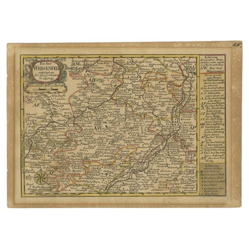
View AllAntique Map of the Region of Weißenfels by Schreiber, 1749
By Schreiber
Located in Langweer, NL
Antique map titled 'Das Amt Weissenfels (..)'. Map of the region of Weißenfels, Germany. This map originates from 'Atlas Selectus von allen Konigreichen und Landern der Welt' by Joha...
Category
Antique 18th Century Maps
Materials
Paper
$89 Sale Price
20% Off
Antique Map of the Region of Zeitz in Germany, 1749
By Schreiber
Located in Langweer, NL
Antique map titled 'Das Stifft Zeitz (..)'. Map of the region of Zeitz, Germany. Zeitz is a town in the Burgenlandkreis district, in Saxony-Anhalt, Germany. It is situated on the riv...
Category
Antique 18th Century Maps
Materials
Paper

$316 Sale Price
20% Off
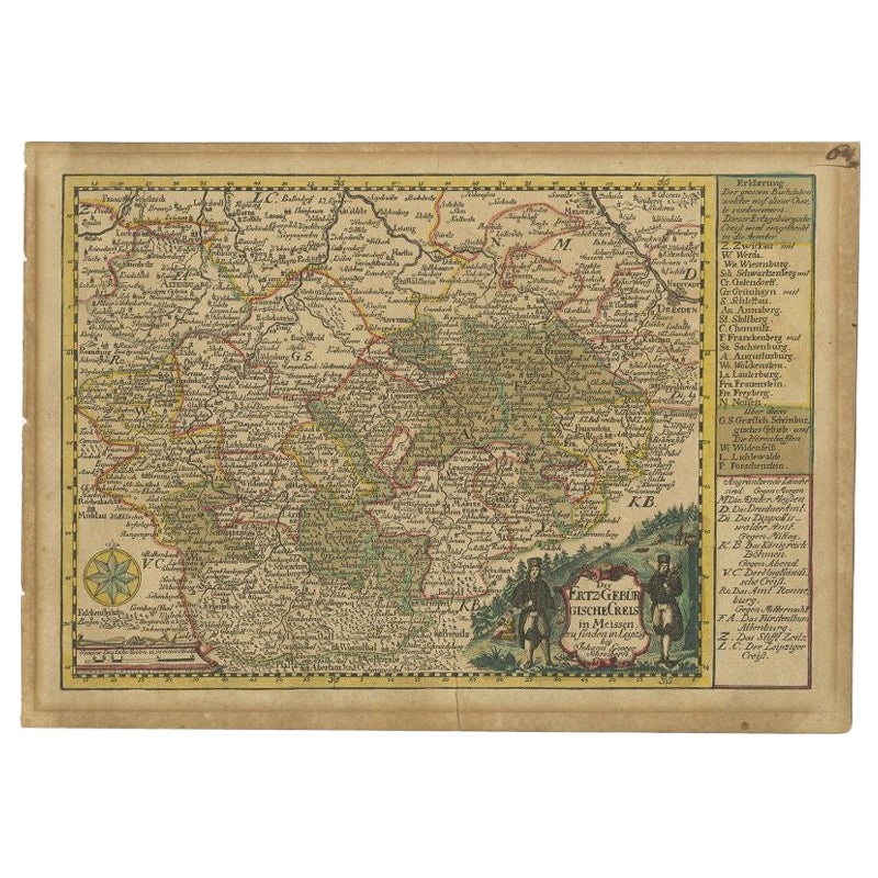
Antique Map of the Region of Meissen by Schreiber, 1749
Located in Langweer, NL
Antique map titled 'Der Ertz-Gebürgische Creis in Meissen (..)'. Map of the region of Meissen, Germany. This map originates from 'Atlas Selectus von allen Ko...
Category
Antique 18th Century Maps
Materials
Paper
$89 Sale Price
20% Off
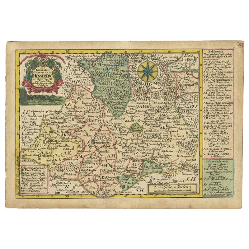
Antique Map of the Region of Henneberg by Schreiber, 1749
Located in Langweer, NL
Antique map titled 'Die Gefürstete Henneberg'. Map of the region of Henneberg, Germany. This map originates from 'Atlas Selectus von allen Konigreichen und L...
Category
Antique 18th Century Maps
Materials
Paper
$89 Sale Price
20% Off
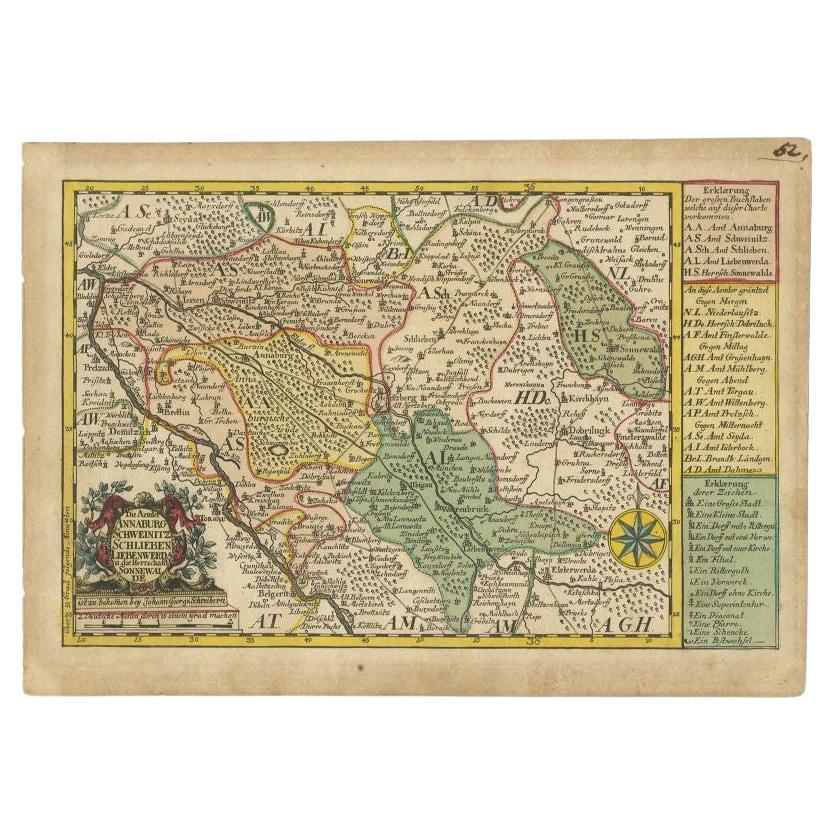
Antique Map of the Region of Annaburg by Schreiber, 1749
By Schreiber
Located in Langweer, NL
Antique map titled 'Die Aemter Annaburg, Schweinitz (..)'. Map of the region of Annaburg, Germany. This map originates from 'Atlas Selectus von allen Konigreichen und Landern der Wel...
Category
Antique 18th Century Maps
Materials
Paper
$89 Sale Price
20% Off
Antique Map of the Region of Dölitzsch by Schreiber, 1749
By Schreiber
Located in Langweer, NL
Antique map titled 'Die Aemter Doelitsch, Bitterfeld und Zörbig'. Map of the region of Dölitzsch, Germany. This map originates from 'Atlas Selectus von allen Konigreichen und Landern...
Category
Antique 18th Century Maps
Materials
Paper
$89 Sale Price
20% Off
You May Also Like
17th Century Hand Colored Map of the Liege Region in Belgium by Visscher
By Nicolaes Visscher II
Located in Alamo, CA
An original 17th century map entitled "Leodiensis Episcopatus in omnes Subjacentes Provincias distincté divisusVisscher, Leodiensis Episcopatus" by Nicolaes Visscher II, published in Amsterdam in 1688. The map is centered on Liege, Belgium, includes the area between Antwerp, Turnhout, Roermond, Cologne, Trier and Dinant.
This attractive map is presented in a cream-colored mat measuring 30" wide x 27.5" high. There is a central fold, as issued. There is minimal spotting in the upper margin and a tiny spot in the right lower margin, which are under the mat. The map is otherwise in excellent condition.
The Visscher family were one of the great cartographic families of the 17th century. Begun by Claes Jansz Visscher...
Category
Antique Late 17th Century Dutch Maps
Materials
Paper

17th Century Hand-Colored Map of a Region in West Germany by Janssonius
By Johannes Janssonius
Located in Alamo, CA
This attractive highly detailed 17th century original hand-colored map is entitled "Archiepiscopatus Maghdeburgensis et Anhaltinus Ducatus cum terris adjacentibus". It was published ...
Category
Antique Mid-17th Century Dutch Maps
Materials
Paper

18th Century Hand-Colored Homann Map of Germany, Including Frankfurt and Berlin
By Johann Baptist Homann
Located in Alamo, CA
An 18th century hand-colored map entitled "Tabula Marchionatus Brandenburgici et Ducatus Pomeraniae quae sunt Pars Septentrionalis Circuli Saxoniae Superioris" by Johann Baptist Homa...
Category
Antique Early 18th Century German Maps
Materials
Paper

Antique Map Of Brabantia Ducantus By Bleau Circa 1640
Located in Brussels, Brussels
map of theBrabantia Ducantus (Belgium) circa 1640 by Bléau. Bléau was well known for antique atlas that he draw during the 17 century
beautiful map, double page folded in the middle,...
Category
Antique 17th Century French Renaissance Maps
Materials
Paper

1640 Joan Bleau Map Entitled"Diocecese de rheims et le pais de rethel, " Eic.a011
Located in Norton, MA
1640 Joan Bleau map entitled
"Diocecese de rheims et le pais de rethel,"
Ric.a011
OAN BLAEU
Diocecese de Rheims, et le pais de Rethel.
Handcolored engraving, c.1640.
...
Category
Antique 17th Century Dutch Maps
Materials
Paper

1640 Willem Blaeu Map Entitled "Contado di molise et principato vltra, " Ric.a003
By Willem Blaeu
Located in Norton, MA
1640 Willem Blaeu map entitled
"Contado di molise et principato vltra,"
Colored
Ric. a003
Measures: 38 x 49.6 cm and wide margins
DBLAEU.
Cou...
Category
Antique 17th Century Dutch Maps
Materials
Paper

More Ways To Browse
Antique Furniture Dundee
Antique Saudi Arabia
Otto Petri
Serbia Antique Map
Taiwan Map
Antique Maps Colorado
Antique Wooden Roller
Hemisphere Antiques
Map Of Jamaica
Raleigh Antique Furniture
Antique Map Of Colombia
Antique Map Palestine
Vintage Wooden Roller
Antique Constellation Map
Antique Maps Of Cape Of Good Hope
Caucasus Map
Map Of Puerto Rico
Nevada Antique Map