Items Similar to Antique Map of the Region of Weißenfels by Schreiber, 1749

Want more images or videos?
Request additional images or videos from the seller
1 of 5
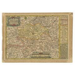
Antique Map of the Region of Weißenfels by Schreiber, 1749
$87.69
$109.6120% Off
£66.05
£82.5620% Off
€74.40
€9320% Off
CA$120.93
CA$151.1620% Off
A$135.86
A$169.8220% Off
CHF 70.99
CHF 88.7320% Off
MX$1,658.20
MX$2,072.7420% Off
NOK 901.31
NOK 1,126.6320% Off
SEK 848.39
SEK 1,060.4920% Off
DKK 566.30
DKK 707.8820% Off
About the Item
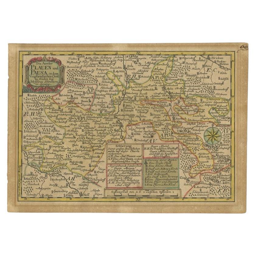
Antique map titled 'Das Amt Weissenfels (..)'. Map of the region of Weißenfels, Germany. This map originates from 'Atlas Selectus von allen Konigreichen und Landern der Welt' by Johann Georg Schreiber.
Artists and Engravers: Johann Georg Schreiber, a German cartographer and geographer, was born 1676 and lived in Leipzig. His only work was the Atlas Selectus published first 1740 and reissued 1749. He died in 1745.
Condition: Fair, original/contemporary hand coloring. Strong toning, minor wear. Blank verso, please study image carefully.
Date: 1749
Overall size: 27 x 19 cm.
Image size: 23.5 x 16 cm.
We sell original antique maps to collectors, historians, educators and interior decorators all over the world. Our collection includes a wide range of authentic antique maps from the 16th to the 20th centuries. Buying and collecting antique maps is a tradition that goes back hundreds of years. Antique maps have proved a richly rewarding investment over the past decade, thanks to a growing appreciation of their unique historical appeal. Today the decorative qualities of antique maps are widely recognized by interior designers who appreciate their beauty and design flexibility. Depending on the individual map, presentation, and context, a rare or antique map can be modern, traditional, abstract, figurative, serious or whimsical. We offer a wide range of authentic antique maps for any budget.
- Creator:Schreiber (Artist)
- Dimensions:Height: 7.49 in (19 cm)Width: 10.63 in (27 cm)Depth: 0 in (0.01 mm)
- Materials and Techniques:
- Period:
- Date of Manufacture:1749
- Condition:
- Seller Location:Langweer, NL
- Reference Number:Seller: JAK-12361stDibs: LU3054327927472
About the Seller
5.0
Recognized Seller
These prestigious sellers are industry leaders and represent the highest echelon for item quality and design.
Platinum Seller
Premium sellers with a 4.7+ rating and 24-hour response times
Established in 2009
1stDibs seller since 2017
2,534 sales on 1stDibs
Typical response time: <1 hour
- ShippingRetrieving quote...Shipping from: Langweer, Netherlands
- Return Policy
Authenticity Guarantee
In the unlikely event there’s an issue with an item’s authenticity, contact us within 1 year for a full refund. DetailsMoney-Back Guarantee
If your item is not as described, is damaged in transit, or does not arrive, contact us within 7 days for a full refund. Details24-Hour Cancellation
You have a 24-hour grace period in which to reconsider your purchase, with no questions asked.Vetted Professional Sellers
Our world-class sellers must adhere to strict standards for service and quality, maintaining the integrity of our listings.Price-Match Guarantee
If you find that a seller listed the same item for a lower price elsewhere, we’ll match it.Trusted Global Delivery
Our best-in-class carrier network provides specialized shipping options worldwide, including custom delivery.More From This Seller
View AllAntique Map of the Region of Weißensee by Schreiber, 1749
By Schreiber
Located in Langweer, NL
Antique map titled 'Die Chursaechsischen Aemter in Thüringen gelegen Sachsenburg, Weissensee (..)'. Map of the region of Weißensee, Germany. This map originates from 'Atlas Selectus von allen...
Category
Antique 18th Century Maps
Materials
Paper
$367 Sale Price
20% Off
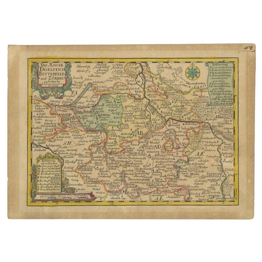
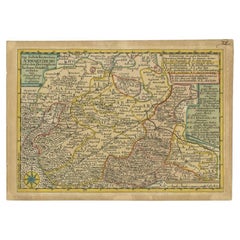
Antique Map of the Region of Dölitzsch by Schreiber, 1749
By Schreiber
Located in Langweer, NL
Antique map titled 'Die Aemter Doelitsch, Bitterfeld und Zörbig'. Map of the region of Dölitzsch, Germany. This map originates from 'Atlas Selectus von allen Konigreichen und Landern...
Category
Antique 18th Century Maps
Materials
Paper
$87 Sale Price
20% Off
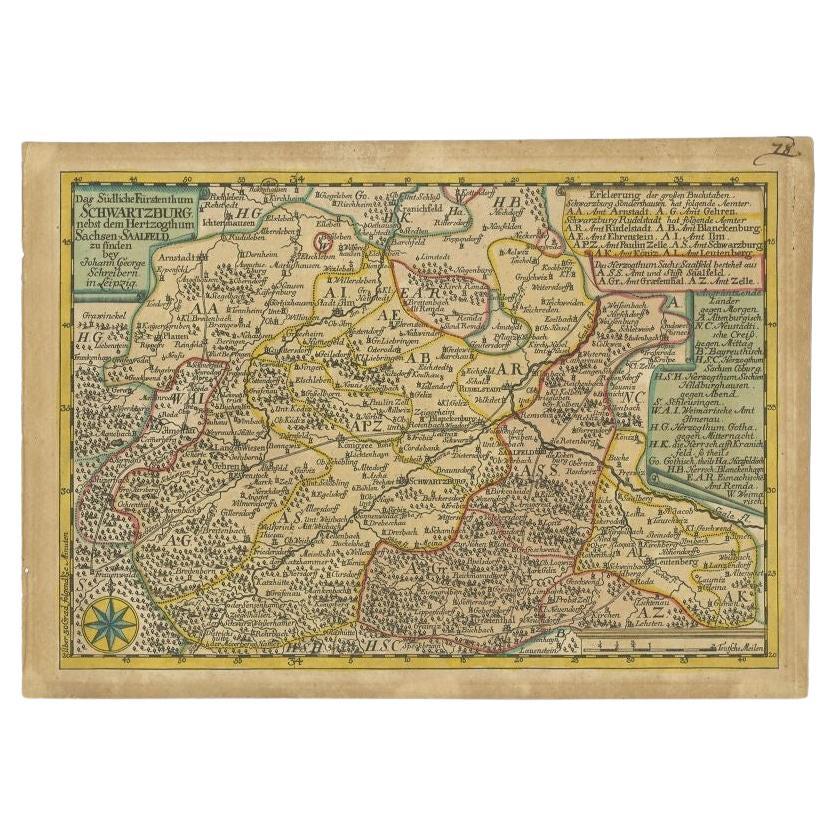
Antique Map of the Region of Schwarzburg by Schreiber, 1749
By Schreiber
Located in Langweer, NL
Antique map titled 'Die Südliche Fürstenthum Schwartzburg (..)'. Map of the region of Schwarzburg, Germany. This map originates from 'Atlas Selectus von allen Konigreichen und Lander...
Category
Antique 18th Century Maps
Materials
Paper
$87 Sale Price
20% Off
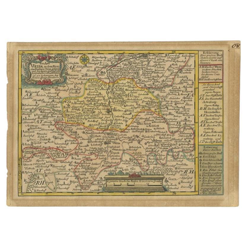
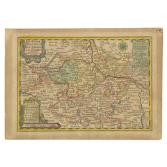
Antique Map of the Region of Weida by Schreiber, 1749
By Schreiber
Located in Langweer, NL
Antique map titled 'Das Amt Weida (..)'. Map of the region of Weida, Germany. This map originates from 'Atlas Selectus von allen Konigreichen und Landern der Welt' by Johann Georg Sc...
Category
Antique 18th Century Maps
Materials
Paper
$132 Sale Price
20% Off
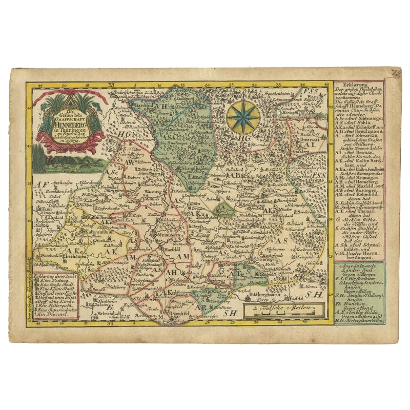
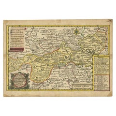
Antique Map of the Region of Henneberg by Schreiber, 1749
Located in Langweer, NL
Antique map titled 'Die Gefürstete Henneberg'. Map of the region of Henneberg, Germany. This map originates from 'Atlas Selectus von allen Konigreichen und L...
Category
Antique 18th Century Maps
Materials
Paper
$87 Sale Price
20% Off
Antique Map of the Region of Plauen by Schreiber '1749'
By Schreiber
Located in Langweer, NL
Antique map titled 'Die Aemter Plauen und Pausa (..)'. Map of the region of Plauen, Germany. This map originates from 'Atlas Selectus von allen Konigreichen und Landern der Welt' by ...
Category
Antique 18th Century Maps
Materials
Paper
$87 Sale Price
20% Off
You May Also Like
Antique Map Of Brabantia Ducantus By Bleau Circa 1640
Located in Brussels, Brussels
map of theBrabantia Ducantus (Belgium) circa 1640 by Bléau. Bléau was well known for antique atlas that he draw during the 17 century
beautiful map, double page folded in the middle,...
Category
Antique 17th Century French Renaissance Maps
Materials
Paper

Original Antique Map of Switzerland, Engraved By Barlow, Dated 1807
Located in St Annes, Lancashire
Great map of Switzerland
Copper-plate engraving by Barlow
Published by Brightly & Kinnersly, Bungay, Suffolk.
Dated 1807
Unframed.
Category
Antique Early 1800s English Maps
Materials
Paper

Antique County Map, Shropshire, English, Atlas Engraving, Richard Blome, C.1673
Located in Hele, Devon, GB
This is an antique county map of Shropshire. An English, framed atlas engraving by Richard Blome, dating to the 17th century and later.
A treat for the collector or county native, ...
Category
Antique 17th Century British Restauration Maps
Materials
Glass, Wood, Paper

1640 Joan Bleau Map Entitled"Diocecese de rheims et le pais de rethel, " Eic.a011
Located in Norton, MA
1640 Joan Bleau map entitled
"Diocecese de rheims et le pais de rethel,"
Ric.a011
OAN BLAEU
Diocecese de Rheims, et le pais de Rethel.
Handcolored engraving, c.1640.
...
Category
Antique 17th Century Dutch Maps
Materials
Paper

1657 Janssonius Map of Vermandois and Cappelle, Ric. A-004
Located in Norton, MA
1657 Janssonius map of
Vermandois and Cappelle
Ric.a004
Description: Antique map of France titled 'Descriptio Veromanduorum - Gouvernement de la Cappelle'. Two detailed maps o...
Category
Antique 17th Century Unknown Maps
Materials
Paper

West Germany: Original Hand Colored 17th Century Map by Johannes Janssonius
By Johannes Janssonius
Located in Alamo, CA
An original hand colored copperplate engraved map entitled in Latin "Archiepiscopatus Maghdeburgensis et Anhaltinus Ducatus cum terris adjacentibus", published in Amsterdam in 1640 i...
Category
Mid-17th Century Old Masters More Prints
Materials
Engraving

More Ways To Browse
Caucasus Map
Map Of Puerto Rico
Nevada Antique Map
Shetland Map
Antique Chicago Maps
Kolkata Antique Furniture
Antique Bermuda Furniture
Antique Dairy Collectibles
Antique Map Of Cuba
Antique Map Of Yorkshire
Antique Map Vietnam
Antique Maps Massachusetts
Guyana Antique Map
Peninsular War
Santa Cruz Island
Ukraine Antique Map
Antique Life Buoy
Antique Map Nova Scotia