Items Similar to Antique Map of South America by Petri, c.1873


Want more images or videos?
Request additional images or videos from the seller
1 of 5
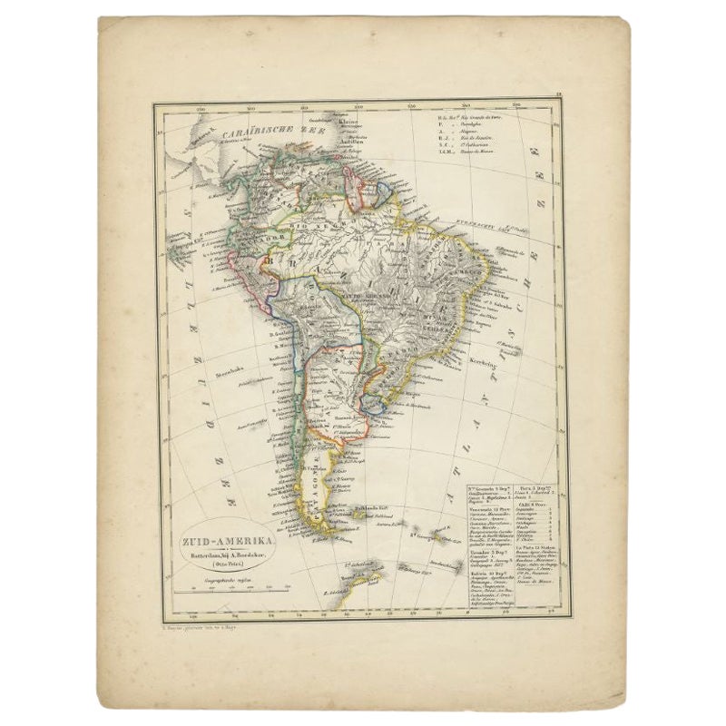
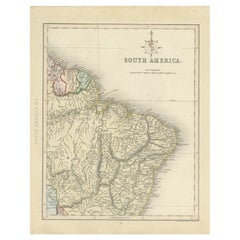
Antique Map of South America by Petri, c.1873
$118.15
$147.6820% Off
£88.56
£110.7020% Off
€100
€12520% Off
CA$162.31
CA$202.8920% Off
A$181.21
A$226.5120% Off
CHF 94.95
CHF 118.6920% Off
MX$2,218.13
MX$2,772.6720% Off
NOK 1,205.85
NOK 1,507.3220% Off
SEK 1,136.97
SEK 1,421.2120% Off
DKK 761.24
DKK 951.5520% Off
Shipping
Retrieving quote...The 1stDibs Promise:
Authenticity Guarantee,
Money-Back Guarantee,
24-Hour Cancellation
About the Item
Antique map titled 'Zuid-Amerika'. Old map depicting South America, with an inset map of the highland of Quito. This map originates from 'School-Atlas van alle Deelen der Aarde'. Artists and Engravers: Published by O. Petri, Rotterdam.
Artist: Published by O. Petri, Rotterdam.
Condition: Good, general age-related toning. Split on folding line, please study image carefully.
Date: c.1873
Overall size: 26.2 x 33.1 cm.
Image size: 0.001 x 20.4 x 27.4 cm.
Antique prints have long been appreciated for both their aesthetic and investment value. They were the product of engraved, etched or lithographed plates. These plates were handmade out of wood or metal, which required an incredible level of skill, patience and craftsmanship. Whether you have a house with Victorian furniture or more contemporary decor an old engraving can enhance your living space. We offer a wide range of authentic antique prints for any budget.
- Creator:Thomas Kitchin (Author)
- Dimensions:Height: 13.04 in (33.1 cm)Width: 10.32 in (26.2 cm)Depth: 0 in (0.01 mm)
- Materials and Techniques:
- Period:
- Date of Manufacture:circa 1873
- Condition:
- Seller Location:Langweer, NL
- Reference Number:Seller: BG-06667-11stDibs: LU3054327622122
About the Seller
5.0
Recognized Seller
These prestigious sellers are industry leaders and represent the highest echelon for item quality and design.
Platinum Seller
Premium sellers with a 4.7+ rating and 24-hour response times
Established in 2009
1stDibs seller since 2017
2,511 sales on 1stDibs
Typical response time: <1 hour
- ShippingRetrieving quote...Shipping from: Langweer, Netherlands
- Return Policy
Authenticity Guarantee
In the unlikely event there’s an issue with an item’s authenticity, contact us within 1 year for a full refund. DetailsMoney-Back Guarantee
If your item is not as described, is damaged in transit, or does not arrive, contact us within 7 days for a full refund. Details24-Hour Cancellation
You have a 24-hour grace period in which to reconsider your purchase, with no questions asked.Vetted Professional Sellers
Our world-class sellers must adhere to strict standards for service and quality, maintaining the integrity of our listings.Price-Match Guarantee
If you find that a seller listed the same item for a lower price elsewhere, we’ll match it.Trusted Global Delivery
Our best-in-class carrier network provides specialized shipping options worldwide, including custom delivery.More From This Seller
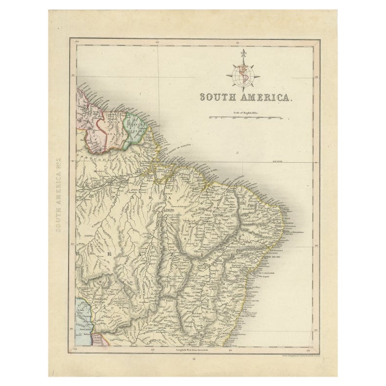
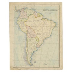
View AllAntique Map of South America by Petri, 1852
By Thomas Kitchin
Located in Langweer, NL
Antique map titled 'Zuid-Amerika'. Map of South America. This map originates from 'School-Atlas van alle deelen der Aarde' by Otto Petri. Artists and Engrav...
Category
Antique 19th Century Maps
Materials
Paper
$125 Sale Price
20% Off
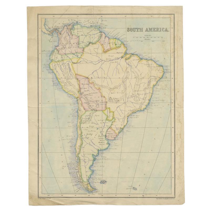
Antique Map of South America by W. G. Blackie, 1859
Located in Langweer, NL
Antique map titled 'South America'. Original antique map of South America. This map originates from ‘The Imperial Atlas of Modern Geography’. Published by W. G. Blackie, 1859.
Category
Antique Mid-19th Century Maps
Materials
Paper

$236 Sale Price
20% Off
Antique Map of South America by A & C. Black, 1870
Located in Langweer, NL
Antique map titled 'South America'. Original antique map of Map of South America. This map originates from ‘Black's General Atlas of The World’. Published by A & C. Black, 1870.
Category
Antique Late 19th Century Maps
Materials
Paper

$259 Sale Price
20% Off
Antique Map of Part of South America by Archer, C.1860
Located in Langweer, NL
Antique map titled 'South America'. This antique map depicts the north-east of South America, including a large part of Brazil. Artists and Engravers: Drawn and engraved by J. Archer...
Category
Antique 19th Century Maps
Materials
Paper
$89 Sale Price
20% Off
Antique Map of South America by Philip & Son, 1875
Located in Langweer, NL
Antique map titled 'South America'. Old map of South America. Source unknown, to be determined.
Artists and Engravers: George Philip (1800–1882) was a cartographer, map publisher...
Category
Antique 19th Century Maps
Materials
Paper
$56 Sale Price
20% Off
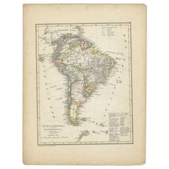
Antique Map of South America by Lapie '1842'
Located in Langweer, NL
Antique map titled 'Carte Générale de l'Amérique Meridionale'. Map of South America. This map originates from 'Atlas universel de géographie ancienne et moderne (..)' by Pierre M. La...
Category
Antique Mid-19th Century Maps
Materials
Paper

$567 Sale Price
20% Off
You May Also Like
South America, Eastern Part. Century Atlas antique vintage map
Located in Melbourne, Victoria
'The Century Atlas. South America. Eastern Part'
Original antique map, 1903.
Inset map 'Rio de Janeiro and Vicinity'.
Central fold as issued. Map name and number printed on the rev...
Category
Early 20th Century Victorian More Prints
Materials
Lithograph

Original Antique Decorative Map of South America-West Coast, Fullarton, C.1870
Located in St Annes, Lancashire
Great map of Chili, Peru and part of Bolivia
Wonderful figural border
From the celebrated Royal Illustrated Atlas
Lithograph. Original color.
Published by Fullarton, Edi...
Category
Antique 1870s Scottish Maps
Materials
Paper

South America, North-West Part. Century Atlas antique vintage map
Located in Melbourne, Victoria
'The Century Atlas. South America, North-West Part'
Original antique map, 1903.
Central fold as issued. Map name and number printed on the reverse corners.
Sheet 40cm by 29.5cm.
Category
Early 20th Century Victorian More Prints
Materials
Lithograph

Charte von Sud-America (Map of South America) - Etching with Hand-Drawn Outlines
Located in Soquel, CA
Map of south America, engraved by Franz Pluth (Czech, 1800-1871), from the book "Neueste Länder - und Völkerkunde, ein geographisches Lesebuch für alle Stände" by Linder, F. L. (Prag...
Category
1820s Other Art Style More Prints
Materials
Paper, Printer's Ink, Etching

Carte du Bresil, antique 1860s engraved map of Brazil
Located in Melbourne, Victoria
'Carte du Bresil'
Engraving with original outline colouring, circa 1860, by Alexandre Vuillemin, published in Paris.
31cm by 41cm (sheet)
21.5cm by 31.5cm (image)
Category
Late 19th Century Victorian More Prints
Materials
Lithograph

Antique Map of South America in Roma Frame
Located in Malibu, CA
Antique map of South America. Displayed in a new Roma frame with museum quality matting. Custom frame in platinum. No print date, but cert...
Category
Antique Late 19th Century Victorian Prints
Materials
Hardwood, Paper

$262 Sale Price
30% Off
More Ways To Browse
Thomas Toner
Highland House Furniture
John Speed Antique Maps
Malaysia Map
Sebastian Munster
Antique Map Chile
Antique Map Of Boston
Ipswich Antique Furniture
Maps Balkans
Missouri Map
Antique Maps Of Texas
Antique Maps Virginia
Antique Railroad Scale
Jamaican Antique
Hindeloopen Furniture
Romania Map
Stanford Antique Furniture
Sardinia Map