Items Similar to Antique Map of South Carolina, North Carolina, and Virginia by Tardieu, 1802


Want more images or videos?
Request additional images or videos from the seller
1 of 8
Antique Map of South Carolina, North Carolina, and Virginia by Tardieu, 1802
$536.77
$670.9620% Off
£399.52
£499.3920% Off
€448
€56020% Off
CA$735.24
CA$919.0520% Off
A$817.75
A$1,022.1820% Off
CHF 427
CHF 533.7520% Off
MX$9,951.09
MX$12,438.8720% Off
NOK 5,453.46
NOK 6,816.8220% Off
SEK 5,114.38
SEK 6,392.9820% Off
DKK 3,410.47
DKK 4,263.0820% Off
Shipping
Retrieving quote...The 1stDibs Promise:
Authenticity Guarantee,
Money-Back Guarantee,
24-Hour Cancellation
About the Item
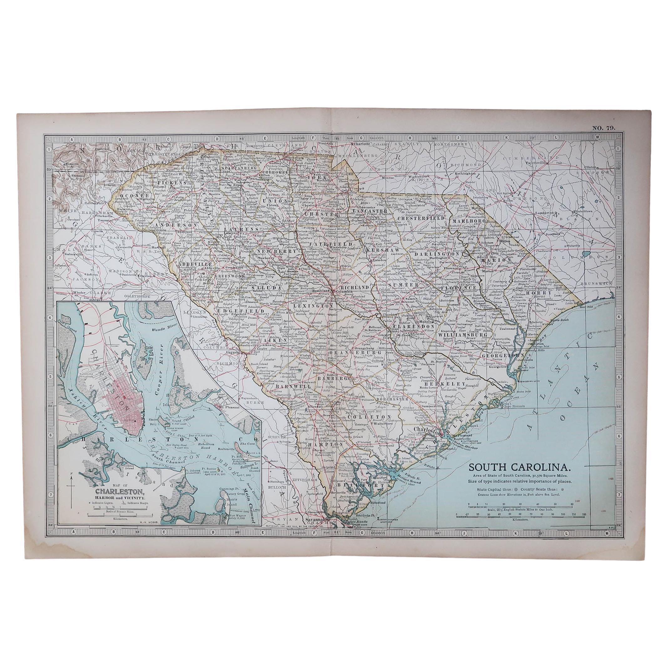
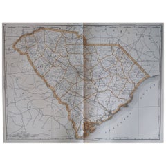
This is an original antique map titled "Carte de la Caroline Méridionale et Septentrionale et de la Virginie," depicting the regions of South Carolina, North Carolina, and Virginia in the early 19th century. Created by Pierre Antoine Tardieu, this map provides a detailed view of the geographical and political landscape of these southeastern United States areas.
Map Details:
- **Title**: Carte de la Caroline Méridionale et Septentrionale et de la Virginie
- **Creator**: Pierre Antoine Tardieu (1784-1869)
- **Publication Date**: Early 19th century
- **Dimensions**: Approximately 34.5 x 43.5 cm (13.5 x 17.25 inches)
- **Features**: The map includes detailed representations of South Carolina, North Carolina, and Virginia, highlighting political boundaries, major cities, rivers, and other geographical features. The title cartouche is located in the lower right corner, and the outlines are hand-colored to distinguish different regions.
Key Geographic Features and Areas:
1. **South Carolina**:
- Major cities such as Charleston and Columbia are marked.
- The map details the rivers and topography, including the Savannah River and various inland features.
2. **North Carolina**:
- Key locations such as Raleigh and New Bern are shown.
- The map highlights rivers such as the Roanoke and Cape Fear rivers and the extensive coastline along the Atlantic Ocean.
3. **Virginia**:
- Important cities like Richmond, Norfolk, and Williamsburg are depicted.
- The map details the state's rivers, such as the James River and the Potomac River, and the Chesapeake Bay area.
Condition Overview:
1. **Paper Quality**: The paper shows typical signs of aging, such as slight yellowing, but remains in good condition without major tears or damage.
2. **Edges and Corners**: The edges are slightly worn, with minor fraying and small tears, particularly near the center fold. These imperfections do not significantly impact the overall readability or aesthetic value.
3. **Center Fold**: A center fold is present, which is common for maps of this period that were often folded for storage or publication. The fold appears intact without significant separation or damage.
4. **Color and Print Quality**: The hand-colored outlines remain vibrant and clear, highlighting the borders of different regions. The print quality is excellent, with sharp, legible text and detailed illustrations.
5. **Staining and Spots**: There are a few spots and stains, particularly near the edges and along the fold. These do not obscure any critical details of the map.
Historical Context
Political Landscape
1. **South Carolina and North Carolina**:
- South Carolina and North Carolina were significant states in the early United States, with economies based on agriculture, particularly the cultivation of cotton, tobacco, and rice.
- Both states were undergoing expansion and development, with increasing settlement in the western regions.
2. **Virginia**:
- Virginia, one of the original thirteen colonies, played a central role in the early history of the United States. It was an economic and political hub, with a strong plantation economy.
- The state's capital, Richmond, and other cities like Williamsburg were important centers of governance and trade.
Socio-Economic Conditions
1. **Agriculture**:
- The economy in these states was heavily based on agriculture, with large plantations relying on enslaved labor for the production of cash crops such as tobacco, cotton, and rice.
- The fertile lands and favorable climate supported extensive agricultural activities.
2. **Trade and Commerce**:
- Major port cities such as Charleston and Norfolk were crucial hubs for trade, facilitating the export of agricultural products and the import of goods.
- Rivers and the coastline played significant roles in transportation and trade.
Cultural and Social Aspects
1. **Diverse Populations**:
- The population included European settlers, enslaved Africans, and Native American tribes.
- The cultural landscape was influenced by the interactions between these diverse groups, leading to a rich blend of traditions and customs.
2. **Urban and Rural Life**:
- Urban centers like Charleston and Richmond were bustling with economic and social activities, while rural areas were dominated by plantation life.
Conflicts and Changes
1. **Native American Relations**:
- The westward expansion often led to conflicts with Native American tribes, resulting in displacement and treaties that were frequently broken by settlers.
- The map may depict some of these territories and regions under Native American control or influence.
2. **Political Developments**:
- The early 19th century was marked by the United States' expansionist policies, including the admission of new states and the development of infrastructure.
- Political changes and developments, including debates over states' rights and the economy, were significant during this period.
Summary
South Carolina, North Carolina, and Virginia around 1800 were regions of significant political, economic, and cultural importance. The map by Pierre Antoine Tardieu provides a detailed and historically valuable representation of these southeastern United States areas, reflecting the geographical and political complexities of the time.
- Dimensions:Height: 16.34 in (41.5 cm)Width: 22.25 in (56.5 cm)Depth: 0.01 in (0.2 mm)
- Materials and Techniques:Paper,Engraved
- Period:
- Date of Manufacture:1802
- Condition:Good condition with minor age-related wear. Hand-colored boundaries are well-preserved, enhancing the clarity of regions and features. Fold lines as issued. Damp spot at bottom edge. Some wear due to handling and age. Study the images carefully.
- Seller Location:Langweer, NL
- Reference Number:Seller: BG-13769-371stDibs: LU3054340578832
About the Seller
5.0
Recognized Seller
These prestigious sellers are industry leaders and represent the highest echelon for item quality and design.
Platinum Seller
Premium sellers with a 4.7+ rating and 24-hour response times
Established in 2009
1stDibs seller since 2017
2,508 sales on 1stDibs
Typical response time: <1 hour
- ShippingRetrieving quote...Shipping from: Langweer, Netherlands
- Return Policy
Authenticity Guarantee
In the unlikely event there’s an issue with an item’s authenticity, contact us within 1 year for a full refund. DetailsMoney-Back Guarantee
If your item is not as described, is damaged in transit, or does not arrive, contact us within 7 days for a full refund. Details24-Hour Cancellation
You have a 24-hour grace period in which to reconsider your purchase, with no questions asked.Vetted Professional Sellers
Our world-class sellers must adhere to strict standards for service and quality, maintaining the integrity of our listings.Price-Match Guarantee
If you find that a seller listed the same item for a lower price elsewhere, we’ll match it.Trusted Global Delivery
Our best-in-class carrier network provides specialized shipping options worldwide, including custom delivery.More From This Seller
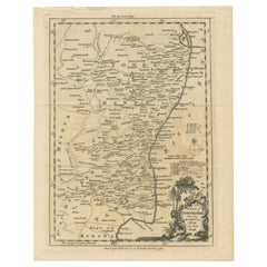
View AllAntique Map of North Carolina, with inset map of the western part
Located in Langweer, NL
Antique map titled 'North Carolina'. Original antique map of North Carolina, United States. With inset map of the western part of North Carolina....
Category
Antique Late 19th Century Maps
Materials
Paper

$277 Sale Price
20% Off
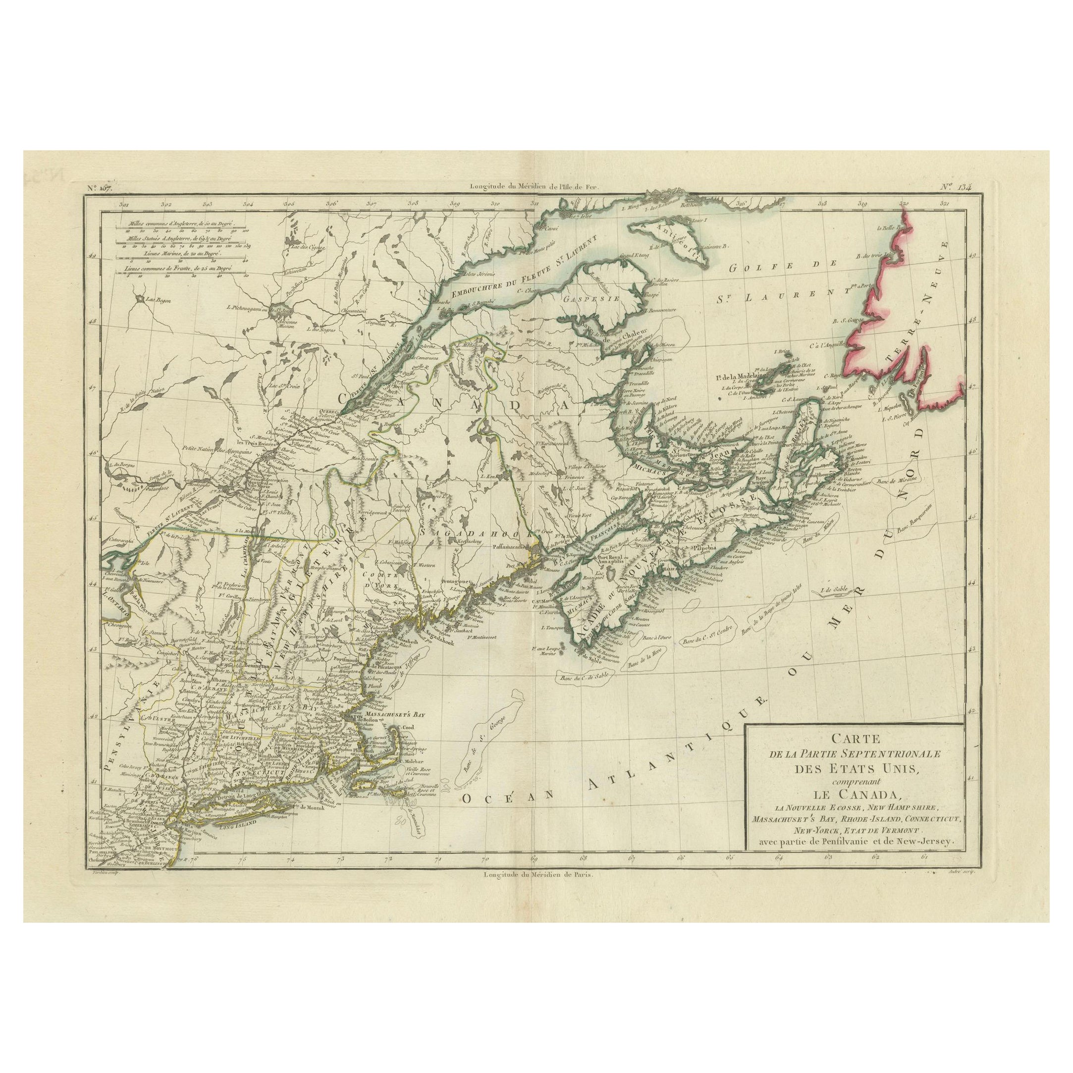
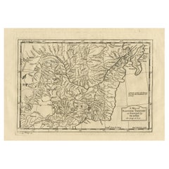
Antique Map of the Northeastern United States and Canada by Tardieu, 1802
Located in Langweer, NL
This antique map titled "Carte de la Partie Septentrionale des Etats Unis," created by Pierre Antoine Tardieu, depicts the northeastern part of the United States and parts of Canada....
Category
Antique Early 1800s Maps
Materials
Paper

$536 Sale Price
20% Off
Antique Map of the United States of North America by Wyld '1845'
Located in Langweer, NL
Antique map titled 'Map of The United States of North America'. Original antique map of the United States of North America. This map originates from 'An Atlas of the World, Comprehen...
Category
Antique Mid-19th Century Maps
Materials
Paper

$239 Sale Price
20% Off
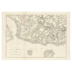
Circa 1802 Map of the Troad Region by Tardieu – From the Voyage de la Troade
Located in Langweer, NL
This is a large fold-out map titled *Carte de la Troade*, measuring approximately 53.5 x 68 cm, engraved by Tardieu, and extracted from the atlas of *Voyage de la Troade, fait dans l...
Category
Antique Early 1800s Maps
Materials
Paper
$239 Sale Price
20% Off
Antique Map of Eastern Tartary as Surveyed by the Jesuits, 1746
By Thomas Kitchin
Located in Langweer, NL
Antique map titled 'A Map of Eastern Tartary as Surveyed by the Jesuits in 1709, 10 & 11'. The map covers much of the course of the Amur River or Heilong Jiang, the world's tenth lon...
Category
Antique 18th Century Maps
Materials
Paper
$277 Sale Price
20% Off
Antique Map of the Coromandel Peninsula, 1754
Located in Langweer, NL
Antique map titled 'A map of Coromandel shewing the Seat of War on that coast'. Rare map of Coromandel printed for the London Magazine.
Artists and Engr...
Category
Antique 18th Century Maps
Materials
Paper
$114 Sale Price
20% Off
You May Also Like
1796 Map of North Carolina by John Reid
Located in Chapel Hill, NC
1796 Map of North Carolina by John Reid. A rare & important early map of the state based on the 1795 Lewis/Carey map for his "An American Atlas". Engraved by Benjamin Tanner. Old pur...
Category
Antique Late 18th Century American Prints
Materials
Paper

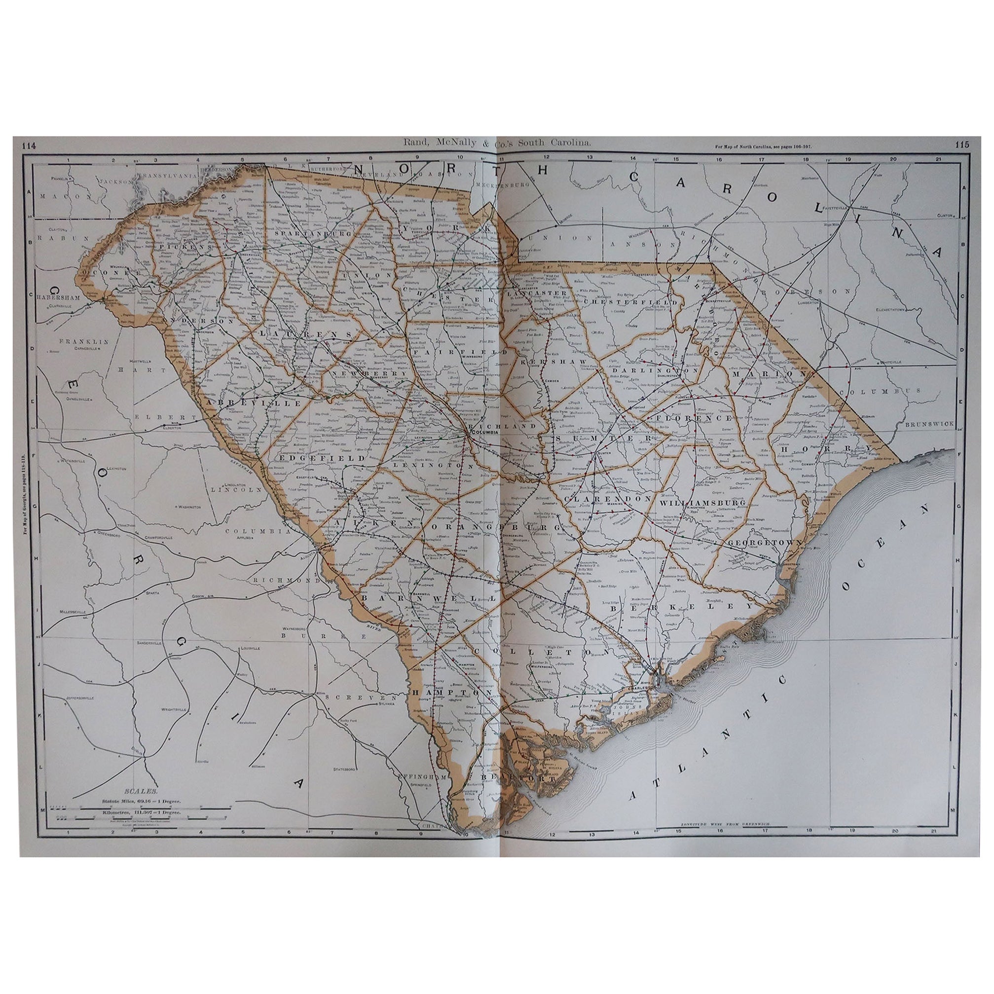
Large Original Antique Map of South Carolina, USA, 1894
By Rand McNally & Co.
Located in St Annes, Lancashire
Fabulous map of South Carolina
Original color
By Rand, McNally & Co.
Published, 1894
Unframed
Free shipping.
Category
Antique 1890s American Maps
Materials
Paper
Large Original Antique Map of North Carolina, USA, 1894
By Rand McNally & Co.
Located in St Annes, Lancashire
Fabulous map of North Carolina
Original color
By Rand, McNally & Co.
Published, 1894
Unframed
Free shipping.
Category
Antique 1890s American Maps
Materials
Paper

Original Antique Map of the American State of South Carolina, 1903
Located in St Annes, Lancashire
Antique map of South Carolina
Published By A & C Black. 1903
Original colour
Good condition
Unframed.
Free shipping
Category
Antique Early 1900s English Maps
Materials
Paper

Original Antique Map of the American State of North Carolina, 1903
Located in St Annes, Lancashire
Antique map of North Carolina
Published By A & C Black. 1903
Original colour
Good condition
Unframed.
Free shipping
Category
Antique Early 1900s English Maps
Materials
Paper

English Engraved Hand Colored Map of the North Eastern United States, circa 1817
Located in Charleston, SC
English copper engraved hand colored map of the North Eastern United States matted under glass in a gilt frame, Early 19th Century. Drawn and Engraved for Thomson's New General Atlas...
Category
Antique 1810s English George III Maps
Materials
Glass, Giltwood, Paint, Paper

More Ways To Browse
South African Antique
Antique Furniture South Africa
Antique Furniture South Carolina
Antique North Carolina Furniture
Map Storage
Charleston Used Furniture
Used Furniture North Bay
Charleston Antique
Antique Plantation Furniture
Richmond Virginia
Rice Storage
Charleston Used Office Furniture
Antique Map Storage
James River Plantation
Historical James River Plantation
Silver Over Copper
Vintage Barware Glasses
Coffee Table Black Italian Modern