Items Similar to Antique Map of St. Jago, St Mayo and Praya Harbour, Mauritania, Africa, c.1750


Want more images or videos?
Request additional images or videos from the seller
1 of 5
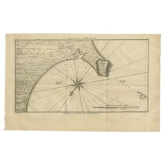
Antique Map of St. Jago, St Mayo and Praya Harbour, Mauritania, Africa, c.1750
$263.43
£194.73
€220
CA$358.28
A$401.45
CHF 208.97
MX$4,911.12
NOK 2,652.49
SEK 2,505.24
DKK 1,675.19
Shipping
Retrieving quote...The 1stDibs Promise:
Authenticity Guarantee,
Money-Back Guarantee,
24-Hour Cancellation
About the Item
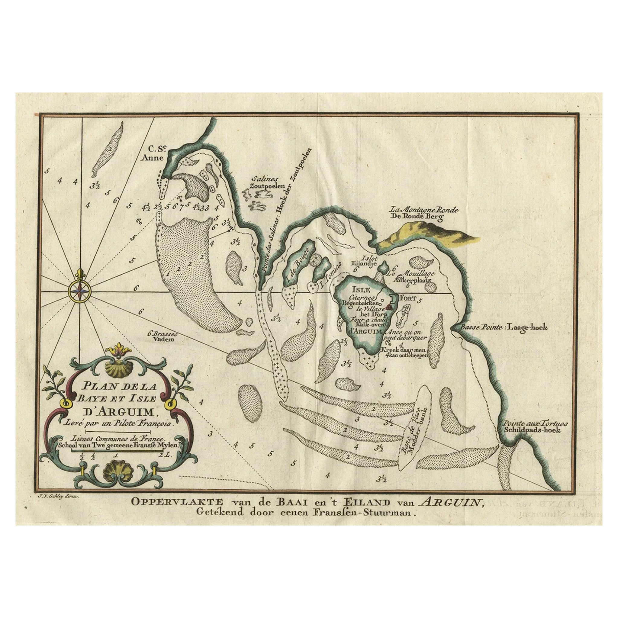
Antique map Africa titled 'Gezigt van 't Eiland St. Jago en de Stad St. Jago of Ribeyro Grande, Haven van Praya in 't Eiland St. Jago'. To the left, two views of the island and city of St. Jago. To the right, the harbour of Praya, St. Jago, Mauritania. Artists and Engravers: Jakob van der Schley (1715-1779) was a Dutch draughtsman and engraver, who studied under Bernard Picart.
Artist: Jakob van der Schley (1715-1779) was a Dutch draughtsman and engraver, who studied under Bernard Picart.
Condition: Very good, general age-related toning. Please study image carefully.
Date: c.1750
Overall size: 25 x 20 cm.
Image size: 20.5 x 14.5 cm.
Antique prints have long been appreciated for both their aesthetic and investment value. They were the product of engraved, etched or lithographed plates. These plates were handmade out of wood or metal, which required an incredible level of skill, patience and craftsmanship. Whether you have a house with Victorian furniture or more contemporary decor an old engraving can enhance your living space.
- Dimensions:Height: 7.88 in (20 cm)Width: 9.85 in (25 cm)Depth: 0 in (0.01 mm)
- Materials and Techniques:
- Period:
- Date of Manufacture:circa 1750
- Condition:Condition: Very good, general age-related toning. Please study image carefully.
- Seller Location:Langweer, NL
- Reference Number:Seller: BG-094941stDibs: LU3054327771182
About the Seller
5.0
Recognized Seller
These prestigious sellers are industry leaders and represent the highest echelon for item quality and design.
Platinum Seller
Premium sellers with a 4.7+ rating and 24-hour response times
Established in 2009
1stDibs seller since 2017
2,494 sales on 1stDibs
Typical response time: <1 hour
- ShippingRetrieving quote...Shipping from: Langweer, Netherlands
- Return Policy
Authenticity Guarantee
In the unlikely event there’s an issue with an item’s authenticity, contact us within 1 year for a full refund. DetailsMoney-Back Guarantee
If your item is not as described, is damaged in transit, or does not arrive, contact us within 7 days for a full refund. Details24-Hour Cancellation
You have a 24-hour grace period in which to reconsider your purchase, with no questions asked.Vetted Professional Sellers
Our world-class sellers must adhere to strict standards for service and quality, maintaining the integrity of our listings.Price-Match Guarantee
If you find that a seller listed the same item for a lower price elsewhere, we’ll match it.Trusted Global Delivery
Our best-in-class carrier network provides specialized shipping options worldwide, including custom delivery.More From This Seller
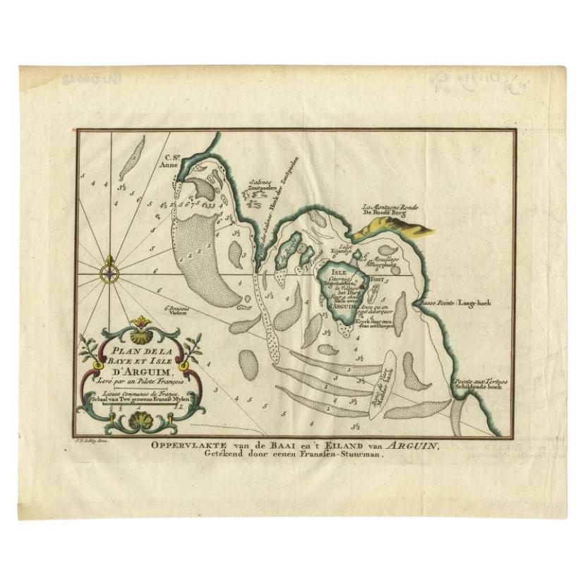
View AllOriginal Antique Map of the Bay and the Island of Arguin, Mauritania, 1747
Located in Langweer, NL
Antique map titled ’Plan de la Baye et Isle d'Arguim (..) - Oppervlakte van de Baai en 't Eiland van Arguin (..)'.
Original antique map of the bay and the island of Arguin. This ...
Category
Antique 1740s Maps
Materials
Paper
$249 Sale Price
20% Off
Antique Map of the Bay and Rocks of Petatlan by Anson, 1749
Located in Langweer, NL
Antique map titled 'Baye et Rochers de Petaplan (..) - De Baay en de Rotsen van Petaplan (..)'. Original antique map of the bay and rocks of Petatlan, Mexico. This map originates fro...
Category
Antique 18th Century Maps
Materials
Paper
$153 Sale Price
20% Off
Antique Map of a Bay on the Coast of Chile, South America, c.1749
Located in Langweer, NL
Antique map titled 'Plan van een Baai en Haven aan de Kust van Chili (..) - Plan d'une Baye de la Côte du Chili (..)'. Original antique map of a bay on the coast of Chile discovered ...
Category
Antique 18th Century Maps
Materials
Paper

$306 Sale Price
20% Off
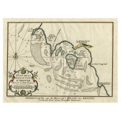
Antique Map of the Bay and Island of Arguin by Van Schley, 1747
Located in Langweer, NL
Antique map titled ?Plan de la Baye et Isle d'Arguim (..) - Oppervlakte van de Baai en 't Eiland van Arguin (..)'. Original antique map of the bay and the island of Arguin. This map ...
Category
Antique 18th Century Maps
Materials
Paper

$93 Sale Price
20% Off
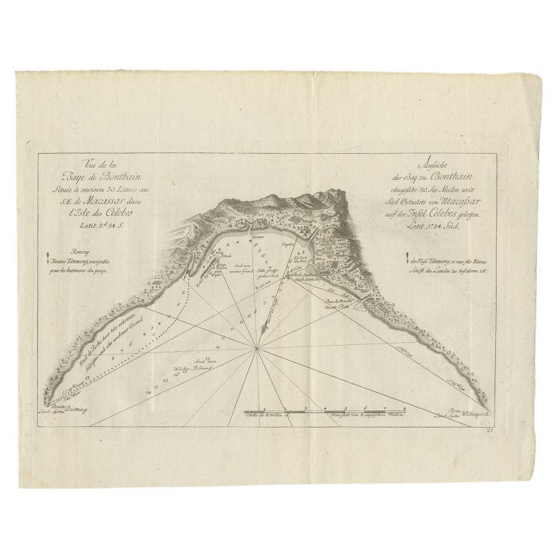
Antique Map of a Bay Nearby Makassar, Celebes 'Sulawesi)' by Hawkesworth, 1774
Located in Langweer, NL
Antique map titled 'Vue de la Baye de Bonthain (..)'. Map of the island Sulawesi (Celebes), Indonesia that Philip Carteret rested his crew and made repairs to his ship the Swallow fo...
Category
Antique 18th Century Maps
Materials
Paper
$110 Sale Price
20% Off
Antique Map of the Bay of Batavia by Van der Aa, c.1720
Located in Langweer, NL
Antique map titled 'La Rade de Batavia'. A small early 18th century black and white map of the Bay of Batavia (Jakarta), Indonesia. Published by P....
Category
Antique 18th Century Maps
Materials
Paper

$258 Sale Price
20% Off
You May Also Like
West Coast of Africa, Guinea & Sierra Leone: An 18th Century Map by Bellin
By Jacques-Nicolas Bellin
Located in Alamo, CA
Jacques Bellin's copper-plate map entitled "Partie de la Coste de Guinee Dupuis la Riviere de Sierra Leona Jusquau Cap das Palmas", depicting the coast of Guinea and Sierra Leone in ...
Category
Antique Mid-18th Century French Maps
Materials
Paper

Dartmouth, England: A Hand-Colored 17th Century Sea Chart by Captain Collins
By Captain Greenvile Collins
Located in Alamo, CA
This hand-colored sea chart of the area around Dartmouth, England is from "Great Britain's Coasting Pilot. Being a New and Exact Survey of the Sea-Coast of England", first published ...
Category
Antique Late 17th Century English Maps
Materials
Paper

California, Alaska and Mexico: 18th Century Hand-Colored Map by de Vaugondy
By Didier Robert de Vaugondy
Located in Alamo, CA
This is an 18th century hand-colored map of the western portions of North America entitled "Carte de la Californie et des Pays Nord-Ouest separés de l'Asie par le détroit d'Anian, ex...
Category
Antique 1770s French Maps
Materials
Paper

1646 Jansson Map Entitled "Procinvia Connactiae, " Ric.a006
Located in Norton, MA
1646 Jansson map entitled
"Procinvia connactiae,"
Ric.a006
Description: The PROVINCE of CONNAVGT 490 x 380From vol 4 of Jansson's Atlas Novus 1646, published in Amsterdam with...
Category
Antique 17th Century Unknown Maps
Materials
Paper

Rare 18th C. Newport Map
Located in Sandwich, MA
Rare 18th C, Map titled "A plan of the town of Newport in the province of Rhode Island". Earliest printed plan of Newport, published for the use of the British just prior to their o...
Category
Antique 1770s American Maps
Materials
Paper

$19,500 / item
Plan of Port Siagi - Etching by Joseph Roux - 1795
Located in Roma, IT
Plan of Port Siagi is al colored etching realized by Joseph Roux in 1795.
The title at the top " Plan du Port Siagi"
Passepartout included: 34 x 49
The artwork is hand water-color...
Category
1790s Modern Figurative Prints
Materials
Etching

More Ways To Browse
African Plate
Jamaican Antique
Hindeloopen Furniture
Romania Map
Stanford Antique Furniture
Sardinia Map
Victorian Staircase
Nantucket Map
Afghanistan Antique Map
Antique Map Of Hawaii
Antique Florida Map
Map Of Syria
Napoleon Map
South Arabian
Antique Geological Maps
French School Map
Nova Scotia Antique Furniture
Richard Wentworth