Items Similar to Antique Map of Turkestan – Vandermaelen Lithograph of Central Asia, 1827
Want more images or videos?
Request additional images or videos from the seller
1 of 10
Antique Map of Turkestan – Vandermaelen Lithograph of Central Asia, 1827
$428.32
£320.60
€360
CA$588.31
A$657.80
CHF 345.05
MX$7,967.59
NOK 4,355.53
SEK 4,114.92
DKK 2,740.78
About the Item
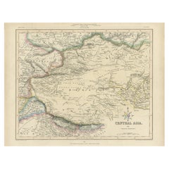
Antique Map of Turkestan – Vandermaelen Lithograph of Central Asia, 1827
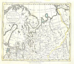
This finely detailed antique map titled “Turkestan” (No. 34) is an original lithograph from the groundbreaking Atlas Universel by Philippe Marie Vandermaelen, published in Brussels in 1827. This map offers a meticulous rendering of Central Asia during the early 19th century, a region that was then only partially explored by European geographers and cartographers.
Centered on the heartland of Turkestan, this map covers key areas of present-day Uzbekistan, Turkmenistan, Tajikistan, and parts of northern Afghanistan. It features important cities of the time, including Samarkand, Tashkent, Bukhara (Boukhara), Khiva, and Balkh. Geographic features such as mountain ranges, rivers, roads, and political borders are carefully traced, and the map is hand-colored in outline to differentiate regional boundaries. The names “Roukharie,” “Turkestan,” “Khanat de Boukhara,” and “Mawer” appear prominently, capturing the political and tribal landscape as understood in Europe at the time.
Of particular note is the depiction of ancient trade routes and strategic cities along the Silk Road. This map reflects European interest in the Khanates of Central Asia, which were then independent powers at the fringes of Russian and British imperial interests. Vandermaelen's use of a uniform scale of 1:1,641,836 across all sheets in the atlas was revolutionary, allowing for a consistent global cartographic vision. Each sheet was designed to align with others to form a giant globe when assembled—an extraordinary concept for its time.
The map was produced at Vandermaelen’s pioneering Établissement Géographique in Brussels, one of the first institutions to use lithography for mass map production, and an important center for geographical and educational innovation in 19th-century Europe.
Condition: Good condition. Original hand-coloring in outline. Light age-related toning and minor handling marks, with no tears or repairs. A clean impression on strong paper, lightly creased along the original centerfold.
Framing tips: Ideal for display in a dark wood or ebonized frame with a pale ivory or warm gray mat to accentuate the fine linework and subtle hand-coloring. Works well as a standalone piece or in a group with other maps from the same atlas.
Technique: Lithograph with original hand color
Maker: Philippe Marie Vandermaelen, Brussels, 1827
- Dimensions:Height: 18.51 in (47 cm)Width: 20.28 in (51.5 cm)Depth: 0.01 in (0.2 mm)
- Materials and Techniques:Paper,Engraved
- Place of Origin:
- Period:
- Date of Manufacture:1827
- Condition:Condition: Good condition. Original hand-coloring in outline. Light age-related toning and minor handling marks, with no tears or repairs. A clean impression on strong paper, lightly creased along the original centerfold. Folding line as issued.
- Seller Location:Langweer, NL
- Reference Number:Seller: BG-13457-51stDibs: LU3054346159092
About the Seller
5.0
Recognized Seller
These prestigious sellers are industry leaders and represent the highest echelon for item quality and design.
Platinum Seller
Premium sellers with a 4.7+ rating and 24-hour response times
Established in 2009
1stDibs seller since 2017
2,565 sales on 1stDibs
Typical response time: <1 hour
- ShippingRetrieving quote...Shipping from: Langweer, Netherlands
- Return Policy
Authenticity Guarantee
In the unlikely event there’s an issue with an item’s authenticity, contact us within 1 year for a full refund. DetailsMoney-Back Guarantee
If your item is not as described, is damaged in transit, or does not arrive, contact us within 7 days for a full refund. Details24-Hour Cancellation
You have a 24-hour grace period in which to reconsider your purchase, with no questions asked.Vetted Professional Sellers
Our world-class sellers must adhere to strict standards for service and quality, maintaining the integrity of our listings.Price-Match Guarantee
If you find that a seller listed the same item for a lower price elsewhere, we’ll match it.Trusted Global Delivery
Our best-in-class carrier network provides specialized shipping options worldwide, including custom delivery.More From This Seller
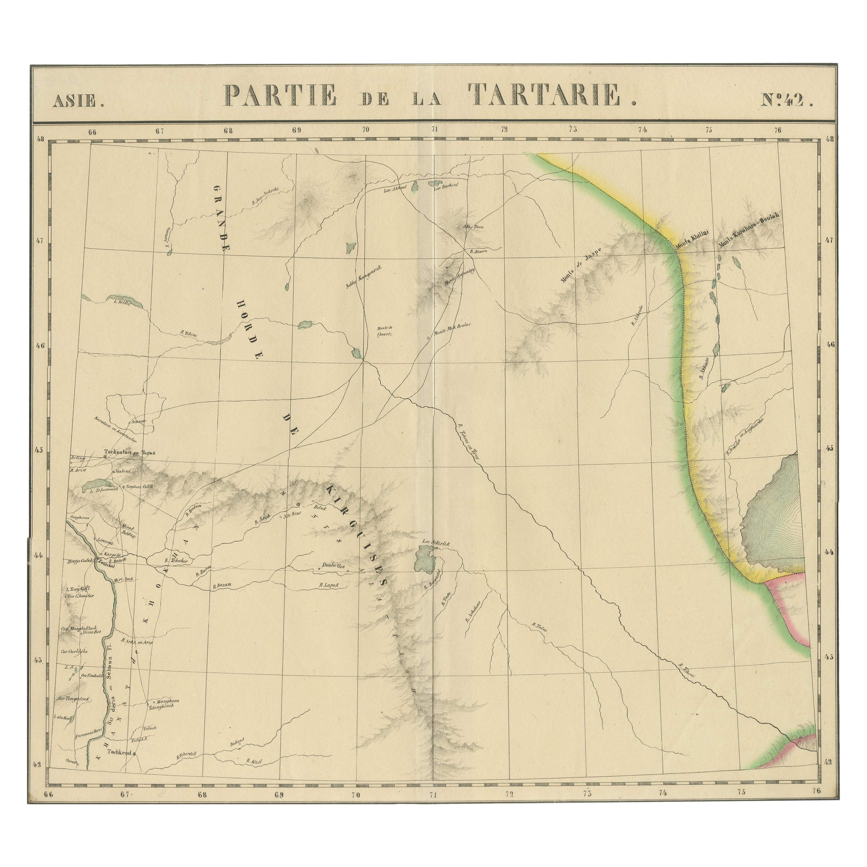
View AllAntique Map of Tartary – Hand-Colored Lithograph of Central Asia, 1827
Located in Langweer, NL
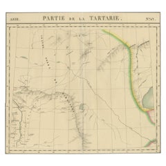
Antique Map of Tartary – Hand-Colored Lithograph of Central Asia, 1827
This original antique map, titled "Partie de la Tartarie" (No. 42), is an exceptional example of early 19th-ce...
Category
Antique Early 19th Century Belgian Maps
Materials
Paper
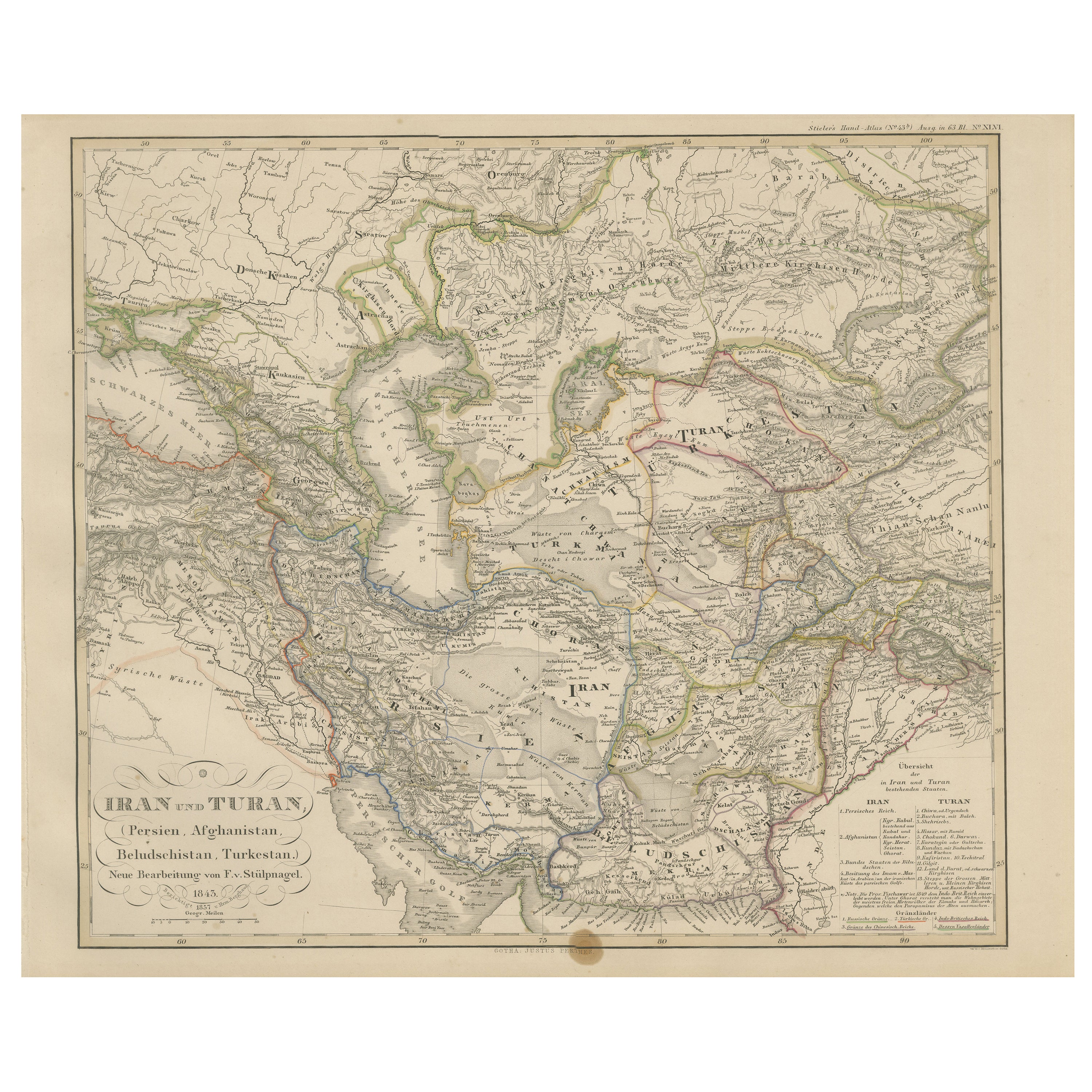
Iran and Turan Map – Persia, Afghanistan, Baluchistan, Turkestan 1858
Located in Langweer, NL
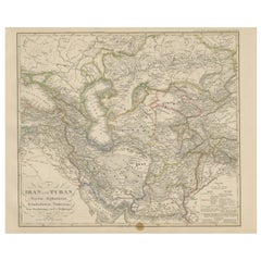
Iran and Turan Map – Persia, Afghanistan, Baluchistan, Turkestan 1858
This impressive antique print shows “Iran und Turan (Persien, Afghanistan, Beludschistan, Turkestan),” meaning ...
Category
Antique Mid-19th Century German Maps
Materials
Paper
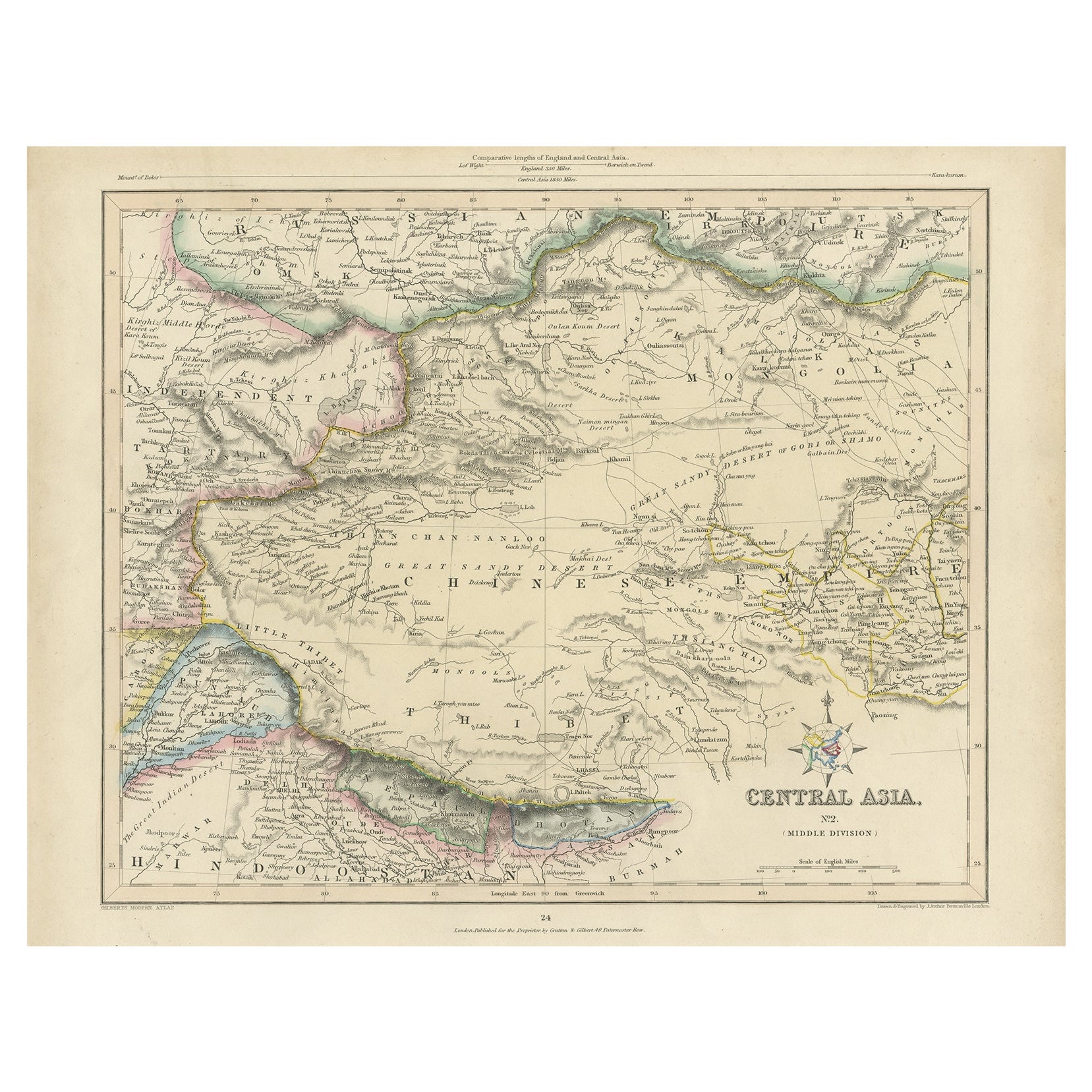
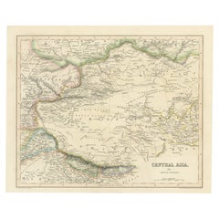
Antique Map of Central Asia, Finely Engraved, 1841
Located in Langweer, NL
Antique map titled 'Central Asia, Middle Division'. A finely engraved and attractive mid 19th Century map of Central Asia which was drawn and engraved by Joshua Archer and published ...
Category
Antique 19th Century Maps
Materials
Paper
$228 Sale Price
20% Off
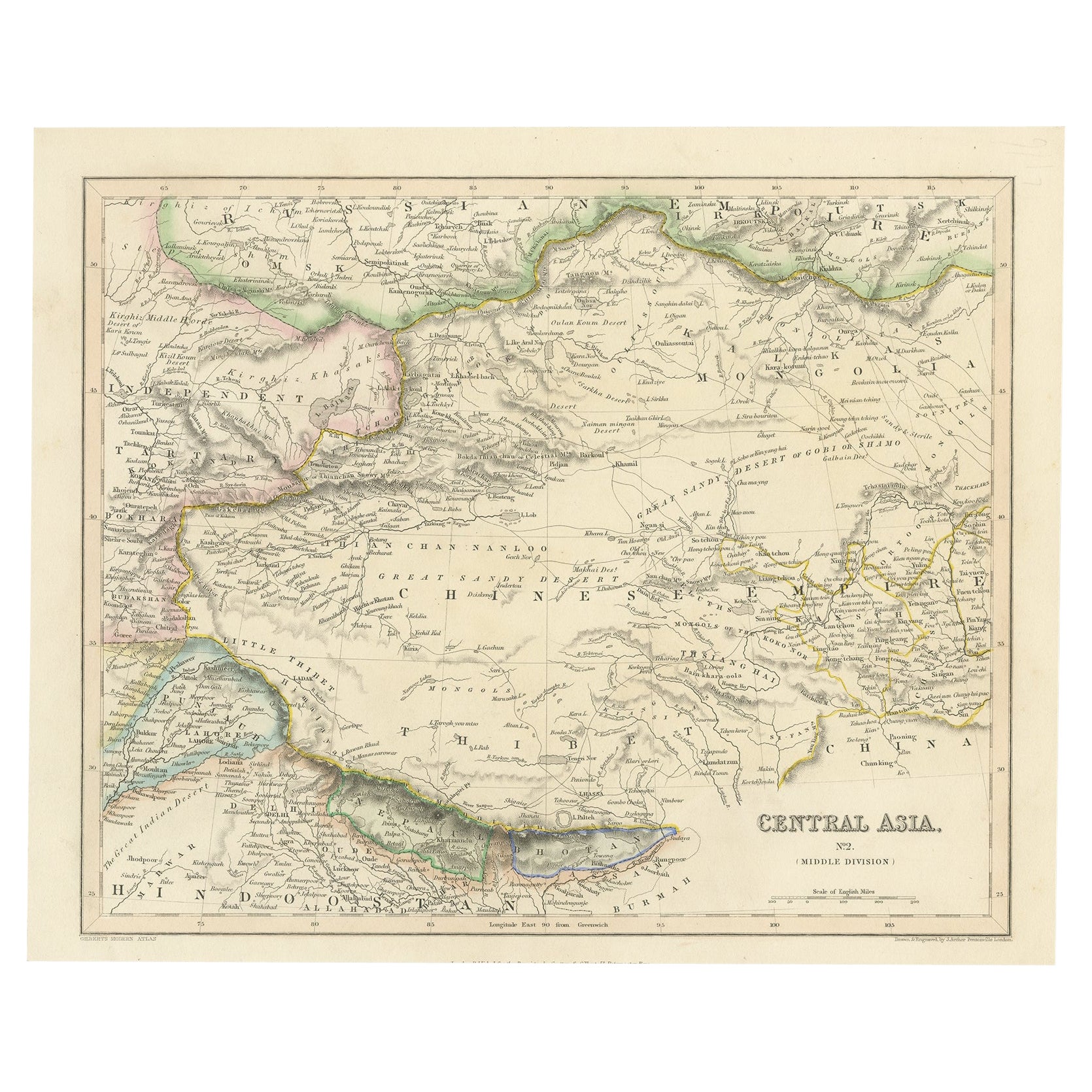
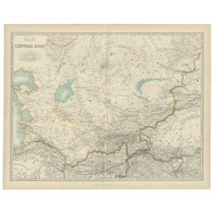
Steel Engraved Map of Central Asia Covering the Chinese Empire, Tibet Etc, C1843
Located in Langweer, NL
Antique map titled 'Central Asia (Middle Division)'.
Steel engraved map of Central Asia covering the Chinese Empire, Tibet and surroundings. This map originates from 'Gilberts Mo...
Category
Antique 1840s Maps
Materials
Paper
$247 Sale Price
20% Off
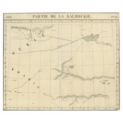
Antique Map of Kalmykia – Vandermaelen Lithograph of Central Asia, 1827
Located in Langweer, NL
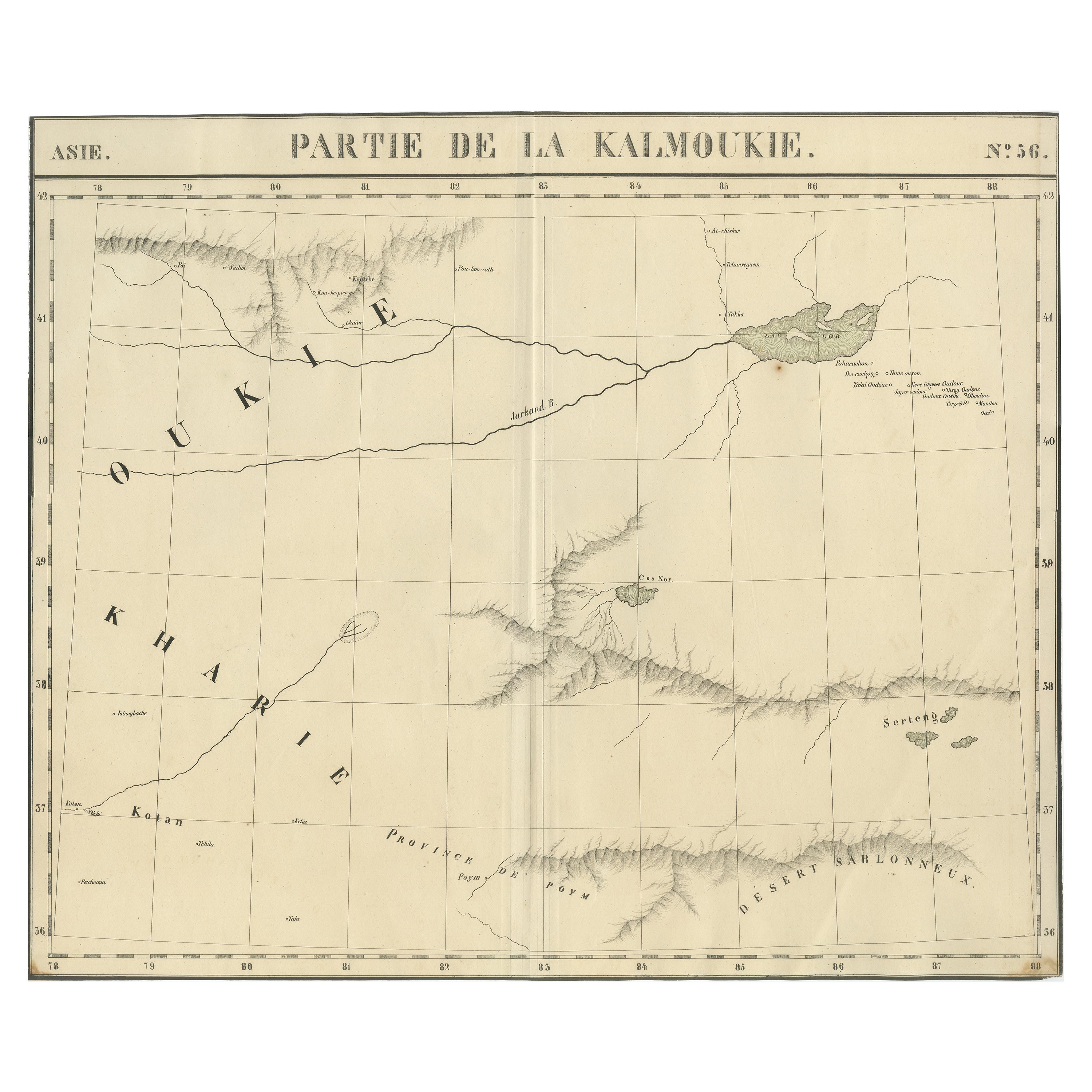
Antique Map of Kalmykia – Vandermaelen Lithograph of Central Asia, 1827
This rare antique map titled “Partie de la Kalmoukie” (No. 56) is an original 1827 lithograph by Belgian cart...
Category
Antique Early 19th Century Belgian Maps
Materials
Paper
Antique Map of Central Asia by Johnston '1909'
Located in Langweer, NL
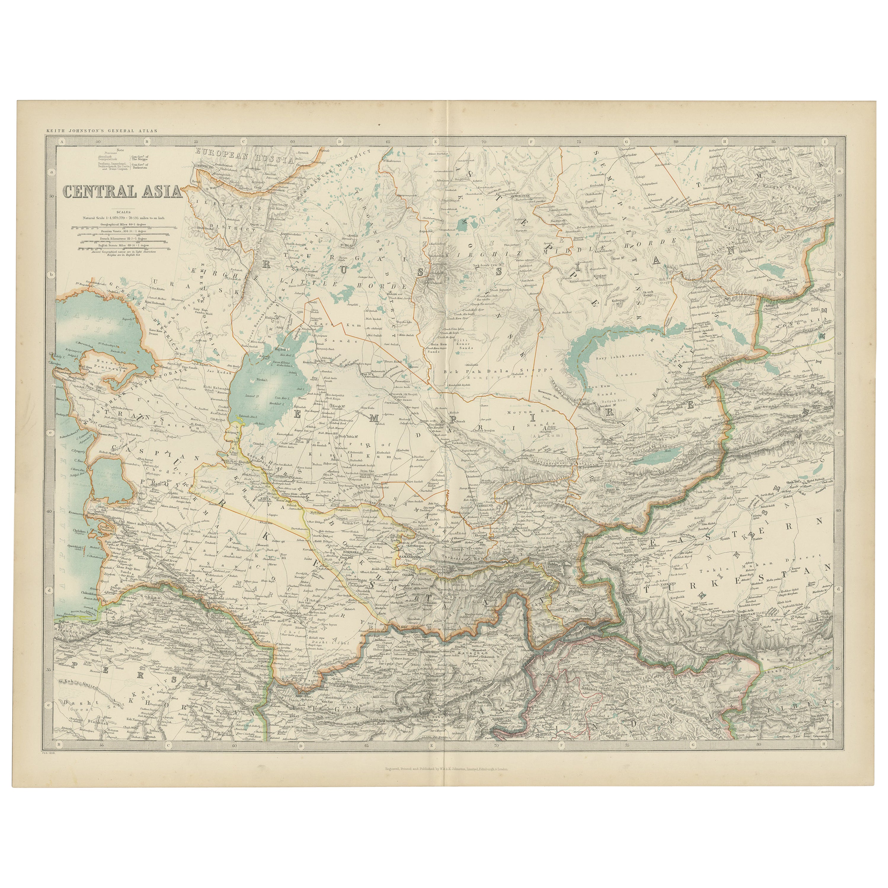
Antique map titled 'Central Asia'. Original antique map of Central Asia. This map originates from the ‘Royal Atlas of Modern Geography’. Published by W. & A.K. Johnston, 1909.
Category
Early 20th Century Maps
Materials
Paper
$237 Sale Price
20% Off
You May Also Like
Large Original Antique Map of Afghanistan. Edward Weller, 1861
Located in St Annes, Lancashire
Great map of Afghanistan
Lithograph engraving by Edward Weller
Original colour
Published, 1861
Unframed
Good condition
Category
Antique 1860s English Victorian Maps
Materials
Paper

Original Antique Map of China, Arrowsmith, 1820
Located in St Annes, Lancashire
Great map of China
Drawn under the direction of Arrowsmith
Copper-plate engraving
Published by Longman, Hurst, Rees, Orme and Brown, 1820
Unfr...
Category
Antique 1820s English Maps
Materials
Paper

1860 Large Map "Carte De La Siberie Russie D'asie, " Ric.R0001
Located in Norton, MA
Large 1860 map "Carte De La Siberie Russie D'Asie," R-0001
" Authentic" - 1860 map "Carte De La Siberie Russie D'Asie,"
Dimension: Paper: 68 cm W x 51 cm H ; Sight: 51cm W x 4...
Category
Antique 19th Century Unknown Maps
Materials
Paper

Map of Russia - Original Etching - Late 19th Century
Located in Roma, IT
This Map of Russia is an etching realized by an anonymous artist.
The state of preservation of the artwork is good with some small diffused stains.
Sheet dimension:27.5 x 44
At t...
Category
Late 19th Century Modern Figurative Prints
Materials
Etching
Map of Eastern Roman Empire -Vintage Offset Print - Early 20th Century
Located in Roma, IT
This map of Eastern Roman Empire is a vintage offset print realized in the early 20th Century.
The state of preservation of the artwork is aged with dif...
Category
Early 20th Century Figurative Prints
Materials
Offset

Persia & Afghanistan: A Framed Hand-colored 17th Century Map by John Cary
By John Cary
Located in Alamo, CA
This colorful and detailed early 18th century copperplate map by John Cary entitled "A New Map of Persia from the Latest Authorities" was published in London in 1801. It depicts Persia, the region of modern day Afghanistan, the Caspian Sea, the Sea of Aral, the Persian Gulf...
Category
Early 19th Century Old Masters More Prints
Materials
Engraving
