Items Similar to Cartographic Elegance of the Mughal Dominion in a Hand-Colored Antique Map, 1705


Want more images or videos?
Request additional images or videos from the seller
1 of 8
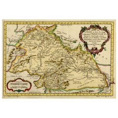
Cartographic Elegance of the Mughal Dominion in a Hand-Colored Antique Map, 1705
$622.31
$777.8920% Off
£468.73
£585.9120% Off
€528
€66020% Off
CA$858.20
CA$1,072.7420% Off
A$964.14
A$1,205.1820% Off
CHF 503.77
CHF 629.7120% Off
MX$11,767.84
MX$14,709.8020% Off
NOK 6,396.37
NOK 7,995.4620% Off
SEK 6,020.84
SEK 7,526.0420% Off
DKK 4,018.94
DKK 5,023.6720% Off
About the Item
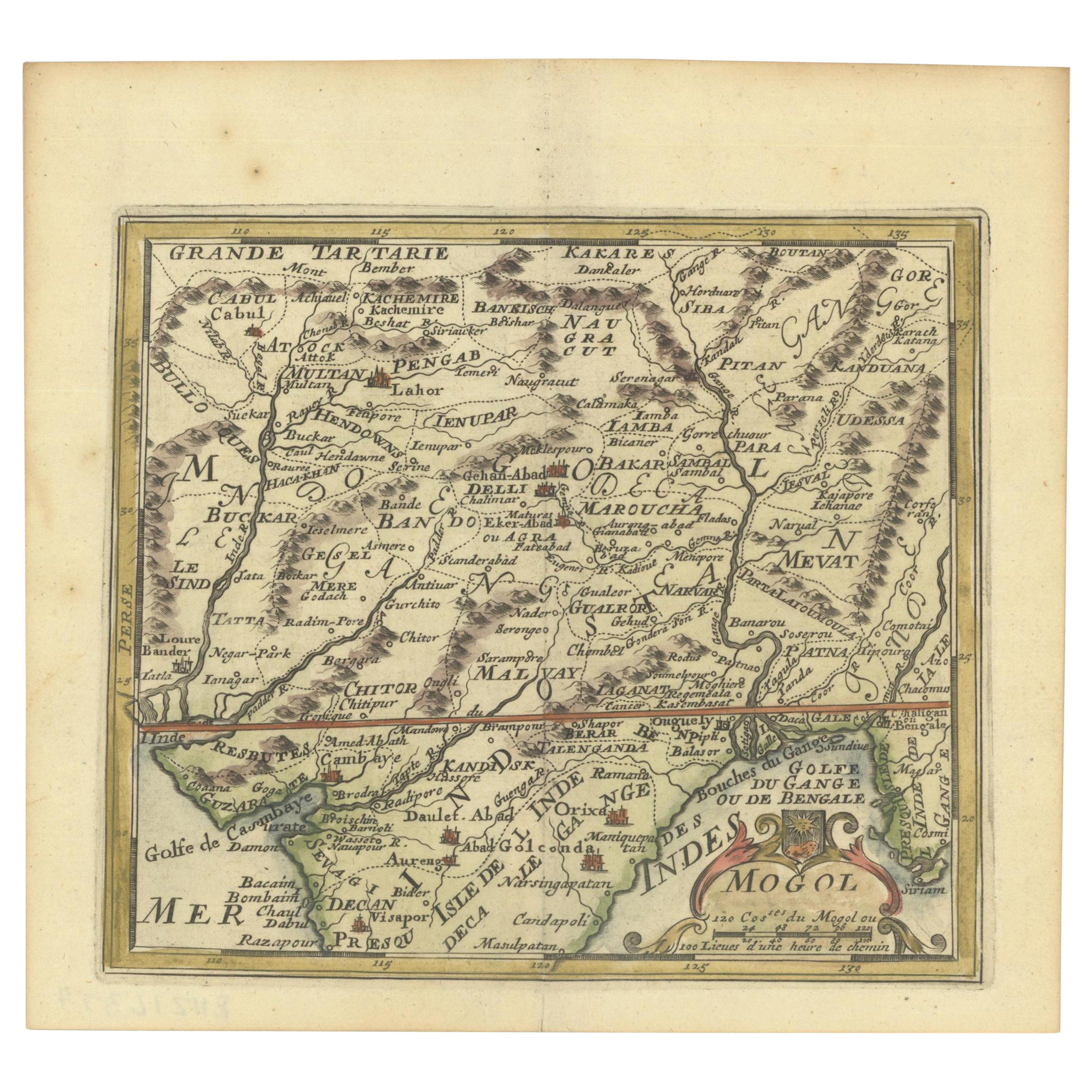
This original antique map titled “'T Ryk van den Grooten Mogol” by Nicolas Sanson from 1705 is an interesting historical artifact. It depicts the extent of the Mughal Empire in Northern India and adjacent regions during the early 18th century. This period corresponds to the later years of the Mughal Empire's peak and hints towards its subsequent decline.
The map shows the political divisions, topography, cities, and major towns of the time. The presence of the mythical Lac de Chiamay, a lake that was once thought to be the source of important Southeast Asian rivers, is particularly notable for illustrating the geographical misconceptions of that era.
Sanson's maps were widely copied and reissued with various modifications by different publishers, indicating their popularity and the importance of his work in the cartographic community. These maps would have been used for navigation, trade, and also to assert political claims over territories.
In more detail:
Title: “'T Ryk van den Grooten Mogol”
Subject: Northern India
Creator: Sanson, Nicolas
Date: 1705 (published)
Color: Hand Color
Size: 9.7 x 7.6 inches (24.6 x 19.3 cm)
Source: Algemeene Weereld-Beschryving…
Description: This small map covers Northern India and present-day Nepal and Bangladesh and shows the political divisions, topography, cities and major towns. At right is the mythical Lac de Chiamay with three rivers flowing south. It is decorated with a strapwork title cartouche.
Sanson's small maps from his L'Asie en Plusieurs Cartes..., first published in 1652 and engraved by A. Peyrounin, were copied several times by various map publishers. Johann David Zunners made copies of Sanson's maps for his German translation of Die Gantze Erd-Kugel in 1679. Johannes Ribbius and Simon de Vries published copies in 1682 and 1683, with new maps engraved by Antoine d'Winter. The plates were later sold to Francois Halma, who used them in 1699 and then again in 1705 with the titles re-engraved in Dutch. The titles on the d'Winter plates were re-engraved back into French, and then used by Nicholas Chemereau in 1715 and by Henri du Sauzet in 1738.
- Dimensions:Height: 8.67 in (22 cm)Width: 11.89 in (30.2 cm)Depth: 0 in (0.02 mm)
- Materials and Techniques:Paper,Engraved
- Period:1700-1709
- Date of Manufacture:1705
- Condition:Very good. A dark and attractive impression on a bright sheet and a narrow top margin. Middle fold as issued. Study the scans carefully.`.
- Seller Location:Langweer, NL
- Reference Number:Seller: BG-137271stDibs: LU3054338603492
About the Seller
5.0
Recognized Seller
These prestigious sellers are industry leaders and represent the highest echelon for item quality and design.
Platinum Seller
Premium sellers with a 4.7+ rating and 24-hour response times
Established in 2009
1stDibs seller since 2017
2,533 sales on 1stDibs
Typical response time: <1 hour
- ShippingRetrieving quote...Shipping from: Langweer, Netherlands
- Return Policy
Authenticity Guarantee
In the unlikely event there’s an issue with an item’s authenticity, contact us within 1 year for a full refund. DetailsMoney-Back Guarantee
If your item is not as described, is damaged in transit, or does not arrive, contact us within 7 days for a full refund. Details24-Hour Cancellation
You have a 24-hour grace period in which to reconsider your purchase, with no questions asked.Vetted Professional Sellers
Our world-class sellers must adhere to strict standards for service and quality, maintaining the integrity of our listings.Price-Match Guarantee
If you find that a seller listed the same item for a lower price elsewhere, we’ll match it.Trusted Global Delivery
Our best-in-class carrier network provides specialized shipping options worldwide, including custom delivery.More From This Seller
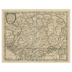
View All1692 Engraved Map: Detailed Mogul Empire, India to Afghanistan, Hand-Colored
Located in Langweer, NL
1692 Map of the Mogul Empire by Jacques Peeters
This finely engraved map, published in 1692 by Jacques Peeters, showcases the Mogul Empire region, covering areas from northern India...
Category
Antique 1690s Maps
Materials
Paper
$462 Sale Price
20% Off
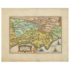
Antique Map of the Mughal Empire by Van der Aa, C.1725
By Pieter Van Der Aa
Located in Langweer, NL
Antique map titled 'Royaume de Grand Mogol (..).' This map shows the extend of the Mughal Empire, which includes northern India, from Golconda to Afghanistan and eastwards to Bengal....
Category
Antique 18th Century Maps
Materials
Paper

Nicely Hand-Colored Antique Map of Part of India, the Ganges & Hindustan, 1755
Located in Langweer, NL
Antique map titled 'Carte de l'Inde en deca du Gange comprenant l' Indoustan (..)'
A map of part of India, the Ganges and Hindustan. From: Antoine Francois Prevost d'Exiles' (or ...
Category
Antique 1750s Maps
Materials
Paper
$603 Sale Price
20% Off
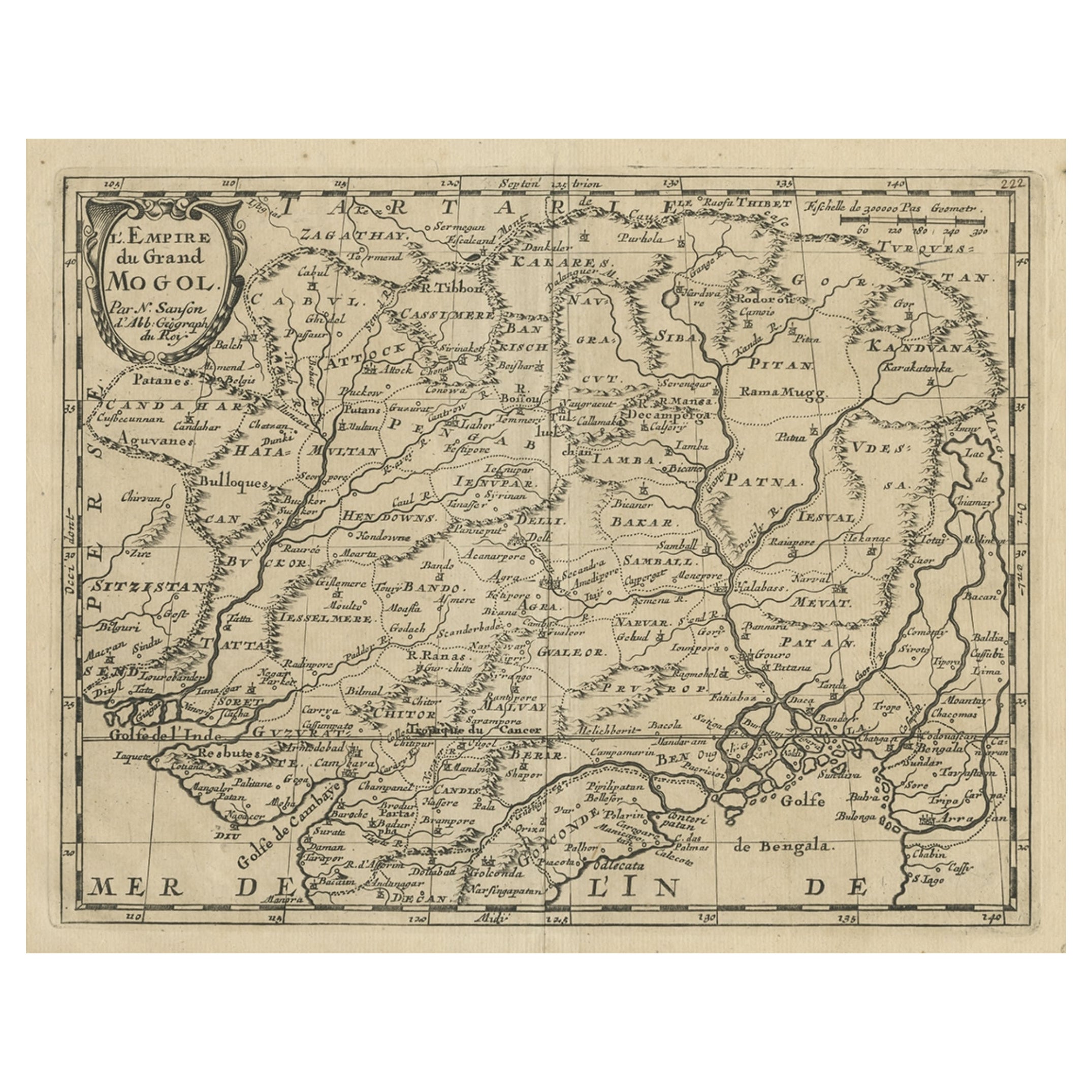
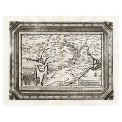
Old Map of the Mughal Empire, Persia in the West to Lake Chimay etc., ca.1685
Located in Langweer, NL
Antique map titled 'L'Empire du Grand Mogol'. Old map of India and Central Asia.
The map extends from Persia in the West to Lake Chimay and the Bay of Bengal...
Category
Antique 1680s Maps
Materials
Paper
$301 Sale Price
20% Off
Antique Map of Granada Spain – Hand-Coloured Tassin Engraving 1651
Located in Langweer, NL
Antique Map of Granada Spain – Hand-Coloured Tassin Engraving 1651
This beautiful hand-coloured engraved map depicts the historic Kingdom of Granada in southern Spain, created by th...
Category
Antique Mid-17th Century French Maps
Materials
Paper
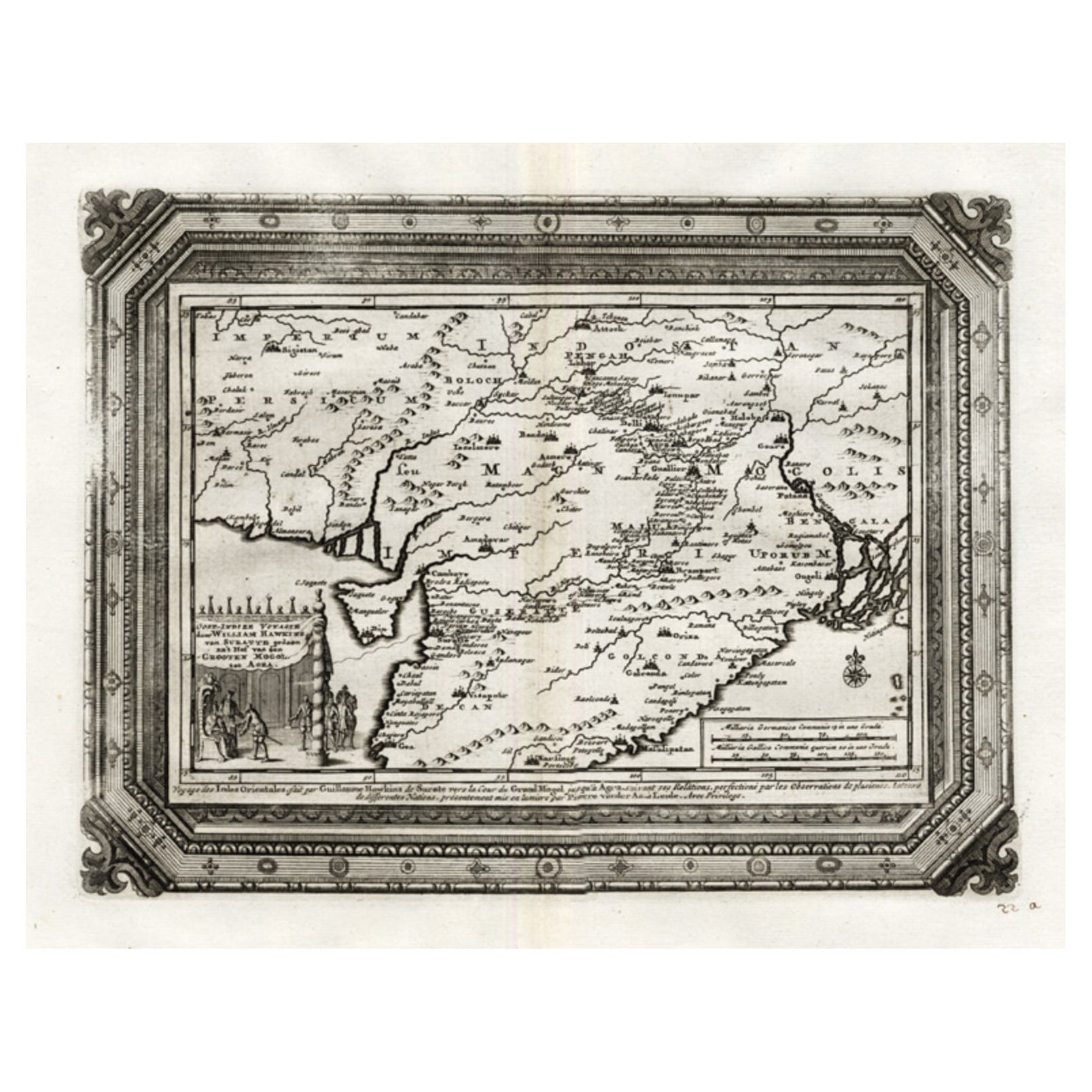
Rare Antique Map of the Moghul Empire, ca.1725
Located in Langweer, NL
Antique map titled 'Oost-Indize Voyagie door William Hawkins van Suratte gedaan na 't Hof van den Grooten Mogol tot Agra. - Voyage des Indes Orientales...
Category
Antique 1720s Maps
Materials
Paper
$792 Sale Price
20% Off
You May Also Like
1640 Willem Blaeu Map Entitled "Contado di molise et principato vltra, " Ric.a003
By Willem Blaeu
Located in Norton, MA
1640 Willem Blaeu map entitled
"Contado di molise et principato vltra,"
Colored
Ric. a003
Measures: 38 x 49.6 cm and wide margins
DBLAEU.
Cou...
Category
Antique 17th Century Dutch Maps
Materials
Paper

1571-1638 Willem Blaeu map entitled, "Ilcadorino, " Hand Colored Ric0009
Located in Norton, MA
Willem Blaeu map entitled,
"Ilcadorino,".
Hand colored.
Description: large, unusual, and nice antique copper engraved map of Ilcadorino, by Willem BL...
Category
Antique 16th Century Dutch Maps
Materials
Paper

Antique French Map of Asia Including China Indoneseia India, 1783
Located in Amsterdam, Noord Holland
Very nice map of Asia. 1783 Dedie au Roy.
Additional information:
Country of Manufacturing: Europe
Period: 18th century Qing (1661 - 1912)
Condition: Overall Condition B (Good Used)...
Category
Antique 18th Century European Maps
Materials
Paper

$648 Sale Price
20% Off
1640 Joan Bleau Map Entitled"Diocecese de rheims et le pais de rethel, " Eic.a011
Located in Norton, MA
1640 Joan Bleau map entitled
"Diocecese de rheims et le pais de rethel,"
Ric.a011
OAN BLAEU
Diocecese de Rheims, et le pais de Rethel.
Handcolored engraving, c.1640.
...
Category
Antique 17th Century Dutch Maps
Materials
Paper

Southern Greece: A Large 17th Century Hand-colored Map By Sanson and Jaillot
By Nicholas Sanson d'Abbeville
Located in Alamo, CA
This large original hand-colored copperplate engraved map of southern Greece and the Pelopponese Peninsula entitled "La Moree Et Les Isles De Zante, Cefalonie, Ste. Marie, Cerigo & C...
Category
1690s Landscape Prints
Materials
Engraving

1633 Map Entitled "Beauvaisis Comitatus Belova Cium, Ric.0002
Located in Norton, MA
1633 map entitled
"Beauvaisis Comitatus Belova Cium,"
Hand Colored
Ric.0002
Description: Cartographer : - Hondius, Henricus 1587-1638
Artists and Engravers:Jodocus Hondius, one of the most notable engravers of his time. He is known for his work in association with many of the cartographers and publishers prominent at the end of the sixteenth and the beginning of the seventeenth century. A native of Flanders, he grew up in Ghent, apprenticed as an instrument and globe maker and map engraver. In 1584, to escape the religious troubles sweeping the Low Countries at that time, he fled to London where he spent some years before finally settling in Amsterdam about 1593. In the London period he came into contact with the leading scientists and geographers of the day and engraved maps in The Mariner\\\\\\\\\\\\\\\'s Mirrour, the English edition of Waghenaer\\\\\\\\\\\\\\\'s Sea Atlas, as well as others with Pieter van den Keere, his brother-in-law. No doubt his temporary exile in London stood him in good stead, earning him an international reputation, for it could have been no accident that Speed chose Hondius to engrave the plates for the maps in The Theatre of the Empire of Great Britaine in the years between 1605 and 1610. In 1604 Hondius bought the plates of Mercator\\\\\\\\\\\\\\\'s Atlas which, in spite of its excellence, had not competed successfully with the continuing demand for the Ortelius Theatrum Orbis Terrarum. To meet this competition Hondius added about 40 maps to Mercator\\\\\\\\\\\\\\\'s original number and from 1606 published enlarged editions in many languages, still under Mercator\\\\\\\\\\\\\\\'s name but with his own name as publisher. These atlases have become known as the Mercator/Hondius series. The following year the maps were reengraved in miniature form and issued as a pocket Atlas Minor. After the death of Jodocus Hondius the Elder in 1612, work on the two atlases, folio and miniature, was carried on by his widow and sons, Jodocus II and Henricus, and eventually in conjunction with Jan Jansson in Amsterdam.
In all, from 1606 onwards, nearly 50 editions with increasing numbers of maps with texts in the main European languages were printed. Summaries of these issues are given under the entry for Gerard Mercator. Jodocus Hondius the Elder * 1588 Maps in The Mariner\\\\\\\\\\\\\\\'s Mirrour (Waghenaer/Ashley) * 1590 World Map...
Category
Antique 17th Century Dutch Maps
Materials
Paper

More Ways To Browse
Antiques Nepal
Antique Hand Carts
Antique Hand Trolley
German Kugel
20th Century Spanish Table
Antonio Bellini
Antique Oushak Carpets
Blue Coffee Tables
German Bauhaus Posters
1945 Chair Juhl
Antique Three Leg Table
Folke Arstrom
Silver Over Copper
Vintage Barware Glasses
Antique Etched Glass
Antique French Shell
Coffee Table Black Italian Modern
Christofle America