Items Similar to Charting the Course of Empire: Bonne's 1770 Masterpiece Maps of the Indian Ocean

Want more images or videos?
Request additional images or videos from the seller
1 of 11
Charting the Course of Empire: Bonne's 1770 Masterpiece Maps of the Indian Ocean
$469.51per set
$586.89per set20% Off
£347.94per set
£434.92per set20% Off
€392per set
€490per set20% Off
CA$640.98per set
CA$801.22per set20% Off
A$713.06per set
A$891.32per set20% Off
CHF 373.79per set
CHF 467.24per set20% Off
MX$8,713.41per set
MX$10,891.76per set20% Off
NOK 4,759.81per set
NOK 5,949.76per set20% Off
SEK 4,480.70per set
SEK 5,600.88per set20% Off
DKK 2,984.65per set
DKK 3,730.82per set20% Off
Shipping
Retrieving quote...The 1stDibs Promise:
Authenticity Guarantee,
Money-Back Guarantee,
24-Hour Cancellation
About the Item
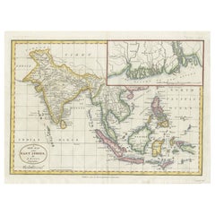
A voyage through history with an exquisite collection of Rigobert Bonne's 1770 maps, as featured in the coveted Atlas Moderne circa 1770. Each map, a cartographic treasure, captures the intricate dance of land and sea across the Indian subcontinent and its surrounding waters. These are not mere maps; they are windows into the past, detailing the Malabar and Coromandel coasts, the ethereal Maldives, the storied isle of Ceylon (Sri Lanka), and beyond to the Andaman Islands, Sumatra, and the veiled mysteries of Southeast Asia.
Expertly crafted by the distinguished Royal Hydrographer, these maps boast an array of rhumb lines and wind arrows, vividly portraying the vital trade winds that propelled the storied vessels of the 18th century along their lucrative routes. Each map serves as a testament to the era's indomitable spirit of exploration and commerce that shaped our modern world.
This collection is an ode to the artistry and precision of historical mapmaking, offering an unparalleled level of detail and accuracy. The maps' dimensions, standing at a display-worthy 11.7 inches by 16.5 inches, make them perfect for the collector, the connoisseur of history, or as a statement piece for any library, study, or office.
Let the "Charting the Course of Empire" collection transport you to an age where the map was a key to untold riches and uncharted lands. These are not just maps; they are artifacts of human endeavor, ambition, and the eternal allure of the unknown. Secure your piece of history today, and own a legacy of the world's maritime heritage that continues to inspire and awe.
More in detail:
This is a set of two maps from Rigobert Bonne's 1770 decorative map of India, which were intended for Jean Lattre's Atlas Moderne around 1775. These maps are examples of 18th-century cartography and show northern and southern India, along with notable features like the Malabar and Coromandel coasts, the Maldives, Ceylon (now known as Sri Lanka), the Andaman Islands, and parts of Sumatra and Southeast Asia.
Rigobert Bonne was a significant figure in the field of cartography in the 18th century, known for his detailed and precise maps. As the Royal Hydrographer, his work was particularly valuable for maritime navigation. The Atlas Moderne was a comprehensive collection of maps covering various parts of the world and was an important publication for expanding geographic knowledge during the Age of Enlightenment.
The dimensions provided indicate that the original maps are relatively modest in size, suitable for inclusion in a published atlas of the period. Collectors and historians value such maps for their aesthetic and historical significance, as they represent not only the geographic knowledge of the time but also the artistry involved in mapmaking before the advent of modern printing technology.
- Dimensions:Height: 14.18 in (36 cm)Width: 20.28 in (51.5 cm)Depth: 0 in (0.02 mm)
- Sold As:Set of 2
- Materials and Techniques:Paper,Engraved
- Period:1770-1779
- Date of Manufacture:1770
- Condition:Good. Some light offset and one brown spot in the lower map. General age-related toning and/or occasional minor defects from handling. Please study scans carefully. Middle folds as issued.
- Seller Location:Langweer, NL
- Reference Number:Seller: BG-13721-4 BG-13721-51stDibs: LU3054338605102
About the Seller
5.0
Recognized Seller
These prestigious sellers are industry leaders and represent the highest echelon for item quality and design.
Platinum Seller
Premium sellers with a 4.7+ rating and 24-hour response times
Established in 2009
1stDibs seller since 2017
2,494 sales on 1stDibs
Typical response time: 1 hour
- ShippingRetrieving quote...Shipping from: Langweer, Netherlands
- Return Policy
Authenticity Guarantee
In the unlikely event there’s an issue with an item’s authenticity, contact us within 1 year for a full refund. DetailsMoney-Back Guarantee
If your item is not as described, is damaged in transit, or does not arrive, contact us within 7 days for a full refund. Details24-Hour Cancellation
You have a 24-hour grace period in which to reconsider your purchase, with no questions asked.Vetted Professional Sellers
Our world-class sellers must adhere to strict standards for service and quality, maintaining the integrity of our listings.Price-Match Guarantee
If you find that a seller listed the same item for a lower price elsewhere, we’ll match it.Trusted Global Delivery
Our best-in-class carrier network provides specialized shipping options worldwide, including custom delivery.More From This Seller
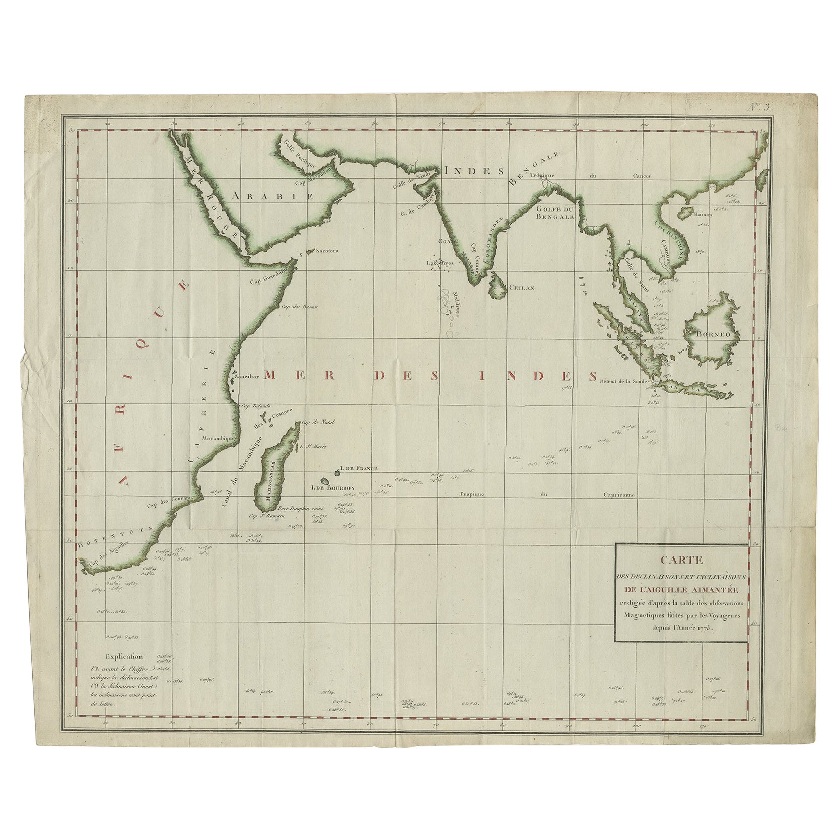
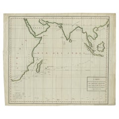
View AllOld Map of Indian Ocean & Sumatra, Java, Borneo, India, Arabia, Africa, c.1783
Located in Langweer, NL
Antique map titled 'Carte des Declinaisons et Inclinaisons de L'Aiguille Aimantée redigée d'après la table des observations Magnetiques faites par les Voyageurs depuis l'Année 1775'....
Category
Antique 1780s Maps
Materials
Paper
$1,341 Sale Price
20% Off
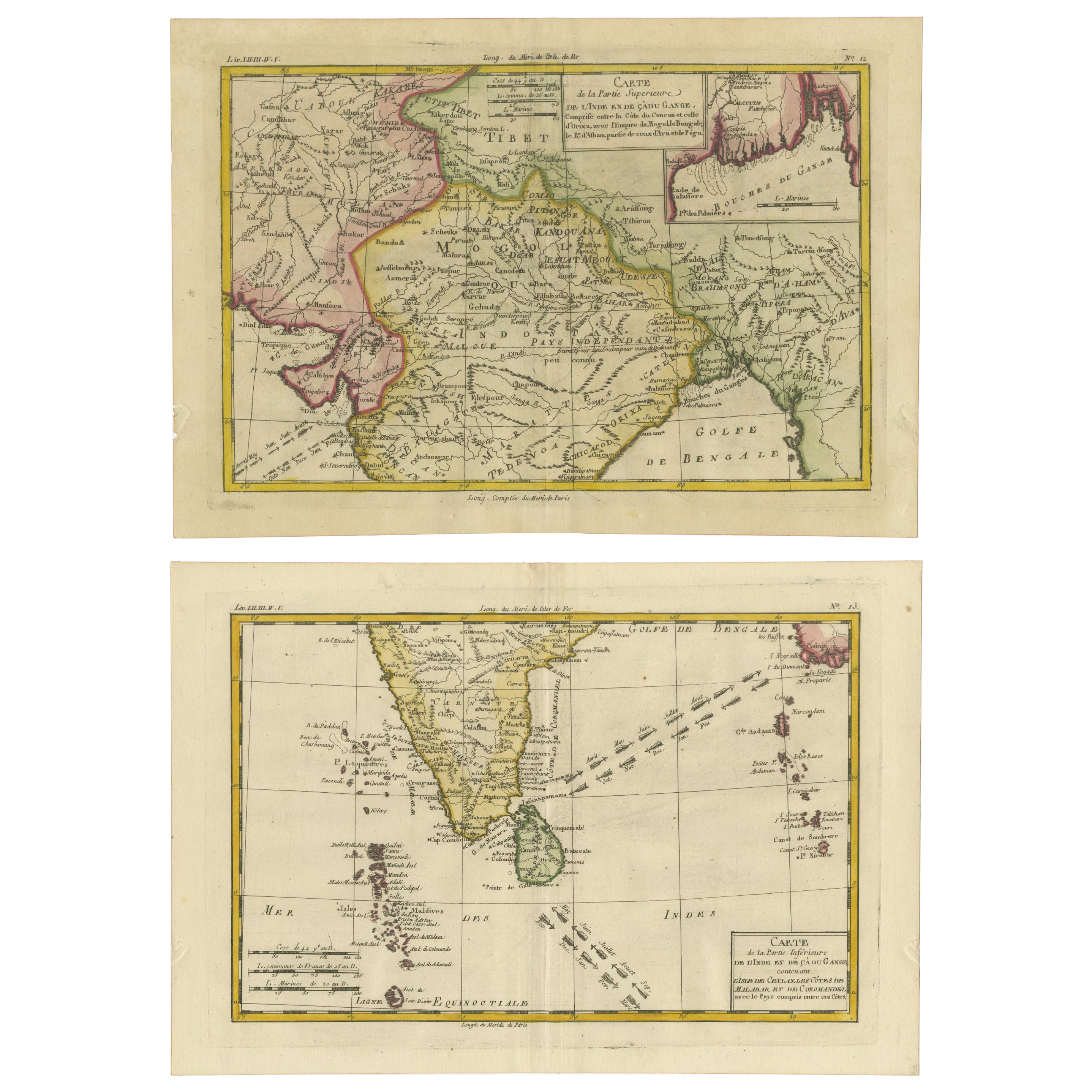
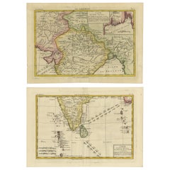
18th Century Cartographic Depiction of Upper India and Ceylon, 1835
Located in Langweer, NL
An exquisite set of two maps, 'Carte de la Partie Superieure De L'Inde en de Cadu Gange,' masterfully crafted by the renowned 18th-century French cartographer, Charles Marie Rigobert...
Category
Antique 1830s Maps
Materials
Paper
$421 Sale Price
20% Off
Free Shipping
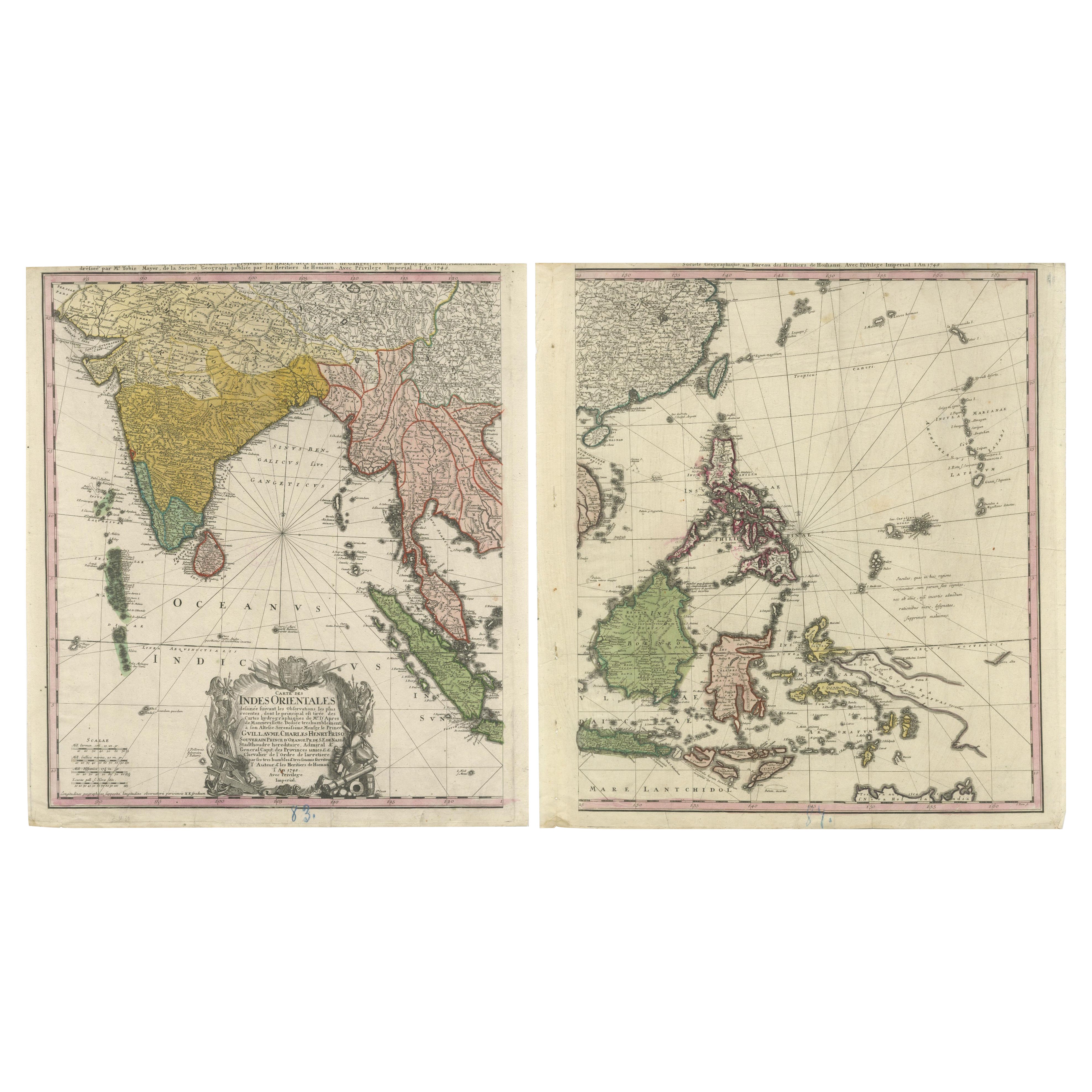
1748 Homann Heirs Double Map of the East Indies and Southeast Asia
Located in Langweer, NL
Title: 1774 Homann Heirs Double Map of the East Indies and Southeast Asia
Description:
This stunning 1774 double map by the Homann Heirs showcases the East Indies and Southeast ...
Category
Antique 1740s Maps
Materials
Paper
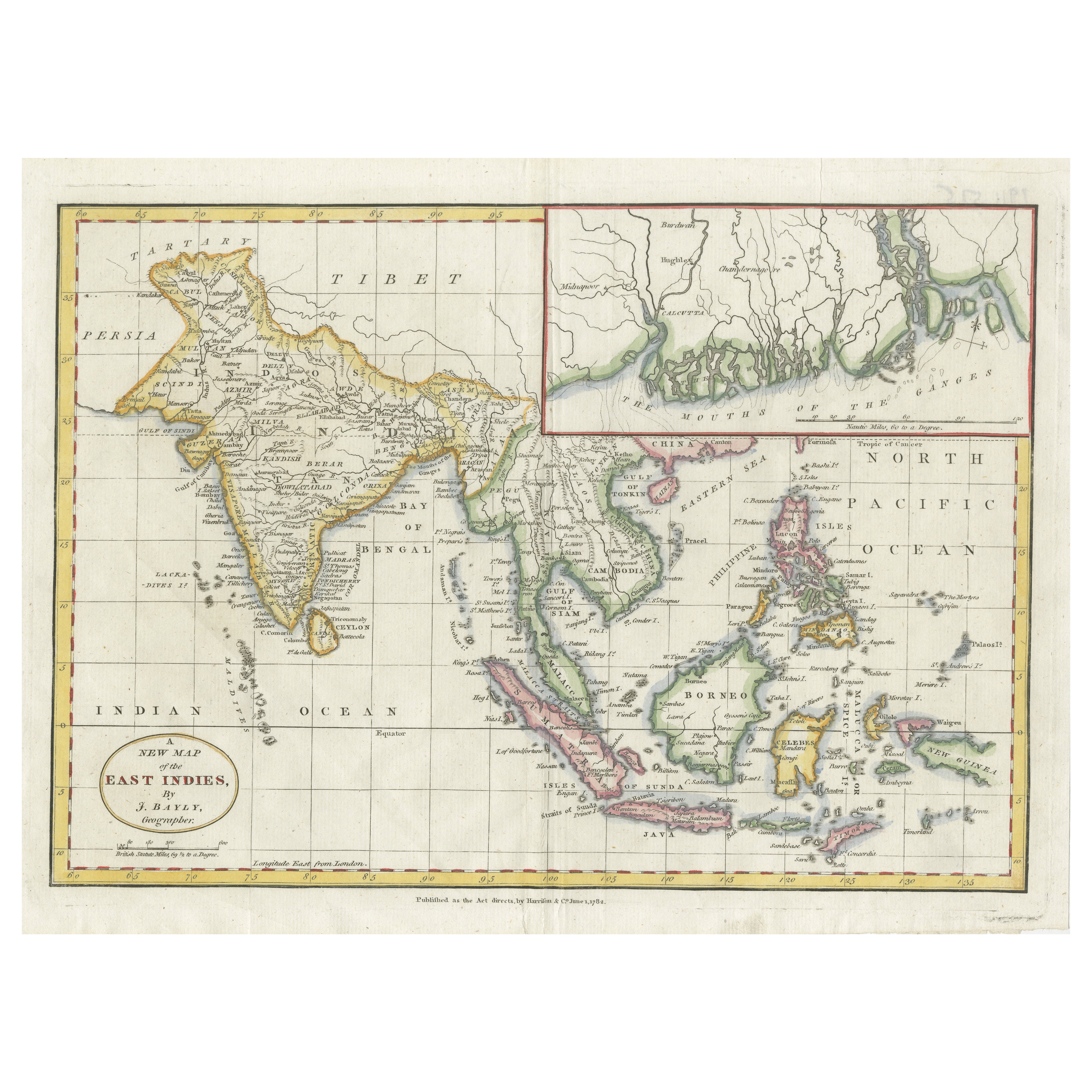
1782 Map of the East Indies – India, Siam, Philippines, Java, Borneo, Ganges
Located in Langweer, NL
1782 Bayly Map of the East Indies – India, Siam, Philippines, Java, Borneo, Ganges
This finely engraved and vibrantly hand-colored map titled 'A New Map of the East Indies' was dr...
Category
Antique 1780s Maps
Materials
Paper
$316 Sale Price
20% Off
1705 Sanson Map of Southern India and Malabar with an Inset Map
Located in Langweer, NL
Title: 1705 Sanson Map of Southern India and Malabar with an Inset Map
Description: This finely engraved and beautifully hand-colored antique map, published in 1705, depicts south...
Category
Antique Early 1700s Maps
Materials
Paper

$737 Sale Price
20% Off
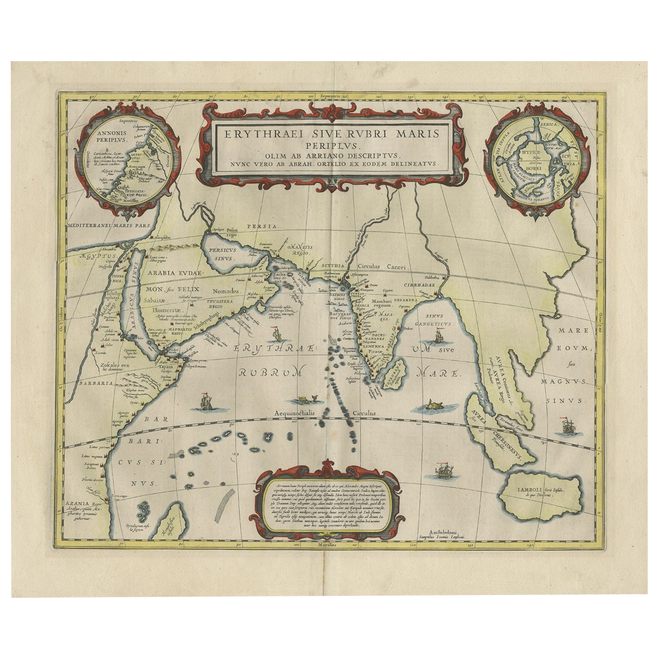
Old Map of Ancient Times covering Egypt Towards Arabia and India to Java, c.1660
Located in Langweer, NL
Description: Antique map titled 'Erythraei Sive Rubri Maris Periplus olim ab arriano descriptus nunc vero ab abrah ortelio ex eodem delineatus'. Map of the Indian Ocean, or Erythraea...
Category
Antique 1660s Maps
Materials
Paper
$1,054 Sale Price
20% Off
You May Also Like
Antique French Map of Asia Including China Indoneseia India, 1783
Located in Amsterdam, Noord Holland
Very nice map of Asia. 1783 Dedie au Roy.
Additional information:
Country of Manufacturing: Europe
Period: 18th century Qing (1661 - 1912)
Condition: Overall Condition B (Good Used)...
Category
Antique 18th Century European Maps
Materials
Paper

$648 Sale Price
20% Off
Antique 1803 Italian Map of Asia Including China Indoneseia India
Located in Amsterdam, Noord Holland
Antique 1803 Italian Map of Asia Including China Indoneseia India
Very nice map of Asia. 1803.
Additional information:
Type: Map
Country of Manufacturing: Europe
Period: 19th centu...
Category
Antique 19th Century European Maps
Materials
Paper

$584 Sale Price
20% Off
West Coast of Africa, Guinea & Sierra Leone: An 18th Century Map by Bellin
By Jacques-Nicolas Bellin
Located in Alamo, CA
Jacques Bellin's copper-plate map entitled "Partie de la Coste de Guinee Dupuis la Riviere de Sierra Leona Jusquau Cap das Palmas", depicting the coast of Guinea and Sierra Leone in ...
Category
Antique Mid-18th Century French Maps
Materials
Paper

1627 Hendrik Hondius Map Entitled "Vltoniae Orientalis Pars, " Ric.a009
Located in Norton, MA
1627 Hendrik Hondius map entitled
"Vltoniae orientalis pars,"
Ric.a009
Title:
Vltoniae orientalis : pars
Title (alt.) :
Ultoniae orientalis pars
Creator:
Mercator, Gerh...
Category
Antique 17th Century Dutch Maps
Materials
Paper

California, Alaska and Mexico: 18th Century Hand-Colored Map by de Vaugondy
By Didier Robert de Vaugondy
Located in Alamo, CA
This is an 18th century hand-colored map of the western portions of North America entitled "Carte de la Californie et des Pays Nord-Ouest separés de l'Asie par le détroit d'Anian, ex...
Category
Antique 1770s French Maps
Materials
Paper

Original Antique Map of The World by Thomas Clerk, 1817
Located in St Annes, Lancashire
Great map of The Eastern and Western Hemispheres
On 2 sheets
Copper-plate engraving
Drawn and engraved by Thomas Clerk, Edinburgh.
Published by Mackenzie And Dent, 1817
...
Category
Antique 1810s English Maps
Materials
Paper

More Ways To Browse
Empire Library
Spirit Level Antique
Asian Arrow
Antique Indian Windows
Asian Dancing Figure
20th Century Spanish Table
Antonio Bellini
Antique Oushak Carpets
Blue Coffee Tables
German Bauhaus Posters
1945 Chair Juhl
Antique Three Leg Table
Folke Arstrom
Silver Over Copper
Vintage Barware Glasses
Antique Etched Glass
Antique French Shell
Coffee Table Black Italian Modern