Items Similar to Charting Eastern Tartary: An 18th-Century Jesuit and English Collaboration, 1757


Want more images or videos?
Request additional images or videos from the seller
1 of 6
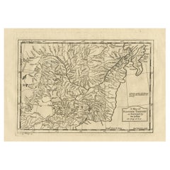
Charting Eastern Tartary: An 18th-Century Jesuit and English Collaboration, 1757
$364.24
$455.2920% Off
£271.15
£338.9420% Off
€304
€38020% Off
CA$498.91
CA$623.6420% Off
A$554.90
A$693.6220% Off
CHF 289.75
CHF 362.1920% Off
MX$6,752.53
MX$8,440.6620% Off
NOK 3,700.56
NOK 4,625.7020% Off
SEK 3,470.47
SEK 4,338.0920% Off
DKK 2,314.25
DKK 2,892.8120% Off
Shipping
Retrieving quote...The 1stDibs Promise:
Authenticity Guarantee,
Money-Back Guarantee,
24-Hour Cancellation
About the Item
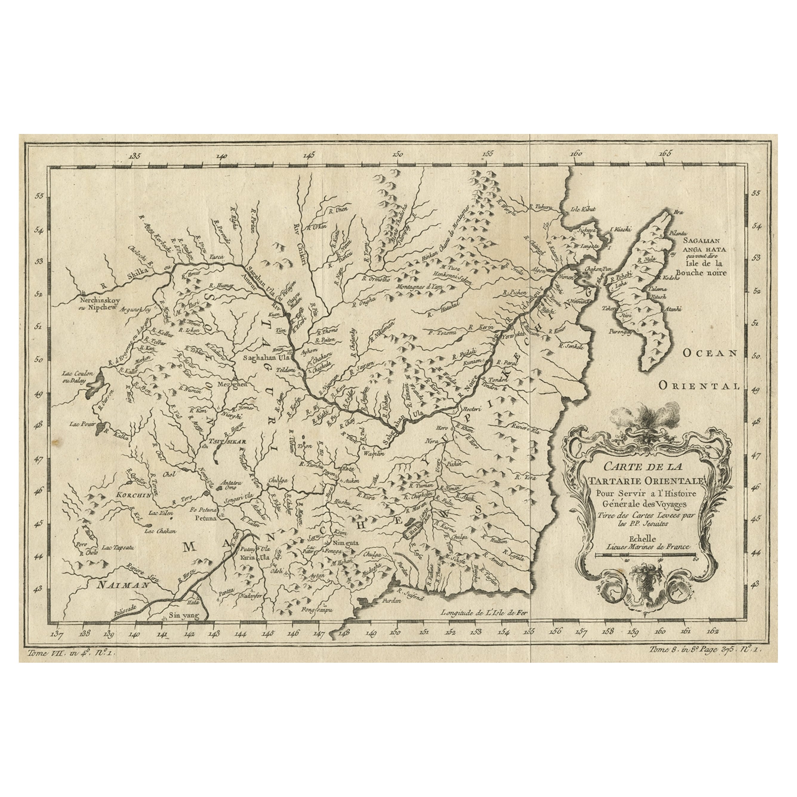
The antique map titled 'Carte de la Tartarie Orientale pour Servir a l'Histoire Generale des Voyages Tiree des Cartes Levees par les P.P. Jesuites' is an original old map that covers the eastern part of Tartary, including part of present-day Manchuria and Sakhalin Island. This map is particularly detailed in depicting river systems and geographic features. It was based primarily on Jesuit and English sources and was published in 1757 as part of 'Histoire Generale des Voyages.'
**Key Aspects of the Map:**
1. **Geographic Coverage**: The map focuses on the eastern part of Tartary, providing a detailed view of the region that includes present-day Manchuria and Sakhalin Island. It likely includes rivers, mountains, coastlines, and other geographical features.
2. **Cartographic Sources**: The map is based on information gathered from Jesuit sources and English maps, indicating a collaborative effort in mapping and exploration during the 18th century.
3. **River Systems**: The map's particular emphasis on river systems suggests the importance of waterways for navigation, trade, and transportation in the region.
4. **Historical Context**: Published in 1757, this map reflects the geographical knowledge and cartographic techniques of the time. It provides insights into the exploration and mapping of Eastern Tartary during the 18th century.
5. **'Histoire Generale des Voyages'**: The map originates from 'Histoire Generale des Voyages,' a significant work in the field of travel literature and geography. It was a compilation of travel accounts and maps from various explorers and travelers.
6. **Educational and Informative**: Antique maps like this one served educational and informative purposes, providing valuable geographic knowledge to readers and scholars of the era.
7. **Historical Mapping**: This map contributes to the historical record of how the region was represented and understood in the 18th century, making it a valuable resource for historical research.
8. **Collaborative Effort**: The involvement of Jesuit cartographers and the use of English sources highlight the collaborative nature of cartography and exploration during this period.
Overall, the 'Carte de la Tartarie Orientale' antique map is a significant artifact that offers insights into the cartographic and geographical knowledge of Eastern Tartary in the 18th century. It provides a window into the exploration and mapping efforts of the time and serves as a historical reference for researchers and historians interested in the region's past.
Jacques-Nicolas Bellin (1703 - 1772) was one of the most important cartographers of the 18th century. With a career spanning some 50 years, Bellin is best understood as geographe de cabinet and transitional mapmaker spanning the gap between 18th and early 19th century cartographic styles. His long career as Hydrographer and Ingénieur Hydrographe at the French Dépôt des cartes et plans de la Marine resulted in hundreds of high quality nautical charts of practically everywhere in the world. A true child of the Enlightenment Era, Bellin's work focuses on function and accuracy tending in the process to be less decorative than the earlier 17th and 18th century cartographic work. Unlike many of his contemporaries, Bellin was always careful to cite his references and his scholarly corpus consists of over 1400 articles on geography prepared for Diderot's Encyclopedie. Bellin, despite his extraordinary success, may not have enjoyed his work, which is described as "long, unpleasant, and hard." In addition to numerous maps and charts published during his lifetime, many of Bellin's maps were updated (or not) and published posthumously.
- Dimensions:Height: 9.34 in (23.7 cm)Width: 13.12 in (33.3 cm)Depth: 0.02 in (0.5 mm)
- Materials and Techniques:
- Period:
- Date of Manufacture:1757
- Condition:General age-related toning. Original folding lines. Minor wear and soiling, blank verso. Please study image carefully.
- Seller Location:Langweer, NL
- Reference Number:Seller: BG-13512-51stDibs: LU3054335937842
About the Seller
5.0
Recognized Seller
These prestigious sellers are industry leaders and represent the highest echelon for item quality and design.
Platinum Seller
Premium sellers with a 4.7+ rating and 24-hour response times
Established in 2009
1stDibs seller since 2017
2,510 sales on 1stDibs
Typical response time: <1 hour
- ShippingRetrieving quote...Shipping from: Langweer, Netherlands
- Return Policy
Authenticity Guarantee
In the unlikely event there’s an issue with an item’s authenticity, contact us within 1 year for a full refund. DetailsMoney-Back Guarantee
If your item is not as described, is damaged in transit, or does not arrive, contact us within 7 days for a full refund. Details24-Hour Cancellation
You have a 24-hour grace period in which to reconsider your purchase, with no questions asked.Vetted Professional Sellers
Our world-class sellers must adhere to strict standards for service and quality, maintaining the integrity of our listings.Price-Match Guarantee
If you find that a seller listed the same item for a lower price elsewhere, we’ll match it.Trusted Global Delivery
Our best-in-class carrier network provides specialized shipping options worldwide, including custom delivery.More From This Seller
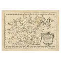
View AllOriginal Antique Map of Tartary 'Northern China & Far Eastern Russia', 1757
Located in Langweer, NL
Antique map titled 'Carte de la Tartarie Orientale (..)'.
Original antique map of what is present day northern China and far eastern Russia. Centere...
Category
Antique 1750s Maps
Materials
Paper

$277 Sale Price
20% Off
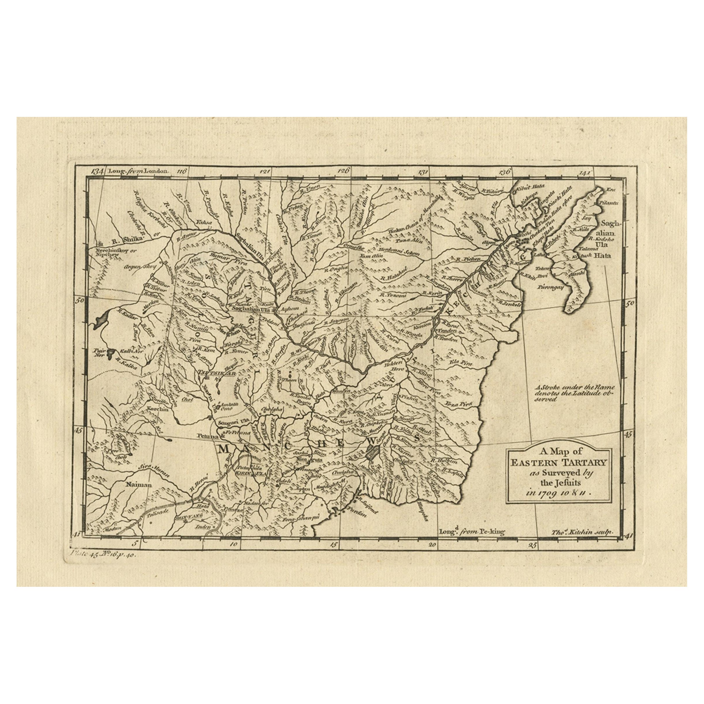
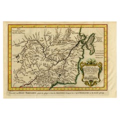
Antique Map of Eastern Tartary as Surveyed by the Jesuits, 1746
By Thomas Kitchin
Located in Langweer, NL
Antique map titled 'A Map of Eastern Tartary as Surveyed by the Jesuits in 1709, 10 & 11'. The map covers much of the course of the Amur River or Heilong Jiang, the world's tenth lon...
Category
Antique 18th Century Maps
Materials
Paper
$277 Sale Price
20% Off
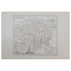
Antique Map of Northern China and Far Eastern Russia Around the Amur River, 1754
Located in Langweer, NL
Antique map titled 'Carte De La Tartarie Orientale (..)'. A map for this far eastern portion of what is present day northern China and far eastern Russia...
Category
Antique 1750s Maps
Materials
Paper

$479 Sale Price
20% Off
Antique Map of Northern China and Eastern Russia by Bellin, 1757
Located in Langweer, NL
Antique map titled 'Carte de la Tartarie Orientale (..)'. Original antique map of what is present day northern China and far eastern Russia. Centered on...
Category
Antique 18th Century Maps
Materials
Paper
Antique Map of Eastern Tartary, now the Primorsky Krai Area, Russia, 1758
By Jakob van der Schley
Located in Langweer, NL
Antique map titled 'Carte de la Tartarie orientale.' A map of Eastern Tartary. East Tartary is an old names for the Manchu-inhabited territory extending from the River Amur to Sakhal...
Category
Antique 18th Century Maps
Materials
Paper
$623 Sale Price
20% Off
Antique Map of Manchuria and the Northeast Portion of Tartary
Located in Langweer, NL
Antique map titled 'Carte de la Tartarie Orientale (..)'. Detailed map of Manchuria and the Northeast portion of Tartary, including Sagallan Anga Hata--Isle de la Bouche...
Category
Antique Mid-18th Century Maps
Materials
Paper

$277 Sale Price
20% Off
You May Also Like
1714 Henri Chatelain "Nouvelle Carte Des Etatas Du Grand.Duc De Mos Moscovie Eur
Located in Norton, MA
A 1714 Henri Chatelain map, entitled
"Nouvelle Carte Des Etatas Du Grand Duc De Moscovie En Europe,"
Ricb001
Henri Abraham Chatelain (1684-1743) was a Huguenot pastor of Parisi...
Category
Antique Early 18th Century Dutch Maps
Materials
Paper

1633 Map "La Souverainete De Sedan Et De Raucourt, Et La Prevoste Ric0011
Located in Norton, MA
1653 map entitled
"La Souverainete de Sedan et de Raucourt, et la Prevoste de Doncheri,"
Ric0011
Description:
Lovely map centered on Sedan and Doncheri and the Meuze River fr...
Category
Antique 17th Century Dutch Maps
Materials
Paper

17th Century Nicolas Visscher Map of Southeastern Europe
Located in Hamilton, Ontario
A beautiful, highly detailed map of southeastern Europe by Nicolas Visscher. Includes regions of Northern Italy (showing the cities Bologna, Padua, and Venice), Bohemia, Austria (sho...
Category
Antique 17th Century Dutch Maps
Materials
Paper

$1,350 Sale Price
38% Off
1627 Hendrik Hondius Map Entitled "Vltoniae Orientalis Pars, " Ric.a009
Located in Norton, MA
1627 Hendrik Hondius map entitled
"Vltoniae orientalis pars,"
Ric.a009
Title:
Vltoniae orientalis : pars
Title (alt.) :
Ultoniae orientalis pars
Creator:
Mercator, Gerh...
Category
Antique 17th Century Dutch Maps
Materials
Paper

1762 Berri, Nivernois Bourbonois, Lyonois, Bourgogine, Bresse, et, Franche - Com
Located in Norton, MA
1762 Vaugondy map, entitled
"Berrl Nivernois Bourbonois Lyonois, Bourgone, Bresse, Et Franche-Comte,"
Ric.b003
About this Item
A fine Copperplate Engraving with original han...
Category
Antique 18th Century Unknown Maps
Materials
Paper
Prussia, Poland, N. Germany, Etc: A Hand-colored 17th Century Map by Janssonius
By Johannes Janssonius
Located in Alamo, CA
This is an attractive hand-colored copperplate engraved 17th century map of Prussia entitled "Prussia Accurate Descripta a Gasparo Henneberg Erlichensi", published in Amsterdam by Joannes Janssonius in 1664. This very detailed map from the golden age of Dutch cartography includes present-day Poland, Latvia, Lithuania, Estonia and portions of Germany. This highly detailed map is embellished by three ornate pink, red, mint green and gold...
Category
Antique Mid-17th Century Dutch Maps
Materials
Paper

More Ways To Browse
English Early 17th Century Furniture
Map Cabinet
19th Century Corpus
Antique Map Cabinet
Giacometti Chairs
Antique Rug Wool Navy Blue Red
Bauhaus Flower Stand
French Table With Drawers
North Carolina Furniture
Antique Silver Platter
Boat Blueprint
Cream Plates
Vintage Art Deco Rugs
Vintage Serving Forks
Brewery Signs
Herati Rug
Venice Wood
Gold Leaf Furniture Black