Items Similar to Curaçao map - C. van Baarsel en zoon

Want more images or videos?
Request additional images or videos from the seller
1 of 7
Curaçao map - C. van Baarsel en zoon
$2,754.80
£2,041.46
€2,300
CA$3,760.83
A$4,183.77
CHF 2,193.18
MX$51,124.61
NOK 27,927.45
SEK 26,289.83
DKK 17,512
Shipping
Retrieving quote...The 1stDibs Promise:
Authenticity Guarantee,
Money-Back Guarantee,
24-Hour Cancellation
About the Item
“Kaart van het eiland Curaçao.”, “Algemeene kaart der Caraïbische eilanden”, “Plan van het fort Amsterdam op Curaçao” from the atlas “Atlas der overzeesche bezittingen van Zijne Majesteit den Koning der Nederlanden, aan hoogst denzelven opgedragen”, engraved by C. van Baarsel en zoon and published by Gebroeders van Cleef in The Hague in 1818. Later coloured in by hand. Size: 52,5 x 38 cm. Size including frame: 70 x 55,5 cm.
Van Baarsel was born on November 15, 1761 in Utrecht. His father was Cornelis van Baarsel Sr., a grocer from Utrecht. At a young age, Van Baarsel moved with his family to Amsterdam, where his father opened a grocery store. There, the young Cornelis was also trained as a grocer, but he felt out of place and could not use his creativity. To find his true calling, Van Baarsel has had a number of different jobs. He has worked in a cloth shop and at a drugstore. However, because he was always drawing and not paying attention to the shop, Van Baarsel was fired by both his employers. He then spent a number of years at sea before devoting himself entirely to drawing.
After Van Baarsel's time at sea, he returned to Amsterdam and married his childhood sweetheart Dorothea Veelwaard. In 1791 they had a son, Willem Cornelis van Baarsel. His wife Dorothea was related to the well-known engraver Daniel Veelwaard. Her family recognized his talent and urged him to retrain as an engraver. Then in 1789 he started working as an independent engraver and specialized mainly in engraving maps. His studio was probably located on the Haarlemmerdijk.
Under the reign of King Lodewijk, Van Baarsel was appointed first engraver at the Depot General of the War in Amsterdam and then The Hague. After the departure of King Lodewijk around 1810, Van Baarsel left for Paris to work as an engraver at the war depot there. In 1815 he returned to Amsterdam to work as an engraver for private individuals.
Van Baarsel trained his son Willem Cornelis van Baarsel as an engraver and from 1817 the work from Van Baarsel's studio was provided with the signature 'C. van Baarsel & Son.’ After the death of his father in 1826, Willem Cornelis continued his studio under the name W. C. Van Baarsel. In addition to his son, Van Baarsel also regularly worked with Cornelis Covens and sons, and P. N. Tuyn.
- Dimensions:Height: 21.86 in (55.5 cm)Width: 27.56 in (70 cm)Depth: 0.79 in (2 cm)
- Style:Other (In the Style Of)
- Materials and Techniques:
- Place of Origin:
- Period:
- Date of Manufacture:1818
- Condition:Wear consistent with age and use.
- Seller Location:UTRECHT, NL
- Reference Number:1stDibs: LU6566238893262
About the Seller
No Reviews Yet
Vetted Professional Seller
Every seller passes strict standards for authenticity and reliability
Established in 2014
1stDibs seller since 2022
- ShippingRetrieving quote...Shipping from: UTRECHT, Netherlands
- Return Policy
Authenticity Guarantee
In the unlikely event there’s an issue with an item’s authenticity, contact us within 1 year for a full refund. DetailsMoney-Back Guarantee
If your item is not as described, is damaged in transit, or does not arrive, contact us within 7 days for a full refund. Details24-Hour Cancellation
You have a 24-hour grace period in which to reconsider your purchase, with no questions asked.Vetted Professional Sellers
Our world-class sellers must adhere to strict standards for service and quality, maintaining the integrity of our listings.Price-Match Guarantee
If you find that a seller listed the same item for a lower price elsewhere, we’ll match it.Trusted Global Delivery
Our best-in-class carrier network provides specialized shipping options worldwide, including custom delivery.More From This Seller
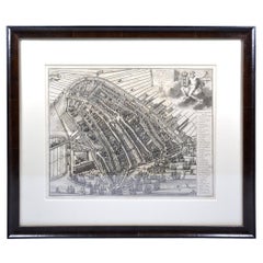
View AllUtrecht city plan
Located in UTRECHT, UT
“Platte grond der Stad Utrecht vertonende alle Gragten, Straaten, Stegen, Gangen, Markten, en plaatsen der openbare Gebouwen”, engraving published by Johannes van Schoonhoven in Amst...
Category
Antique 1770s Dutch Other Maps
Materials
Paper

$3,892
Amsterdam city plan - Joost van Sassen
Located in UTRECHT, UT
“Afbeeldinge der Stad Amsterdam, gelyk deselve in den jaren 1536 door Cornelis Antonisz na ’t leven is geschildert, en Ao 1544 in druk uytgegeven.”, engraved by Joost van Sassen and ...
Category
Antique 1720s Dutch Other Maps
Materials
Paper
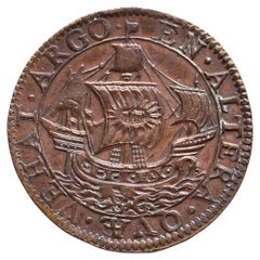
Expedition ro Brazil and capture of St. Tomas by admiral Van der Does
Located in UTRECHT, UT
Obverse: EN ALTERA QVÆ VEHAT ARGO, the ship the Argo seen from the side, a standing soldier on the prow, the large sail with the name of Jehovah, the golden fleece hanging from the p...
Category
Antique 16th Century Dutch Antiquities
Materials
Bronze
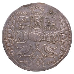
1621. Golden wedding anniversary Maarten Ruychaver and Aleyd van der Laen
Located in UTRECHT, UT
Obverse: ANNO – 1570 / .M. – .R. / .28. – OCTO, clasped hands coming out of the clouds, above the wedding date and the initials and coat of arms of Maarten Ruychaver, below two turtl...
Category
Antique 1620s Dutch Neoclassical Antiquities
Materials
Silver
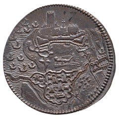
1593. Beleg van Geertruidenberg
Located in UTRECHT, UT
Obverse: Geertruidenberg under siege by the armies of prince Maurice by land and by water
Reverse: .*. / GERTRVDIS / BERGA. AB. HISP. / VINDICANT. ORD / CONFŒD. DVCE. PRIN / NASS. IN...
Category
Antique 16th Century Dutch Antiquities
Materials
Silver
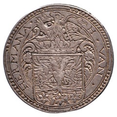
N.d. Marriage Hessel van Hermane & Anna van Lyauckema
Located in UTRECHT, UT
Obverse: H ✶ VAN ✶ – HERMANA ✶, crowned coat of arms with lion crest
Reverse: ✶ A ✶ VAN ✶ – ✶ LYAUCKEMA ✶, crowned diamond-shaped coat of arms
Earliest known Dutch wedding medal and...
Category
Antique 16th Century Other Antiquities
Materials
Silver
You May Also Like
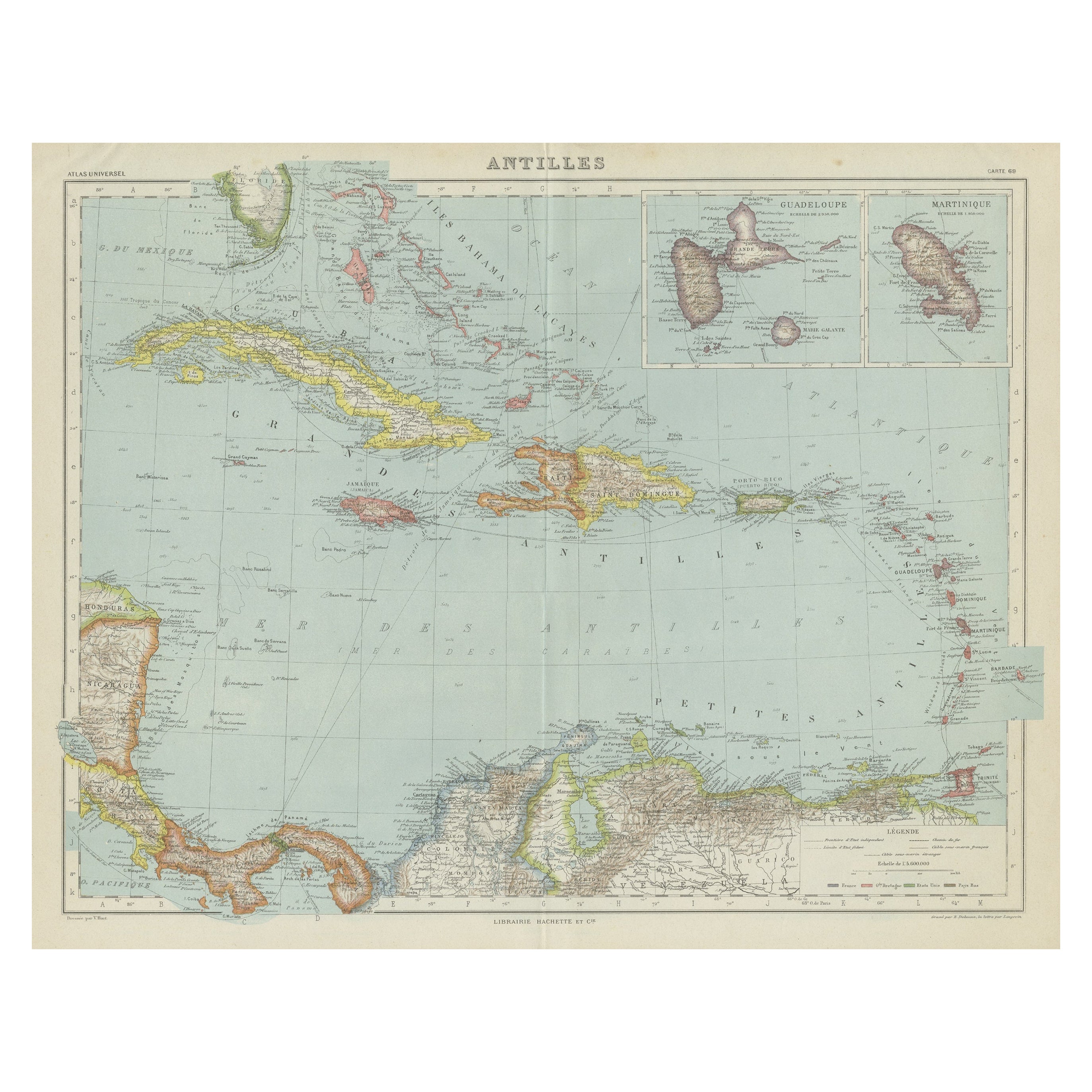
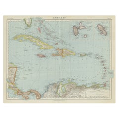
Vintage Map of the Greater Antilles and Lesser Antilles
Located in Langweer, NL
Vintage map titled 'Antilles'. Original map of the Antilles. Shows the Cayman Islands, Cuba, Hispaniola (subdivided into the nations of the Dominican Republic and Haiti), Jamaica, and Puerto Rico. Also shows the Lesser Antilles...
Category
20th Century Maps
Materials
Paper
$134 Sale Price
20% Off
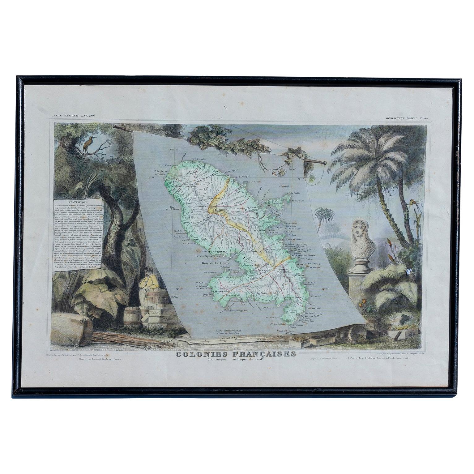
Map Colonies Francaises Martinique, 1845
Located in BUNGAY, SUFFOLK
Colonies Francaises, Martinique, Amerique DU SUD
Geographie et Statistique par V.Levasseur. Ing'r Geographe.
Illustre par Raymond Bonheur, peintre.
Grave par Laguihermie, Rue St...
Category
Antique 19th Century French Maps
Materials
Paper

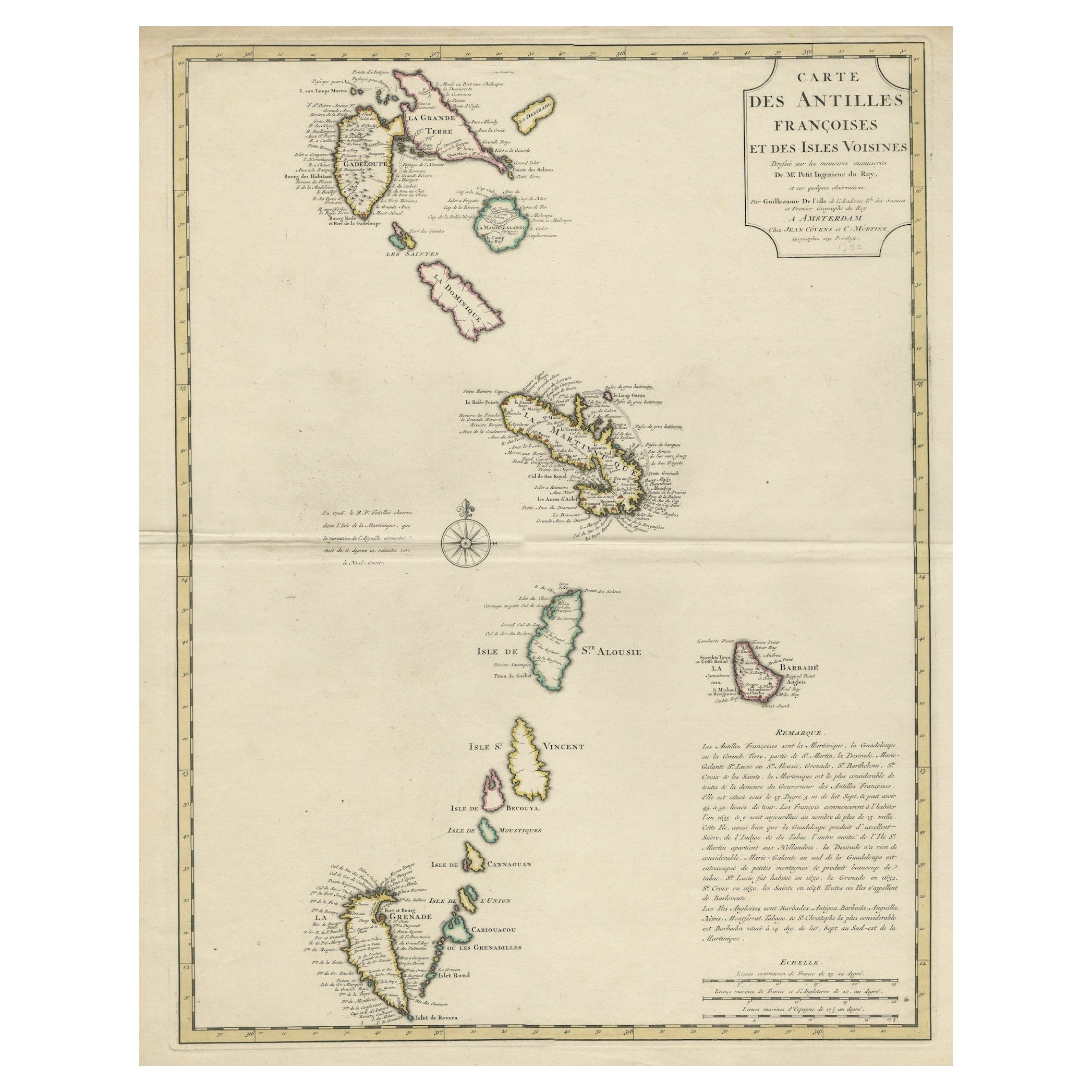
Detailed Antique Map of the Windward Islands in the Caribbean
By Covens & Mortier
Located in Langweer, NL
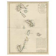
Antique map titled 'Carte des Antilles Francoises et des Isles Voisines'. Original antique map of the French Antilles, covering an area stretching from Guadeloupe in the north to Gre...
Category
Antique Early 18th Century Maps
Materials
Paper
$900 Sale Price
20% Off
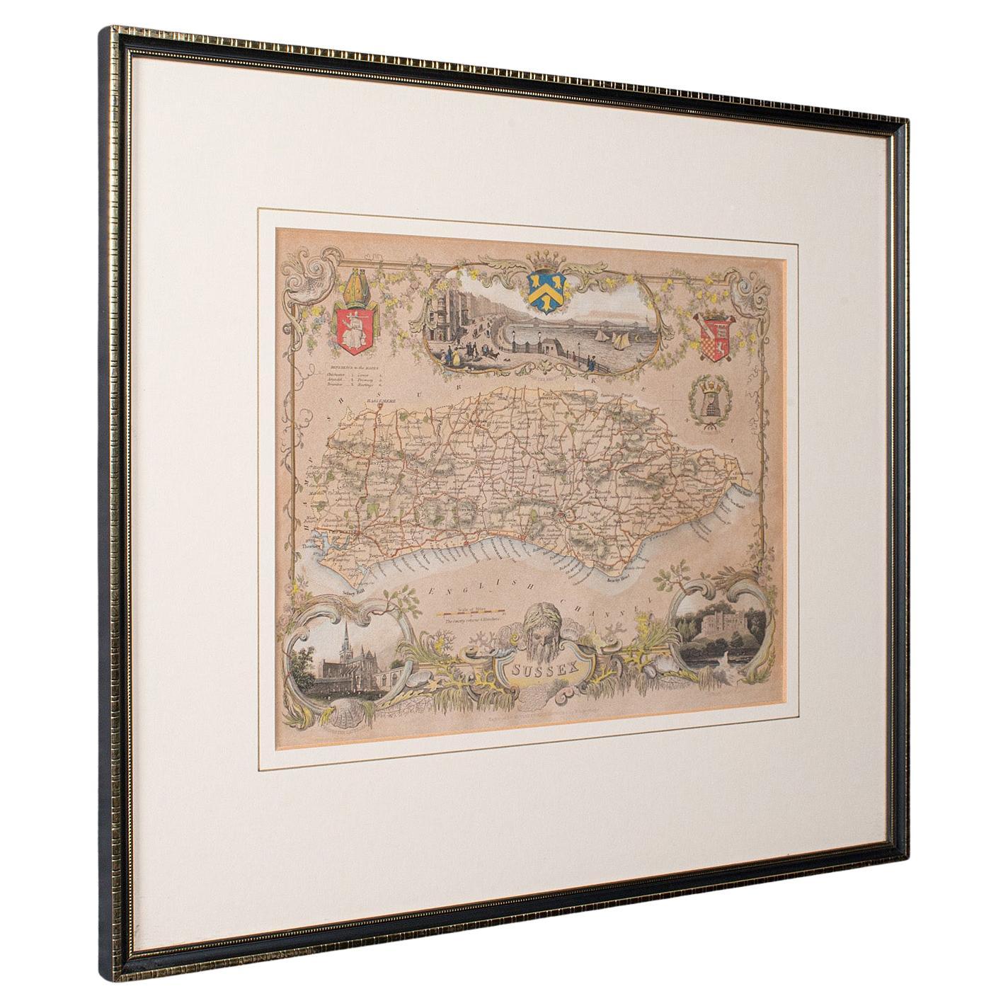
Antique County Map, Sussex, English, Framed Lithography, Cartography, Victorian
Located in Hele, Devon, GB
This is an antique lithography map of Sussex. An English, framed atlas engraving of cartographic interest, dating to the mid 19th century and later.
Superb lithography of Sussex an...
Category
Antique Mid-19th Century British Victorian Maps
Materials
Paper

Antique Map of the Islands of the Atlantic by J. Tallis
Located in Langweer, NL
A highly decorative and detailed mid-19th century map of the Islands of the Atlantic -- including the Azores, Madeira, Bermuda, the Canary Islands and the Cape Verde Islands -- which...
Category
Antique Mid-19th Century Maps
Materials
Paper

$287 Sale Price
20% Off
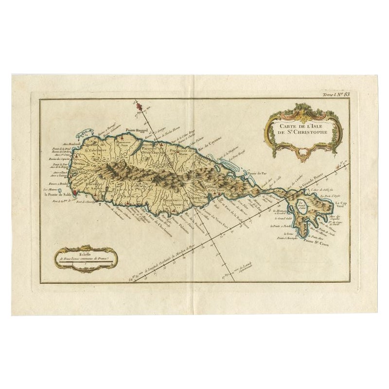
Old Map of the island of Saint Christopher or St. Kitts in the Caribbean, c.1765
Located in Langweer, NL
Antique map titled 'Carte de l'Isle de Saint-Christophe'.
A detailed map of the island of Saint Christopher or St. Kitts showing mountain ranges, port towns and parishes. This map ...
Category
Antique 18th Century Maps
Materials
Paper

More Ways To Browse
20th Century Spanish Table
Antonio Bellini
Antique Oushak Carpets
Blue Coffee Tables
German Bauhaus Posters
1945 Chair Juhl
Antique Three Leg Table
Folke Arstrom
Silver Over Copper
Vintage Barware Glasses
Antique Etched Glass
Antique French Shell
Coffee Table Black Italian Modern
Christofle America
Iranian Silk Rug Carpet
Poul Moller
Tables With Inlaid Wood
World War Table