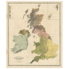
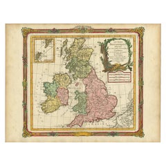
Ethnographic Map of Great Britain and Ireland – Distribution of People, c.1860
View Similar Items


Want more images or videos?
Request additional images or videos from the seller
1 of 10
Ethnographic Map of Great Britain and Ireland – Distribution of People, c.1860
Price:$800
$1,039.33List Price
About the Item
- Dimensions:Height: 26.66 in (67.7 cm)Width: 21.93 in (55.7 cm)Depth: 0.02 in (0.5 mm)
- Materials and Techniques:
- Period:
- Date of Manufacture:c.1860
- Condition:General age-related toning, original folding line. Shows overall staining and darker staining in margins. Some wear and creasing, blank verso. Please study image carefully.
- Seller Location:Langweer, NL
- Reference Number:Seller: BG-134651stDibs: LU3054339045892
About the Seller
5.0
Recognized Seller
These prestigious sellers are industry leaders and represent the highest echelon for item quality and design.
Platinum Seller
Premium sellers with a 4.7+ rating and 24-hour response times
Established in 2009
1stDibs seller since 2017
2,533 sales on 1stDibs
Authenticity Guarantee
In the unlikely event there’s an issue with an item’s authenticity, contact us within 1 year for a full refund. DetailsMoney-Back Guarantee
If your item is not as described, is damaged in transit, or does not arrive, contact us within 7 days for a full refund. Details24-Hour Cancellation
You have a 24-hour grace period in which to reconsider your purchase, with no questions asked.Vetted Professional Sellers
Our world-class sellers must adhere to strict standards for service and quality, maintaining the integrity of our listings.Price-Match Guarantee
If you find that a seller listed the same item for a lower price elsewhere, we’ll match it.Trusted Global Delivery
Our best-in-class carrier network provides specialized shipping options worldwide, including custom delivery.More From This Seller
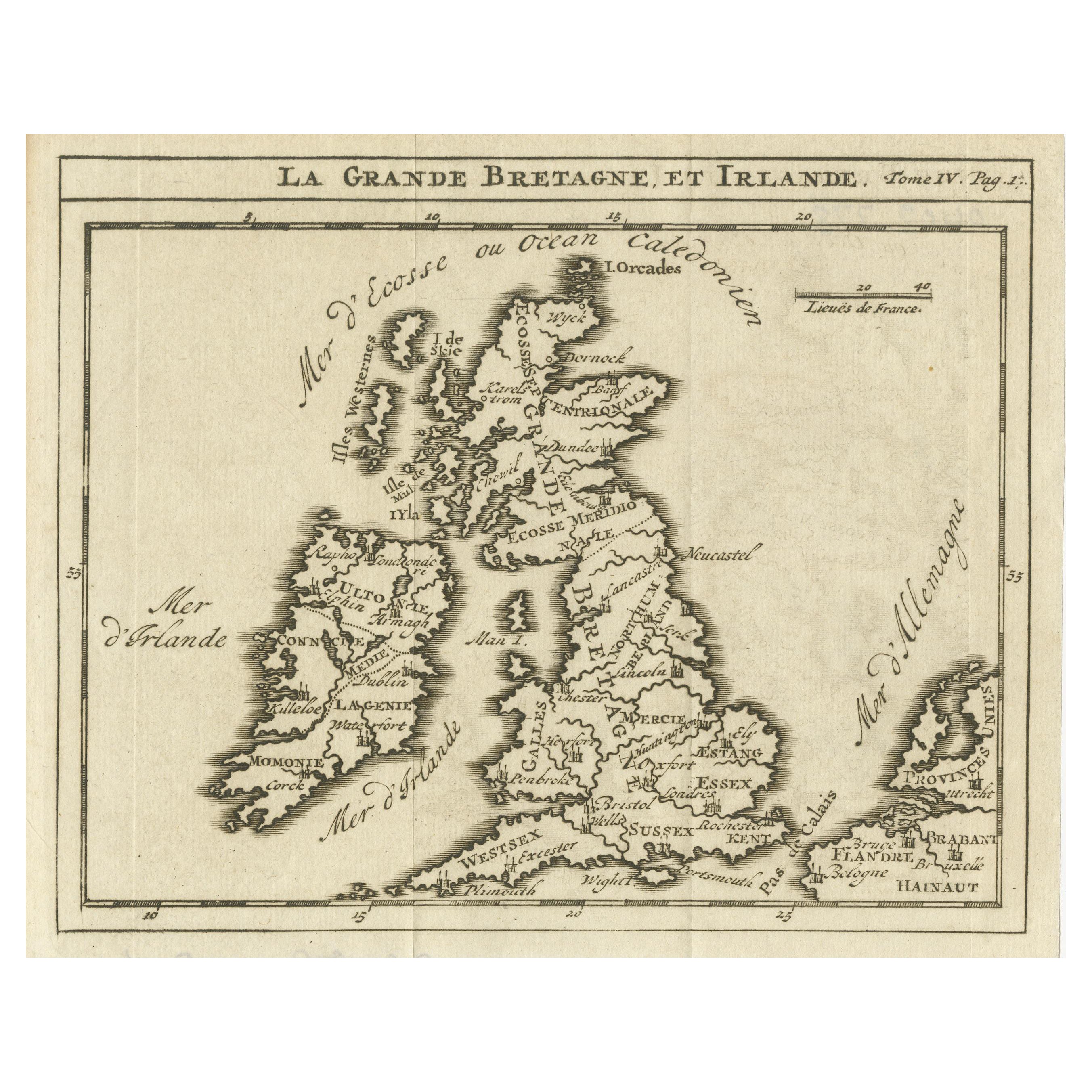
View AllRare Small Antique Map of Great Britain and Ireland
Located in Langweer, NL
Antique map titled 'La Grande Bretagne et Irlande'. Small antique map of Great Britain and Ireland. Source unknown, to be determined. Publ...
Category
Antique Mid-18th Century Maps
Materials
Paper
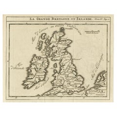
$217 Sale Price
20% Off
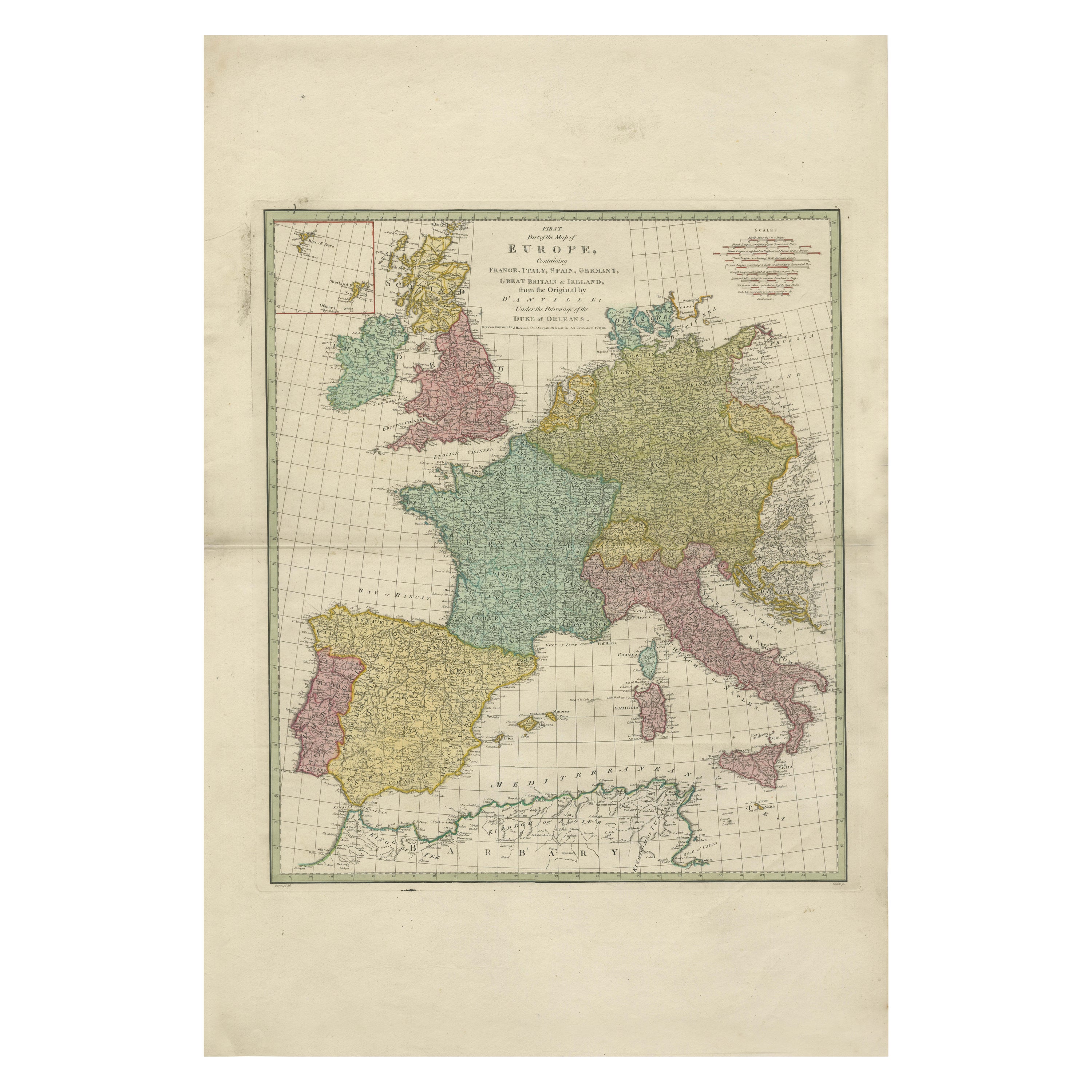
1788 Map of Europe - France, Italy, Spain, Germany, Great Britain & Ireland
Located in Langweer, NL
Title: "1788 Map of Europe - France, Italy, Spain, Germany, Great Britain & Ireland by D'Anville"
Description:
This detailed map of Europe, titled "First Part of the Map of Europe...
Category
Antique 1780s Maps
Materials
Paper
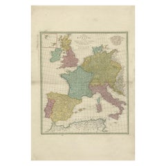
$1,058 Sale Price
20% Off
Antique Map of Great Britain and Ireland by Brion de la Tour, 1766
Located in Langweer, NL
Antique map titled 'Les Isles Britanniques (..).'
Attractive map of Great Britain surrounded by an engraved border printed from a separate coppe...
Category
Antique 18th Century Maps
Materials
Paper
$519 Sale Price
20% Off
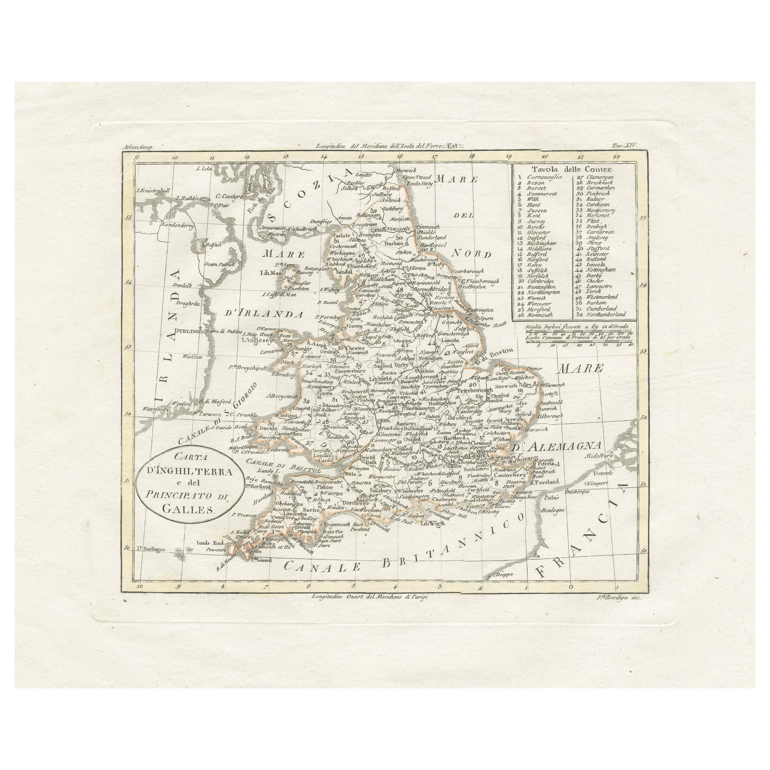
Detailed Antique Map of Britain, Wales and the Coast of Ireland
Located in Langweer, NL
Antique map titled 'Carta d'Inghilterra e del Principato di Galles'. Detailed map of Britain, Wales and the coast of Ireland with a list of counties. This map originates from 'Nuovo ...
Category
Antique Mid-19th Century Maps
Materials
Paper

$245 Sale Price
20% Off
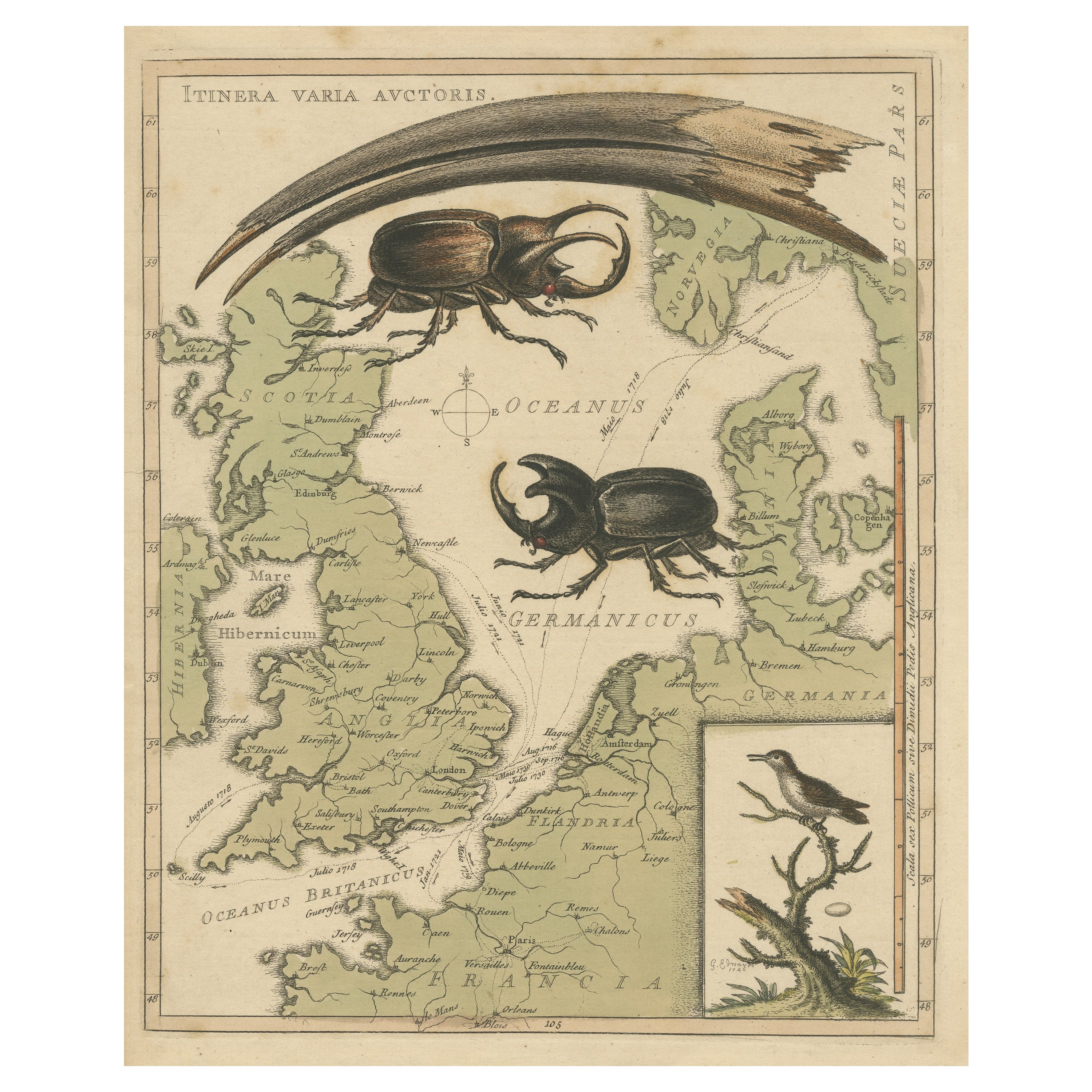
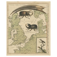
Interesting Map of Great Britain and Northern Europe with various Illustrations
Located in Langweer, NL
Antique map titled 'Itinera Varia Auctoris'. Very interesting map of Great Britain and Northern Europe. The map shows Edwards' journeys between 1716-1730 to study his beloved birds a...
Category
Antique Mid-18th Century Maps
Materials
Paper
$415 Sale Price
20% Off
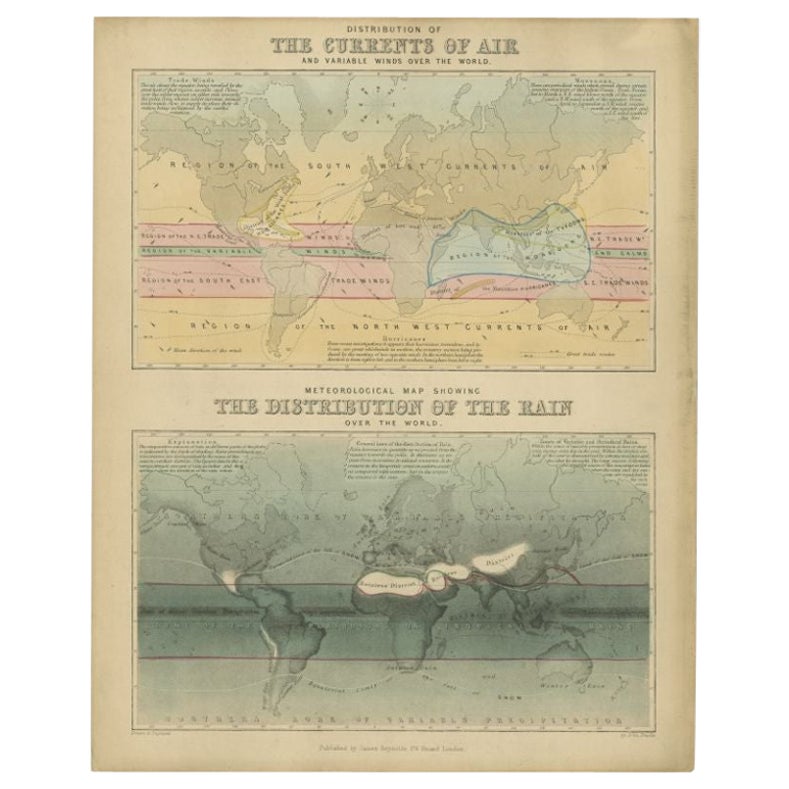
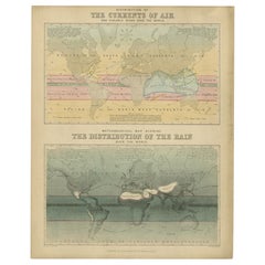
Antique Map of the Distribution of Air and Rain by Reynolds, 1843
Located in Langweer, NL
Two antique world maps on one sheet. The upper map shows the distribution of the currents of air and variable winds over the world. The lower meteorological map shows the distributio...
Category
Antique 19th Century Maps
Materials
Paper
$169 Sale Price
20% Off
You May Also Like
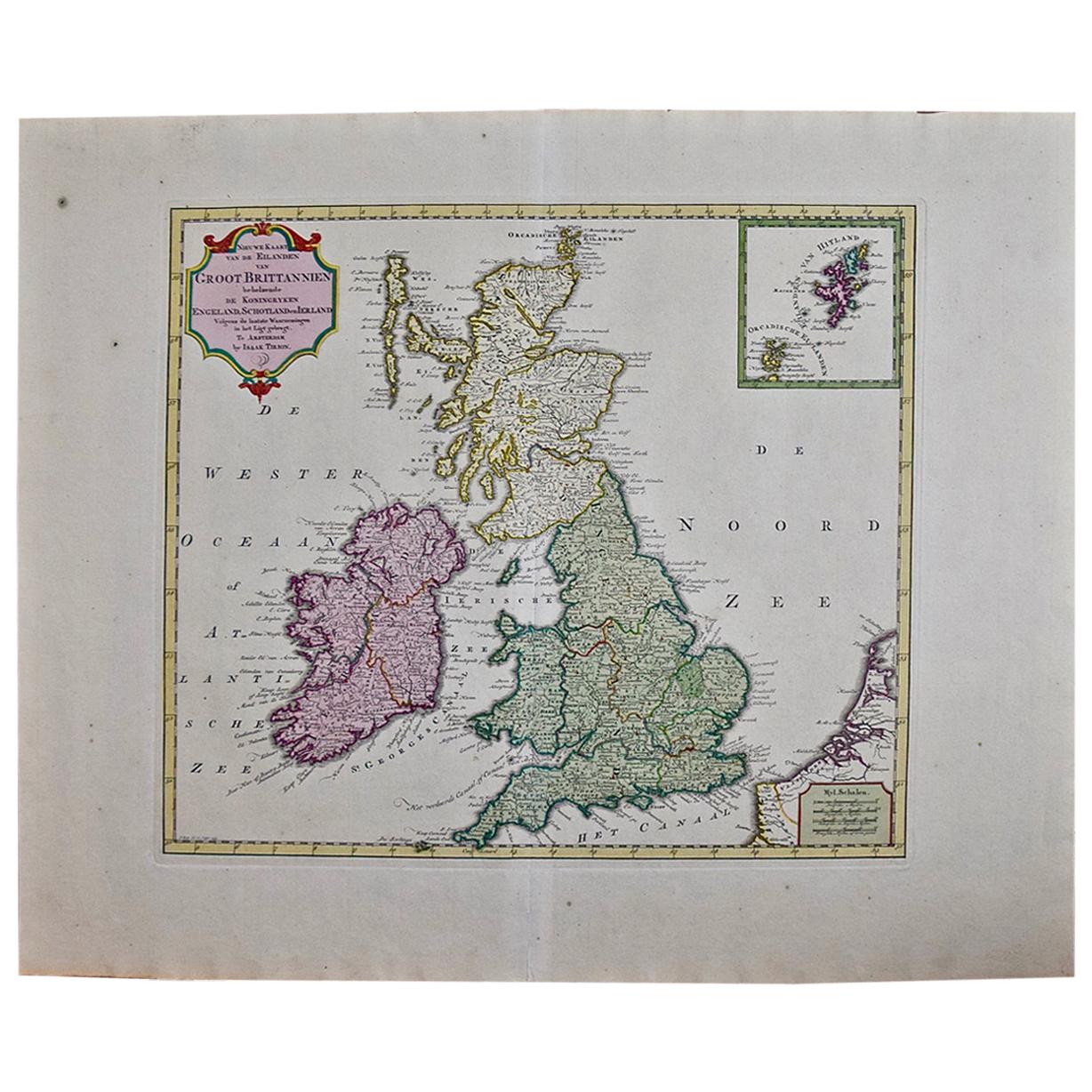
England, Scotland & Ireland: A Hand Colored Map of Great Britain by Tirion
By Isaak Tirion
Located in Alamo, CA
This is a hand-colored double page copperplate map of Great Britain entitled "Nieuwe Kaart van de Eilanden van Groot Brittannien Behelzende de Kon...
Category
Antique Mid-18th Century Dutch Maps
Materials
Paper

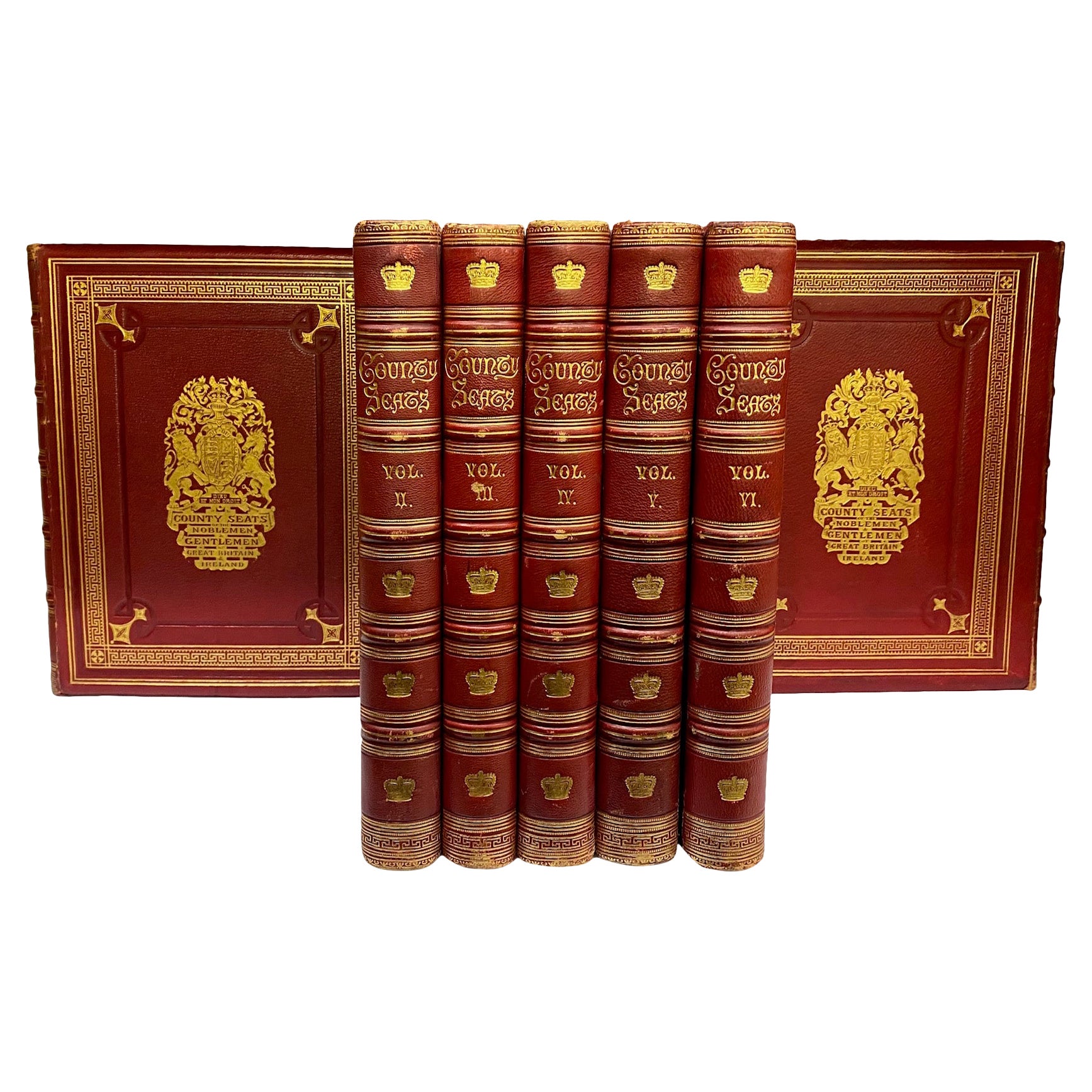
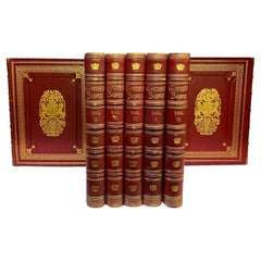
County Seats of the Noblemen & Gentlemen of Great Britain & Ireland (Book)
Located in North Yorkshire, GB
A set of seven beautifully bound volumes in morocco red leather with gilt decorations and crest to front and rear. A stunning collection of this pictorial work of British and Irish c...
Category
Antique 19th Century English Books
Materials
Paper
20thC Leather Cased Collection Of Bartholomew Maps Of Great Britain c.1920
Located in Royal Tunbridge Wells, Kent
Antique 20th Century leather-cased collection of Bartholomew British road maps by Edward Stanford Ltd of London. One volume features a map of the entire British Isles, divided into n...
Category
20th Century British Other Maps
Materials
Leather, Paper

Original Antique Map of Ireland- Tipperary and Waterford. C.1840
Located in St Annes, Lancashire
Great map of Tipperary and Waterford
Steel engraving
Drawn under the direction of A.Adlard
Published by How and Parsons, C.1840
Unframed.
Category
Antique 1840s English Maps
Materials
Paper

Original Antique Map of Ireland- Kerry. C.1840
Located in St Annes, Lancashire
Great map of Kerry
Steel engraving
Drawn under the direction of A.Adlard
Published by How and Parsons, C.1840
Unframed.
Category
Antique 1840s English Maps
Materials
Paper

Large Original Antique Map of Ireland. C.1900
Located in St Annes, Lancashire
Fabulous map of Ireland
Original color.
Engraved and printed by the George F. Cram Company, Indianapolis.
Published, C.1900.
Unframed.
Free shipping.
Category
Antique 1890s American Maps
Materials
Paper

Recently Viewed
View AllMore Ways To Browse
20th Century Spanish Table
Antonio Bellini
Antique Oushak Carpets
Blue Coffee Tables
German Bauhaus Posters
1945 Chair Juhl
Antique Three Leg Table
Folke Arstrom
Silver Over Copper
Vintage Barware Glasses
Antique Etched Glass
Antique French Shell
Coffee Table Black Italian Modern
Christofle America
Iranian Silk Rug Carpet
Poul Moller
Tables With Inlaid Wood
World War Table