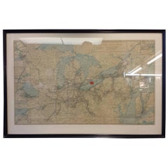
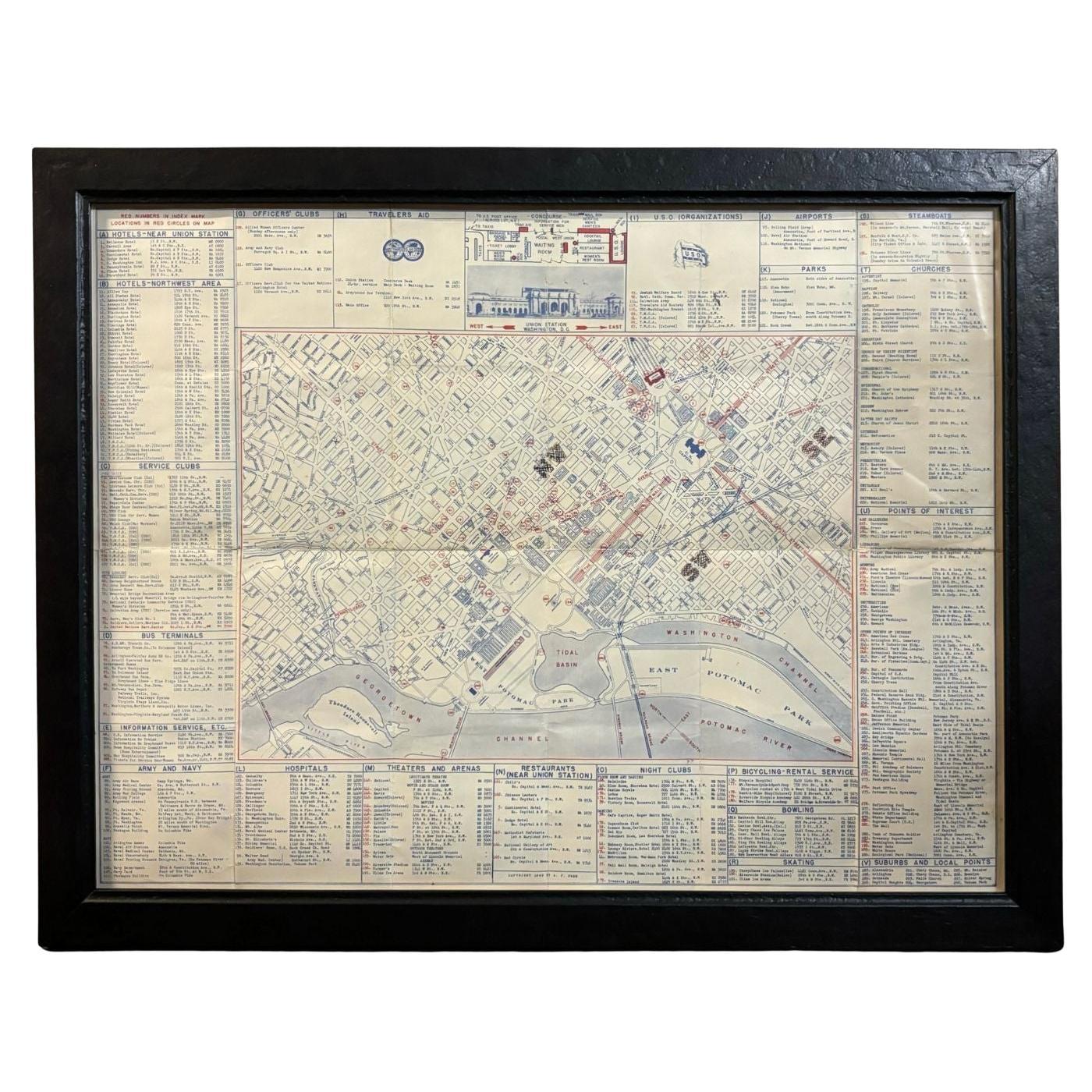
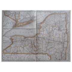
Framed New York Central Railway Map Original from 1943 with Railway Label
View Similar Items


Want more images or videos?
Request additional images or videos from the seller
1 of 11
Framed New York Central Railway Map Original from 1943 with Railway Label
$575List Price
About the Item
- Creator:Baker, Jones, Hausauer, Inc. 1 (Maker)
- Dimensions:Height: 26.5 in (67.31 cm)Width: 41 in (104.14 cm)Depth: 0.75 in (1.91 cm)
- Style:Mid-Century Modern (Of the Period)
- Materials and Techniques:
- Place of Origin:
- Period:
- Date of Manufacture:circa 1943
- Condition:Wear consistent with age and use. May be shipped (Map Only) No Frame in a tube, if you decide.
- Seller Location:Ottawa, CA
- Reference Number:1stDibs: LU141723875662
About the Seller
5.0
Gold Seller
Premium sellers maintaining a 4.3+ rating and 24-hour response times
Established in 1989
1stDibs seller since 2015
458 sales on 1stDibs
Typical response time: 3 hours
Authenticity Guarantee
In the unlikely event there’s an issue with an item’s authenticity, contact us within 1 year for a full refund. DetailsMoney-Back Guarantee
If your item is not as described, is damaged in transit, or does not arrive, contact us within 7 days for a full refund. Details24-Hour Cancellation
You have a 24-hour grace period in which to reconsider your purchase, with no questions asked.Vetted Professional Sellers
Our world-class sellers must adhere to strict standards for service and quality, maintaining the integrity of our listings.Price-Match Guarantee
If you find that a seller listed the same item for a lower price elsewhere, we’ll match it.Trusted Global Delivery
Our best-in-class carrier network provides specialized shipping options worldwide, including custom delivery.More From This Seller
View All'With Fly, Plug & Bait' Signed Presentation Copy to Publisher, Leather Bound
By Ray Bergman
Located in Ottawa, Ontario
With Fly, Plug & Bait Signed Presentation Copy To Publisher Leather Bound Only One Copy Done for Publisher, Printed Presentation inside and pen signed fr...
Category
Vintage 1940s American Country Books
Materials
Paper
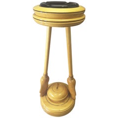
Curling Bonspiel Trophy Stand-Up Ashtray Early, 1960s
Located in Ottawa, Ontario
Curling Bonspiel trophy stand-up ashtray, early 1960s, The stand is maple with two curling brooms holding the top ashtray with the base mounted on a turned base and centered by a curling stone. The stand is made of maple, with a black glass ashtray...
Category
Vintage 1960s Canadian Mid-Century Modern Sports Equipment and Memorabilia
Materials
Maple
Victorian Taxidermy Toy Horse, Late 19th Century
Located in Ottawa, Ontario
Victorian taxidermy toy horse, late 19th century.
Unusual and rare, a bit bizarre, this model of a horse with glass eyes, is made of a stuff...
Category
Antique Late 19th Century English Victorian Taxidermy
Materials
Animal Skin

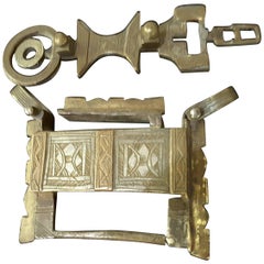
Silver and Bronze Camel Chest Lock 19th Century, North Africa
Located in Ottawa, Ontario
A silver and bronze camel chest lock 19th century, North Africa, bought in Tunisia in the early 1960s directly from Nomads. The lock was used to lock valuables in chests which were then packed on camel caravans...
Category
Antique Early 19th Century Tunisian Other Historical Memorabilia
Materials
Silver, Bronze
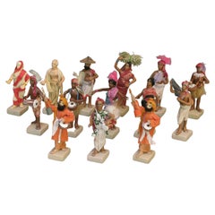
Group of Fourteen Indian Painted Terracotta & Cotton Dressed Figures
Located in Ottawa, Ontario
A group of fourteen Indian painted terracotta
and cotton dressed figures
Krishnanagar, West Bengal, 20th century
Mounted on square bases,
depicting mainly processional figur...
Category
20th Century Indian Tribal Figurative Sculptures
Materials
Terracotta
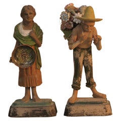
Lot of Two Indian Terracotta Figures
Located in Ottawa, Ontario
Lot of two Indian terracotta figures.
Lucknow, India, 19th Century.
Painted terracotta figures, depicting a female pottery seller
and a male flow...
Category
Antique 19th Century Indian Tribal Figurative Sculptures
Materials
Terracotta
You May Also Like
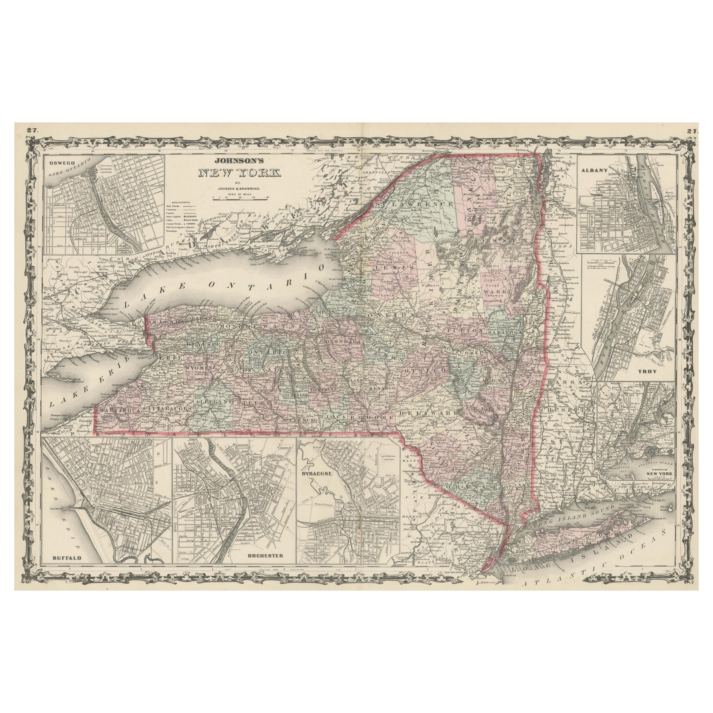
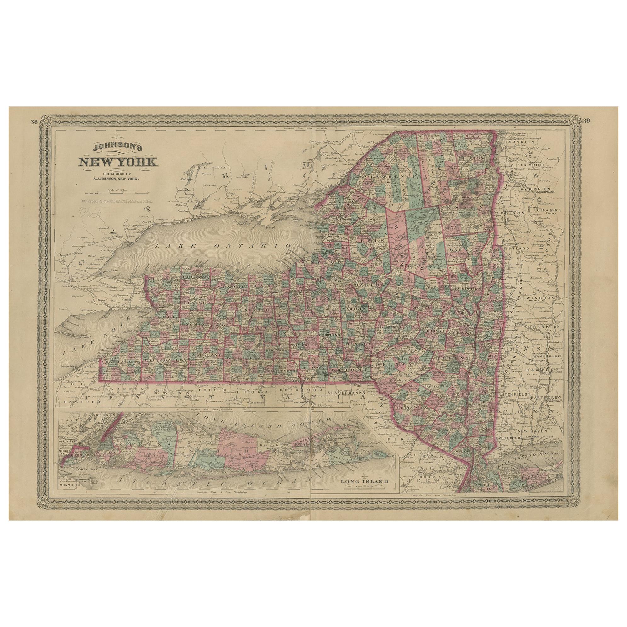
Large Antique Map of New York State with Inset Maps
Located in Langweer, NL
Antique map titled 'Johnson's New York' Large map of New York State. With insets of Albany, Oswego, Buffalo, Rochester, Syracuse, Troy and NYC. Published by Johnson and Browning, 186...
Category
Antique Mid-19th Century Maps
Materials
Paper

$469 Sale Price
20% Off
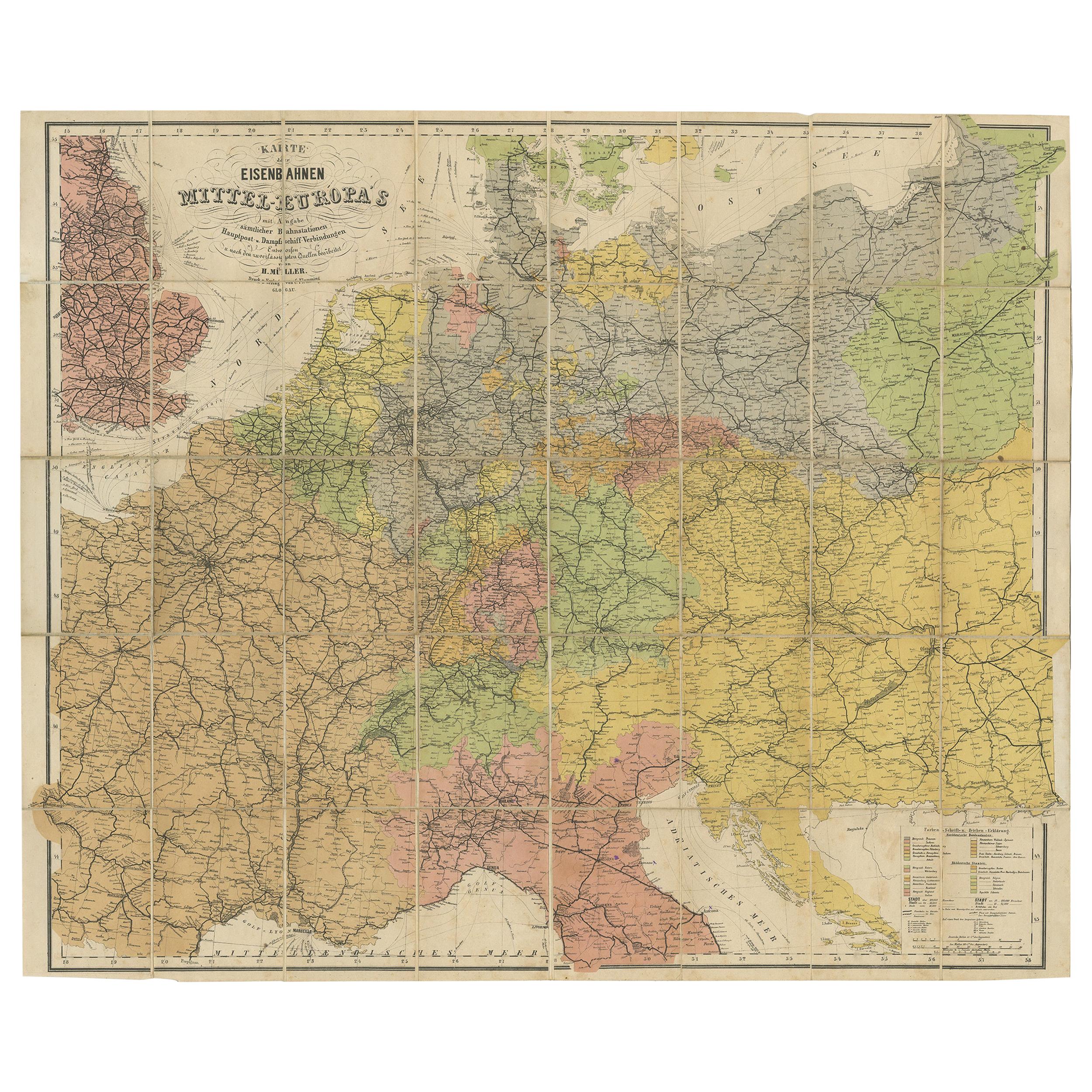
Antique Railway Folding Map of Central Europe by Müller, 1870
Located in Langweer, NL
Antique map titled 'Karte der Eisenbahnen Mittel-Europa's (..)'. Railway folding map of Central Europe. Published by Carl Flemming, 1870.
Category
Antique Late 19th Century Maps
Materials
Paper
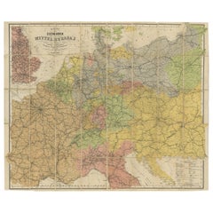
$718 Sale Price
20% Off
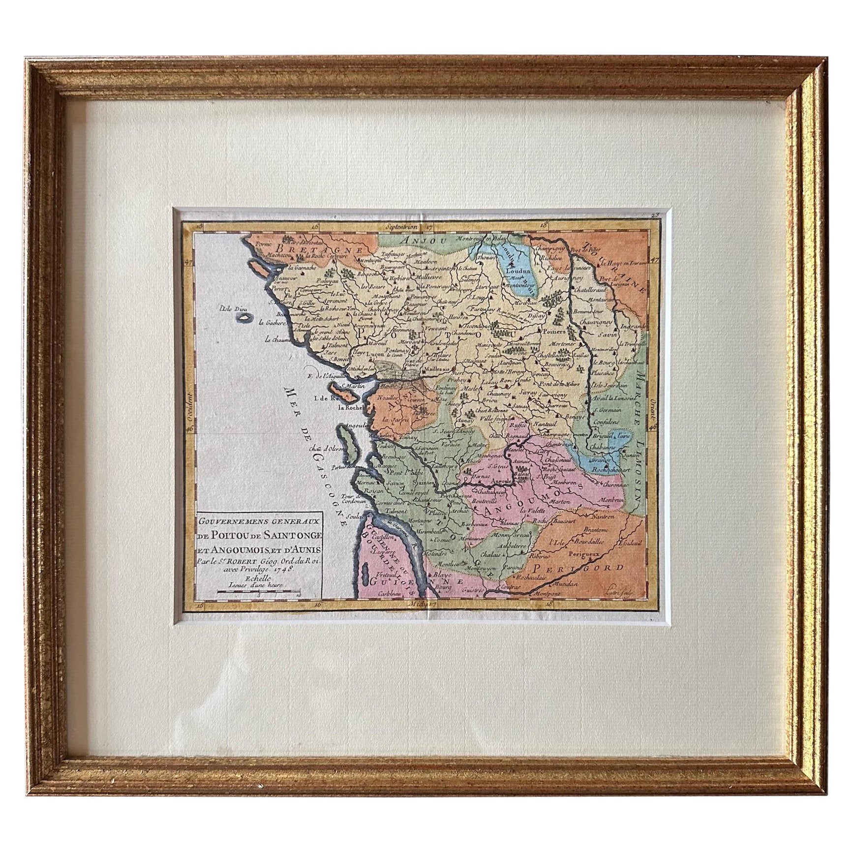
Original Antique Map of West Central France in Frame, 1748
Located in Langweer, NL
A nicely framed and hand-coloured decorative map titled "Gouvernemens Generaux De Poitou et De Saintonge" and engraved by M. Robert. This historical international map includes several specific locations, such as the Isle Dieu, Bretagne, Anjou, Touraine, Angoumois, Perigold, Saintonge, Mer de Gascogne (Bay of Biscay), Poitou, Aunis, Guienne, la Garonne Riviere (Garonne River), and Loudunois, as well as the Tour de Cordouan (Cordouan Lighthouse).
Featured towns on this map include Tonnay, Talmont, Loudun, Mortemer, Poitiers, Chalais, Riberac, Angoule, Marton, Blaye, and Monbrun.
This antique map represents the west-central region of France.
The theme of the atlas from which this map originates is the "Atlas Portatif Universel Et Militaire" by M. Robert. The source description indicates that this atlas is a portable, universal, and military collection...
Category
Antique 1740s Maps
Materials
Paper
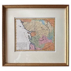
$277 Sale Price
20% Off
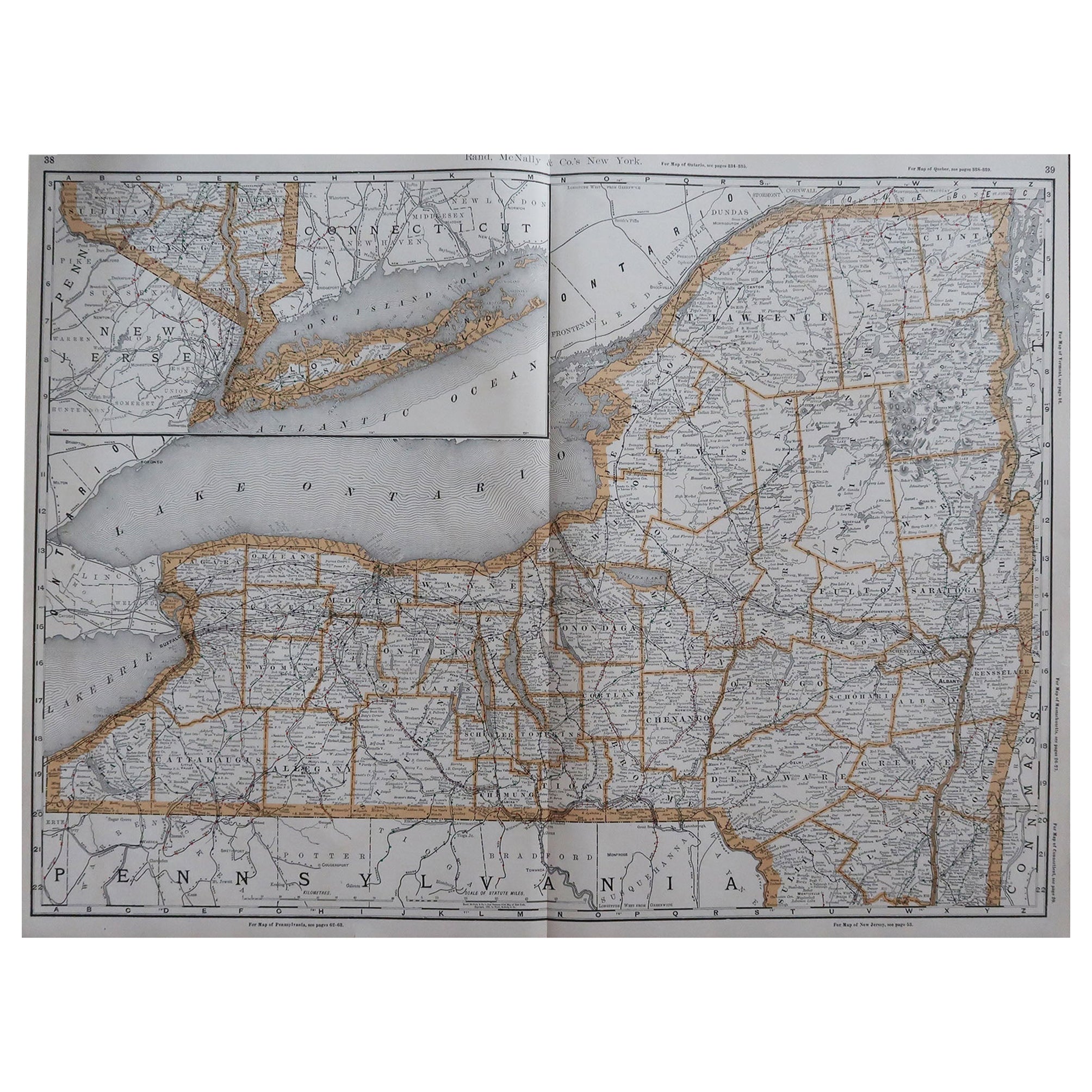
Large Original Antique Map of New York, USA, 1894
By Rand McNally & Co.
Located in St Annes, Lancashire
Fabulous map of New York.
Original color.
By Rand, McNally & Co.
Published, 1894
Unframed
Free shipping.
Category
Antique 1890s American Maps
Materials
Paper
Rare Original Map of New Amsterdam (New York) – “Restitutio”, ca. 1674 –
Located in Dronten, NL
An exceptionally rare and original 17th-century engraving of New Amsterdam, now New York City, published by the renowned Amsterdam cartographer Carel (Carolus) Allard around 1674. Kn...
Category
Antique 17th Century Dutch Maps
Materials
Paper

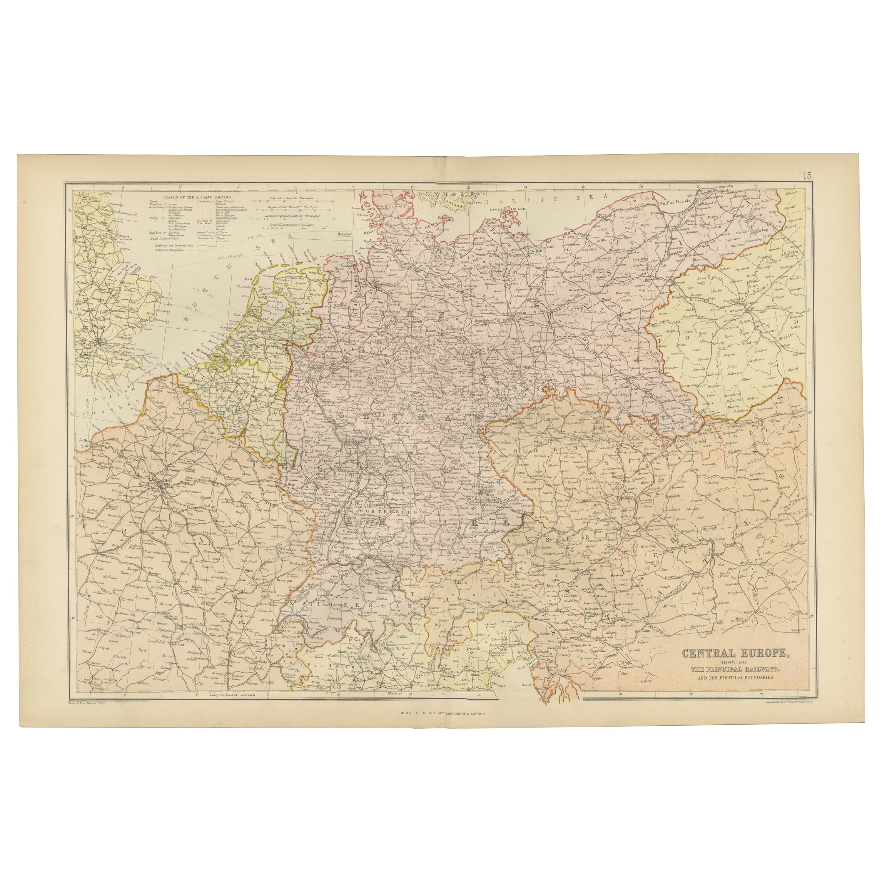
Antique Map of Central Europe Showing The Railways and The Political Bounderies
Located in Langweer, NL
Explore the Heart of Europe with the 'Central Europe' Map, Featuring Principal Railways and Political Boundaries! This map offers a captivating view of the dynamic landscapes and pol...
Category
Antique 1880s Maps
Materials
Paper

$162 Sale Price
20% Off